Showing 24073 items
matching matthew-creek
-
 Stawell Historical Society Inc
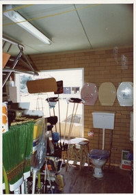
Photograph, Pleasant Creek Special School, Frank Floyd Pty Ltd. Hardware Store interior Wimmera Street Stawell Nov 1975, Nov 1975
Photographs taken by teacher at Pleasant Creek Training Centre to help train students in living skills and becoming familiar with what shops sold. Part of socializing students for leaving the training centre.Business in Wimmera Street Stawell selling hardware education -
 Stawell Historical Society Inc
Photograph, Pleasant Creek Special School, Frank Floyd Pty Ltd. Hardware Store interior Wimmera Street Stawell Nov 1975, Nov 1975
Photographs taken by teacher at Pleasant Creek Training Centre to help train students in living skills and becoming familiar with what shops sold. Part of socializing students for leaving the training centre.Business in Wimmera Street Stawell selling hardware education -
 Falls Creek Historical Society
Document - Meeting Minutes Of Falls Creek Alpine Village Advisory Committee
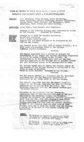
Bob Hymans Collection Bob (Herman) Hymans (a former member of the Royal Netherlands Navy was born in Bloemendaal, Holland on 30th September 1922. During World War II he fought against the Japanese in the Dutch East Indies (now Indonesia) and was imprisoned in Changi and on the Burma Railway. After gaining qualifications as a Ski Instructor, Bob arrived in Falls Creek in May 1950. Working as an Instructor and Supervisor at Bogong Lodge, Bob decided his future was in accommodation. He was successful in negotiating an indenture for land from the State Electricity Commission (SEC). It took Bob two years to build his Grande Coeur Chalet but, tragically, it was burned down in August 1961. Bob also built the first Chairlift in Australia. This was a single chairlift and the structure was built from wooden electricity poles. He was constantly full of new ideas and proposals for the village. Bob Hymans died on 7th July 2007. This Collection of documents and letters tells the story of Bob’s endeavours to develop Falls Creek into the ski village it is today.This document is significant because it documents discussion concerning the operation of Falls Creek.MInutes of the Falls Creek Alpine Village Advisory Committee held on 21 September 1957 typed on foolscap size paper. Topics of discussion included contributions to the Ski Improvement Fund, equipment in the Casualty Room and also the possibility of erecting a simple rope tow on the nursery slope.chairlift falls creek, bob hymans, ski improvement fund, falls creek alpine village advisory committee -
 Federation University Historical Collection
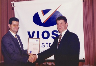
Photograph - Photograph -colour, VIOSH Australia Annual Dinner, July 1999: Presentation of Award to Matthew Piscioneri
Victorian Institute of Occupational Safety and Health (VIOSH) Australia is the Asia-Pacific centre for teaching and research in occupational health and safety (OHS) and is known as one of Australia's leaders in the field. VIOSH has a global reputation for its innovative approach within the field of OHS management. Federation University VIOSH Australia students are safety managers, senior advisors and experienced OHS professionals. They come from all over Australia and industry. Students are taught active research and enquiry; rather than textbook learning and a one-size fits all approach. VIOSH accepts people into the Graduate Diploma of Occupational Hazard Management who have no undergraduate degree – on the basis of extensive work experience and knowledge.Professional coloured photographs. Presenter and recipient standing in front of VIOSH banner.viosh, viosh australia, occupational health and safety, victorian institute of occupational health and safety, occupational hazard management, ian benjamin, susan capper, george cavanagh, paul coghlan, bryan colburn, timothy crouch, iain day, karina dine, david ellis, ken fuhrmeister, iain gillespie, donald gillies, linda grannas, rhonda hall, sue hardy, genevieve hawkins, paul hennekam, danielle mik, jo millard, vanessa moore, ashok nath, geoffrey poulton, terry ridley, jennifer sever, brian smith, kerry smith, krystie spratt, ian sterry, david taylor, sean turner, allison warwick, judith wenban, stuart wright, william wasley, linda smith, john maclean, steven baldwin, paul brass, phil clark, dennis cordner, save crawcour, steven duke, david fitzgerald, julie fitzgerald, gary lennon, patrick mcattackney, sue pannet, stephen pavlich, lloyd quarmby, noel read, tricia smith, robert turner, barrie wright, rae epthorp human factors prize, matthew piscioneri, steve cowley -
 Phillip Island and District Historical Society Inc.
Book, CUTHBERTSON, Bern, In the wake of Bass and Flinders : 200 years on : the story of the re-enactment voyages 200 years on in the whaleboat Elizabeth and the replica sloop Norfolk to celebrate the bicentenary of the voyages of George Bass and Matthew Flinders, 2001
Stamped 'Phillip Island & District Historical Society'. Signed by the author.george bass, journeys, australia, bern cuthbertson, matthew flinders, elizabeth, boat, norfolk, ship, historical reenactments, explorers, 18th century, discovery, exploration -
Phillip Island and District Historical Society Inc.
Book, ?BOWDEN, Keith, Matthew Flinders' narrative of Tom Thumb's cruise to Canoe Rivulet, 1985
Stamped 'Phillip Island & District Historical Society'.matthew flinders, travel, new south wales, tom thumb, boat, coasts, discovery, exploration -
Phillip Island and District Historical Society Inc.
Book, COLWELL, Max, Voyages of Matthew Flinders, 1970
Relevant for background information on discovery of the Island and surroundsHistoricalHard back with coloured dust cover matthew flinders, voyages, australia, discovery, exploration, westernport bay, george bass -
Phillip Island and District Historical Society Inc.
Book, GUTHRIE, Margaret D, First tourist : commemorating the bicentenary of Matthew Flinders' voyage in the sloop 'Norfolk' to Bribie Island and Moreton Bay, 1799-1999, 1999
Best wishes to the Phillip Island Historical Society from Bribie Island. Margaret D. Guthrie, 2003matthew flinders, journeys, genealogy, bribie island, queensland, discovery, exploration, history -
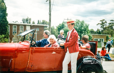 Eltham District Historical Society Inc
Photograph, Kath Stephenson and Matthew Smith (on running board), Eltham Community Festival Parade, 8 November 1986, 08/11/1986
[from a contemporary report:] The Shire of Eltham Historical Society's entry in the 1986 Eltham Community Festival Parade included Ben Hall's Cobb & Co. coach along with several vintage motor vehicles and the Society's new Community Banner. Members dressed in in an appropriate costume to ride in one of the vehicles or walk along with them. The assembly point was in Cecil St. at 11.45 a.m. The Society's entry was awarded the major prize for the parade.Colour photographeltham festival, shire of eltham historical society, 1986, main road, matthew smith, kath stephenson -
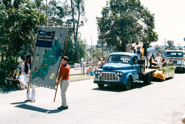 Eltham District Historical Society Inc
Photograph, Russell Yeoman and Matthew Smith, Eltham Festival Community Parade, 7 November 1987, 07/11/1987
[from a contemporary report:] Our float with its colonial washing day theme won the trophy for the best display. Bruce Ness arranged items from the Society's collection on his truck. Joh Ebeli and Russell Yeoman set up further items on the trailer loaned by Denis McKay. An important part of the event was the members who came along in their “old gear” to complete the picture. As usual musicians from the Victorian Folk Music Club helped us out with their lively music.Colour photographeltham festival, shire of eltham historical society, 1987, main road, russell yeoman, matthew smith -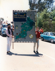
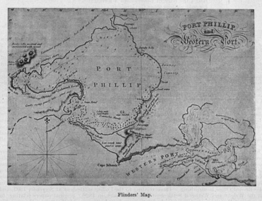 Federation University Historical Collection
Image, Matthew Flinders' Map of Port Phillip
Scanned from "The Old Pioneers' Memorial History of Melbourne From the Discovery of Port Phillip to the World War".matthew flinders, flinders map, port phillip bay -
 NMIT (Northern Melbourne Institute of TAFE)
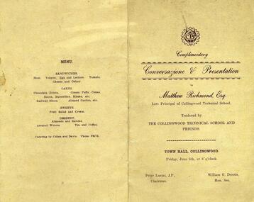
Program: for Farewell to Matthew Richmond 6 June 1930 CTS, Program for Farewell to Matthew Richmond 6 June 1930 Collingwood Technical School
collingwood technical school, program, matthew richmond, nmit, -
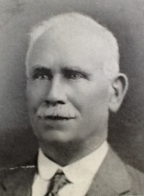 NMIT (Northern Melbourne Institute of TAFE)
Photograph: Matthew Richmond, Principal CTS 1912, Photograph: Collingwood Technical School Principal Matthew Richmond, 1912
Framed photograph.collingwood technical school, principal, matthew richmond, staff, nmit -
Stawell Historical Society Inc
Archive - Blueprint, St Matthew Uniting Church Plans, 12/10/1997
Proposed alterations to Uniting Church St Matthews Stawell N.H. Cottman 12/10/1979Paper & Tracing Paper in brown Cardboard roll holderreligion -
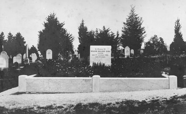
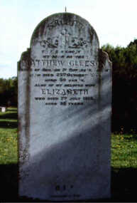 Inverloch Historical Society
000681 Photograph - 1996 - Anderson Inlet Cemetery, Inverloch - Gleeson grave (Matthew & Elizabeth) - from Ken Howsam
-
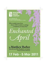 Heidelberg Theatre Company Inc..
Program Photos Newsletter, Enchanted April by Matthew Barber from the novel by Elizabeth von Arnim by arrangement with Hal Leonard Australia Pty. Ltd. on behalf of Joseph Weinberger Ltd. London directed by Maureen McInerney
2011, 382 -
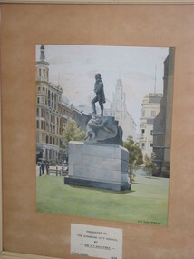 Brimbank City Council Art Collection
Painting - Gouache on paper, H T Shuffey, Statue of Matthew Flinders, 1958
gouache on paper -
Stawell Historical Society Inc
Archive, Matthew Dalkin and Sons Produce Merchants Grocers Main Street Stawell Journal, 1870 - 1883
Folio Sized Leather Bound. Marbled End PapersHand Writtenstawell, business -
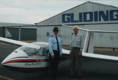 Benalla Aviation Museum and Men's Shed Inc.
Photograph - Matt Kilpatrick, Matthew Kilpatrick Gliding Benalla
-
Bass Coast Shire Council - Art Collection
Artwork, other - Cypress Pine, Archies Creek, Matthew Petrucci
AustraliaOil on canvasSigned -
 Orbost & District Historical Society
black and white photograph, late 19th - early 20th century?
Bunga Creek is approximately 5km east of Lakes Entrance.This is a pictorial record of horse-drawn transport of the late 19th century used in East Gippsland.A black / white photograph of a bush scene with a horse - drawn coach running along a track beside a creek.. It is on a cream coloured buff card.on back - "No. 5" on front - "At Bunga Creek"bunga-creek horse-drawn-coach -
 Stawell Historical Society Inc
Photograph, Pleasant Creek -- Stawell Hospital -- Grave of Dr W H Syme -- Surgeon of Pleasant Creek Hospital
Pleasant Creek. Stawell Hospital Photo of Grave of Dr. & Mrs. W. H. Syme Surgeon of Pleasant Creek Hospitalstawell hospital medical -
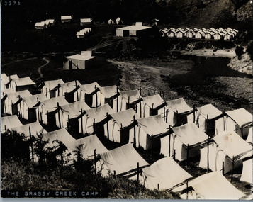 Lorne Historical Society
Photograph, The Grassy Creek Camp
Close up photograph of tents and site camp at Grassy Creek G.O.Rg.o.r. country roads board camp site - construction grassy creek -
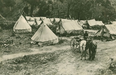 Lorne Historical Society
Photograph, Bell Tents at Bridge near Grassy Creek 1920
Tent encampment and horse trap near Grassy Creek Bridge 1920 -
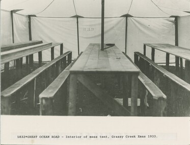 Lorne Historical Society
Photograph, Interior of mess tent at Grassy Creek Christmas 1933
Photograph showing the interior of the mess tent at Grassy Creek Christmas 1933christmas 1933, mess-tent at grassy-creek -
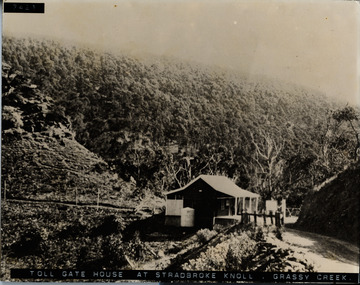 Lorne Historical Society
Photograph, Tolgate house at Stradbroke Knoll, Grassy Creek
Photograph showing Toll Gate House at Stradbroke Knoll, Grassy Creekg.o.r; toll-gate-house: stradbroke-knoll; grassy-creek; -
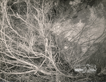 Eltham District Historical Society Inc
Photograph, George W. Bell, Beside Diamond Creek, 1965, 1965
Black and white photograph of creekside vegetation, Diamond Creek, Eltham, 1965.diamond creek, eltham, vegetation, george w bell collection -
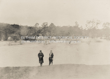 Eltham District Historical Society Inc
Photograph, Diamond Creek in flood 1924, 1924
Colour photograph of original showing Diamond Creek in flood at Eltham 1924floods, diamond creek, eltham -
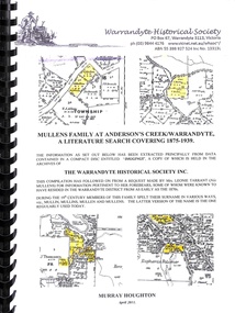 Ringwood and District Historical Society
Book, Mullens Family at Anderson's Creek/Warrandyte
Covering Mullen's Family at Anderson's Creek/Warrandyte from 1875 to 1939