Showing 5605 items
matching melbourne area.
-
 Eltham District Historical Society Inc
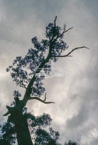
Slide - Photograph, Unidentified significant tree, Eltham district, c.Feb. 1993
Possibly the Yellow Box, Eucalyptus melliodora, Laughing Waters Road, Eltham 80 m from Reynolds Road http://vhd.heritagecouncil.vic.gov.au/places/71057 Outstanding size Outstanding specimen Located 80m from Reynolds Road, this tree is one of the few remaining forest trees that covered the area before settlement. Measurements: 11/1981 Spread (m): 23 Girth (m): 4.3 Height (m): 42 Estimated Age (yrs): 250+ Condition: Good Measurements: 20/09/2010 Spread (m): EW 20 NS 23 Girth (m): 4..5 Height (m): 40 Estimated Age (yrs): 250+ Condition: Access: Unrestricted Classified: 17/02/198335mm colour positive transparency (1 of 3) Mount - Kodak Ektachromeunidentified, significant tree -
 Eltham District Historical Society Inc
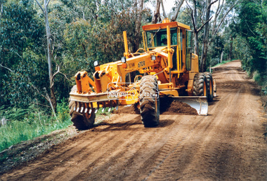
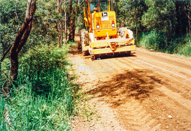
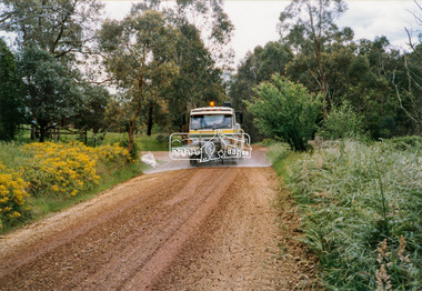
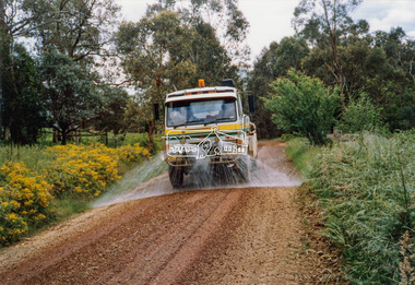
Photograph - Colour Print, Eltham Shire Council, Council oerations road grading and gravel water truck, c.1990
The cost of providing equivalent levels of services to the more rural areas of the Shire with respect to those in the more urban areas of Eltham, Montmorency and Briar Hill was relatively expensive. Road maintenance of rural unsealed gravel roads is one of those areas of higher costs particulary as a result of water erosion. The same applies for Nillumbik Shire Council today. Here we see Council operations grading a road and laying new gravel, followed by a gravel water truck to help bed the surface down. Unfortunately there is no information with these prints as to where this particular location is.graders, infrastructure, road maintenance, roads, shire of eltham, rural road, unidentified -
 Eltham District Historical Society Inc
Photograph - Black and White Print, Unidentified road, Eltham district, c. Sep. 1966
On the left is an advertising sign for a housing development lots for auction sale, 20 acre lotsBlack and white photographic printOriginally located in a Filmpro King Size Prints processing envelope $3.01 Shire of Eltham 9/9/66 and noted as Calrossie Ave area and crossed out Eltham-Yarra Glen Road, Bridge Street to Elsa Court existing conditions mid 1967auction sale, housing estate, infrastructure, real estate agent, roads, sign, unidentified -
 Eltham District Historical Society Inc
Photograph - Black and White Print, Unidentified road, Eltham district, c. Sep. 1966
Black and white photographic printOriginally located in a Filmpro King Size Prints processing envelope $3.01 Shire of Eltham 9/9/66 and noted as Calrossie Ave area and crossed out Eltham-Yarra Glen Road, Bridge Street to Elsa Court existing conditions mid 1967infrastructure, roads, unidentified -
 Eltham District Historical Society Inc
Photograph - Black and White Print, Unidentified road, Eltham district, c. Sep. 1966
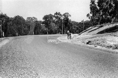
A postal employee (Postie) of the Post Master General (PMG) is delivering mail by bicycleBlack and white photographic printOriginally located in a Filmpro King Size Prints processing envelope $3.01 Shire of Eltham 9/9/66 and noted as Calrossie Ave area and crossed out Eltham-Yarra Glen Road, Bridge Street to Elsa Court existing conditions mid 1967infrastructure, roads, unidentified, australia post, post master general, postie, bicycle -
 Eltham District Historical Society Inc
Photograph - Black and White Print, Unidentified road, Eltham district, possibly Montmorency, c. Sep. 1966
Black and white photographic printOriginally located in a Filmpro King Size Prints processing envelope $3.01 Shire of Eltham 9/9/66 and noted as Calrossie Ave area and crossed out Eltham-Yarra Glen Road, Bridge Street to Elsa Court existing conditions mid 1967infrastructure, roads, unidentified -
 Eltham District Historical Society Inc
Photograph - Black and White Print, Moor-rul Viewing Platform, March 2007
Early stages - no display panels installed. OPENING OF THE VIEWING PLATFORM AT KANGAROO GROUND Nillumbik Council has advised that the viewing platform at Kangaroo Ground 27km NE of Melbourne is to be opened to the public on Wednesday, March 26th 2008 (Melway 271 , G10). The function of the platform is to provide shelter adjacent to the War Memorial Tower whilst allowing all people to enjoy the stunning panoramic views. From the platform you. can see the Dandenongs, the city of Melbourne, the You Yangs, Mount Macedon, the Kinglake Ranges and the Mt Baw-Baw Ranges where the Yarra River starts. This landscape covers all the ancestral lands of the Wurundjeri and some of the wider Kulin nation land. The platform has been given the name Moor-rut, a name which described the fertile soils of the Kangaroo Ground area in contrast to the poorer (Silurian) country of its surrounds, which the Wurundjeri knew as 'Nillumbik' or less rich country. The full 360 degree view can be seen from the adjacent Tower of Remembrance which has 53 stairs. The viewing platform however can be accessed by wheelchair. Inside the viewing platform there are eight double sided interpretive panels giving the history and information regarding this special area. The viewing platform's interpretive panels set out the Aboriginal and European history of the area and also the geology and the local flora and fauna, so that the casual visitor comes away understanding more about this significant part of Victoria. The concept of the viewing platform is part of the refurbishment project for the Kangaroo Ground War Memorial Park which has taken place since 1997 with the active approval and financial assistance of the Nillumbik Shire Council. This project has been guided by an Advisory Committee with volunteer community representatives from the local Historical Societies, the Country Fire Authority, the Returned Services League and the Wurundjeri people. Other allied groups such as the Nillumbik Reconciliation Group have been called upon for their expertise. The initial idea for the viewing platform came from Dean Stewart when he was the caretaker while living at the park. He discussed this idea with local author Mick Woiwod and Harry Gilham of Eltham District Historical Society when they were planning the refurbishment of the War Memorial Park in 1996. When the committee was formalised by the Nillumbik Council in 1997, Nicholas Pelling, representing the CFA and RSL, joined the group. Dennis Ward, local architect, then volunteered to develop the concept plan for the refurbishment of the park and later drew up the plans for the viewing platform. The Kangaroo Ground War Memorial Park and its Tower of Remembrance is located on one of the highest locations in the Yarra Valley. The Tower of Remembrance is a unique war memorial constructed from local stone standing 14 metres high. It was built in the style of a Scottish watchtower reflecting the strong Scottish influence of the first European settlers of the district from the 1840s onward. The park was opened in 1921 and the Tower of Remembrance was dedicated in 1926 recognising the local people who served in the First World War. Those who served in the Second World War were recognised by plaques dedicated in 1951 and more recently those who served in Korea, Borneo, Malaya and Vietnam by plaques unveiled in 2001. Harry Gilham, Advisory Committee Convenor - Eltham District Historical Society Newsletter N0 179 March 2008 Black and white inkjet print on paper 14 x 21 cmmoor-rul viewing platform, garden hill, kangaroo ground, memorial park -
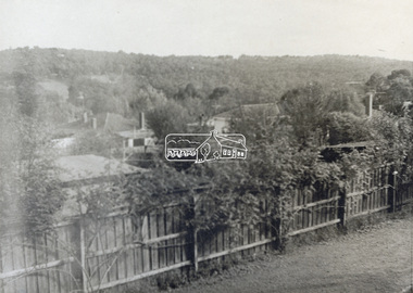 Eltham District Historical Society Inc
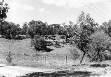
Photograph - Black and White Print, Unidentified view, possibly Eltham, c.1985
View looking over residential housing towards hills covered in trees - possibly Eltham areaBlack & White print on textured photographic paperunidentified, residential -
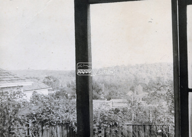 Eltham District Historical Society Inc
Photograph - Black and White Print, Unidentified view, possibly Eltham, c.1985
View looking over residential housing towards hills covered in trees - possibly Eltham areaBlack & White print on textured photographic paperunidentified, residential -
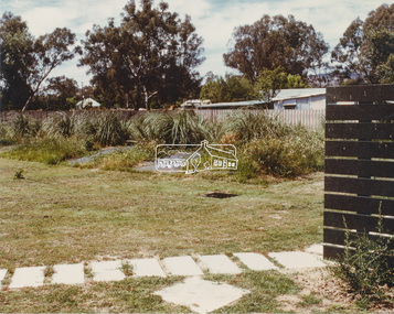 Eltham District Historical Society Inc
Photograph - Colour Print, Unidentified, possibly Eltham area, c.1980
On reverse - Ex 5landscape, parks and gardens, unidentified -
 Eltham District Historical Society Inc
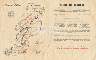
Document - Pamphlet, Shire of Eltham, December 1962
This pamphlet was issued for the information of ratepayers, with the compliments of the Eltham Shire Council. Subjects of information included: Shire statistics and history Members of Council 1962-63 Bushfires Dogs Rates Works Programme Shire Offices Town Planning Map of Shire of Eltham with Bushfire area outlined in redbushfires, charis pelling, charles m. a. pelling, councillors, dogs, eric dudley butler, eric percival harmer, franklin william nankervis, george l. cresp, leslie christopher docksey, m.b. watson, map, maxwell alexander spence, rates, raymond clive duncan, rodney d. quin, shire of eltham, shire offices, town planning, works programme -
 Eltham District Historical Society Inc
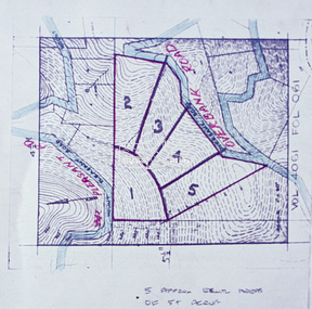
Slide - Photograph, Eltham Shire Council, Proposed subdivision of five approximately equal areas of 5 acres, Vol. 4061, Fol. 061, Overbank Road, North Warrandyte, 1969
35mm colour positive transparency blue Agfacolour Service plastic mountD4, 55341, Peck subdivision, Mount Pleasant Road, 4 August 1969infrastructure, map, planning, subdivison lots, overbank road, mount pleasant road, north warrandyte -
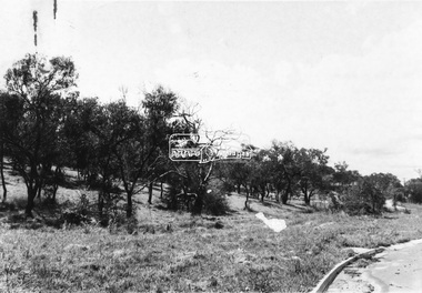
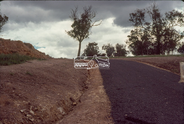
 Eltham District Historical Society Inc
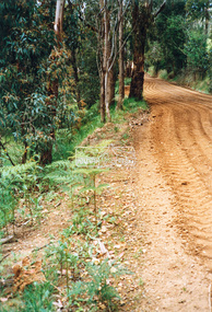
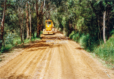
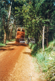
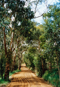
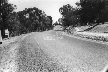
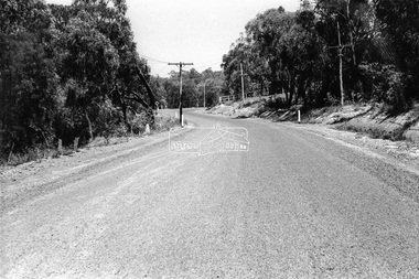
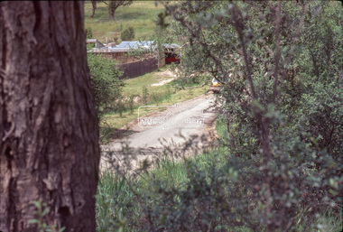
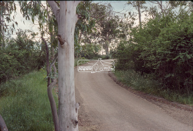
Slide - Photograph, Eltham Shire Council, Unidentified rural road within the Shire of Eltham, c.Nov. 1980
... melbourne Infrastructure rural areas Rural road Unidentified ...35mm colour positive transparency Kodak Kodachrome cardboard mountProcessed Nov 1980infrastructure, rural areas, rural road, unidentified -
 Eltham District Historical Society Inc
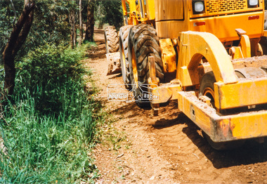
Slide - Photograph, Eltham Shire Council, Unidentified rural road within the Shire of Eltham, c.Nov. 1980
... melbourne Infrastructure rural areas Rural road Unidentified ...35mm colour positive transparency Kodak Kodachrome cardboard mountProcessed Nov 1980infrastructure, rural areas, rural road, unidentified -
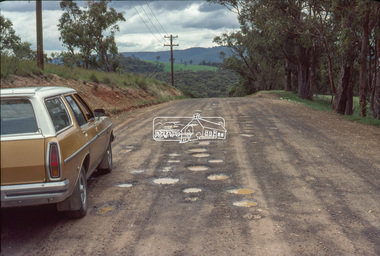
 Eltham District Historical Society Inc
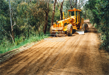
Slide - Photograph, Eltham Shire Council, Unidentified rural road within the Shire of Eltham, c.Nov. 1980
... melbourne Infrastructure rural areas Rural road Unidentified ...35mm colour positive transparency Kodak Kodachrome cardboard mountProcessed Nov 1980infrastructure, rural areas, rural road, unidentified -
 Eltham District Historical Society Inc
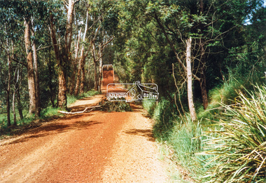
Slide - Photograph, Eltham Shire Council, Unidentified rural road within the Shire of Eltham, c.Nov. 1980
... melbourne Infrastructure rural areas Rural road Unidentified ...35mm colour positive transparency Kodak Kodachrome cardboard mountProcessed Nov 1980infrastructure, rural areas, rural road, unidentified -
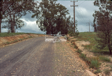
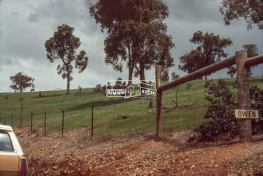
 Eltham District Historical Society Inc
Slide - Photograph, Eltham Shire Council, Unidentified rural road within the Shire of Eltham, c.Nov. 1980
... melbourne Infrastructure rural areas Rural road Unidentified ...35mm colour positive transparency Kodak Kodachrome cardboard mountProcessed Nov 1980infrastructure, rural areas, rural road, unidentified -
 Eltham District Historical Society Inc
Slide - Photograph, Eltham Shire Council, Unidentified rural road within the Shire of Eltham, c.Nov. 1980
... melbourne Infrastructure rural areas Rural road Unidentified ...35mm colour positive transparency Kodak Kodachrome cardboard mountProcessed Nov 1980infrastructure, rural areas, rural road, unidentified