Showing 596 items matching "railway station buildings"
-
 Kew Historical Society Inc
Photograph - Country Roads Board and Denmark Street Baby Health Centre, Ron Setford, 1961
Ron Setford and his wife Grace Setford lived in Tanner Avenue, East Kew, from c.1946 to c.1995. A keen photographer, he recorded the changing face of Kew over a 20 year period. Apart from 30 photographs of built structures and places in Kew dating from 1960 and 1961, 145 of his 35mm colour slides chronicle the development of the Eastern Freeway through the Yarra Valley over a five year period from c.1972 to c.1977. This important collection was donated to the Society by his granddaughter in 2025.This collection of 175 35mm slides is of local and statewide significance, owing to its subject matter, particularly the major development of road transport infrastructure during the 1970s with the construction of the Eastern Freeway. The photographer also took care to annotate and date most of his slides which enable the researcher to pinpoint temporal and spatial locations.A photograph providing a visual contrast of the pre and post-World War II architectural styles of the Denmark Street Baby Health Centre and two of the Country Roads Board office buildings. Each was built on part of the land fronting the Kew branch line. In May 1939, the Railway Commissioners agreed to lease a site at the Kew Railway Station for a Baby Health Centre. The single-storey cream brick building was designed by Roland Chipperfield. The Country Roads Board (1913–83), later renamed VicRoads, transferred its headquarters from the Royal Exhibition Building to Kew in 1961, following the completion of two modernist eight-storey office towers in 1960. The VicRoads buildings were closed in 2024, and there is ongoing debate about what replaces them.Nilron setford, photographs -- kew (vic.) -- 1960s, country roads board, vicroads, denmark street -- kew (vic.), denmark street baby health centre -
 Melbourne Tram Museum
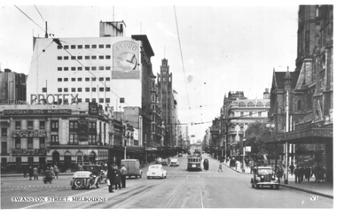
Postcard, Valentine's, "Swanston Street, Melbourne", 1930s
Valentine's postcard titled "Swanston Street, Melbourne", Number V1, looking north from south of Flinders Street. A W2 class tram with dash canopy lighting bound for East Bright on Route 64 is at the Flinders Street tram stop in Swanston Street. There are people standing in the north bound safety zone. Has Young & Jacksons Hotel advertising Protex and shows at the Tivoli Theatre. In the background is a sign for Aspro on the Nicholas Building. To the right is part of the awning leading into the Princes Bridge Railway Station.Yields information about Swanston Street during the 1940s.Postcard - printed, unused, Valentine Seriestrams, tramways, swanston st, princes bridge station, flinders street, flinders st, w2 class, route 64 -
 Ringwood and District Historical Society
Photograph, New East Ringwood railway station - 1975. (Replacing old building)
... New East Ringwood railway station - 1975. (Replacing old... station - 1975. (Replacing old building)".... station - 1975. (Replacing old building)". Black and white ...Black and white photographWritten on backing sheet, "New East Ringwood railway station - 1975. (Replacing old building)". -
 Ringwood and District Historical Society
Photograph, New East Ringwood railway station - 1975. (Replacing old building)
... New East Ringwood railway station - 1975. (Replacing old... Ringwood railway station - 1975. (Replacing old building ...Black and white photographWritten on backing sheet, "New East Ringwood Station - 1975 (Replacing old building). -
 Ringwood and District Historical Society
Photograph, Ringwood railway station precinct. Post number 35 in view from the foot bridge. The signalman is giving the staff to the driver of a dog box suburban train, from Bayswater
Black and White PhotographAccompanying sheet reads, " 'Post 35' shows the scene from the foot bridge. The signalman is giving the staff to the driver of a dog box suburban train, from Bayswater because there is a train probably on arrival Croydon on the Croydon line. The right hand arm of the bracket is off for Bayswater. Post 35 at that time was a prefab structure which replaced the signal posts knocked down on 22/6/1945. The red brick building bottom right corner is the relay room which included devices which would probably have prevented the June 1945 accident". -
 Melbourne Tram Museum
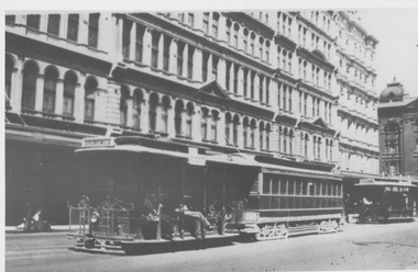
Photograph - Departing Elizabeth Street Terminus, c1928
Photograph shows a Dummy and bogie trailer car departing Flinders Street terminus in Elizabeth Street while a North Melbourne Dummy is shunted in the background. Several multi storey buildings along Elizabeth Street and a glimpse of Flinders Street Railway Station are also shown. D O'Brien CollectionYields information about Elizabeth Street terminusBlack and white photograph with note on rearIn ink "19" and "K McC"tramcars, tramways, cable trams, dummy, grip car, terminus, elizabeth street, flinders street, flinders street station, north melbourne, shunt -
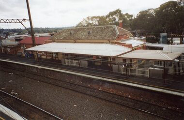 Ringwood and District Historical Society
Photograph, Ringwood Railway Precinct in 2009, showing heritage Station building on platform no. 1, taken from foot ramp on opposite platform
-
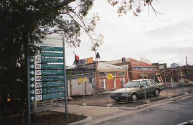 Ringwood and District Historical Society
Photograph, Ringwood Railway Precinct circa 2009, demolition of east part of heritage station building
-
 Melbourne Tram Museum
Negative - cable trams - Collins and Elizabeth Sts, c1914
Photograph of cable cars in Elizabeth St at the corner with Collins St. Has the Elizabeth St station in the view, along with Craigs and the Royal Bank. Rod Atkins advised 24/08/2020: "Dates from around 1914. taken 11.53 am in high summer. The Flinders Street Railway station looks complete but we still have all the telephone cables on poles in both Elizabeth and Collins Streets. I don't know the year they all went underground. We have two standard "Fitzroy" trams in Collins Street and one West Melbourne tram with standard eight-window trailer - no bogie trailers in the photo. Some of the West Melbourne trailers were still six window cars in the 1920's. The major building in the photo is the "Royal Bank" on the South East Cnr. of Collins and Elizabeth Street. "Yields information about the intersection of Collins and Elizabeth St.Copy negative of an illustration and a black and white print.On rear of print in ink "T153, Melbourne Tramways Co, later MMTB. North Fitzroy cable in Collins St. West Melb & Brunswick in Elizabeth St, about 1920?. " W Jack photo" and in top right hand corner "28"trams, tramways, cable trams, collins st, elizabeth st -
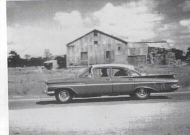 Sunbury Family History and Heritage Society Inc.
Photograph, Hay shed, c1960s
The hay shed was sited on railway land fronting onto Evans Street and near Station Street. Retail shops including Harris Scarf now occupy the site. The pine trees in the background were along Horne Street.The hay was stored in this building before being transported.Cereal growing was one of the agricultural activities carried out in the Sunbury area.A scanned print of an old black and white photograph of a corrugated shed with hay bales stacked at the rear of the building. A 1960s sedan car is parked in front of the building and there is a smaller shed in the background.hay shed, railways, sunbury station, evans street, horne street -
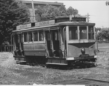
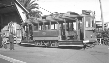 Melbourne Tram Museum
Photograph - VR tram 7 Elwood depot, 16-8-1947
Set of two photographs taken while on an AETA tour 16-8-1947 - see reference .1 - View of the tram and the depot building. .2 - End on photograph of the tram showing the white bumpers and steps, taken at St Kilda Station Side on photo, showing the strengthening steel work applied to this four wheel tram. Has two Robur Tea advertisements. Tram possibly preparing for a tour given the number of men standing on the side. Yields information about VR tram No. 7 at St Kilda station and Elwood depot.Negative (120) and contact print of VR tram No. 7 at the Elwood depot. See also Reg Item 3623 for another photo showing the tram.Envelope containing negative and photo typed "Tram VR Elwood Spread the load." .1 - On the rear of the print "VR Tram - Elwood Depot 5'3" gauge". .2 - 'VR Tram St Kilda Station Extension 5'3" gauge".trams, tramways, victorian railways, vr, elwood depot, aeta, st kilda railway station, tram 7 -
 Ringwood and District Historical Society
Photograph, Ringwood Railway Precinct circa 2009, demolished buildings all gone on east side on station entrance
-
 Ringwood and District Historical Society
Photograph, Ringwood Railway Precinct circa 2009, demolition of east part of heritage station building
-
 Ringwood and District Historical Society
Photograph, Ringwood Railway Precinct circa 2009, demolition of east part of heritage station building
-
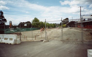
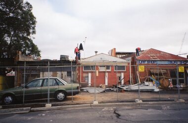
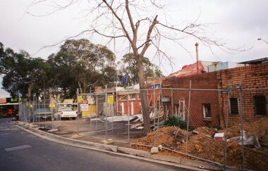
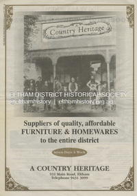 Eltham District Historical Society Inc
Document - Property Binder, 931 Main Road, Eltham
Present day location of Nongkhai Thai Eltham restaurant Formerly the location of: Luther Haleys Bakery and General Store (Sep 1902-1917) - Hayley built this store, which was the first store erected in the present-day Eltham shopping district Hannah Lloyd's General Store (1917-c.Feb 1920) Various owners Staff's General Store (c.1939-Feb 1965) then demolished Ray Staff Eltham Big Star Food Centre (c.1965-1967) Eltham Big Star Food Centre (Staffs new building c.1965-1967) A Country Heritage Furniture and Homewares (?-2006) Newspaper advertisement: Leader Associated Newspapers, 100 Years of News Special Edition, August 27, 1997, p6; A Country Heritage Newspaper advertisement: Diamond Valley Leader, 4 September 2006, Closing Down Sale, A Country Heritage In February 1965, Staffs Railway Store, the oldest business premises in the Eltham shopping district was demolished. Formerly a self-service grocery, restaurant and electrical repair shop, the building for many years housed Eltham’s only ‘family’ grocer and feed store. Earlier it had appeared to have been the town’s bakery. The building had been purchased in late March 1939 by Mr Eric N. Staff. At the time of E.N. Staff’s purchase there were huge bakers’ ovens located at the rear and the building also had a well and four toilets for employees. When the ‘pictures’ came to Eltham with the opening of the Eltham Public Hall across the road in 1941, Mr E.N. Staff extended the business and opened a milk bar and sweet shop. Further extensions re-established the tea rooms of days gone by. Mr E.N. Staff conducted business for about 15 years before handing over the reins to his son, Ray Staff. When his son Ray took over, the milk bar and tea rooms were closed for several years but the milk bar and was later re-opened and subsequently became a greengrocers and later again, a restaurant. The tea rooms section was converted to an electrical repair shop about 1955. Electoral Roll records for 1967 record Raymond Charles Staff at 929 Main Road, Eltham, grocer, and in 1968 at Lot 4, Hillcrest Avenue, Eltham, taxi truck operator. Staff’s store appears to have occupied 929-933 Main Road and the Eltham Big Star Food Centre was centred around 931 Main Road. It would appear that Ray continued to run the business for approximately two years after the original store was demolished and a new supermarket was built. Today, 931 Main Road is the Nongkhai Thai Restaurant and is precisely where the original Staffs store stood. Even though the facade has been modified at eye level with new larger windows, the upper facade is identical to that of the new Eltham Big Star Food Centre of 1965/66. But how did the original building, the oldest premises in the 1965 era shopping centre come about? On August 12th, 1902 at the Eltham Courthouse, appearing before T. Smallman, Esq,. Police Magistrate, and Messrs. W. Duncan and W.J. Taylor, Justices of the Peace is Luther Haley, baker. Wilfred Henry Johnston, by his agent Stanley Ernest Elder had applied for a warrant of ejectment under the Landlord and Tenant Act 1890 against Luther Haley from the bakery premises at the corner of Main Road and York Street. From the evidence presented we learn that Mrs Burgoyne of Eltham had purchased the property some months earlier from Mr Johnston, which consisted of a store and bakery establishment at Eltham occupied by Mr. Luther Haley, and whose lease expired some little time back, and up to the present time, Mr. Haley was not prepared to leave. He informed the court that he is unable to secure at Eltham a suitable house in which to carry on his business, but was building a place near the railway station which he expected to be done in about three weeks time, and he is then prepared to give up possession of the premises he now occupies. Mr Smallman informed the defendant, Luther Haley, that he will have to quit the premises in three weeks from the present date, and that a warrant of ejectment would be issued. However he also informed Mr Haley that he would order the warrant to lie in the office for three weeks from that date. The premises under construction referred to by Luther Haley in court were situated on the western side of Main Road, near the railway station slightly opposite present-day Arthur Street. It was opened around September 1902 as a General Store, Bakery and Tea Rooms. This was the original building in the present-day shopping precinct. At the time the only thing nearby was the railway station. Luther Haley’s business appeared to prosper and he would have catered to not only the locals abut also day visitors by train on Sundays coming up from Melbourne, offering fresh baked produce, tea rooms and summer drinks. The fields across Main Road running between present day Arthur Street and Luck Street were known as Haley’s Paddock and at times were used for community festivities and picnics. A newspaper report on the annual State schools picnic held at Haley’s Paddock on March 11, 1904 described it as “quite close to the railway station, and is quite capable of holding comfortably 10,000 people. With its ample shade and hilly surroundings, it is an ideal place for any gathering.” Luther Haley successfully ran his general store, bakery and tea rooms until 1917 when he and his family departed the district and moved to Westgarth Street in Northcote where he changed careers and became a publisher. It was then taken over by Hannah Lloyd and became known as Lloyd’s Railway General Store from 1917 to 1920. From then it had a succession of owners, one as short as two months until March 31, 1939 when the Grocery Business formerly carried on by Mr. T.K. White of Eltham for the previous eight years was purchased by Mr Eric N. Staff of Research and became known as E.N. Staff’s Railway Store. The ownership timeline for the store is as follows: Luther Haley Sep 1902-1917 Hannah Lloyd 1917-c.Feb 1920 Messrs J.R. & N.E. Lee 1920-Sep 1922 A. & E. Copeland Sep 1922-Sep 1925 Mr Price Sep 1925-Nov 1925 Mr Warren Nov 1925?-Nov 1926 A.W.J. Edwards Nov 1926-1931 T.K. White 1931-Mar 1939 Eric Staff Apr 1939-c.1954 Ray Staff c.1954-Feb 1965 then demolished Ray Staff Eltham Big Star Food Centre c.1965-1967 THROWBACKTHURSDAY: ELTHAM BIG STAR FOOD CENTRE, MAIN ROAD, 1966 https://elthamhistory.wordpress.com/2020/04/16/throwbackthursday-eltham-big-star-food-centre-main-road-1966/eltham, businesses, a country heritage, property, shops, main road eltham, a. copeland, a.w.j. edwards, big star food centre, e. copeland, eric staff, general store, hannah lloyd, j.r. lee, lloyd's general store, luther haley, n.e. lee, price, ray staff, staffs general store, supermarket, t.k. white -
 Ringwood and District Historical Society
Photograph, Ringwood Railway Precinct circa 2008, showing the heritage Station building and former entrance to platform no. 1
-
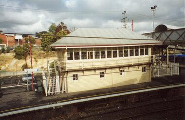 Ringwood and District Historical Society
Photograph, Ringwood Railway Precinct circa 2008, showing the heritage Signal Box, later relocated on the north side of the Station building
-
 Narre Warren and District Family History Group
Booklet, Narre Warren & District Family History Group Inc, Casey Cardinia Collection - Nar Nar Goon Information File, 2005
Nar Nar Goon, a town in Gippsland, Victoria, has a rich history dating back to the mid-19th century. Originally part of the Kulin nation, the area was home to the Boon Wurrung people. The name "Nar Nar Goon" is believed to come from a Boonwurrung word referring to either the koala or the rakali. European settlement began with the establishment of the Mount Ararat pastoral run in 1844, followed by land sales in the 1850s and 1860s. Many settlers came from Ireland, particularly from the Monteagle estate in Limerick. The arrival of the railway in 1881 was a turning point, facilitating timber and agricultural industries. Several sawmills operated in the area, transporting timber via wooden tramways to the railway station. By the early 20th century, Nar Nar Goon had developed into a thriving township with a general store, hotel, butcher, baker, and garage. The town had strong Catholic roots, with a church opening in 1905. Over time, timber milling declined, and dairy farming became the dominant industry. In 2021, part of Nar Nar Goon was annexed to form the new suburb of Pakenham East. Today, Nar Nar Goon is known for its murals, historical buildings, and community spirit. It remains a small but significant town in Victoria’s history. [AI generated text]Display book containing a table of contents and various newspaper clippings and other information pertaining to the Nar Nar Goon area.non-fictionnar nar goon (vic.), nar nar goon (vic.) -- history, bernie byrne, jack egan, mark & sylvia jones, daisy lia, bill doherty, michael o'brien, joan & frank lindsay, paddy henwood, bob rose, harry james, ray coombs, jack payroll, deb bramley, nar nar goon-maryknoll cricket club, john byrne, bernie dingle, jan van steensel, len & mary bramley, kylie shanks, bill bickerton, james dore, red gem potatoes, brydie cunningham -
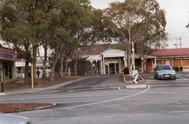
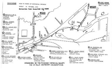 Ringwood and District Historical Society
Pamphlet, Ringwood Walk - Points of Historical Interest, 1979
Sketch of walking route for 17 historical points of interest organised by the Ringwood Historical Society for St. Paul's Church Centenary Celebrations - 14 October 1979, estimated duration 2-1/4hours.1 - Start 2 - Cnr Braeside Avenue, old township, brickworks 1881-1916, Guests, Herrys, Hills 3 - Club Hotel, Ringwood Hall, 1st site of C of E church corner 4 - Ringwood Lake, Anthony Ford - pioneer 5 - Opposite Bardia Street, Sandy Gully, Duncan's Hotel 6 - Opposite Pratt Street, 2nd site of C of E, 2nd fire station, Bentleys, old shopping centre 7 - Warrandyte Road, Former Clocktower site, Pratts butcher shop, Bamfords 8 - End of Pitt Street, building viaduct 9 - Bedford Road, Webdales, old crossing, railway station 10 - Station Street, views over railways 11 - Station entrance, old shopping centre, 2nd Postoffice, 2nd blacksmiths, Mechanics Institute, Town Hall 12 - Clocktower, 3rd State School, coolstores, 3rd Postoffice, market, Kenworthys 13 - Opposite market, 3rd site of C of E, Ringwood views 14 - Adelaide Street, Dickens, 1st fire station, Ringwood Reserve 15 - Opposite squash courts, Matlocks, Salvation Army 16 - Opposite library, bowling club, old baths 17 - Outside C of E, Ringwood views, Brittens, Glamorgan -
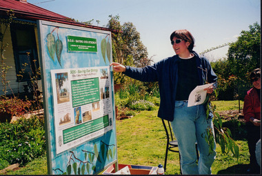 Wooragee Landcare Group
Photograph, 5 September 2004
Wooragee Landcare Group took a bus trip Sunday 5th September to Samaria, Tatong area (near Benalla) to look at land use on small farms. Around this time, Wooragee Landcare were looking into how small land holders could run some enterprises. This photo was taken at Tatong Tavern where the group had lunch. The Tatong Tavern is an old English style pub situated in the foothills of the Great Dividing Range the small community of Tatong 23km south-east of Benalla. The original weatherboard hotel was originally built in the 1880s by William Worrall who was listed as Hotel Keeper from 1886 to 1910. It was destroyed by fire in 1923 and replaced by the current building, which has undergone many changes over the past 100 years. The name has also changed from the Tatong Hotel or ‘Pub’ to the current name of Tatong Tavern.Tatong is a rural village in north-east Victoria, set in undulating country that rises southwards to the Tolmie ranges. The name is thought to derive from an Aboriginal expression, possibly referring to something unseen. The Tatong pastoral run was taken up in 1847 and farm selections began in the 1870s. A school opened in 1890 (closed in 2006). Dairy herds were grazed on the Tatong flats and a cooperative creamery operated from 1892 until 1918. In 1914 a branch railway line was opened from Benalla to Tatong that carried farm produce and timber to Tatong, which had two sawmills in the 1920s. There was also a general store, a police station, and a livestock trucking yard. St Albans Church of England was built in 1921. Most of those buildings have now disappeared. The Tatong Tavern along with the Hall built in 1904 are the only remaining buildings. The Tatong Tavern is a significant tangible and visual representation of the area’s cultural and social history over the past 100 years. Coloured rectangular photograph printed on paperReverse: WAN NA E0NA2N2. NNN- 14240/ (No. 20) 373/ tatong, tatong pub, tatong tavern, tolmie ranges, tatong flats, benalla, wooragee landcare, wooragee landcare group, bus trip, samaria, land use, william worrall, 1800s, 2004, mount samaria -
 Melbourne Tram Museum
Photograph - VR Single truck tram 3 second fleet
Photograph shows single truck VR tram 3 second fleet in Elwood Depot yard with trolley pole raised, weather blinds raised and destination Dickens St. The exterior of the tram appears to be in poor condition and it stands amid low grass with trees and a large building at the rear. Dickens St was an intermediate crossover about 2 km south of the St Kilda Station terminus and was used as a turnback for short run cars during peak hours.Yields information about VR tram 3 and Elwood Depot Black and white photograph with surface peeling at bottom of printvictorian railways, st kilda railway station, vr tram 3, second fleet, dickens st, elwood depot -
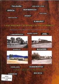 Victorian Railway History Library
Book, Jeffrey, Max et al, Lost Railway Stations of the Pyrenees, 2019
Illustrated history of the railway stations on the closed railway lines of the Victorian Pyrenees including the line to Navarre & Ararat to Maryborough.ill, maps, p.226.non-fictionIllustrated history of the railway stations on the closed railway lines of the Victorian Pyrenees including the line to Navarre & Ararat to Maryborough.pyrenee range (vic.) -- buildings, structures, etc -- history, railroad stations -- victoria -- pyrenee range -- history -
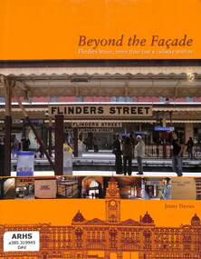 Victorian Railway History Library
Book, Davies, Jenny, Beyond the Facade Flinders Street, more than just a railway station, 2008
A history of the Flinders St station and the shops and facilities in the 1910 built building.index, ill, p.338.non-fictionA history of the Flinders St station and the shops and facilities in the 1910 built building.railroad infrastructure - victoria, flinders st station - victoria - history -
 Victorian Railway History Library
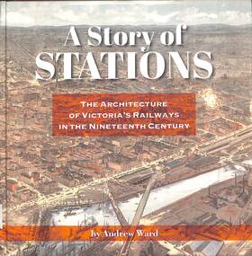
Book, Ward, Andrew, A Story of Stations The Architecture of Victoria's Railways in the Nineteenth Century, 2019
... - history Details of the architecture of railway stations building ...Details of the architecture of railway stations building in Victoria Australia in the 19th century.index, ill, maps, p.337.non-fictionDetails of the architecture of railway stations building in Victoria Australia in the 19th century.railroad infrastructure - victoria, railroads - victoria - history -
 Chelsea & District Historical Society Inc
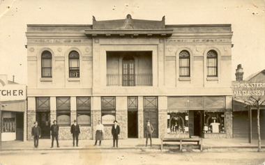
Photograph - Chelsea Shops, Butcher shop - Chelsea Wine Bar - Upholsterer, 1920's
The Chelsea Wine Cafe was situated in Point Nepean Highway opposite the Chelsea railway station. It offered meals, accommodation and wine. In late 1936 the building was pulled down.Two black and white photos of Chelsea Wine Cafe also in the photos are a butcher shop and an upholsterer.Chelsea Wine Cafe Cash Butcher Upholsterer - All classes of Furniture chelsea, chelsea wine cafe, point nepean road, nepean highway -
 Chelsea & District Historical Society Inc
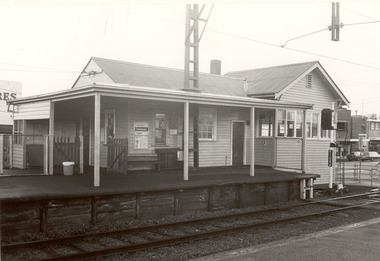
Photograph - Chelsea Railway Station, 1993
... railway station showing down side (Frankston) office building... platform stopping station, on a single railway line to Frankston ...Chelsea station opened on 4 February 1907 as a single platform stopping station, on a single railway line to Frankston, which was laid in 1882. The double line was introduced in December 1910, and the station expanded to two platforms. In 1922 the railway line was electrified. Four black and white photos of Chelsea Railway station. P01067: Chelsea Railway Station showing office on Melbourne side of station (west); P01068: An electric train (Harris Train also known as the "Blue Train") stationary at Chelsea Station; P 01069: Chelsea railway station showing down side (Frankston) office building; P01070: Chelsea Railway Station office, taken from the ramp on the west side of line.chelsea, electric train, frankston railway line, harris train, blue train