Showing 23108 items
matching sardine-creek
-
 Melton City Libraries
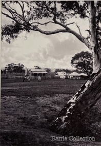
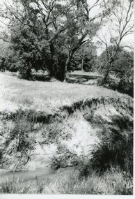
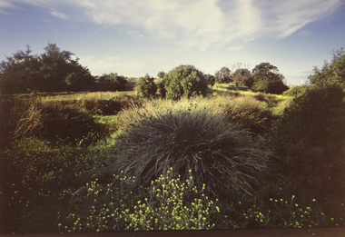
Photograph, Old Gum Toolern Creek, Unknown
Old Gum Toolern Creek from North side, Main Road. landscapes of significance -
 Ballarat Heritage Services
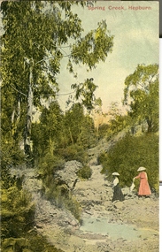
Postcard - Photograph - Colour, Spring Creek, Hepburn
Two women walk along Spring Creek in the Hepburn Springs Reserve. hepburn springs, hepburn springs reserve, spring creek -
 Buninyong & District Historical Society
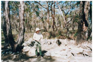
Photograph - Colour photograph, Susan Cherry (researcher) at Dolly's Creek, Jan. 1992, Susan Cherry (researcher) at Dolly's Creek, Jan. 1992
historic, mining, Colour photo, Susan Cherry (researcher) at Dolly's Creek, Jan. 1992dolly's creek, mining, susan cherry -
 Orbost & District Historical Society
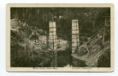
photograph / postcard, early 20th century
Boggy Creek Bridge was built in 1916 as part of the Bairnsdale to Orbost extension to the main Gippsland Railway, and is situated in the middle of the township of Nowa Nowa, crossing a steep-sided and well-timbered creek-valley. This section of the line closed in 1987.This item is a pictorial record of the construction of the Boggy Creek railway bridge on the East Gippsland line. This bridge plays a major part in the identity and history of the town of Nowa Nowa, since Boggy Creek’s steep sided valley divides the township into two components. A black / white photograph on a postcard showing the construction of a railway bridge across a creek. The end pylons are evident and there is scaffolding on both sides of the creek. Two copies of a black / white photograph showing the construction of a railway bridge across a cree. The end pylons are evident and there is scaffolding on both sides of the creek. There is a steam train on the rail track.on front of postcard - caption - " Boggy Creek, Nowa Nowa, W.S. Vogt, Bairnsdale"boggy-creek-bridge vogt-w.s. railway-bridges east-gippsland-railway railway-construction train -
 Ringwood and District Historical Society
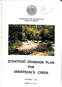
Book, Strategic Drainage Plan For Anderson's Creek, 1978
Melbourne and Metropolitan Board of Works 1988 report on physical characteristics of Anderson's Creek and development of management strategies formulated in consultation with Cities of Croydon, Doncaster & Templestowe, and Ringwood, in which the Anderson's Creek Basin is located. Foreword by Alan H. Croxford, M.M.B.W. Chairman. -
 Falls Creek Historical Society
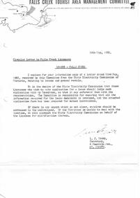
Letter - Circular To Licensees - Leases - Falls Creek
Bob (Herman) Hymans (a former member of the Royal Netherlands Navy) was born in Bloemendaal, Holland on 30th September 1922. During World War II he fought against the Japanese in the Dutch East Indies (now Indonesia) and was imprisoned in Changi and on the Burma Railway. After gaining qualifications as a Ski Instructor, Bob arrived in Falls Creek in July 1950. Working as an Instructor and Supervisor at Bogong Lodge, Bob decided his future was in accommodation. He was successful in negotiating an indenture for land from the State Electricity Commission (SEC). It took Bob two years to build his Grand Coeur Chalet but, tragically, it was burned down in August 1961. Bob also built the first Chairlift in Australia. This was a single chairlift and the structure was built from wooden electricity poles. He was constantly full of new ideas and proposals for the village. Bob Hymans died on 7th July 2007. This Collection of documents and letters tells the story of Bob's endeavours to develop Falls Creek into the ski village it is today.This letter is significant because it documents actions which needed to be taken by the Falls Creek Tourist Area Management Committee in their role overseeing the Tourist Area.A letter and application form dated 28th May 1962 from the Management Committee to Falls Creek Licensees. The form had to be completed by all licensees who wished to make application for a lease. It was to be lodged with the Management Committee, who would forward it to the State Electricity Commission along with Committee's recommendations.falls creek tourist area management committee, sec licenses -
 Ringwood and District Historical Society
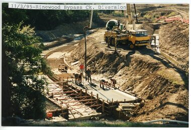
photograph, Eastlink Ringwood Bypass Construction-Ringwood Bypass Creek Diversion
Colour photographWritten on back of photo: "11/3/95 Bypass-Creek Diversion" -
 Ringwood and District Historical Society
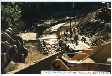
photograph, Eastlink Ringwood Bypass Construction-Ringwood Bypass Creek Diversion 11/3/95
Colour photographWritten on back of photo: "11/3/95 Bypass-Creek Diversion" -
 Ringwood and District Historical Society
Photograph, Mullum Mullum Creek- 29-10-89
Black and white photograph"Written on back of photograph" Mullum Mullum Creek Near Acacia St -
 Ringwood and District Historical Society
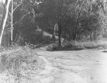
Photograph, Deep Creek Road bridge early 1900s
Black and white photograph taken from unmade road. Road zigzags over bridge with wooden balustrades. Bushland setting. (3 copies)Typed below photograph, "Deep Creek Road bridge in the early days". -
 Ringwood and District Historical Society
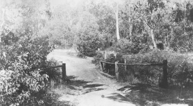
Photograph, Deep Creek bridge and road c.1935
Black and white photograph of narrow unmade road showing narrow bridge with wooded balustrades. Forested area at edge of roadway.Typed below photograph, "Deep Creek bridge and road. c.1935". -
 Ringwood and District Historical Society
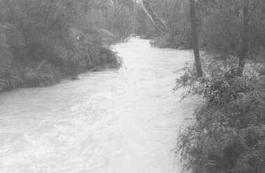
Photograph, Mullum Creek in flood, July 1963. Taken from foot bridge at end of Adelaide St., Ringwood
See also 2982Typed below photograph, "Mullum Creek in Flood - 1963". Other photographs read, "Mullum Creek in flood, July 1963. Taken from foot bridge at end of Adelaide St." -
 Federation University Historical Collection
Document, Leigh Creek Mine Reports
In 1905 Richard Squire was manager of the West Berry Consols at Allendale, and developed an improved system of mine ventilation, which was supported in "The Age."[4] He was successful in combating and remedying the gas and ventilation troubles of the Deep Mines of Creswick and Allendale Districts after all had failedVarious documents relating to Leigh Creek Mine, which include documents related to the wages for a Mr Trenerry, Leigh Creek Mine No Liability Report , A Letter to Mr Squire and other correspondence both typed and Handwrittenrichard squire, leigh river mine, j. trenerry, ewen tierney, mount mercer, j. bowston, w. dickson, a.j. peacock, m.j. mcmanus, geo e. deeble, r.t. squire, r.b. squire, albert kuchel, h.y. peacock -
 Stawell Historical Society Inc
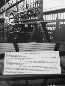
Photograph, Mine Stamper from Newchum Mine Pleasant Creek called "Vivian"
The main photograph of the battery, "Vivian" a 24 Head Stamper is now in Beaconsfield, Tasmania. The battery head stamper was made in 1862 for crushing gold ore for the "Newchum" mine at Pleasant Creek (now Stawell) Victoria. In 1933 the Chintock family used the Head Stamper to cruse tin ore in a mine at Blue Teir in north-eastern Tasmania. It is not know how or when "Vivian" the battery head stamper came to Tasmania. In 1993 the battery was restored as is a working exhibit in the museum at Beaconsfield Tasmania.Two colour photographs, one of the Battery and the other information about the Battery. The main photograph of the battery, "Vivian" a 24 Head Stamper now in Beaconsfield, Tasmania. The battery head stamper was made in 1862 for crushing gold ore for the "Newchum" mine at Pleasant Creek (now Stawell) Victoria. Beaconsfieldstawell, mining -
 Eltham District Historical Society Inc
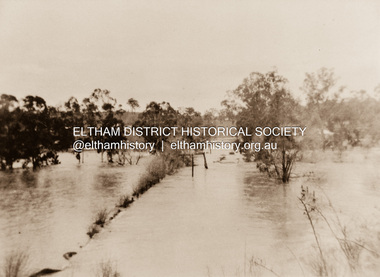
Photograph, Diamond Creek in flood 1924, 1924
Colour reproduction copy of an original sepia photograph of Diamond Creek in flood 1924diamond creek, floods -
 Stawell Historical Society Inc
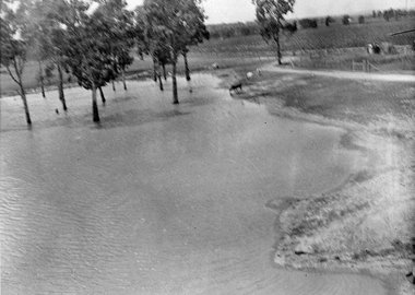
Photograph, Flood on Concongella Creek, Great Western, early 1900's
Digital Photo taken from glass slide by Geoff McMillan, Cooper Street Stawell and reproduced as a photo - printed at Stawell Historical Society 2019Black & White Photo of flood on the Concongella Creek at Best's vineyard, Great Western. -
 Whitehorse Historical Society Inc.
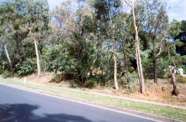
Photograph, Deep Creek Road, 2001
Coloured Photo of Deep Creek Road, Mitcham, prior to clearing for erection of Bridge.deep creek road, mitcham. -
 Whitehorse Historical Society Inc.
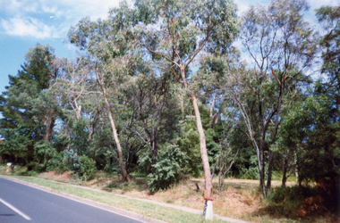
Photograph, Deep Creek Road, 2001
Coloured Photo of Deep Creek Road, Mitcham, prior to clearance for Bridge building.deep creek road, mitcham -
 Whitehorse Historical Society Inc.
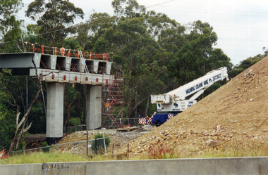
Photograph, Bridge Work - Deep Creek Road, 1/02/2002 12:00:00 AM
Coloured Photo of Work progressing on Bridge spanning Deep Creek Road, Mitcham.deep creek road, mitcham. -
 Ballarat Heritage Services
Photograph, Clare Gervasoni, Brookside Farm Looking Towards the Creek, 21/01/2021
A video of Brookside Homestead looking towards the Creek, taken from the public roadway.brookside, farm, homestead -
 Whitehorse Historical Society Inc.
Photograph, Mullum Mullum Creek
Black and white photograph of the Mullum Mullum Creek flowing past Yarran Dheranyarran dheran, mullum mullum creek -
 Ballarat Heritage Services
Postcard, Spring Creek, Hepburn
A coloured postcard showing women at Spring Creek, the former name for Hepburn Springs. hepburn springs, spring creek, mineral water -
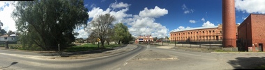 Ballarat Heritage Services
Photograph, Clare Gervasoni, Hill Street Bridge, Yarrowee Creek, and Sunnyside Mill, Ballarat East, 2016, 17/09/2016
Four panoramas showing Hill Street Bridge, Yarrowee Creek, and Sunnyside Mill.yarrowee creek, hill street bridge, sunnyside mill, ballarat woollen mill -
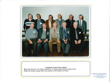 Old Castlemaine Schoolboys Association Inc.
Photograph, Past Pupils of Campbells Creek Primary School 2001, 13/10/2001
photograph Containing past pupils of Campbells creek Primary School at reunion in 2001 -
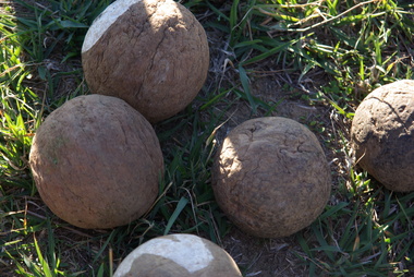 Ballarat Heritage Services
Photograph - Colour, Clare Gervasoni, Wooden bocce balls at Yandoit Creek, 2016, 2016
The Gervasoni family made bocce balls from the roots of trees, because the timber was harder. These bocce balls are probably over 100 years old.Colour photographs of wooden bocce ball used by the Gervasoni family at Yandoit Creek.maurie gervasoni, bocce, yandoit creek -
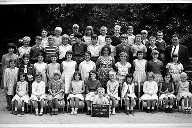 Southern Sherbrooke Historical Society Inc.
Photograph, Menzies Creek State School photo, 1966
A photograph of students, teacher and Head Teacher from Menzies Creek State School. -
 Brimbank City Council Art Collection
Photograph, Robert Pointon, West Bank of the Kororoit Creek looking north, 1988
Local SceneHuntsman Chemical works, West Bank of the Kororoit Creek looking north - AR0019 -
 Brimbank City Council Art Collection
Photograph, Robert Pointon, Kororoit Creek looking North east, 1993
Local SceneKororoit Creek looking North east with the Albion explosive site in the background - AR0020 -
 Whitehorse Historical Society Inc.
Photograph - B/W Photograph, Area North of Burwood Road near Dandenong Creek. For subdivision, 1971
Black and White Photo of Area North of Burwood Road near Dandenong Creek,dandenong, burwwd road -
 Greensborough Historical Society
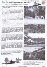
Article, Keith Patterson et al, The Eltham/Hurstbridge Railway, 1912-2012
Account of the extension and electrification of the Eltham to Hurstbridge railway line. Article is in two parts: Part 1: Steam days 1912-1925, published in Diamond Creek News, Autumn 2012; Part 2: Electrification 1926-2012, published in Nillumbik Custodian, v. 8, Issue 2, June 20123 pages, printed both sides. Text and illus. (some col.).eltham, hurstbridge, railways, hurstbridge rail line