Showing 10764 items
matching site
-
 Ballarat Heritage Services
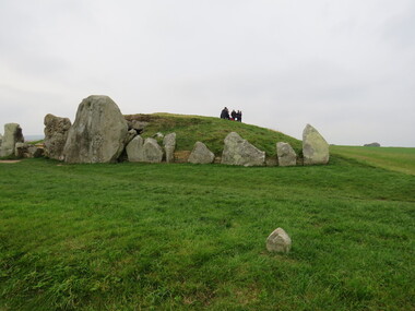
Photograph - Colour, Avebury World Heritage Site, Prehistoric Monuments, England
-
 Ballarat Heritage Services
Photograph, Clare Gervasoni, Camberville Mill Site, 2014, 04/11/2014
Colour photograph at Camberville, Victoria.camberville, forestry, forest -
 Ballarat Heritage Services
Photograph, Clare Gervasoni, Camberville Mill Site, 2014, 04/11/2014
Colour photograph at Camberville, Victoria.camberville, forest -
 Ballarat Heritage Services
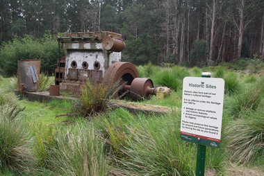
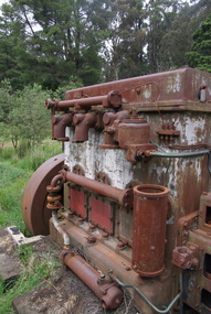
Photograph, Clare Gervasoni, Camberville Mill Site, 2014, 04/11/2014
Colour photograph of abandoned machinery at Camberville. camberville, forestry, machinery -
 Ballarat Heritage Services
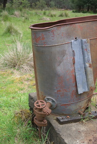
Photograph, Camberville Mill Site, 2014, 04/11/2014
camberville, camberville mill -
 Ballarat Heritage Services
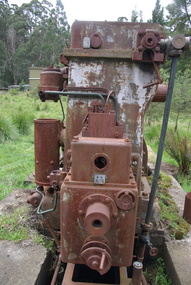
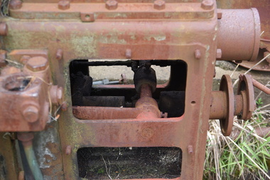
Photograph, Camberville Mill Site, 2014, 04/11/2014
camberville, camberville mill -
 Ballarat Heritage Services
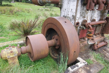
Photograph, Camberville Mill Site, 2014, 04/11/2014
-
 Ballarat Heritage Services
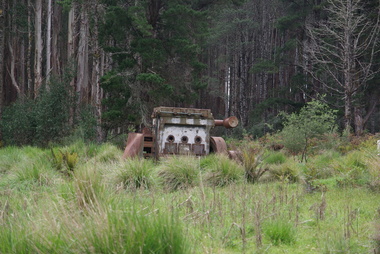
Photograph, Camberville Mill Site, 2014, 04/11/2014
camberville, camberville mill -
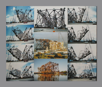
 Lions Club of Maldon Inc.
Document, The History of Dragline Gold Mining Bucket Dredge at a site on Bendigo Road
-
 City of Ballarat Libraries
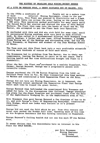
Photograph - Card Box Photographs, Site of St Martins in the Pine circa 1880
Pictured are the Fanning family who were toll-keepers. The property on Geelong Road is now St Martins in the Pines which was gifted to the Sisters of Mercy by Alice Fanning.st martins in the pines, alice fanning, sisters of mercy, building, vehicle, persons, private dwelling -
 Ballarat Heritage Services
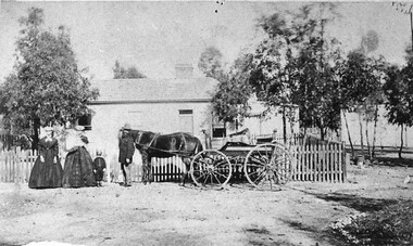
Photograph - Colour, Site of the Bakery Hill Monster Meeting, 2016, 03/12/2016
Flag pole behind St Paul's Anglican Church. It was on the brow of this hill that the Bakery Hill Monster Meetings took place in the prelude to the Eureka Stocade.st paul's anglican church, bakery hill, bakery hill monster meeting, eureka stockade, eureka flag -
 Ballarat Heritage Services
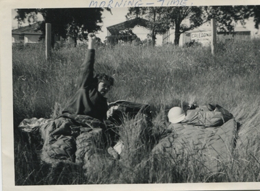
b & w photograph, Morning time at Camp site, 1962
Letter sent with two photographs. Please find enclosed a couple of photos taken in Ballarat in 1962 which came from an album of my mother's Marian Mitchell (nee Robinson). She and some friends were on a road trip across Victoria to New South Wales. You are welcome to reprint these. One is of the Ballarat Rodeo and the other is of mum in the morning at their roadside camp in Ballarat. The sign on the shed has two words, the first one says Caledonia - the second perhaps you'll be able to find out? Both taken in 1962. I hereby give you permission for your society to re-print and distribute both these photos as you choose (although these aren't exactly the most expertly taken pictures). If more come our way over the course of my continued cleaning out of the cupboards I will send these too. Cheers etc3.5" x 5" landscape size black and white photographMORNING - TIME (top front) Verso: Me at Ballarat (trying not to laugh) Marian Robinson -1962- -
 Inverloch Historical Society
002638 - Photograph - 1997 - Old Outtrim - site of town - Nancye Durham
-
 Inverloch Historical Society
002637 - Photograph - 1997 - Old Outtrim - site of mines - Nancye Durham
-
 Inverloch Historical Society
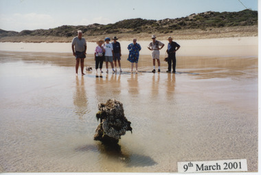
002723 - Photograph - 9th March 2001 - Group Inspecting part of the Magnat Wreck site - from Elizabeth Duff
-
 Inverloch Historical Society
000383A - Photograph - 1994 - Wonthaggi 9 McKenzie St - 11 April 1994 - site of Ferndale Private Hospital - frontview
-
 Inverloch Historical Society
000712 - Photograph - 1997 - Old Outtrim - site of main street - Nancye Durham
-
 RMIT Design Archives
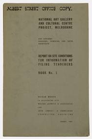
Books, National Art Gallery and Cultural Centre Project, Melbourne: Report on Site Conditions for Information of Piling Tenderers, Book No. 1
architecture -
 Mt Dandenong & District Historical Society Inc.
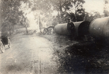
Photograph, At Site of Silvan Dam Pipes c1924, c1924
Man posed for photograph beside large water pipes destined for Silvan Dam. Car is parked at side of road.Black and white photograph with well dressed man in suit and hat standing beside large water pipes beside a treed road. Part of a car is visible to the left.silvan dam, pipe -
 Mt Dandenong & District Historical Society Inc.
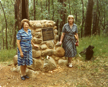
Photograph, Cairn at Kyeema Crash Site 1988, 1988
Visitors at the 1988 Service to commemorate 50th anniversary of the Kyeema Crash. LHS - friend of Miss Delphine Goddard, sister of passenger Gordon Goddard and RHS- Patricia Hogan from Mt Dandenong & District Historical Society.air crash, kyeema, cairn, mt dandenong -
 Mt Dandenong & District Historical Society Inc.
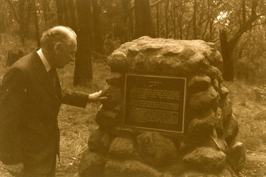
Photograph, Kyeema Crash Site Cairn 1978, 1978
Macarthur Job at the cairn unveiled at the 40 year anniversary of the crash of the aircraft Kyeema (October 1938).air crash, kyeema, cairn, mt dandenong -
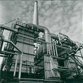
 South Gippsland Shire Council
Photograph, Mounted, Construction site Barry's Beach
Colour photograph taken at Barrys Beach, South Gippsland. Features an oil rig under construction. Trees and foliage in foreground. Blockmounted on board. -
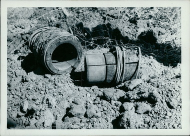 Department of Health and Human Services
Photograph, These old style water pipes fittings, built with wood, were unearthed when excavating the Boort hospital site in 1961. The pipe on the right has a sleeve that is engineered to fit into the piece on the left - Note the wire that binds the wood together - Black & White Photos
-
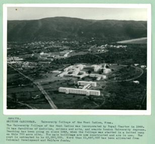 Department of Health and Human Services
An aerial photo of University College, on a 700 acre site, in the West Indies at Mona Jamaica - Department of Health – National Fitness Office (Sports & Recreation) – Press Release Photo - Empire Youth Day & Royal Tours
Department of Health – National Fitness Office (Sports & Recreation) – Historical Press Release Photo - Empire Youth Day & Royals on Tour CollectionDepartment of Health – National Fitness Office (Sports & Recreation) – Historical Press Release Photo - Empire Youth Day & Royals on Tour Collection -
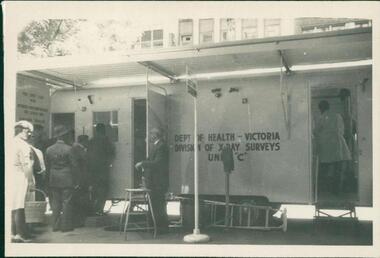 Department of Health and Human Services
Photograph, Mobile chest x-ray clinic van on site on Melbourne street, showing individuals queuing to undertake screening for tuberculosis. Photo is from a photograph album circa 1962
Black and white photograph -
 Department of Health and Human Services
Photograph, Photo of an unidentified Industrial Site / Plant Circa 1960s or 1970s - DEPARTMENT OF HEALTH - PUBLICITY PHOTOGRAPHS
-
 Moorabbin Air Museum
Manual (Item) - Covers area 2 E range Provisional issue manual No.135, Woomera Weapons research establishment blueprints of site
-
Moorabbin Air Museum
Book (Item) - Ansett Sydney Airport Site Plan
-
 Archive of Vietnamese Boat People
A crematorium at refugee camp, Site II, in Thailand
-
 Kew Historical Society Inc
Map, Robert Russell, Map Shewing the Site of Melbourne and the Position of the Huts & Buildings Previous to the Foundation of the Township by Sir Richard Bourke in 1837
Map shows the first layout of Melbourne by Government surveyor Robert Russell, who accompanied Governor Richard Bourke in 1837. The surveyed blocks extend from present-day Flinders Street to Lonsdale Street, and Spring Street to Spencer Street, with extensive vacant land west to a salt lake (afterwards Batman's Swamp, later drained), north beyond Flagstaff Hill and south towards South Melbourne. Vegetation coverage is indicated, and tracks and existing buildings and cultivated land are shown.Printed map was created by Day & Haghe, Lithographers to the Queen, sometime after 1838, when the company received its Royal appointment. Copies of the 1837 map exist in several major map collections in Australia; most are uncoloured. This particular map is the earliest in the Kew Historical Society's map collection. It is a nationally significant artefact. Black and white lithographed map hand-coloured in blue and yellow gouache of the town of Melbourne in 1837. In contrast to the original lithograph, the river and the township blocks are coloured blue and yellow. A similar, partly coloured copy is in the collection of the University of Melbourne.maps - melbourne - 1830s, governor sir richard bourke, robert russell - surveyor, cartography