Showing 4075 items matching "survey"
-
 Bendigo Military Museum
Administrative record - Royal Australian Survey Corps Report on Activities - 1 Jul 1992 - 30 Jun 1994, DSvy - A, Circa 1994
Report is a summary of activities of the R0yal Australian Survey Corps Financial Years 92/9411 Pages stapled, reports and diagramsroyal australian survey corps, rasvy, fortuna, army survey regiment, army svy regt, asr -
 Bendigo Military Museum
Administrative record - Royal Australian Survey Corps Report on Activities - 1 July 1994 - 30 Jun 1995, DSvy - A, Circa 1995
Report is a summary of activities of the Royal Australian Survey Corps Financial year 94/958 pages, stapled, reports and diagrams royal australian survey corps, rasvy, fortuna, army survey regiment, army svy regt, asr -
 National Wool Museum
Book, A survey of private treaty trading in Australia
"A survey of private treaty trading in Australia", Jenny Dickson, Australian Wool Corporation, 1975wool sales wool brokering wool marketing, australian wool corporation private treaty wool merchants association of australia, wool sales, wool brokering, wool marketing -
 Bendigo Military Museum
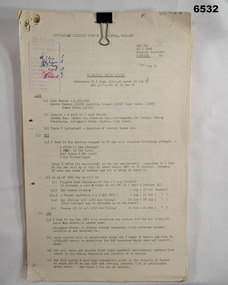
Administrative record - Royal Australian Survey Corps - Central Command Operation Order C/1/61 Northern Territory 1961, DAD Svy, HQ Central Command , Keswick Barracks, SA, 1961
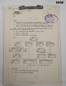
This is a Central Command Operation for the Royal Australian Survey Corps to conduct a Survey Operation in Northern Territory in 1961. The task is to acquire Survey Control for the production of maps coving the following 1:250 000 map areas of Alligator River, Mt Evelyn, Coburg Peninsula, (including the offshore Islands, Melville Island and Bathurst Island. The Operation Order details the tasks for the 6 x Officers (or equivalent) and 34 x OR's (or equivalent) and the support that was allocated including Frigate HMAS Gasgoyne, LSM landing craft, Trucks amphibian (DUKW), Helicopter and Cessna aircraft.A 11 x page foolscap size paper report and 1 x foldout map Annex held together with a paper clip. Two hole punched.Hand written File Number in top RH Corner "101-310-4". Distribution stamp in top LH Corner. Hand written No7 in Top RH Corner.royal australian survey corps, rasvy, fortuna, army survey regiment, army svy regt -
 Bendigo Military Museum
Journal - Army Survey Regiment Map Store Distribution Register 1978-1986, 04.07.1978
This is a record of the maps that were despatched from the Army Survey Regiment Map Store 1978 - 1986Leather Bound "Minute Book", lined paper, hand written records of ASR Map distribution. royal australian survey corps, rasvy, fortuna, army survey regiment, army svy regt, asr -
National Wool Museum
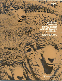
Report, Australian Corriedale survey mission to South America and Mexico July -Sept 1970
Australian Corriedale Association export survey mission to South America and Mexico July -Sept 1970.R W Pettittcorriedale sheep sheep breeding, australian corriedale association, pettitt, mr r. w., corriedale sheep, sheep breeding -
National Wool Museum
Report, Australian Corriedale survey mission to South America and Mexico July -Sept 1970
Australian Corriedale Association export survey mission to South America and Mexico July -Sept 1970corriedale sheep sheep breeding, australian corriedale association, pettitt, mr r. w., corriedale sheep, sheep breeding -
 National Wool Museum
Report, Australian Corriedale survey mission to South America and Mexico July -Sept 1970
Australian Corriedale Association export survey mission to South America and Mexico July -Sept 1970corriedale sheep sheep breeding, australian corriedale association, pettitt, mr r. w., corriedale sheep, sheep breeding -
 Greensborough Historical Society
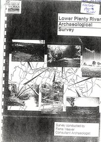
Report, Lower Plenty River Archaeological Survey; Fiona Weaver, 1989_
Archaeological survey of the Lower Plenty River undertaken in 1989-1990 by Fiona Weaver for the Board of Works. Indigenous heritage sites along the Plenty River are examined and recommendations made for the preservation and to lessen the impact of development on these sites.Printed on white A4 paper. Approx 92 pages (not numbered). Illus., maps. 2 copies.plenty river, board of works, aboriginal heritage sites, fiona weaver -
 Bendigo Military Museum
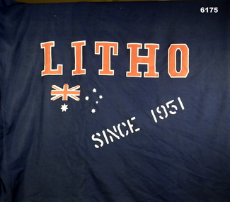
Flag - Lithographic Squadron, Army Survey Regiment Flag, Lithographic Squadron, circa 1970s
The Squadron Flag used by Lithographic Squadron, Army Survey Regiment members on social and ceremonial occasionsA Blue Flag with a 3.5cm diameter staff, 187cm long. Text "LITHO" , "SINCE 1951" and an Australian Flag logo silk screened onto it.royal australian survey corps, rasvy, fortuna, army survey regiment, army svy regt, asr -
 Federation University Historical Collection
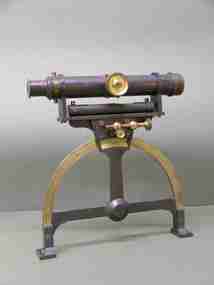
Instrument - Scientific Equipment, Miner's Dial, c1893 - 1901
Used for surveying classes at the Ballarat School of Mines. Purchased/acquired during Queen Victoria's reign. The 1893 Ballarat School of Mines Calendar states that mine surveying instruments "always at the disposal of the students" including "one miner's dial".A surveying instrument consisting of theodolite with single crosshair(.1) mountable on a magnetic compass (.2), designed to sit inside a polished wood carry box. Serial Number 4470On suppliers label: "Instrument maker to the surveying and engineering departments of her Majesty's Government of South Australia"ballarat school of mines, surveying, scientific instruments, scientific objects, otto boettger, optician, miner's dial -
 Bendigo Military Museum
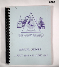
Administrative record - Army Survey Regiment Annual Report - 1 July 1986 - 30 Jun 1987
This report is a summary of activities carried out at the Army Survey Regiment during the F/Y 1986/87A4 report, light blue cardboard covered paper pages. Plastic ring binding. Army Svy Regt Logo/Emblem on cover. Contains text, photographs and diagrams.royal australian survey corps, rasvy, fortuna, army survey regiment, army svy regt, asr -
National Wool Museum
Book, Reconnaissance survey of the sheep industry, No.8: the counties of Tatchera and Gunbower, Victoria, 1952
"Reconnaissance survey of the sheep industry, No.8: the counties of Tatchera and Gunbower, Victoria, 1952" Bureau of Agricultural Economicsagriculture wool growing, c. of a. - bureau of agricultural economics, agriculture, wool growing -
University of Melbourne, Burnley Campus Archives
Plan - Photocopy, Proposed Reserve for Horticultural and Experimental Garden in the Survey Paddock Richmond, 1862-1948
Photocopy of Plan Gazetted 01.08.1863. From Central Plan Office Department of Natural Resources.Original signed by Clement Hodgkinson, Deputy Surveyor General. Stamped Department of Lands and Survey 7.12.48 Neg.18377. Handwritten notes on back "Melb Roll 23, R.19(A)"burnley, horticultural and experimental garden, survey paddock, richmond, clement hodgkinson -
 Bendigo Military Museum
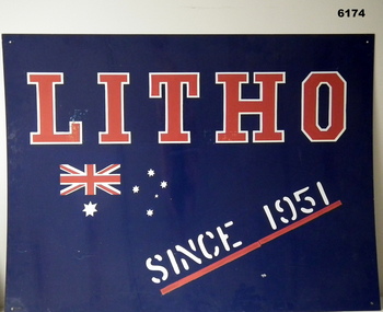
Sign - Litho Squadron, Army Survey Regiment metal sign, Signwriter for Lithographic Squadron, circa 1970's
This large metal sign was affixed to the wall outside the entrance to the Lithographic Squadron at the Army Survey Regiment at Fortuna VillaA large metal sheet sign , painted dark blue with text "LITHO" in red, outlined in white. Text "SINCE 1951" painted in white underlined in red. An Australian flag in red and white is incorporated in the design."LITHO SINCE 1951"royal australian survey corps, rasvy, fortuna, army survey regiment, army svy regt, asr -
Port Melbourne Historical & Preservation Society
Letter - Department of Lands and Survey grant for improving public parks in Sandridge, Department of Lands and Survey, 19 Oct 1863
Handwritten letter from Dept of Lands and Survey 19.10.1863, notifying grant of £90/0/0 for the improving of public parks in Sandridge for 1863local government - borough of sandridge -
 Bendigo Military Museum
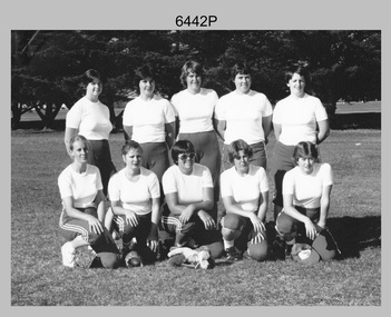
Photograph - Army’s 3rd Military District Inter-Service Softball Team, Victoria, 1981
This is a photograph of Army’s Inter-Service Softball Team that competed in the 3rd Military District, Victoria against Navy and Air Force taken on the 26th of February 1981. The competition was held from the 23rd to the 27th of February 1981. A note on the back of the photo indicated Army’s team came second. It is not known who the winning team was and where the competition was held.This is a photograph of Army’s Team that competed in the 3rd Military District Inter-Service Softball competition against Navy and Air Force, taken in an unknown location in Victoria on the 26th of February 1981. The black and white photo is on photographic paper and was scanned at 300 dpi. It is part of the Army Survey Regiment’s Collection. .1) - Photo, black and white, 1981. Back row L to R: PTE Karen Ball – DSU Broadmeadows, CPL Kay Melton – DSU Puckapunyal, SPR Scheryl Delforce – Army Survey Regiment Bendigo, WO2 Dizzy Dowsett – CARO, LT Jan McFarlane. Front row L to R: SPR Sharon Jones – Army Survey Regiment Bendigo, CPL Donna Sheldrick, CPL Di Chalmers – Army Survey Regiment Bendigo, PTE Karen ???, PTE Jackie Hubbard.Personnel and dates are identified on the back of the photo as well as on paper. royal australian survey corps, rasvy, army survey regiment, army svy regt, fortuna, asr -
 National Vietnam Veterans Museum (NVVM)
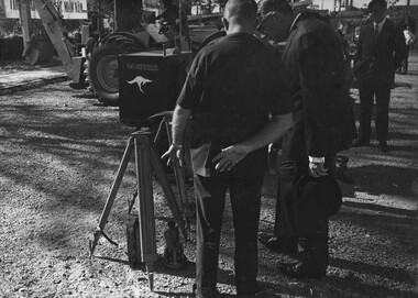
Photograph, Gibbons, Denis, Survey Equipment
Denis Gibbons (1937 – 2011) Trained with the Australian Army, before travelling to Vietnam in January 1966, Denis stayed with the 1st Australian Task Force in Nui Dat working as a photographer. For almost five years Gibbons toured with nine Australian infantry battalions, posting compelling war images from within many combat zones before being flown out in late November 1970 after sustaining injuries. The images held within the National Vietnam Veterans Museum make up the Gibbons Collection.A black and white photograph of The Australian Ambassador to South Vietnam, Mr Ralph Harry inspects survey equipment at the Phuoc Tuy Province Capital, Baria, with an Australian advisor prior to a Handing Over Ceramony Of Equipment, to the Provincial Chief Lt Col Nguyen Ba Truoc.photograph, mr ralph harry (australian ambassador to south vietnam), phuoc tuy province, baria, lt col nguyen ba truoc, gibbons collection catalogue, survey equipment, handing over ceramony of equipment, provincial chief lt col nguyen ba truoc, denis gibbons -
National Wool Museum
Book, A Survey of Scouring and Milling in the Wool Industry
"A Survey of Scouring and Milling in the Wool Industry" - B.F.J. Moxon & J. Barritt, Wool Industries Research Association, June 1950.wool industries research association, scouring, milling -
 Bacchus Marsh & District Historical Society
Map, Plan of Survey of Part of Crown Allotment 9, Parish of Korkuperrimul, 1890
This map documents a transfer of an allotment of land in Clarke Street Bacchus Marsh in 1890. Clarke Street is located on the eastern side of Bacchus Marsh not far from Main Street and Crook Street. It is now known as Candeloro Street. The map indicates J. Booth as the owner of the land and H. Simpson as the occupier. Next to this allotment is a an allotment of land owned by J. Elmore,Single page map showing Crown allotment 9, Parish of Korkuperrimul, County of Bourke. Scale 100 feet to inch. Part of a set of maps which are pasted into a bound volume containing 76 maps or plans in total. High resolution digital image stored on BMDHS computer network. At bottom of map: I hereby certify that I have made this survey expressly for the purpose of an application under the Transfer of Land Statute that this plan is correct. Barry B???, Lic. Surveyor, 16.10.90bacchus marsh victoria maps, clarke street bacchus marsh maps -
 Bendigo Military Museum
Document - Army Survey Regiment Army and Civilian Establishment Authorisation, 23 05 1975
This document was a directive from Army Headquarters authorising the allocation of Army and Civilian positions to the Army Survey Regiment. It provided an organisational wire diagram summarising the overall numbers of Officer, Civilian and Other Ranks to RHQ, and Headquarters, Air Survey, Cartographic and Lithographic Squadrons. Staff allocations to RHQ and each of the four squadron's troop and/or sections were identified in a table format, by hierarchy of rank and employment categories.This document comprises 7 pages of information in black and white with diagrams and tables detailing the allocation of staff to the unit. Pages are fixed by a metal fastener. There is no cover.royal australian survey corps, rasvy, fortuna, army survey regiment, army svy regt, asr -
Federation University Historical Collection
Book, Tourism & Marketing Unit, Ballarat University College, Grampians Tourist Survey - Summary Results January-December, 1991, 1991
Grampians Tourist Survey - Summary Results January-December, 1991. Tourism & Marketing Unit, Ballarat University College, Students' Project.White bound book of 12 pages plus 15 tables and 1 appendix.ballarat university college, grampians, stawell, introduction, methodology, results, conclusion, stawell and grampians economic development association, halls gap, grampians national park, great ocean road, victorian otways, mckenzie falls, wonderland forest, brambuk cultural centre, grampians/gariwerd region -
 Federation University Historical Collection
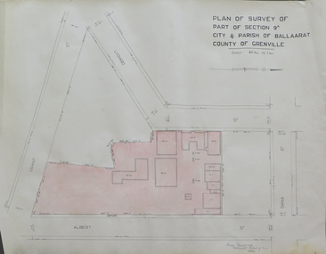
Plan, Plan of Survey of Part of Section 9A City & Parish of Ballarat County of Grenville (Albert Street frontage), 1932
The M.B. John Trade Building was built on the Albert Street Frontage..1) Plan of SMB showing Albert, Grant, Lydiard and Dana streets, on paper with colored highlights undertaken by Ballarat School of Mines student George Murrowood in 1932 .2) Hand written page by George Murrowood, of technical description of land surveying Grade II 1932ballarat school of mines, surveying, george murrowood, albert street, alumni, m.b. john building, architectural plan -
 Montmorency–Eltham RSL Sub Branch
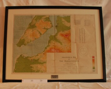
Map - Framed 1915 Map of Krithia, Gallipoli, 1915 Map of Krithia, Gallipolli, 1915
A framed topographical map of The Dardenelles produced from captured Turkish maps by the Egyptian Survey Department. The main feature is the Krithia battlefield area in 1915.Krithia Peninsula (The Dardenelles) World War One - 1915 Mapworld war one, 1915, egypt, map, dardenelles, krithia, survey department, turkey, battlefields -
 Bendigo Military Museum
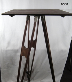
Instrument - Survey Plane Table with Tripod, Circa 1910
A Plane Table consists of a smooth wooden table surface (with metal strengthening supports) mounted on a sturdy base. The base, a three-legged Tripod, is designed to support the table over a specific point on land. The connection between the tabletop and the adjustable Tripod legs permits the user to level the table precisely, using bubble levels in a horizontal plane regardless of the roughness of the terrain. The Plane Table is a surveying device used in surveying and mapping to provide a level surface on which to make drawings, charts or maps. An alidade, with or without a telescope located on the tabletop is used to sight features and draw angles to that feature. Using these lines to the same feature from different setup locations it is possible to locate that feature on the map. Plane Tabeling was widely used by the early members of the Australian Survey Corps and in both World Wars. It remains a simple and effective tool to teach the fundamentals of mapping and surveying. It was simple to use and was reasonably robust and portable. See also item 6489.2 for the Plane Table Alidade.A wooden Plane Table with alloy fittings to strengthen and support the table top. The table is fixed to a three-legged wooden Tripod with cast alloy fittings and metal pointed tips.royal australian survey corps, rasvy, fortuna, army survey regiment, army svy regt, asr, 4 fd svy sqn, school of military survey -
 Melbourne Tram Museum
Document - Report, Melbourne & Metropolitan Tramways Board (MMTB), "East Burwood Passenger Survey November 1978", Nov. 1978
Report -A4 bound with brown comb binder, 45 pages + fawn covers, titled "East Burwood Passenger Survey November 1978".. Contents include passenger origins, access modes, trip purpose, frequency, destinations and comments. Has 14 appendices, Not all sheets scannedtrams, tramways, east burwood, new tramways, passengers, surveys -
![Book - Article, Fiona Weaver, Lower Plenty River Archaeological Survey by Fiona Weaver [excerpt], 1991](/media/collectors/62fc2e8d3b4c83fe7f279a1c/items/6450d73a49371722cf4f2ee8/item-media/6450d9b949371722cf4f5830/item-fit-380x285.jpg) Heidelberg Golf Club
Heidelberg Golf ClubBook - Article, Fiona Weaver, Lower Plenty River Archaeological Survey by Fiona Weaver [excerpt], 1991
Excerpt from Lower Plenty River Archaeological Survey by Fiona Weaver. Section 5 on Aboriginal archaeological sites in the Lower Plenty River area.A survey of First Nations sites in the Lower Plenty River area.Copy of part of book.lower plenty river, aboriginal sites -
Port Melbourne Historical & Preservation Society
Photograph, Aerial Survey of Port Melbourne; December 1945, 2105
Seventeen (17) individual photos were joined together by John KIRBY to make a compsite image.Aerial Survey of Port Melbourne; December 1945 Large photograph mounted on foam board. Shows aerial view of Port Melbourne showing its extent from the Bay. Panel on right hand side has key to numbered areas on map . PMHPS logo on top left cornereclipse picture theatre, brookes lemos ltd, built environment, local government, natural environment, built environment - industrial, religion - roman catholic church (st josephs), gmh, general motors-holden, rotten row, sport - trotting, j kitchen & sons pty ltd, australian wool board, government aircraft factory, gaf, commonwealth aircraft corporation, cac, north port oval, fire and fire services, market reserve, religion - presbyterian church, leading lights, foresters arms hotel, commonwealth government engine works, st josephs catholic primary school, mission to seamen, centenary bridge, naval drill hall, mail exchange, gasworks, piers and wharves - town pier, robert harper & co ltd, ran - royal australian navy, hmas lonsdale, port melbourne yacht club, pmyc -
Villa Alba Museum
Document, Andrew Thorn, Villa Alba: Condition Survey and Stabilization of Critical Surfaces, 1997
This report was commissioned by the Villa Alba Preservation Committee following evidence of deterioration on a number of important surfaces at Villa Alba. The report documents changes that have occurred and compares them to the situation reported on in 1986. The report then outlines treatments carried out in 1986 and recently for each of the rooms worked on in 1986.36-page conservation report conducted by Andrew Thorn (Artcare) in 1997 of surfaces in Villa Alba. The report has the following structure: Condition Survey, Treatment Materials and Methods, Detailed Work in Each Room. This copy of the draft report includes detailed plans showing areas requiring stabilization.This report was commissioned by the Villa Alba Preservation Committee following evidence of deterioration on a number of important surfaces at Villa Alba. The report documents changes that have occurred and compares them to the situation reported on in 1986. The report then outlines treatments carried out in 1986 and recently for each of the rooms worked on in 1986. villa alba museum, conservation reports, andrew thorn, artcare, conservation treatments -
Port Melbourne Historical & Preservation Society
Letter - Department of Lands and Survey reply re setting out Sandridge streets, Department of Lands and Survey, 30 Jan 1861
Handwritten letter on blue foolscap laid paper, from Dept of Lands and Survey 13.1.1861 replying to Town Clerk's request on setting out Sandridge streetslocal government - borough of sandridge