Showing 6999 items
matching historical parks
-
 Whitehorse Historical Society Inc.
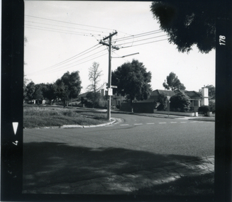
Photograph, Corner Victoria & Edward Streets, Mitcham, c 1987
Photograph taken prior to the building of the Coles supermarket and car parkBlack and white photograph of the corner of Victoria and Edwards Streets, Mitcham; looking south and west c. 1987victoria street, mitcham, edward street -
 Whitehorse Historical Society Inc.
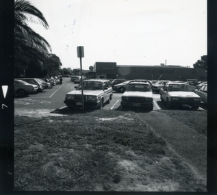
Photograph, Coles car park c. 1987, c. 1987
Black and white photograph of the Coles Car Park in Mitcham Road, Mitcham., looking west. c. 1987 Note palm trees at left. Coles and car park were built on original site of Mitcham Primary Schoolcoles supermarket, mitcham, car parks, mitcham road, mitcham primary school, no. 2904 -
 Whitehorse Historical Society Inc.
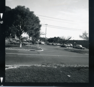
Photograph, Car park - Coles, c 1987
Black and white photograph of the Coles Car park taken from the corner of Mitcham Road and Victoria Street. c 1987car parks, coles supermarket, mitcham, mitcham road, victoria street -
 Whitehorse Historical Society Inc.
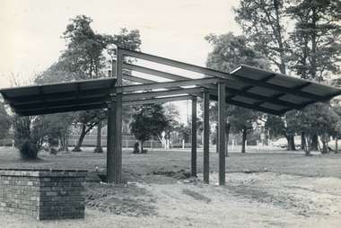
Photograph, Antonio Park Shelter, c 1977
Black and white photograph of the shelter being erected at Antonio Park by Rotary, Mitcham, as a memorial to Bill Sewart, a Rotarian and City Engineer in the City of Nunawadingantonio park mitcham, sewart, bill, rotary club of mitcham, whitehorse road, mitcham -
 Whitehorse Historical Society Inc.
Photograph, Antonio Park Shelter and BBQ, 1980's
Coloured photograph of the Bill Sewart Memorial Shelter and BBQ at Antonio Park , erected in 1977antonio park, mitcham, barbecues, whitehorse road -
 Whitehorse Historical Society Inc.
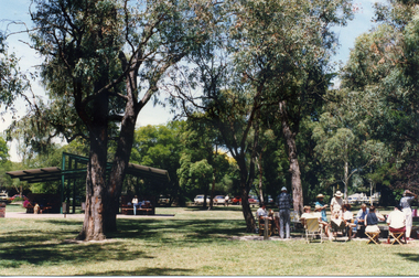
Photograph, Antonio Park - general view, 1980's
Coloured photograph of Antonio Park showing the playground, picnic and BBQ area in the 1980'santonio park, mitcham -
 Whitehorse Historical Society Inc.
Photograph, Antonio Park, 1980's
Coloured photograph of picnic area at Antonio Park in the 1980'santonio park, mitcham -
 Whitehorse Historical Society Inc.
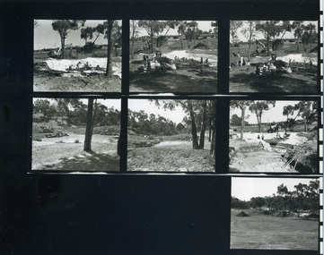
Photograph, Yarran Dheran - entry, 1980's
A series of black and white photographs of the construction of the entry roundabout off Ashburton Drive, Mitcham to the Yarran Dheran Information Centre and parkyarran dheran -
 Whitehorse Historical Society Inc.
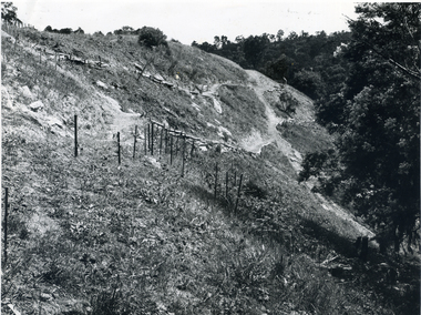
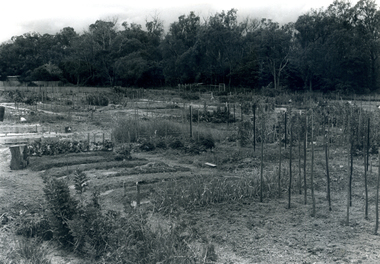
Photograph, Yarran Dheran - quarry, 1972
Black and white photograph of the paths and planting on the quarry face at Yarran Dheran Park in 1972yarran dheran, quarries, native plants -
 Whitehorse Historical Society Inc.
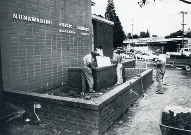
Photograph, Landscaping - Blackburn Library
Black and white photograph of workmen finishing the garden area of the Blackburn Branch of the Nunawading Public Library in 1977-78 prior to the landscaping by Parks and Gardens staff.city of nunawading - gardens and environment, blackburn branch library -
 Whitehorse Historical Society Inc.
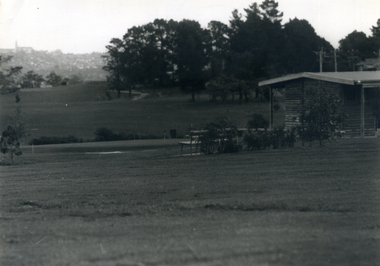
Photograph, Morack Golf Course, c 1976
Black and white photograph of the Morack Golf Course looking south to the final holes with the original club house on the right. Course opened as 9 holes in 1976, extended into 18 holes in 1980. c 1976morack golf course, city of nunawading, parks and reserves -
 Whitehorse Historical Society Inc.
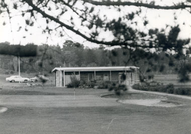
Photograph, Morack Golf Course - clubhouse, c 1976
Black and white photograph showing the clubhouse at the Morack Golf Course seen from the final hole. Course and clubhouse opened in 1976 as 9 holes, later extended to 18 holes in 1980. c1976morack golf course, city of nunawading, parks and reserves -
 Whitehorse Historical Society Inc.
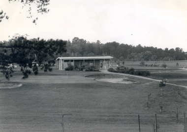
Photograph, Morack Golf Course, c 1976
Black and white photograph of the clubhouse and a general view of the Morack Golf Course c 1976. Course was originally 9 holes in 1976 and extended to 18 holes in 1980morack golf course, city of whitehorse, parks and reserves -
 Whitehorse Historical Society Inc.
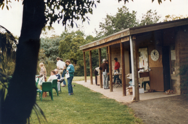
Photograph, Morack Golf Course - clubhouse, 9/11/1986 12:00:00 AM
Coloured photograph of the Morack Golf Course clubhouse taken on 9th November 1986. Taken on a 'Go bush in Nunawading' as part of an initiative of the then Mayor Wendy Reidmorack golf course, city of nunawading, parks and reserves, 'go bush' initiative -
 Whitehorse Historical Society Inc.
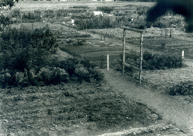
Photograph, Nunawading Community Garden
Black and white photograph of the Nunawading Community Garden in Jolimont Road, Forest Hill established in October 1977. This photo would have been taken 1977-78community gardens, city of nunawading, nunawading community garden, parks and reserves -
 Whitehorse Historical Society Inc.
Photograph, Nunawading Community Garden
Black and white photograph of the Nunawading Community Gardens in Jolimont Road, Forest Hill established in October 1977. this photo would have been taken in 1977-78community gardens, city of nunawading, nunawading community garden, parks and reserves -
 Whitehorse Historical Society Inc.
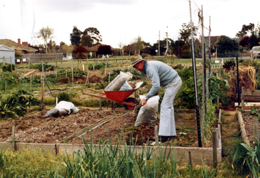
Photograph, Nunawading Community Garden
Coloured photograph of gardener attending his plot at the Nunawading Community Gardens in Jolimont Road, Forest Hill c1980. the gardens were opened in 1977community gardens, city of nunawading, nunawading community garden, parks and reserves -
 Whitehorse Historical Society Inc.
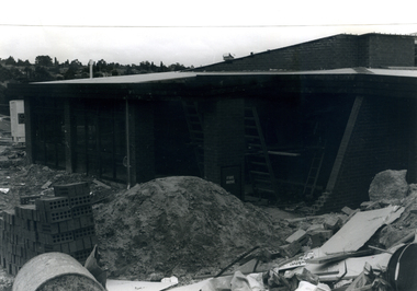
Photograph, Eley Park Community Centre - construction, 1978
Black and white photograph of the construction of the Eley Park Community Centre in 1978city of nunawading, eley park community centre, eley road, burwood east -
 Whitehorse Historical Society Inc.
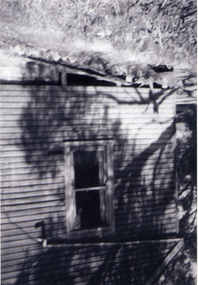
Photograph, Antonio Park - The Shack, C1960
The photo is part of a set provided by Robin Harris of his early life (1953-1962) in 'The Shack' at Antonio Park. See ND5241 for his story 'When Antonio Park was home'.)Black & white photograph of 'The Shack' in Antonio Park where Robin Harris lived with his family in 1953 - 1962. His nephew, Mark Coleclough is standing in front. See ND5241 for history.antonio park, mitcham, coleclough. mark, the shack, whitehorse road, no.627, harris. robin -
 Whitehorse Historical Society Inc.
Photograph, Antonio Park - The Shack - East side, C1960
The photo is part of a set provided by Robin Harris of his early life (1953-1962) in 'The Shack' at Antonio Park. See ND5241 for his story 'When Antonio Park was home'.)Black & white photograph of the Shack in Antonio Park (1953-1962) showing the eastern side which faced Deep Creek Road. See ND5241 for history.antonio park mitcham, the shack, whitehorse road, mitcham, no.627, harris. robin, bushfire - 1962 -
 Whitehorse Historical Society Inc.
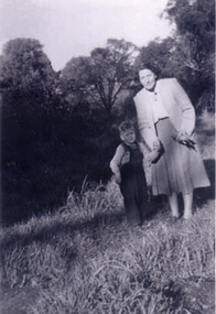
Photograph, Antonio Park - Doris Harris, C1960
The photo is part of a set provided by Robin Harris of his early life (1953-1962) in 'The Shack' at Antonio Park. See ND5241 for his story 'When Antonio Park was home'.)Black & white photograph of Doris Harris (1900-1975) with her grandson, and Robin Harris's nephew, Mark Coleclough. Photo was taken from the eastern side of the shack looking toward Deep Creek Road and showing part of the overgrown fruit orchard in the background. See ND5241 for history.antonio park mitcham, harris. dorothy, coleclough. mark, the shack, whitehorse road, mitcham, no.627, harris. robin, bushfire - 1962 -
 Whitehorse Historical Society Inc.
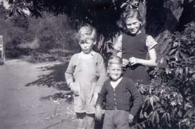
Photograph, Antonio Park - The Harris Children, C1960
The photo is part of a set provided by Robin Harris of his early life (1953-1962) in 'The Shack' at Antonio Park. See ND5241 for his story 'When Antonio Park was home'.)Black & white photograph of of Robin Harris, nephew Mark Coleclough and sister Margaret Julie Harris. See ND5241 for history.antonio park mitcham, coleclough. mark, the shack, whitehorse road, mitcham, no. 627, harris. robin, harris. margaret julie, bushfire - 1962 -
 Whitehorse Historical Society Inc.
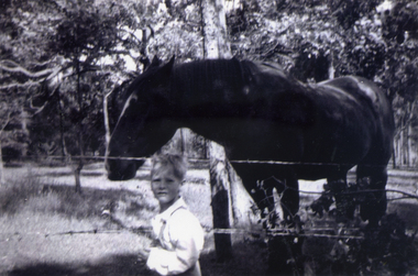
Photograph, Antonio Park - Mark with 'Clumpy Jim', C1960
The photo is part of a set provided by Robin Harris of his early life (1953-1962) in 'The Shack' at Antonio Park. See ND5241 for his story 'When Antonio Park was home'.)Black & white photograph of Mark Coleclough feeding 'Clumpy Jim'. The horse belonged to a neighbour. The paddock later became part of the Antonio Park Primary School. See ND5241 for history.antonio park mitcham, coleclough. mark, whitehorse road, mitcham, no. 627, bushfire - 1962 -
 Whitehorse Historical Society Inc.
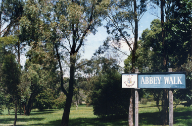
Photograph, Abbey Walk, Vermont
Coloured photograph of Abbey Walk, Vermontabbey walk, vermont, parks and reserves, city of nunawading - parks and recreation -
 Whitehorse Historical Society Inc.
Book - History, Wandinong Sanctuary Advisory Committee, The Wandinong Story (2023), October 2023
The book describes the origins of Wandinong Sanctuary, Blackburn as a home for the Hookes family from 1913 and its transformation into a public park in 1973.Color Reprint of 110 pp, with a new front page and new color photographs of the vegetation. non-fictionThe book describes the origins of Wandinong Sanctuary, Blackburn as a home for the Hookes family from 1913 and its transformation into a public park in 1973.wandinong sanctuary, hooke janet, hooke arthur -
 Whitehorse Historical Society Inc.
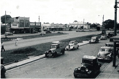
Photograph, Whitehorse Road, Mitcham
An early black and white photograph of the Mitcham shopping centre. Cars parked in the side road to the right.whitehorse road, mitcham, mitcham whitehorse road, shopping centre, mitcham -
 Whitehorse Historical Society Inc.
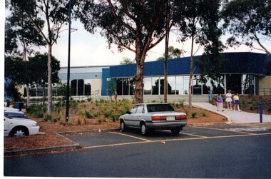
Photograph, Whitehorse Club|Function & Convention Centre
The Whitehorse Club and Convention Centre was built in 1984. It is open seven days a week with special days for members. As well as catering for corporate, private and community functions, there are bocce, card and billiard competitions.Coloured photograph of the Convention Centre, basketball stadium to the left and the East Burwood hall on the far right. Cars parked at the front.whitehorse convention centre, basketball stadium -
 Whitehorse Historical Society Inc.
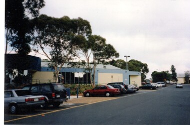
Photograph, Basketball Stadium, East Burwood
The East Burwood stadium was opened on the 24th July 1970 by Victorian Premier, Dick Hamer. It was the most famous basketball venue in the 70's and 80's costing $8 million. The stadium was financed by basketball patrons under administration of the Nunawading Basketball Association, a non-profit community advancement company. The stadium caters for 7000 players per week.Coloured photograph of the basketball stadium East Burwood. Cars parked at the front. The East Burwood hall in the distance. Located in Burwood Hwy East Burwood.basketball stadium, east burwood, sporting venue -
 Whitehorse Historical Society Inc.
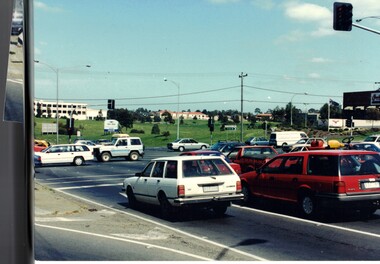
Photograph, Springvale Road East Burwood
The Tally Ho Business Park was built on vacant land previously owned by the Methodist Church. The land was sold cheaply to the Church by Abel Hoadley, and the Tally Ho Boys Home was erected there. A change in the care of the boys meant that the land became vacant for a considerable time before buildings appeared. The Country Fire Authority, Vic Roads and World Vision are also located there.4 coloured photographs (a-d) taken at the intersection of Springvale Road & Burwood Hwy East Burwood. First stages of the Tally Ho Business Park in the background.tally ho business park, businesses -
 Whitehorse Historical Society Inc.
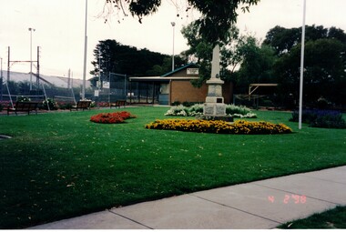
Photograph, Blackburn War Memorial
Built after World War 1, the monument originally stood on the corner of Whitehorse & Railway Roads before being moved to Morton Park on 20th April 1969. The memorial was erected in memory of those from the district who were killed during WW1. Those who lost their lives in WW2 were added on the other side of the memorial as well as plaques commemorating later conflicts. The monument is a grey granite obelisk on a single stepped bluestone base on a concrete platform.Coloured photograph of a war memorial surrounded by flower gardens. Blackburn Tennis Club , rooms & courts on the left.blackburn war memorial, war memorials