Showing 127075 items
matching main-road
-
 Eltham District Historical Society Inc
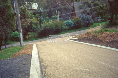
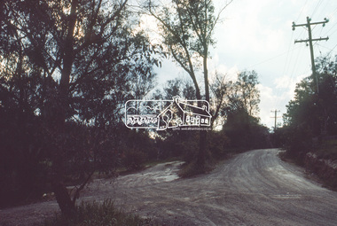
Slide - Photograph, Eltham Shire Council, Roadside drainage control, unidentified road, Shire of Eltham, c.1989
Eltham Shire Council review of various kerb profiles and road side drainage35mm colour positive transparency Mount - Black and Whiteinfrastructure, footpaths and gutters, road drainage, roads, shire or eltham, streets -
 Greensborough Historical Society
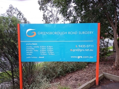
Photograph - Digital image, Marilyn Smith, Greensborough Road Surgery Sign, 10/07/2016
The Greensborough Road Surgery moved to this location in 1985 in response to increased demand for services.greensborough road surgery, medical centre -
 Eltham District Historical Society Inc
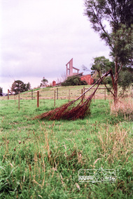
Photograph, Coorie Bank, 410 Eltham Yarra-Glen Road, Kangaroo Ground, 5 Jun 1990, 5 June 1990
On the road to yarra glen past tower on right Home of Charis and Bill PellingRoll of 35mm colour negative film, 7 stripsFuji 200 Abuildings, houses, kangaroo ground, coorie bank, charis pelling -
 Eltham District Historical Society Inc
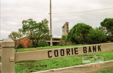
Photograph, Coorie Bank, 410 Eltham Yarra-Glen Road, Kangaroo Ground, 5 Jun 1990, 5 June 1990
On the road to yarra glen past tower on right Home of Charis and Bill PellingRoll of 35mm colour negative film, 7 stripsFuji 200 Abuildings, houses, kangaroo ground, coorie bank, charis pelling -
 Eltham District Historical Society Inc
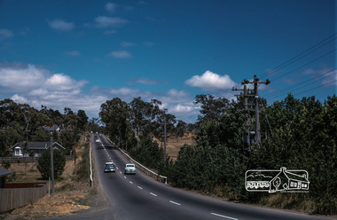
Photograph, Fred Mitchell, Lower Plenty Road, Yallambie, 1968
Road to Rosanna beside Watsonia Army Barracks. Immediately to left is Broadlea Crescent.Digital copy of colour photographfred mitchell collection, 1968, broadlea crescent, lower plenty road, watsonia barracks, yallambie -
 Eltham District Historical Society Inc
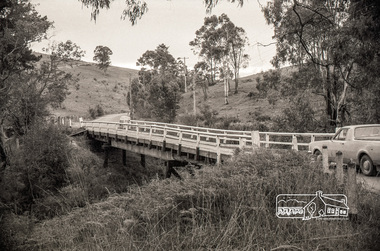
Negative - Photograph, Russell Yeoman, Cottles Bridge over Diamond Creek, Cottles Bridge-Strathewan Road, Cottlesbridge, c.1970
Cottles Bridge over Diamond Creek, Cottles Bridge-Strathewen Road, CottlesbridgeRoll of 35mm black and white negative film, 4 of 7 stripsIlford HP4bridge, cars, cottles bridge, cottles bridge-strathewen road, diamond creek (creek) -
 St Kilda Historical Society
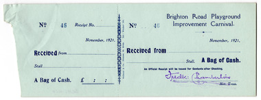
Administrative record - Form, Brighton Road Playground Improvement Carnival receipt, 1921
Uncompleted forms for receipt of money at the Brighton Road Playground Improvement Carnival, 1921Blue coloured uncompleted paper forms printed in blueNumbered 43-59, stamped in blue. Name of the Treasurer stamped in purple. (17 forms)brighton road playground, city of st kilda -
 Whittlesea Historical Society Inc.
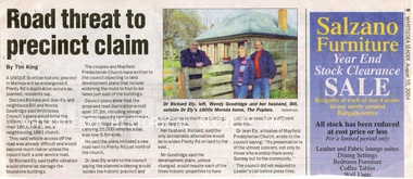
Newspaper - Newspaper Clipping, Whittlesea Leader, Road threat to precinct claim, 10 Aug 2004
An article about the Mayfield Precinct in Mernda becoming endangered if Plenty Road is widened.Newsprint with colour photomernda, richard ely, jean ely, the poplars mernda, bluestone house, mayfield precinct, wendy goodridge, bill goodridge -
 Stawell Historical Society Inc
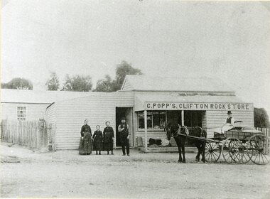
Photograph, Mr C. Popp’s Clifton Rock Store on the corner of Newington Road & Sophia Street
Clifton Rock Store (C. Popp’s) Cnr Newington Road and Sophia Streetstawell business -
 Wonga Park Community Cottage History Group
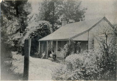
Photograph (sub-item) - Mr. Edward Hughes’ home, ‘The Oaks’, in Hartley Road, Wonga Park in 1933
Mr. Edward Hughes’ home, ‘The Oaks’, in Hartley Road, Wonga Park in 1933. -
 Kew Historical Society Inc
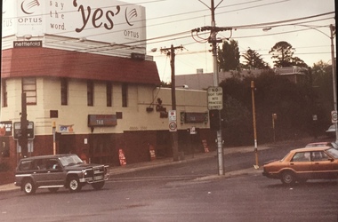
Photograph - Clifton Hotel, Kew Junction, 1994
Of the eight hotels established in Kew since European settlement, The Hotel Kew, known for most of its existence, as the Clifton Hotel was the seventh to be built in 1868. Its location on the corner of Studley Park Road and High Street at Kew Junction makes it a prominent landmark. Its current name is confusing for local historians as its main rival for the first 52 years was O'Shaughnessy's Hotel (1855), later renamed the Kew Hotel, on the corner of High Street and Denmark Street. Looking at the façade of the Hotel Kew, it is hard to imagine its mid-nineteenth appearance. There have probably been at least four renovations or rebuilding(s) of the structure. The documented renovations have occurred in the 1930s when the late Victorian façade was given an Art Deco update. In about 1970 its façade was again 'improved'. The many publicans who have held the licenses of the Clifton Hotel have been identified in in the 'Tetlow Index' and on the 'Boroondara Local History Wiki'. The most significant of these are Henry Madden (1880-87); Michael O'Donnell (1902-1920); and the Cronin-Ryan family (1935–53ff).Fading colour positive photograph of the Clifton Hotel at Kew Junction on the corner of High Street South and Studley Park Road. The hotel had been modified extensively over time, disguising the original Italianate facade. This is the colour scheme of the fourth restoration, including huge advertising billboards on the roof.Reverse: "Clifton Hotel. Studley Park Road at Kew Junction. 1994clifton hotel -- kew (vic.), hotels -- kew (vic.), kew junction -
 Eltham District Historical Society Inc
Negative - Photograph, J.A. McDonald, Sherbourne Road, Montmorency, c. July 1962
View looking west across Sherbourne Road to intersection of Rattray Road from present-day forecourt entrance to 7-Eleven Eltham service station The BP Service Station is now an Ampol Service Station (2022) Google Street View Apr.. 2022 https://goo.gl/maps/LM4APKCwj1ohBDPv5Record of various Shire of Eltham infrastructure works undertaken during the period of 1952-1962 involving bridge and road reconstruction projects, sometimes with Eltham Shire Council Project Reference numbers quoted. It was during this period that a number of significant improvements were made to roads and new bridges constructed within the shire that remain in place as of present day (2022). In many situations, the photos provide a tangible visible record of infrastructure that existed throughout the early days of the Shire. The album was put together by or under the direction of the Shire Engineer, J.A. McDonald.1962-07, ampol service station, bp service station, montmorency, rattray road, service station, sherbourne road, graders, infrastructure, public telephone box (red), reconstruction works, road construction, shire of eltham -
 Eltham District Historical Society Inc
Negative - Photograph, J.A. McDonald, Sherbourne Road, Montmorency, c. July 1962
View looking west across Sherbourne Road to intersection of Rattray Road from present-day forecourt entrance to 7-Eleven Eltham service station The BP Service Station is now an Ampol Service Station (2022) Google Street View Apr.. 2022 https://goo.gl/maps/LM4APKCwj1ohBDPv5Record of various Shire of Eltham infrastructure works undertaken during the period of 1952-1962 involving bridge and road reconstruction projects, sometimes with Eltham Shire Council Project Reference numbers quoted. It was during this period that a number of significant improvements were made to roads and new bridges constructed within the shire that remain in place as of present day (2022). In many situations, the photos provide a tangible visible record of infrastructure that existed throughout the early days of the Shire. The album was put together by or under the direction of the Shire Engineer, J.A. McDonald.1962-07, ampol service station, bp service station, montmorency, rattray road, service station, sherbourne road, infrastructure, reconstruction works, road construction, shire of eltham -
 Eltham District Historical Society Inc
Slide, Sackville Street, Montmorency; split road near no. 36, c.Oct. 1980
One of a series of images of roads and infrastructure focussed on the Quinn Estate in Montmorency taken by Eltham Shire Council Planning and Engineering officers. They provide perspective of the changes in housing styles and road development that began sweeping in from the mid 1970s with increasing urbanisation of what was once more outlying suburbs and regions.35 mm colour positive transparency Mount - Kodak Kodachrome CardProcessed Oct 1980sackville street, infrastructure, montmorency, roads -
 Eltham District Historical Society Inc
Slide, Quinn Estate, Reichelt Avenue near Riverina Road, Montmorency, c.Oct. 1980
One of a series of images of roads and infrastructure focussed on the Quinn Estate in Montmorency taken by Eltham Shire Council Planning and Engineering officers. They provide perspective of the changes in housing styles and road development that began sweeping in from the mid 1970s with increasing urbanisation of what was once more outlying suburbs and regions.35 mm colour positive transparency Mount - Kodak Kodachrome CardProcessed Oct 1980housing estate, infrastructure, montmorency, quinn estate, reichelt avenue, roads -
 Ballarat Tramway Museum
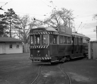
Photograph - Digital Image, Peter Knife, SEC 43 squeezing into Road 0 at Ballarat Depot, 14/8/1965
Digital image of SEC 43 squeezing or turning into Road 0 at Ballarat Depot. Tram has an electric cooking roof advert. Photo by Peter Knife 14 Aug 1965. This track "0 Road" was built to accommodate bogie cars in the mid-1950s, a set of very sharp reverse curves. Yields information about Ballarat's trams in August 1965.Digital image of a black and white negativetramways, tramcars, ballarat, tram 43, sec depot, 0 road -
 Melbourne Tram Museum
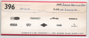
Negative, Bruce Herbert, "Burwood Tram Line Extns - near Blackburn Road", 29/12/1977 12:00:00 AM
Negative folder - made by SAGA Japan, containing 6 no. 120 film negatives 60mm x 90mm of the works on the extension to East Burwood, Burwood Highway, near Blackburn Road, 29-12-1977. Folder stamped 396 .1 - Burwood highway - out of focus - showing end of slab. .2 - ditto - looking west? - shows cross section of slab. .3 - Blackburn road with poles positioned - with BP service station in background. .4 - ditto .5 - sign showing tramway works in progress .6 - from the kerbside showing the track.trams, tramways, burwood highway, tramway construction, construction, east burwood -
 Melbourne Tram Museum
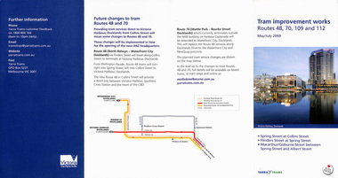
Pamphlet, Yarra Trams, "Tram improvement works routes 48, 70, 109 and 112", "Tram service changes St Kilda Road - tram track renewal", 2008 and 2012
,1 - pamphlet - 4 fold DL, titled "Tram improvement works routes 48, 70, 109 and 112" - May and July 2008 - installation of curves at Wellington Parade, Spring and Flinders St and for Spring Macarthur and Collins St along with tram stop works. Has a map and project details. .2 - Pamphlet - 3 fold DL - "Tram service changes St Kilda Road - tram track renewal" - April 2012 - between commercial road and Domain Interchange. Has map. Both have State Govt and Yarra trams logos.trams, tramways, trackwork, new tramway, spring st, flinders st, junction, collins st, wellington parade, macarthur st, st kilda road, domain interchange, commercial road -
 Ringwood and District Historical Society
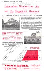
Flyer, Advertisement for Mullum Mullum Road, Ringwood, Vic., Sale of "Bonnie View" Villa and five allotments. - 1923
Single page flyer advertising realising sale of villa and land in Mullum Mullum Road, Ringwood, at 3 o'clock on Saturday, August 18th, 1923. Also includes descriptions and photographs of the property, location of the blocks, and summary of local train services.Auctioneer - Knight & Harwood, 315 Collins Street, Melbourne, Tel 10615, 10616, in conjunction with local agent - J.B. McAlpin, Opposite Railway Station, Ringwood, Tel. Ringwood 7. -
 Ringwood and District Historical Society
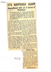
Newspaper, Newspaper articles detailing the gift of 17 acres of land south end of New Street, by Frank Pike of Heatherdale Road, for parkland
Newspaper articles detailing the gift of 17 acres of land south end of New Street, by Frank Pike of Heatherdale Road, for parkland. The new park will be called Pomona Park. It was later called Proclamation Park, used for athletics, baseball and cricket. -
 Ringwood and District Historical Society
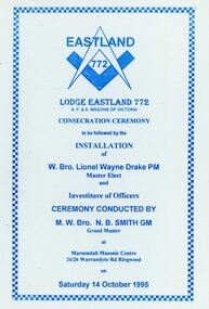
Programme - Consecration Ceremony, Eastland Lodge No.772, A.F. and A. Masons of Victoria, Maroondah Masonic Centre, 24-26 Warrandyte Road, Ringwood, Victoria
Installation of W.Bro. Lionel Wayne Drake and Investiture of Officers Ceremony at Maroondah Masonic Centre, 24-26 Warrandyte Road, Ringwood, 14 October,1995. Includes Toast list, Foundation Team list, and alphabetical list of Foundation Members. -
 Port Melbourne Historical & Preservation Society
Document, "Barak Road redevelopment", 1955 - 1970
"Barak road redevelopment". Manilla folder of papers relating to Port Melbourne City Council's efforts to remove the World War 2 storage sheds along Beacon Rd/Barak Rd and its replacement with housing by the Housing Commission of Victoriabuilt environment, public housing, engineering, barak road, housing commission of victoria -
 National Vietnam Veterans Museum (NVVM)
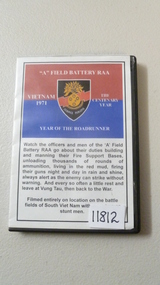
Film - Film, DVD, Year of the Road Runner
A Film, DVD in case named "A" Field Battery RAA. Red & Blue colours with a shield with the words 'Semper Paratus' (US Coast Guard song). Year of the Road Runner & description of contents of Film, DVD which runs 40 minsfilm, dvd, field battery raa -
 Whitehorse Historical Society Inc.
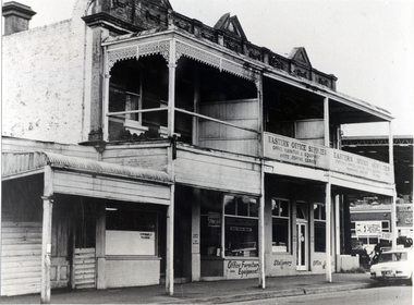
Photograph, 93 - 97 Railway Road Blackburn, 1964
Used by donor in 'Blackburn - a picturesque history'Black & white photo of oldest business premises at 93 - 97 Railway Road Blackburn. Built in 1888 of Blackburn bricks. It is oldest business premises in the township.(1978) Later the Blackburn Eastern Office Supplies (see NA8) Page 31railway road blackburn, nos. 93-97, eastern office supplies -
 Whitehorse Historical Society Inc.
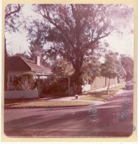
Photograph, 93 Central Road, Blackburn - View -3
Colour photograph of the house at 93 Central Road, Blackburn, purchased from William Elliott Wilson, by the Rev. John Flynn of the Australian Inland Mission, for his sister Rosetta Flynn in 1928. Photo shows view of house from street.central road, blackburn, no.93, wilson, william, elliott, flynn, rev. john, rosetta -
 Rutherglen Historical Society
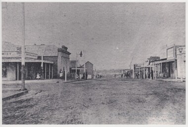
Image, 1900 Approximate
Donated by Mr Greg Thomson, a former resident of RutherglenBlack & white reproduction, unframed, laminated. This photograph is of Main St Rutherglen facing east. At the end of the right hand side in middle of photograph is a small white patch, this is the Chinese camp. Left hand corner is where Fire Station now stands, old Blue Bird Hall is next (now Goodfellows Supermarket)On back of photo: "Main St Rutherglen - facing east"main street, chinese camp, blue bird hall, goodfellows supermarket -
 Ringwood and District Historical Society
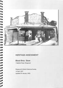
Book, Heritage Assessment - Blood Bros. Store, 1 Bedford Road, Ringwood, Victoria, 2022
A4 size wire-bound book compiled by Ringwood and District Historical Society Project Team 14 April, 2021, Updated 20 January, 2022.This report register dcuments the development and issue of the report titled Heritage Assessment 1 Bedford Road, Ringwood, which was undertaken by Ringwood and District Historical Society, in accordance with our internal quality management system. -
 Ringwood and District Historical Society
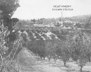
Photograph, View of what was Heathmont township taken from about Royal Avenue looking at Mr. Herman Pump's orchard. Old bridge over Canterbury Road can be seen on left
Typed below photograph, "View of what was Heathmont township taken from about Royal Avenue looking at Mr. Herman Pump's orchard. Old bridge over Canterbury Road can be seen on left." -
 Ringwood and District Historical Society
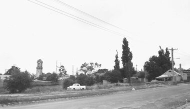
Photograph, Maroondah Highway Central, Ringwood. Rear of shops in Whitehorse Road, 1963
Black and white photographWritten on rear of backing sheet: "Clock Tower from front of 'Mail' office - 30 November 1963." Photograph taken in Adelaide Street looking towards clock tower then located at the Warrandyte Road intersection. -
 Greensborough Historical Society
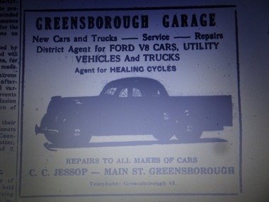
Advertisement - Digital Image, Greensborough Garage 1940s, 1940s
Advertisement from a newspaper for Greensborough Garage of Main Street Greensborough 1940s. Proprietor: C.C. Jessop (known as Snowy Jessop).Part of a collection of miscellaneous advertisements for businesses in Greensborough and surrounding areas.Digital copy of newspaper advertisement.main street greensborough, greensborough garage, snowy jessop, clarrie jessop, jessop family