Showing 126749 items
matching main-road
-
 Greensborough Historical Society
Poster, Kathleen Hislop, St Katherine's Anglican Church and Cemetery, St Helena Road, St Helena, 1980c
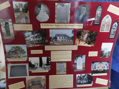
Student poster on the history of St Katherine's Anglican Church and Cemetery, St Helena Road, St Helena.Poster, possibly school assignment. Colour photographs and text mounted on dark red poster. References on back. Poster is laminatedst katherines church st helena -
 Greensborough Historical Society
Newspaper Clipping, Diamond Valley Leader, Link road depends on poll, 14/12/2016
The North East Link will connect the Metropolitan Ring Road and Eastern Freeway. It is under consideration by the Victorian Government.News clipping, black text. north east link, metropolitan ring road -
 City of Ballarat Libraries
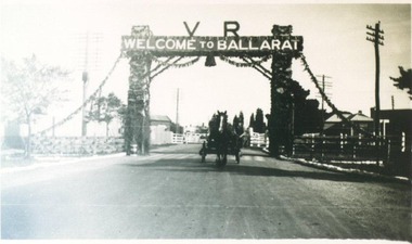
Photograph, Decorative Arch over Creswick Road Rail Crossing for Ballarat Centenary Celebrations 1938
Victorian Railways Decorative arch over the Creswick Road railway crossing for the Ballarat Centenary Celebrations in 1938.streetscape, centenary, ballarat, creswick road, railway -
 Port Melbourne Historical & Preservation Society
Photograph, James Lauritz, Looking towards the Beacon and Beacon Road housing, 1989 - 1990
Looking towards the Beacon and Beacon Road housing. Shows undeveloped paddocks between Beacon and the railway. Also West Gate Bridge is in the distance James LAURITZ print of Port Melbourne, laminated (one of 18). Copies of slides produced for Port Melbourne Councillocal government - city of port melbourne, built environment, james lauritz, beacon cove, beacons, engineering - bridges, west gate bridge -
 Southern Sherbrooke Historical Society Inc.
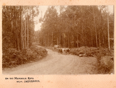
Photograph, On the Monbulk Road near Sherbrooke
Photo shows a team of cattle (bullocks, cows or steers) hauling a log down to the sawmill. A huge piece of timber is clearly seen chained to the dray. Heavy timber both sides of the road, most likely present-day Sherbrooke Forest. c.1920. -
 Kew Historical Society Inc
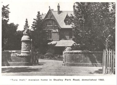
Photograph, ' Tara Hall,' Mansion home in Studley Park Road, demolished 1960, 1891
This work forms part of the collection assembled by the historian Dorothy Rogers, that was donated to the Kew Historical Society by her son John Rogers in 2015. The manuscripts, photographs, maps, and documents were sourced by her from both family and local collections or produced as references for her print publications. Many were directly used by Rogers in writing ‘Lovely Old Homes of Kew’ (1961) and 'A History of Kew' (1973), or the numerous articles on local history that she produced for suburban newspapers. Most of the photographs in the collection include detailed annotations in her hand. The Rogers Collection provides a comprehensive insight into the working habits of a historian in the 1960s and 1970s. Together it forms the largest privately-donated collection within the archives of the Kew Historical SocietyA view of Tara Hall from Studley Park Road, originally photographed by J.F.C. Farquhar in 1891 for the photographic album 'Kew: Where We Live', published by Henry Kellett. This image of the mansion has been used in a number of publications. The house was demolished in 1960.tara hall, goathland, byram, ramsden, dorothy rogers -
 Kew Historical Society Inc
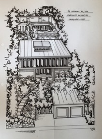
Drawing - Property Illustration, Margaret Picken, 34 Yarravale Road, Kew, 1994
After training as a Cartographic Draftsman within the mining industry, I worked as a property illustrator for real estate firms in the eastern suburbs of Melbourne for 22 years from 1983. I initially photographed houses with a Polaroid camera and made a 'thumbnail' sketch while there. The photos were used to scale off a sketch in pencil and then that sketch was overlaid with drafting film and the 'pen and ink' completed. The pens I used were the Rotring ‘Rapidigraph’ drafting pens. The ink was also made by Rotring (German).The film was ‘Rapidraw’, polyester drafting film, double matte. It takes a very fine line and doesn’t bleed. As well as house sketches, there were often floor plans and site plans ordered. Aerial sketches were ordered when the property needed an overall view. (Margaret Picken, 2020)This drawing is one of a series created by Margaret Picken for a number of real estate agents in Melbourne between 1983 and 2005. Each work is signed and dated by the artist.Gift of Margaret Picken, 2020Designed for Sir Zelman Cowen in 1959 by Grounds, Romberg and Boyd (architects), this mid-century modernist residence has undergone a series of modifications to the original design. The pen and ink property illustration of 34 Yarravale Road, Kew by Margaret Picken was made in 1989.34 YARRAVALE RD., KEW / MARGARET PICKEN '89 / WOODARDS ~ KEWartist -- margaret picken 1950-, architectural drawings -- houses -- kew (vic.), 34 yarravale road -- kew (vic.), sir zelman cowen, grounds romberg and boyd (architects) -
 Surrey Hills Historical Society Collection
Pamphlet - Ephemera, Brochure for Holmsdale Convalescent and Rest Home, 257 Union Road, Surrey Hills, 1936
Holmsdale Convalescent and Rest Home was built by John Mawson for his sisters Muriel, Beatrice and Harriet (and ? Ethel or Dorothy), all nurses. It was named after the sailing ship that their parents, Frederick W and Mary Mawson and baby Beatrice migrated on from England in 1882. John was a partner in the Box Hill building firm Garre tt and Mawson. The sketch of the nursing home used in the brochure was his work. It was opened on Saturday 14 March 1936 by Mr M J Boyland, MLA. The home was closed in the mid-1950s and converted into 4 self-contained flats, one of which was occupied by the sisters in their retirement; the others provided them with an income. Initial photocopies of this brochure, an invitation to the official opening of Holmsdale, photos of the ship Holmsdale, passengers' ticket for Fred W Mawson, Mary Mawson & Beatrice Mawson and notes compiled by John Howden about his late aunts (Bea, Hadge & Mouse) were donated to the collection by Randy Johnson, a tenant of John Howden's in late 2004. Subsequent research papers and photocopies of other family ephemera from John Howden are also filed in the Mawson vertical file.A brown bi-fold leaflet advertising the Holmsdale Convalescent and Rest Home located at 257 Union Road, Surrey Hills under the direction of the Misses Mawson (late Australian Army Nursing Service A I F). Inside is an artist's sketch of the exterior of Holmsdale.holmsdale convalescent and rest home, garrett and mawson, nursing homes, nurses, builders, john mawson, beatrice mawson, harriet mawson, muriel mawson, ethel mawson, dorothy mawson -
![Photograph - Digital Image, Ray White Greensborough, 3 St Helena Road Greensborough [bedrooms and bathrooms], 2017_](/media/collectors/4f729f5697f83e03086015b8/items/5d3c00e921ea6715d01e47d8/item-media/5d3c011d21ea6715d01e7d3e/item-fit-380x285.jpg) Greensborough Historical Society
Greensborough Historical SocietyPhotograph - Digital Image, Ray White Greensborough, 3 St Helena Road Greensborough [bedrooms and bathrooms], 2017_
Interior photographs of the house at 3 St Helena Road Greensborough (corner Diamond Creek Road), showing the bedrooms and bathroms. The house was built in 1920. These photographs are from the Ray White sales brochure 2017. The 4 bedroom property sold in December 2017 for $900,000; previous sales: April 2009, $600,000; June 1981, $36,500; June 1976, $32,500. Digital copy of 4 colour photographs.st helena road greensborough, diamond creek road greensborough -
 Melbourne Tram Museum
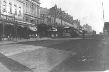
Photograph, Cable tram 41 Bridge Road Richmond, c1900
The photograph shows cable, trailer 41 climbing the Bridge Road hill just west of Waltham Steet bound for the city. A second cable set can be seen in the distance, bound for Hawthorn Bridge. Nearly all of the buildings on this south side of Bridge Road remain today including the former Forbes and Sons building. Photo possibly dated c1900.Yields information about cable trams in Bridge Road Richmond and associated buildings.Photograph, black and white, plain papertrams, tramways, cable tram, bridge road, tram 41, richmond -
 Kew Historical Society Inc
Photograph - Street Works, Studley Park Road, March 1934
Studley Park Road, like most streets in Kew, was originally a dirt road. Street works during the Great Depression included bituminising major roads in the district. This photograph of Council works originated in the City of Kew Engineers Department as a record of works undertaken. It was given to the collection by a Mrs Fisher in 1998.Well provenanced photograph of Council-funded public works in Kew during the Great Depression. Original sepia monochrome positive of Council workers standing on and beside a dray in Studley Park Road, Kew while resurfacing of the street was taking place. The Kew Junction is just visible behind the men.Typed reverse: "B4 / Kew C.C. / Spreading premixed material on Studley Park Road with drag spreader, view from rear of machine, March 1934"roadworks -- kew (vic.), street works -- kew (vic.), public works kew (vic.), studley park road -- kew (vic.), city of kew -- engineers department, city of kew -- public works -- great depression -- 1930s -
 National Wool Museum
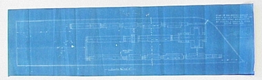
Plan - Machinery Layouts, J Dyson & Sons Pty Ltd
Two machinery plan layouts for Mimosa Wool & Textiles Pty Ltd in Hobson's Road, Kensington.1617.1 Rectangular blue paper with white lined plan drawing and white text 1617.2 Rectangular blue paper with white lined plan drawing1617.1 Front: Final Plan / PLAN OF MACHINERY LAYOUT / MIMOSA WOOL & TEXTILES PTY LTD / HOBSON'S ROAD KENSINGTON / BY MESSRS J DYSON & SONS / SOUTH GEELONG / Scale 3/32" - 1.0"factory, machinery, wool, textiles, mill, kensington, south geelong, plans, drawings, blueprint, layout, mimosa, j. dyson and sons pty ltd -
 Eltham District Historical Society Inc
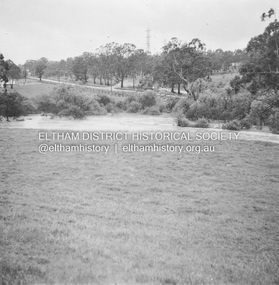
Album - Photograph, J.A. McDonald, Eltham-Yarra Glen Road, 18 Oct. 1956
Eltham-Yarra Glen Road Proposed crossing of Plenty River at Lower Plenty. Floods 18th October 1956.Record of various Shire of Eltham infrastructure works undertaken during the period of 1952-1962 involving bridge and road reconstruction projects, sometimes with Eltham Shire Council Project Reference numbers quoted. It was during this period that a number of significant improvements were made to roads and new bridges constructed within the shire that remain in place as of present day (2022). In many situations, the photos provide a tangible visible record of infrastructure that existed throughout the early days of the Shire. The album was put together by or under the direction of the Shire Engineer, J.A. McDonald.infrastructure, road construction, shire of eltham, bridge construction, eltham-yarra glen road, 1956-10-18, floods, floodwater, lower plenty, plenty river -
 Eltham District Historical Society Inc
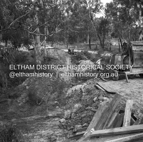
Negative - Photograph, J.A. McDonald, Henley Road at Watsons Creek, Apr. 1961
Henley Road at Watsons Creek looking easterly along centreline from west abutment Early April 1961Record of various Shire of Eltham infrastructure works undertaken during the period of 1952-1962 involving bridge and road reconstruction projects, sometimes with Eltham Shire Council Project Reference numbers quoted. It was during this period that a number of significant improvements were made to roads and new bridges constructed within the shire that remain in place as of present day (2022). In many situations, the photos provide a tangible visible record of infrastructure that existed throughout the early days of the Shire. The album was put together by or under the direction of the Shire Engineer, J.A. McDonald.infrastructure, shire of eltham, bend of islands, cr. charis pelling, henley road, henley road bridge, kangaroo ground, oxley bridge, watsons creek, w.e. wolf, bridge construction, road construction, 1961-04 -
 Eltham District Historical Society Inc
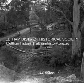
Negative - Photograph, J.A. McDonald, Henley Road at Watsons Creek, Apr. 1961
Henley Road at Watsons Creek looking westerly along centreline from east abutment Early April 1961Record of various Shire of Eltham infrastructure works undertaken during the period of 1952-1962 involving bridge and road reconstruction projects, sometimes with Eltham Shire Council Project Reference numbers quoted. It was during this period that a number of significant improvements were made to roads and new bridges constructed within the shire that remain in place as of present day (2022). In many situations, the photos provide a tangible visible record of infrastructure that existed throughout the early days of the Shire. The album was put together by or under the direction of the Shire Engineer, J.A. McDonald.infrastructure, shire of eltham, bend of islands, cr. charis pelling, henley road, henley road bridge, kangaroo ground, oxley bridge, watsons creek, w.e. wolf, bridge construction, road construction, 1961-04 -
 Eltham District Historical Society Inc
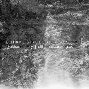
Negative - Photograph, J.A. McDonald, Henley Road at Watsons Creek, Apr. 1961
Henley Road at Watsons Creek looking westerly along centreline from east abutment Early April 1961Record of various Shire of Eltham infrastructure works undertaken during the period of 1952-1962 involving bridge and road reconstruction projects, sometimes with Eltham Shire Council Project Reference numbers quoted. It was during this period that a number of significant improvements were made to roads and new bridges constructed within the shire that remain in place as of present day (2022). In many situations, the photos provide a tangible visible record of infrastructure that existed throughout the early days of the Shire. The album was put together by or under the direction of the Shire Engineer, J.A. McDonald.infrastructure, shire of eltham, bend of islands, cr. charis pelling, henley road, henley road bridge, kangaroo ground, oxley bridge, watsons creek, w.e. wolf, bridge construction, road construction, 1961-04 -
 Eltham District Historical Society Inc
Slide - Photograph, Kangaroo Ground-St Andrews Road, Kangaroo Ground, c.May 1988
Kangaroo Ground-St Andrews Road, Kangaroo Ground, opposite Kangaroo Ground Pony Club, C.May 198835mm colour positive transparency (1 of 36) Mount - Kodak KodachromeProcess Date MAY 88Minfrastructure, roads, kangaroo ground, kangaroo ground pony club, kangaroo ground-st andrews road -
 Greensborough Historical Society
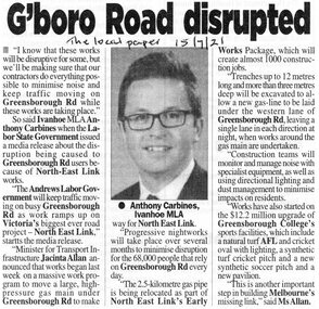
Article - Newspaper Clipping, G'boro Road disrupted, 22/07/2020
Noise and disruption on Greensborough Road will be kept to a minimum, when roadworks for the North East Link Project begin [2021]News clipping, black and white text and image.greensborough road, north east link -
 Greensborough Historical Society
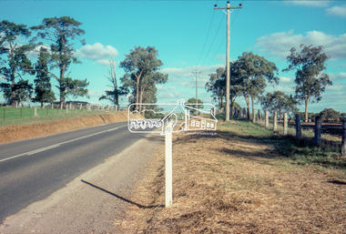
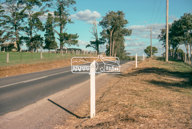
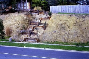
Slide - Photograph, John Ramsdale, Rattray Road erosion: Slide 2, 1990s
Photograph shows a retaining wall leading up an embankment to a fence line. This shows erosion on Rattray Road Montmorency.Part of the John Ramsdale collection of slides and audio visual material.Colour photograph scanned from slide.erosion, rattray road montmorency -
 Greensborough Historical Society
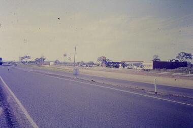
Slide - Photograph, John Ramsdale, Plenty Road and urban creep: Slide 28, 1990s
Photograph shows Plenty Road Mill Park with Shell petrol station and Macdonalds, showing the urban expansion in this area.Part of the John Ramsdale collection of slides and audio visual material.Colour photograph scanned from slide.No maker's marks. No caption on slide.plenty road mill park, urbanisation -
 Greensborough Historical Society
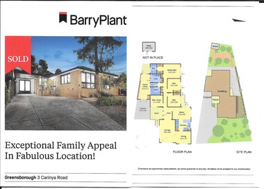
Advertising leaflet, Barry Plant Greensborough, 3 Carinya Road Greensborough, 2019
3 Carinya Road Greensborough, 4 bedroom single storey house, sold 15 June 2019 for $736,0002 p. cardboard leaflet, printed in colour both sides, folded twicecarinya road greensborough -
 Greensborough Historical Society
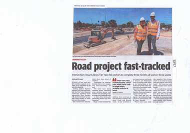
Newspaper Clipping, Diamond Valley Leader, Road project fast-tracked, 30/01/2019
Stage 1 of Yan Yean Road's $131.2 million upgrade is on track to be completed by its mid 2019 deadline.News article 1 page, black text.yan yean road, yan yean, traffic, roadworks -
 Greensborough Historical Society
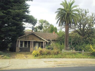
Photograph - Digital Image, Marilyn Smith, 113 Mountainview Road Briar Hill, 2012, 05/02/2012
Photographs of house at 113 Mountainview Road Briar Hill, taken in 2012. The house was destroyed by fire in July 2018.Digital images of 5 colour photographs.mountainview road briar hill -
 Greensborough Historical Society
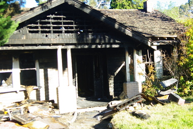
Photograph - Digital Image, 113 Mountainview Road Briar Hill, 2018 - post-fire, 19/07/2018
Photographs of house at 113 Mountainview Road Briar Hill, taken after the house was destroyed by fire in July 2018.Digital images of 5 colour photographs.mountainview road briar hill, house fire -
Greensborough Historical Society
Report - Digital Image, Metropolitan Fire Brigade, 113 Mountainview Road Briar Hill, 2018, 11/07/2018
Metropolitan Fire Brigade media release on house fire at 113 Mountainview Road Briar Hill, July 2018.Digital copy of MFB media release.mountainview road briar hill, house fire, metropolitan fire brigade -
 Greensborough Historical Society
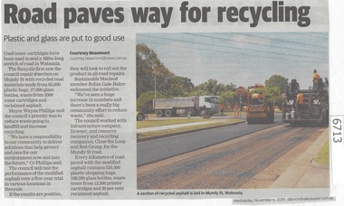
Newspaper Clipping, Diamond Valley Leader, Road paves way for recycling, 06/11/2019
Used toner cartridges have been used to seal a 160m long stretch of road in Mundy Street, WatsoniaNews article 1 page, black text, colour image.watsonia, used toner cartridges for recycling, mundy street watsonia, banyule city council, recycled road materials -
 Greensborough Historical Society
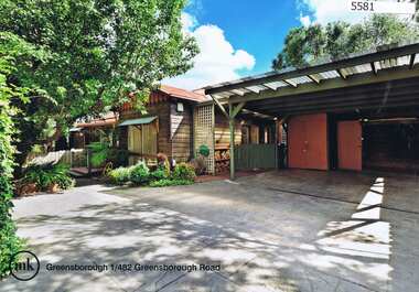
Advertising Leaflet, 1/482 Greensborough Road Greensborough, 11/04/2015
1/482 Greensborough Road Greensborough, 3 bedroom home, auctioned 11 April 2015, sold for $459,000Real estate advertising leaflet, 1 sheet, printed in colour both sidesgreensborough road greensborough -
 Greensborough Historical Society
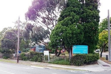
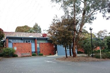
Photograph - Digital image, Marilyn Smith, Greensborough Road Surgery, 10/07/2016
The Greensborough Road Surgery moved to this location in 1985 in response to increased demand for services. This building was built in the late 1950s.Digital copy of colour photographgreensborough road surgery, medical centre -
 Greensborough Historical Society
Photograph - Digital image, Marilyn Smith, Greensborough Road Surgery, 10/07/2016
The Greensborough Road Surgery moved to this location in 1985 in response to increased demand for services. This building was built in the late 1950s.Digital copy of colour photographgreensborough road surgery, medical centre