Showing 107 items
matching sugarloaf
-
 Greensborough Historical Society
Book, Nillumbik Shire Council, Nillumbik Community Guide 2000/2001, 2000-2001
Guide to services provided by Nillumbik Shire Council. Nillumbik Shire is located 25 kilometres north-east of Melbourne and the southern boundary is the Yarra River. The south of Nillumbik is predominantly urban, with commercial centres at Eltham and Diamond Creek. The north of the municipality includes significant natural features like Kinglake National Park and Sugarloaf ReservoirAnnual guide to services in Nillumbik76 pages, black and white illustrations. Cover has a collage of local children with title in white on mid-blue background.nillumbik shire council, handbooks -
 Eltham District Historical Society Inc
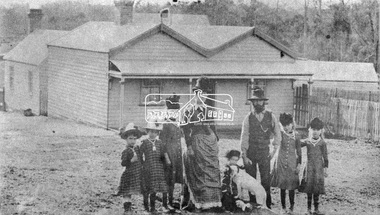
Photograph, Early Settlers, Christmas Hills
Unknown family of a woman, a bearded man, five girls and possibly the youngest child, a boy with dog standing in front of a timber house with paling fence at the side. This photo also appears in "The Christmas Hills Story: once around the sugarloaf 11" by Mick Woiwod (2010). It is captioned: William Smith and family in front of their recently completed Christmas Hills home in the late 1890s.This photo forms part of a collection of photographs gathered by the Shire of Eltham for their centenary project book,"Pioneers and Painters: 100 years of the Shire of Eltham" by Alan Marshall (1971). The collection of over 500 images is held in partnership between Eltham District Historical Society and Yarra Plenty Regional Library (Eltham Library) and is now formally known as the 'The Shire of Eltham Pioneers Photograph Collection.' It is significant in being the first community sourced collection representing the places and people of the Shire's first one hundred years.Digital imagesepp, shire of eltham pioneers photograph collection, christmas hills, william smith, pioneers, family, settlers -
 Federation University Historical Collection
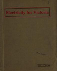
Book, Electricity for Victoria, 1927, 1927
Brown soft covered book. Contents include: Winning Brown Coal at Yallourn Dredge Operation for Overburden Removal Boiler Plant at the Yallourn Power Station Electrical Equipment at the Yallourn Power Station Steam Plant at the Yallourn Power Station Yallourn-Melbourne High Tension Line Yarraville Terminal Station Transmission distribution High Transmission Towers for River Crossing Sugarloaf-Rubicon Hydroelectric Development Briquette factory Subsidiary Activities at Yallourn Future Developments thompson's engineering & pipe co. ltd, briquettes, electricity, power generation, yallourn, yallourn briguetting works, transmission lines, high tension switchgear, insulators, australian porcelain company, substation, brown coal, high tension line, sugarloaf-rubicon, plans, suspension tower, transposition tower, yarraville terminal station, condenser, newport power station, gippsland, hydroelectric -
 Eltham District Historical Society Inc
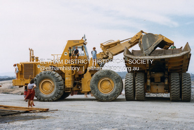
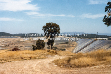
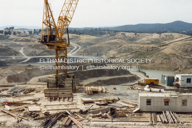
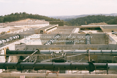
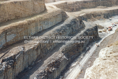
Photograph - Colour Print, Lewis Tulk, Construction Winneke Reservoir and treatment plant / Melbourne and Metropolitan Board of Works, c.1981
Sugarloaf Reservoir is situated on former farmland. This large water storage was completed in 1982 and serves Melbourne's northern suburbs. Within the visitor areas are two picnic grounds and other recreational facilities. Below its massive rock embankment is located the Winnecke Treatment Plan designed to purify its water before being piped into Melbourne. The dam partly inundated the old firing ranges of the former Christmas Hills Rifle Club. Source: Christmas Hills Now and then: Yarra Glen & District Historical Society, 2004.lewis tulk collection, construction, sugarloaf reservoir, winnecke dam -
 Eltham District Historical Society Inc
Photograph - Colour Print, Lewis Tulk, Construction Winneke Reservoir and treatment plant / Melbourne and Metropolitan Board of Works, c.1981
Sugarloaf Reservoir is situated on former farmland. This large water storage was completed in 1982 and serves Melbourne's northern suburbs. Within the visitor areas are two picnic grounds and other recreational facilities. Below its massive rock embankment is located the Winnecke Treatment Plan designed to purify its water before being piped into Melbourne. The dam partly inundated the old firing ranges of the former Christmas Hills Rifle Club. Source: Christmas Hills Now and then: Yarra Glen & District Historical Society, 2004.lewis tulk collection, construction, sugarloaf reservoir, winnecke dam -
 Bendigo Historical Society Inc.
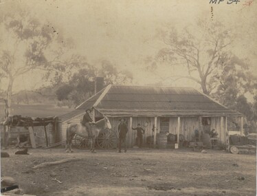
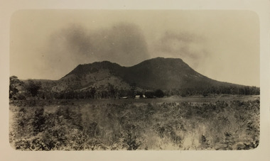
Photograph - FARMHOUSE NEAR MT SUGARLOAF - SLAB HUT, c.1880
Sepia photograph. Slab hut with bark roof, verandah. One brick chimney, weatherboard skillion at L end. One male under verandah. One male in yard. One male mounted on horse. Barrels, wheelbarrow, four wheeled horse drawn vehicle under or near verandah. Inscriptions on front 'MP94', in red ballpoint ink '28'.On Back in grey lead 'Axedale family near Sugarloaf'.( near Fosterville ) On back in red ball point pen '28'. History of object: Previous Acc. No. 'MP 94'. An important photo of early settlers showing type and construction of farmhouse, type of farm implements and clothingBendigo Advertiserbuildings, residential, cottage -
 Bendigo Historical Society Inc.
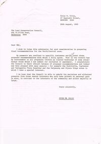
Document - PETER ELLIS COLLECTION: LETTER, 20th August, 1980
Letter (11 Pages) from Peter N Ellis to the Land Conservation Council. Letter refers to proposed State parks - Kamarooka State Park and Whipstick State Park. other areas mentioned are the Wellsford Forest, Mandurang Forest, Lockwood Forest, Waanyaraa, Fryerstown, Whipstick Hill (Flagstaff Hill) and Black Rock. Other areas are Wellsford/Axedale Forest, Sugarloaf Range, Mandurang Forest, Main Coliban Channel, Lockwood Forest, Tarnagulla/Dunolly Forest, Fryerstown, Seven Sisters (between Huntly and Goornong). Plant and tree life in each area is mentioned including the cutting of eucalypt for the production of Eucalyptus oil.person, individual, peter ellis oam, peter ellis collection, land conservation council, kamarooka state park, whipstick state park, eucalyptus oil production, fncv victorian naturalist, d j paton, bendigo field naturalists club, wellsford forest, mandurang forest, main coliban channel, lockwood forest, waanyaras, fryerstown, whipstick hill (flagstaff hill), parish of neilborough, old underground water race, puddling machine, srwsc -
 Kew Historical Society Inc
Photograph - Cathedral Range and Mt Sugarloaf, c.1926
Henry Beater Christian (1886-1962) , was a descendant of one of the earliest settler families in Kew. Employed at the Kew Asylum as a 'public servant', he was a skilled amateur photographer, photographing numerous scenes in Kew and on his travels around Victoria. The majority of his photographs date from 1916 to 1929. His finest photographs are housed in two photograph albums. Digital copy of a photograph from page 18 of the 47-page photograph album containing 261 gelatinous silver images, loaned by Diane Washfold with permission given to digitise and hold a copy in our collection. This photograph, dating from c.1926, forms part of a group of photos taken on a bushwalking trip to Marysville, Victoria. John Chapman has written in 'Bushwalking Clubs - A Brief History', about the establishment in Victoria of the first bushwalking club in 1888, and the popularisation of bushwalking during the interwar period. The photograph shows the Cathedral Range on the Buxton Marysville Road in the distance.The high peak on the right is Mt Sugarloaf. "Spur" [illegible ink inscription]henry beater christian (1886-1962), landscape photography, kew (vic.) — yarra river, christian-washfold collection, photograph albums, bushwalking -- victoria, cathedral range, mt sugarloaf -
 Bendigo Historical Society Inc.
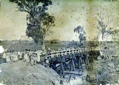
Photograph - AXEDALE BRIDGE
Sepia photograph. Wooden bridge over dry creek ( possibly Campaspe or Axe Creek ?) Dead trees lying in creek. Large group of people, men women and children on bridge. Horse and vehicle at CR. Haystack in centre with stock yards. Inscriptions: On back - in pencil 'Mrs Harris Axedale 21/-' Circular stamp and 1/2 circular stamp 'Royal Historical Society of Victoria, Bendigo Branch'. Pencil note front BR - indecipherable. History: Prev. Acc. No. MP211 Research indicates that this is the bridge over Axe Creek, on the Sugarloaf Road, Axedale. The property in the background belonged to Jonathan and Harriet Harris.place, landscape view -
 Ballarat Tramway Museum
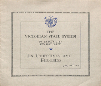
Pamphlet, State Electricity Commission of Victoria (SECV), "The Victorian State System of Electricity and Fuel Supply", Jan. 1938
12 page pamphlet printed on light grey paper with blue SEC logo and blue border on each page that has text. Titled "The Victorian State System of Electricity and Fuel Supply", with subsidiary title "Its Objectives and Progress". Dated January 1938. Produced by the State Electricity Commission of Victoria, Sets out the constitution and objects of Victorian State Power system, notes Act of Parliament of 1918, Yallourn, Newport B, Richmond, Ballarat and Geelong Power stations, Sugarloaf - Rubicon Hydro electric stations. Other subjects are Rural Electrification, system growth, tariffs, and financial stability, Kiewa, and future planning. Only mention of the tramways is the amount of fixed capital involved - L328,000. trams, tramways, power supply, secv, electricity generation -
 Eltham District Historical Society Inc
Photograph - Digital Photograph, Alan King, Maroondah Aqueduct Siphon Bridge over the Plenty River, 26 January 2008
Opened in 1891, the bridge formed part of the Maroondah Aqueduct carrying water from Watts River near Healesville to the reservoir at Preston where it joined Melbourne's metropolitan water system. Covered under Heritage Overlay, Nillumbik Planning Scheme. Published: Nillumbik Now and Then / Marguerite Marshall 2008; photographs Alan King with Marguerite Marshall.; p99 Built to supply thirsty Melbourne in the late 19th century, the siphon bridge spanning the Plenty River off Leischa Court, Greensborough, was part of an engineering masterpiece. Opened in 1891, the bridge formed part of the Maroondah Aqueduct carrying water from the Watts River near Healesville to the reservoir at Preston where it joined the metropolitan distribution system. A major link in Melbourne’s water supply, it also had a huge impact on communities, which mushroomed along its route. Named after the Aboriginal word for the area around the Maroondah Reservoir, the Maroondah Aqueduct was fully operational until the 1970s. Since the 1980s the land along parts of the aqueduct have been used for walking and bicycle riding, shaded in places by Monterey Pine trees planted to stabilise the surrounding ground. From 1857 the Yan Yean Reservoir supplied Melbourne’s water but the growing city needed additional catchments.1 In 1886 work began on a weir on the Watts River to enable the aqueduct to carry most of the river water 41 miles (66km) to Melbourne. The aqueduct, built by the Board of Works, is the oldest remaining aqueduct near Melbourne and was probably the first built with concrete.2 Although the aqueduct is now only used between the Maroondah and Sugarloaf Reservoirs, it can still be traced across the Shire. It extends from the Maroondah Reservoir through Christmas Hills, Kangaroo Ground, Research, Eltham, St Helena and then previously wound west through Greensborough to Reservoir.3 Built by horse and manpower the aqueduct gravity fed 25 million gallons (113.6ML) of water a day to Melbourne along a gradient of one foot to the mile. It included 25 miles (41km) of open concrete and brick channel, six miles (10km) of tunnels, and nine miles (15km) of 14 inverted siphons of riveted wrought-iron across creeks. Bricks for the aqueduct were made from clay found near the sites and remains of several kilns can still be found between Kangaroo Ground and Christmas Hills. Building the aqueduct transformed local communities. An abattoir was established at Christmas Hills. Grog shanties and labourers’ camps sprang up and local courts dealt with cases of ‘petty pilfering and boisterous behaviour’.4 The Kangaroo Ground school population jumped to 91, crammed into a room with one teacher. Miners who built the tunnels camped just north of Churinga in Greensborough – then called Tunnel Hill Camp – and adjacent to the Evelyn Arms Hotel. The miners’ high spirits were sometimes quenched in horse troughs or by a ‘welt under the ear and kick on the behind’ as the local constable calmed them down rather than lock them up.5 But the growing city of Melbourne needed more water, so the O’Shannassy catchment, east of Warburton, was added to the system in 1914. In 1920 work began on the present concrete Maroondah Dam one mile (1.6km) from the weir on the Watts River. The aqueduct capacity was thus doubled to 50 million gallons (227ML) a day.6 Intense land development threatened to pollute the open water supply, so channel sections were replaced with large pipes. In the late 1960s a large water main was built from the tunnel outlet at Research and extended through St Helena and Greensborough, so this section of the aqueduct was taken out of use. Long sections of the unused open channels in Greensborough and Bundoora were destroyed, but the old channel in Research and Eltham North remained largely intact. In the 1970s, the Sugarloaf Reservoir was constructed, inundating 445 hectares of land in Christmas Hills. Sugarloaf was officially opened in 1980 and serves as a water storage and treatment plant supplying Melbourne. In the early 1980s pipes replaced the section from Sugarloaf Reservoir to the tunnel entrance at Kangaroo Ground. The Research-Kangaroo Ground tunnel operates as part of the pipeline system.This collection of almost 130 photos about places and people within the Shire of Nillumbik, an urban and rural municipality in Melbourne's north, contributes to an understanding of the history of the Shire. Published in 2008 immediately prior to the Black Saturday bushfires of February 7, 2009, it documents sites that were impacted, and in some cases destroyed by the fires. It includes photographs taken especially for the publication, creating a unique time capsule representing the Shire in the early 21st century. It remains the most recent comprehenesive publication devoted to the Shire's history connecting local residents to the past. nillumbik now and then (marshall-king) collection, maroondah aqueduct, pipe bridge, siphon bridge -
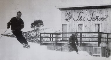 Falls Creek Historical Society
Photograph - Bernhardt Plohberger and Felix Soratroi near Falls Creek Ski School
Bernard Plohberger was one of the early ski instructors at Falls Creek. He was born in Austria on 14 January 1930. He was a ski instructor before he left Austria in 1955. He spent the winter of 1956 working as a ski instructor and during the summer Bernie worked as a chainman for the SEC Surveyor. He built the Ski School at Falls Creek in 1957 as well as the Frying Pan Inn. In 1960 the Frying Pan Inn was taken over by Bill Bridgford who had helped to finance its construction. Bernie married his wife Trudi in 1958 and their son Gerhard was born at the ski school in 1959, the first child born at Falls Creek. Both Trudi and Bernie worked for Bob Hymans for a period at Grand Coeur Chalet. After leaving Falls Creek, Bernie and Trudi moved to Canberra where Bernie took work on civil engineering projects such as the coal loader in Wollongong, the Vietnam memorial in Canberra, highway work on the Hume and Sugarloaf Dam in Victoria. Bernie Plohberger died on 18 May 2020. Felix Soratroi was also an Austrian Ski Instructor who was encouraged by Bernie to move to Falls Creek and work at the Ski School.This item is significant because it depicts early Ski Instructors at Falls Creek Ski School.A black and white image of two skiers near the Falls Creek Ski School.bernard plohberger, frying pan inn, falls creek ski school, felix soratroi -
 Eltham District Historical Society Inc
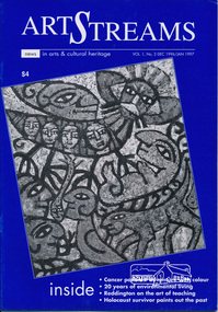
Journal, Peter Doughtery, ArtStreams: News in arts and cultural heritage; Vol. 1, No. 2, Dec 1996/Jan 1997, 1996
Vol. 1, No. 2 Dec 1996/Jan 1997 CONTENTS ADVENTURE WITH COLOUR Teenage cancer patients challenge their illness with art 3 CD REVIEWS New music by local musicians 5 LIVE AND LET LIVE 20 years of environmental living 6 AUSTRALIA REVISITED Artist Charles Reddington ponders live 30 years on 8 POETRY REVIEW Anne Delaney looks at new work by Jennifer Harrison and Jordie Albiston 11 PHOTOGRAPHY Katherine Jones aims at hard edges 16 IMAGES FROM A DARK PAST Holocaust survivor paints out a traumatic part of his life 18 MORALITY OF JUSTICE The Truth Game - a play by Ray Mooney 21 ART FROM THE HEART An exhibition that crosses boundaries 22 SHORT STORY New story from an emerging writer 25 ART IN THE CEMETERY Darebin launches a new project to decorate its new mausoleum 28 LISTINGS Artists, performers and galleries 29 KEYWORDS 895 Main Road, 1994 Moet et Chandon Fellowship, Adventure with Colour, Alan Bonney, Alan Constable, Alun Leach-Jones, Amada Laming, Anne Connor & Associates, Anne Delaney, Anthony Day, Art Streams Magazine, Artist-in-residence, Arts by the Waters, Arts project Australia, Auschwitz, Banyule Jazz Festival, Barbara Veheary, Bend of Islands Conservation Association (BICA), Bend of Islands Estate, Bend of Islands, Bill Downing, Bulleen Art & Garden Centre, Bulleen Nursery, Caffe Poco, Carlton Courthouse Theatre, Catani Boulevard, Catherine Oxley Reserve, Charles Reddington, Charlie Dowley, Cheryl Daye, Chris McAuliffe, Clifton Pugh, Colin Lanceley, Cornelia Selover, Creativitie et Handicap Mental (CREAHM), Cynthia Hardman, Cyril Tawney, Damian Eyre, Daniel Lillford, Danuta Michalska, Darebin Arts and Entertainment Centre, Darebin City Council, Department of Fine Arts, Donald Campbell, Dora Zable, Dorothy Berry, dunmoochin, E.H. Cameron, Edward (Ned) Haughton, Edward Car, Elizabeth Vercoe, Eltham High School, Eltham Living and Learning Centre, Environmental Living Zone (ELZ), Eric Bogle, Eucalypso, Felix Tuszynski, Food For All Seasons, Frank Hodgkinson, Fulli Andrinopoulos, Gallery of Georges of Collins Street, Gallery of Slavic Art, Glen Agnes Bend of Islands Estate, Glen Agnes Estate, Gongflers drive, Greg O'Leary, Harold (Jimmy) Fuller, Helen O'Grady Children's Drama Academy, Henley Road, Ian Doolan Hamilton, Ian Gawler, Inside Out/Outside In, Ironbark Road, Janice McBride, Jennifer Harrison, Jennifer McGregor, Jessie Agnes Haughton, Jimmy Pike, Joan Blakey, John Mackay Northe, John Rasmussen, Jordie Albiston, Julian Martin, Kangaroo Ground, Katherine Jones, Kelvin Heffernan, Kew Coattage, Kitty Ginter, Lavita Mossop, Les darcy, Les Gyori, Life with Jane, Lorraine Larter, Luc Boulange, Luciana Giardina, Manningham Artspace, Manningham City Council, Mariann Moxon, Mark Capozzi, Mark Chapman, Mark Wilkinson, Maxine Ryder, Melbourne Police Pipe Band, Mick Woiwod, Mike O'Rourke, Monica Burns, Montsalvat, Myra Hilgendorf, Nancye Ball, Page family, Pam Crohan, Pam Dougherty, Poetry, Preston Public Cemetery, Ray Mooney, Richard Haese, Robert Hughes, Robyn Kirkpatrick, Roger Lemke, Ron Hanson, Sandra Harvey, Shire of Eltham Office site, Shire of Healesville, Shire of Nillumbik, Shire Offices, Sounds by the Waters, Stelio Costa, Steven Tynan, Steven Worrell, Stewart Whiffin, Sue Howard, Sue Whiffin, Sugarloaf Reservoir, Sydney Ball, The Art of Australia, The Mews, The Truth Game, Tom Fantl, Tony Inglese, Tuszynski Survey Exhibition, University of Melbourne, Valerio Ciccone, victorian artists supplies, Watson Creek Bridge, Watsons Creek, Wayne Marnell, Woody Guthrie, Yarra Brae Dam, Yarra River"Peter Dougherty has been involved in the local art scene for many years. As publisher and editor of the arts magazine Artstreams, his comments on the various branches of the arts are widely respected. His "The Arts" column in the Diamond Valley Leader presents a brief summary for a much wider cross section of the local community. Peter also operates his own gallery and the Artstreams Cafe at the St Andrews market. Peter has a wealth of knowledge about present day and historical aspects of local art and artists." - Eltham District Historical Society Newsletter No. 161, March 2005Colour front and back cover with feature articles and literary pieces with photographs and advertisements printed in black and white. 36 pages, 30 cm. Vol. 1, no. 1 (Nov. 1996) - Vol. 10, no. 5 (summer ed. 2005/06) art streams, feliz tuszynski, elizabeth vercoe, eucalypso, bend of islands, charles reddington, jennifer harrison, jordie albiston, katherine jones, anne bonney, mick woiwood, anne connor, anne delaney, ray mooney, pam dougherty, arts project australia, lavita mossop, preston public cemetery, helen o'grady children's drama academy, bulleen nursery -
 Eltham District Historical Society Inc
Photograph - Digital Photograph, Alan King, Kinglake National Park, 27 March 2008
Fern gullies around Jehosaphat Gully Covered under National Estate. Published: Nillumbik Now and Then / Marguerite Marshall 2008; photographs Alan King with Marguerite Marshall.; p125 The magnificent Kinglake National Park, fringing Nillumbik’s north, is the largest national park close to Melbourne. Thanks to the vision and hard work of a band of local people, the park was created from what was rapidly becoming degraded land. Seeing a threat to Kinglake’s indigenous flora and fauna, several prominent local people campaigned for a national park, which was established in 1928.1 Since then, the park has grown through donations and acquisitions of land, from around 13,800 acres of land (5585ha) to 22,360 hectares. The Sugarloaf and Everard Blocks – of almost 8000 hectares – stand in Nillumbik and the park extends into Mitchell and Murrundindi Shires and the City of Whittlesea. Mt Everard commemorates William Hugh Everard, State member for Evelyn when the park was established. Before 1928, European settlers had degraded the Kinglake area, which was named after the celebrated English author and lawyer, Alexander William Kinglake. Remains of gold shafts and diggings in the park are reminders of Kinglake’s first settlers, who hoped to strike it rich at the gold diggings. But like other gold fields in this shire, they proved not very lucrative and soon timber cutting replaced mining in importance. However, before long, the accessible timber supply ran out, so in the 1920s agriculture took over – particularly potatoes and berry fruits – which involved large-scale clearing.2 The park’s instigator was retired Melbourne University Professor of Music, William Laver.3 As chair of the Kinglake Progress Association he began negotiations to have crown lands on the southern scarp of the Great Dividing Range reserved as a national park. Even before the park was proclaimed, from 1927, KPA members cut tracks to the major scenic points. Professor Laver was one of several people who gave land for the park, donating around 50 acres (20ha), including the Jehosaphat Gully.4 Laver chaired the park’s first Committee of Management, which raised money to employ a ranger and provide facilities, including tracks and roads for fire protection vehicles, toilets and shelters. The committee charged fees for firewood collection, some grazing of livestock, and visitor entrance, and obtained small State Government and Eltham Shire grants. In 1957 the State Government provided revenue for national parks. Then, in 1975, the State Government took over the management and the Committee of Management became an advisory committee, which disbanded in 1978. Originally, the park covered crown land in the Shires of Eltham and Whittlesea; then Wombelano Falls in Yea and other areas were added. In 1970 the park extended into the Shires of Eltham, Healesville, Whittlesea and Yea.5 Bush fires have been an ongoing problem. In 1939 hundreds of eucalypts and acacias had to be sown around the Jehosaphat Gully to rejuvenate the forest. To manage bushfires, the Committee of Management, then the State Government, worked closely with the Forestry Commission, shire councils and local fire brigades. Early national parks focussed on recreation. But by the 1980s, conservation, education and scientific research became more important, playing a vital role in preserving representative samples of the natural environment. Each year many thousands of people use the park’s extensive network of walking tracks amongst the protected plant and animal life as well as camping, cycling and horse riding. The park, along the slopes of the Great Dividing Range, has lookouts revealing magnificent views of the Melbourne skyline, Port Phillip Bay, the Yarra Valley and the You Yangs. Vegetation in the Masons Falls area includes messmate forest, Austral grass-trees, ferns and Hazel Pomaderris. In spring, orchids, lilies, everlasting daisies, correas, grevillea and heath appear. Around Jehosaphat Gully are wet and dry forest, fern gullies and banksia. Animal life includes wallabies, kangaroos, koalas, echidnas, possums, gliders and bandicoots. Male lyrebirds can be heard mimicking in the Jehosaphat Gully, particularly in the Everard Block in winter.This collection of almost 130 photos about places and people within the Shire of Nillumbik, an urban and rural municipality in Melbourne's north, contributes to an understanding of the history of the Shire. Published in 2008 immediately prior to the Black Saturday bushfires of February 7, 2009, it documents sites that were impacted, and in some cases destroyed by the fires. It includes photographs taken especially for the publication, creating a unique time capsule representing the Shire in the early 21st century. It remains the most recent comprehenesive publication devoted to the Shire's history connecting local residents to the past. nillumbik now and then (marshall-king) collection, kinglake national park, jehosaphat gully -
 Eltham District Historical Society Inc
Photograph - Digital Photograph, Marguerite Marshall, Strathewen Public Hall, 20 August 2008
Strathewen Public Hall, social and spiritual centre was later lost in the Black Saturday fires 2009. The Strathewen Community decided a community hall was needed in 1901. In 1902 locals built the hall with messmate trees. It was located on the Cottlesbridge-Strathewen Road. The first function was a Grand concert and Balll attended by about 120 people. Several denominations held Church services and Sunday School services in the Hall. It survived several bushfires until after this photo was taken when it was destroyed in Black Saturday, 9 February 2009. Published: Nillumbik Now and Then / Marguerite Marshall 2008; photographs Alan King with Marguerite Marshall.; p89 Strathewen was settled late, largely because it was difficult to access.1 Early selectors found it a struggle to survive. They had to do everything themselves, from felling trees for buildings, to taking produce to market along bush tracks that they had helped cut. Small dairy farms were typical but fruit became the district’s prime produce. The first settlers east of Arthurs Creek were brothers John and Duncan Smith whose station Glen-Ard was probably operated as a sheep run. Other early settlers were the Mann family, who were to donate land for the hall, provide postal services and John Mann was an Eltham Shire councillor from 1916 to 1919.2 In 1873 James Mann, his wife Jane and their six children, settled on 207 acres (83.7) (Lang Fauld Farm) on both sides of Eagles Nest Road, from the foot of Mount Sugarloaf to the bank of the Arthurs Creek. In 1883 James took up another selection on Chads Creek. It was very hard work and at times he was well behind with his rent. However the family had a good social life, attending the Primitive Methodist Church at the Arthurs Creek Township and on New Year’s Eve throwing a party for all the locals. By 1874 James Mann’s younger brother, John, selected 311 acres (125.8ha) between Eagles Nest Road and upper Arthurs Creek. He called it Carseburn after his home parish in Scotland. Tragically in 1875 John drowned in the Yarra River, at Richmond.3 John Mann’s oldest son, also John, later purchased Duncan Smith’s land, which he named Violet Glen. He was to give one acre (0.4ha) of this land for the Strathewen Hall site. A Mann family diary written at Carseburn in 1897, tells how the district’s name was selected. Strathewen is derived from ‘strath’ meaning ‘broad mountain valley’ and from the name of Ewen H. Cameron, the local parliamentarian for almost 40 years. ‘George Brain came around to get a petition signed to get a post office up here and we had to vote for a name—Strathewen, Glen-Ard, or Headcorie’.4 It was at Carseburn that a public meeting in 1901, decided to build the Strathewen Hall on the Cottlesbridge-Strathewen Road. In 1902 the locals built the hall with messmate trees. The first function was a Grand Concert and Ball attended by around 120 people and several Protestant denominations took turns to hold church services and Sunday School there. Fortunately the hall has survived bushfires to be the town’s spiritual and social centre.5 The area continued to develop and in 1909 a post office operated somewhere at Strathewen and from around 1916 at Carseburn.6 It was not until 1914 that land was bought to establish the Strathewen State School on School Ridge Road. The residents paid £100 to build it on two acres (0.8 ha) while the Education Department contributed £30 and leased the building annually for £1. When teacher Miss Mary Golding opened the school in 1917, it had no equipment.7 But in 1921 the Education Department provided desks and a hexagonal shelter shed (now a rare style in Victoria) and took control in 1925.8 By 1917 Strathewen was booming.9 George Apted had built a coolstore in 1916, and local orchardists bought storage space until the 1950s. This allowed the area to supply the market in and out of season. Guesthouses catered for growing tourism. In the mid 1920s Mrs Eleanor Sparkes built the guest-house Singing Waters, which operated through the 1930s. Her daughter Mrs Vera McKimmie, ran it until the 1950s and the house remains in Chads Creek Road. In the Great Depression land was cleared for timber to be sold as firewood and there was small scale sawmilling. However the orchard industry diminished for several reasons including the 1939 bushfires and rapid changes in production methods. Today the Apteds still operate an orchard and farm at Glen-Ard, which straddles the border between Strathewen and Arthurs Creek. It includes the southern part of Duncan Smith’s original Glen-Ard selection.This collection of almost 130 photos about places and people within the Shire of Nillumbik, an urban and rural municipality in Melbourne's north, contributes to an understanding of the history of the Shire. Published in 2008 immediately prior to the Black Saturday bushfires of February 7, 2009, it documents sites that were impacted, and in some cases destroyed by the fires. It includes photographs taken especially for the publication, creating a unique time capsule representing the Shire in the early 21st century. It remains the most recent comprehenesive publication devoted to the Shire's history connecting local residents to the past. nillumbik now and then (marshall-king) collection, strathewan public hall -
 Eltham District Historical Society Inc
Film - Video (VHS), Nillumbik Shire Council, The Nillumbik Story, 1996
PART 1 – NILLUMBIK (00:00-07:17) Opening features various scenes around Nillumbik Shire. For 40,000 years Nillumbik was the home of the Wurundjeri people. Robert Hoddle gave the district its name. Jock Ryan, then president of Nillumbik Historical Society discusses the names Nillumbik and Diamond Creek. In the late 1830s white occupation began with gold found in Warrandyte in 1851 and 12 years later at Diamond Creek -the Diamond Reef which led to the Caledonian gold rush. Jock Ryan discusses the Diamond Creek mine, which was thriving until it burnt out in 1915. Large numbers of workmen moved into area in late 1870s to construct the Maroondah Aqueduct. With growing population of Melbourne, the nearby Yan Yean system had severely disrupted the flow of the Plenty River, forcing the closure of three flour mills there. The aqueduct came to the rescue carrying water 66km from Healesville to Preston. When the Diamond Creek gold mine burnt down the local economy suffered but fruit growing industry had already been established and Diamond Creek became a thriving fruit growing centre. Interview with Jack Powell, a long-time fruiterer at St Andrews market, his family had lived in the area for a hundred years, 3 to 4 generations, “a lot of hard work”. By the time the railway arrived fruit growing was no longer competitive. The railway brought the city closer and day trippers. The Green Wedge separates the shire from the more densely developed neighbours such as Whittlesea, Doncaster, Templestowe, Bulleen and Greensborough. Population at the time (1996) was 19,000 but links to the past remain strong. Mudbrick houses along the Heritage Trail The saving of Shillinglaw Cottage from demolition in 1963 and relocation brick by brick. PART 2 – ENVIRONMENT (07:18-14:44) Peter Brock (with Bev Brock in background) at St Andrews market discusses his childhood growing up in the district and the environment and the values it instilled upon him and his own family. The Brocks have been in the district since the 1860s. Nillumbik Shire responsible for managing three catchment areas; Diamond Creek, Arthurs Creek and Watsons Creek. Follows the course of the Diamond Creek commencing in Kinglake through the district to its confluence with the Yarra River at Eltham at Eltham Lower Park. Highlights Eltham Lower Park community revegetation program and the newly constructed (1996) viewing platform built of new and recycled timbers at the confluence of the Diamond Creek and Yarra River. Also featured are outdoor recreation on the river and at Eltham Lower Park including the Diamond Valley miniature railway. Sugarloaf reservoir and recreational activities and fishing. Aerial view of Memorial Park and Shire of Eltham War Memorial tower at Garden Hill, Kangaroo Ground. Significant tourism opportunities for the shire with 3 million potential day-trippers in metropolitan Melbourne. Council and community working together to find a way to promote the shires natural and artistic assets. At Arthurs Creek, the Brock family and neighbours working together to take care of their waterway. Peter Brock’s uncle, Sandy Brock talks about environmental management and the Arthurs Creek Landcare group and actions to eradicate blackberry problem. Having previously planted Cypress rows they are replacing them with indigenous species to improve the water supply, keeping cattle out of the creek bed to improve the quality downstream flowing into the Yarra. Eltham East Primary School Band playing “All things bright and beautiful” merges into scenes of the bushland sanctuary set aside by the school in 1980 with unidentified teacher discusses the sanctuary and their education program and school children’s comments. Plight of a family of Wedgetail eagles nesting in the path of a developer’s bulldozer at North Warrandyte and actions to save their nesting areas. PART 3 – ARTS (14:45-22:00) Arts and Jazz festival at Montsalvat featuring interviews with Sigmund Jorgensen discussing Montsalvat and its principles. Also Matcham Skipper. Clifton Pugh’s funeral at Montsalvat and his legacy at Dunmoochin near Cottlesbridge with artists in residence, at the time, Chicago artist Charles Reddington who discusses the benefits of the experience. An unidentified female artist also talks about the program and why people are drawn to the area. Unidentified man on street talking about the amount of talent in the area, artists, poets, musicians, authors. Artist Ming Mackay (1918-2009) interviewed talking about the people she mixes with on “the Hill”. Works of local artists are displayed Eltham Library Community Gallery and Wiregrass gallery with a new coffee shop at the Wiregrass making it an even more popular destination. Music at St Andrews Hotel (may be a little bit country) and the Saturday market where likely to hear anything. Sellers and patrons at the market asked about what attracts them to the market and where they came from. Scenes of poets/authors giving readings. CREDITS Music by John Greenfield from the CD Sweet Rain “The Snow Tree”, Uncle Music UNC 2001 Cameras - David Mirabella and Peter Farragher Editor – Olwyn Jones Written and Produced by Jason Cameron A Jason Cameron Proction for Nillumbik ShireProvides a record of the relatively newly created Shire of Nillumbik at the time and the features and attactions of the shire in its people arts, culture and environmentVHS Cassette (five copies) DVD (one copy) Converted to MP4 file format 0:22:00, 1.60GBvideo recording, arthurs creek, arthurs creek landcare group, artists, artists in residence, arts, arts festival, authors, blackberry, brock family, bulldozer, bulleen, bushland sanctuary, caledonian gold rush, charles reddington, clifton pugh, cottlesbridge, cypress rows, developer, diamond creek, diamond creek mine, diamond reef, diamond valley miniature railway, doncaster, dunmoochin, education program, eeps, eltham, eltham east primary school, eltham east primary school band, eltham library community gallery, eltham lower park, environment, fishing, flour mill, fruit growing, fruiterer, garden hill, gold mining, green wedge, greensborough, heritage trail, hurstbridge railway line, jazz festival, jock ryan, kangaroo ground, kangaroo ground tower, kinglake, maroondah aqueduct, matcham skipper, memorial park, ming mackay (1918-2009), montsalvat, mudbrick houses, music, musicians, nesting area, nillumbik historical society, nillumbik shire, north warrandyte, old timer, orchards, peter brock, plenty river, poets, population, recreation, recreational activities, revegetation, robert hoddle, sandy brock, shillinglaw cottage, shire of eltham war memorial, sigmund jorgensen, st andrews hotel, st andrews market, sugarloaf reservoir, templestowe, the hill, tourism, viewing platform, warrandyte, water catchment area, watsons creek, wedgetail eagle, whittlesea, wiregrass gallery, wurundjeri, yarra river, jack powell -
 Federation University Historical Collection
Reports, Thylacines and Large Predators Sightings, 1950-2011, 1950-2011
The folder or correspondence is the result of a Freedom of Information request made to the Department of Sustainability and Environment in 2011. The folder was collected for research being conducted by David Waldron.Folder of newsclips and articles relating to "Big Cats", Thylacines, and other large predators. * The Argus, 04 May 1940 - 'Strange Animal a Dog' at Daylesford (Lyonville) sighted by J.R. Templeton australian mythical animals collection, david waldron, tiger, greenwald, tasmanian tiger, roberts wadsworth, mary wadsworth, portland, leo gillick, merino, ann matthews, h. mincham, footprint, helena lucas, cape bridgewater, wilbert wilson, puma paw, rocklands reservoir, paw cast, emmaville, panther, mulgoa, jack victory, samela harris, narrabri, c.j. johnson, wandsworth, robertson, edward hallstron, yetman, d. liddicoot, f. hallam, liger, ben lomand, ben lomand panther, methvern park, john hutton, black mountain, elvy adams, joe clifford, armidale, australian marsupial cat, glenn innes, barraba, manilla, uralla, stan wyatt, ashford, emaville, kingston, laurence miller, a.t. o'farrell, pad marks, edward hallstrom, tasmanian devil, wonthaggi, jim drodge, cyril maurier, j. wright, jack brennocks, marsupial wolf, hyaena, b.l. meeby, circus animals, blue mountains, jack duane, coff's harbour, daylesford, lyonville, j.r. templeton, otways, p.w. hunt, emmaville panther, dingos, coolatai panther, wilson's promontory, hambley-clark, mark foster, broken hill, puma, tarnagulla, tarnagulla puma, jan juc, grampians, tom croderick, clifford andrews, bunyip, wedderburn, john lavery, mt korong, rare fauna research society, peter chappell, denmark, mt barker, mike voss, ernie palm, southern pantgher, yowie, min min, mongarlowe river, monga state forest, john reid, thylacine, prospect reservoir, sugarloaf, john higgins, kyneton, ravenswood, bendigotom austin, hamilton, ron strachan, samuel wilson, albert austin, jaguars, inverell, r.s. paterson, ian lobsey, black sal, new england panther, kingstown, a.f. o'farrell, mile creek -
 Camperdown & District Historical Society
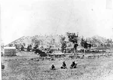
Photograph - Aboriginal people at Mt Leura, Camperdown, c1875
Three Djargurd Wurrung people on Country, pictured in front of Mt Leura, Camperdown c1875. This image also shows early primitive dwellings, Ower's flour mill (built 1868) and surviving native vegetation. Image of three Djargurd Wurrung people seated in front of Mt Leura, Camperdown, taken near corner of Scott and Curdie Streets c1875. On back: Early 1870s, Bought at first land sale Cr Scott & Curdie St, F.H. Grant, 11 Adeney Streetcdhs, djargurdwurrung, wombeetch puyuun, camperdown george, prince charlie, mount leura, mount sugarloaf, mt sugarloaf, ower's mill, cdhsfirstnations -
 Camperdown & District Historical Society
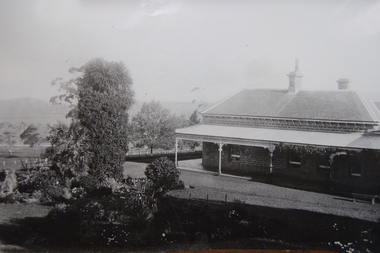
Photograph - Renny Hill homestead, Camperdown, c1890s
''Renny Hill'', built c1876, was the home of William Andrew Taylor (1849-1927) and Isabella Park Taylor, nee Dawson (1842-1929). Isabella was a friend to First Nations people and together with her father, James Dawson, recorded their languages and customs. William Taylor was a farmer, Councillor and civic leader. In 1883 he gifted the world's oldest statue of Robert Burns to the people of Camperdown.Black and white image of ''Renny Hill'' homestead, Camperdown Renny Hill built 1876? Built for Isabella Park (Dawson) Taylor and William Taylormt sugarloaf, mount sugarloaf, cdhs, renny hill, djargurd wurrung, djargurdwurrung, cdhsfirstnations -
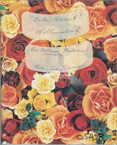 Eltham District Historical Society Inc
Album - Photo Album, Ruth Pendavingh, Take Heart, Nillumbik, 1998-2002
Album of photographs associated with activities of the Cardiac Rehab "Take Heart" Group including the Arthritis Group (Land and Water exercise) managed by Eltham Community Health Centre allied health assistant, arthritis group (land and water exercise), arthritis group, arthurs creek, betty willis, bundoora park, cardiac rehab 'take heart' group, christmas break-up, diamond valley railway, dirk pendavingh, elizabeth dick, eltham community health centre, eltham health group, eltham leisure centre, eltham lower park, eltham, ernie robinson, fairfield park, fairfield, flagstaff hill, griffiths park, ken willis, lavender farm, migrant teachers, mt cooper, new eltham diabetes contact group, parkinson support group, picnic, ruth pendavingh, scienceworks, sugarloaf reservoir, veronica white-hall, warringal, water exercise group, warrrnambool, warrnambool rsl -
 Eltham District Historical Society Inc
Slide, Road sealing: Cottlesbridge-Strathewan Road, Jun. 1981
Road sealing operations undertaken throughout the Shire of Eltham35 mm colour positive transparency (1 of 4) Mount - Kodak Kodachrome Cardinfrastructure, road maintenance, road sealing, cottles bridge-strathewen road, mount sugarloaf -
 Eltham District Historical Society Inc
Book, Diamond Creek Basin Study. Part 1, A Compendium of Factors Relevant to Stormwater Flows, 1980
Basin Studies are studies to evaluate water supply and demand and help ensure reliable water supplies by identifying strategies to address imbalances in water supply and demand.Spiral Bound. 157 leaves in various foliations (some folded) : illustrated. (some colour.), maps (some colour.)aerial photographs, allendale road, arthurs creek mine, arthurs creek road bridge, arthurs creek, bald spur look-out, bank protection, bolton steet, bridge street bridge, bridge street, bridges, challenger street, chute street, construction, coolaroo drive, culvert, deep creek, diamond creek basin, diamond creek region, diamond creek, diamond street bridge, drainage works, eltham lower park, eltham town park, eltham trestle bridge, eltham west drains, eltham, erosion, flood management, floods, footbridge, glen katherine estate, gold mining, gum glade, hurstbridge, kangaroo ground, kinglake escarpment, kinglake national park, latiners hat factory, main road bridge, main road, masons falls, melbourne metropolitan board of works, monash bridge, mount sugarloaf, nillumbik park, orchards, railway culvert, railway line, ramptons road, real estate advertisement, research creek, st helena east drain, st helena road, st helena, storm sewers, stormwater, sugarloaf-preston transfer main crossing, susan street, union mine, village pond, water flow, watkins street, wattletree road, weidlich road, wingrove park, yarra river, zig zag road, water supply, basin study -
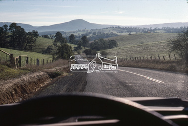
 Marysville & District Historical Society
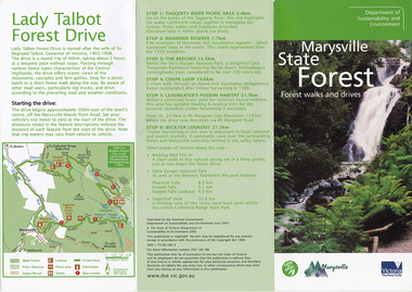
Flyer (item) - Information Flyer, Department of Conservation, Forests & Lands, Lady Talbot Forest Drive, February 1988
A flyer with information on Lady Talbot Forest Drive and the attractions in the area surrounding it.A flyer with information on Lady Talbot Forest Drive and the attractions in the area surrounding it. Lady Talbot Drive a 24 kilometer scenic rainforest car journey which passes a number of walks and waterfalls in the Yarra Ranges National Park. Lady Talbot Drive is named after Lady Sarah Elizabeth, the wife of Sir Reginald Talbot, who was the Governor of Victoria from 25th April, 1904 to 6th July 1908.7761(F1)lady talbot drive, lady talbot forest drive, marysville state forest, sir reginald talbot, lady sarah elizabeth talbot, wishing well, taggerty river, phantom falls, keppel falls, beeches walking track, marysville, mount sugarloaf, logging, victoria, walking tracks -
 Marysville & District Historical Society
Flyer (item) - Brochure, Department of Natural Resources and Environment-Forest Service, Marysville State Forest-Forest walks and drives-Lady Talbot Forest Drive, Pre 2009
A brochure that was produced as a guide to Lady Talbot Forest Drive in Marysville in Victoria.A brochure that was produced as a guide to Lady Talbot Forest Drive in Marysville in Victoria. Lady Talbot Drive a 24 kilometer scenic rainforest car journey which passes a number of walks and waterfalls in the Yarra Ranges National Park. Lady Talbot Drive is named after Lady Sarah Elizabeth, the wife of Sir Reginald Talbot, who was the Governor of Victoria from 25th April, 1904 to 6th July 1908.50 cents Bob McNamara/ Real Estate Agent/ Tourism Info Centre Co-Ordinatorlady talbot forest drive, lady talbot drive, sir reginald talbot, lady sarah elizabeth talbot, marysville, wishing well, phantom falls, keppel falls walk, keppel falls lookout, taggerty river, beeches rainforest walk, logging, mount sugarloaf, victoria -
 Marysville & District Historical Society
Flyer (item) - Brochure, Natural Resources and Evironment, Marysville State Forest-Forest walks and drives-Lady Talbot Forest Drive, Pre 2009
A brochure that was produced as a guide to Lady Talbot Forest Drive in Marysville in Victoria.A brochure that was produced as a guide to Lady Talbot Forest Drive in Marysville in Victoria. Lady Talbot Drive a 24 kilometer scenic rainforest car journey which passes a number of walks and waterfalls in the Yarra Ranges National Park. Lady Talbot Drive is named after Lady Sarah Elizabeth, the wife of Sir Reginald Talbot, who was the Governor of Victoria from 25th April, 1904 to 6th July 1908.lady talbot forest drive, lady talbot drive, sir reginald talbot, lady sarah elizabeth talbot, marysville, wishing well, phantom falls, keppel falls walk, keppel falls lookout, taggerty river, beeches rainforest walk, logging, mount sugarloaf, victoria -
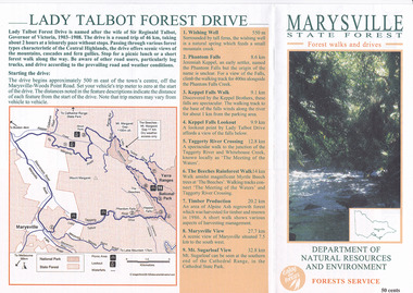
 Marysville & District Historical Society
Flyer (item) - Brochure, Dept. Sustainability & Environment, Marysville State Forest-Forest walks and drives-Lady Talbot Forest Drive, 2003
A brochure that was produced as a guide to Lady Talbot Forest Drive in Marysville in Victoria.A brochure that was produced as a guide to Lady Talbot Forest Drive in Marysville in Victoria. Lady Talbot Drive a 24 kilometer scenic rainforest car journey which passes a number of walks and waterfalls in the Yarra Ranges National Park. Lady Talbot Drive is named after Lady Sarah Elizabeth, the wife of Sir Reginald Talbot, who was the Governor of Victoria from 25th April, 1904 to 6th July 1908.ISBN 1 74106 695 6lady talbot forest drive, lady talbot drive, sir reginald talbot, lady sarah elizabeth talbot, marysville, wishing well, phantom falls, keppel falls walk, keppel falls lookout, taggerty river, beeches rainforest walk, logging, mount sugarloaf, victoria, leadbeater's possum, beckter lookout, steavenson falls, isbn 1 74106 695 6 -
 Marysville & District Historical Society
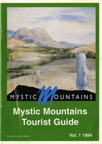
Ephemera (Item) - Tourist Guide, Michael Nash et al, Mystic Mountains Tourist Guide Vol. 1 1994, 1994
A tourist guide outlining services, accommodation, activities and places of interest to visit in and around Marysville and the local district.A tourist guide outlining services, accommodation, activities and places of interest to visit in and around Marysville and the local district.ACKNOWLEDGEMENTS:/ Marysville and District Tourist and Progress Association, Marysville/ Office of the Department of Conservation & Natural Resources, Shire/ of Alexandra Visitors Guide and all our advertisers whom without/ their support this publication would not have been possible.marysville, victoria, australia, tourist guide, mystic mountains, michael nash, dudley jones, marysville and district tourist and progress association, department of conservation & natural resources, shire of alexandra, paperwork professionals, pp art services, harrier printing, darrowby deer farm, heidi boesch, hidden talent craft gallery, olde yarra track shoppe, lady talbot forest drive, mathilde's of marysville country guest house, wishing well, taggerty river picnic area, taggery river, phantom falls, keppel falls, the beeches walking track, mount sugarloaf, beauty spot walk, tree fern gully walk, michaeldene track, keppel track, woods lookout track, marysville caravan park, baree mud brick cottages, cumberland scenic reserve, nanda binya lodge, cambarville, the big tree, barton's lookout, cumberland falls, our lady of the snows catholic church, anglican church christ, marysville christian fellowship, sovereign view, the big culvert, st fillan, steavenson's restaurant, the birches resort, cathedral range state park, tower motel, marysville post shop, lake mountain, wirreanda festival, cross country ski hire, marysville hotel motel, kerami house, marysville holiday cottages, missing links miniature golf, top shop pancake parlour, marylands guest house, dalrymples guest cottages, crossways country inn, esa camping & conference centre, scenic motel, the cumberland, maryton park holiday cottages, lomatia lodge holiday house, willowbank gallery and art centre, igloo roadhouse, a model tours, geoffrey pope & associates