Showing 73 items
matching australian atlas
-
 Kilmore Historical Society
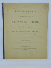
Book, Baron Ferdinand von Mueller et al, EUCALYPTOGRAPHIA. Third Decade, 1879
... . botany eucalypts australia A descriptive atlas of the Eucalypts ...A descriptive atlas of the Eucalypts of Australia and the adjoining islandsLight card cover, creased top right front, tearing at bottom, with faded and worn blue cloth backstrip to spine. Backstrip torn at top and separated from body of book. Several pages missing at the front. Moisture stains on cover. Minor insect damage to some pages. Foxing throughout. Poor condition.non-fictionA descriptive atlas of the Eucalypts of Australia and the adjoining islandsbotany, eucalypts, australia -
 Kilmore Historical Society
Book, Baron Ferdinand von Mueller et al, EUCALYPTOGRAPHIA. Tenth Decade, 1884
... atlas of the Eucalypts of Australia and adjoining islands ...A descriptive atlas of the Eucalypts of Australia and adjoining islands. This last part of the series also contains a Synopsis of the Species, Geographic Index, Index of Vernacular Names, Index of Decades and Alphabetical Index.Light card cover with blue cloth backstrip to spine, torn at upper extremity. Some staining and marks on cover, discoloration from light exposure. Some foxing through out. Binding intact. Fair condition.non-fictionA descriptive atlas of the Eucalypts of Australia and adjoining islands. This last part of the series also contains a Synopsis of the Species, Geographic Index, Index of Vernacular Names, Index of Decades and Alphabetical Index.botany, eucalypts, australia -
 Kilmore Historical Society
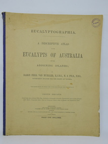
Book, Baron Ferdinand von Mueller et al, EUCALYPTOGRAPHIA. Second Decade, 1879
... atlas of the Eucalypts of Australia and adjoining islands ...A descriptive atlas of the Eucalypts of Australia and adjoining islands.Light card cover with green cloth backstrip to spine. Significant moisture, mildew and fungal staining on cover and throughout. cover and several pages are torn at extremities. Poor condition.non-fictionA descriptive atlas of the Eucalypts of Australia and adjoining islands.botany, eucalypts, australia -
 Kilmore Historical Society
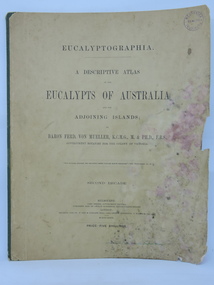
Book, Baron Ferdinand von Mueller et al, EUCALYPTOGRAPHIA. First Decade, 1879
... of Australian Eucalypts. botany eucalypts australia A descriptive atlas ...A descriptive atlas of the Eucalypts of Australia and the adjoining islands.Light card cover with green cloth backstrip to spine, worn at extremities. Widespread foxing and moisture stains throughout. Some insect damage to front pages. Poor condition.non-fictionA descriptive atlas of the Eucalypts of Australia and the adjoining islands.botany, eucalypts, australia -
 Port Melbourne Historical & Preservation Society
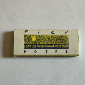
Domestic object - Matchbox, Pier Hotel, Port Melbourne, Atlas Match Australia, 1990s
... Atlas Match Australia..., Pier Hotel, Port Melbourne Atlas Match Australia ...Picked up at the Pier, donatedMini matchbox promoting Pier Hotel, blue and yellow; 'Pier Hotel" on front, 'Piranna Lounge' on back. contains 7 blue-headed matchesbusiness and traders - hotels, pier hotel, piranha lounge -
 Warrnambool and District Historical Society Inc.
Booklet, New Bennettitalean Leaves from the Mesozoic of Eastern Australia, 1963
This booklet contains an article on the plant fossil deposits in Eastern Victoria. It has been written by Dr John Douglas in 1963. He published extensively on a range of geological and natural history themes. His major works included co-editing the Geological Society of Victoria’s Geology of Victoria and his PH.D. thesis for the University of Melbourne contained in two Geological Survey Memoirs on the Mesozoic floras of Victoria. He was also responsible for the Geology and Sport and Recreation chapters in the State Government’s Atlas of Victoria and wrote the booklet, What Fossil Plant is That? He was a Supervising Geologist with the Department of Minerals and Energy in Victoria for many years and lectured extensively at Botany and Geology conferences in Australia and overseas. This book is of some interest as it was written by a former resident of Warrnambool, Dr John Douglas (1997 to his death in 2007). He was an active member of the Warrnambool Field Naturalists’ Group and edited for this group the book, The Nature of Warrnambool. This is a small booklet of 16 pages reprinted from the Proceedings of the Royal Society of Victoria, Vol. 77, Part 1. It has a grey cover with the logo of the Royal Society of Victoria on the front cover. It has printed material on plant fossil deposits in eastern Victoria and several sketches and black and white plates of plant fossil photographs and cross-sections. The pages were stapled but the staples have been removed. There is some rust where the staples were removed. Front cover: ‘Royal Society of Victoria, New Bennettitalean Leaves from the Mesozoic of Eastern Australia by J. G. Douglas, reprinted from Proc. Roy. Soc. Victoria, Vol 77, Part 1, Issued separately, 13 December, 1963.’ micro- paleontology in eastern victoria, dr john douglas, warrnambool -
 Bendigo Historical Society Inc.
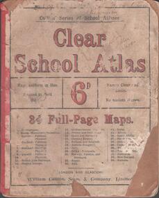
Book - SCHOOL ATLAS, 1880s
Atlas. 34 page 'CLEAR SCHOOL ATLAS' in colour. Price sixpence. On the map of Australia, page 32, the location of Sandhurst is shown. Handwritten in ink at top of front cover, 'Fifth Class, Bamawm'William Collins, Sons & Company, London and Glasgoweducation, bendigo, atlas, bamawm, sandhurst -
Clunes Museum
Book, PAUL HAMLYN PTL LTD, AUSTRALIA - THE FIRST HUNDRED YEARS, 1978
... PICTURESQUE ATLAS OF AUSTRALIA...THE FIRST HUNDRED YEARS PICTURESQUE ATLAS OF AUSTRALIA ...THE PICTURESQUE ATLAS WAS DESINGED TO GIVE A GRAPHIC AND SUMMARISED CONCEPTION OF AUSTRALASIAN HISTORY AND LIFE FROM THE OF THE EARLIEST PRTUGUESE, SPANISH, DUTCH, ENGLISH AND FRENCH NAVIGATORS...YELLOW PAPERBACK BOOK WITH ADHESIVE PLASTIC COVER. ON THE COVER FEATURES A DRAWING OF CIRCULAR QUAY. WEST SIDE. "BEING A FACSIMILE OF VOLUMES 1 AND 2 OF THE PICTURESQUE ATLAS OF AUSTRALASIA 1888", EDITED BY THE HON. ANDREW GARRAN. M.A., L.L.D/M.L.C. ILLUSTRATED WITH 700 ENGRAVINGS ON STEEL AND WOOD 530 PAGES + 26 PAGES OF FULL-PAGE ENGRAVINGSnon-fictionTHE PICTURESQUE ATLAS WAS DESINGED TO GIVE A GRAPHIC AND SUMMARISED CONCEPTION OF AUSTRALASIAN HISTORY AND LIFE FROM THE OF THE EARLIEST PRTUGUESE, SPANISH, DUTCH, ENGLISH AND FRENCH NAVIGATORS...the first hundred years, picturesque atlas of australia -
 Bendigo Military Museum
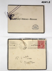
Card - SYMPATHY CARD and ENVELOPE, Atlas Press Marlborough series, printed in Australia, 1917
Items relate to George Frederick Pierce DCM. Refer Cat No 4136P for his service details, award and death. Part of the collection of William (Bill) Thomason, refer Cat No 4136P for more items..1) Four page folding card, front has an embossed map of Australia, central in gold a scroll, Rising Sun, crown and a wreath. Inside has a short poem headed by “Greater love hath no man than this”, next page a brief sympathy message, under in ink an entry by hand. A small string holds the pages together. .2) yellowish envelope with black edging, mail stamps and a 1 penny red stamp. Envelope dated 21 Nov ....... .1) On the front “ Duty - Valour - Honour”. Inside in ink from, ”Mr and Mrs F Stevens"sympathy, cards, military -
 Bendigo Military Museum
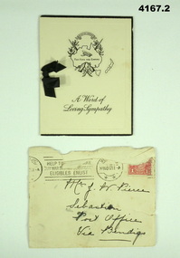
Card - SYMPATHY CARD and ENVELOPE, ATLAS PRESS Marlborough series, Both 1917
Items in the collection relating to George Frederick Pierce DCM. Refer Cat No 4136P for his service details, award and death Part of the collection of William (Bill) Thomason, refer Cat No 4136P..1) four page folding card, front cover has a map of Australia, crossed rifles, wreath, Corolla, inside has a short poem headed “He hath fought the good fight”. Next page a brief sympathy message with hand written entry in ink, a small black ribbon holds the pages together. .2) Yellowish envelope with two circular stamp marks, red 1 penny stamp and addressed in black pen. Envelope is stamped “20 NOV 2017.1) front cover,” A world of Sympathy”. Inside in ink from “Hilda C Stephens” .2) on front in black pen, “Mrs J Pierce Sebastian Post Office Via Bendigo”sympathy, cards, military -
 Lakes Entrance Historical Society
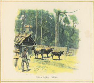
Postcard - Scene Near Lake Tyers, Pictorial Atlas of Australia, Small building among trees, Gippsland Victoria, 1889
... Pictorial Atlas of Australia... Scene Near Lake Tyers Pictorial Atlas of Australia ...Coloured lithographic postcard showing small clearing in bush, bark barn, paling fence, three cattle and one man, small building among trees in Gippsland VictoriaNear Lake Tyersfarming -
 Flagstaff Hill Maritime Museum and Village
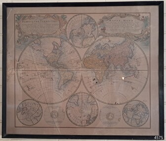
Map - World Map, Mappe Monde [Medieval Map of the World], 1910
This map from the mid-18th century doesn't include the finer details of land and sea masses that we know today. The map was produced by German cartographer and publisher, Johann Baptist Homann (1663-1724) and published in 1746, after his death. Earlier versions were published, such as 1707 and 1716. The date can be calculated from the Roman numerals on the top left text area. This print of a map is significant for its connection with early world explorers. A comparison of maps over the centuries shows the progression of navigational technology, the countries who claimed the land they explored. The naming of even some Australian locations shows who had already made their mark on Australia in the early 18th century. The print shows the fine details included by the cartographer and the beauty included that makes it attractive and interesting even today. The map is also significant for its connection with German cartographer, Johann Baptist Homann, whose Homann publishing company was renewed in Germany for producing high quality maps and atlases. Map behind glass in dark brown wooden frame on beige paper. The Coloured hand drawn line drawings show different hemispheres of the known world in the mid-18th century. Beautifully drawn figures and decorative embellishments enhance the map. The text on the top right has an explanation of the Figures I, II, III, and IV. This print of the 1746 map was produced in England by Leisure Arts Ltd. "PLANIGLOBIL TERRESTRIS" "MDCCXXXXVI" [1746] "MAPPE_MONDE" [Medieval Map of the World] "LEISURE ARTS LTD" "Printed in England"flagstaff hill, warrnambool, flagstaff hill maritime museum, flagstaff hill maritime village, flagstaff hill maritime museum and village, shipwreck coast, world map, french map, 18th century map, leisure arts ltd, cartography, early exploration, cartographer, johann homann (1663-1724), exploration, naviagtion, 1746 planiglobil terrestris -
 Lakes Entrance Historical Society
Postcard - Hops picking, Bairnsdale Victoria, Pictorial Atlas of Australia, 1889 c
... Pictorial Atlas of Australia..., Bairnsdale Victoria Pictorial Atlas of Australia ...Coloureed lithographic postcard showing men hop picking near Bairnsdale Victoria. Also another lithographic postcard with inscription In the Gippsland Bush settlers, agriculture, farming