Showing 86 items matching "country lands"
-
 Victorian Aboriginal Corporation for Languages
Periodical, Australian Institute of Aboriginal and Torres Strait Islander Studies, Australian Aboriginal studies : journal of the Australian Institute of Aboriginal and Torres Strait Islander Studies, 2010
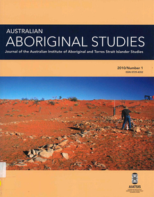
Mediating conflict in the age of Native Title Peter Sutton (The University of Adelaide and South Australian Museum) Mediators have played roles in managing conflict in Aboriginal societies for a long time. This paper discusses some of the similarities and differences between older customary mediator roles and those of the modern Native Title process. Determinants of tribunal outcomes for Indigenous footballers Neil Brewer, Carla Welsh and Jenny Williams (School of Psychology, Flinders University) This paper reports on a study that examined whether football tribunal members? judgments concerning players? alleged misdemeanours on the sporting field are likely to be shaped by extra-evidential factors that disadvantage players from Indigenous backgrounds. Indigenous and non-Indigenous Australian Football League (AFL) players, matched in terms of their typical levels of confidence and demeanour in public situations, were interrogated in a mock tribunal hearing about a hypothetical incident on the football field. The specific aim was to determine if the pressures of such questioning elicited behavioural differences likely to be interpreted as indicative of testimonial unreliability. Mock tribunal members (number = 103) then made judgments about the degree to which a number of behavioural characteristics were evident in the players? testimonies. Under intense interrogation, Indigenous players were judged as presenting less confidently and displaying a greater degree of gaze aversion than non-Indigenous players. These behavioural characteristics are commonly ? and inappropriately ? used as cues or heuristics to infer testimonial accuracy. The paper discusses the implications for Indigenous players appearing at tribunal hearings ? and for the justice system more broadly. Timothy Korkanoon: A child artist at the Merri Creek Baptist Aboriginal School, Melbourne, Victoria, 1846?47 ? a new interpretation of his life and work Ian D Clark (School of Business, University of Ballarat) This paper is concerned with the Coranderrk Aboriginal artist Timothy Korkanoon. Research has uncovered more about his life before he settled at the Coranderrk station in 1863. Evidence is provided that five sketches acquired by George Augustus Robinson, the former Chief Protector of Aborigines, in November 1851 in Melbourne, and found in his papers in the State Library of New South Wales, may also be attributed to the work of the young Korkanoon when he was a student at the Merri Creek Baptist Aboriginal School from 1846 to 1847. Developing a database for Australian Indigenous kinship terminology: The AustKin project Laurent Dousset (CREDO, and CNRS, Ecole des Hautes Etudes en Sciences Sociales), Rachel Hendery (The Australian National University), Claire Bowern (Yale University), Harold Koch (The Australian National University) and Patrick McConvell (The Australian National University) In order to make Australian Indigenous kinship vocabulary from hundreds of sources comparable, searchable and accessible for research and community purposes, we have developed a database that collates these resources. The creation of such a database brings with it technical, theoretical and practical challenges, some of which also apply to other research projects that collect and compare large amounts of Australian language data, and some of which apply to any database project in the humanities or social sciences. Our project has sought to overcome these challenges by adopting a modular, object-oriented, incremental programming approach, by keeping metadata, data and analysis sharply distinguished, and through ongoing consultation between programmers, linguists and communities. In this paper we report on the challenges and solutions we have come across and the lessons that can be drawn from our experience for other social science database projects, particularly in Australia. A time for change? Indigenous heritage values and management practice in the Coorong and Lower Murray Lakes region, South Australia Lynley A Wallis (Aboriginal Environments Research Centre, The University of Queensland) and Alice C Gorman (Department of Archaeology, Flinders University) The Coorong and Lower Murray Lakes in South Australia have long been recognised under the Ramsar Convention for their natural heritage values. Less well known is the fact that this area also has high social and cultural values, encompassing the traditional lands and waters (ruwe) of the Ngarrindjeri Nation. This unique ecosystem is currently teetering on the verge of collapse, a situation arguably brought about by prolonged drought after decades of unsustainable management practices. While at the federal level there have been moves to better integrate typically disparate ?cultural? and ?natural? heritage management regimes ? thereby supporting Indigenous groups in their attempts to gain a greater voice in how their traditional country is managed ? the distance has not yet been bridged in the Coorong. Here, current management planning continues to emphasise natural heritage values, with limited practical integration of cultural values or Ngarrindjeri viewpoints. As the future of the Coorong and Lower Murray Lakes is being debated, we suggest decision makers would do well to look to the Ngarrindjeri for guidance on the integration of natural and cultural values in management regimes as a vital step towards securing the long-term ecological viability of this iconic part of Australia. Hearts and minds: Evolving understandings of chronic cardiovascular disease in Aboriginal and Torres Strait Islander populations Ernest Hunter (Queensland Health and James Cook University) Using the experience and reflections of a non-Indigenous clinician and researcher, Randolph Spargo, who has worked in remote Aboriginal Australia for more than 40 years, this paper tracks how those at the clinical coal-face thought and responded as cardiovascular and other chronic diseases emerged as new health concerns in the 1970s to become major contributors to the burden of excess ill health across Indigenous Australia. The paper cites research evidence that informed prevailing paradigms drawing primarily on work in which the clinician participated, which was undertaken in the remote Kimberley region in the north of Western Australia. Two reports, one relating to the Narcoonie quarry in the Strzelecki Desert and the other concerning problematic alcohol use in urban settings.maps, b&w photographs, colour photographs, tablesstrzelecki desert, native title, timothy korkanoon, merri creek baptist aboriginal school, austkin project, coorong, lower murray lakes district, south australia, indigenous health -
 Victorian Aboriginal Corporation for Languages
Periodical, Australian Institute of Aboriginal and Torres Strait Islander Studies, Australian Aboriginal studies : journal of the Australian Institute of Aboriginal and Torres Strait Islander Studies, 2010
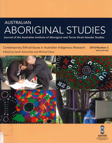
'Whose Ethics?':Codifying and enacting ethics in research settings Bringing ethics up to date? A review of the AIATSIS ethical guidelines Michael Davis (Independent Academic) A revision of the AIATSIS Guidelines for Ethical Research in Indigenous Studies was carried out during 2009-10. The purpose of the revision was to bring the Guidelines up to date in light of a range of critical developments that have occurred in Indigenous rights, research and knowledge management since the previous version of the Guidelines was released in 2000. In this paper I present an outline of these developments, and briefly discuss the review process. I argue that the review, and the developments that it responded to, have highlighted that ethical research needs to be thought about more as a type of behaviour and practice between engaged participants, and less as an institutionalised, document-focused and prescriptive approach. The arrogance of ethnography: Managing anthropological research knowledge Sarah Holcombe (ANU) The ethnographic method is a core feature of anthropological practice. This locally intensive research enables insight into local praxis and culturally relative practices that would otherwise not be possible. Indeed, empathetic engagement is only possible in this close and intimate encounter. However, this paper argues that this method can also provide the practitioner with a false sense of his or her own knowing and expertise and, indeed, with arrogance. And the boundaries between the anthropologist as knowledge sink - cultural translator and interpreter - and the knowledge of the local knowledge owners can become opaque. Globalisation and the knowledge ?commons?, exemplified by Google, also highlight the increasing complexities in this area of the governance and ownership of knowledge. Our stronghold of working in remote areas and/or with marginalised groups places us at the forefront of negotiating the multiple new technological knowledge spaces that are opening up in the form of Indigenous websites and knowledge centres in these areas. Anthropology is not immune from the increasing awareness of the limitations and risks of the intellectual property regime for protecting or managing Indigenous knowledge. The relevance of the Declaration on the Rights of Indigenous Peoples in opening up a ?rights-based? discourse, especially in the area of knowledge ownership, brings these issues to the fore. For anthropology to remain relevant, we have to engage locally with these global discourses. This paper begins to traverse some of this ground. Protocols: Devices for translating moralities, controlling knowledge and defining actors in Indigenous research, and critical ethical reflection Margaret Raven (Institute for Sustainability and Technology Policy (ISTP), Murdoch University) Protocols are devices that act to assist with ethical research behaviour in Indigenous research contexts. Protocols also attempt to play a mediating role in the power and control inherent in research. While the development of bureaucratically derived protocols is on the increase, critiques and review of protocols have been undertaken in an ad hoc manner and in the absence of an overarching ethical framework or standard. Additionally, actors implicated in research networks are seldom theorised. This paper sketches out a typology of research characters and the different moral positioning that each of them plays in the research game. It argues that by understanding the ways actors enact research protocols we are better able to understand what protocols are, and how they seek to build ethical research practices. Ethics and research: Dilemmas raised in managing research collections of Aboriginal and Torres Strait Islander materials Grace Koch (AIATSIS) This paper examines some of the ethical dilemmas for the proper management of research collections of Indigenous cultural materials, concentrating upon the use of such material for Native Title purposes. It refers directly to a number of points in the draft of the revised AIATSIS Guidelines for Ethical Research in Indigenous Studies and draws upon both actual and hypothetical examples of issues that may arise when requests are made for Indigenous material. Specific concerns about ethical practices in collecting data and the subsequent control of access to both the data itself and to published works based upon it are raised within the context of several types of collections, including those held by AIATSIS and by Native Title Representative Bodies. Ethics or social justice? Heritage and the politics of recognition Laurajane Smith (ANU) Nancy Fraser?s model of the politics of recognition is used to examine how ethical practices are interconnected with wider struggles for recognition and social justice. This paper focuses on the concept of 'heritage' and the way it is often uncritically linked to 'identity' to illustrate how expert knowledge can become implicated in struggles for recognition. The consequences of this for ethical practice and for rethinking the role of expertise, professional discourses and disciplinary identity are discussed. The ethics of teaching from country Michael Christie (CDU), with the assistance of Yi?iya Guyula, Kathy Gotha and Dh�?gal Gurruwiwi The 'Teaching from Country' program provided the opportunity and the funding for Yol?u (north-east Arnhem Land Aboriginal) knowledge authorities to participate actively in the academic teaching of their languages and cultures from their remote homeland centres using new digital technologies. As two knowledge systems and their practices came to work together, so too did two divergent epistemologies and metaphysics, and challenges to our understandings of our ethical behaviour. This paper uses an examination of the philosophical and pedagogical work of the Yol?u Elders and their students to reflect upon ethical teaching and research in postcolonial knowledge practices. Closing the gaps in and through Indigenous health research: Guidelines, processes and practices Pat Dudgeon (UWA), Kerrie Kelly (Australian Indigenous Psychologists Association) and Roz Walker (UWA) Research in Aboriginal contexts remains a vexed issue given the ongoing inequities and injustices in Indigenous health. It is widely accepted that good research providing a sound evidence base is critical to closing the gap in Aboriginal health and wellbeing outcomes. However, key contemporary research issues still remain regarding how that research is prioritised, carried out, disseminated and translated so that Aboriginal people are the main beneficiaries of the research in every sense. It is widely acknowledged that, historically, research on Indigenous groups by non-Indigenous researchers has benefited the careers and reputations of researchers, often with little benefit and considerably more harm for Indigenous peoples in Australia and internationally. This paper argues that genuine collaborative and equal partnerships in Indigenous health research are critical to enable Aboriginal and Torres Islander people to determine the solutions to close the gap on many contemporary health issues. It suggests that greater recognition of research methodologies, such as community participatory action research, is necessary to ensure that Aboriginal people have control of, or significant input into, determining the Indigenous health research agenda at all levels. This can occur at a national level, such as through the National Health and Medical Research Council (NHMRC) Road Map on Indigenous research priorities (RAWG 2002), and at a local level through the development of structural mechanisms and processes, including research ethics committees? research protocols to hold researchers accountable to the NHMRC ethical guidelines and values which recognise Indigenous culture in all aspects of research. Researching on Ngarrindjeri Ruwe/Ruwar: Methodologies for positive transformation Steve Hemming (Flinders University) , Daryle Rigney (Flinders University) and Shaun Berg (Berg Lawyers) Ngarrindjeri engagement with cultural and natural resource management over the past decade provides a useful case study for examining the relationship between research, colonialism and improved Indigenous wellbeing. The Ngarrindjeri nation is located in south-eastern Australia, a ?white? space framed by Aboriginalist myths of cultural extinction recycled through burgeoning heritage, Native Title, natural resource management ?industries?. Research is a central element of this network of intrusive interests and colonising practices. Government management regimes such as natural resource management draw upon the research and business sectors to form complex alliances to access funds to support their research, monitoring, policy development, management and on-ground works programs. We argue that understanding the political and ethical location of research in this contemporary management landscape is crucial to any assessment of the potential positive contribution of research to 'Bridging the Gap' or improving Indigenous wellbeing. Recognition that research conducted on Ngarrindjeri Ruwe/Ruwar (country/body/spirit) has impacts on Ngarrindjeri and that Ngarrindjeri have a right and responsibility to care for their lands and waters are important platforms for any just or ethical research. Ngarrindjeri have linked these rights and responsibilities to long-term community development focused on Ngarrindjeri capacity building and shifts in Ngarrindjeri power in programs designed to research and manage Ngarrindjeri Ruwe/Ruwar. Research agreements that protect Ngarrindjeri interests, including cultural knowledge and intellectual property, are crucial elements in these shifts in power. A preliminary review of ethics resources, with particular focus on those available online from Indigenous organisations in WA, NT and Qld Sarah Holcombe (ANU) and Natalia Gould (La Trobe University) In light of a growing interest in Indigenous knowledge, this preliminary review maps the forms and contents of some existing resources and processes currently available and under development in the Northern Territory, Queensland and Western Australia, along with those enacted through several cross-jurisdictional initiatives. A significant majority of ethics resources have been developed in response to a growing interest in the application of Indigenous knowledge in land and natural resource management. The aim of these resources is to ?manage? (i.e. protect and maintain) Indigenous knowledge by ensuring ethical engagement with the knowledge holders. Case studies are drawn on from each jurisdiction to illustrate both the diversity and commonality in the approach to managing this intercultural engagement. Such resources include protocols, guidelines, memorandums of understanding, research agreements and strategic plans. In conducting this review we encourage greater awareness of the range of approaches in practice and under development today, while emphasising that systematic, localised processes for establishing these mechanisms is of fundamental importance to ensuring equitable collaboration. Likewise, making available a range of ethics tools and resources also enables the sharing of the local and regional initiatives in this very dynamic area of Indigenous knowledge rights.b&w photographs, colour photographsngarrindjeri, ethics, ethnography, indigenous research, social justice, indigenous health -
 Victorian Aboriginal Corporation for Languages
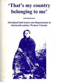
Book, Ian D Clark, That's my country belonging to me : Aboriginal land tenure and dispossession in nineteenth century Western Victoria, 1998
Investigating the dispossession of Aboriginal people from their lands in Western Victoria. The methods of dispossession (exclusion etc.) and restrictions, with the consequences of this.maps, tables, b&w photographsdjab wurrung, dhauwurd wurrung, bargundidj, djadja wurrung, djagurd wurrung, gadubanud, girai wurrung, gulidjan, jardwadjali, watha wurrung, wergaia, western victoria, land tenure -
 National Wool Museum
Photo Album, 1930-1934
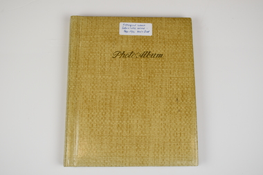
The Photo Album was created by Hans Beck, who interned with the donor's father (Wilhelm Eckels). The Photo Album depicts wool buying and sheep station related life between 1927-1939. Each photograph has been individually labelled.Straw coloured booklet with gold cursive writing on front cover spelling 'Photo Album'. Inside are 18 pages containing 63 photographs, each individually captioned. Internal pages show signs of age with discolouration, particularly in areas of previous adhesive application.Lettering, Front: Historic Interest Before WME arrived - 1930-1934 Wool & Sheep Photo Album Lettering, Internal by Page: Page 1 - Bottom Left Conner: Table from right:/ O. Hilbert sen. / WW. Richter, W. Ehrig/ Sampler: C. McCarthy/ at desk: E.S. Bottom Right Corner: 1927/ Wool Sample Room/ O. Hilbert/ Terranora Buildings/ Reiby Lane Page 2 - Bottom Middle: 1931/ Opening Sale/ Sydney Page 3 - Bottom Middle: 1934/ Opening Sale/ Sydney Page 4 - Bottom Middle: 1933/ Wool Auctions/ Brisbane Page 5 - Top Left Corner: 1930 Escapade/ Sydney to CAIRNS/ via Bourke, Central/ Queensland, Hinter-/ land & Atherton/ Table Lands Top Right Corner: Dubbo: Main Street/ (1st Night)/ 31.7.1930 Middle Right: 1st Night-"OUT"/ Stranded 11 miles/ from Bourke. (Red/ Dust in Carburettor Bottom Right Corner: Our "ERSKINE'/ hits Culvert &/ breaks both King-/pins. 1 1/2 miles from/ CUNNAMULLA SW-Q. Page 6 - Top Right Corner: "Rosevale Station"/ via Cunnamulla SWQ/ "Gidgi" country/ Gidgi Creak &/ Warrigo R. Middle Left: STAN HILL Page 7 - Middle Top: Blackhall/ Tattersall's Hotel/ Yarning at Cross-/roads. Middle Left: FO Wool Sales/ 22 Horse team Middle Right: Roadsign to:/ ISIS DOWNS &/ Homestead (Fart Page 8 - Middle Top: Muster: 3000 sheep/ Semi-circular/ Shearing shed/ ISIS DOWNS Page 9 - Middle Top: Shearer/ Water Tower/ Counting out/ pens Middle Bottom: Shearers Cook/ Hot Water & Soup/ Cake for Shearing/ Shed Charity Ball Page 10 - Middle Left: Isis Downs Home-/ stead with fire// flood Lookout./ Artesian Borewell Bottom Right: Manager: Moore/ & Alfred Loh-/ mann with kills/ Ducks & Emus Page 11 - Top Middle: PORTLAND DOWNS/ Muster: 10,000/ Sheep Bottom Left: Manager:/ Mr. Luck/ with A.L./Moore Page 12 - Middle Top: ROOKWOOD Station/ near/ HUGHENDEN/ Central NWQ Page 13 - Top Middle: 'HINTERLAND"/ Cattle country/ Spear Grass/ Tracks Bottom Middle: Crossings:/ Creeks: Quick/ Sand/ Rivers: rocky Page 14 - Middle Right: Lyndhurst stat/tion/ Head Stockman Middle Left: -Valley of la-/goons/ Station Bottom Right Corner: Master Atkinson/ saves/ Petrol shortage Page 15 - Top Middle: ATHERTON TABLELANDS/ LAKE BERRINE Middle Centre: Tropical Rainforest/ near/ Lake Berrine Page 16 - Top Middle: ATHERTON TABLELANDS/ Timber Country Bottom Middle Edge: CAIRNS/ Imperial Hotel Page 17 - Hans Beck with/ Betty Hilbert/ Lapstone Hill 1931 wool - transportation, wool sales, wool growing, wool growing agriculture farming, wool industry, wool sales - sydney, wool sales - brisbane, dubbo, 1930, bourke, cunnamulla, isis downs, shearing, shearing - lifestyle, portland downs, muster, hughenden, hinterland, lake berrine, cairns -
 Koorie Heritage Trust
Book, Brown, Anne, Wotjobaluk Dreaming: a case study of the Wotjobaluk People and their Country, 2001
This study examines a number of Aboriginal and Natural Places listed on the Natioonal Estate Register for the Wimmera and Southern Mallee Districts of Victoria. These are the traditional lands of the Wotjobaluk people. Their descendantssee these sites as a vital partof their culltural heritage and along with government agencies are actively involved in preservation and management issues.i-xii-Pp 253; illus; appendices; figs.; maps; 30 cm.This study examines a number of Aboriginal and Natural Places listed on the Natioonal Estate Register for the Wimmera and Southern Mallee Districts of Victoria. These are the traditional lands of the Wotjobaluk people. Their descendantssee these sites as a vital partof their culltural heritage and along with government agencies are actively involved in preservation and management issues.wotjobaluk people history - lifestyle -, wimmera-aboriginal sites, southern mallee - aboriginal sites, ebenezer mission - history, aboriginal protection board - parliamentary reports, native title-wotjobaluk people. -
 Rutherglen Historical Society
Document - License to thin trees, 1899 (Exact)
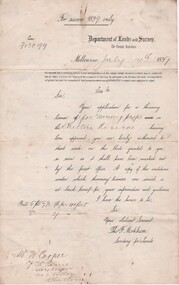
Dated July 14th 1899. Sent to Mr W. Cooper / c/o Mr Barrie / Storekeeper / No. 2 Valley / Chiltern / "Copy of Land Act 1896 / Regulations. Chapter XI Thinning Licenses"Document on stiff paper. Letter to Mr W. Cooper granting license to thin trees on a block of land at Chiltern Reserve. On back, copy of Land Act Regulations 1890"Department of Lands and Survey. On Forest Business"license, timber felling, cooper family, forestry, chiltern reserve -
 Otway Districts Historical Society
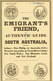
Book, Reader's Digest Services Pty Limited, The emigrant's friend, or authentic guide to South Australia, 1974
This book is a replica of a booklet printed in the United Kingdom. In 1848, when it was published in London as a guide to prospective emigrants, 23,904 people left the United Kingdom for the Australian colonies and New Zealand. In 1847, with the failure of potato crops threatening famine in Ireland and growing political unrest at home, the British Government had once again encouraged emigration by offering free passage to candidates of 'good character'. Immigration, particularly by the labouring classes, was intended to relieve both the overburdened Mother Country and the colonies which had acute labour shortages. The booklet gives some history of each colony as well as the sale of lands, mines and mining, produce, the price of living, wages and, generally, the situation. The emigrant's friend, or authentic guide to South Australia including Sydney: Port Phillip, or Australia Felix: Western Australia, or Swan River Colony: New South Wales: Van Dieman's Land: and New Zealand. Reprint. Reader's Digest Services Pty Limited; Surrey Hills (NSW); 1974. 40 p. Soft cover. australia; colonies; settlement; nsw; port phillip; western australia; south australia; van dieman's land; new zealand; emigration; immigration; -
 Bendigo Historical Society Inc.
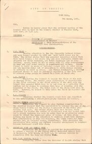
Document - IAN DYETT COLLECTION: AGENDA OF COUNCIL MEETING
Four page agenda for the next Council Meeting, dated 7th March, 1952. Listed is business and correspondence. Correspondence from S E Beard, A H Pappos, E J Golding, Bendigo Tennis Association, Secretary Home and Family Week, Hon L W Galvin MLA, Country Roads Board, Bendigo District Cricket Association, YWCA Hockey Association, F Ebsary, RACV, Mitchell Popular Girl Committee, Bendigo Free Kindergarten, Dept of Health, Bendigo Football League, Les N Jennings, Education Dept, Secretary for Lands, Music Advancement Society of Bendigo, Cr H McF Cameron, Bendigo Preserving Company, Mrs A P Lyon, Golden City Motors, Mrs E M Taylor, Chamber of Commerce, K E Fischer, Wilson Hall Appeal Committee,business, auctioneers, j h curnow & son pty ltd, ian dyett collection - agenda of council meeting, s e beard, a h pappos, e j golding, bendigo tennis association, hon l w galvin mla, country roads board, bendigo district cricket association, f ebsary, racv, bendigo free kindergarten, dept of health, bendigo football league, les n jennings, education dept, secretary for lands, music advancement society of bendigo, cr h mcf cameron, loddon regional committee, shire of kara kara, bendigo preserving company, mrs a p lyon, golden city motors, mrs e m taylor, chamber of commerce, k e fischer, wilson hall appeal committee, university of melbourne -
Beechworth Honey Archive
Particulars of Land
Particulars of land; Particulars of improvements in lands included in returns stated here. [ca 1910] Blue-ish coloured document with yellowing edges. Has two sections; Nature of Improvements and Values as at 30th June 1910. In section one, 6 subsections listed. 1:1; fencing, draining, clearing, 2:1; £350.0.0 1:2; building, fencing, drainage, clearing, 2:2; £397.0.0 1:3; fencing, clearing, 2:3; £387.0.0 1:4a; dwelling (2), fencing, clearing 2:4a; £352.0.0 1:5; fencing, clearing, 2:5; £18.0.0 1:4b; fencing clearing, 2:4b £25.0.0 Total £1529.0.0particulars of land, frost, beekeeper, beechworth honey -
![Publication, Keeping bees on forested lands: a code of practice. (Benecke, F. S.). [np], [nd], [nd]](/media/collectors/51d110e42162ef12e06aa06b/items/535efd552162ef07189079c8/item-media/53717c952162ef165899cc5b/item-fit-380x285.jpg) Beechworth Honey Archive
Beechworth Honey ArchivePublication, Keeping bees on forested lands: a code of practice. (Benecke, F. S.). [np], [nd], [nd]
9 pages. -
![Publication, Keeping bees on forested lands: a code of practice. (Benecke, F. S.). [np], [nd], [nd]](/media/collectors/51d110e42162ef12e06aa06b/items/535efded2162ef071890886a/item-media/53717cae2162ef165899cef7/item-fit-380x285.jpg) Beechworth Honey Archive
Beechworth Honey ArchivePublication, Keeping bees on forested lands: a code of practice. (Benecke, F. S.). [np], [nd], [nd]
9 pages. -
 Beechworth Honey Archive
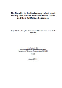
Publication, The benefits to the beekeeping industry and society from secure access to public lands and the melliferous resources. (Gill, Roderic). Canberra, 1996, 1996
53 pages, illustrated. -
Federation University Art Collection
Work on paper - Digital Prints, Gilson, Deanne, 'Wadawurrung Axe Heads 1-4' by Deanne Gilson, 2011
Dr Deanne GILSON (1967- ) Country: Wadawurrung Deanne Gilson is a Federation University alumni, and an award-winning multi-disciplinary artist. Her practice draws its inspiration from ‘Ancestral marks’ and design on cultural objects found in museum archives and family oral histories. Deanne’s practice seeks to interrogate the colonial legacy of settlement and the western hegemonic systems of class, race and representation in historical photographs that were imposed on her Ancestors. Her work also explores the matriarchal role through her feminist perspectives, looking at the history of marriage and the oppressive function it has played within her family. Deanne has completed the following educationala achievements. 2014 – 2015 Masters by Research (Visual Art), Deakin University Geelong 2013 Graduate Diploma in Education Secondary, Federation University 2011 Certificate IV in Aboriginal Contemporary Art & Craft 2010 Cultural Heritage Management Course, Lakes Entrance 1 Week 2007 – 2010 Graduated, Bachelor of Visual Arts with Honours, University of Ballarat 1984 Diploma of Art, School of Mines & Industries TAFE This item is part of the Federation University Art Collection. The Art Collection features over 2000 works and was listed as a 'Ballarat Treasure' in 2007.This work depicts an axehead found on Wadawurrung country and is a responce to workign alongside archeologists untertaking land surveys of her ancestral lands and the visual documentaiton of artefcts.art, artwork, deanne gilson, gilson, wadawurrung, stone axe, aboriginal, alumni -
 Mont De Lancey
Book, E.Payson Hammond, M.A et al, Roger's Travels; or Scenes and Incidents with the Journey of two boys in foreign lands, and how they were led to start for the better country, 1886
The journey of two boys in overseas countries and their adventures with strong religious themes.Orange hardcover children's fiction book, Roger's Travels by E. Payson Hammond. M.A with the title surrounded by gold boxes and an illustration of a Dutch windmill and boat in the countryside. Brown flowers decorate the right side with the author's name E. Payson Hammond M.A underneath. The spine has the title author flowers and initials of the publisher SSU at the bottom. Black and white illustrations and full page plates are throughout. At the end are 15 pages of recommended books for young children by the Sunday School Union. 155p.fictionThe journey of two boys in overseas countries and their adventures with strong religious themes.religious fiction, adventure stories, children's books, morals fiction -
 Wodonga & District Historical Society Inc
Functional object - Haeusler Collection Tobacco Pipe c. Mid-Century
The Wodonga Historical Society Haeusler Collection provides invaluable insight into life in late nineteenth and early twentieth century north east Victoria. The collection comprises manuscripts, personal artefacts used by the Haeusler family on their farm in Wodonga, and a set of glass negatives which offer a unique visual snapshot of the domestic and social lives of the Haeusler family and local Wodonga community. The Haeusler family migrated from Prussia (Germany) to South Australia in the 1840s and 1850s, before purchasing 100 acres of Crown Land made available under the Victorian Lands Act 1862 (also known as ‘Duffy’s Land Act’) in 1866 in what is now Wodonga West. The Haeusler family were one of several German families to migrate from South Australia to Wodonga in the 1860s. This tobacco pipe is one of the many objects in the Haeusler Collection that provides insight into life in early to mid-twentieth century Wodonga, and Australia more broadly. Smoking in the first half of the twentieth century was incredibly common in Australia and other western countries. In 1945, more than three out of every four men and one in every four women were regular smokers. While rates of smoking decreased over the next two decades due to observations and research regarding the links between smoking and illness, an increase in tobacco use was documented after the advent of television as people were bombarded with advertisements for cigarettes. This item has well documented provenance and a known owner. It forms part of a significant and representative historical collection which reflects the local history of Wodonga. It contributes to our understanding of domestic and family life in early twentieth century Wodonga, as well as providing interpretative capacity for themes including local history, social history, and women’s history. A tobacco pipe with brass coloured fitting and black stem.tobacco, smoking, pipe, tobacco pipe, haeusler, haeusler collection, wodonga -
 Wodonga & District Historical Society Inc
Functional object - Haeusler Collection Mid-Century 'Miranda's Dream Cigarettes' Tobacco Tin, Dodo Designs
The Wodonga Historical Society Haeusler Collection provides invaluable insight into life in late nineteenth and early twentieth century north east Victoria. The collection comprises manuscripts, personal artefacts used by the Haeusler family on their farm in Wodonga, and a set of glass negatives which offer a unique visual snapshot of the domestic and social lives of the Haeusler family and local Wodonga community. The Haeusler family migrated from Prussia (Germany) to South Australia in the 1840s and 1850s, before purchasing 100 acres of Crown Land made available under the Victorian Lands Act 1862 (also known as ‘Duffy’s Land Act’) in 1866 in what is now Wodonga West. The Haeusler family were one of several German families to migrate from South Australia to Wodonga in the 1860s. This tobacco tin is one of the many objects in the Haeusler Collection that provides insight into life in early to mid-twentieth century Wodonga, and Australia more broadly. Smoking in the first half of the twentieth century was incredibly common in Australia and other western countries. In 1945, more than three out of every four men and one in every four women were regular smokers. While rates of smoking decreased over the next two decades due to observations and research regarding the links between smoking and illness, an increase in tobacco use was documented after the advent of television as people were bombarded with advertisements for cigarettes. These advertisements, much like the image on the Haeusler Collection 'Miranda's Dream Cigarettes' Tobacco Tin, depicted smoking as sophisticated and glamorous, distracting consumers from the serious health risks associated with smoking. Orientalist depictions of Middle East were common in tobacco advertising in the West in the first half of the twentieth century, an attempt to associate cigarettes with the supposed sensuality and mystery of the Orient. There have been significant changes in both legislation and popular perceptions of smoking in Australian society since the manufacture and consumption of 'Miranda's Dream Cigarettes'. In 1992 the Tobacco Advertising Prohibition Act was introduced, making it illegal in Australia to publish or broadcast messages that encourage people to start or continue smoking. In 2011 the Australian government also introduced plain packaging laws to reduce the appeal and promotion of tobacco products, and make health warnings more effective. This item has well documented provenance and a known owner. It forms part of a significant and representative historical collection which reflects the local history of Wodonga. It contributes to our understanding of domestic and family life in early twentieth century Wodonga, as well as providing interpretative capacity for themes including local history and social history. A tobacco tin with a coloured illustration of a woman in stylish 1920s-1930s dress sitting in an armchair smoking a cigarette, while watching an Orientalist scene featuring a belly dancer and a snake charmer wearing a turban. Branding on the lid of tin: "Miranda's Dream Cigarettes"cigarettes, tobacco, smoking, cigarette tin, haeusler, haeusler collection, wodonga -
 Wodonga & District Historical Society Inc
Functional object - Haeusler Collection Havelock Tobacco c. Early-Mid Twentieth Century, W.D. Wills (Aust.) LTD
The Wodonga Historical Society Haeusler Collection provides invaluable insight into life in late nineteenth and early twentieth century north east Victoria. The collection comprises manuscripts, personal artefacts used by the Haeusler family on their farm in Wodonga, and a set of glass negatives which offer a unique visual snapshot of the domestic and social lives of the Haeusler family and local Wodonga community. The Haeusler family migrated from Prussia (Germany) to South Australia in the 1840s and 1850s, before purchasing 100 acres of Crown Land made available under the Victorian Lands Act 1862 (also known as ‘Duffy’s Land Act’) in 1866 in what is now Wodonga West. The Haeusler family were one of several German families to migrate from South Australia to Wodonga in the 1860s. This tobacco is one of the many objects in the Haeusler Collection that provides insight into life in early to mid-twentieth century Wodonga, and Australia more broadly. Smoking in the first half of the twentieth century was incredibly common in Australia and other western countries. In 1945, more than three out of every four men and one in every four women were regular smokers. While rates of smoking decreased over the next two decades due to observations and research regarding the links between smoking and illness, an increase in tobacco use was documented after the advent of television as people were bombarded with advertisements for cigarettes.This item has well documented provenance and a known owner. It forms part of a significant and representative historical collection which reflects the local history of Wodonga. It contributes to our understanding of domestic and family life in early twentieth century Wodonga, as well as providing interpretative capacity for themes including local history and social history. Lump of tobacco with Havelock Tobacco makers mark on tin insert, with manufacture details on paper"HAVELOCK/TOBACCO" and "J D & (unintelligible) WILLS (AUST.) LTD./Made in Australia/D10114".tobacco, smoking, social history, wodonga, haeusler, haeusler collection -
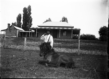 Wodonga & District Historical Society Inc
Negative - Haeusler Glass Negatives Collection - Jack Parker and the pony he taught to do tricks
The Wodonga Historical Society Haeusler Collection provides invaluable insight into life in late nineteenth and early twentieth century north east Victoria. The collection comprises manuscripts, personal artefacts used by the Haeusler family on their farm in Wodonga, and a set of glass negatives which offer a unique visual snapshot of the domestic and social lives of the Haeusler family and local Wodonga community. The Haeusler family migrated from Prussia (Germany) to South Australia in the 1840s and 1850s, before purchasing 100 acres of Crown Land made available under the Victorian Lands Act 1862 (also known as ‘Duffy’s Land Act’) in 1866 in what is now Wodonga West. The Haeusler family were one of several German families to migrate from South Australia to Wodonga in the 1860s. This digital image was produced from one of the glass negatives that form part of the collection, probably taken by Louis Haeusler (b.1887) with the photographic equipment in the Wodonga Historical Society Haeusler Collection. Parker Family - Samuel Skelton Parker, Jack Parker’s father, migrated to Australia from Ballymena, Country Antrim, Ireland in 1884. He married Bridget Cusack from County Clare in 1883. They had children William, James, Jack, Samuel and Rachel. After working on a station in northern NSW, they moved to Barnawartha and set up a butchery and later a bakery. In 1890 the family moved to Wodonga, buying a property in West Wodonga, which he called “Park Hall” after his home in Ireland. The property is now the location of the Wodonga Golf Club in Parkers Road, West Wodonga.This item is unique and has well documented provenance and a known owner. It forms part of a significant and representative historical collection which reflects the local history of Wodonga. It contributes to our understanding of domestic and family life in early twentieth century Wodonga, as well as providing interpretative capacity for themes including local history and social history.Digital image created from the Haeusler Glass negative collection. Jack Parker and his pony in the centre front of the image. Jack taught this pony to perform several tricks. The Parker family home and some outbuildings are visible in the background. This is a substantial brick house with corrugated iron roof.wodonga pioneers, haeusler family, glass negatives, dry plate photography, parker family wodonga -
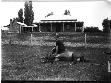 Wodonga & District Historical Society Inc
Negative - Haeusler Glass Negatives Collection - Jack Parker with the pony he taught to do tricks
The Wodonga Historical Society Haeusler Collection provides invaluable insight into life in late nineteenth and early twentieth century north east Victoria. The collection comprises manuscripts, personal artefacts used by the Haeusler family on their farm in Wodonga, and a set of glass negatives which offer a unique visual snapshot of the domestic and social lives of the Haeusler family and local Wodonga community. The Haeusler family migrated from Prussia (Germany) to South Australia in the 1840s and 1850s, before purchasing 100 acres of Crown Land made available under the Victorian Lands Act 1862 (also known as ‘Duffy’s Land Act’) in 1866 in what is now Wodonga West. The Haeusler family were one of several German families to migrate from South Australia to Wodonga in the 1860s. This digital image was produced from one of the glass negatives that form part of the collection, probably taken by Louis Haeusler (b.1887) with the photographic equipment in the Wodonga Historical Society Haeusler Collection. Parker Family - Samuel Skelton Parker, Jack Parker’s father, migrated to Australia from Ballymena, Country Antrim, Ireland in 1884. He married Bridget Cusack from County Clare in 1883. They had children William, James, Jack, Samuel and Rachel. After working on a station in northern NSW, they moved to Barnawartha and set up a butchery and later a bakery. In 1890 the family moved to Wodonga, buying a property in West Wodonga, which he called “Park Hall” after his home in Ireland. The property is now the location of the Wodonga Golf Club in Parkers Road, West Wodonga.This item is unique and has well documented provenance and a known owner. It forms part of a significant and representative historical collection which reflects the local history of Wodonga. It contributes to our understanding of domestic and family life in early twentieth century Wodonga, as well as providing interpretative capacity for themes including local history and social history.Digital image created from the Haeusler Glass negative collection. Jack Parker sitting on his pony which is lying down on the ground. Jack taught this pony to perform several tricks. The Parker family home and some outbuildings are visible in the background. This is a substantial brick house with corrugated iron roof.wodonga pioneers, haeusler family, glass negatives, dry plate photography, parker family wodonga, horsemanship -
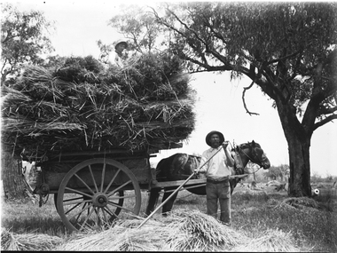 Wodonga & District Historical Society Inc
Negative - Haeusler Glass Negatives Collection - Sam Parker's Farm c1910
The Wodonga Historical Society Haeusler Collection provides invaluable insight into life in late nineteenth and early twentieth century north east Victoria. The collection comprises manuscripts, personal artefacts used by the Haeusler family on their farm in Wodonga, and a set of glass negatives which offer a unique visual snapshot of the domestic and social lives of the Haeusler family and local Wodonga community. The Haeusler family migrated from Prussia (Germany) to South Australia in the 1840s and 1850s, before purchasing 100 acres of Crown Land made available under the Victorian Lands Act 1862 (also known as ‘Duffy’s Land Act’) in 1866 in what is now Wodonga West. The Haeusler family were one of several German families to migrate from South Australia to Wodonga in the 1860s. This digital image was produced from one of the glass negatives that form part of the collection, probably taken by Louis Haeusler (b.1887) with the photographic equipment in the Wodonga Historical Society Haeusler Collection. Parker Family - Samuel Skelton Parker, Jack Parker’s father, migrated to Australia from Ballymena, Country Antrim, Ireland in 1884. He married Bridget Cusack from County Clare in 1883. They had children William, James, Jack, Samuel and Rachel. After working on a station in northern NSW, they moved to Barnawartha and set up a butchery and later a bakery. In 1890 the family moved to Wodonga, buying a property in West Wodonga, which he called “Park Hall” after his home in Ireland. The property is now the location of the Wodonga Golf Club in Parkers Road, West Wodonga.This item is unique and has well documented provenance and a known owner. It forms part of a significant and representative historical collection which reflects the local history of Wodonga. It contributes to our understanding of domestic and family life in early twentieth century Wodonga, as well as providing interpretative capacity for themes including local history and social history.Digital image created from the Haeusler Glass negative collection. A man spreading hay with a rake in the foreground. A horse and cart loaded with hay is behind him.wodonga pioneers, haeusler family, glass negatives, dry plate photography, wodonga families, early farming -
 Bendigo Historical Society Inc.
Document - LANDS OFFICE REGISTER OF CROWN LANDS SOLD SANDHURST, 1855 - 1869
Journal: black hard cover journal with buff spine and corners. Front cover badly damaged Written on spine ' S.I. Sales 1855 - 1869' '05' written in red ink on top of spine. On front cover 'G.W. Groves' written in blue ink under torn cover. Blue lined pages contain details of crown lands surveyed in district of Sandhurst, town, suburban and country. Details of parish, area, date of sale, price and name of purchaser. Indexed by parish on first page.Lands Officeland sales, lands office, land sales, land surveyed, sandhurst, bendigo -
 Bendigo Historical Society Inc.
Document - LANDS OFFICE - CROWN LANDS SURVEYED AND SOLD SANDHURST, 1860 onwards
Journal: LANDS OFFICE - CROWN LANDS SURVEYED AND SOLD SANDHURST green hard cover journal with buff spine and corners. Contains details of crown land surveyed and sold in the district of Sandhurst. Indexed in front by parish, alphabetical double pages not numbered. On LH page, parish, town, suburban, country, date of survey. On RH page, date of sale, auction, selection, price, total amount, purchaser. On spine ' index book' 'F' and '09'. Dated from 1860 onwardsLands Officeland sales, bendigo -
 Eltham District Historical Society Inc
Photograph - Digital Photograph, Alan King, Panton Hill Hotel, 27 March 2008
Today’s Panton Hill Hotel was built around 1920. Published: Nillumbik Now and Then / Marguerite Marshall 2008; photographs Alan King with Marguerite Marshall.; p61 Panton Hill was originally known as Kingstown, and consisted of only one hotel when the Orams Reef was discovered in 1859. Kingstown was a quartz mining centre and many old mine shafts remain in the area. Orams Reef was one of the first reefs with a rich find of gold in the area. The Hotel Francais, which had been operating in 1861, was well situated on the way to Queenstown (later St Andrews). So was Herr Hirt’s Hotel and store at Smiths Gully. The Kingstown hotel, known as the Frenchman’s and in 1864 as the Hotel de France, was run by a Monsieur Emile Hude and his wife Jeanne, and known for its good food. They hosted social events, business conventions and debates, attracting patrons from as far as Melbourne. The hotel’s name was changed to Panton Hill Hotel in 1905. In 1883 Charles Caudwell built another hotel nearby, possibly in Long Gully Road,3 which it is thought, was burnt down early last century. Today’s Panton Hill Hotel, built around 1920, is the only one of the cluster of buildings in the main road, not to date from around the turn of last century. It was severely damaged by fire in 2003, then underwent extensive alterations. It is the township’s only hotel and is an example of a modest hotel building exterior, constructed early last century. In its early days the hotel also housed the first post office, newsagency and store. Orams Reef yielded a total of £100,000, and fossikers also found alluvial gold in the creeks and gullies, but there is no record of the total value of their finds. Gold greatly increased the Panton Hill population, which peaked between 1865 and 1885. On holidays large sports meetings were held with wood chopping contests and foot races and the day would end with a ball. Miners came from various countries to seek their fortune, including many from China. The Chinese became unpopular however, and gradually left the district, although some stayed and grew and sold vegetables.5 Panton Hill was named after Joseph Panton, who in 1862 was appointed Police Magistrate for the Woods Point, Heidelberg and Yarra districts. Panton was an outstanding man, who in 1852, was Commissioner of Crown Lands and Assistant Commissioner of Goldfields at Bendigo. In 1874 he was promoted to Chief Magistrate for the Melbourne Police. Panton was also an artist, becoming president of the Victorian Arts Society in 1888, and in 1913, president of the Royal Geographical Society. Despite Panton Hill’s prosperity, it still lacked many services as poor roads made access to Melbourne difficult. A horse-drawn mail coach travelled to Melbourne until 1890, when the railway came to Heidelberg. The nearest doctor was at Yarra Glen or Heidelberg, and the Indian hawker Singh’s annual visit was very welcome. A miner’s shack opposite the school was used as a post office. Today’s general store and post office in the main road dates from early last century, and has changed considerably. While most people searched for gold, the more enterprising ones established farms to feed the diggers. Farmers grew wheat, barley and oats, and sent animal skins to the Eltham tannery, to make furs in Melbourne. As gold became scarce from around 1880, miners took up farming on 19 to 20 acre (8ha) allotments. The first settlers in Cherry Tree Road included Purcell, Smith, Owens, Hughes and Shillinglaw. By 1900 all the land had been taken up around Panton Hill and Hurstbridge. The orchards in Panton Hill and the wider district, particularly of apple and pear, were very successful, and made Panton Hill a cohesive and successful community. About 1914 the Moores built the first cool-store and refrigeration plant at their orchard in Cherry Tree Road. Many settlers planted vineyards and made high quality wine, but in 1922 the blight destroyed them.This collection of almost 130 photos about places and people within the Shire of Nillumbik, an urban and rural municipality in Melbourne's north, contributes to an understanding of the history of the Shire. Published in 2008 immediately prior to the Black Saturday bushfires of February 7, 2009, it documents sites that were impacted, and in some cases destroyed by the fires. It includes photographs taken especially for the publication, creating a unique time capsule representing the Shire in the early 21st century. It remains the most recent comprehenesive publication devoted to the Shire's history connecting local residents to the past. nillumbik now and then (marshall-king) collection, panton hill hotel -
 Bendigo Historical Society Inc.
Document - LANDS OFFICE, REPORTS OF SALES BY PUBLIC AUCTION BENDIGO DISTRICT
... land sold public auction country Victoria Lands Office Document ...Document: green hard cover book with buff spine and corners. Contains details of public auctions of land in Bendigo and district. Entries are in chronological order of sales with sale advertisement attached to page. Includes Manangatang, Boort, Rushworth, Maldon, Heathcote, Castlemaine, Sea Lake, Avoca.Lands Officeland sales, northern victoria, lands office, land surveyed, land sold, public auction, country victoria -
 Bendigo Historical Society Inc.
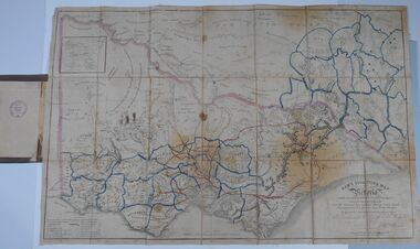
Document - HARRIS COLLECTION: HAMS SQUATTING MAP OF VICTORIA, PORT PHILLIP DISTRICT, NSW
Thomas Ham was a cartographer, engraver, lithographer and publisher in Victoria and Queensland. He compiled and printed several editions of his squatting map, beginning with A map of Australia Felix in 1847 and changing its title to Ham's squatting map of Victoria in 1851. The 1851 edition was accompanied by a key listing the names of all the squatters within squatting districts and counties. Later editions show the existing counties, but some areas of Gippsland and the Australian Alps are still described as 'unsurveyed country'. (State Library Victoria https://www.slv.vic.gov.au/squatting-map-victoria)Folding map enclosed in burgundy cover. Map backed by cloth and bound. Rare, early map of Victoria and neighbouring Port Phillip District of New South Wales. Written on bottom RH corner of map: Ham's Squatting Map of Victoria ( Port Phillip District, New South Wales ) carefully corrected to this date from the Colonial Government Surveys, Crown Lands, Commissioners & Explorers Maps, Private Surveys & c. Respectfully inscribed (with permission ) to His Excellency Sir Chas A. Fitz-Roy Knt, Governor of New South Wales &c &c by his Obedient Servant, The Compiler, 1851. Compiled, engraved and published by Thomas Ham, Melbourne. Proposed and original boundary ( in legend) have been coloured in in blue and pink ink ( later addition ?) Number on map show 'reference to proprietor's Printed on back of map ' J.G. AD 1852, with two cross hatched decorations and two hearts entwined. On other back panel in pencil enclosed in a drawn frame ' G.S.H., 1889, Axedale' (George Harris, Axedale, belongs in Harris Collection) Stamped in purple ink 'Royal Historical Society of Victoria, Bendigo Branch. Written 1959, 53.map, victoria, squatting map -
 Merri-bek City Council
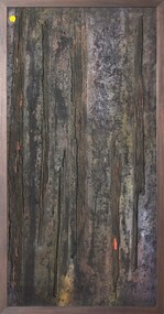
Mixed media - Callistemon charcoal and ink on marine ply, Brian McKinnon, Bush Fire I “Redgum Sleeper”, 2019