Showing 64 items matching "explorers -- australia -- maps"
-
 Warrnambool and District Historical Society Inc.
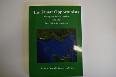
Book, The Tamar Opportunists - Mahogany Ship Mysteries and the Port Fairy Adventurers, 2022
This book explores aspects of the Mahogany Ship wreck and aspects of early Port Fairy history.This is a book of 122 pages. The cover is green with a green and blue map on the front and white printing on the front and back. It contains a Foreword and Acknowledgements, an Epilogue, Appendices, Bibliography, Index and printed material, maps, sketches, tables and black and white photographs.non-fictionThis book explores aspects of the Mahogany Ship wreck and aspects of early Port Fairy history.port fairy history, the tamar opportunists, mahogany ship -
 Flagstaff Hill Maritime Museum and Village
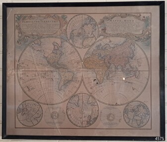
Map - World Map, Mappe Monde [Medieval Map of the World], 1910
This map from the mid-18th century doesn't include the finer details of land and sea masses that we know today. The map was produced by German cartographer and publisher, Johann Baptist Homann (1663-1724) and published in 1746, after his death. Earlier versions were published, such as 1707 and 1716. The date can be calculated from the Roman numerals on the top left text area. This print of a map is significant for its connection with early world explorers. A comparison of maps over the centuries shows the progression of navigational technology, the countries who claimed the land they explored. The naming of even some Australian locations shows who had already made their mark on Australia in the early 18th century. The print shows the fine details included by the cartographer and the beauty included that makes it attractive and interesting even today. The map is also significant for its connection with German cartographer, Johann Baptist Homann, whose Homann publishing company was renewed in Germany for producing high quality maps and atlases. Map behind glass in dark brown wooden frame on beige paper. The Coloured hand drawn line drawings show different hemispheres of the known world in the mid-18th century. Beautifully drawn figures and decorative embellishments enhance the map. The text on the top right has an explanation of the Figures I, II, III, and IV. This print of the 1746 map was produced in England by Leisure Arts Ltd. "PLANIGLOBIL TERRESTRIS" "MDCCXXXXVI" [1746] "MAPPE_MONDE" [Medieval Map of the World] "LEISURE ARTS LTD" "Printed in England"flagstaff hill, warrnambool, flagstaff hill maritime museum, flagstaff hill maritime village, flagstaff hill maritime museum and village, shipwreck coast, world map, french map, 18th century map, leisure arts ltd, cartography, early exploration, cartographer, johann homann (1663-1724), exploration, naviagtion, 1746 planiglobil terrestris -
 Narre Warren and District Family History Group
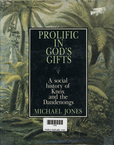
Book, MA Jones, Prolific in God's gifts : a social history of Knox and the Dandenongs, 1983
a detailed historical account of the Knox and Dandenong regions in Victoria, Australia. The book explores the area's development from the arrival of the first pastoralists to its transformation into part of urban Melbourne. It highlights key figures such as James Clow, a clergyman and pastoralist, and John Wood Beilby, an explorer and speculator. The book also discusses the region's early agricultural struggles, the impact of the railway, and its emergence as one of Australia's first tourist destinations. Richly illustrated with photographs and maps, it provides a vivid picture of the area's history through original newspaper excerpts and documents. [AI generated text]328 p.; 24 cmnon-fictiona detailed historical account of the Knox and Dandenong regions in Victoria, Australia. The book explores the area's development from the arrival of the first pastoralists to its transformation into part of urban Melbourne. It highlights key figures such as James Clow, a clergyman and pastoralist, and John Wood Beilby, an explorer and speculator. The book also discusses the region's early agricultural struggles, the impact of the railway, and its emergence as one of Australia's first tourist destinations. Richly illustrated with photographs and maps, it provides a vivid picture of the area's history through original newspaper excerpts and documents. [AI generated text]knox (vic.), dandenongs -
 Narre Warren and District Family History Group
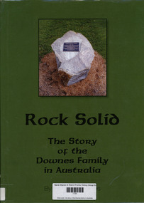
Book, Graham Downes, Rock solid : the story of the Downes family in Australia, 2013
A genealogical and historical account of the Downes family, tracing their roots from Ireland to Australia. The book explores the life of Timothy Downes (1794–1894) and his descendants, detailing their experiences, challenges, and contributions to Australian society. It includes maps, portraits, and genealogical tables to provide a comprehensive view of the family's journey.144, 187 pages : illustrations, maps, portraits, genealogical tables ; 30 cmnon-fictionA genealogical and historical account of the Downes family, tracing their roots from Ireland to Australia. The book explores the life of Timothy Downes (1794–1894) and his descendants, detailing their experiences, challenges, and contributions to Australian society. It includes maps, portraits, and genealogical tables to provide a comprehensive view of the family's journey.timothy downes (c1794-1894), downes family