Showing 1941 items matching "flood"
-
 Eltham District Historical Society Inc
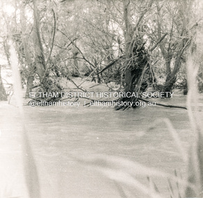
Photograph, George W. Bell, Flood Eltham early 1950's, 1950c
Black and white photograph of flood remains Eltham early 1950s.floods, eltham, diamond creek, george w bell collection -
 Eltham District Historical Society Inc
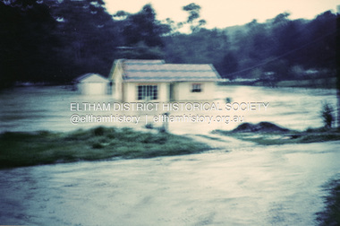
Photograph, 1957 flood, Railway Parade, Eltham, 1957
Colour photograph of flooded house Railway Parade Eltham 1957floods, diamond creek, eltham, railway parade -
 University of Melbourne, Burnley Campus Archives
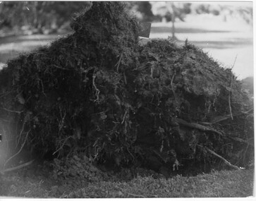
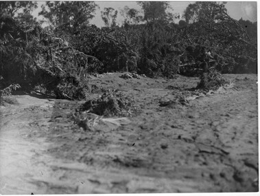
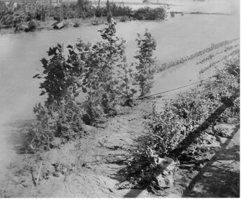
Photograph - Black and white print, Orchard After Flood, 1934
Orchard after flood: shows close up of uprooted tree.orchard, yarra river, floods, 1934, fruit trees -
 University of Melbourne, Burnley Campus Archives
Photograph - Black and white print, Orchard in Flood, 1934
Black and white photograph. Orchard in flood, shows uprooted trees.orchard, yarra river, floods, 1934 -
 University of Melbourne, Burnley Campus Archives
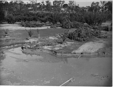
Photograph - Black and white print, Orchard in Flood, 1934
Black and white photograph. Orchard in flood: small shed in the centre.orchard, yarra river, floods, 1934 -
 University of Melbourne, Burnley Campus Archives
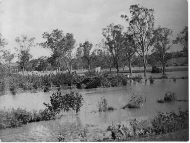
Photograph - Black and white print, Orchard in Flood, 1934
Black and white photograph. Orchard in flood: shows uprooted trees.orchard, yarra river, floods, 1934, fruit trees -
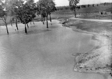
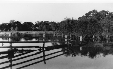
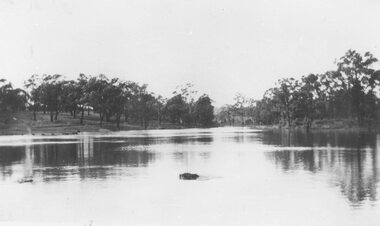 Ringwood and District Historical Society
Photograph, Ringwood Lake in flood - 1950
Typed below photograph, "Ringwood Lake in flood - 1950" -
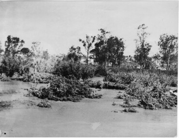
 Eltham District Historical Society Inc
Photograph, George W. Bell, Flood Eltham early 1950's, 1950c
Black and white photograph of Diamond Creek in flood at Eltham early 1950sfloods, diamond creek, eltham, george w bell collection -
 Eltham District Historical Society Inc
Photograph, Diamond Creek in flood 1924, 1924
Colour photograph of original showing Diamond Creek in flood at Eltham 1924floods, diamond creek, eltham -
 University of Melbourne, Burnley Campus Archives
Photograph - Black and white print, Orchard After Flood, 1934
Black and white photograph. Orchard after flood: shows uprooted trees.orchard, yarra river, floods, 1934, fruit trees -
 Eltham District Historical Society Inc
Photograph, Diamond Creek in flood 1924, 1924
Colour reproduction copy of an original sepia photograph of Diamond Creek in flood 1924diamond creek, floods -
 Stawell Historical Society Inc
Photograph, Flood on Concongella Creek, Great Western, early 1900's
Digital Photo taken from glass slide by Geoff McMillan, Cooper Street Stawell and reproduced as a photo - printed at Stawell Historical Society 2019Black & White Photo of flood on the Concongella Creek at Best's vineyard, Great Western. -
 Whitehorse Historical Society Inc.
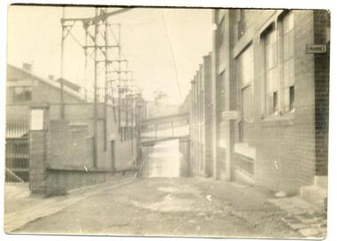
Article, Flood plan, 1993
$100,000 will be spent by Melbourne Water to solve flooding problems in the Fulton Road area.$100,000 will be spent by Melbourne Water to solve flooding problems in the Fulton Road area.$100,000 will be spent by Melbourne Water to solve flooding problems in the Fulton Road area.melbourne water, fulton road, blackburn south, drainage -
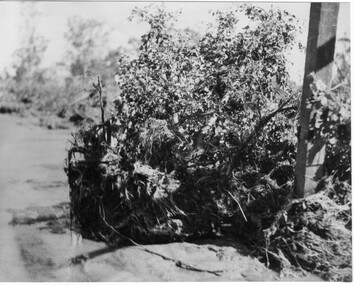 University of Melbourne, Burnley Campus Archives
Photograph - Black and white print, Orchard After Flood, 1934
Black and white photograph. Orchard after flood: shows close up of uprooted tree.orchard, yarra river, floods, 1934, fruit trees -
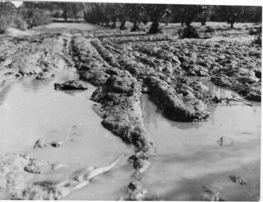 University of Melbourne, Burnley Campus Archives
Photograph - Black and white print, Orchard After Flood, 1934
Black and white photograph. Orchard after flood: shows damage to the soil. Enlarged photograph.orchard, yarra river, floods, 1934, soil -
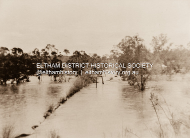
 Kew Historical Society Inc
Photograph - River Yarra in Flood from Kilby Road
Flooding of the Yarra Valley, including that section of the Yarra bordering Kew and Kew East in the north and west of the municipality, was a regular occurrence. Extreme flood events of the Yarra River are recorded to have occurred in 1891, 1901, 1916, 1923 and 1934. The Municipality of Kew's response to these floods was to enact planning decisions restricting residential development in flood prone areas following the floods of 1916, 1921 and 1934. While floods continued after the development of the Upper Yarra Reservoir (construction 1948-57), the regularity and extent of these inundations diminished.Print copy of an original photo of the River Yarra in Flood, taken from Kilby Road.VIEW ACROSS YARRA IN FLOOD / FROM KILBY RD KEWkilby road, floods -- kew (vic.), kilby farm -
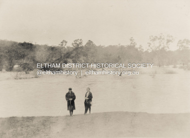
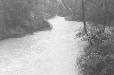 Ringwood and District Historical Society
Photograph, Mullum Creek in flood, July 1963. Taken from foot bridge at end of Adelaide St., Ringwood
See also 2982Typed below photograph, "Mullum Creek in Flood - 1963". Other photographs read, "Mullum Creek in flood, July 1963. Taken from foot bridge at end of Adelaide St." -
 National Wool Museum
Photograph, Yarra Falls: Yarra River in Flood
James Murgatroyd worked at Warrnambool Woollen Mills, Federal Mill, Tweedside, Collins Mills and set up looms for Alexander Spinning Mills Sydney, his son Fred Murgatroyd worked as a loom tuner at Yarra Falls, Tweedside and Collins mills in Victoria as well as in Sydney, and studied at Leeds University.Murgatroyd Photograph CollectionF Murgatroyd Yarra Falls: Yarra River in Flood KODAK PRINTtextile machinery textile mills textile mills, yarra falls mill, murgatroyd, mr fred murgatroyd, mr james, textile machinery, textile mills -
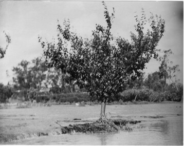 University of Melbourne, Burnley Campus Archives
Photograph - Black and white print, Orchard After Flood, 1934
Black and white photograph. Orchard after flood: shows single fruit tree surrounded by water. Enlargement.orchard, yarra river, floods, 1934, fruit tree -
Lakes Entrance Historical Society
Book, East Gippsland Catchment Management, Flood Event Photos 2007, 2007
A pictorial record in colour of the widespread damaging floods in East Gippsland in June 2007 . Spiral bound bookletnatural disasters, waterways, township -
Lakes Entrance Historical Society
Book, Glenvale School Committee, From Fire to Flood, 2007
A pictorial record which graphically represents the devastation caused by fire and flood in Gippsland during 2006-2007.natural disasters -
 Kew Historical Society Inc
Photograph - Yarra Valley Floods: Kew East, 1916
Flooding of the Yarra Valley, including that section of the Yarra bordering Kew and Kew East in the north and west of the municipality, was a regular occurrence. Extreme flood events of the Yarra River are recorded to have occurred in 1891, 1901, 1916, 1923 and 1934. The Municipality of Kew's response to these floods was to enact planning decisions restricting residential development in flood prone areas following the floods of 1916, 1921 and 1934. While floods continued after the development of the Upper Yarra Reservoir (construction 1948-57), the regularity and extent of these inundations diminished. During the nineteenth century, the land abutting the south side of the Yarra in Kew was devoted to dairy farming. In the twentieth century, before and after the construction of the Eastern Freeway, much of this low-lying area was used as golf courses and public parks.One of a collection of photographs of flooding in the Kew section of the Yarra Valley which are in important research resource for the location and extent of flooding in the first half of the twentieth century. Flooding of the Yarra Valley at East Kew in 1916. The view is taken from a street (maybe Birdwood Avenue) intersecting with Kilby Road looking northeast across the flood waters to Ivanhoe and Heidelberg. The extensive flooded area shown in the photograph would have included remnant dairy farms and the Kew Golf Club. Verso: "Floods / Yarra River / East Kew / Kilby Road / 1917? / 87"yarra river, yarra valley, floods -- kew, kilby road -- kew (vic.), kew golf club -
 Kew Historical Society Inc
Photograph - Yarra Valley Floods: Kew East, 1916
Flooding of the Yarra Valley, including that section of the Yarra bordering Kew and Kew East in the north and west of the municipality, was a regular occurrence. Extreme flood events of the Yarra River are recorded to have occurred in 1891, 1901, 1916, 1923 and 1934. The Municipality of Kew's response to these floods was to enact planning decisions restricting residential development in flood prone areas following the floods of 1916, 1921 and 1934. While floods continued after the development of the Upper Yarra Reservoir (construction 1948-57), the regularity and extent of these inundations diminished. During the nineteenth century, the land abutting the south side of the Yarra in Kew was devoted to dairy farming. In the twentieth century, before and after the construction of the Eastern Freeway, much of this low-lying area was used as golf courses and public parks.One of a collection of photographs of flooding in the Kew section of the Yarra Valley which are in important research resource for the location and extent of flooding in the first half of the twentieth century. Flooding of the Yarra Valley at East Kew in 1916. The view is taken from the intersection of Kilby Road with what is believed to be Birdwood Street, looking across the flood waters to Ivanhoe. The extensive flooded area shown in the photograph would have included the Kew Golf Club. Verso: "Floods along Kilby Road / near Birdwood St? & Kilby Road / 1917? / 87yarra river, yarra valley, floods -- kew, kilby road -- kew (vic.), kew golf club -
 Kew Historical Society Inc
Photograph - Flood at Fairfield Park, 1934
Flooding of the Yarra Valley, including that section of the Yarra bordering Kew and Kew East in the north and west of the municipality, was a regular occurrence. Extreme flood events of the Yarra River are recorded to have occurred in 1891, 1901, 1916, 1923 and 1934. The Municipality of Kew's response to these floods was to enact planning decisions restricting residential development in flood prone areas following the floods of 1916, 1921 and 1934. While floods continued after the development of the Upper Yarra Reservoir (construction 1948-57), the regularity and extent of these inundations diminished.Black and white print positive. Yarra River at Fairfield in 1934. Major flood resulting in submerged buildings in middle ground and onlookers on far bankReverse: "Flood of Yarra at Fairfield Park 1934"fairfield park, yarra valley, river yarra, floods -- 1934 -
 Ringwood and District Historical Society
Photograph, Ringwood Bowling Club- Installation of flood wall along the Miles Avenue frontage, 1979
Black and white photographs (2)Photographs show volunteers constructing the flood wall along the Miles Avenue frontage. Text attached to photos includes names of Committee Members who accepted the responsibility of recommending changes in 1979 including the flood wall. -
 National Wool Museum
Photograph, Yarra Falls: Yarra flood, early 1930's
James Murgatroyd worked at Warrnambool Woollen Mills, Federal Mill, Tweedside, Collins Mills and set up looms for Alexander Spinning Mills Sydney, his son Fred Murgatroyd worked as a loom tuner at Yarra Falls, Tweedside and Collins mills in Victoria as well as in Sydney, and studied at Leeds University.Murgatroyd Photograph CollectionF Murgatroyd Yarra Falls: Yarra flood, early 1930's KODAK PRINTtextile machinery textile mills weaving mills textile mills, yarra falls mill, murgatroyd, mr fred murgatroyd, mr james, textile machinery, textile mills, weaving mills -
 University of Melbourne, Burnley Campus Archives
Photograph - Black and white print, Orchard in Flood, 1934
Black and white photograph. Orchard in flood: an irrigation ? Pipe is showing. Yarra River broke its bank on the night of 30.11.1934.orchard, yarra river, floods, 1934 -
Tatura Irrigation & Wartime Camps Museum
Photograph - copy, 1955 Floods, 1955
Copy of photograph of floods outside Tacey's Garage, Tatura.Black and white photograph of floods, outside Tacey's Garage, 1955.on back: Tacey's garage, Tatura. Corner Park and Hogan Streets. 1955 Floods.1955 floods tatura -
 Charlton Golden Grains Museum Inc
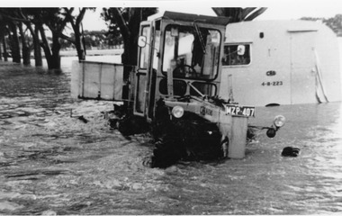
Photograph, Cameron, Ian, c.1973
CRB grader towing a caravan 1973 Flood - washed off road before Yeungroon turnoff in 1973 flood.B/W photograph CRB grader towing a caravan 1973 Flood - washed off road before Yeungroon turnoff in 1973 floodflood, calder highway, yeungroon -
 Charlton Golden Grains Museum Inc
Photograph
Flooded Billabong Cadgow's Dairy in the bend of the Avoca River Oct 1975Black and white photograph of flooded billabong.flood, charlton