Showing 95 items
matching geological heritage
-
 Ballarat Heritage Services
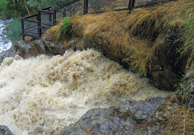
Photograph - Digital photographs, L.J. Gervasoni, Hepburn Blowhole blowing, c2004
Water flowing through the tunnel at The Blowhole, Hepburnhepburn, landscape, heritage, hepburn regional park, mining, blowhole, floods, weather, geology -
 Ballarat Heritage Services
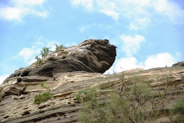
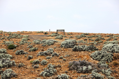
Digital photographs, L.J. Gervasoni, Tower Hill - international geological significance, c2015
... Ballarat Heritage Services PO Box 2209 Bakery Hill Post ...tower hill, volcano, natural heritage, koroit, landscape, ash, geological, international significance -
 Ballarat Heritage Services
Photograph - Digital photographs, L.J. Gervasoni, Tower Hill - international geological significance - maar, c2015
... Ballarat Heritage Services PO Box 2209 Bakery Hill Post ...Digital Photographs of tower hill near Koroit Victoria tower hill, volcano, natural heritage, koroit, landscape, ash, geological, international significance -
 Ballarat Heritage Services
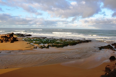
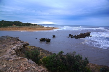
Digital photographs, L.J. Gervasoni, Hopkins River Mouth reef exposed after flood, c2010 - 2017
hopkins river, mouth, point ritchie, bluehole, warrnambool, coast, coastal, beach, seascape, flood, post flood, reef, exposed, geology, coastal geomorphology -
 Ballarat Heritage Services
Digital photographs, L.J. Gervasoni, Hopkins River Mouth in flood as the waters receed, c2010 - 2017
Colour photograph of the mouth of the Hopkins River at Warrnambool,hopkins river, mouth, point ritchie, bluehole, warrnambool, coast, coastal, beach, seascape, flood, post flood, geology, coastal geomorphology, waters receeding -
 Ballarat Heritage Services
Digital photographs, L.J. Gervasoni, Hopkins River Mouth in flood - waters receeding, c2010 - 2017
hopkins river, mouth, point ritchie, bluehole, warrnambool, coast, coastal, beach, seascape, flood, post flood, geology, coastal geomorphology, waters receeding -
 Ballarat Heritage Services
Digital photographs, L.J. Gervasoni, Hopkins River Mouth after the flood, c2010 - 2017
hopkins river, mouth, point ritchie, bluehole, warrnambool, coast, coastal, beach, seascape, flood, post flood, geology, coastal geomorphology, waters receeding -
 Ballarat Heritage Services
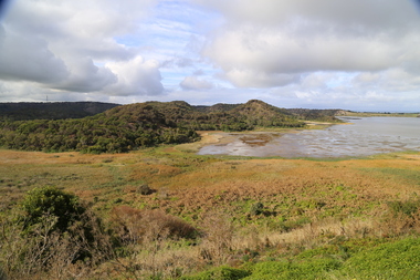
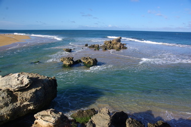
Digital photographs, L.J. Gervasoni, Geology at Stingray Bay / middle island, c2010
Colour photograph of Middle Island, Warrnambool.warrnambool, landscape, seascape, ocean, water, middle island, stingray bay, geology, coastal geomorphology -
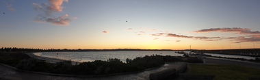 Ballarat Heritage Services
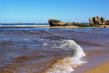
Photograph - Digital photographs, Clare Gervasoni, The Warrnambool Coast from Lady Bay, 29/06/2020
Panoramo at Warrnamboollandscape, seascape, geology, warrnambool, coast, coastal, breakwater, lady bay -
 Ballarat Heritage Services
Photograph - Photograph - Colour, Anticline in the Hepburn Springs Reserve, 2019, 22/04/2019
Anticlines are folded rock formations that have an upwards convex shape. Anticlines can exist as a single fold or as a series of adjacent folds of alternating synclines and anticlines. The Hepburn Springs anticline is geologically associated with the west dipping fissures cutting across sandstone strata of the Hepburn Spring anticline.Colour photograph of an anticline at Hepburn Mineral Springs Reserve, in close proximity to the Sulphur Spring. hepburn springs, anticline, geology, hepburn mineral springs reserve, hepburn anticline, hepburn geology -
 Ballarat Heritage Services
Digital photograph, Lisa Gervasoni, Portland, c2015
cape bridgewater, geology, ocean, coastal, landscape, seascape -
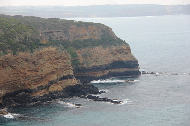
 Ballarat Heritage Services
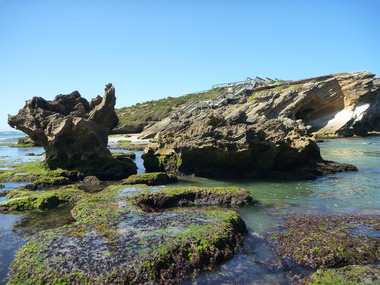
Digital photograph, Lisa Gervasoni, Cape Bridgewater, c2015
cape bridgewater, geology, ocean, coastal, landscape, seascape, petrified forest -
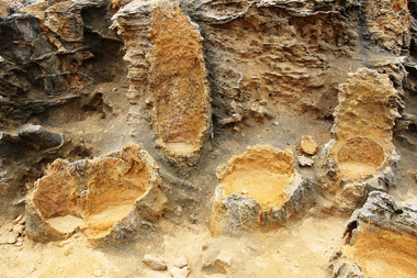 Ballarat Heritage Services
Digital photograph, Lisa Gervasoni, Petrified Forest at Cape Bridgewater, c2015
Colour photograph of the Petrified Forest at Cape Bridgewatercape bridgewater, geology, ocean, coastal, landscape, seascape, petrified forest -
 Ballarat Heritage Services
Digital photograph, Lisa Gervasoni, Cape Bridgewater, c2015
cape bridgewater, geology, ocean, coastal, landscape, seascape, petrified forest -
 Ballarat Heritage Services
Digital photograph, Lisa Gervasoni, Cape Bridgewater, c2015, c2015
Colour photograph of a landscape at Cape Bridgewater.cape bridgewater, geology, ocean, coastal, landscape, seascape, petrified forest -
 Ballarat Heritage Services
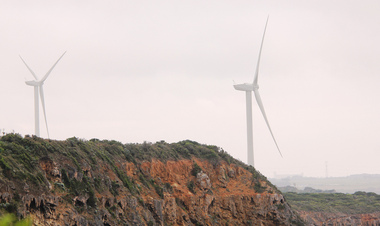
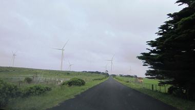
Digital photograph, Lisa Gervasoni, Cape Bridgewater, c2015
Colour photograph of wind turbines at Cape Bridgewater.cape bridgewater, geology, ocean, coastal, landscape, seascape, petrified forest, wind farm, wind turbine -
 Ballarat Heritage Services
Digital photograph, Lisa Gervasoni, Cape Bridgewater, c2015
cape bridgewater, geology, ocean, coastal, landscape, seascape, petrified forest, wind farm, wind turbine -
 Ballarat Heritage Services
Digital photograph, Lisa Gervasoni, Cape Bridgewater, c2015
cape bridgewater, geology, ocean, coastal, landscape, seascape -
 Ballarat Heritage Services
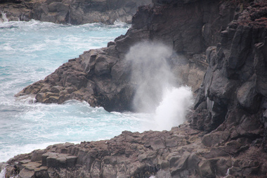
Digital photograph, Lisa Gervasoni, Cape Bridgewater, c2015
cape bridgewater, geology, ocean, coastal, landscape, seascape, blowhole, volcanic rock -
 Ballarat Heritage Services
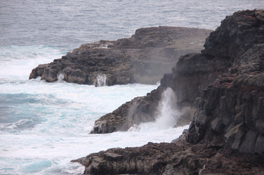
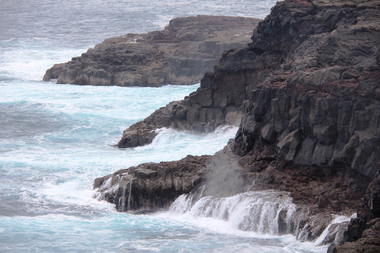
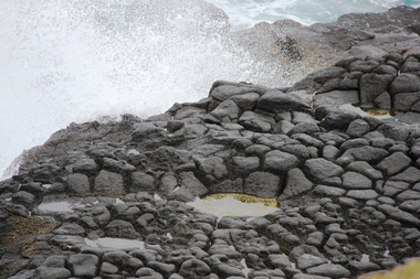
Digital photograph, Lisa Gervasoni, Cape Bridgewater, c2015
Colour photograph of the coastline at Cape Bridgewater, Victoria. cape bridgewater, geology, ocean, coastal, landscape, seascape, blowhole, volcanic rock -
 Ballarat Heritage Services
Digital photograph, Lisa Gervasoni, Cape Bridgewater, c2015
cape bridgewater, geology, ocean, coastal, landscape, seascape, blowhole, volcanic rock -
 Ballarat Heritage Services
Digital photograph, Lisa Gervasoni, Cape Bridgewater, c2015
cape bridgewater, geology, ocean, coastal, landscape, seascape, blowhole, volcanic rock -
 Ballarat Heritage Services
Digital photograph, Lisa Gervasoni, Cape Bridgewater, c2015
cape bridgewater, geology, ocean, coastal, landscape, seascape, blowhole, volcanic rock -
 Ballarat Heritage Services
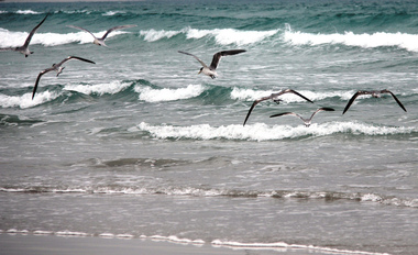
Digital photograph, Lisa Gervasoni, Cape Bridgewater, c2015
cape bridgewater, geology, ocean, coastal, landscape, seascape, birds, waves -
 Ballarat Heritage Services
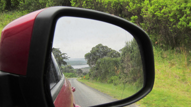
Digital photograph, Lisa Gervasoni, Cape Bridgewater, c2015
Colour photograph of Cape Bridgewater taken in the side mirror of a car.cape bridgewater, geology, ocean, coastal, landscape, seascape, birds, waves -
 Ballarat Heritage Services
Digital photograph, Lisa Gervasoni, Cape Bridgewater, c2015
cape bridgewater, geology, ocean, coastal, landscape, wind farm, wind turbines -
 Ballarat Heritage Services
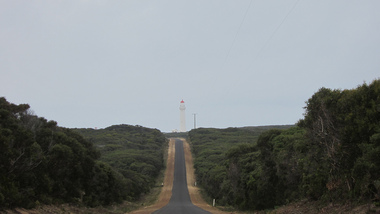
Digital photograph, Lisa Gervasoni, Cape Bridgewater, c2015
Colour photograph of the road to the Cape Bridgewater lighthouse. cape bridgewater, geology, ocean, coastal, landscape, lighthouse -
 Ballarat Heritage Services
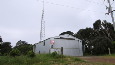
Digital photograph, Lisa Gervasoni, Cape Bridgewater Fire Brigade, c2015, c2015
Colour photograph of a metal fire brigade at Cape Bridgewater.cape bridgewater, geology, ocean, coastal, landscape, cfa, fire, station, fire brigade, cape bridgewater fire brigade -
 Ballarat Heritage Services
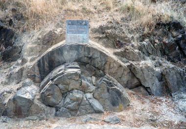
Photograph - Photograph - Colour, Clare Gervasoni, Anticlinal Fold, Castlemaine, c2007
In 1927 a plaque was installed at this anticlinal fold. Since no plaque is evident in the photo the date would be pre1927. The plaque states "This fine exhibit was disclosed when Lyttleton Street East was constructed in 1874. Saddle reefs occur in similar folds of the sandstones and slates on lower geological horizons."Colour photograph of an anticlinal fold in Lyttleton Street, Castlemaine, Victoriaanticlinal fold, geology, geological feature, castlemaine -
 Ballarat Heritage Services
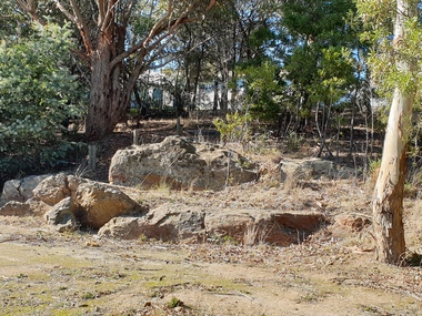
Photograph - Photograph - Colour, Clare Gervasoni, Pulpit Rock, Magpie, Victoria, 2019, 18/05/2019
Wesleyans at Magpie collected money to built a tent chapel at Magpie, but the rush had moved on before it was erected so the tent was taken to Ballarat where it becme the basis of the Lydiard Street Wesleyan Church (now Uniting Church). A bluestone church was later bulit above the Magpie School which was demolished in the 1960s with the stone used in the entrance building at Sovereign Hill.A large rock at Magpie, beside the Yarrowee Creek, was called Pulpit Rock. It was at this rock that the early miners gathered in 1853 for open air religious services. magpie, wesleyan church, religion, pulpit rock, geology