Showing 14692 items matching "north road"
-
 Eltham District Historical Society Inc
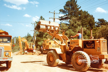
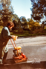
Photograph, Road construction near 'Jingalong', Ryans Road, Eltham North, 1983, 1983
... Road construction near 'Jingalong', Ryans Road, Eltham.... eltham north road construction ryans road jingalong Four colour ...Originally contained in a 'magnetic' photo album believed to have been donated by Mr Eric Stephenson, Jingalong, 110 Ryans Road, Eltham, Vic. 3095; relocated to archival safe storage.Four colour photographseltham north, road construction, ryans road, jingalong -
 Eltham District Historical Society Inc
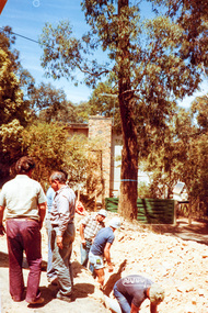
Photograph, Ross Johnston and road construction near 'Jingalong', Ryans Road, Eltham North, 1983, 1983
... Road, Eltham North, 1983.... eltham north road construction ryans road jingalong ross johnston ...Originally contained in a 'magnetic' photo album believed to have been donated by Mr Eric Stephenson, Jingalong, 110 Ryans Road, Eltham, Vic. 3095; relocated to archival safe storage.Colour photographeltham north, road construction, ryans road, jingalong, ross johnston -
 Eltham District Historical Society Inc
Photograph, Road construction in front of 'Jingalong', 110 Ryans Road, Eltham North, 1983, 1983
... Road construction in front of 'Jingalong', 110 Ryans Road.... eltham north road construction ryans road jingalong 110 ryans ...Originally contained in a 'magnetic' photo album believed to have been donated by Mr Eric Stephenson, Jingalong, 110 Ryans Road, Eltham, Vic. 3095; relocated to archival safe storage.Colour photographeltham north, road construction, ryans road, jingalong, 110 ryans road -
 Eltham District Historical Society Inc
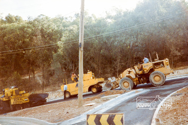
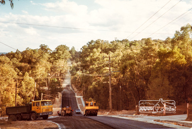
Photograph, Putting on the bitumen, road construction, Ryans Road, Eltham North, 1983, 1983
... Putting on the bitumen, road construction, Ryans Road.... eltham north road construction ryans road Three colour ...Originally contained in a 'magnetic' photo album believed to have been donated by Mr Eric Stephenson, Jingalong, 110 Ryans Road, Eltham, Vic. 3095; relocated to archival safe storage.Three colour photographseltham north, road construction, ryans road -
 Eltham District Historical Society Inc
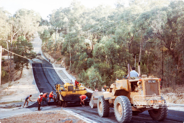
Photograph, Putting on the bitumen, bottom of the 'Big Dipper', road construction, Ryans Road, Eltham North, 1983, 1983
... construction, Ryans Road, Eltham North, 1983.... eltham north road construction ryans road Colour photograph ...Originally contained in a 'magnetic' photo album believed to have been donated by Mr Eric Stephenson, Jingalong, 110 Ryans Road, Eltham, Vic. 3095; relocated to archival safe storage.Colour photographeltham north, road construction, ryans road -
 Eltham District Historical Society Inc
Photograph, Compacting bitumen on driveway crossing, road construction, Ryans Road, Eltham North, 1983, 1983
... , Ryans Road, Eltham North, 1983.... eltham north road construction ryans road Colour photograph ...Originally contained in a 'magnetic' photo album believed to have been donated by Mr Eric Stephenson, Jingalong, 110 Ryans Road, Eltham, Vic. 3095; relocated to archival safe storage.Colour photographeltham north, road construction, ryans road -
 Eltham District Historical Society Inc
Photograph, Rolling the bitumen, road construction, Ryans Road, Eltham North, 1983, 1983
... Rolling the bitumen, road construction, Ryans Road, Eltham.... eltham north road construction ryans road Colour photograph ...Originally contained in a 'magnetic' photo album believed to have been donated by Mr Eric Stephenson, Jingalong, 110 Ryans Road, Eltham, Vic. 3095; relocated to archival safe storage.Colour photographeltham north, road construction, ryans road -
 Eltham District Historical Society Inc
Photograph, Laying the bitumen for entrance crossing, road construction, Ryans Road, Eltham North, 1983, 1983
... , Ryans Road, Eltham North, 1983.... eltham north road construction ryans road Three colour ...Originally contained in a 'magnetic' photo album believed to have been donated by Mr Eric Stephenson, Jingalong, 110 Ryans Road, Eltham, Vic. 3095; relocated to archival safe storage.Three colour photographseltham north, road construction, ryans road -
 Eltham District Historical Society Inc
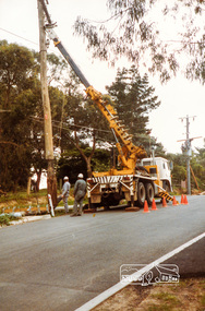
Photograph, Repairs to State Electricity Commission pole, road construction, Ryans Road, Eltham North, 1983, 1983
... construction, Ryans Road, Eltham North, 1983.... eltham north road construction ryans road Two colour photographs ...Originally contained in a 'magnetic' photo album believed to have been donated by Mr Eric Stephenson, Jingalong, 110 Ryans Road, Eltham, Vic. 3095; relocated to archival safe storage.Two colour photographseltham north, road construction, ryans road -
 Greensborough Historical Society
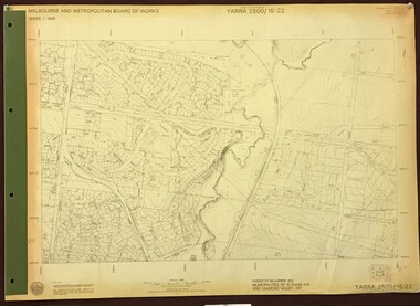
Map, Melbourne and Metropolitan Board of Works. Survey Division, MMBW, Yarra 2500 / 15.22. Eltham North. Allendale Road, 1979_08
... MMBW, Yarra 2500 / 15.22. Eltham North. Allendale Road.... map] 15.22. Eltham North, Allendale Road. Parish of Nillumbik... of Works. Yarra 2500 [base map] 15.22. Eltham North, Allendale Road ...Melbourne and Metropolitan Board of Works. Yarra 2500 [base map] 15.22. Eltham North, Allendale Road. Parish of Nillumbik. Municipalities of Eltham 238 and Diamond Valley 257. Prominent streets include: Allendale Road, Godber Road and Ryans Road. Features include the Diamond Creek.MMBW Map in 1:2500 [scale] series. Cream parchment with green tape reinforcing on edges and punched holes on left edge.mmbw, melbourne and metropolitan board of works, shire of diamond valley, nillumbik, eltham - maps -
 Ballarat Heritage Services
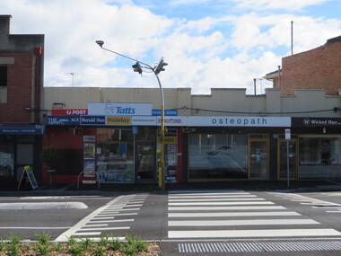
Photograph, Clare Gervasoni, North Kew Newsagency, 93 Willsmere Road, North Kew, 2017, 10/07/2017
... North Kew Newsagency, 93 Willsmere Road, North Kew, 2017...Willsmere Road, Kew North...North Kew Newsagency, 93 Willsmere Road, North Kew.... newsagent Willsmere Road, Kew North North Kew Newsagency, 93 ...North Kew Newsagency, 93 Willsmere Road, North Kew.north kew newsagency, north kew village, newsagent, willsmere road, kew north -
 Whitehorse Historical Society Inc.
Photograph - B/W Photograph, Area North of Burwood Road near Dandenong Creek. For subdivision, 1971
... Area North of Burwood Road near Dandenong Creek. For...Black and White Photo of Area North of Burwood Road near...Dandenong Burwwd Road Black and White Photo of Area North ...Black and White Photo of Area North of Burwood Road near Dandenong Creek,dandenong, burwwd road -
 Eltham District Historical Society Inc
Photograph, Fay Bridge, Former Glynn's Dairy Farm, Glynns Road, North Warrandyte, 31 August 2018
... Former Glynn's Dairy Farm, Glynns Road, North Warrandyte... Road North Warrandyte Parks Victoria Ruins Riverswood Kenneth ...Glynn’s farm Originally Section 7, Parish of Nillumbik marked Aborigine Reserve in 1866 Crown Allotment 8, Section 7, Parish of Nillumbik, County of Evelyn, Certificate of Title Volume 4095, Folio 818.835, approx. 93 acres purchased by Joseph Panton in 1881 for £1/acre and known as Panton’s Point. By 1924 owned by S.S. Sergeant and called Riverswood. Sergeant commissioned Edna Walling to design the garden. In September 1929 the property was sold at auction by Mortgagee’s sale. Described as well built, brick, tile roof, Attic Villa containing downstairs 7 good rooms, bath, scullery, inside lavatory, etc. Upstairs 2 bedrooms and sleep out. Outbuildings compromising of brick and weatherboard wash house, stables, workshop, feed room, cow bails, large G.I. Hay shed, etc In January 1931 Riverswood property was proclaimed a sanctuary for native game for the entire year. A private swing bridge crossed the river at Pound Bend was known as Pearson’s bridge after C.W.K. Pearson who bought Riverswood in the early 1930s. The bridge was swept away in the December 1934 floods. Riverswood was sold by C.W.K. Pearson at auction on 25 November 1936. Described as a beautiful farm home of 93 acres and over one mile of River Yarra frontage, modern brick residence, lovely garden, rich river flat pastures, model poultry farm. The fine brick home was destroyed on Black Friday (13 Jan.) 1939. It was still a ruin when the Evelyn Evans purchased Waikowhane above Riverswood in 1940. The Glynn family purchased the Riverswood property in 1941 from Robert and Emily Hannon. Their son Kenneth Patrick Glynn inherited the property and he set about clearing the land during WW2 selling wood. Prior to marriage, Kenneth was living alone on the farm in a house he had built from whatever was available. He used the bluestone foundations from the original fine brick home. He met and married Honora Elizabeth Drew in early 1945 and their daughter Anna grew up on the farm. It was compulsorily acquired by the Board of Works in 1976 who then rented the house out in the 1980s. The property was transferred to Melbourne Parks and Waterways in 1996. Waikowhane was a pretty timber house built on top of the hill on 50 acres above Riverswood by retired nurse Jessie MacBeth. (This would be at the intersection of Glynns Road and Overbank Road where the big water tank is now situated on what was once James Orford’s property.) It was also destroyed Black Friday and she rebuilt it from the plans living in a caravan on site supervising the build. It was almost complete when she died May 1939. The property was bought by Evelyn Evans (a city girl) and her estranged husband in 1940. She had two sons, one only 9 months old at the time. It was a timber house with no power or water connected. The Ewen Cameron family bought Waikowhane in 1957. They had to evacuate when the 1961 bushfires swept through. The house was saved by Matcham Skipper. It was demolished by Melbourne Water in the 1990s when they acquired it.fay bridge collection, 2018-08-31, glynn's, glynn's dairy farm, glynns road, north warrandyte, parks victoria, ruins, riverswood, kenneth patrick glynn -
 Eltham District Historical Society Inc
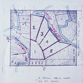
Slide - Photograph, Eltham Shire Council, Proposed subdivision of five approximately equal areas of 5 acres, Vol. 4061, Fol. 061, Overbank Road, North Warrandyte, 1969
... acres, Vol. 4061, Fol. 061, Overbank Road, North Warrandyte... Mount Pleasant Road North Warrandyte D4, 55341, Peck subdivision ...35mm colour positive transparency blue Agfacolour Service plastic mountD4, 55341, Peck subdivision, Mount Pleasant Road, 4 August 1969infrastructure, map, planning, subdivison lots, overbank road, mount pleasant road, north warrandyte -
 Eltham District Historical Society Inc
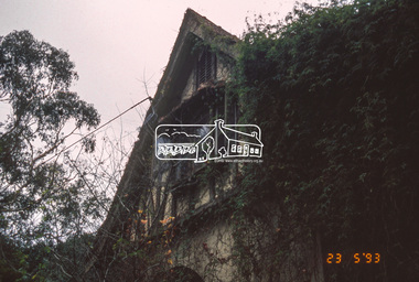
Slide - Photograph, The Robins. Kangaroo Ground-Warrandyte Road, North Warrandyte, 23 May 1993
... The Robins. Kangaroo Ground-Warrandyte Road, North.... Activities Kangaroo Ground-Warrandyte Road North Warrandyte Shire ...The 1993 Eltham Heritage Tour was enjoyed by a busload of members of the Historical Society on a fine, calm day, Sunday May 23rd. Between 10.00 am and 4.30 pm, except for a brief lunch stop at the Eltham Living and Learning Centre, members passed about thirty places of local interest and others recommended for the Historic Buildings Register and the Register of the National Estate. A number of significant trees and buildings were also highlighted along with the opportunity to explored some of the properties.35mm colour positive transparency (1 of 24) Mount - Kodak Kodachromeactivities, kangaroo ground-warrandyte road, north warrandyte, shire of eltham historical society, the robins, heritage excursion -
 Eltham District Historical Society Inc
Slide - Photograph, The Robins. Kangaroo Ground-Warrandyte Road, North Warrandyte, 23 May 1993
... The Robins. Kangaroo Ground-Warrandyte Road, North.... activities kangaroo ground-warrandyte road north warrandyte shire ...The 1993 Eltham Heritage Tour was enjoyed by a busload of members of the Historical Society on a fine, calm day, Sunday May 23rd. Between 10.00 am and 4.30 pm, except for a brief lunch stop at the Eltham Living and Learning Centre, members passed about thirty places of local interest and others recommended for the Historic Buildings Register and the Register of the National Estate. A number of significant trees and buildings were also highlighted along with the opportunity to explored some of the properties.35mm colour positive transparency (1 of 24) Mount - Kodak Kodachromeactivities, kangaroo ground-warrandyte road, north warrandyte, shire of eltham historical society, the robins, heritage excursion -
 Eltham District Historical Society Inc
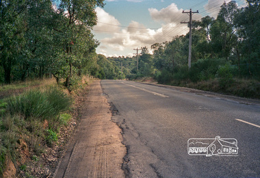
Slide - Photograph, Stony Creek Road, North Warrandyte, c.1993
... Stony Creek Road, North Warrandyte... melbourne infrastructure roads Doleen Road North Warrandyte Stony ...35mm colour positive transparency Mount - Black and Whiteinfrastructure, roads, doleen road, north warrandyte, stony creek road -
 Eltham District Historical Society Inc
Slide - Photograph, Stony Creek Road, North Warrandyte, c.1993
... Stony Creek Road, North Warrandyte... melbourne infrastructure roads doleen road north warrandyte stony ...35mm colour positive transparency Mount - Black and Whiteinfrastructure, roads, doleen road, north warrandyte, stony creek road -
 Eltham District Historical Society Inc
Slide - Photograph, Stony Creek Road, North Warrandyte, c.1993
... Stony Creek Road, North Warrandyte... melbourne infrastructure roads Doleen Road North Warrandyte Stony ...35mm colour positive transparency Mount - Black and Whiteinfrastructure, roads, doleen road, north warrandyte, stony creek road -
 Eltham District Historical Society Inc
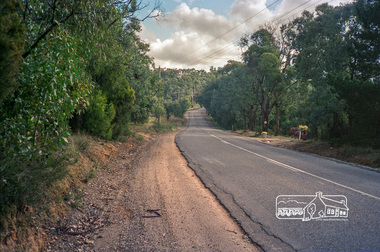
Photograph, Kangaroo Ground-Warrandyte Road, North Warrandyte, c.1988, 1988c
... Kangaroo Ground-Warrandyte Road, North Warrandyte, c.1988... strips Kangaroo Ground-Warrandyte Road, North Warrandyte, c.1988 ...Looking southeast, Kruses Road on left.Roll of 35mm colour negative film, 7 stripsFuji 100eltham shire council, infrastructure, kangaroo ground-warrandyte road, kruses road, north warrandyte -
 Eltham District Historical Society Inc
Photograph, Kangaroo Ground-Warrandyte Road, North Warrandyte, c.1988, 1988c
... Kangaroo Ground-Warrandyte Road, North Warrandyte, c.1988... kangaroo ground-warrandyte road north warrandyte Fuji 100 Roll ...Looking northwest.Roll of 35mm colour negative film, 7 stripsFuji 100eltham shire council, infrastructure, kangaroo ground-warrandyte road, north warrandyte -
 Eltham District Historical Society Inc
Photograph - Digital Photograph, Alan King, Stonygrad, 34 Hamilton Road, North Warrandyte, 30 January 2008
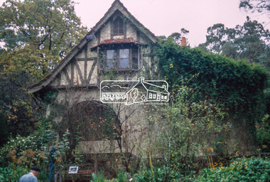
... Stonygrad, 34 Hamilton Road, North Warrandyte... Vassilieff Hamilton Road North Warrandyte Stonygrad Born digital ...Vassilieff dynamited rock from his own property to build his house. Stonygrad is reminiscent of a grotto and in parts, of a sculpture. Covered under Heritage Overlay, Nillumbik Planning Scheme. Published: Nillumbik Now and Then / Marguerite Marshall 2008; photographs Alan King with Marguerite Marshall.; p135 Stonygrad, the home built by Expressionist painter and sculptor Danila Vassilieff, is reminiscent of a grotto and in parts, of a sculpture. Vassilieff, who amongst others influenced painter Sydney Nolan and Albert Tucker, was a member of the artists group the Angry Penguins. He was also a highly regarded art teacher at the nearby Koornong Experimental School and taught at Eltham High School. Art critic Robert Hughes described Vassilieff’s painting as ‘lyrical without social commentary’, and said Vassilieff was ‘the most oddly neglected artist in recent Australian History’. Vassilieff, who was born in 1897 in Russia, had an unusually adventurous life before he settled in Warrandyte. The 12th of 18 children, he lived on a farm in the Don Basin. Vassilieff trained with the Imperial Military Academy at St Petersburg and fought in World War One as an officer in the White Russian Army against the communists. In 1920 he was captured, then escaped from prison, stole a horse and rode bareback 150 miles to the Black Sea, helped at first by Tartar freebooters. He then travelled to India, Shanghai and arrived in Queensland as a refugee in 1923 where he began painting. He and his wife Anisia bought a sugar farm near Ingram, and later he constructed railway lines at Mataranka, in the Northern Territory.4 In 1929 Vassilieff went to Brazil for formal art training from former fellow-officer Dmitri Ismailovich, but he soon left to travel up the Amazon River. He then worked as a sidewalk artist in the West Indies and travelled for two years in England, France and Spain. In 1937 he arrived in Melbourne where he lived until his death in 1958. His first major Australian series was the Carlton streetscapes and from 1951 he sculpted in local hard limestone. Vassilieff rejected all dogma and regarded religious subjects as suitable only for decorative arts. In 1944 he helped defeat a communist attempt to take over the Contemporary Art Society. For a short time, from around 1955, Vassilieff taught at various Victorian schools. The Angry Penguins painted mainly between 1937 and 1947, and included Arthur Boyd, Albert Tucker, Sidney Nolan and Joy Hester. The group formed as they felt isolated from European thought and art (including Surrealism) from which their work was derived. They were also angry at what they considered to be the complacency and insularity of their society. They maintained Australians at first were scarcely aware of the threats of the Wall Street Crash and Hitler and were little interested in the Spanish Civil War. The Angry Penguins also objected to the White Australia Policy. Hughes said although most of the Melbourne Expressionists in the 1940s were unskilled and their work crude in style, they helped jolt Australian painting from its pastoral complacency. Their style influenced nearly every painting produced by significant figurative artists in Melbourne in the 1950s such as Charles Blackman. From 1939 Vassilieff built Stonygrad, mainly with local stone. The house stands at the end of a private road surrounded by trees with the quiet occasionally broken by the sounds of bellbirds. To build his house Vassilieff dynamited rock and cut trees from his own property. The original section of the three-level house is of irregular-shaped pieces of solid stone, exposed inside like the exterior. Vassilieff later built sections with timber and brick. Inside is rustic and cave-like, and several rooms are linked by arched openings with no doors. One undulating wall was carved out of rock from which two sculptured heads protrude. Several ceilings are of rough-hewn logs and the built-in table and bookcase are rough, as is a timber ladder leading to a bedroom. Not for the elderly or unsteady! Yet the general impression in the muted light is beautiful, with artistic originality.This collection of almost 130 photos about places and people within the Shire of Nillumbik, an urban and rural municipality in Melbourne's north, contributes to an understanding of the history of the Shire. Published in 2008 immediately prior to the Black Saturday bushfires of February 7, 2009, it documents sites that were impacted, and in some cases destroyed by the fires. It includes photographs taken especially for the publication, creating a unique time capsule representing the Shire in the early 21st century. It remains the most recent comprehenesive publication devoted to the Shire's history connecting local residents to the past. nillumbik now and then (marshall-king) collection, danila vassilieff, hamilton road, north warrandyte, stonygrad -
 Eltham District Historical Society Inc
Photograph - Digital Photograph, Alan King, The Robins, 13 Kangaroo Ground-Warrandyte Road, North Warrandyte, 2 March 2008
... The Robins, 13 Kangaroo Ground-Warrandyte Road, North...-Warrandyte Road North Warrandyte The Robins Born digital image file ...Built by noted artist Theodore Penleigh Boyd, father of architect Robin Boyd. Covered under National Estate, National Trust of Australia (Victoria) Local Significance and Heritage Overlay, Nillumbik Planning Scheme. Published: Nillumbik Now and Then / Marguerite Marshall 2008; photographs Alan King with Marguerite Marshall.; p111 The Robins at Warrandyte,* was once home to a member of a famous family and is also one of the first reinforced concrete houses in Victoria. The builder, Theodore Penleigh Boyd, born in 1890, was a talented painter1 noted for his works of the Warrandyte bush. He was the father of architect Robin Boyd, author of the Australian Ugliness and the uncle of painter, Arthur Boyd. Penleigh Boyd’s great grandfather was Sir William A’Beckett, Victoria’s first Chief Justice. Penleigh Boyd is considered by some to be an ‘unsung hero’ overshadowed by more famous members of his family. Mornington Gallery Director Andrea May said many believed Boyd ‘had never received the national acclaim that he deserved’.2 Classified by the National Trust3 and part of the Australian National Heritage,4 The Robins is set well back near the end of Kangaroo Ground – Warrandyte Road, unobserved by passers-by. Built in 1913, The Robins has some Art Nouveau influences and is a descendant of the Queen Anne style. It is covered in stucco and has a prominent attic, which Boyd used as a studio. Some parts of the house are up to 33 centimetres thick and built in part with pisé (rammed earth) and in part with reinforced concrete. Amazingly, Boyd built The Robins without an accessible driveway, and only a narrow track along which he had to cart building materials. The journey was uphill and Boyd terraced the land with Warrandyte rock5 without the aid of machinery. At only 33 years, Boyd was killed in a car accident in 1923. He was buried in Brighton near the home of his parents. Several people have since owned the house, including political journalist, Owen Webster. Boyd was born at Penleigh House, Wiltshire, and studied at Haileybury College, Melbourne and The Hutchins School, Hobart. He attended the Melbourne National Gallery School and in his final year exhibited at the Victorian Artists’ Society. He arrived in London in 1911 and his painting Springtime was hung at the Royal Academy. He painted in several studios in England and then worked in Paris.6 There he met painter Phillips Fox through whom he met artists of the French modern school and also his wife-to-be, Edith Anderson, whom he married in Paris in 1912. After touring France and Italy, the couple returned to Melbourne. In 1913 Boyd held an exhibition and won second prize in the Federal Capital site competition, then the Wynne Prize for landscape in 1914. In 1915 Boyd joined the Australian Imperial Force, and became a sergeant in the Electrical and Mechanical Mining Company. However he was severely gassed at Ypres and invalided to England. In 1918 in London Boyd published Salvage, writing the text and illustrating it with 20 black-and-white ink-sketches of army scenes. Later that year he returned to Melbourne, and, despite suffering from the effects of gas, he held several successful one-man shows, quickly selling his water-colour and oil paintings. In his short career Penleigh Boyd was recognized as one of Australia’s finest landscape painters. He loved colour, having been influenced early by Turner and McCubbin. His works are in all Australian state galleries, the National Collection in Canberra as well as in regional galleries.7 His wife Edith was also an artist having studied at the Slade School, London, and in Paris with Phillips Fox. After her marriage she continued to paint and excelled in drawing. In later years she wrote several dramas, staged by repertory companies, and radio plays for the Australian Broadcasting Commission, in which she took part. She was the model for the beautiful red-haired woman in several of Phillips Fox’s paintings and the family hold three of his portraits of her. *Possibly named after the Aboriginal words warran, meaning ‘object’ and dyte, meaning ‘thrown at’.This collection of almost 130 photos about places and people within the Shire of Nillumbik, an urban and rural municipality in Melbourne's north, contributes to an understanding of the history of the Shire. Published in 2008 immediately prior to the Black Saturday bushfires of February 7, 2009, it documents sites that were impacted, and in some cases destroyed by the fires. It includes photographs taken especially for the publication, creating a unique time capsule representing the Shire in the early 21st century. It remains the most recent comprehenesive publication devoted to the Shire's history connecting local residents to the past. nillumbik now and then (marshall-king) collection, kangaroo ground-warrandyte road, north warrandyte, the robins -
 Eltham District Historical Society Inc
Photograph - Digital Photograph, Alan King, Stonygrad, 34 Hamilton Road, North Warrandyte, 30 January 2008
... Stonygrad, 34 Hamilton Road, North Warrandyte... Hamilton Road North Warrandyte Stonygrad Born digital image file ...Vassilieff dynamited rock from his own property to build his house. Stonygrad is reminiscent of a grotto and in parts, of a sculpture. Covered under Heritage Overlay, Nillumbik Planning Scheme. Published: Nillumbik Now and Then / Marguerite Marshall 2008; photographs Alan King with Marguerite Marshall.; p135This collection of almost 130 photos about places and people within the Shire of Nillumbik, an urban and rural municipality in Melbourne's north, contributes to an understanding of the history of the Shire. Published in 2008 immediately prior to the Black Saturday bushfires of February 7, 2009, it documents sites that were impacted, and in some cases destroyed by the fires. It includes photographs taken especially for the publication, creating a unique time capsule representing the Shire in the early 21st century. It remains the most recent comprehenesive publication devoted to the Shire's history connecting local residents to the past. nillumbik now and then (marshall-king) collection, danila vassilieff, hamilton road, north warrandyte, stonygrad -
 Eltham District Historical Society Inc
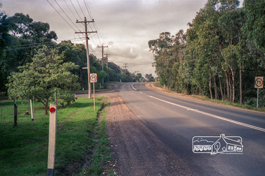
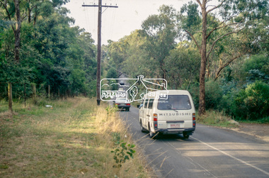
Slide - Photograph, Ryans Road, Eltham North, c.1992
... Ryans Road, Eltham North... melbourne infrastructure roads Eltham North Ryans Road 35mm colour ...35mm colour positive transparency Mount - Black and Whiteinfrastructure, roads, eltham north, ryans road -
 Eltham District Historical Society Inc
Photograph, Michael Wood, Looking east along Progress Road, Eltham North, February 1970, 1970
... Looking east along Progress Road, Eltham North, February...eltham north, progress road...Progress Road, Eltham North, Victoria... by Knox and Hellemons eltham north, progress road Inscribed in ink ...Wood family home (1969-2011) pre and post construction by Knox and HellemonsKodachrome 35mm colour transparency in cardboard mount Processing date FEB70M6Inscribed in ink "Progress Rd looking east Eltham North from 184 to Lower Rd 1970"eltham north, progress road -
 Eltham District Historical Society Inc
Photograph, Doug Orford, Bridge across Diamond Creek, Allendale Road, Eltham North, 1991, 1991
... Bridge across Diamond Creek, Allendale Road, Eltham North... of Eltham. bridges diamond creek eltham north allendale road Colour ...From a collection of 35 photos taken by Doug Orford at 35 specific locations along the exact boundary of the then Shire of Eltham.Colour photographbridges, diamond creek, eltham north, allendale road -
 Eltham District Historical Society Inc
Slide - Photograph, Adventure Playground, Wattletree Road, Eltham North, c.Nov. 2001
... Adventure Playground, Wattletree Road, Eltham North... in 2018. Adventure Playground Eltham North Wattletree Road 35mm ...Part of a slide show presentation "A Trip Down the Diamond Creek" by Russell Yeoman to the Eltham District Historical Society meeting of 14 Nov. 2001 A community group project steered by Bambi McLean led to the construction of the Eltham North Adventure Playground which opened off Wattletree Road in 1995. The structure was mainly wooden and included an undercover element with slides and areas to climb. It was destroyed by fire in the early hours of 16 December 2017. A new adventure playground was built in 2018. 35mm colour positive transparency Mount - Black and Whiteadventure playground, eltham north, wattletree road -
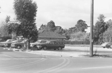 Ringwood and District Historical Society
Photograph, Car park at corner of Dickson Cres. and Warrandyte Road, North Ringwood (undated)
... Car park at corner of Dickson Cres. and Warrandyte Road... of Dickson Cres. and Warrandyte Road, North Ringwood".... Road Ringwood North melbourne Written on back of photograph ...Written on back of photograph, "Car park at corner of Dickson Cres. and Warrandyte Road, North Ringwood".