Showing 1800 items matching "regions"
-
 Federation University Historical Collection
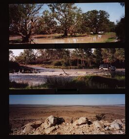
Photograph - Colour, Chatham-Holmes Collection: Outback Tour, 2003, 2003
Tour to outback regions of Australia - Innamincka and Cameron Corner. This is where the Queensland, New South Wales and South Australia borders meet. Photos show the floods, dryness of the land and the regeneration of plant life. Elizabeth Chatham is with family memberschatham-holmes collection, elizabeth chatham, outback, cameron corner, innamincka, queensland, new south wales, south australia, floods, desert plants -
 Warrnambool and District Historical Society Inc.
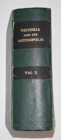
Book, Victoria and its Metropolis Vol 2, 1888
Information on the of Colony of VictoriaThe book has a green cloth cover with an indented pattern. The spine has gold printing on black cloth attached to the green cloth. The 820 pages are gilt edged and, to some extent, are water damaged. They contain printed text and lithographs .Some original pages relating to Warrnambool have been removed and replaced with photocopies which are pasted in. There are fold out coloured maps.non-fictionInformation on the of Colony of Victoria warrnambool history, history of victoria -
 Frankston RSL Sub Branch
Compass, Astro
A World War 2 era W. W. Boes and Co. MKll astro compass typically used as an aviation navigation aid. It is manufactured from aluminum with black enamel finish. An astro compass is a navigational tool used to determine true north from the position of the sun or astronomical bodies. These are used in circumstances where magnetic compasses and gyrocompasses are unreliable, for example in the presence of magnetic field anomalies (such as polar regions, ships hulls, aircraft hulls, etc.). Nameplate on the base reads "ASTRO-COMPASS MK II / The W.W. BOES CO. / DAYTON, OHIO, USA"compass, astro compass, navigation, aeronautical, raaf, raf, ww2, -
 Victorian Aboriginal Corporation for Languages
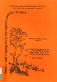
Book, Sue C Wesson, An overview of the sources for a language and clan atlas of Eastern Victoria and Southern New South Wales, 1994
This monograph concerns Eastern Victoria and Southern New South Wales and reviews the ethnographic record available for the study area. A test case is made of one tribe within the study area which requires further research. Overall, the literature review and the case study demonstrate that the ability to undertake detailed reconstructions, as Clark and Barwick have done for the other regions, can be undertaken in Eastern Victoria and Southern New South Wales, and this model will form the basis of future research.maps, b&w illustrations, b&w photographs, document reproductions, tableswoiworung, bunurong, taungurong, ngurai-illam-wurung, bidawal, maap, norman tindale, diane barwick, aldo massola, eve fesl, ian david clark, george augustus robinson, reverend john bulmer, robert brough smyth, alfred william howitt, moieties, clan names -
 Melbourne Tram Museum
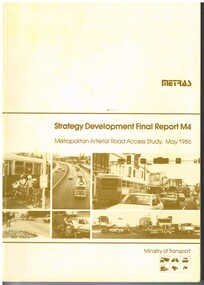
Document - Report, Ministry of Transport, "METRAS - Strategy Development Final Report M4 - Metropolitan Arterial Road Access Study, May. 1986
Report - 198 pages - perfect bound +card covers + fold out maps and charts, looks at the development of arterial roads in the various Melbourne regions, includes recommendations, funding, Punt Road, management. Has table of contents, diagrams and maps. Includes findings of the studies, issues with freight transport, improvement proposals. Little work on public transport as such. Title - "METRAS - Strategy Development Final Report M4 - Metropolitan Arterial Road Access Study - May 1986"has pen marks alongside some paragraphs or underneath headings in the recommendations section.trams, tramways, public transport, road transport, minister for transport -
 Eltham District Historical Society Inc
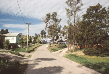
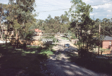
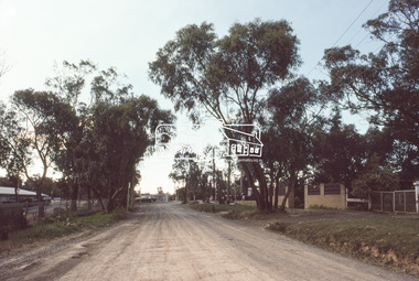
Slide, View looking northeast to turnabout near 10 McCarthy Grove, Montmorency, c.Oct. 1980
One of a series of images of roads and infrastructure taken by Eltham Shire Council Planning and Engineering officers. They provide perspective of the changes in housing styles and road development that began sweeping in from the mid 1970s with increasing urbanisation of what was once more outlying suburbs and regions.35 mm colour positive transparency Mount - Kodak Kodachrome CardProcessed Oct 1980houses, infrastructure, mccarthy grove, montmorency, roads -
 Eltham District Historical Society Inc
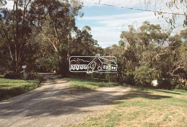
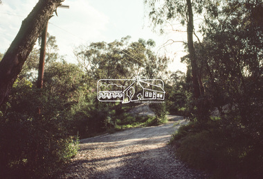
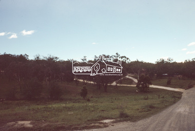
Slide, McCarthy Grove, Montmorency, extended driveway from Main Road, c.Oct. 1980
One of a series of images of roads and infrastructure taken by Eltham Shire Council Planning and Engineering officers. They provide perspective of the changes in housing styles and road development that began sweeping in from the mid 1970s with increasing urbanisation of what was once more outlying suburbs and regions.35 mm colour positive transparency Mount - Kodak Kodachrome CardProcessed Oct 1980houses, infrastructure, mccarthy grove, montmorency, roads -
 Eltham District Historical Society Inc
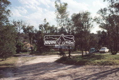
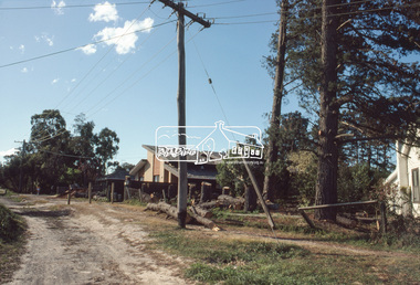
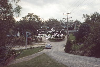
Slide, View looking southwest to turnabout near 9 McCarthy Grove, Montmorency, c.Oct. 1980
One of a series of images of roads and infrastructure taken by Eltham Shire Council Planning and Engineering officers. They provide perspective of the changes in housing styles and road development that began sweeping in from the mid 1970s with increasing urbanisation of what was once more outlying suburbs and regions.35 mm colour positive transparency Mount - Kodak Kodachrome CardProcessed Oct 1980houses, infrastructure, mccarthy grove, montmorency, roads -
 Eltham District Historical Society Inc
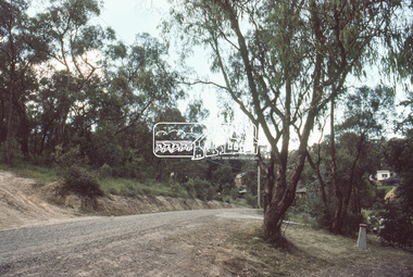
Slide, McCarthy Grove, Montmorency looking west near No. 27, c.Oct. 1980
One of a series of images of roads and infrastructure taken by Eltham Shire Council Planning and Engineering officers. They provide perspective of the changes in housing styles and road development that began sweeping in from the mid 1970s with increasing urbanisation of what was once more outlying suburbs and regions.35 mm colour positive transparency Mount - Kodak Kodachrome CardProcessed Oct 1980houses, infrastructure, mccarthy grove, montmorency, roads -
 Eltham District Historical Society Inc
Slide, McCarthy Grove, Montmorency looking east towards Reichelt Avenue, near no. 27, c.Oct. 1980
One of a series of images of roads and infrastructure taken by Eltham Shire Council Planning and Engineering officers. They provide perspective of the changes in housing styles and road development that began sweeping in from the mid 1970s with increasing urbanisation of what was once more outlying suburbs and regions.35 mm colour positive transparency Mount - Kodak Kodachrome CardProcessed Oct 1980houses, infrastructure, mccarthy grove, montmorency, roads -
 Eltham District Historical Society Inc
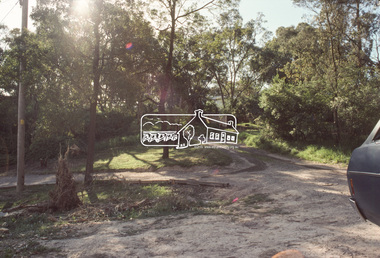
Slide, Quinn Estate, McCarthy Grove ext. driveway, Montmorency, near no. 31, c.Oct. 1980
One of a series of images of roads and infrastructure taken by Eltham Shire Council Planning and Engineering officers. They provide perspective of the changes in housing styles and road development that began sweeping in from the mid 1970s with increasing urbanisation of what was once more outlying suburbs and regions.35 mm colour positive transparency Mount - Kodak Kodachrome CardProcessed Oct 1980houses, infrastructure, mccarthy grove, montmorency, roads -
 Eltham District Historical Society Inc
Slide, Looking towards 99 Buena Vista Drive, Montmorency, c.Oct. 1980
One of a series of images of roads and infrastructure taken by Eltham Shire Council Planning and Engineering officers. They provide perspective of the changes in housing styles and road development that began sweeping in from the mid 1970s with increasing urbanisation of what was once more outlying suburbs and regions.35 mm colour positive transparency Mount - Kodak Kodachrome CardProcessed Oct 1980houses, infrastructure, mccarthy grove, montmorency, roads -
 Kiewa Valley Historical Society
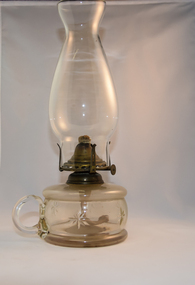
Lamp Table Kerosene, pre 1950s
This particular lamp was made for the dinner table or "parlour". This was the most effective indoor lighting before electrical lighting was introduced in the 1940's. These table lights would have still been used after this time as emergency lighting during electrical power shortages (outages). These emergency lighting lamps, including candles, were eventually replaced by battery power. The Kiewa Valley was supplied by electricity well before many other rural regions due to the State Electricity Commission constructing the Kiewa Hydro Electricity power turbines (late 1930's to mid 1950's). Petrol and diesel generators were used in other rural regions before state wide electricity was available.The significance of this kerosene lamp to the Kiewa Valley is that it provides the proof that before the Hydro electricity scheme was established in the valley, householder and commerce relied on candle/kerosene power. Although at certain times before battery and solar energy became the night time lighters the sole source of lighting was candle power and kerosene power. The supply of both however was still required by most of the population by supply from city and larger country town suppliers. This nearly fully glass made table lamp(kerosene) has a large glass bowl/basin like kerosene storage unit with a glass circular finger handle (similar to a ordinary cup). Formed single star like patterns (50mm apart) encircle the centre of the bowl. On top of the bowl sits the metal (brass) wick holder with a small wheel protruding out one side for adjusting the wick length(increasing or decreasing the strength(regulating) of the amount of light projected. Four prongs rise from the circular base light fixture holding the windproof and refractive glass "pot belly" shield. lamp table, kerosene lamp, household lighting (non electrical) -
 Rutherglen Historical Society
Letter, 28/10/1947
In 1909 students of Rutherglen State School sent an Australian flag to pupils of Rutherglen Scotland Schools, and a year later a Union Jack flag was sent to the Australian Rutherglen School. This established a relationship between the two regions, which has continued with letters, visits, and exchanges of gifts.Copy of an air-letter sent from Hugh Aitken, at the Gallowflat Junior School, Rutherglen Scotland, to Barry Warren, at the Rutherglen Higher Elementary School, Rutherglen Victoria.schools, rutherglen scotland, rutherglen connection, gallowflat junior school, rutherglen higher elementary school, barry warren, hugh aitken -
 Rutherglen Historical Society
Letter, 17/03/1948
In 1909 students of Rutherglen State School sent an Australian flag to pupils of Rutherglen Scotland Schools, and a year later a Union Jack flag was sent to the Australian Rutherglen School. This established a relationship between the two regions, which has continued with letters, visits, and exchanges of gifts.Copy of a letter sent from Hugh Aitken, Headmaster at the Gallowflat Junior School, Rutherglen Scotland, to Mrs Dorothy Maddocks and to Barry Warren, at the Rutherglen Higher Elementary School, Rutherglen Victoria.schools, rutherglen scotland, rutherglen connection, gallowflat junior school, rutherglen higher elementary school -
 8th/13th Victorian Mounted Rifles Regimental Collection
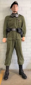
Uniform - Crewman in green tanksuit
This uniform was of the Vietnam War era, but was not favoured by crewmen operating in the tropics being considered too hot. US lightweight flying suits were greatly prised as an alternative working dress. The tanksuit was however a very suitable work dress for reserve units training in temperate regions.Mannequin dressed in green tanksuit, belt, ammunition pouch and pistol holster depicting tank crewman of 8/13 Victorian Mounted Rifles c.1970. Beret has woven hat badge.uniform, tank, vmr, vietnam -
 Eltham District Historical Society Inc
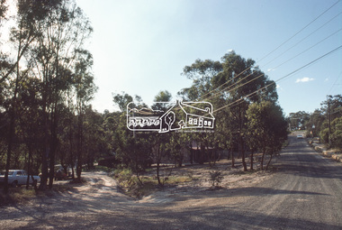
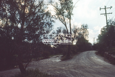
Slide, Roundabout at Reichelt Avenue and McCarthy Grove, Montmorency, c.Oct. 1980
One of a series of images of roads and infrastructure focussed on the Quinn Estate in Montmorency taken by Eltham Shire Council Planning and Engineering officers. They provide perspective of the changes in housing styles and road development that began sweeping in from the mid 1970s with increasing urbanisation of what was once more outlying suburbs and regions.35 mm colour positive transparency Mount - Kodak Kodachrome CardProcessed Oct 1980infrastructure, mccarthy grove, montmorency, reichelt avenue, roads, roundabout -
 Eltham District Historical Society Inc
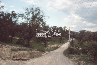
Slide, Mitchell Avenue near Panorama Heights Preschool, Montmorency, c.Oct. 1980
One of a series of images of roads and infrastructure focussed on the Quinn Estate in Montmorency taken by Eltham Shire Council Planning and Engineering officers. They provide perspective of the changes in housing styles and road development that began sweeping in from the mid 1970s with increasing urbanisation of what was once more outlying suburbs and regions.35 mm colour positive transparency Mount - Kodak Kodachrome CardProcessed Oct 1980infrastructure, mitchell avenue, montmorency, panorama heights preschool, roads -
 Eltham District Historical Society Inc
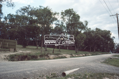
Slide, Mitchell Avenue looking towrads Montmorency South Primary School, c.Oct. 1980
One of a series of images of roads and infrastructure focussed on the Quinn Estate in Montmorency taken by Eltham Shire Council Planning and Engineering officers. They provide perspective of the changes in housing styles and road development that began sweeping in from the mid 1970s with increasing urbanisation of what was once more outlying suburbs and regions.35 mm colour positive transparency Mount - Kodak Kodachrome CardProcessed Oct 1980infrastructure, mitchell avenue, montmorency, montmorency south primary school, roads -
 Eltham District Historical Society Inc
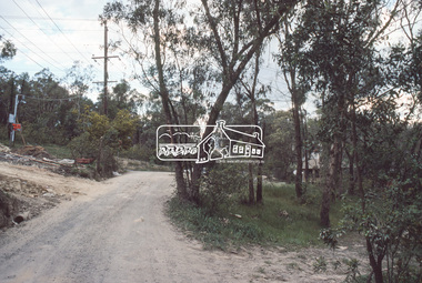
Slide, Looking east along Buena Vista Drive, Montmorency near no. 69, c.Oct. 1980
One of a series of images of roads and infrastructure focussed on the Quinn Estate in Montmorency taken by Eltham Shire Council Planning and Engineering officers. They provide perspective of the changes in housing styles and road development that began sweeping in from the mid 1970s with increasing urbanisation of what was once more outlying suburbs and regions.35 mm colour positive transparency Mount - Kodak Kodachrome CardProcessed Oct 1980buena vista drive, horse, infrastructure, montmorency, roads -
 Eltham District Historical Society Inc
Slide, Quinn Estate, Buena Vista Drive, Montmorency near school looking northwest, c.Oct. 1980
One of a series of images of roads and infrastructure focussed on the Quinn Estate in Montmorency taken by Eltham Shire Council Planning and Engineering officers. They provide perspective of the changes in housing styles and road development that began sweeping in from the mid 1970s with increasing urbanisation of what was once more outlying suburbs and regions.35 mm colour positive transparency Mount - Kodak Kodachrome CardProcessed Oct 1980housing estate, infrastructure, montmorency, quinn estate, roads -
 Eltham District Historical Society Inc
Slide, Looking north along Buena Vista Drive near Montmorency South Primary School, c.Oct. 1980
One of a series of images of roads and infrastructure focussed on the Quinn Estate in Montmorency taken by Eltham Shire Council Planning and Engineering officers. They provide perspective of the changes in housing styles and road development that began sweeping in from the mid 1970s with increasing urbanisation of what was once more outlying suburbs and regions.35 mm colour positive transparency Mount - Kodak Kodachrome CardProcessed Oct 1980buena vista drive, infrastructure, montmorency, montmorency south primary school, roads -
 Eltham District Historical Society Inc
Slide, Quinn Estate looking east along Cressy Streett, Montmorency before Quinn Way, c.Oct. 1980
One of a series of images of roads and infrastructure focussed on the Quinn Estate in Montmorency taken by Eltham Shire Council Planning and Engineering officers. They provide perspective of the changes in housing styles and road development that began sweeping in from the mid 1970s with increasing urbanisation of what was once more outlying suburbs and regions.35 mm colour positive transparency Mount - Kodak Kodachrome CardProcessed Oct 1980infrastructure, montmorency, cressy street, housing estate, quinn estate, quinn way, roads -
 Eltham District Historical Society Inc
Slide, Quinn Estate from Sackville Street looking west to 'T-bowl' near Main Road, Montmorency, c.Oct. 1980
One of a series of images of roads and infrastructure focussed on the Quinn Estate in Montmorency taken by Eltham Shire Council Planning and Engineering officers. They provide perspective of the changes in housing styles and road development that began sweeping in from the mid 1970s with increasing urbanisation of what was once more outlying suburbs and regions.35 mm colour positive transparency Mount - Kodak Kodachrome CardProcessed Oct 1980roads, housing estate, infrastructure, main road, montmorency, quinn estate, sackville street, t-bowl -
 Eltham District Historical Society Inc
Slide, Quinn Estate, looking northeast along Sackville Street, Montmorency near no. 12, c.Oct. 1980
One of a series of images of roads and infrastructure focussed on the Quinn Estate in Montmorency taken by Eltham Shire Council Planning and Engineering officers. They provide perspective of the changes in housing styles and road development that began sweeping in from the mid 1970s with increasing urbanisation of what was once more outlying suburbs and regions.35 mm colour positive transparency Mount - Kodak Kodachrome CardProcessed Oct 1980infrastructure, housing estate, montmorency, quinn estate, roads, sackville street -
 Eltham District Historical Society Inc
Slide, Sackville Street, Montmorency; split road near no. 36, c.Oct. 1980
One of a series of images of roads and infrastructure focussed on the Quinn Estate in Montmorency taken by Eltham Shire Council Planning and Engineering officers. They provide perspective of the changes in housing styles and road development that began sweeping in from the mid 1970s with increasing urbanisation of what was once more outlying suburbs and regions.35 mm colour positive transparency Mount - Kodak Kodachrome CardProcessed Oct 1980sackville street, infrastructure, montmorency, roads -
 Eltham District Historical Society Inc
Slide, Quinn Estate looking east along Sackville Street just prior to Quinn Way, Montmorency, c.Oct. 1980
One of a series of images of roads and infrastructure focussed on the Quinn Estate in Montmorency taken by Eltham Shire Council Planning and Engineering officers. They provide perspective of the changes in housing styles and road development that began sweeping in from the mid 1970s with increasing urbanisation of what was once more outlying suburbs and regions.35 mm colour positive transparency Mount - Kodak Kodachrome CardProcessed Oct 1980roads, housing estate, infrastructure, montmorency, quinn estate, quinn way, sackville street -
 Eltham District Historical Society Inc
Slide, Quinn Estate near Sackville Reserve, Montmorency, c.Oct. 1980
One of a series of images of roads and infrastructure focussed on the Quinn Estate in Montmorency taken by Eltham Shire Council Planning and Engineering officers. They provide perspective of the changes in housing styles and road development that began sweeping in from the mid 1970s with increasing urbanisation of what was once more outlying suburbs and regions.35 mm colour positive transparency Mount - Kodak Kodachrome CardProcessed Oct 1980quinn estate, housing estate, infrastructure, montmorency, roads, sackville reserve, sackville street -
 Eltham District Historical Society Inc
Slide, Reichelt Avenue, Montmorency at intersection with Bolton Street (now closed), c.Oct. 1980
One of a series of images of roads and infrastructure focussed on the Quinn Estate in Montmorency taken by Eltham Shire Council Planning and Engineering officers. They provide perspective of the changes in housing styles and road development that began sweeping in from the mid 1970s with increasing urbanisation of what was once more outlying suburbs and regions.35 mm colour positive transparency Mount - Kodak Kodachrome CardProcessed Oct 1980bolton steet, eltham, infrastructure, montmorency, reichelt avenue, roads -
 Eltham District Historical Society Inc
Slide, Quinn Estate, Reichelt Avenue near Riverina Road, Montmorency, c.Oct. 1980
One of a series of images of roads and infrastructure focussed on the Quinn Estate in Montmorency taken by Eltham Shire Council Planning and Engineering officers. They provide perspective of the changes in housing styles and road development that began sweeping in from the mid 1970s with increasing urbanisation of what was once more outlying suburbs and regions.35 mm colour positive transparency Mount - Kodak Kodachrome CardProcessed Oct 1980housing estate, infrastructure, montmorency, quinn estate, reichelt avenue, roads