Showing 251 items matching "roundabout"
-
 Buninyong & District Historical Society
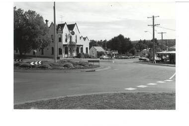
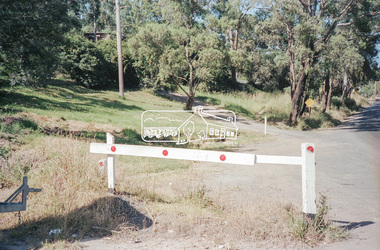
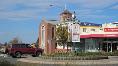
Photograph - B/W photograph, Roundabout - intersection of Learmonth and Warrenheip Streets Buninyong. Background Crown Hotel, 1995
Shows major intersection in mid 1990's. Record of intersection in mid 1990'sB/W photograph of intersection of Learmonth and Warrenheip Streets Buninyong. Crown Hotel centre background, bottle shop next door, and corner shop visible on right.buninyong, streeetscape, buiulding, crown hotel, corner shop -
 Thompson's Foundry Band Inc. (Castlemaine)
Sheet Music, Cornet Roundabout
-
 Wodonga & District Historical Society Inc
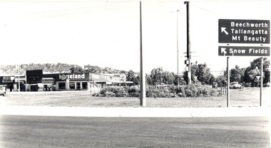
Photograph - Codling Collection 01 - Dunstan’s Corner and Beechworth Road Roundabout, Mid 1980s
These Wodonga photos are part of a collection donated by Miss Olive Codling. Arthur Dunstan Arthur Dunstan established mills at Red Bluff on the Mitta and a timber yard at Wodonga. He also built a sawmill at Glen Wills in 1931 which operated for about 16 years. A larger and more modern sawmill with drying kilns was erected at Eskdale in 1947. He was contracted to build Wodonga’s Municipal sale yards in 1935, followed by the Wangaratta sale yards. This created so many forward orders that he bought a large block of land on the corner of Beechworth and Tallangatta Roads and opened a timber mill and hardware store. The business stood on this corner for about 40 years. A large proportion of the company's timber output was processed at the Wodonga yards into flooring, weatherboards, mouldings etc. and practically the whole output was distributed locally and throughout the Riverina and eastern areas of New South Wales, and Canberra. At its peak Dunstan’s was one of the biggest sawmilling businesses in Victoria and in Wodonga employed 150 people and milled l6,000,000 super feet of timber annually. A super foot is a measurement for timber, equal to one foot square by one inch thick. Arthur Dunstan also built Tower Place in High Street. He died in Wodonga in 1963 and the business was continued on by his sons. Dunstan’s timber yards in Wodonga were sold to Ezerd Industries in 1987 with the retail section being bought by BBC Hardware.This photo collection is significant as it documents how the businesses and buildings in Wodonga have evolved and contributed to community throughout the 20th century.The first business at this location was a timber will and hardware store established by Arthur Dunstan in 1935. It operated there for about 40 years. In this photo Horseland occupies the corner premises including a video outlet. On the left is the Victoria Star Hot Bread Kitchen. This area is now know as Southside.wodonga businesses, dunstan's corner wodonga, thomas mitchell drive -
 Eltham District Historical Society Inc
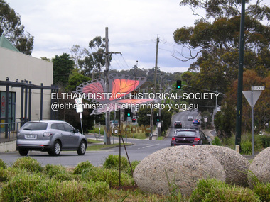
Photograph, Fay Bridge, Welcome Butterfly, Roundabout, Main Road and Luck Street, Eltham, 7 November 2016
Plans by the Federal Government to temporarily settle 120 Christian Syrian refugees at the St Vincents facility in Diamond Street (Judge Book Village) brought out national protest by far right groups, many travelling intersate to demonstarte in Eltham against the settlement. Many locals stood up against these protesters, forming Welcome to Eltham, symbolised by the (Eltham Copper) butterfly. The planned demonstartion by the far right was deflated by over 200 locals turning up and peacefully supporting the refugees with butterflies placed throughout parks, paths and roadways. This butterfly was created by Tim Read and Linda MacAulay was later relocated to the Judge Book Village fay bridge collection, 2016-11-07, diamond street, judge book village, luck street, main road, protests, syrian refugees, welcome to eltham, tim read, linda macaulay -
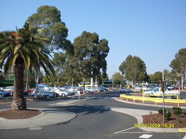
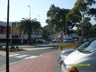
 Ringwood and District Historical Society
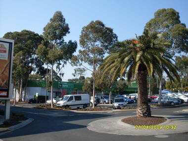
Photograph, Looking along former Adelaide Street, from the access road roundabout, towards the south-east, on 21 April 2009. Showing bus terminus on the other side of the highway, at the station, and former Harris Scarfe store
Ron Brons photographic study of Ringwood. -
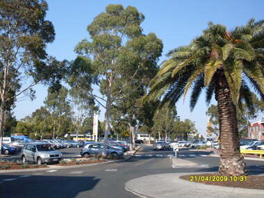
 Ringwood and District Historical Society
Photograph, Looking along former Adelaide Street, from the access road roundabout, towards the south-east, on 21 April 2009. Showing bus terminus on the other side of the highway, at the station
Ron Brons photographic study of Ringwood. -
 Ringwood and District Historical Society
Photograph, Looking along former Adelaide Street, from the access road roundabout, towards the south, on 21 April 2009. Showing bus terminus on the other side of the highway, at the station
Ron Brons photographic study of Ringwood. -
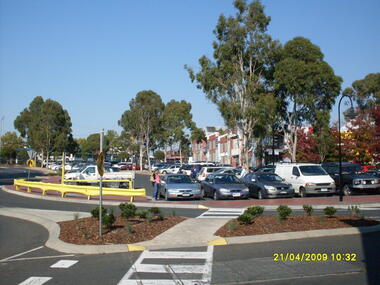 Ringwood and District Historical Society
Photograph, Looking along former Adelaide Street, from the access road roundabout, towards the south-east, on 21 April 2009. Showing pedestrian crossings
Ron Brons photographic study of Ringwood. -
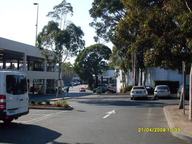
 Ringwood and District Historical Society
Photograph, Looking from the Eastland access road roundabout, towards the south-east, on 21 April 2009. Showing pedestrian crossing and car park
Ron Brons photographic study of Ringwood. -
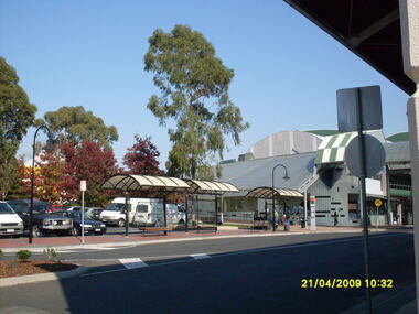
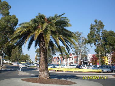
 Ringwood and District Historical Society
Photograph, Looking along Eastland access road looking east, on 21 April 2009. Showing entrance to Eastland carparks, and traffic roundabout
Ron Brons photographic study of Ringwood. -
 Ringwood and District Historical Society
Photograph, Looking along former Adelaide Street, from the access road roundabout, towards the south, on 21 April 2009. Showing pedestrian crossing to south car park and shops
Ron Brons photographic study of Ringwood. -
 Ringwood and District Historical Society
Photograph, Looking from the Eastland access road roundabout, towards the east, on 21 April 2009. Showing Eastland car park
Ron Brons photographic study of Ringwood. -
Glenelg Shire Council Cultural Collection
Photograph - Photograph - Anderson's Reef, Portland Victoria, Aug-70
Black and white photo of Anderson's Reef, below the roundabout in Hanlon Parade.Front: 'Portland Victoria, August 1970' - handwritten, blue ink. Black stamp - 'B.E. Carthew 9 Hurd st. PORTLAND, VICTORIA AUSTRALIA' Back: 'Anderson's Reef Below the new roundabout Hanlon Parade' 'typed in red -
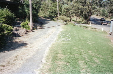
 Eltham District Historical Society Inc
Slide - Photograph, Ryans Road, Eltham, c.1989
Ryans Road was reconstructed and sealed to the north of Kerrie Crescent in 1983. Roundabout and southern reconstruction added later. This photo is probably shortly after construction of roundabout.35mm colour positive transparency Mount - Black and Whiteeltham, infrastructure, kerrie crescent, roundabout, ryans roads -
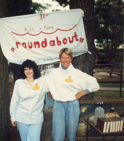 Park Orchards Community House
Photograph, Park Orchards Community House Market, circa 1983
Ruth and Pam's "Roundabout" -
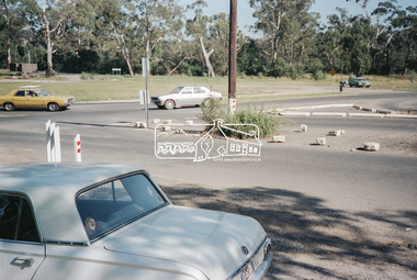
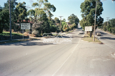 Eltham District Historical Society Inc
Negative - Photograph, Main Road, Eltham, c.Dec. 1983
Road sign advising of proposed reconstruction works of Main Road to install a roundabout at Mount Pleasant Road. Traffic to Lower Plenty and Templestowe to be diverted down Bridge Street (and Bolton Street) effective January 1984. The proposed roundabout did not proceed. Instead traffic islands on Mount Pleasant Road were installed in place of temporary blocked out islands.Film - Kodak CM 400 5079 7 strips, 26 framesinfrastructure, roads, road construction, roundabout, road sign, main road, mount pleasant road -
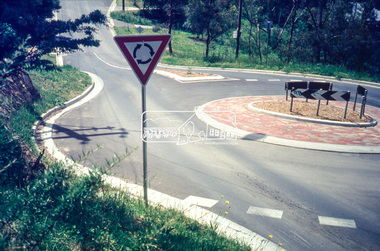
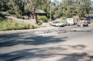
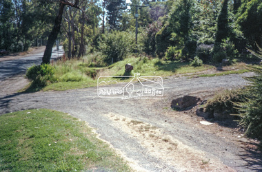
 Eltham District Historical Society Inc
Slide - Photograph, Kangaroo Ground-St Andrews Road, Panton Hill, c.Apr. 1988
The Shire of Eltham was introducing a number of traffic calming measures throughout the shire such as speed humps, roundabouts, chicanes and took a photographic record of various new installations.35mm colour positive transparency (4 of 11) Mount - whiteProcess Date "Apr M"infrastructure, roads, bishops road, panton hill, roundabout, merritts road, kangaroo ground-st andrews road -
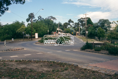
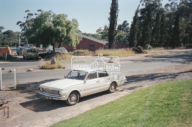
 Eltham District Historical Society Inc
Negative - Photograph, Intersection of Mt Pleasant Road at Main Road, Eltham, c.Dec. 1983
Reconstruction work was planned for Main Road to install a roundabout at Mount Pleasant Road. Traffic to Lower Plenty and Templestowe to be diverted down Bridge Street (and Bolton Street) effective January 1984. The proposed roundabout did not proceed. Instead traffic islands on Mount Pleasant Road were installed in place of temporary blocked out islands and revised extended driveway to properties 622-642 Main Road with access off Mount Pleasant Road instead.Film - Kodak CM 400 5079 7 strips, 26 framesinfrastructure, roads, road construction, roundabout, road sign, main road, mount pleasant road, eltham -
 Ballarat Heritage Services
Digital photographs, L.J. Gervasoni, Warrnambool Koroit Street, c2011
Colour photograph of a roundabout at Koroit Street, Warrnambool.warrnambool, landscape, koroit street, shops, commercial centre -
 Eltham District Historical Society Inc
Negative - Photograph, Intersection of Mt Pleasant Road at Main Road, Eltham, c.Dec. 1983
Reconstruction work was planned for Main Road to install a roundabout at Mount Pleasant Road. Traffic to Lower Plenty and Templestowe to be diverted down Bridge Street (and Bolton Street) effective January 1984. The proposed roundabout did not proceed. Instead traffic islands on Mount Pleasant Road were installed in place of temporary blocked out islands and revised extended driveway to properties 622-642 Main Road with access off Mount Pleasant Road instead.Film - Kodak CM 400 5079 7 strips, 26 framesinfrastructure, roads, road construction, roundabout, road sign, main road, mount pleasant road, eltham, service station -
 Marysville & District Historical Society
Photograph (Item) - Colour photograph, 2000
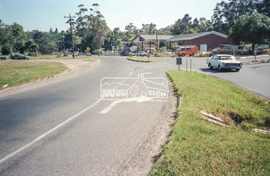
A colour photograph of Murchison Street in Marysville in Victoria.A colour photograph of the roundabout at the corner of Murchison and Lyell Streets in Marysville in Victoria.TOP SHOP & ROUND ABOUT/ MURCHISON STREET, 2000 BABARA HOLMESmurchison street, lyell street, marysville, victoria, photograph -
 Marysville & District Historical Society
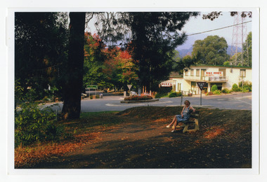
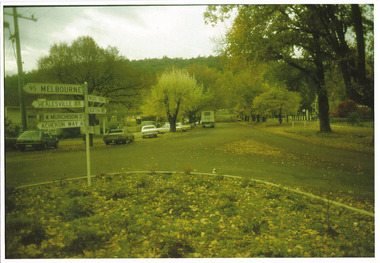
Photograph (Item) - Colour photograph, 05-1985
A colour photograph of Murchison Street in Marysville in Victoria.A colour photograph of the roundabout at the corner of Murchison and Lyell Streets in Marysville in Victoria.MARYSVILLE SIGNPOST - MAY 1985murchison street, lyell street, marysville, victoria, photograph