Showing 414 items
matching topography
-
 Lakes Entrance Historical Society
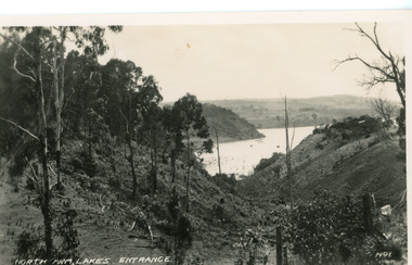
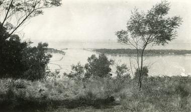
Postcard - North Arm, Valentine Series, 1920c
No. 1 from Valentine Series of small postcardsBlack and white postcard showing lower reach of North Arm, and gully. Vegetation has been removed from both sides of gully. Lakes Entrance VictoriaNorth Arm Lakes Entrance topography, waterways -
 Lakes Entrance Historical Society
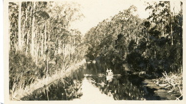
Photograph - North Arm, 1926c
Black and white photograph showing upper reaches of North Arm. Small rowing boat with several people standing in boat. Reflection of vegetation on water. Lakes Entrance Victoriatopography, waterways -
 Lakes Entrance Historical Society
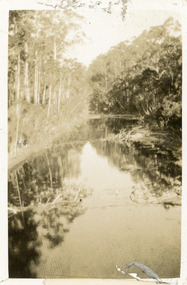
Photograph - North Arm, 1924
Black and white small format photograph showing upper reaches of North Arm. Reflections of vegetation on water. Lakes Entrance Victoriatopography, waterways -
 Lakes Entrance Historical Society
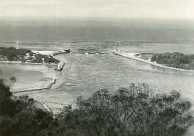
Postcard - The Entrance, 1940c
Black and white small format postcard of the man-made entrance to the Gippsland Lakes taken from Jemmys Point. It also shows the rock groynes at Bullock Island and entrance to Cunninghame Arm. Lakes Entrance Victoriawaterways, topography -
 Lakes Entrance Historical Society
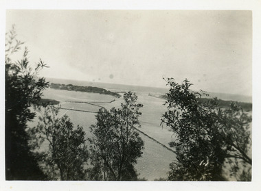
Photograph - The Entrance, 1939c
Black and white photograph of Bullock Island, rock groynes, lake and man-made entrance taken from Jemmys Point. Three people sitting on grass in left foreground. Lakes Entrance Victoriawaterways, topography -
 Lakes Entrance Historical Society
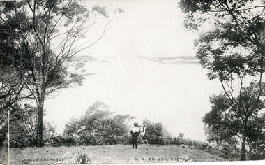
Postcard - The Entrance, Bulmer H D, 1910c
Also black and white enlargement size 16 x 25.| Note on back of postcard, 'Bemm River 16/8/11, To My Dear Elsie, Just a line....., Much love from all, Annie.'Black and white postcard of the man made entrance through the sand hummocks, taken from Jemmys Point. Small boy looking towards entrance, natural vegetation on brow of hill. Lakes Entrance VictoriaLakes Entrance waterways, topography -
 Lakes Entrance Historical Society
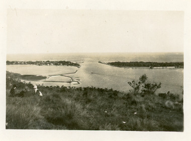
Postcard - The Entrance, 1935c
Also small format identical postcard 6.5 x 8.5, very faded,|also small format photo, same view donated by D & M FletcherBlack and white small format postcard of the man made entrance to the Gippsland Lakes, taken from Jemmys Point. It shows the rock groynes beside Bullock Island, a barge in North Arm below Jemmys Point. Lakes Entrance VictoriaThe Entrance to Gippsland Lakes waterways, topography -
 Lakes Entrance Historical Society
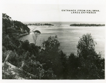
Postcard - The Entrance, 1935c
Also 2 identical small format postcardsBlack and white small format postcard taken from the cliff top at Kalimna. It shows the man made entrance through the hummocks, rock groynes, Jemmys Point cliff and natural vegetation in foreground. Lakes Entrance VictoriaEntrance from Kalimna, Lakes Entrance waterways, topography -
 Lakes Entrance Historical Society
Postcard - The Entrance
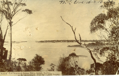
Black and white post card showing the man made entrance through the hummock. It shows the fishermen's cottages on the western side of the entrance, Rigby Island and the Doughboy, small island, with salt affected vegetation and a small sand bar in the channel. Natural vegetation of Kalimna cliff in foreground. Lakes Entrance VictoriaLakes Entrance from Kalimna Hotel waterways, topography -
 Lakes Entrance Historical Society
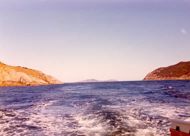
Photograph, 1975
Also second photograph similar unknown location in Bass Strait.Colour photograph of rugged coastline in Bass Strait, taken from fishing boat Minawie. Victoriawaterways, topography -
 Lakes Entrance Historical Society
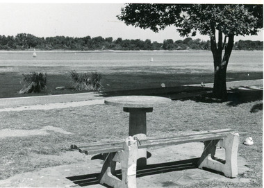
Photograph - Cunninghame Arm, Lakes Post Newspaper, 1992c
Black and white photograph of part of the lake and waterfront. It shows the scrub covered south shore, the Cunninghame Arm, the foreshore littered with dead seagrass, the path and lawn verge, and small concrete picnic table and broken seat. Lakes Entrance Victoria waterways, topography -
 Lakes Entrance Historical Society
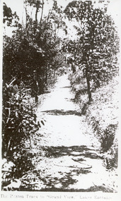
Photograph, Valentine Series, 1920c
Black and white photograph of the track through natural vegetation to Grand View Guesthouse and Tea Rooms on Kalimna escarpment, Lakes Entrance Victoria.The Beaten Track to Grand View, Lakes Entrance topography, vegetation -
 Lakes Entrance Historical Society
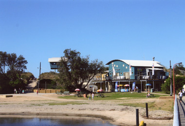
Photograph - Surf Lifesaving, 2008
Date made August 2008Colour photograph of the Surf Life Saving Club with lookout tower, people at kiosk and walking to the surf beach, at Lakes Entrance, Victoria.topography, occupation -
 Lakes Entrance Historical Society
Book, Land Conservation Council, Victoria, East Gippsland Area Review Final Recommendations Land Conservation, 1986
Report describing the physical nature of the East Gippsland area (Victoria) study area. History, climate, geomorphology, land use, flora and fauna are presented. Map included.topography, land settlement -
Lakes Entrance Historical Society
Book, Devonshire, James, The Lake Bunga Oil Bore, 1999
Research, interpretation and management recommendations for the Lake Bunga oil bore, near Lakes Entrance, East Gippsland,Victoria by Forestec student.industrial, topography -
 Lakes Entrance Historical Society
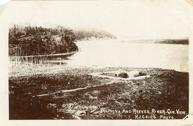
Postcard - Maringa Creek, Caire Nicholas John, 1900c
Also three black and white copies 17 x 25First generation black and white postcard of the Kalimna area of the Gippsland Lakes. It shows a residence surrounded by a paling fence at Maringa Creek in foreground, dead vegetation at mouth of creek. Steep cliffs of lake shore opposite low lying Rigby Island. Lakes Entrance VictoriaKalimna and Reeves River. Gen View.waterways, topography -
 Lakes Entrance Historical Society
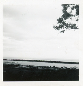
Photograph - Cunninghame Arm, Fraser, Nancy, 1970c
Black and white photograph of a distant view township and Cunninghame Arm and scrub covered hummocks of southern shore in distance. Lakes Entrance Victoria topography, waterways -
 Lakes Entrance Historical Society
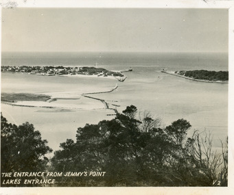
Postcard - The Entrance, 1940c
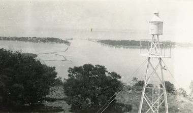
Originally in a pack of miniature postcards produced for sale to tourists.Black and white small format postcard of the Western end of Bullock Island, Reeves and Entrance Channels, the Entrance and Carpenter Town at the New Works. Taken from Jemmys Point, it shows rock groynes built to channel water flow to the Entrance. Lakes Entrance VictoriaThe Entrance Jemmys Point Lakes Entrance V2 topography, waterways -
 Lakes Entrance Historical Society
Postcard - The Entrance, 1940c
Black and white postcard of the entrance to Bass Strait taken from Kalimna Hill VictoriaThe Entrance Lakes Entrance waterways, topography -
 Lakes Entrance Historical Society
Postcard - The Entrance, 1940c
Black and white postcard of the entrance to Bass Strait taken from Kalimna Lookout VictoriaThe Entrance Lakes Entrance waterways, topography -
 Lakes Entrance Historical Society
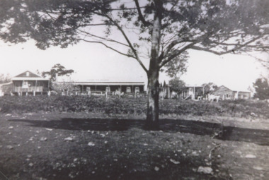
Photograph, Toorloo House guesthouse Lake Tyers Victoria, 1935 c
Large house on right has been demolished small detached building on left remains Lake Tyers Victoria.Black and white photograph of Toorloo House guesthouse at Bills Arm owned by Bills family. Also two similar black and white photographs of Toorloo House topography, guesthouses -
Lakes Entrance Historical Society
Book - Foreshore Strategy Lakes Entrance, Tract Consultants Australia Pty Ltd, 1987
Foreshore strategy of Lakes Entrance September 1987topography, conservation -
Lakes Entrance Historical Society
Book, Land Conservation Council Victoria Alpine Area, 1977
Report containing information from various sources relevant to the future use of public land in the alpine area of Victoria. History, climate, landform, vegetation, land use, are some of the aspects presented.Ruth Clarktopography, vegetation -
 Lakes Entrance Historical Society
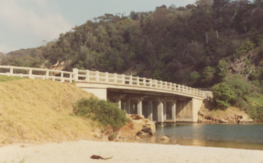
Photograph - North Arm bridge Lakes Entrance Victoria, M Fish, 1970 c
concrete bridge over North Arm taken from Eastern side of bridge southern shore of North Arm Lakes Entrance Victoria. Bridge built 1916 to 1917 demolished after opening of new bridgeColour photograph of concrete bridge over North Arm taken from Eastern side of bridge southern shore of North Arm Lakes Entrance Victoriabridges, topography -
 Lakes Entrance Historical Society
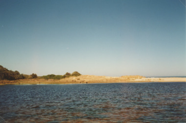
Photograph - Lake Bunga, M Holding, 1990c
Colour photograph of eastern shore near the entrance to ocean, the low area between upland and sand dune indicating the original waterway Lake Bunga Victoriatopography, waterfront -
 Lakes Entrance Historical Society
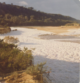
Photograph - Lake Bunga, Marie Fish, 1987c
Also three other colour phoptographs of foam at entrance and on lake after severe storm in June July 1978 numbers 03847.1, 03847.2, 03847.3 size 9 x 8.5 cmColour photograph showing foam across the open entrance after a severe storm, timbered hill in distance, Lake Bunga Victoriatopography, waterways -
 Lakes Entrance Historical Society
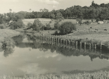
Photograph, G Legg Bairnsdale, Mossiface wharf at Mossiface Victoria, c1980
Black and white photograph of the remains of Mossiface wharf on the Tambo River at Mossiface Victoria c1980 topography, rivers -
Lakes Entrance Historical Society
Book, A guide to Buchan Caves, 2007
A reprint of a guidebook published by the Cunninghame Progressive Association, originally produced by Frank Whitcombe in 1908. reprinted to mark the cenenary of Frank Moons discovery of the Fairy Caves.topography, tourism -
 Lakes Entrance Historical Society
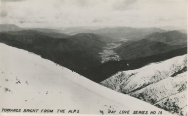
Photograph - High Country looking toward Bright, Victoria c1940, Ray Love series, High Country looking toward Bright, Victoria c1940, 1940 c
Black and white photograph of Alps looking toward Bright, snow of closer heights, Alps VictoriaTowards Bright from the Alps Ray Love series No 15high country of victoria and nsw, topography -
 Lakes Entrance Historical Society
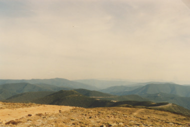
Photograph - Mt Hotham Victoria 1993, S Payne, 1/04/1993 12:00:00 AM
Colour photograph of scene from Mt Hotham showing Alps in distance and road to Omeo Victoria. Also a second colour photograph showing Mt Feathertop topography, roads and streets