Showing 69 items
matching walhalla -- victoria
-
 Victorian Railway History Library
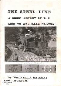
Book, Walhalla Railway Museum, The Steel Link A Brief History of The Moe to Walhalla Railway
... - Victoria A brief pictorial history of the 2'6" Moe to Walhalla ...A brief pictorial history of the 2'6" Moe to Walhalla railway in Victoria.ill, p.20.non-fictionA brief pictorial history of the 2'6" Moe to Walhalla railway in Victoria.puffing billy - victoria - history, railroad operations - victoria -
 Victorian Railway History Library
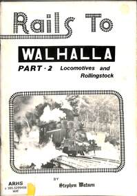
Book, Watson, Stephen E, Rails to Walhalla Part 2 Locomotives and Rollingstock, 1981
... - Victoria A brief pictorial history of the 2'6" Moe to Walhalla ...A brief pictorial history of the 2'6" Moe to Walhalla railway in Victoria focusing on the locomotives and rollingstock.ill, p.64.non-fictionA brief pictorial history of the 2'6" Moe to Walhalla railway in Victoria focusing on the locomotives and rollingstock.puffing billy - victoria - history, railroad operations - victoria -
 Victorian Railway History Library
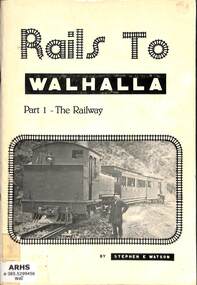
Book, Watson, Stephen E, Rails to Walhalla Part 1 The Railway, 1980
... - Victoria A brief pictorial history of the 2'6" Moe to Walhalla ...A brief pictorial history of the 2'6" Moe to Walhalla railway in Victoria focusing on the railway line.ill, maps, p.108.non-fictionA brief pictorial history of the 2'6" Moe to Walhalla railway in Victoria focusing on the railway line.puffing billy - victoria - history, railroad operations - victoria -
 Ringwood and District Historical Society
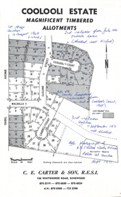
Document - Folder, Coolooli Estate Subdivision, Ringwood East, Vic. - Four Releases 1969-1975
Collection of Subdivision Plans, Land Sale flyers, Auction notices, and Real Estate Agent's notes for Coolooli Estate, Ringwood East, Victoria. Subdivision includes Coolooli Court, Isabel Avenue, Walhalla Drive, Cleland Street, Landell Court, Byways Drive, Heathwood Street and Hume Street, released over four stages - First Stage auction 16 August 1969, Second Release private sales from July 1970, Third Release Auction 11 September 1971, Final Release auction June 21st 1975. Agents - C.E. Carter & Son, 126 Whitehorse Road, Ringwood until moving to 122 Whitehorse Road in 1973 - Tel. 870 6024, 870 6830, 870 2519, A.H. 723 3298, 870 6960. Digitised copy of photograph - A.B. Carter and Andy McLean at Coolooli Estate auction, 11 September, 1971. -
 Ringwood and District Historical Society
Photograph, James Handforth, father of Katherine, wife of Louis Herry, formerly of Walhalla and Cheshire, England. c1880
Black and white photographWritten on backing sheet, "James Handforth, father of Katherine, wife of Louis Herry, formerly of Walhalla and Cheshire, England". From the Place of Many Eagles book, "Louis was born in Purdu, France, in 1855, and came to Ringwood from Walhalla in 1887 and erected a weatherboard house and shop opposite the Club Hotel, using a Miner's Right to secure the land. When he arrived, Louis was a married man with three children, Leopold (1882), Marie (1884), John (1886). He had married Kate Handforth at Walhalla in 1879. In later years Elizabeth, Minellia, Louis and Denise were born. Kate's father was known as the midwife of the Gippsiand township because he had once been a fourth year medical student in England, but earnt a living as a goldbuyer in Victoria. Marie Herry would grow up remembering her grandfather calling sometimes at Ringwood; he would bring the children jubilee Mixture to eat and he carried a revolver in his pocket. Often he would play the violin while Marie would stepdance on the kitchen table." -
 Victorian Railway History Library
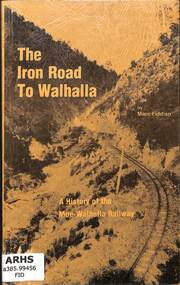
Book, Fiddian, Marc, The Iron Road To Walhalla, 1981
A history of the Victorian Railway's narrow gauge 2'6" branch line from Moe to Walhalla.index, ill, maps, p.100.non-fictionA history of the Victorian Railway's narrow gauge 2'6" branch line from Moe to Walhalla.railroad construction - victoria - history, vr narrow gauge railways - victoria - history -
 Lakes Entrance Historical Society
Album - Photograph Album, LERHS members, Lakes Entrance History Excursions, 1990
A blue covered photograph album containing photographs taken during excursions to Walhalla, Willis through the forest of South Buchan, Lakes Trip on the Llinase and to Eden.from Lakes Entrance Victoria. Please visit History Centre to view all photos in this Albumcelebrations -
 Falls Creek Historical Society
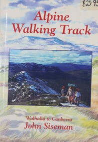
Book - Alpine Walking Track - Walhalla to Canberra, John Siseman, 1993
A guide for travellers of the Alpine Walking Track which stretches 750 kilometres through three major alpine nationals parks, ascends the highest mountains in Victoria, New South Wales and the Australian Capital Territory. It features information about alternative routes and side trips. and is illustrated, with maps and photographs.A light hearted look at the world of skiing featuring cartoons.non-fictionA guide for travellers of the Alpine Walking Track which stretches 750 kilometres through three major alpine nationals parks, ascends the highest mountains in Victoria, New South Wales and the Australian Capital Territory. It features information about alternative routes and side trips. and is illustrated, with maps and photographs.alpine walking track, bushwalking, walhalla -
 Kiewa Valley Historical Society
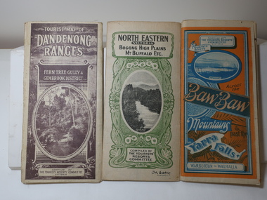
Maps - Tourist
These maps were all dated 1933 which was before the construction of the Kiewa Hydro Electric Scheme and when Tawonga was spelt Towonga. North East Victoria in 1933 was before the construction of the Kiewa Hydro Electric Scheme so the townships of Mt Beauty and Bogong are not shown. The description of the Snow Lines was important as skiers, bushwalkers and campers relied on them. The details on the map include "ADB. Numbered from A.1-377 round plates. CD Numbered from C 1-235 square plates. Poles about 3 chains apart 27 to the mile." 3 Tourist location maps (folded) and printed on parchment. 1. Tourist map of the Dandenong Ranges. Brown cover. dated 6-4-33. Govt. printer showing roads, tracks in red and heights of the land. 2. Tourist Map of Warburton, Mt Baw Baw, and Walhalla. Blue and Orange cover. dated 23-5-33 Govt. printer. 3 different maps of each area showin roads, tracks and timber tramways.Also in red and blue. 3. Tourist Map of North Eastern Victoria including Bogong High Plains Mt Buffalo Etc. Green cover. dated June 1933 Govt. printer. Main map and insert titled Bogong High Plains. Showing roads , tracks and tram ways. On insert showing snow poles. Also Red and Blue and mountains.By Authority of H.J. Green - 6 pence. Dept of Lands and Survey, Melbourne1933 maps, tourism maps, bogong high plains map 1933, snow poles