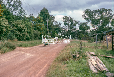
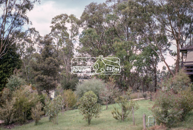
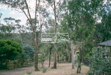
Showing 5612 items matching " suburbs"
-
 Eltham District Historical Society Inc
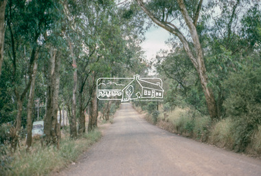
Photograph, Vacant Lot, 57 Park Road, Eltham, Dec. 1980
Roll of film taken by Eltham Shire Council officers of roads and houses in the Eltham East area in December 1980. They provide perspective of the changes in housing styles and road development that began sweeping in from the mid 1970s with increasing urbanisation of what was once more outlying suburbs and regions. Typically part of the Beard street group, a private street scheme that developed the road infrastructure commencing in February 1982.35mm colour positive transparency Mount - Kodak Kodachrome Cardeltham, housing estate, infrastructure, park road, roads -
 Eltham District Historical Society Inc
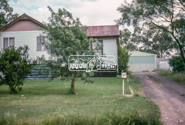
Photograph, 53 Park Road, Eltham, Dec. 1980
Roll of film taken by Eltham Shire Council officers of roads and houses in the Eltham East area in December 1980. They provide perspective of the changes in housing styles and road development that began sweeping in from the mid 1970s with increasing urbanisation of what was once more outlying suburbs and regions. Typically part of the Beard street group, a private street scheme that developed the road infrastructure commencing in February 1982.35mm colour positive transparency Mount - Kodak Kodachrome Cardeltham, housing estate, infrastructure, park road, roads -
 Eltham District Historical Society Inc
Photograph, 85 Park Road, Eltham, Dec. 1980
Roll of film taken by Eltham Shire Council officers of roads and houses in the Eltham East area in December 1980. They provide perspective of the changes in housing styles and road development that began sweeping in from the mid 1970s with increasing urbanisation of what was once more outlying suburbs and regions. Typically part of the Beard street group, a private street scheme that developed the road infrastructure commencing in February 1982.35mm colour positive transparency Mount - Kodak Kodachrome Cardeltham, housing estate, infrastructure, park road, roads -
 Eltham District Historical Society Inc
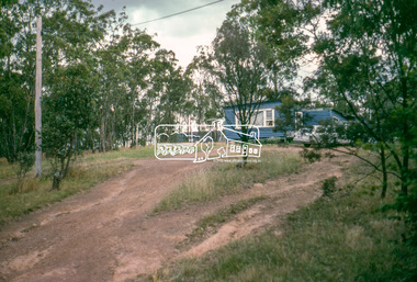
Photograph, Undeveloped land, Beard Street, Eltham, Dec. 1980
Roll of film taken by Eltham Shire Council officers of roads and houses in the Eltham East area in December 1980. They provide perspective of the changes in housing styles and road development that began sweeping in from the mid 1970s with increasing urbanisation of what was once more outlying suburbs and regions. Typically part of the Beard street group, a private street scheme that developed the road infrastructure commencing in February 1982.35mm colour positive transparency Mount - Kodak Kodachrome Cardeltham, housing estate, infrastructure, roads, andrews street, beard street -
 Eltham District Historical Society Inc
Photograph, Andrews Street, Eltham, Dec. 1980
Roll of film taken by Eltham Shire Council officers of roads and houses in the Eltham East area in December 1980. They provide perspective of the changes in housing styles and road development that began sweeping in from the mid 1970s with increasing urbanisation of what was once more outlying suburbs and regions. Typically part of the Beard street group, a private street scheme that developed the road infrastructure commencing in February 1982.35mm colour positive transparency Mount - Kodak Kodachrome Cardeltham, housing estate, infrastructure, roads, andrews street -
 Eltham District Historical Society Inc
Photograph, Frank Street, Eltham, Dec. 1980
Roll of film taken by Eltham Shire Council officers of roads and houses in the Eltham East area in December 1980. They provide perspective of the changes in housing styles and road development that began sweeping in from the mid 1970s with increasing urbanisation of what was once more outlying suburbs and regions. Typically part of the Beard street group, a private street scheme that developed the road infrastructure commencing in February 1982.35mm colour positive transparency Mount - Kodak Kodachrome Cardeltham, housing estate, infrastructure, roads, frank street -
 Eltham District Historical Society Inc
Photograph, Frank Street, Eltham, Dec. 1980
Roll of film taken by Eltham Shire Council officers of roads and houses in the Eltham East area in December 1980. They provide perspective of the changes in housing styles and road development that began sweeping in from the mid 1970s with increasing urbanisation of what was once more outlying suburbs and regions. Typically part of the Beard street group, a private street scheme that developed the road infrastructure commencing in February 1982.35mm colour positive transparency Mount - Kodak Kodachrome Cardeltham, housing estate, infrastructure, roads, frank street, beard street -
 Eltham District Historical Society Inc
Photograph, Frank Street, Eltham, Dec. 1980
Roll of film taken by Eltham Shire Council officers of roads and houses in the Eltham East area in December 1980. They provide perspective of the changes in housing styles and road development that began sweeping in from the mid 1970s with increasing urbanisation of what was once more outlying suburbs and regions. Typically part of the Beard street group, a private street scheme that developed the road infrastructure commencing in February 1982.35mm colour positive transparency Mount - Kodak Kodachrome Cardeltham, housing estate, infrastructure, roads, frank street -
 Eltham District Historical Society Inc
Photograph, Shalbury Avenue, Eltham, Dec. 1980
Roll of film taken by Eltham Shire Council officers of roads and houses in the Eltham East area in December 1980. They provide perspective of the changes in housing styles and road development that began sweeping in from the mid 1970s with increasing urbanisation of what was once more outlying suburbs and regions. Typically part of the Beard street group, a private street scheme that developed the road infrastructure commencing in February 1982.35mm colour positive transparency Mount - Kodak Kodachrome Cardeltham, housing estate, infrastructure, roads, shalbury avenue -
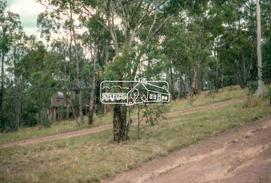
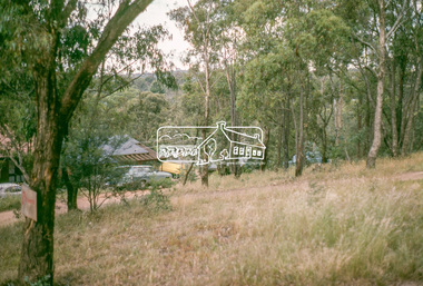
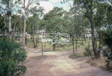
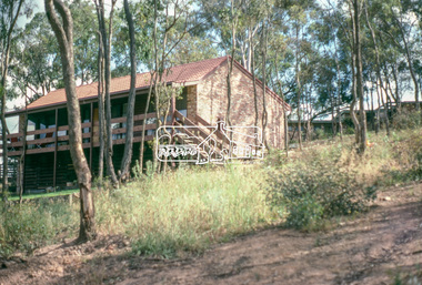
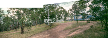 Eltham District Historical Society Inc
Photograph, Shalbury Avenue, Eltham, Dec. 1980
Roll of film taken by Eltham Shire Council officers of roads and houses in the Eltham East area in December 1980. They provide perspective of the changes in housing styles and road development that began sweeping in from the mid 1970s with increasing urbanisation of what was once more outlying suburbs and regions. Typically part of the Beard street group, a private street scheme that developed the road infrastructure commencing in February 1982.Born digital based on two 35mm colour positive transparencies converged into a panormaeltham, housing estate, infrastructure, roads, shalbury avenue -
 Eltham District Historical Society Inc
Photograph, Shalbury Avenue, Eltham, Dec. 1980
Roll of film taken by Eltham Shire Council officers of roads and houses in the Eltham East area in December 1980. They provide perspective of the changes in housing styles and road development that began sweeping in from the mid 1970s with increasing urbanisation of what was once more outlying suburbs and regions. Typically part of the Beard street group, a private street scheme that developed the road infrastructure commencing in February 1982.35mm colour positive transparency Mount - Kodak Kodachrome Cardeltham, housing estate, infrastructure, roads, shalbury avenue -
 Bayside Gallery - Bayside City Council Art & Heritage Collection
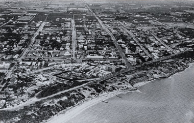
Photograph, W.H. Hansom, Sandringham, 1921
sandringham, aerial, coast, bathing box, w.h. hansom, victoria, suburbs, photograph, airspy, beach street, bay road, abbott street, sandringham hotel -
 Surrey Hills Historical Society Collection
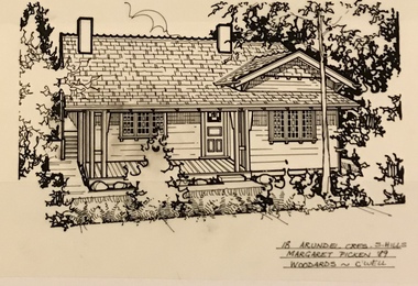
Drawing - Architectural drawing, 18 Arundel Crescent, Surrey Hills by Margaret Picken, 1989, 1989
Margaret Picken (1950-) trained and worked as a cartographic draftsman from 1968-1975 within the mining industry. These skills were readily transferable to work as a property illustrator for the real estate industry. Process: “Sketches were ordered by phone initially as there were no mobile phones or computers then. I would take our 2 year-old son with me to the houses when the other 2 boys were at school. I photographed houses with a Polaroid camera and made a ‘thumbnail’ sketch while there. The photos were used to scale off a sketch in pencil and then that sketch was overlaid with drafting film and the ‘pen and ink’ was completed. This process was the only one I used the entire time. Polaroid photos gave an instant usable photo. I then delivered the sketches by hand to the offices. There were deadlines each week on a Tuesday.” “… about 2003 coloured photos began to take over the sketches and mainstream companies replaced sole traders like myself providing a one-stop shop for all advertising. I produced my last Real Estate sketches in late 2005.” Margaret Picken (1950-) trained and worked as a cartographic draftsman from 1968-1975 within the mining industry. These skills were readily transferable to work as a property illustrator for the real estate industry. This architectural drawing is one of a series created by Margaret Picken for a range of real estate agents in Melbourne between c.1983 and 2005. Each work is signed and dated. Margaret Picken approached a number of historical societies in July 2020 with a view to donating her work. Sketches for post code 3127 are held by this collection. Others for suburbs including Ashburton, Balwyn, Camberwell, Canterbury, Blackburn, Box Hill, Burwood, Glen Iris, Hawthorn, Kew, Mont Albert North and Nunawading have been donated to the relevant historical group in those suburbs. (See Balwyn Historical Society, Box Hill Historical Society, Camberwell Historical Society, Hawthorn Historical Society, Kew Historical Society, Whitehorse Historical Society). In some cases, this collection also has a copy of the matching newspaper advertisement. Pen and ink architectural drawing on drafting film of 18 Arundel Crescent, Surrey Hills (VIC) by Margaret Picken. The drawing, dated 1989 , was commissioned by the Woodards real estate company.18 ARUNDEL CRES. S. HILLS / MARGARET PICKEN '89 / WOODARDS ~ C'WELLarchitectural drawing, houses, surrey hills / mont albert (vic.), artists, margaret picken 1950-, californian bungalow, arundel crescent -
 Surrey Hills Historical Society Collection
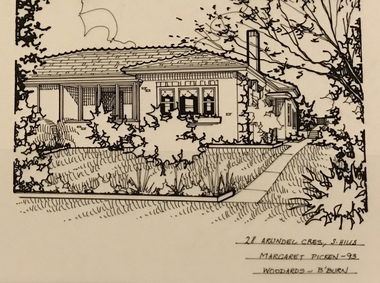
Drawing - Architectural drawing, 28 Arundel Crescent, Surrey Hills by Margaret Picken, 1993, 1989
Margaret Picken (1950-) trained and worked as a cartographic draftsman from 1968-1975 within the mining industry. These skills were readily transferable to work as a property illustrator for the real estate industry. Process: “Sketches were ordered by phone initially as there were no mobile phones or computers then. I would take our 2 year-old son with me to the houses when the other 2 boys were at school. I photographed houses with a Polaroid camera and made a ‘thumbnail’ sketch while there. The photos were used to scale off a sketch in pencil and then that sketch was overlaid with drafting film and the ‘pen and ink’ was completed. This process was the only one I used the entire time. Polaroid photos gave an instant usable photo. I then delivered the sketches by hand to the offices. There were deadlines each week on a Tuesday.” “… about 2003 coloured photos began to take over the sketches and mainstream companies replaced sole traders like myself providing a one-stop shop for all advertising. I produced my last Real Estate sketches in late 2005.” Margaret Picken (1950-) trained and worked as a cartographic draftsman from 1968-1975 within the mining industry. These skills were readily transferable to work as a property illustrator for the real estate industry. This architectural drawing is one of a series created by Margaret Picken for a range of real estate agents in Melbourne between c.1983 and 2005. Each work is signed and dated. Margaret Picken approached a number of historical societies in July 2020 with a view to donating her work. Sketches for post code 3127 are held by this collection. Others for suburbs including Ashburton, Balwyn, Camberwell, Canterbury, Blackburn, Box Hill, Burwood, Glen Iris, Hawthorn, Kew, Mont Albert North and Nunawading have been donated to the relevant historical group in those suburbs. (See Balwyn Historical Society, Box Hill Historical Society, Camberwell Historical Society, Hawthorn Historical Society, Kew Historical Society, Whitehorse Historical Society). In some cases, this collection also has a copy of the matching newspaper advertisement. Pen and ink architectural drawing on drafting film of 28 Arundel Crescent, Surrey Hills (VIC) by Margaret Picken. The drawing, dated 1993, was commissioned by the Woodards real estate company.28 ARUNDEL CRES, S. HILLS / MARGARET PICKEN ~ 93 / WOODARDSarchitectural drawing, houses, surrey hills / mont albert (vic.), artists, margaret picken 1950-, arundel crescent, 1940 -
 Surrey Hills Historical Society Collection
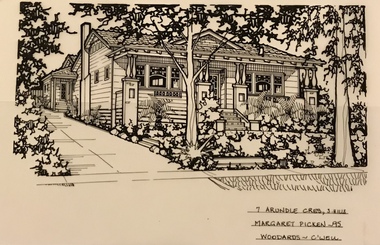
Drawing - Architectural drawing, Margaret Picken, 7 Arundel Crescent, Surrey Hills by Margaret Picken, 1995, 1995
Margaret Picken (1950-) trained and worked as a cartographic draftsman from 1968-1975 within the mining industry. These skills were readily transferable to work as a property illustrator for the real estate industry. Process: “Sketches were ordered by phone initially as there were no mobile phones or computers then. I would take our 2 year-old son with me to the houses when the other 2 boys were at school. I photographed houses with a Polaroid camera and made a ‘thumbnail’ sketch while there. The photos were used to scale off a sketch in pencil and then that sketch was overlaid with drafting film and the ‘pen and ink’ was completed. This process was the only one I used the entire time. Polaroid photos gave an instant usable photo. I then delivered the sketches by hand to the offices. There were deadlines each week on a Tuesday.” “… about 2003 coloured photos began to take over the sketches and mainstream companies replaced sole traders like myself providing a one-stop shop for all advertising. I produced my last Real Estate sketches in late 2005.” Margaret Picken (1950-) trained and worked as a cartographic draftsman from 1968-1975 within the mining industry. These skills were readily transferable to work as a property illustrator for the real estate industry. This architectural drawing is one of a series created by Margaret Picken for a range of real estate agents in Melbourne between c.1983 and 2005. Each work is signed and dated. Margaret Picken approached a number of historical societies in July 2020 with a view to donating her work. Sketches for post code 3127 are held by this collection. Others for suburbs including Ashburton, Balwyn, Camberwell, Canterbury, Blackburn, Box Hill, Burwood, Glen Iris, Hawthorn, Kew, Mont Albert North and Nunawading have been donated to the relevant historical group in those suburbs. (See Balwyn Historical Society, Box Hill Historical Society, Camberwell Historical Society, Hawthorn Historical Society, Kew Historical Society, Whitehorse Historical Society). In some cases, this collection also has a copy of the matching newspaper advertisement. Pen and ink architectural drawing on drafting film of 7 Arundel Crescent, Surrey Hills (VIC) by Margaret Picken. The drawing, dated 1995, was commissioned by the Woodards real estate company.7 ARUNDEL CRES., S. HILLS / MARGARET PICKEN ~ 95 / WOODARDS ~ C'WELLarchitectural drawing, houses, surrey hills / mont albert (vic.), artists, margaret picken 1950-, californian bungalow, arundel crescent -
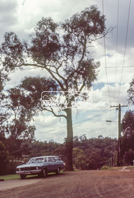
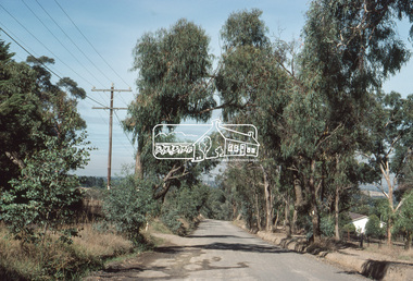
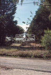
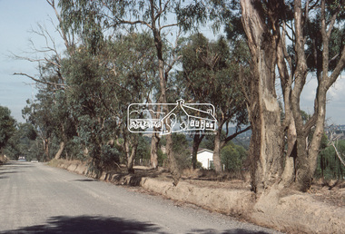
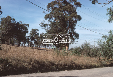
 Eltham District Historical Society Inc
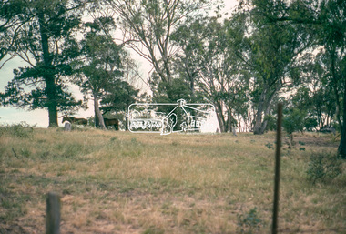
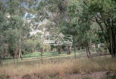
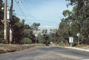
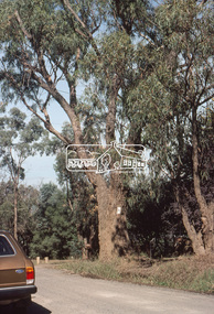
Slide, Bonds Road, Lower Plenty, Mar. 1981
One of a series of images of road infrastructure focussed on Bonds Road, Lower Plenty, the section connecting Old Eltham Road with Rosehill Road, taken by Eltham Shire Council Planning and Engineering officers. They provide perspective of the changes in housing styles and road development that began sweeping in from the mid 1970s with increasing urbanisation of what was once more outlying suburbs and regions. All images have been identified with GPS35 mm colour positive transparency (1 of 13) Mount - Kodak Kodachrome CardProcessed Mar 1981infrastructure, roads, bonds road, lower plenty, old eltham road -
 Eltham District Historical Society Inc
Slide, Bonds Road, Lower Plenty, Mar. 1981
One of a series of images of road infrastructure focussed on Bonds Road, Lower Plenty, the section connecting Old Eltham Road with Rosehill Road, taken by Eltham Shire Council Planning and Engineering officers. They provide perspective of the changes in housing styles and road development that began sweeping in from the mid 1970s with increasing urbanisation of what was once more outlying suburbs and regions. All images have been identified with GPS35 mm colour positive transparency (1 of 13) Mount - Kodak Kodachrome CardProcessed Mar 1981infrastructure, roads, bonds road, lower plenty -
 Eltham District Historical Society Inc
Slide, Bonds Road, Lower Plenty, Mar. 1981
One of a series of images of road infrastructure focussed on Bonds Road, Lower Plenty, the section connecting Old Eltham Road with Rosehill Road, taken by Eltham Shire Council Planning and Engineering officers. They provide perspective of the changes in housing styles and road development that began sweeping in from the mid 1970s with increasing urbanisation of what was once more outlying suburbs and regions. All images have been identified with GPS35 mm colour positive transparency (1 of 13) Mount - Kodak Kodachrome CardProcessed Mar 1981infrastructure, roads, bonds road, lower plenty