Showing 742 items
matching land grant
-
 Bendigo Historical Society Inc.
Document - H.A. & S.R. WILKINSON COLLECTION: CONDITION OF SALE
Conditions of sale by private contract issued by H.A. Wilkinson and dated 25th September 1950 between George Franklin Humphrey & Ethel May Humphries (sellers) and Ernest James Robinson (buyer) for land situate Williams Road Eaglehawk being Crown allotment378 section A Borough of Eaglehawk described in Crown grant volume 3816 folio 763025, together with 4-roomed weatherboard dwelling and all sundry. Price 1,000 pounds.organization, business, h.a. & s.r wilkinson real estate -
 Bendigo Historical Society Inc.
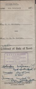
Document - H.A. & S.R. WILKINSON COLLECTION: CONDITION OF SALE
Contract of sale of land issued by H.A. Wilkinson and dated 4th February 1952 between Mr. E.J. Stirton (seller) and Mrs. G.B.R. Rodier (buyer) for land being allotment 12A section 49B, Parish of Sandhurst, City and County of Bendigo described in Crown grant volume 2580 folio 515907 situate No. 325 Barnard Street Bendigo together with 4-roomed weatherboard dwelling and all sundry. Price 880 pounds.organization, business, h.a. & s.r wilkinson real estate -
 Bendigo Historical Society Inc.
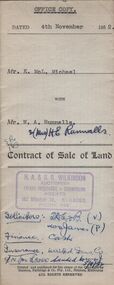
Document - H.A. & S.R. WILKINSON COLLECTION: CONDITION OF SALE
Contract of sale of land issued by H.A. Wilkinson and dated 4th November 1952 between Mr. K. McL. Michael (seller) and Mr. W. A. Runnalls for land being allotment 521 section M, Borough of Eaglehawk, Parish of Sandhurst County of Bendigo described in Crown grant volume 6071 folio 124 situate No. 23 Nelson Street California Gully, together with 5-roomed brick dwelling and all sundry. Price 1,950 pounds.organization, business, h.a. & s.r wilkinson real estate -
 Cobden & District Historical Society
footbal medal
... the person to whom it was awarded, granted land for the first ...This medal was awarded to William (Bill) John Thomas HEYWOOD by the Victorian Country Football League in 11963This item is historically and socially significant because the person to whom it was awarded, granted land for the first football ground at South Pyurrumbete in the 1920s. This donation of land shows the community and sporting interests of Bill Heywood, as does his continuing interst in the South Purrumbete football Club over many years. This ground is still in existence today. -
 Bendigo Historical Society Inc.
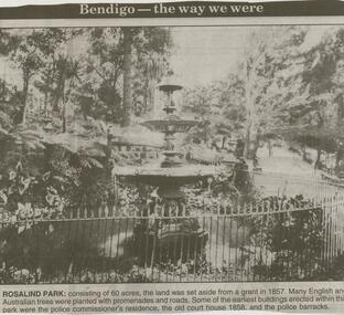
Newspaper - JENNY FOLEY COLLECTION: ROSALIND PARK
Bendigo Advertiser ''The way we were'' from 2000. Rosalind Park: consisting of 60 acres, the land was set aside from a grant in 1857. Many English and Australian trees were planted with promenades and roads. Some of the earliest buildings erected within this park were the police commissioner's residence, the old court house 1858 and the police barracks.. The clip is in a folder.newspaper, bendigo advertiser, the way we were -
 Bendigo Historical Society Inc.
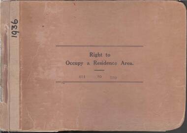
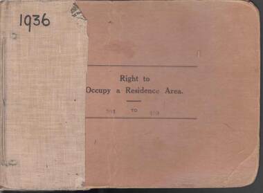
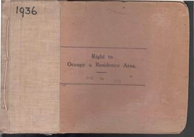
Book - RIGHT TO OCCUPY RESIDENCE AREA COLLECTION: REGISTER 1936
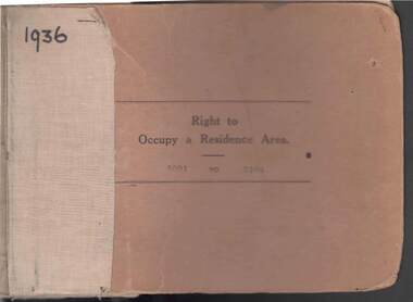
COLLECTION OF RIGHT TO OCCUPY A RESIDENCE AREA -LAND (RESIDENCE AREAS ) Act 1935 / thick cardboard book -cloth and string binding / written on front in texter '1936' / numbers 401 to 500 / inside - stubs of documents showing Granted to , of, period, Date of Right , Description of Land , Allotment, Section, City, Town, Borough, Township of, Parish of, Authorised Person . Rubber stamps show The interest of this Right has been transferred to / note on Bendigo Historical Society Catalogue Sheet dated 12.6.2008 All buts completed and original application forms removed. Note -forms were originally in triplicate on one page with serrations for removal of two parts; butts remain. Residence areas in Central Goldfields / form for butt 454 is included.Bendigo City Council - Acquisition 1990organization, government, bendigo land office, right to occupy a residence area -land (residence areas ) act 1935 -
 Bendigo Historical Society Inc.
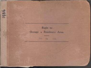
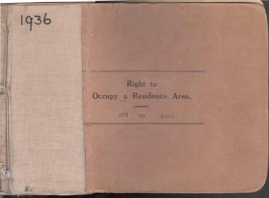
Book - RIGHT TO OCCUPY RESIDENCE AREA COLLECTION: REGISTER 1936
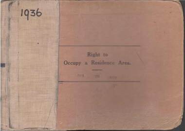
COLLECTION OF RIGHT TO OCCUPY A RESIDENCE AREA -LAND (RESIDENCE AREAS ) Act 1935 / thick cardboard book -cloth and string binding / written on front in texter '1936' / numbers 301 to 400 / inside - stubs of documents showing Granted to , of, period, Date of Right , Description of Land , Allotment, Section, City, Town, Borough, Township of, Parish of, Authorised Person . Rubber stamps show The interest of this Right has been transferred to / note on Bendigo Historical Society Catalogue Sheet dated 12.6.2008 All buts completed and original application forms removed. Note -forms were originally in triplicate on one page with serrations for removal of two parts; butts remain .Residence areas in Central Goldfields / form for butt N0 331 is included.Bendigo City Council - Acquisition 1990organization, government, bendigo land office, right to occupy a residence area -land (residence areas ) act 1935 -
 Bendigo Historical Society Inc.
Book - RIGHT TO OCCUPY RESIDENCE AREA COLLECTION: REGISTER 1936
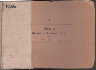
COLLECTION OF RIGHT TO OCCUPY A RESIDENCE AREA -LAND (RESIDENCE AREAS ) Act 1935 / thick cardboard book -cloth and string binding / written on front in texter '1936' / numbers 201 to 300 / inside - stubs of documents showing Granted to, of, period, Date of Right , Description of Land, Allotment, Section, City, Town, Borough, Township of , Parish of , Authorised Person. Rubber stamps show The interest of this Right has been transferred to/ note on Bendigo Historical Society Catalogue Sheet dated 12.6.2008 All buts completed and original application forms removed. Note -forms were originally in triplicate on one page with serrations for removal of two parts; butts remain. Residence areas in Central Goldfields.Bendigo City Council - Acquisition 1990organization, government, bendigo land office, right to occupy a residence area -land (residence areas ) act 1935 -
 Bendigo Historical Society Inc.
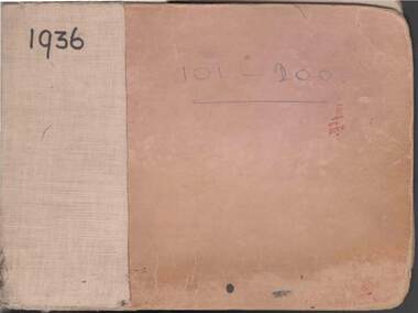
Book - RIGHT TO OCCUPY RESIDENCE AREA COLLECTION: REGISTER 1936
COLLECTION OF RIGHT TO OCCUPY A RESIDENCE AREA -LAND (RESIDENCE AREAS ) Act 1935 / thick cardboard book -cloth and string binding / written on front in texter '1936' / numbers 101 to 200 / inside - stubs of documents showing Granted to , of, period, Date of Right , Description of Land , Allotment, Section, City, Town, Borough, Township of, Parish of, Authorised Person . Rubber stamps show The interest of this Right has been transferred to / note on Bendigo Historical Society Catalogue Sheet dated 12.6.2008 All buts completed and original application forms removed. Note -forms were originally in triplicate on one page with serrations for removal of two parts; butts remain .Residence areas in Central Goldfields.Bendigo City Council - Acquisition 1990organization, government, bendigo land office, right to occupy a residence area -land (residence areas ) act 1935 -
 Bendigo Historical Society Inc.
Book - RIGHT TO OCCUPY RESIDENCE AREA COLLECTION: REGISTER 1936
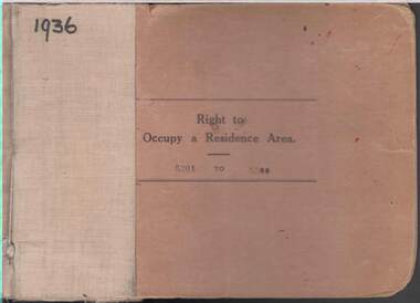
COLLECTION OF RIGHT TO OCCUPY A RESIDENCE AREA -LAND (RESIDENCE AREAS ) Act 1935 / thick cardboard book -cloth and string binding / written on front in texter '1936' / numbers 001 to 100 / inside - stubs of documents showing Granted to , of, period, Date of Right , Description of Land , Allotment, Section, City, Town, Borough, Township, of , Parish of , Authorised Person . Rubber stamps show The interest of this Right has been transferred to/ note on Bendigo Historical Society Catalogue Sheet dated 12.6.2008 All butts completed and original application forms removed. Note -forms were originally in triplicate on one page with serrations for removal of two parts; butts remain . Residence areas in Central Goldfields.Bendigo City Council - Acquisition 1990organization, government, bendigo land office, right to occupy a residence area -land (residence areas ) act 1935 -
 Bendigo Historical Society Inc.
Book - RIGHT TO OCCUPY RESIDENCE AREA COLLECTION: REGISTER 1936
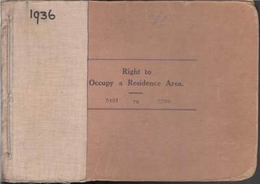
COLLECTION OF RIGHT TO OCCUPY A RESIDENCE AREA -LAND (RESIDENCE AREAS ) Act 1935 / thick cardboard book -cloth and string binding / written on front in texter '1936' / numbers 5301 to 5400 / inside - stubs of documents showing Granted to , of, period, Date of Right , Description of Land , Allotment, Section, City, Town, Borough , Township of , Parish of , Authorised Person . Rubber stamps show The interest of this Right has been transferred to / note on Bendigo Historical Society Catalogue Sheet dated 12.6.2008 All butts completed and original application forms removed. Note -forms were originally in triplicate on one page with serrations for removal of two parts; butts remain .Residence areas in Central Goldfields.Bendigo City Council - Acquisition 1990organization, government, bendigo land office, right to occupy a residence area -land (residence areas ) act 1935 -
 Bendigo Historical Society Inc.
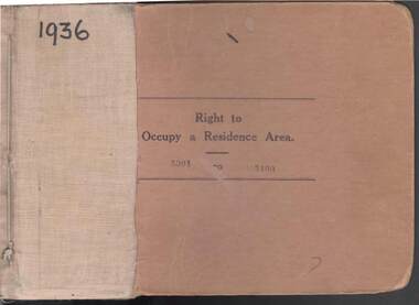
Book - RIGHT TO OCCUPY RESIDENCE AREA COLLECTION: REGISTER 1936
COLLECTION OF RIGHT TO OCCUPY A RESIDENCE AREA -LAND (RESIDENCE AREAS ) Act 1935 / thick cardboard book -cloth and string binding / written on front in texter '1936' / numbers 5401 to 5500 / inside - stubs of documents showing Granted to , of, period, Date of Right , Description of Land , Allotment, Section, City, Town, Borough , Township of , Parish of , Authorised Person . Rubber stamps show The interest of this Right has been transferred to / note on Bendigo Historical Society Catalogue Sheet dated 12.6.2008 All butts completed and original application forms removed. Note -forms were originally in triplicate on one page with serrations for removal of two parts; butts remain .Residence areas in Central Goldfields.Bendigo City Council - Acquisition 1990organization, government, bendigo land office, right to occupy a residence area -land (residence areas ) act 1935 -
 Bendigo Historical Society Inc.
Book - RIGHT TO OCCUPY RESIDENCE AREA COLLECTION: REGISTER 1936
COLLECTION OF RIGHT TO OCCUPY A RESIDENCE AREA -LAND (RESIDENCE AREAS ) Act 1935 / thick cardboard book -cloth and string binding / written on front in texta '1936' / numbers 5201 to 5300 / inside - stubs of documents showing Granted to , of, period, Date of Right , Description of Land , Allotment, Section, City, Town, Borough , Township of , Parish of , Authorised Person . Rubber stamps show The interest of this Right has been transferred to / note on Bendigo Historical Society Catalogue Sheet dated 12.6.2008 All butts completed and original application forms removed. Note -forms were originally in triplicate on one page with serrations for removal of two parts; butts remain .Residence areas in Central Goldfields.Bendigo City Council - Acquisition 1990organization, government, bendigo land office, right to occupy a residence area -land (residence areas ) act 1935 -
 Bendigo Historical Society Inc.
Book - RIGHT TO OCCUPY RESIDENCE AREA COLLECTION: REGISTER 1936
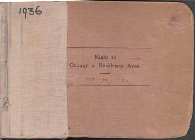
COLLECTION OF RIGHT TO OCCUPY A RESIDENCE AREA -LAND (RESIDENCE AREAS ) Act 1935 / thick cardboard book -cloth and string binding / written on front in texter '1936' / numbers 5101 to 5200 / inside - stubs of documents showing Granted to , of, period, Date of Right , Description of Land , Allotment, Section, City, Town, Borough , Township of , Parish of , Authorised Person . Rubber stamps show The interest of this Right has been transferred to/ note on Bendigo Historical Society Catalogue Sheet dated 12.6.2008 All buts completed and original application forms removed. Note -forms were originally in triplicate on one page with serrations for removal of two parts; butts remain .Residence areas in Central Goldfields.Bendigo City Council - Acquisition 1990organization, government, bendigo land office, right to occupy a residence area -land (residence areas ) act 1935 / / -
 Bendigo Historical Society Inc.
Book - RIGHT TO OCCUPY RESIDENCE AREA COLLECTION: REGISTER 1936
COLLECTION OF RIGHT TO OCCUPY A RESIDENCE AREA -LAND (RESIDENCE AREAS ) Act 1935 / thick cardboard book -cloth and string binding / written on front in texter '1936' / numbers 5001 to 5100 / inside - stubs of documents showing Granted to , of, period, Date of Right , Description of Land , Allotment, Section, City, Town , Borough , Township of , Parish of , Authorised Person . Rubber stamps show The interest of this Right has been transferred to /one stub shows Department of Lands and Survey note on Bendigo Historical Society Catalogue Sheet dated 12.6.2008 All buts completed and original application forms removed. Note -forms were originally in triplicate on one page with serrations for removal of two parts; butts remain .Residence areas in Central Goldfields.Bendigo City Council - Acquisition 1990organization, government, official -
 Bendigo Historical Society Inc.
Book - RIGHT TO OCCUPY RESIDENCE AREA COLLECTION: REGISTER 1936
COLLECTION OF RIGHT TO OCCUPY A RESIDENCE AREA -LAND (RESIDENCE AREAS ) Act 1935 / thick cardboard book -cloth and string binding / written on front in texter '1936' / numbers 501 to 600 / inside - stubs of documents showing Granted to , of, period, Date of Right , Description of Land , Allotment, Section, City , Town , Borough , Township of , Parish of , Authorised Person . Rubber stamps show The interest of this Right has been transferred to/ note on Bendigo Historical Society Catalogue Sheet dated 12.6.2008 All buts completed and original application forms removed. Note -forms were originally in triplicate on one page with serrations for removal of two parts; butts remain .Residence areas in Central Goldfields.Bendigo City Council - Acquisition 1990organization, government, bendigo land office, right to occupy a residence area -land (residence areas ) act 1935 / -
 Bendigo Historical Society Inc.
Book - RIGHT TO OCCUPY RESIDENCE AREA COLLECTION: REGISTER 1936
COLLECTION OF RIGHT TO OCCUPY A RESIDENCE AREA -LAND (RESIDENCE AREAS ) Act 1935 / thick cardboard book -cloth and string binding / written on front in texter '1936' / numbers 801 to 900 / inside - stubs of documents showing Granted to , of, period, Date of Right , Description of Land , Allotment, Section, City, Town , Borough , Township of , Parish of , Authorised Person . Rubber stamps show The interest of this Right has been transferred to / note on Bendigo Historical Society Catalogue Sheet dated 12.6.2008 All buts completed and original application forms removed. Note -forms were originally in triplicate on one page with serrations for removal of two parts; butts remain .Residence areas in Central GoldfieldsBendigo City Council - Acquisition 1990organization, government, bendigo land office -
 Bendigo Historical Society Inc.
Book - RIGHT TO OCCUPY RESIDENCE AREA COLLECTION: REGISTER 1936
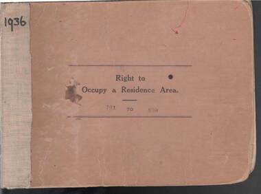
COLLECTION OF RIGHT TO OCCUPY A RESIDENCE AREA -LAND (RESIDENCE AREAS ) ACT 19355 / thick cardboard book -cloth and string binding / written on front in texter '1936' / numbers 701 to 800/ inside - stubs of documents showing Granted to , of, period, Date of Right , Description of Land , Allotment, Section, City, Town , Borough , Township of , Parish of , Authorised Person . Rubber stamps show The interest of this Right has been transferred to / note on Bendigo Historical Society Catalogue Sheet dated 12.6.2008 All buts completed and original application forms removed. Note -forms were originally in triplicate on one page with serrations for removal of two parts; butts remain .Residence areas in Central Goldfields.Bendigo City Council - Acquisition 1990organization, government, bendigo land office -
 Bendigo Historical Society Inc.
Book - RIGHT TO OCCUPY RESIDENCE AREA COLLECTION: REGISTER 1936
COLLECTION OF RIGHT TO OCCUPY A RESIDENCE AREA -LAND (RESIDENCE AREAS ) ACT 19355 / thick cardboard book -cloth and string binding / written on front in texter '1936' / numbers 601 to 700 / inside - stubs of documents showing Granted to , of, period, Date of Right , Description of Land , Allotment, Section, City , Town , Borough , Township of , Parish of , Authorised Person . Rubber stamps show The interest of this Right has been transferred to/ note on Bendigo Historical Society Catalogue Sheet dated 12.6.2008 All buts completed and original application forms removed. Note -forms were originally in triplicate on one page with serrations for removal of two parts; butts remain .Residence areas in Central Goldfields.Bendigo City Council - Acquisition 1990organization, government, bendigo land office, right to occupy a residence area -land (residence areas ) act 19355 / -
 Bendigo Historical Society Inc.
Book - RIGHT TO OCCUPY RESIDENCE AREA COLLECTION: REGISTER 1936
COLLECTION OF RIGHT TO OCCUPY A RESIDENCE AREA -LAND (RESIDENCE AREAS ) Act 1935 / thick cardboard book -cloth and string binding / written on front in texter '1936' / numbers 901 to 1000 / inside - stubs of documents showing Granted to, of, period, Date of Right , Description of Land, Allotment, Section, City, Town, Borough, Township of, Parish of, Authorised Person . Rubber stamps show The interest of this Right has been transferred to / stub 905 has the relevant document attached stating RIGHT TO OCCUPY A RESIDENCE AREA . Know all men that I, the undersigned , being in that behalf duly authorized by the Governor of the State of Victoria , DO HEREBY , in pursuance of the Land (Residence Areas ) Act 1935 , and in consideration of the payment of an occupation fee of FIVE SHILLINGS, GRANT To. Of a RIGHT TO OCCUPY AS A RESIDENCE AREA the land herein specified , for a period of one year from subject to the conditions of the conditions set out on the back thereof. Authorised Description of land / the reverse of the document gives the CONDITIONS- (SEE RESEARCH FOR DETAILS//// note on Bendigo Historical Society Catalogue Sheet dated 12.6.2008 All butts completed and original application forms removed . Note -forms were originally in triplicate on one page with serrations for removal of two parts; butts remain .Residence areas in Central Goldfields.Bendigo City Council - Acquisition 1990organization, government, bendigo land office, right to occupy a residence area -land (residence areas ) act 1935/ -
 Bendigo Historical Society Inc.
Document - ''THE LODDON LAND SWINDLERS'' CHAPTER FROM RESEARCH PAPER, 1992
''The Loddon Land Swindlers'' - chapter from Research Paper, Graduate Diploma - Regional Studies (History), LaTrobe University College of Northern Victoria (Mark Ritchie, 1992). Research Paper is titled ''Masters, Mediums, Mortals and Mysia - A Regional Study of Land Settlement'' - the first chapter - 21 pages - is titled ''The Loddon Land Swindlers''. Appendix is 'poem' (''The Charge of the Dirty Three Hundred'' (not by Tennyson). Described in the accompanying note to the B.H.S by the author as ''a fascinating event in The History of Bendigo''. It relates to the Amending Land Act of 1865 (known as the 'Grant Act') and to details of the July 1865 involvement of Bendigo people - 200 men - in the Inglewood Land Selections. Reference to 'mediums' and 'dummies'. References to reports of the time in the Bendigo Advertiser.Mark Ritchieinglewood, history, land settlement, amending land act of 1965, james macpherson grant, shamrock hotel, cobb & co, inglewood advertiser, henry byron moore, mr grant minister of lands, dummies, belle-latrobe, inglewood -
 Bendigo Historical Society Inc.
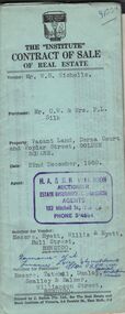
Document - H.A. & S.R. WILKINSON COLLECTION: CONTRACT OF SALE
Contract of sale of real estate dated 22nd December, 1960 between Mr. W. B. Nicholls (vendor) and Mr. C. W. & Mrs. F. L. Silk (purchaser). Solicitor for vendor: Messrs Hyett, Willis & Hyett, Bull Street, Bendigo. Solicitor for purchaser: Messrs. Tatchell, Dunlop, Smalloy & Balmer, Williamson Street, Bendigo. Property: vacant land corner Derna Court and Poplar Street, Golden Square, being lots 20,21,22,23,24, 25, 26 and 27 fronting Derna Courton plan of subdivision no. B80611 and lot 1 on plan of subdivision no. 51583 lodged in the office of titles and being part of Crown allotment 11 section 24A at Bendigo described in Crown grant volume 8217 folio 121. Price 4,900 pounds .organization, business, h.a. & s.r wilkinson real estate -
 Bendigo Historical Society Inc.
Document - H. A. & S. R. WILKINSON COLLECTION: CONTRACT OF SALE
Contract of sale of real estate dated 11th June, 1964 between Miss B. Dunn (vendor) and Mr. E. T. Simmonds (purchaser). Solicitor for vendor: Watson, James & Rogers, Bull Street, Bendigo. Solicitor for purchaser: Schleiger & Smalley, Williamson Street, Bendigo. Property: 49 Hamlet Street, Bendigo being part of Crown allotment 9, section 108C land now remaining in Crown Grant volume 1576, folio 142. A copy of the certificate of title is enclosed with the contract. Price 1,100 pounds.organization, business, h.a. & s.r wilkinson real estate -
 Bendigo Historical Society Inc.
Document - H. A. & S. R. WILKINSON COLLECTION: CONTRACT OF SALE
Contract of sale of real estate dated 11th June, 1964 between Miss B. Dunn (vendor) and Mr. E. T. Simmonds (purchaser). Solicitor for vendor: Watson, James & Rogers, Bull Street, Bendigo. Solicitor for purchaser: Schleiger & Smalley, Williamson Street, Bendigo. Property: 49 Hamlet Street, Bendigo being part of Crown allotment 9, section 108C land now remaining in Crown Grant volume 1576, folio 142. Price 1,100 pounds.organization, business, h.a. & s.r wilkinson real estate -
 Bendigo Historical Society Inc.
Document - H. A. & S. R. WILKINSON COLLECTION: CONTRACT OF SALE
Contract of sale of land by public auction dated 29th August, 1956 between Farmers and Citizens Trustees Company Bendigo executor of the will of F. R. Schilling deceased (vendor) and Mr. A. C. & Mrs. A. Sprawson (purchaser). Property: land that lies above the depth of 100 feet below the surface of all that land containing 35 perches and 8/10 of a perch being allotment 20 section 49B comprised in Crown Grant volume 2193 folio 493 situate No. 120 Rowan Street, Bendigo. Price: 2,725 pounds.organization, business, h.a. & s.r wilkinson real estate -
 Bendigo Historical Society Inc.
Document - H. A. & S. R. WILKINSON COLLECTION: CONTRACT OF SALE
Contract of sale of land dated 20th May, 1954 between Mrs. B. S. Grant (vendor) and Mr. J. C. & Mrs. V. C. Tarr (purchaser). Solicitors for vendor: Noel & Woodward. Solicitor for purchaser: T. M. Williams, Watson & James. Property: that piece of land part of Crown allotment 12 section 19B Parish of Sandhurst City of Bendigo, land described in certificate of title volume 2734 folio 653 and situate No. 30 Shamrock street, Bendigo, together with 5 roomed weatherboard dwelling and all sundry outbuildings, also electric stovette, electric copper, all electric light fittings and shades, rotary clothes line, all blinds and linos. Price: 2,000 pounds.organization, business, h.a. & s.r wilkinson real estate -
Port Melbourne Historical & Preservation Society
Document - Notice, Attendance at deputation to Public Work re Williamstown Road grant, Edward Clark, Town Clerk, 27 Jan 1880
Pinned with item 600.02Small (4pg) notice inviting attendance at deputation to Minister of Lands, 28 January 1880 re sale of lands along Williamstown Short Road'(Copy)'town planning, edward clark, town clerks, george f smith, land sales -
Port Melbourne Historical & Preservation Society
Letter - Lands & Survey Office re permission to use land for football ground, 13 May 1880
Letter from Lands & Survey Office granting permission for use of land as per tracing sheet for football ground, 1880sport - australian rules football, sport - recreational grounds, peter gallienne grut, port melbourne football club, pmfc -
 Bendigo Historical Society Inc.
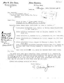
Document - MCCOLL, RANKIN AND STANISTREET COLLECTION: LETTER FROM MISS. G. ALICE JONES RE LAND SALE, 1941
Document: Crown Grant dated 12/10/1959 to John X. Walton with conveyance 21/3/1912 from F.O. Lacey to Deborah Reef Gold Mining Company no Liability No. 521 Book 460.Miss G. Alice Jones, Barrister and Solicitororganization, mining, mccoll, rankin and stanistreet, mccoll, rankin and stanistreet: deborah gold mines nl., mr. j. j. stanistreet, bendigo, deborah reef gold mining co. nl -
 Bendigo Historical Society Inc.
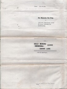
Document - MCCOLL, RANKIN AND STANISTREET COLLECTION: CENTRAL NAPOLEON GOLD MINING CO. N.L, 28 March 1951
Document: A letter from the Mines Department to Central Napoleon Gold Mining Co. N.L informing them of land application no 94/152 by Mr J. Bakker which a portion of the block is within their lease no 11272 Bendigo, the letter is asking whether or not the Company has any objection to their granting of the application.organization, business, industrial - mining, mccoll rankin & stanistreet, mining, gold mining, central napoleon