Showing 11424 items
matching maps
-
 Kilmore Historical Society
CHAMBERS INFORMATION FOR THE PEOPLE VOL 1, 1848
Faded brown loose cloth cover with embossed detailing on cover and spine 'Chambers information for the People, Vol 1 Sciences - Arts & C.' 809 pages ; Maps; Illus; 27cm Handwritten inscription on first page - '36, 41, 040 CHA R 28' Stamp on various pages 'Kilmore Mechanics Institute' science, arts, kilmore mechanics institute library. -
 Canterbury History Group
Pamphlet - Camberwell Golf Links, c1932 original
Brochure produced for Land Sub-division sale by auction of Camberwell Golf Links on Saturday 28 May c1932. Reproduced from the original, includes Map and some historic photographscamberwell, fairmont avenue, camberwell road, christowell street, trams, vintage cars -
 Falls Creek Historical Society
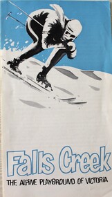
Booklet - Falls Creek THE ALPINE PLAYGROUND OF VICTORIA
This publication was released by the Falls Creek Tourist Area Management Committee during the 1969 snow season. It followed decisions to expand the accommodation and services to approximately double its size at that time. It was aimed at promoting the Resort in an effort to attract further interest and potential investment in this development.This brochure is significant because it documents the manner in which the Tourist Resort was prompted for investors.A fold out brochure with a skier on the front cover. The leaflet information about the size and location of Falls Creek including names of several lodges and a map of the Tourist Village on the back cover.Front cover: Falls Creek THE ALPINE PLAYGROUND OF VICTORIAfalls creek tourist resort, falls creek development, falls creek promotion -
 Friends of Ballarat Botanical Gardens History Group
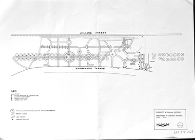
Work on paper - Ballarat Botanical Garden Conservation Analysis and Policy, Volume 1, December 1994 and 2002, December 1994 and April/May 2002
The work entitled Ballarat Botanical Garden Conservation Analysis and Policy was prepared for the City of Ballarat.The pages selected give some perspective on the policy and planning of the Ballarat Botanical Gardens in the recent past.14 pages printed on both sides with black and white pictures and one map. Pages are not numbered consecutively; a selection has been made from the work cited in the name and title."Joan" is printed in blue biro in the top lefthand corner of the title page. [Presumably Joan Garner, President of the FBBG].ballarat botanical garden, conservation analysis and policy, city of ballarat, allom lovell & associates pty ltd., conservation architects, john patrick pty.ltd., landscape architects, friends of ballarat botanical gardens, john garner, doctor john garner, john garner collection, gardens, ballarat -
 Wodonga & District Historical Society Inc
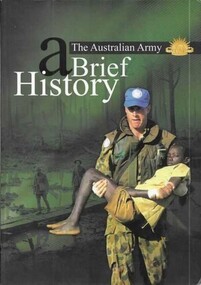
Book - The Australian Army - A Brief History, Austin, Brigadier M and Lever, Major Geoff, 2001
A revised short history of the Australian Army beginning with Aboriginal resistance to settlement; through an examination of the service of colonial forces in the Sudan and Boer Wars; both World Wars, Korea, Vietnam and Afghanistan. It contains a detailed section explaining the history and traditions of the Australian Army including patches, badges, the slouch hat and the Rising Sun badge.A bound volume of 96 pages featuring an image of an Australian soldier carrying an injured child on the cover. This publication includes 11 maps in colour as well as black and white and colour illustrations.A revised short history of the Australian Army beginning with Aboriginal resistance to settlement; through an examination of the service of colonial forces in the Sudan and Boer Wars; both World Wars, Korea, Vietnam and Afghanistan. It contains a detailed section explaining the history and traditions of the Australian Army including patches, badges, the slouch hat and the Rising Sun badge.australian military, military history -
 Wodonga & District Historical Society Inc
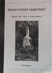
Booklet - Wood's Point Cemetery Records Burials 1863 - 1920 & Transcriptions, Rogers, J. G, 1995
A detailed history of the town of Wood's Point and stories of many of the people buried in the Cemetery. It also contains an analysis of places of origin and a glossary of causes of death. An index and a bibliography are included.A book containing detailed information about the history of Wood's Point, Victoria. It gives detailed information about citizens of Wood's Point buried at the local cemetery. Maps of the area are included.non-fictionA detailed history of the town of Wood's Point and stories of many of the people buried in the Cemetery. It also contains an analysis of places of origin and a glossary of causes of death. An index and a bibliography are included.epitaphs -- victoria -- woods point, cemeteries -- victoria -- woods point, woods point cemetery -
 City of Kingston
Pamphlet - Colour, Fergusson & Mitchell Lith, Sandringham Rises, c. 1888
Sales plan for land in the suburb of Sandringham, bounded by Bluff Road, Bay Road and William Street, and incorporating Frances Street.The developing urban area of Highett (then called Sandringham) within the City of Kingston. This land sale pamphlet illustrates the subdivision of land within the municipality and the changing demographic of the district as new houses are constructed close to infrastructure.Colour pamphlet advertising for sale 35 lots in Sandringham Rises, Sandringham. Incorporates a map of the estate bordered by Bluff Road, Bay Road and William Street, including Frances Street.Handwritten in grey pencil next to the words 'THREE O'CLOCK': 1888 Handwritten in blue ben next to the words '& BUSINESS SITES': 1888land sales, sandringham, highett -
 City of Kingston
Pamphlet - Colour, Highett Town, 1888
Sales plan for land in the suburb of Highett, bounded by Highett Road, Worthing Terrace and the railway line, and incorporating Major Street and Train Street.The developing urban area of Highett within the City of Kingston. This land sale pamphlet illustrates the subdivision of land within the municipality and the changing demographic of the district as new houses are constructed close to infrastructure.Colour pamphlet advertising for private sale the Station Entrance Estate, Highett. Incorporates a map of the estate bordered by Wickham Road, Railway Parade, Highett Road and Point Nepean Road.land sales, highett -
 Bendigo Historical Society Inc.
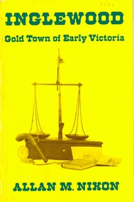
Book - INGLEWOOD
Inglewood gold town of early Victoria by Allan M. Nixon, 136 pages with black and white photographs & maps. Published by the Author 1974 released through ROH-JO Promotions.history, australian, inglewood -
 Whitehorse Historical Society Inc.
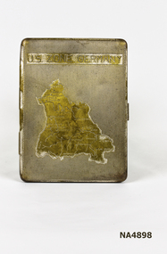
Container - Cigarette Case, 1940's
Metal cigarette case. Map on front shows the U.S. Occupied Zone of Germany in the post war years.|Perhaps issued or sold to the U.S. Forces. There is a clip inside to hold cigarettes.U.S. Zone of Germanypersonal effects, smoking accessories -
 Bendigo Historical Society Inc.
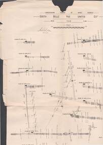
Map - STRUGNELL COLLECTION: UNDERGROUND SURVEY OF MINES BENDIGO, 25/05/01
Map, Underground Survey of Mines, Bendigo, South Belle Vue United Coy, New Chum Line, Surveyed under the Supervision of H.Herman,B.C.E.,F.G.S.,Acting Government Geologist.A.S.Whitelawmap, bendigo, belle vue united coy -
University of Melbourne, Burnley Campus Archives
Map - Topographic Survey, Grampians, 1969
Australia 1:100,000 Topographic Survey Map of the Grampians, Victoria dated 1969. Sheet 7323 (Edition 1) Series R 652. Produced by the Royal Australian Survey Corps.grampians, royal australian survey corps, topographic survey -
Lakes Entrance Historical Society
Book, Hanson Hector Valentine James, Memiors of a larrikin, 1994
A short life history of one Hector Valentine James Hanson who lived and worked in the eastern states of Australia, particularly Mornington Peninsula Victoria. Contains sketch maps and photographsgenealogy -
 Falls Creek Historical Society
Document - Information Bulletin April 1961
Bob Hymans Collection Bob (Herman) Hymans (a former member of the Royal Netherlands Navy) was born in Bloemendaal, Holland on 30th September 1922. During World War II he fought against the Japanese in the Dutch East Indies (now Indonesia) and was imprisoned in Changi and on the Burma Railway. After gaining qualifications as a Ski Instructor, Bob arrived in Falls Creek in July 1950. Working as an Instructor and Supervisor at Bogong Lodge, Bob decided his future was in accommodation. He was successful in negotiating an indenture for land from the State Electricity Commission (SEC). It took Bob two years to build his Grand Coeur Chalet but, tragically, it was burned down in August 1961. Bob also built the first Chairlift in Australia. This was a single chairlift and the structure was built from wooden electricity poles. He was constantly full of new ideas and proposals for the village. Bob Hymans died on 7th July 2007. This Collection of documents and letters tells the story of Bob's endeavours to develop Falls Creek into the ski village it is today.This letter is significant because it documents developments made or endorsed by the Falls Creek Tourist Area Management Committee.An information bulletin published by the Management Committee. Information included is the release of a new subdivision map, establishment of a Ski Rescue Service and notification that Bob Hymans' would not be in operation for the coming season,falls creek tourist area management committee, preparations for winter season 1961 -
 Melbourne Tram Museum
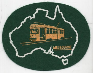
Uniform - Cloth badge, 1970's
Cloth badge or desk item - consisting an oval of green felt with a map of Australia containing an image of PCC class 1041 and the word Melbourne under. Presumed early 1970's.trams, tramways, pcc class, 1041, badges, souvenirs, tram 1041 -
Lakes Entrance Historical Society
Book, Land Conservation Council Victoria Gippsland Lakes Hinterland Area, 1982
Report describing the physical nature of the land in the Gippsland Lakes (Victoria) Hinterland Study area. History, climate, geomorphology, land use, flora and fauna are presented. 1 map in pocket.waterways, gippsland, natural history, vegetation -
 City of Greater Bendigo - Civic Collection
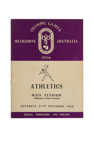
Programme, Wilke and Co Ltd, Olympic Games Melbourne Australia 1956 : Athletics, Main Stadium (Melbourne Cricket Ground), Friday, 23rd November, 1956, 1956
Held in Melbourne from the 22nd November to 8th December, the 1956 Summer Olympics, officially known as the Games of the XVI Olympiad or the Melbourne Olympics were the first held outside of Europe or the USA. The Olympic torch relay passed through Central Victoria on its way from Cairns to Melbourne. Small book containing 15 pages including map of competition venues and programme on the back cover. Front cover depicts male javelin thrower. Printed in black and purple ink.melbourne olympic games, city of greater bendigo tourism -
Clunes Museum
Book, JIM FAULL, THE CORNISH IN AUSTRALIA, 1983
HISTORICAL INFORMATION RELATED TO CORNISH MIGRATION TO AUSTRALIA MANY INVOLVED IN MINING115 PAGE BOOK WITH MAPS, DRAWINGS, PHOTOGRAPHS AND HISTORICAL INFORMATION RELATED TO CORNISH MIGRATION TO AUSTRALIA MANY INVOLVED IN MINING. ORANGE COVER WITH PHOTOGRAPH ON THE FRONT. MUSTARD COLOUR SPINE.non-fictionHISTORICAL INFORMATION RELATED TO CORNISH MIGRATION TO AUSTRALIA MANY INVOLVED IN MININGcornish miners, migration -
 Bendigo Military Museum
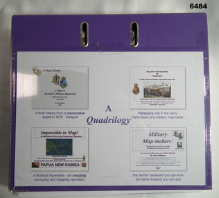
Document - Quadrilology on aspects of Royal Australian Survey Corps mapping by Dr Bob Williams, Dr Bob Williams, 2024
A4 purple two ring folder that contains four illustrated articles about the Royal Australian Survey Corps written by Dr Bob Williams. Article 1. A brief history from a memorable event in 1915 - Gallipoli. A tribute to Australia's Military Mapmakers Videre Parare Est, 1910-2000. Article 2. Fortuna's role in the story, Reflections of a military mapmaker. Military Mapmakers of "Fortuna" The house of the Army Survey Regiment - Royal Australian Survey Corps. Article 3. A Political Imperative - An amazing surveying and mapping operation. Impossible to Map! Papua New Guinea. Article 4. Military Mapmakers. The farther backward you can look; the farther forward you can see. Dr Bob Williams served in the Royal Australian Survey Corps from 1965 as a Sapper in the Royal Australian Survey Corps and retired from the Army in 1991 as a Major to join DSTO continuing his career in the spatial sciences. A4 purple two ring folder that contains four illustrated articles about the Royal Australian Survey Corps written by Dr Bob Williams. Article 1. A brief history from a memorable event in 1915 - Gallipoli. A tribute to Australia's Military Mapmakers Videre Parare Est, 1910-2000. Article 2. Fortuna's role in the story, Reflections of a military mapmaker. Military Mapmakers of "Fortuna" The house of the Army Survey Regiment - Royal Australian Survey Corps. Article 3. A Political Imperative - An amazing surveying and mapping operation. Impossible to Map! Papua New Guinea. Article 4. Military Mapmakers. The farther backward you can look; the farther forward you can see.royal australian survey corps, rasvy, fortuna, army survey regiment, army svy regt, asr -
 Melbourne Tram Museum
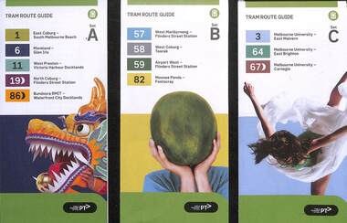
Ephemera, Public Transport Victoria (PTV), "Tram Route Guide", 2/2024
... maps ...Route Guides published Feb. 2024, by Public Transport Victoria listing the stops, interchanges with bus and other tram services, ticketing zones, estimated frequencies with adverts for Night tram services, TramTracker and Myki tickets. On the rear is a large map, and a short summary of the routes list in the guide. .1 - Set A - Routes 1, 6, 11, 19 and 86 .2 - Set B - Routes 57, 58, 59 and 82 .3 - Set C - Routes 3, 64 and 67 .4 - Set D - Routes 48, 70, 75, 78 and 109 .5 - Set E - Routes 5, 6, 16, 58 and 72 .6 - Set F - Routes 12, 30, 35, 96 See item 2279 for an earlier versions.Demonstrates a PTV published tram route guide of 2024.Set of 6 pamphlets folded A2 to DL sheets, full colour.trams, tramways, timetables, route guides, maps, route 1, route 3, route 5, route 6, route 11, route 19, route 86, route 57, route 58, route 59, route 82, route 64, route 67, route 48, route 70, route 75, route 78, route 109, route 16, route 72, route 12, route 30, route 35, route 96 -
Ringwood and District Historical Society
Leaflet, Chris A. Moule, Auctioneer, Pamphlet produced for a builders realisation sale of lets in Manuela Terrace and Lyn Court Ringwood 1979, 1979
Pamphlet produced for a builders realisation sale of lets in Manuela Terrace and Lyn Court Ringwood 6th December 1979 in the "Bel-Air" Estate marked between Glenvale Road and Oban Road on diagrammatic map of Ringwood.Single page double-sided leaflet, black printing, front has red border. +Additional Keywords: Moule, C.A. -
![Map, Public Lands Office, Township of Sandridge [cartographic material] / lithographed at the Public Lands Office, March 30th 1859, 30 March 1859](/media/collectors/4f729f5897f83e0308601603/items/63c6354eae7bf372478c58b7/item-media/63c635d4ae7bf372478c7627/item-fit-380x285.jpg) Mission to Seafarers Victoria
Mission to Seafarers VictoriaMap, Public Lands Office, Township of Sandridge [cartographic material] / lithographed at the Public Lands Office, March 30th 1859, 30 March 1859
The map shows where the land of the Customs House was and where the Bethel church was built in 1860. It also shows the name Gregory, a family of land owners who became the managers of the new building on the same site in 1889.sandridge, bethel church, customs house, gregory -
 Melbourne Tram Museum
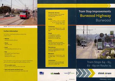
Pamphlet, VicRoads, "Tram stop improvements Burwood Highway Burwood", Feb. 2007
Pamphlet dated Feb. 2007 detailing the installation of platform or super stops in Burwood Highway Burwood in four locations. Has location map. Part of the VicRoads Yarra Trams Think Tram project. Route 75.Yields information about the installation of super stops in Burwood Highway during 2007.Pamphlet - 3 fold DL - full colour.trams, tramways, super stops, platform stops, route 75, burwood highway, burwood -
 Melbourne Tram Museum
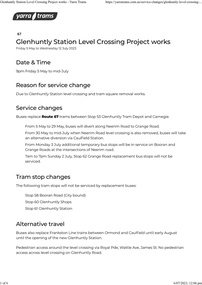
Document - Project Notice, Yarra Trams, "Glenhuntly Station Level Crossing Project works", May 2023
Project notice for - "Glenhuntly Station Level Crossing Project works" - tramway square. Gives details of alternative bus arrangements, maps and timing for the works. Work scheduled 5/5/2023 to mid July 2023.Yields information about the removal of the Glen Huntly station/road level crossing and the associated trackwork.Notice - 6 A4 page document - pdf version downloaded and printed version.tramways, public transport, level crossing, glen huntly road, glenhuntly, railway square, tramway square, trackworks -
 Bendigo Historical Society Inc.
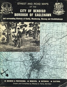
Book - STREET AND ROAD MAPS OF THE CITY OF BENDIGO BOROUGH OF EAGLEHAWK, c1980
Street and Road Maps of the City of Bendigo Borough of Eaglehawk and surrounding Districts of Huntly, Mandurang, Marong and Strathfieldsaye, in color. Drawn and compiled by Wesley C Harry, Bendigo. Publisher: Cambridge Press, Bendigo. ISBN: 9598608.2.2. 68 pages. Photographs, Illustrations & maps. Photos include: Bendigo buildings, scenery mines, streetscapes, parades, pioneer leaders of Bendigo. Many advertisements throughout. List of Justices of the Peace, hospitals, homes for the aged, schools, churches. Page 58: Copy of ''Freedom of the City to the Australian Survey Regiment'' proclamation, 14th June 1970. Maps cover an area of some 169 sq. miles (43,772 hectares). Origin of the name Bendigo. Information on the five Wards of Bendigo, and their councilors.Wesley C Harrybook, bendigo, bendigo & district maps, bendigo and districts map, buildings, streetscapes, historical pictures, advertisements, historical information, commisioners camp, sandhurst -
 Bendigo Historical Society Inc.
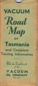
Document - BILL ASHMAN COLLECTION: VACUUM MAP OF TASMANIA
Vacuum Road Map of Tasmania and Complete Touring Information with the Compliments of the Vacuum Oil Company Pty Ltd. Coloured map of Tasmania with trucks, aeroplane, oil bottles and petrol bowsers in the margins. Alphabetical Index of Towns, Lakes, Mountains, Bays, Capes, etc., with key and Licensed Public Aerodromes in Tasmania and Their Location. On the back is Outlets of Hobart, Outlets of Launceston, What to See in Hobart, Beauty Spots and Tourist Information, What to See in Launceston, Vacuum Products, Traffic Hints, Super Plume or Plume, Making Sure of a Trouble-Free Trip and the front cover picture of a lady, child and a man in their car at the petrol bowser. Map folds up and is kept in a light green folder.map, bill ashman collection - correspondence, vacuum road map of tasmania and complete touring information, vacuum oil company pty ltd -
 Bendigo Historical Society Inc.
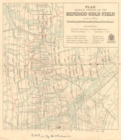
Map - DEPARTMENT OF MINES VICTORIA : PLAN SHOWING PORTION OF THE BENDIGO GOLD FIELD
Department of Mines Victoria. Plan showing portion of the Bendigo Gold Field. On the back is written, in ink, J. J. Tyler 1937 Northern Area. (He was a teacher at Bendigo High - see donation notes). Across the bottom of the map is written ' M. Hill cr. Myrtle & Barnard' .The named reef lines have been numbered with ink across the bottom of the map. The gullies have been coloured with green pencil and a red pencil line is drawn through the western side of the map. Additional information: anticlinal axial lines at surface, alluvial workings, shaft sites, area of Main Goldfield, Deepest mine workings, Gold output of field to 1935, and Dividends paid 1870 - 1935.bendigo, gold mining, bendigo gold field. gold mining. tyler, j. j. -
 Melbourne Tram Museum
Book, Public Transport Corporation (PTC), "Customer Service Employees", c1995
Black vinyl covered two ring folder titled "Customer Service Employees", with the Public Transport Corporation Logo printed on dark green paper. Contains approx. 120 sheets with information about Melbourne's public transport including general information, maps, fares, Met Tickets (3 zones), disabilities, sports and entertainment Map, Hospitals, AFL Grounds, Bus & Tram Services, Night Rider Bus Services and basic first aid. The map shows tram line to Bundoora but no services to Docklands, the Altona - Laverton rail line shown. Gives details of Ansett airlines office. Book not dated as such. Estimated date - mid 1990's, prior to Metcards, still using Met tickets.trams, tramways, ptc, the met, tickets, information, melbourne, buses -
 Bendigo Military Museum
Map - Australian Topographical Survey NAGAMBIE SW Sheet, 1 inch:1 Mile, NW portion Plane Table Field sheet 1921, Australian Survey Corps, 1921
This is a coloured reproduction print of an original Plane Table compilation map sheet of Nagambie area 1inch to 1 Mile scale compiled by Sgt Jack Cullen Australian Survey Corps 30 September 1921. Jack was one of the foundation members of the Australian Survey Corps. Of particular interest is the fact that this is a heighted compilation with contouring (required for Military use) as many early maps were purely planimetric. A table on the right hand side details the number of days that it took to produce the compilation. The reverse side of this print is a copy of the Tallarook plane table South East field sheet.Reprinted coloured Image of Australian Topographical Survey NAGAMBIE SW Sheet,1 inch:1 Mile, NW portion hand drawn Plane Table Field sheet. Includes an itemized summary of work, signed by Sgt J Cullen Australian Survey Corps September1921.royal australian survey corps, rasvy, fortuna, army survey regiment, army svy regt, asr -
 Bendigo Military Museum
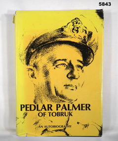
Book - BOOK, AUTOBIOGRAPHY WW2, A. B. Palmer, "Pedlar Palmer of Tobruk", 1981
Owner and donor details, see Cat. No. 5836.3.Hard cover book with dust cover. Cover - cardboard with navy blue buckram. Gold print on spine. Dust cover - paper, black colour print on yellow background, front and spine. Front illustration - black print of RAN portrait. Back cover, sepia tones, photograph of trucks and boats dockside. 384 pages, cut, plain, white paper. Illustrated black and white photographs and maps. End papers front and back - maps.books, military history, ww2, ran, autobiography