Showing 2469 items matching " black bridge"
-
 Eltham District Historical Society Inc
Slide - Photograph, Mittons Bridge, Mittons Bridge Road, St Andrews, c.1993
... transparency Mount - Black and White Mittons Bridge, Mittons Bridge ...35mm colour positive transparency Mount - Black and Whiteinfrastructure, roads, heidelberg-kinglake road, mittons bridge, mittons bridge road, st andrews -
 Eltham District Historical Society Inc
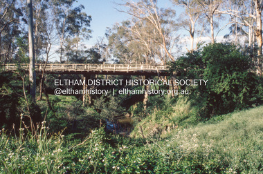
Slide - Photograph, Diamond Street Bridge, Eltham, c.1993
35mm colour positive transparency Mount - Black and Whiteinfrastructure, roads, diamond street bridge, eltham -
 Eltham District Historical Society Inc
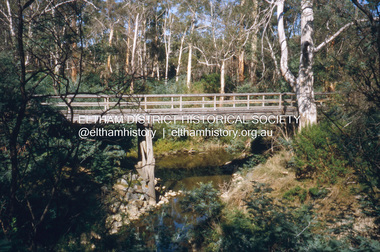
Slide - Photograph, Brougham Street Bridge, Eltham, c.1997
35mm colour positive transparency Mount - Black and Whitebrougham street bridge, eltham, infrastructure, roads -
 Eltham District Historical Society Inc
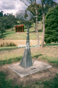
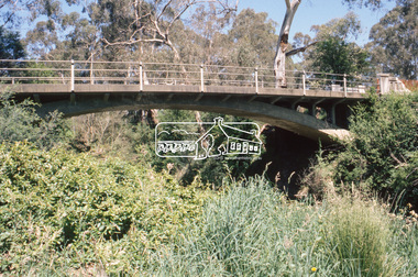
Slide - Photograph, Sculpture, Surveyor of Suburban Environs, Ernst Fries (1991), Alistair Knox Park, cnr Bridge Street and Main Road, Eltham, c.1993
35mm colour positive transparency Mount - Black and Whitealistair knox park, art in public places, classical-landscape (1996), cliff burtt, public art, sculptures, surveyor of suburban environs (1991) -
 Eltham District Historical Society Inc
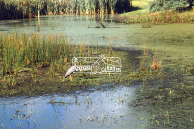
Slide - Photograph, Main Road Bridge over Diamond Creek, Eltham South, c.Nov. 2001
Part of a slide show presentation "A Trip Down the Diamond Creek" by Russell Yeoman to the Eltham District Historical Society meeting of 14 Nov. 200135mm colour positive transparency Mount - Black and Whiteeltham south, main road bridge -
 Eltham District Historical Society Inc
Slide - Photograph, Brougham Street Bridge, Eltham, c.Nov. 2001
Part of a slide show presentation "A Trip Down the Diamond Creek" by Russell Yeoman to the Eltham District Historical Society meeting of 14 Nov. 200135mm colour positive transparency Mount - Black and Whitebrougham street bridge, eltham -
 Eltham District Historical Society Inc
Slide - Photograph, Bridge Street Bridge, Eltham, c.Nov. 2001
... colour positive transparency Mount - Black and White Bridge ...Part of a slide show presentation "A Trip Down the Diamond Creek" by Russell Yeoman to the Eltham District Historical Society meeting of 14 Nov. 200135mm colour positive transparency Mount - Black and Whiteeltham, bridge street bridge -
 Eltham District Historical Society Inc
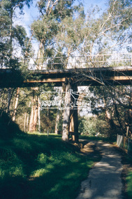
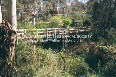
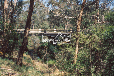
Slide - Photograph, Eltham Railway Trestle Bridge, c.Nov. 2001
Part of a slide show presentation "A Trip Down the Diamond Creek" by Russell Yeoman to the Eltham District Historical Society meeting of 14 Nov. 200135mm colour positive transparency Mount - Black and Whiteeltham, eltham railway trestle bridge, eltham trestle bridge, trestle bridge -
 Eltham District Historical Society Inc
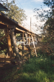
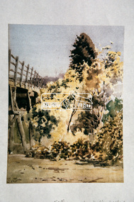
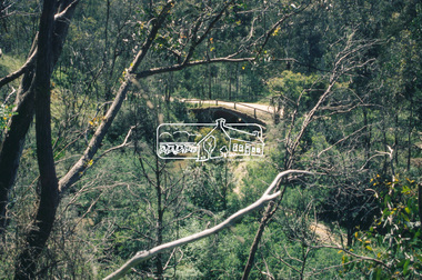
Slide - Photograph, Trestle Bridge, Eltham by Walter Withers, c.Nov. 2001
... bridge eltham trestle bridge trestle bridge Walter Withers 35mm ...Part of a slide show presentation "A Trip Down the Diamond Creek" by Russell Yeoman to the Eltham District Historical Society meeting of 14 Nov. 200135mm colour positive transparency Mount - Black and Whiteeltham, eltham railway trestle bridge, eltham trestle bridge, trestle bridge, walter withers -
 Eltham District Historical Society Inc
Slide - Photograph, Diamond Street Bridge, Eltham, c.Nov. 2001
Part of a slide show presentation "A Trip Down the Diamond Creek" by Russell Yeoman to the Eltham District Historical Society meeting of 14 Nov. 200135mm colour positive transparency Mount - Black and Whiteeltham, diamond street bridge -
 Eltham District Historical Society Inc
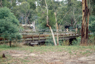
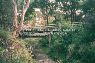
Slide - Photograph, Wattletree Road Bridge, Eltham North, c.Nov. 2001
Part of a slide show presentation "A Trip Down the Diamond Creek" by Russell Yeoman to the Eltham District Historical Society meeting of 14 Nov. 200135mm colour positive transparency Mount - Black and Whiteeltham north, eltham, wattletree road bridge -
 Eltham District Historical Society Inc
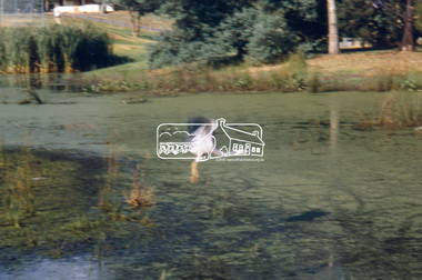
Slide - Photograph, Edendale Bridge, Eltham North, c.Nov. 2001
... Society meeting of 14 Nov. 2001 eltham Edendale Bridge Eltham ...Part of a slide show presentation "A Trip Down the Diamond Creek" by Russell Yeoman to the Eltham District Historical Society meeting of 14 Nov. 200135mm colour positive transparency Mount - Black and Whiteeltham, edendale bridge, eltham north -
 Eltham District Historical Society Inc
Slide - Photograph, Murrays Bridge, Eltham North, c.Nov. 2001
... Society meeting of 14 Nov. 2001 Eltham North murrays bridge 35mm ...Part of a slide show presentation "A Trip Down the Diamond Creek" by Russell Yeoman to the Eltham District Historical Society meeting of 14 Nov. 200135mm colour positive transparency Mount - Black and Whiteeltham north, murrays bridge -
 Eltham District Historical Society Inc
Slide - Photograph, Monash Bridge, Arthurs Creek Road, Hurstbridge, c.Nov. 2001
... Society meeting of 14 Nov. 2001 Monash Bridge Arthurs Creek Road ...Part of a slide show presentation "A Trip Down the Diamond Creek" by Russell Yeoman to the Eltham District Historical Society meeting of 14 Nov. 200135mm colour positive transparency Mount - Black and Whitemonash bridge, arthurs creek road, hurstbridge -
 Eltham District Historical Society Inc
Slide - Photograph, Ferguson's Paddock, Arthurs Creek Road, Hurstbridge, c.Nov. 2001
Part of a slide show presentation "A Trip Down the Diamond Creek" by Russell Yeoman to the Eltham District Historical Society meeting of 14 Nov. 200135mm colour positive transparency Mount - Black and Whitemonash bridge, arthurs creek road, hurstbridge, ferguson's paddock -
 Eltham District Historical Society Inc
Slide - Photograph, Cottles Bridge over Diamond Creek, Cottles Bridge-Strathewan Road, Cottlesbridge, c.Nov. 2001
... transparency Mount - Black and White Cottles Bridge over Diamond Creek ...Part of a slide show presentation "A Trip Down the Diamond Creek" by Russell Yeoman to the Eltham District Historical Society meeting of 14 Nov. 200135mm colour positive transparency Mount - Black and Whitecottles bridge, cottles bridge-strathewan road, cottlesbridge, diamond creek -
 Eltham District Historical Society Inc
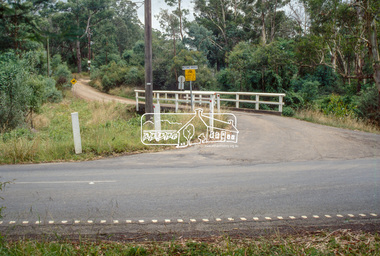
Slide - Photograph, Charlber Lane Bridge, St Andrews, c.Nov. 2001
Part of a slide show presentation "A Trip Down the Diamond Creek" by Russell Yeoman to the Eltham District Historical Society meeting of 14 Nov. 200135mm colour positive transparency Mount - Black and Whitecharlber lane bridge, st andrews -
 Eltham District Historical Society Inc
Slide - Photograph, Mittons Bridge Road, St Andrews, c.Nov. 2001
... Society meeting of 14 Nov. 2001 st andrews Mittons Bridge Road ...Part of a slide show presentation "A Trip Down the Diamond Creek" by Russell Yeoman to the Eltham District Historical Society meeting of 14 Nov. 200135mm colour positive transparency Mount - Black and Whitest andrews, mittons bridge road -
 Eltham District Historical Society Inc
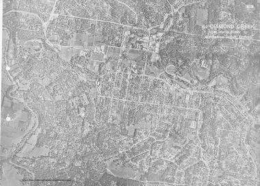
Work on paper (Sub-Item) - Aerial Photograph, Diamond Creek from Yarra River to Wattletree Road, Eltham
Black and white aerial photograph witrh key features around the central place of Eltham township marked inluding Yarra River, Main Road, Bridge Street and Ryans Road, Eltham North land development, real estate, aerial view, eltham, eltham north -
 Eltham District Historical Society Inc
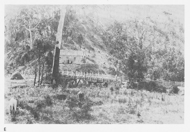
Work on paper (Sub-Item) - Photograph, Arthurs Creek Road Bridge, Hurstbridge, 1885
... melbourne Black and white photograph. bridge Hurstbridge Image ...Black and white photograph.bridge, hurstbridge -
 Eltham District Historical Society Inc
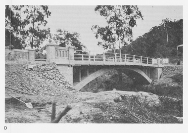
Work on paper (Sub-Item) - Photograph, Monash Bridge, Arthurs Creek Road, Hurstbridge, 1917
Black and white photograph of the new bridge opened in 1917.bridge, hurstbridge -
 Eltham District Historical Society Inc
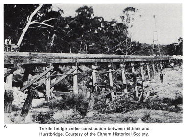
Work on paper (Sub-Item) - Photograph, Trestle bridge under construction between Eltham and Hurstbridge
Black and white photograph of the bridge under construction. The line opened at Hurstbridge in 1912.bridge, hurstbridge -
 Eltham District Historical Society Inc
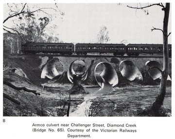
Work on paper (Sub-Item) - Photograph, Armco culvert near Challenger Street, Diamond Creek
Black and white photograph. A passenger train crosses Victorian Railways Bridge No 65 near Challenger Street, Diamond Creek. A series of steel culverts or tunnels carrying a stream have been constructed beneath the railway bridge.bridge, culvert, train, challenger street -
 Eltham District Historical Society Inc
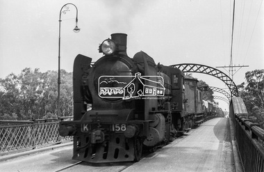
Photograph, Steam locomotive K-158 crossing the railway bridge over the Campaspe River at Rochester, Victoria, c.November 1963, 1963
It is the railway bridge over the Campaspe River at Rochester, Vic. original to the construction of the line. It was taken late on a Saturday morning and shows the regular goods train of that period approaching, then crossing the bridge. I originally planned to take just one view. The approaching train was first then it was a rapid run back along the raised river bank to get the broadside shot. I had little time to steady myself or properly check camera settings, hence the slightly soft focus etc. The train would eventually continue over the Echuca Iron Bridge into NSW. I think its ultimate destination was Deniliquin but not sure.Digital TIFF file Scan of 35mm Ilford FP3 black and white negative transparencygeorge coop collection, k-158, k-class steam locomotive (vr newport workshops), railway bridge, campaspe river, rochester -
 Eltham District Historical Society Inc
Photograph, Steam locomotive K-158 and goods train crossing the Echuca-Moama Road Rail Bridge, November 1963, 1963
Digital TIFF file Scan of 35mm Ilford FP3 black and white negative transparencyechuca-moama road rail bridge, george coop collection, goods train, k-158, k-class steam locomotive (vr newport workshops) -
 Eltham District Historical Society Inc
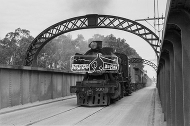
Photograph, Steam locomotive J-500 and goods train crossing the Echuca-Moama Road Rail Bridge, November 1963, 1963
Looking south towards Echuca, Victoria Image dated as November 1963 based on same image in Port of Echuca collection (print 19.5 x 24.5cm) On reverse in blue pen:" Photo by: George L. Coop Nov 1963". In red pen top left hand corner"Ch 11, (circled number )1. In pencil circled: "35". In pencil : " J Class. Intro Scotland 1948 early 50s." https://victoriancollections.net.au/items/59deb0d421ea6e12dc488c2fDigital TIFF file Scan of 35mm Ilford FP3 black and white negative transparencyechuca-moama road rail bridge, george coop collection, goods train, j-500, j-class steam locomotive (vulcan foundry) -
 Eltham District Historical Society Inc
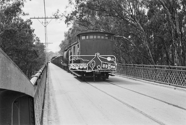
Photograph, Steam locomotive J-500 and goods train crossing the Echuca-Moama Road Rail Bridge, November 1963, 1963
View at guard’s van end of steam train moving over the Echuca Iron Bridge looking north into Moama, New South Wales.Digital TIFF file Scan of 35mm Ilford FP3 black and white negative transparencyechuca-moama road rail bridge, george coop collection, goods train, j-500, j-class steam locomotive (vulcan foundry)