Showing 10890 items
matching land
-
 Rutherglen Historical Society
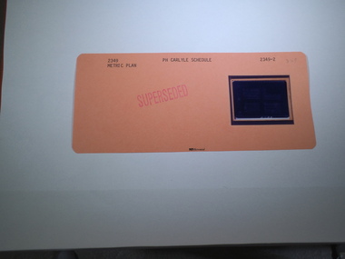
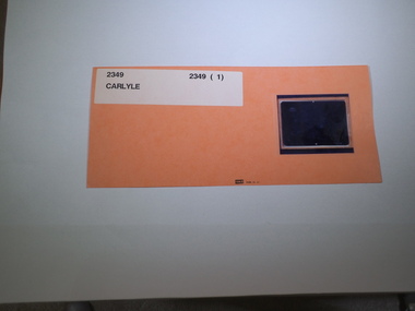
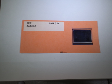
Aperture Card microfilm, Victorian Land Tiltes Office, Parish Schedule Carlyle (Superseded)
Schedule for Carlylecard with a single microfilm insertschedule -
 Rutherglen Historical Society
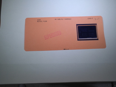
Aperture Card microfilm, Victorian Land Tiltes Office, Parish Schedule Carlyle (Superseded)
Schedule for Carlylecard with a single microfilm insertschedule -
 Rutherglen Historical Society
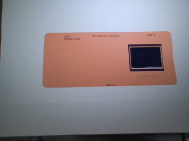
Aperture Card microfilm, Victorian Land Tiltes Office, Parish Schedule Carlyle, 11/07/2000
Schedule for Carlylecard with a single microfilm insertschedule -
 Rutherglen Historical Society
Aperture Card microfilm, Victorian Land Tiltes Office, Parish Schedule Carlyle
Schedule for Carlylecard with a single microfilm insertschedule -
 Rutherglen Historical Society
Aperture Card microfilm, Victorian Land Tiltes Office, Parish Schedule Carlyle
Schedule for Carlylecard with a single microfilm insertschedule -
 Rutherglen Historical Society
Aperture Card microfilm, Victorian Land Tiltes Office, Parish Schedule Carlyle
Schedule for Carlylecard with a single microfilm insertschedule -
 Rutherglen Historical Society
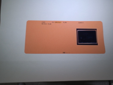
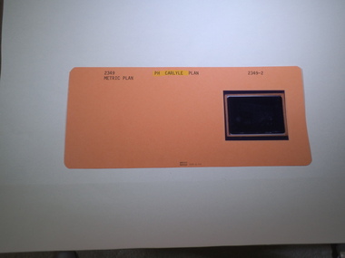
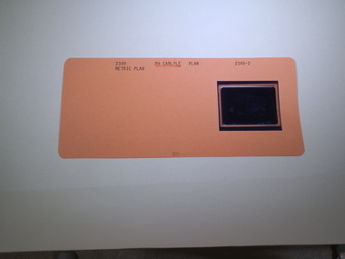
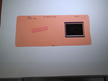
Aperture Card microfilm, Victorian Land Tiltes Office, Parish Plan Carlyle
Town layout of Carlylecard with a single microfilm insertplan, town, boundries, lots, roads -
 Rutherglen Historical Society
Aperture Card microfilm, Victorian Land Tiltes Office, Parish Plan Carlyle
Town layout of Carlylecard with a single microfilm insertplan, town, boundries, lots, roads -
 Rutherglen Historical Society
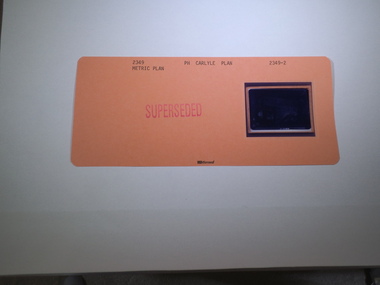
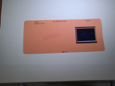
Aperture Card microfilm, Victorian Land Tiltes Office, Parish Plan Carlyle (Superseded)
Town layout of Carlylecard with a single microfilm insertplan, town, boundries, lots, roads -
 Rutherglen Historical Society
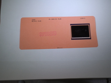
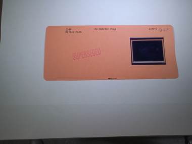
Aperture Card microfilm, Victorian Land Tiltes Office, Parish Plan Carlyle (Superseded)
Town layout of Carlylecard with a single microfilm insertplan, town, boundries, lots, roads -
 Rutherglen Historical Society
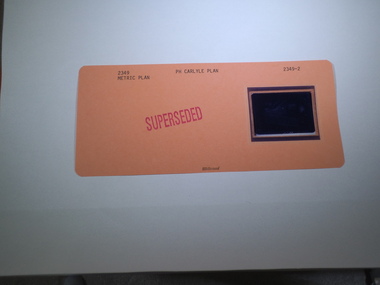
Aperture Card microfilm, Victorian Land Tiltes Office, Parish Plan Carlyle (Superseded)
Town layout of Carlylecard with a single microfilm insertplan, town, boundries, lots, roads -
 Rutherglen Historical Society
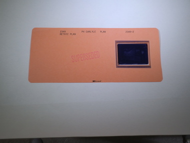
Aperture Card microfilm, Victorian Land Tiltes Office, Parish Plan Carlyle (Superseded)
Town layout of Carlylecard with a single microfilm insertplan, town, boundries, lots, roads -
 Rutherglen Historical Society
Aperture Card microfilm, Victorian Land Tiltes Office, Parish Plan Carlyle (Superseded)
Town layout of Carlylecard with a single microfilm insertplan, town, boundries, lots, roads -
 Rutherglen Historical Society
Aperture Card microfilm, Victorian Land Tiltes Office, Parish Plan Carlyle (Superseded)
Town layout of Carlylecard with a single microfilm insertplan, town, boundries, lots, roads -
 Rutherglen Historical Society
Aperture Card microfilm, Victorian Land Tiltes Office, Parish Plan Carlyle (Superseded)
Town layout of Carlylecard with a single microfilm insertplan, town, boundries, lots, roads -
 Rutherglen Historical Society
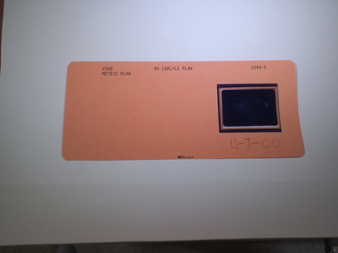
Aperture Card microfilm, Victorian Land Tiltes Office, Parish Plan Carlyle (Superseded), 11/07/2000
Town layout of Carlylecard with a single microfilm insertplan, town, boundries, lots, roads -
 Southern Sherbrooke Historical Society Inc.
Map, Dept of land s & Survey, Dandenong Ranges Area Sheet 28, Jan-56
Owned by David Walker, previously of Menzies Creek. Given by him to Rex Breen in 2001 for donation to society.Aerial survey map of parts of Gembrook, Monbulk and Naree Worran parishes (Victoria). Scale: 10 chains to 1 inch, contour interval 20 feet. Shows Menzies Creek and parts of Kallista, Clematis, Selby and Belgrave South. Ringwood D2C or 849D2C, Zone 7"16563" in pen on top left corner of reverse. -
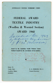 National Wool Museum
Book - Federal Award Textile Industry (Woollen & Worsted Section) Award 1968, Australian Textile Workers’ Union Federal Council, 1968
Thirty six page booklet with printed black and white text. Front and back cover is blue with printed black text. Handwritten text in blue and red is also shown on the front. front: [printed] AUSTRALIAN TEXTILE WORKERS’ UNION / FEDERAL AWARD / TEXTILE INDUSTRY / (Woollen & Worsted Section) / AWARD 1968unions, textile workers union, award, legal document, textile industry, woollen, worsted -
University of Melbourne, Burnley Campus Archives
Poster, CSIRO et al, Australian Soil, Unknown
csiro, soils, soil classification, soil orders -
University of Melbourne, Burnley Campus Archives
Pamphlet - Symposium, Melbourne School of Land and Environment, Symposia on Contemporary Issues in Urban Landscapes, April 2013
horticulture, 150th celebrations, burnley gardens -
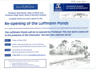 University of Melbourne, Burnley Campus Archives
Card - Invitation, The University of Melbourne et al, Re-Opening of the Luffmann Ponds, 01.05.2010-14.05.2010
luffmann ponds, refurbishment, rick roush, nigel stork, alex chernov, barry jones -
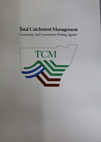 Wodonga & District Historical Society Inc
Booklet - Total Catchment Management: Community and Government Working Together, Department of Conservation and Land Management, C. 1993
Information sheets outlining the need for Total Catchment Management and what this approach means for management into the future,non-fictionInformation sheets outlining the need for Total Catchment Management and what this approach means for management into the future,catchment management, water resources australia -
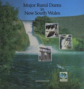 Wodonga & District Historical Society Inc
Book - Major Rural Dams In New South Wales, Department of Land and Water Conservation, NSW, 1996
A pictorial examination of key dams established throughout New South Wales as part of approaches to water management in the state.non-fictionA pictorial examination of key dams established throughout New South Wales as part of approaches to water management in the state.dams new south wales, water management, water conservation -
 Wodonga & District Historical Society Inc
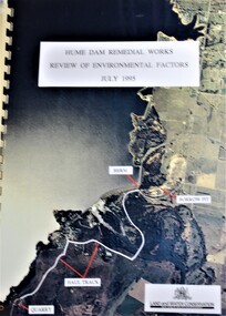
Booklet - Hume Dam Remedial Works - Review of Environmental Factors July 1995, Department of Land and Water Conservation, NSW Government, July 1995
The findings of a review into the environmental impact of remedial works being carried out on the Hume Dam.non-fictionThe findings of a review into the environmental impact of remedial works being carried out on the Hume Dam.hume dam, remedial works dams, environmental impact of dams -
 Wodonga & District Historical Society Inc
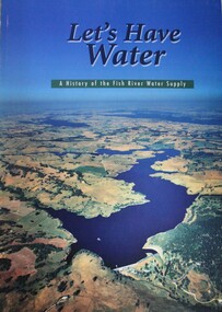
Book - Let's Have Water - A history of the Fish River Water Supply, Robin McLachlan, Denis Barrett, Jack Domis, Nick Welling, 1997
A history of the development of the management of the Fish River Water Supply Scheme in Central NSW. The scheme extends across the local government areas of the Shire of Oberon, the City of Lithgow and the City of the Blue Mountains.non-fictionA history of the development of the management of the Fish River Water Supply Scheme in Central NSW. The scheme extends across the local government areas of the Shire of Oberon, the City of Lithgow and the City of the Blue Mountains.water nsw, fish river region nsw, oberon dam, water resources development nsw australia -
Lakes Entrance Historical Society
Book, East Gippsland Regional Catchment & Land Planning Board, Draft Regional Catchment Strategy 1996, 1996
Draft of regional catchment strategyPaperback 58 pageswaterways, planning committee -
Lakes Entrance Historical Society
Book, Department of Conservation Forests and Land with Save the Gippsland Lakes Committee, Gippsland Lakes Algal Bloom Seminar Discussion Paper 1988, 1988
Collected submissions and discussion papers from the Gippsland Lakes Algal Bloom Seminar held in Bairnsdalemanagement, waterways -
Lakes Entrance Historical Society
Book, Land Conservation Council, Final Recommendations Alpine Area, 1979
Final recommendations for Alpine Area from Land Conservation Council of Victoria told on text and mapsBlue cover 89 pages plus mapsnon-fictionFinal recommendations for Alpine Area from Land Conservation Council of Victoria told on text and mapsland conservation, reports, recommendations -
 Eltham District Historical Society Inc
Ledger, Eltham Road District. Assessment for the Year ending Oct. 14th, 1862, 1861c
The Eltham Roads Board was established in 1856. This is a unique significant record of early settlers in the Shire of Eltham. One of 6 early rate books. This is among the oldest items in the EDHS collection. An article in the Eltham and Whittlesea Shires Advertiser Friday 21 Nov 1941 Page 5 titled: District's Early History states: "The first rate book which is still in existence at the Shire Office is for the year ending October 14, 1858 and is probably the best record possible to indicate the development of the district. At the time properties were rated as follows: Cultivated land. 6d. per acre; pasture land, 1d. per acre: estimated annual value of buildings, etc., 6d in the (pound). The total amount of rate recorded for the year was (pounds)153/14/8. Properties were described as being situated at Lower Plenty, Yarra Yarra, Eltham, Lower Eltham, Kangaroo Ground, Yarra Flats, Diamond Creek and the Yarra."Ledger with printed columns: Number, Name of Occupier, Description, Where situated, Cultivated land, Pasture land, Estimated annual value of buildings, Rate, Remarks, Arrears collected, excused, unoccupied, uncollected and amount actually collected. Ledger filled out by hand with 184 entries (not alphabetically arranged) and summary section. A number of blank pages are included. Inside cover includes pasted printed note: RATE OF ASSESSMENT AS FOLLOWS: Cultivated land 6d per acre Pasture land 1/2d per acre Unalienated Pasture Land 1/28 per Acre Estimated Annual Value of Buildings, &c., 6d. in the Pound eltham roads board, rate book, rate payers, transaction, pioneers, settlers, 1862, assessment ledger, eltham road district, public records office victoria (prov), rate books, shire of eltham archives -
 Eltham District Historical Society Inc
Ledger, Eltham Road District. Assessment for the Year ending Oct. 14th, 1863, 1862c
The Eltham Roads Board was established in 1856. This is a unique significant record of early settlers in the Shire of Eltham. One of 6 early rate books. This is among the oldest items in the EDHS collection. An article in the Eltham and Whittlesea Shires Advertiser Friday 21 Nov 1941 Page 5 titled: District's Early History states: "The first rate book which is still in existence at the Shire Office is for the year ending October 14, 1858 and is probably the best record possible to indicate the development of the district. At the time properties were rated as follows: Cultivated land. 6d. per acre; pasture land, 1d. per acre: estimated annual value of buildings, etc., 6d in the (pound). The total amount of rate recorded for the year was (pounds)153/14/8. Properties were described as being situated at Lower Plenty, Yarra Yarra, Eltham, Lower Eltham, Kangaroo Ground, Yarra Flats, Diamond Creek and the Yarra."Ledger with printed columns: Number, Name of Occupier, Description, Where situated, Cultivated land, Pasture land, Estimated annual value of buildings, Rate, Remarks, Arrears collected, excused, unoccupied, uncollected and amount actually collected. Ledger filled out by hand with 181 entries (not alphabetically arranged) and summary section. A number of blank pages are included. Inside cover includes pasted printed note: RATE OF ASSESSMENT AS FOLLOWS: Cultivated land 6d per acre Pasture land 1/2d per acre Unalienated Pasture Land 1/28 per Acre Estimated Annual Value of Buildings, &c., 6d. in the Pound eltham roads board, rate book, rate payers, transaction, pioneers, settlers, 1863, assessment ledger, eltham road district, public records office victoria (prov), rate books, shire of eltham archives