Showing 731 items matching "baptist"
-
 Eltham District Historical Society Inc
Photograph - Aerial Photograph, Landata, Eltham; Crown Allotment 15, Section 5, Parish of Nillumbik (Stokes Orchard Estate), Feb. 1979
Centred on present day Diosma Rd, Stokes Pl, Nyora Rd and Eucalyptus Rd Historic Aerial Imagery Source: Landata.vic.gov.au Aerial Photo Details: Project No :1716 Project : WESTERN PORT FORESHORES Run : 15 Frame : 91 Date : 02/1979 Film Type : B/W Camera : RC8 Flying Height : 5500 Scale : 10000 Film Number : 3286 GDA2020 : 37°42'47"S, 145°09'57"E MGA2020 : 338339, 5824447 (55) Melways : 22 C4 (ed. 42) A History of the Development of Crown Allotment 15, Section 5, Parish of Nillumbik – Stokes Orchard Crown Allotment 15, Section 5, Parish of Nillumbik (CA15) is a square allotment of 158 acres or approximately a quarter of a square mile. It lies just beyond the eastern end of Pitt Street, south of Nyora Road to the northern end of Eucalyptus Road and extends east from Eucalyptus Road to Reynolds Road. The topography of CA15 is generally steep, sloping up to a hill near the centre of the land, the ridgeline passing through the properties along the southern side of Diosma Road. Eucalyptus Road is a straight north-south road with its northern end at the north west corner of CA15. Until the end of the 1970s this road was an un-named Government Road and was largely not open to traffic. With residential development in the 1970s the road was constructed, and the council allocated the name obviously in recognition of the predominant species of the local bushland. CA15 was purchased from the Crown by George D’Arley Boursiquot, a prominent Melbourne printer, on 28th October 1852. On November 23, 1922, former Member for Gippsland and Melbourne Real Estate Agent, Hubert Patrick Keogh purchased the allotment then sold it March 13, 1925, to local farmer, Robert David Taylor, a former Shire of Eltham Councillor (1911-1920) and Shire President (1919). Taylor had extensive land holdings stretching west towards Bible Street and Main Road. The Taylor home was situated at the top of the hill in Bible Street at present day 82 Bible Street. At the time of Taylor’s purchase in 1925, CA15 was subdivided into 48 lots that could be described as small rural properties or large residential lots. A typical lot size was one hectare or 2.5 acres. The subdivision created two roads, Nyora Road, and Diosma Road, each following an irregular alignment between Eucalyptus and Reynolds Roads. However, the lots were not sold off separately nor were the roads constructed. The land effectively remained as one parcel for many further years. Robert David Taylor died November 30, 1934, and probate was granted to his son of the same name, Robert David Taylor of Bible Street, Salesman and William McLelland Vance Taylor of 73 Emmeline Street, Northcote, Clerk, with the transfer of the land into their names on July 8, 1935. Frank Stokes worked as a qualified accountant at Kennons leather factory in Burnley, while living at 1 Thomas Street, Mitcham. He suffered from migraines and wanted to return to working the land (he had previously worked on farms and orchards since coming to Australia from England in 1926, both in WA and Vic.). He first travelled to the district by train in July 1942 to find land with the intention to establish an orchard. By chance he met Arthur Bird of Bird Orchard (bounded by Pitt Street, Eucalyptus Road, and Wattle Grove) and they got talking over their common interest. Arthur put Frank up for the night and pointed out the land, 158 acres- part of the Taylor Estate- £900, Crown Allotment 15, Section 5, Parish of Nillumbik (CA15) somewhat diagonally opposite Bird Orchard. Stokes applied through the Riverina Agency to purchase the land who in turn applied for permission from Canberra to sell as there was a new government regulation introduced during the Second World War banning land sales except for immediate production. Stokes obtained a loan on his Mitcham house of £600 @ 5% and paid £450 deposit with quarterly payments of £15 spread over 5 years. Stokes was assisted and advised by Arthur Bird who farmed the neighbouring orchard. In early 1943 Stokes took possession and would catch the train out to Eltham on Fridays after work and began building a hut on the corner of Nyora Road and the Government Road (Eucalyptus Road) for shelter and to lock up tools. He established an orchard on the central western part of the land through the centre of which ran a natural waterway (part of the present-day linear park) and was able to pay a neighbour (Hawkins) to help with clearing and fencing 25 acres, and with a horse and single furrowed plough, planted approximately 2,500 fruit trees - cherries, peaches, plums, almonds, pears, apricots and lemons as well as a few apples and oranges; a massive task. Aerial photographs from the 1940s through to the 1990s clearly show the orchard with most of the larger CA15 site remaining as natural bushland. A huge problem was hares and rabbits eating all the new buds off the tiny trees. As well as laying poison he painted the trees with a mixture of cow manure and lime, often working by moonlight. Procurement of wire and wire netting was difficult because of the war but after much effort he obtained a permit from the Agricultural Department for supplies in March 1944. In February 1945 Stokes applied for a permit to build a “packing shed” as no house building was allowed. It was to be 33 feet x 21 feet and cost £312. It was constructed mostly from second-hand materials, which were hard to obtain, especially iron for roofing. Stokes finished work at Kennons on October 31, 1945, and in March 1946 he sold the family home at Mitcham for £1,230 plus £170 for furniture. On May 15, 1946, title to the CA15 property was issued to Frank Howard Alfred Stokes, Orchardist and Gladys Ethel Stokes, Married Woman, both of Pitt Street, Eltham. The family of five then moved into the very unfinished “packing shed” at Eltham, which was a struggle to weatherproof. Eventually rooms were divided off and lined with hessian bags and whitewashed. Their income was firewood (cut and sold), selling rockery stones and cut Sweet Bursaria. (It was discovered during the 1940s that Sweet Bursaria contained the sunscreen compound Aesculin. The RAAF utilised this compound from Sweet Bursaria during WW2 for pilots and gunners.) The orchard’s first fruit sale was a half-case of Le Vanq peaches in December 1947 for the price of 8 shillings. In 1956 plans for house were drawn and Glen Iris bricks purchased (1956 Olympic Rings variant). The building of the house commenced in 1957 - 12 feet of original packing shed was removed – and was completed in 1959. Water was connected from newly built pressure storage on the property at the end of 1959 and the electricity connection for the first time at 3pm on April 29, 1960. The house remains to present day (somewhat modified) at 1 Nyora Road, home to Nyora Studio Gallery. On occasions, spare remnants of the 1956 bricks have been known to be unearthed in gardens on the estate as they were utilised by Frank Stokes to fill in rabbit holes. On May 26, 1950, a parcel of land was compulsorily acquired by the Melbourne and Metropolitan Board of Works on the hilltop to establish an easement for a high-level service reservoir to augment Eltham’s water supply. The project also included pipe tracks for the necessary water mains. The reservoir has now been superseded by higher level water tanks east of Reynolds Road and its former site is now a public reserve. On November 27, 1964, the State Electricity Commission served notice to compulsorily acquire a further parcel through the eastern part of the land for a major electricity transmission line that augmented supply from the La Trobe Valley to Melbourne. The easement was registered February 11, 1966. The easement was widened July 18, 1969 for a second transmission line to be constructed. In 1971 Melbourne Metropolitan Planning Scheme amendments adopted Nyora Road as the boundary between a residential zone to the north and a rural zone to the south. This determined the future development of the land. In the mid-1970s the Shire of Eltham divided the orchard into numerous rate-able parcel lots, the 48 lots having been established in 1925 and the subsequent rates assessment proved unsustainable for Stokes. He commenced selling lots outside the boundary of the orchard, north of Diosma and South of Nyora. However shortly later the land between Nyora and Diosma Roads and west of the electricity easement was sold and subdivided into residential lots, a housing development by Macquarie Builders and marketed as the Stokes Orchard Estate. New streets were created, and most were named after trees, although one, Stokes Place, commemorates the former owners. The development was undertaken in two stages; Stage 1 (1975) encompassing Scarlet Ash Court, Ironbark Close and Peppermint Grove bounded by Nyora and Eucalyptus roads and Stage 2 (1978) encompassing Stokes Place, Orchard Way, The Crest and The Lookout bound by Nyora and Diosma roads. The developer, Macquarie Builders went bankrupt shortly after the release of Stage 2 leaving many purchasers to fend for themselves and arrange for their own independent builders. There were also difficulties with sewerage for the land immediately south of Diosma Road and so the conventional residential lots were abandoned in favour of larger lots. The development of Orchard Way, The Crest and The Lookout did not proceed as planned and the proposed lots were incorporated into five-acre parcels instead. These included a low-density group housing development by the Graves family and the award winning Choong House (1983) with Gordon Ford developed garden immediately next door situated on the ridge of the hill nestled amongst the original bush, Eucalypt trees and Sweet Bursaria. In 1994, Nillumbik Shire Council applied Significant Environment and Significant Landscape overlays upon the properties on the south side of Diosma Road to ensure protection of this natural bush garden environment. With the arrival of the sewer along Diosma Road in the 1990s, most of these five-acre parcels have since been subdivided multiple times. The Choong house presently sits on a 2.7-acre property, which in 2022 Nillumbik Council nominated for Cultural Significance Heritage protection and is considered potentially significant at State level. The Stokes family were also associated with the Eltham Christian Church. In the 1970s this church had met in temporary premises in Eltham. Lots of the original 1925 subdivision remained south of Nyora Road and a number of these lots were utilized for the Eltham Christian School, which was established by the Eltham Christian Church in 1981. The school operated on this site until 2000. The premises are now used by The Vine Baptist Church. By the mid-1980s the whole of CA15 had been developed for residential and school purposes, except for the sections north of Diosma Road and between the transmission lines and Reynolds Road. Sewerage issues had been resolved for the section north of Diosma Road and in 1987 it was in the process of being subdivided into residential lots. The development coincided with the discovery of colonies of the rare and endangered Eltham Copper Butterfly on the site. This resulted in a community and political campaign to save the butterfly habitat. With the co-operation of the land developer the subdivision was altered to create two bushland reserves in the critical butterfly habitat areas. In the late 1980s the State Government was investigating options for establishing a metropolitan ring road link between Diamond Creek and Ringwood. The chosen route was adjacent to Reynolds Road and so this created a freeze on development of CA15 between Reynolds Road and the electricity easement. The ring road proposal was eventually abandoned, and this part of the land was subdivided into low density residential lots. Diosma Road has been discontinued at the electricity easement and the eastern part incorporated into View Mount Court with access from Reynolds Road. The whole of CA15 has now been developed for residential or associated purposes, ranging from conventional density to quite low density south of Nyora Road. Some remnants of the orchard remain, a few cherry trees on the Graves property and a lone apple tree in Stokes Place. The butterfly reserves comprise significant areas of remnant bushland. Linear reserves through the estate link with central Eltham via the Woodridge linear reserve and with Research along the electricity easement. CA15 as it exists today has a complicated history of rural use, Government acquisition, urban development, and community action. References: • “Stokes Orchard, an incomplete history”; Russell Yeoman with Doug Orford • Correspondence, Beryl Bradbury (nee Stokes) • Aerial Photographs, 1931-1991, Landata (landata.vic.gov.au) • Certificate of Title, Vol. 4930 Fol. 985900 • Plan Number LP 10859 aerial photo, diosma road, eltham copper butterfly, eucalyptus road, ironbark close, nyora road, peppermint grove, peter & elizabeth pidgeon collection, power transmission lines, reynolds road, scarlet ash court, stokes orchard estate, stokes place, woodridge estate, frank stokes -
 Eltham District Historical Society Inc
Photograph - Aerial Photograph, Landata, Eltham; Crown Allotment 15, Section 5, Parish of Nillumbik (Stokes Orchard Estate), Jan. 1984
Centred on present day Diosma Rd, Stokes Pl, Nyora Rd and Eucalyptus Rd Historic Aerial Imagery Source: Landata.vic.gov.au Aerial Photo Details: Project No :1716 Project : WESTERN PORT FORESHORES Run : 15 Frame : 70 Date : 01/1984 Film Type : B/W Camera : RC8 Flying Height : 5300 Scale : 10000 Film Number : 3833 GDA2020 : 37°42'38"S, 145°10'09"E MGA2020 : 338612, 5824719 (55) Melways : 22 D4 (ed. 42) A History of the Development of Crown Allotment 15, Section 5, Parish of Nillumbik – Stokes Orchard Crown Allotment 15, Section 5, Parish of Nillumbik (CA15) is a square allotment of 158 acres or approximately a quarter of a square mile. It lies just beyond the eastern end of Pitt Street, south of Nyora Road to the northern end of Eucalyptus Road and extends east from Eucalyptus Road to Reynolds Road. The topography of CA15 is generally steep, sloping up to a hill near the centre of the land, the ridgeline passing through the properties along the southern side of Diosma Road. Eucalyptus Road is a straight north-south road with its northern end at the north west corner of CA15. Until the end of the 1970s this road was an un-named Government Road and was largely not open to traffic. With residential development in the 1970s the road was constructed, and the council allocated the name obviously in recognition of the predominant species of the local bushland. CA15 was purchased from the Crown by George D’Arley Boursiquot, a prominent Melbourne printer, on 28th October 1852. On November 23, 1922, former Member for Gippsland and Melbourne Real Estate Agent, Hubert Patrick Keogh purchased the allotment then sold it March 13, 1925, to local farmer, Robert David Taylor, a former Shire of Eltham Councillor (1911-1920) and Shire President (1919). Taylor had extensive land holdings stretching west towards Bible Street and Main Road. The Taylor home was situated at the top of the hill in Bible Street at present day 82 Bible Street. At the time of Taylor’s purchase in 1925, CA15 was subdivided into 48 lots that could be described as small rural properties or large residential lots. A typical lot size was one hectare or 2.5 acres. The subdivision created two roads, Nyora Road, and Diosma Road, each following an irregular alignment between Eucalyptus and Reynolds Roads. However, the lots were not sold off separately nor were the roads constructed. The land effectively remained as one parcel for many further years. Robert David Taylor died November 30, 1934, and probate was granted to his son of the same name, Robert David Taylor of Bible Street, Salesman and William McLelland Vance Taylor of 73 Emmeline Street, Northcote, Clerk, with the transfer of the land into their names on July 8, 1935. Frank Stokes worked as a qualified accountant at Kennons leather factory in Burnley, while living at 1 Thomas Street, Mitcham. He suffered from migraines and wanted to return to working the land (he had previously worked on farms and orchards since coming to Australia from England in 1926, both in WA and Vic.). He first travelled to the district by train in July 1942 to find land with the intention to establish an orchard. By chance he met Arthur Bird of Bird Orchard (bounded by Pitt Street, Eucalyptus Road, and Wattle Grove) and they got talking over their common interest. Arthur put Frank up for the night and pointed out the land, 158 acres- part of the Taylor Estate- £900, Crown Allotment 15, Section 5, Parish of Nillumbik (CA15) somewhat diagonally opposite Bird Orchard. Stokes applied through the Riverina Agency to purchase the land who in turn applied for permission from Canberra to sell as there was a new government regulation introduced during the Second World War banning land sales except for immediate production. Stokes obtained a loan on his Mitcham house of £600 @ 5% and paid £450 deposit with quarterly payments of £15 spread over 5 years. Stokes was assisted and advised by Arthur Bird who farmed the neighbouring orchard. In early 1943 Stokes took possession and would catch the train out to Eltham on Fridays after work and began building a hut on the corner of Nyora Road and the Government Road (Eucalyptus Road) for shelter and to lock up tools. He established an orchard on the central western part of the land through the centre of which ran a natural waterway (part of the present-day linear park) and was able to pay a neighbour (Hawkins) to help with clearing and fencing 25 acres, and with a horse and single furrowed plough, planted approximately 2,500 fruit trees - cherries, peaches, plums, almonds, pears, apricots and lemons as well as a few apples and oranges; a massive task. Aerial photographs from the 1940s through to the 1990s clearly show the orchard with most of the larger CA15 site remaining as natural bushland. A huge problem was hares and rabbits eating all the new buds off the tiny trees. As well as laying poison he painted the trees with a mixture of cow manure and lime, often working by moonlight. Procurement of wire and wire netting was difficult because of the war but after much effort he obtained a permit from the Agricultural Department for supplies in March 1944. In February 1945 Stokes applied for a permit to build a “packing shed” as no house building was allowed. It was to be 33 feet x 21 feet and cost £312. It was constructed mostly from second-hand materials, which were hard to obtain, especially iron for roofing. Stokes finished work at Kennons on October 31, 1945, and in March 1946 he sold the family home at Mitcham for £1,230 plus £170 for furniture. On May 15, 1946, title to the CA15 property was issued to Frank Howard Alfred Stokes, Orchardist and Gladys Ethel Stokes, Married Woman, both of Pitt Street, Eltham. The family of five then moved into the very unfinished “packing shed” at Eltham, which was a struggle to weatherproof. Eventually rooms were divided off and lined with hessian bags and whitewashed. Their income was firewood (cut and sold), selling rockery stones and cut Sweet Bursaria. (It was discovered during the 1940s that Sweet Bursaria contained the sunscreen compound Aesculin. The RAAF utilised this compound from Sweet Bursaria during WW2 for pilots and gunners.) The orchard’s first fruit sale was a half-case of Le Vanq peaches in December 1947 for the price of 8 shillings. In 1956 plans for house were drawn and Glen Iris bricks purchased (1956 Olympic Rings variant). The building of the house commenced in 1957 - 12 feet of original packing shed was removed – and was completed in 1959. Water was connected from newly built pressure storage on the property at the end of 1959 and the electricity connection for the first time at 3pm on April 29, 1960. The house remains to present day (somewhat modified) at 1 Nyora Road, home to Nyora Studio Gallery. On occasions, spare remnants of the 1956 bricks have been known to be unearthed in gardens on the estate as they were utilised by Frank Stokes to fill in rabbit holes. On May 26, 1950, a parcel of land was compulsorily acquired by the Melbourne and Metropolitan Board of Works on the hilltop to establish an easement for a high-level service reservoir to augment Eltham’s water supply. The project also included pipe tracks for the necessary water mains. The reservoir has now been superseded by higher level water tanks east of Reynolds Road and its former site is now a public reserve. On November 27, 1964, the State Electricity Commission served notice to compulsorily acquire a further parcel through the eastern part of the land for a major electricity transmission line that augmented supply from the La Trobe Valley to Melbourne. The easement was registered February 11, 1966. The easement was widened July 18, 1969 for a second transmission line to be constructed. In 1971 Melbourne Metropolitan Planning Scheme amendments adopted Nyora Road as the boundary between a residential zone to the north and a rural zone to the south. This determined the future development of the land. In the mid-1970s the Shire of Eltham divided the orchard into numerous rate-able parcel lots, the 48 lots having been established in 1925 and the subsequent rates assessment proved unsustainable for Stokes. He commenced selling lots outside the boundary of the orchard, north of Diosma and South of Nyora. However shortly later the land between Nyora and Diosma Roads and west of the electricity easement was sold and subdivided into residential lots, a housing development by Macquarie Builders and marketed as the Stokes Orchard Estate. New streets were created, and most were named after trees, although one, Stokes Place, commemorates the former owners. The development was undertaken in two stages; Stage 1 (1975) encompassing Scarlet Ash Court, Ironbark Close and Peppermint Grove bounded by Nyora and Eucalyptus roads and Stage 2 (1978) encompassing Stokes Place, Orchard Way, The Crest and The Lookout bound by Nyora and Diosma roads. The developer, Macquarie Builders went bankrupt shortly after the release of Stage 2 leaving many purchasers to fend for themselves and arrange for their own independent builders. There were also difficulties with sewerage for the land immediately south of Diosma Road and so the conventional residential lots were abandoned in favour of larger lots. The development of Orchard Way, The Crest and The Lookout did not proceed as planned and the proposed lots were incorporated into five-acre parcels instead. These included a low-density group housing development by the Graves family and the award winning Choong House (1983) with Gordon Ford developed garden immediately next door situated on the ridge of the hill nestled amongst the original bush, Eucalypt trees and Sweet Bursaria. In 1994, Nillumbik Shire Council applied Significant Environment and Significant Landscape overlays upon the properties on the south side of Diosma Road to ensure protection of this natural bush garden environment. With the arrival of the sewer along Diosma Road in the 1990s, most of these five-acre parcels have since been subdivided multiple times. The Choong house presently sits on a 2.7-acre property, which in 2022 Nillumbik Council nominated for Cultural Significance Heritage protection and is considered potentially significant at State level. The Stokes family were also associated with the Eltham Christian Church. In the 1970s this church had met in temporary premises in Eltham. Lots of the original 1925 subdivision remained south of Nyora Road and a number of these lots were utilized for the Eltham Christian School, which was established by the Eltham Christian Church in 1981. The school operated on this site until 2000. The premises are now used by The Vine Baptist Church. By the mid-1980s the whole of CA15 had been developed for residential and school purposes, except for the sections north of Diosma Road and between the transmission lines and Reynolds Road. Sewerage issues had been resolved for the section north of Diosma Road and in 1987 it was in the process of being subdivided into residential lots. The development coincided with the discovery of colonies of the rare and endangered Eltham Copper Butterfly on the site. This resulted in a community and political campaign to save the butterfly habitat. With the co-operation of the land developer the subdivision was altered to create two bushland reserves in the critical butterfly habitat areas. In the late 1980s the State Government was investigating options for establishing a metropolitan ring road link between Diamond Creek and Ringwood. The chosen route was adjacent to Reynolds Road and so this created a freeze on development of CA15 between Reynolds Road and the electricity easement. The ring road proposal was eventually abandoned, and this part of the land was subdivided into low density residential lots. Diosma Road has been discontinued at the electricity easement and the eastern part incorporated into View Mount Court with access from Reynolds Road. The whole of CA15 has now been developed for residential or associated purposes, ranging from conventional density to quite low density south of Nyora Road. Some remnants of the orchard remain, a few cherry trees on the Graves property and a lone apple tree in Stokes Place. The butterfly reserves comprise significant areas of remnant bushland. Linear reserves through the estate link with central Eltham via the Woodridge linear reserve and with Research along the electricity easement. CA15 as it exists today has a complicated history of rural use, Government acquisition, urban development, and community action. References: • “Stokes Orchard, an incomplete history”; Russell Yeoman with Doug Orford • Correspondence, Beryl Bradbury (nee Stokes) • Aerial Photographs, 1931-1991, Landata (landata.vic.gov.au) • Certificate of Title, Vol. 4930 Fol. 985900 • Plan Number LP 10859 aerial photo, diosma road, eltham copper butterfly, eucalyptus road, ironbark close, nyora road, peppermint grove, peter & elizabeth pidgeon collection, power transmission lines, reynolds road, scarlet ash court, stokes orchard estate, stokes place, woodridge estate, frank stokes -
 Eltham District Historical Society Inc
Photograph - Aerial Photograph, Landata, Eltham; Crown Allotment 15, Section 5, Parish of Nillumbik (Stokes Orchard Estate), Mar. 1987
Centred on present day Diosma Rd, Stokes Pl, Nyora Rd and Eucalyptus Rd Historic Aerial Imagery Source: Landata.vic.gov.au Aerial Photo Details: Project No :1716 Project : WESTERN PORT FORESHORES Run : 15 Frame : 108 Date : 03/1987 Film Type : B/W Camera : RC10 Flying Height : 5600 Scale : 10000 Film Number : 4102 GDA2020 : 37°43'00"S, 145°10'13"E MGA2020 : 338725, 5824036 (55) Melways : 22 D5 (ed. 42)719 (55) Melways : 22 D4 (ed. 42) A History of the Development of Crown Allotment 15, Section 5, Parish of Nillumbik – Stokes Orchard Crown Allotment 15, Section 5, Parish of Nillumbik (CA15) is a square allotment of 158 acres or approximately a quarter of a square mile. It lies just beyond the eastern end of Pitt Street, south of Nyora Road to the northern end of Eucalyptus Road and extends east from Eucalyptus Road to Reynolds Road. The topography of CA15 is generally steep, sloping up to a hill near the centre of the land, the ridgeline passing through the properties along the southern side of Diosma Road. Eucalyptus Road is a straight north-south road with its northern end at the north west corner of CA15. Until the end of the 1970s this road was an un-named Government Road and was largely not open to traffic. With residential development in the 1970s the road was constructed, and the council allocated the name obviously in recognition of the predominant species of the local bushland. CA15 was purchased from the Crown by George D’Arley Boursiquot, a prominent Melbourne printer, on 28th October 1852. On November 23, 1922, former Member for Gippsland and Melbourne Real Estate Agent, Hubert Patrick Keogh purchased the allotment then sold it March 13, 1925, to local farmer, Robert David Taylor, a former Shire of Eltham Councillor (1911-1920) and Shire President (1919). Taylor had extensive land holdings stretching west towards Bible Street and Main Road. The Taylor home was situated at the top of the hill in Bible Street at present day 82 Bible Street. At the time of Taylor’s purchase in 1925, CA15 was subdivided into 48 lots that could be described as small rural properties or large residential lots. A typical lot size was one hectare or 2.5 acres. The subdivision created two roads, Nyora Road, and Diosma Road, each following an irregular alignment between Eucalyptus and Reynolds Roads. However, the lots were not sold off separately nor were the roads constructed. The land effectively remained as one parcel for many further years. Robert David Taylor died November 30, 1934, and probate was granted to his son of the same name, Robert David Taylor of Bible Street, Salesman and William McLelland Vance Taylor of 73 Emmeline Street, Northcote, Clerk, with the transfer of the land into their names on July 8, 1935. Frank Stokes worked as a qualified accountant at Kennons leather factory in Burnley, while living at 1 Thomas Street, Mitcham. He suffered from migraines and wanted to return to working the land (he had previously worked on farms and orchards since coming to Australia from England in 1926, both in WA and Vic.). He first travelled to the district by train in July 1942 to find land with the intention to establish an orchard. By chance he met Arthur Bird of Bird Orchard (bounded by Pitt Street, Eucalyptus Road, and Wattle Grove) and they got talking over their common interest. Arthur put Frank up for the night and pointed out the land, 158 acres- part of the Taylor Estate- £900, Crown Allotment 15, Section 5, Parish of Nillumbik (CA15) somewhat diagonally opposite Bird Orchard. Stokes applied through the Riverina Agency to purchase the land who in turn applied for permission from Canberra to sell as there was a new government regulation introduced during the Second World War banning land sales except for immediate production. Stokes obtained a loan on his Mitcham house of £600 @ 5% and paid £450 deposit with quarterly payments of £15 spread over 5 years. Stokes was assisted and advised by Arthur Bird who farmed the neighbouring orchard. In early 1943 Stokes took possession and would catch the train out to Eltham on Fridays after work and began building a hut on the corner of Nyora Road and the Government Road (Eucalyptus Road) for shelter and to lock up tools. He established an orchard on the central western part of the land through the centre of which ran a natural waterway (part of the present-day linear park) and was able to pay a neighbour (Hawkins) to help with clearing and fencing 25 acres, and with a horse and single furrowed plough, planted approximately 2,500 fruit trees - cherries, peaches, plums, almonds, pears, apricots and lemons as well as a few apples and oranges; a massive task. Aerial photographs from the 1940s through to the 1990s clearly show the orchard with most of the larger CA15 site remaining as natural bushland. A huge problem was hares and rabbits eating all the new buds off the tiny trees. As well as laying poison he painted the trees with a mixture of cow manure and lime, often working by moonlight. Procurement of wire and wire netting was difficult because of the war but after much effort he obtained a permit from the Agricultural Department for supplies in March 1944. In February 1945 Stokes applied for a permit to build a “packing shed” as no house building was allowed. It was to be 33 feet x 21 feet and cost £312. It was constructed mostly from second-hand materials, which were hard to obtain, especially iron for roofing. Stokes finished work at Kennons on October 31, 1945, and in March 1946 he sold the family home at Mitcham for £1,230 plus £170 for furniture. On May 15, 1946, title to the CA15 property was issued to Frank Howard Alfred Stokes, Orchardist and Gladys Ethel Stokes, Married Woman, both of Pitt Street, Eltham. The family of five then moved into the very unfinished “packing shed” at Eltham, which was a struggle to weatherproof. Eventually rooms were divided off and lined with hessian bags and whitewashed. Their income was firewood (cut and sold), selling rockery stones and cut Sweet Bursaria. (It was discovered during the 1940s that Sweet Bursaria contained the sunscreen compound Aesculin. The RAAF utilised this compound from Sweet Bursaria during WW2 for pilots and gunners.) The orchard’s first fruit sale was a half-case of Le Vanq peaches in December 1947 for the price of 8 shillings. In 1956 plans for house were drawn and Glen Iris bricks purchased (1956 Olympic Rings variant). The building of the house commenced in 1957 - 12 feet of original packing shed was removed – and was completed in 1959. Water was connected from newly built pressure storage on the property at the end of 1959 and the electricity connection for the first time at 3pm on April 29, 1960. The house remains to present day (somewhat modified) at 1 Nyora Road, home to Nyora Studio Gallery. On occasions, spare remnants of the 1956 bricks have been known to be unearthed in gardens on the estate as they were utilised by Frank Stokes to fill in rabbit holes. On May 26, 1950, a parcel of land was compulsorily acquired by the Melbourne and Metropolitan Board of Works on the hilltop to establish an easement for a high-level service reservoir to augment Eltham’s water supply. The project also included pipe tracks for the necessary water mains. The reservoir has now been superseded by higher level water tanks east of Reynolds Road and its former site is now a public reserve. On November 27, 1964, the State Electricity Commission served notice to compulsorily acquire a further parcel through the eastern part of the land for a major electricity transmission line that augmented supply from the La Trobe Valley to Melbourne. The easement was registered February 11, 1966. The easement was widened July 18, 1969 for a second transmission line to be constructed. In 1971 Melbourne Metropolitan Planning Scheme amendments adopted Nyora Road as the boundary between a residential zone to the north and a rural zone to the south. This determined the future development of the land. In the mid-1970s the Shire of Eltham divided the orchard into numerous rate-able parcel lots, the 48 lots having been established in 1925 and the subsequent rates assessment proved unsustainable for Stokes. He commenced selling lots outside the boundary of the orchard, north of Diosma and South of Nyora. However shortly later the land between Nyora and Diosma Roads and west of the electricity easement was sold and subdivided into residential lots, a housing development by Macquarie Builders and marketed as the Stokes Orchard Estate. New streets were created, and most were named after trees, although one, Stokes Place, commemorates the former owners. The development was undertaken in two stages; Stage 1 (1975) encompassing Scarlet Ash Court, Ironbark Close and Peppermint Grove bounded by Nyora and Eucalyptus roads and Stage 2 (1978) encompassing Stokes Place, Orchard Way, The Crest and The Lookout bound by Nyora and Diosma roads. The developer, Macquarie Builders went bankrupt shortly after the release of Stage 2 leaving many purchasers to fend for themselves and arrange for their own independent builders. There were also difficulties with sewerage for the land immediately south of Diosma Road and so the conventional residential lots were abandoned in favour of larger lots. The development of Orchard Way, The Crest and The Lookout did not proceed as planned and the proposed lots were incorporated into five-acre parcels instead. These included a low-density group housing development by the Graves family and the award winning Choong House (1983) with Gordon Ford developed garden immediately next door situated on the ridge of the hill nestled amongst the original bush, Eucalypt trees and Sweet Bursaria. In 1994, Nillumbik Shire Council applied Significant Environment and Significant Landscape overlays upon the properties on the south side of Diosma Road to ensure protection of this natural bush garden environment. With the arrival of the sewer along Diosma Road in the 1990s, most of these five-acre parcels have since been subdivided multiple times. The Choong house presently sits on a 2.7-acre property, which in 2022 Nillumbik Council nominated for Cultural Significance Heritage protection and is considered potentially significant at State level. The Stokes family were also associated with the Eltham Christian Church. In the 1970s this church had met in temporary premises in Eltham. Lots of the original 1925 subdivision remained south of Nyora Road and a number of these lots were utilized for the Eltham Christian School, which was established by the Eltham Christian Church in 1981. The school operated on this site until 2000. The premises are now used by The Vine Baptist Church. By the mid-1980s the whole of CA15 had been developed for residential and school purposes, except for the sections north of Diosma Road and between the transmission lines and Reynolds Road. Sewerage issues had been resolved for the section north of Diosma Road and in 1987 it was in the process of being subdivided into residential lots. The development coincided with the discovery of colonies of the rare and endangered Eltham Copper Butterfly on the site. This resulted in a community and political campaign to save the butterfly habitat. With the co-operation of the land developer the subdivision was altered to create two bushland reserves in the critical butterfly habitat areas. In the late 1980s the State Government was investigating options for establishing a metropolitan ring road link between Diamond Creek and Ringwood. The chosen route was adjacent to Reynolds Road and so this created a freeze on development of CA15 between Reynolds Road and the electricity easement. The ring road proposal was eventually abandoned, and this part of the land was subdivided into low density residential lots. Diosma Road has been discontinued at the electricity easement and the eastern part incorporated into View Mount Court with access from Reynolds Road. The whole of CA15 has now been developed for residential or associated purposes, ranging from conventional density to quite low density south of Nyora Road. Some remnants of the orchard remain, a few cherry trees on the Graves property and a lone apple tree in Stokes Place. The butterfly reserves comprise significant areas of remnant bushland. Linear reserves through the estate link with central Eltham via the Woodridge linear reserve and with Research along the electricity easement. CA15 as it exists today has a complicated history of rural use, Government acquisition, urban development, and community action. References: • “Stokes Orchard, an incomplete history”; Russell Yeoman with Doug Orford • Correspondence, Beryl Bradbury (nee Stokes) • Aerial Photographs, 1931-1991, Landata (landata.vic.gov.au) • Certificate of Title, Vol. 4930 Fol. 985900 • Plan Number LP 10859 aerial photo, diosma road, eltham copper butterfly, eucalyptus road, ironbark close, nyora road, peppermint grove, peter & elizabeth pidgeon collection, power transmission lines, reynolds road, scarlet ash court, stokes orchard estate, stokes place, woodridge estate, frank stokes -
 Eltham District Historical Society Inc
Photograph - Aerial Photograph, Landata, Eltham; Crown Allotment 15, Section 5, Parish of Nillumbik (Stokes Orchard Estate), Sep. 1991
Centred on present day Diosma Rd, Stokes Pl, Nyora Rd and Eucalyptus Rd Historic Aerial Imagery Source: Landata.vic.gov.au Aerial Photo Details: Project No :2072 Project : MELBOURNE PROJECT Run : 13 Frame : 119 Date : 09/1991 Film Type : COL Camera : RC10 Flying Height : 8300 Scale : 15000 Film Number : 4419 GDA2020 : 37°43'07"S, 145°09'35"E MGA2020 : 337812, 5823811 (55) Melways : 22 B6 (ed. 42) A History of the Development of Crown Allotment 15, Section 5, Parish of Nillumbik – Stokes Orchard Crown Allotment 15, Section 5, Parish of Nillumbik (CA15) is a square allotment of 158 acres or approximately a quarter of a square mile. It lies just beyond the eastern end of Pitt Street, south of Nyora Road to the northern end of Eucalyptus Road and extends east from Eucalyptus Road to Reynolds Road. The topography of CA15 is generally steep, sloping up to a hill near the centre of the land, the ridgeline passing through the properties along the southern side of Diosma Road. Eucalyptus Road is a straight north-south road with its northern end at the north west corner of CA15. Until the end of the 1970s this road was an un-named Government Road and was largely not open to traffic. With residential development in the 1970s the road was constructed, and the council allocated the name obviously in recognition of the predominant species of the local bushland. CA15 was purchased from the Crown by George D’Arley Boursiquot, a prominent Melbourne printer, on 28th October 1852. On November 23, 1922, former Member for Gippsland and Melbourne Real Estate Agent, Hubert Patrick Keogh purchased the allotment then sold it March 13, 1925, to local farmer, Robert David Taylor, a former Shire of Eltham Councillor (1911-1920) and Shire President (1919). Taylor had extensive land holdings stretching west towards Bible Street and Main Road. The Taylor home was situated at the top of the hill in Bible Street at present day 82 Bible Street. At the time of Taylor’s purchase in 1925, CA15 was subdivided into 48 lots that could be described as small rural properties or large residential lots. A typical lot size was one hectare or 2.5 acres. The subdivision created two roads, Nyora Road, and Diosma Road, each following an irregular alignment between Eucalyptus and Reynolds Roads. However, the lots were not sold off separately nor were the roads constructed. The land effectively remained as one parcel for many further years. Robert David Taylor died November 30, 1934, and probate was granted to his son of the same name, Robert David Taylor of Bible Street, Salesman and William McLelland Vance Taylor of 73 Emmeline Street, Northcote, Clerk, with the transfer of the land into their names on July 8, 1935. Frank Stokes worked as a qualified accountant at Kennons leather factory in Burnley, while living at 1 Thomas Street, Mitcham. He suffered from migraines and wanted to return to working the land (he had previously worked on farms and orchards since coming to Australia from England in 1926, both in WA and Vic.). He first travelled to the district by train in July 1942 to find land with the intention to establish an orchard. By chance he met Arthur Bird of Bird Orchard (bounded by Pitt Street, Eucalyptus Road, and Wattle Grove) and they got talking over their common interest. Arthur put Frank up for the night and pointed out the land, 158 acres- part of the Taylor Estate- £900, Crown Allotment 15, Section 5, Parish of Nillumbik (CA15) somewhat diagonally opposite Bird Orchard. Stokes applied through the Riverina Agency to purchase the land who in turn applied for permission from Canberra to sell as there was a new government regulation introduced during the Second World War banning land sales except for immediate production. Stokes obtained a loan on his Mitcham house of £600 @ 5% and paid £450 deposit with quarterly payments of £15 spread over 5 years. Stokes was assisted and advised by Arthur Bird who farmed the neighbouring orchard. In early 1943 Stokes took possession and would catch the train out to Eltham on Fridays after work and began building a hut on the corner of Nyora Road and the Government Road (Eucalyptus Road) for shelter and to lock up tools. He established an orchard on the central western part of the land through the centre of which ran a natural waterway (part of the present-day linear park) and was able to pay a neighbour (Hawkins) to help with clearing and fencing 25 acres, and with a horse and single furrowed plough, planted approximately 2,500 fruit trees - cherries, peaches, plums, almonds, pears, apricots and lemons as well as a few apples and oranges; a massive task. Aerial photographs from the 1940s through to the 1990s clearly show the orchard with most of the larger CA15 site remaining as natural bushland. A huge problem was hares and rabbits eating all the new buds off the tiny trees. As well as laying poison he painted the trees with a mixture of cow manure and lime, often working by moonlight. Procurement of wire and wire netting was difficult because of the war but after much effort he obtained a permit from the Agricultural Department for supplies in March 1944. In February 1945 Stokes applied for a permit to build a “packing shed” as no house building was allowed. It was to be 33 feet x 21 feet and cost £312. It was constructed mostly from second-hand materials, which were hard to obtain, especially iron for roofing. Stokes finished work at Kennons on October 31, 1945, and in March 1946 he sold the family home at Mitcham for £1,230 plus £170 for furniture. On May 15, 1946, title to the CA15 property was issued to Frank Howard Alfred Stokes, Orchardist and Gladys Ethel Stokes, Married Woman, both of Pitt Street, Eltham. The family of five then moved into the very unfinished “packing shed” at Eltham, which was a struggle to weatherproof. Eventually rooms were divided off and lined with hessian bags and whitewashed. Their income was firewood (cut and sold), selling rockery stones and cut Sweet Bursaria. (It was discovered during the 1940s that Sweet Bursaria contained the sunscreen compound Aesculin. The RAAF utilised this compound from Sweet Bursaria during WW2 for pilots and gunners.) The orchard’s first fruit sale was a half-case of Le Vanq peaches in December 1947 for the price of 8 shillings. In 1956 plans for house were drawn and Glen Iris bricks purchased (1956 Olympic Rings variant). The building of the house commenced in 1957 - 12 feet of original packing shed was removed – and was completed in 1959. Water was connected from newly built pressure storage on the property at the end of 1959 and the electricity connection for the first time at 3pm on April 29, 1960. The house remains to present day (somewhat modified) at 1 Nyora Road, home to Nyora Studio Gallery. On occasions, spare remnants of the 1956 bricks have been known to be unearthed in gardens on the estate as they were utilised by Frank Stokes to fill in rabbit holes. On May 26, 1950, a parcel of land was compulsorily acquired by the Melbourne and Metropolitan Board of Works on the hilltop to establish an easement for a high-level service reservoir to augment Eltham’s water supply. The project also included pipe tracks for the necessary water mains. The reservoir has now been superseded by higher level water tanks east of Reynolds Road and its former site is now a public reserve. On November 27, 1964, the State Electricity Commission served notice to compulsorily acquire a further parcel through the eastern part of the land for a major electricity transmission line that augmented supply from the La Trobe Valley to Melbourne. The easement was registered February 11, 1966. The easement was widened July 18, 1969 for a second transmission line to be constructed. In 1971 Melbourne Metropolitan Planning Scheme amendments adopted Nyora Road as the boundary between a residential zone to the north and a rural zone to the south. This determined the future development of the land. In the mid-1970s the Shire of Eltham divided the orchard into numerous rate-able parcel lots, the 48 lots having been established in 1925 and the subsequent rates assessment proved unsustainable for Stokes. He commenced selling lots outside the boundary of the orchard, north of Diosma and South of Nyora. However shortly later the land between Nyora and Diosma Roads and west of the electricity easement was sold and subdivided into residential lots, a housing development by Macquarie Builders and marketed as the Stokes Orchard Estate. New streets were created, and most were named after trees, although one, Stokes Place, commemorates the former owners. The development was undertaken in two stages; Stage 1 (1975) encompassing Scarlet Ash Court, Ironbark Close and Peppermint Grove bounded by Nyora and Eucalyptus roads and Stage 2 (1978) encompassing Stokes Place, Orchard Way, The Crest and The Lookout bound by Nyora and Diosma roads. The developer, Macquarie Builders went bankrupt shortly after the release of Stage 2 leaving many purchasers to fend for themselves and arrange for their own independent builders. There were also difficulties with sewerage for the land immediately south of Diosma Road and so the conventional residential lots were abandoned in favour of larger lots. The development of Orchard Way, The Crest and The Lookout did not proceed as planned and the proposed lots were incorporated into five-acre parcels instead. These included a low-density group housing development by the Graves family and the award winning Choong House (1983) with Gordon Ford developed garden immediately next door situated on the ridge of the hill nestled amongst the original bush, Eucalypt trees and Sweet Bursaria. In 1994, Nillumbik Shire Council applied Significant Environment and Significant Landscape overlays upon the properties on the south side of Diosma Road to ensure protection of this natural bush garden environment. With the arrival of the sewer along Diosma Road in the 1990s, most of these five-acre parcels have since been subdivided multiple times. The Choong house presently sits on a 2.7-acre property, which in 2022 Nillumbik Council nominated for Cultural Significance Heritage protection and is considered potentially significant at State level. The Stokes family were also associated with the Eltham Christian Church. In the 1970s this church had met in temporary premises in Eltham. Lots of the original 1925 subdivision remained south of Nyora Road and a number of these lots were utilized for the Eltham Christian School, which was established by the Eltham Christian Church in 1981. The school operated on this site until 2000. The premises are now used by The Vine Baptist Church. By the mid-1980s the whole of CA15 had been developed for residential and school purposes, except for the sections north of Diosma Road and between the transmission lines and Reynolds Road. Sewerage issues had been resolved for the section north of Diosma Road and in 1987 it was in the process of being subdivided into residential lots. The development coincided with the discovery of colonies of the rare and endangered Eltham Copper Butterfly on the site. This resulted in a community and political campaign to save the butterfly habitat. With the co-operation of the land developer the subdivision was altered to create two bushland reserves in the critical butterfly habitat areas. In the late 1980s the State Government was investigating options for establishing a metropolitan ring road link between Diamond Creek and Ringwood. The chosen route was adjacent to Reynolds Road and so this created a freeze on development of CA15 between Reynolds Road and the electricity easement. The ring road proposal was eventually abandoned, and this part of the land was subdivided into low density residential lots. Diosma Road has been discontinued at the electricity easement and the eastern part incorporated into View Mount Court with access from Reynolds Road. The whole of CA15 has now been developed for residential or associated purposes, ranging from conventional density to quite low density south of Nyora Road. Some remnants of the orchard remain, a few cherry trees on the Graves property and a lone apple tree in Stokes Place. The butterfly reserves comprise significant areas of remnant bushland. Linear reserves through the estate link with central Eltham via the Woodridge linear reserve and with Research along the electricity easement. CA15 as it exists today has a complicated history of rural use, Government acquisition, urban development, and community action. References: • “Stokes Orchard, an incomplete history”; Russell Yeoman with Doug Orford • Correspondence, Beryl Bradbury (nee Stokes) • Aerial Photographs, 1931-1991, Landata (landata.vic.gov.au) • Certificate of Title, Vol. 4930 Fol. 985900 • Plan Number LP 10859 aerial photo, diosma road, eltham copper butterfly, eucalyptus road, ironbark close, nyora road, peppermint grove, peter & elizabeth pidgeon collection, power transmission lines, reynolds road, scarlet ash court, stokes orchard estate, stokes place, woodridge estate, frank stokes -
 Eltham District Historical Society Inc
Document - Certificate of Title, Landata, Vol. 4930 Fol. 985900, Crown Portion 15 Section 5, Parish of Nillumbik, County of Evelyn, 1925
(Cancelled) Certificate of Title originally issued for Crown Portion 15, Section 5 to Robert David Taylor, of Eltham, County of Evelyn, Farmer, 13 March 1925. It is with this title that the land allotment was subdivided into 48 lots. The title shows the issuance to Robert David Taylor with encumbrance placed upon it by immediate former owner, Hugh Patrick Keogh, a former member for Gippsland and Melbourne Real Estate Agent. Following Taylor's death in 1934 the title passes to his Executors, sons Robert David Taylor of Bible Street, Eltham and William McLelland Vance Taylor of Northcote. The property is then sold to Frank Stokes who develops the Stokes Orchard. Compulsory acquisitions by the Melbourne Metropolitan Board of Works and State Electricity Commission show provisions of easemenst for town water supply and high voltage power transmission lines. Subsequent lots are then sold off with the development of the Stokes Orchard Estate residential development in the mid to late 1970s. A History of the Development of Crown Allotment 15, Section 5, Parish of Nillumbik – Stokes Orchard Crown Allotment 15, Section 5, Parish of Nillumbik (CA15) is a square allotment of 158 acres or approximately a quarter of a square mile. It lies just beyond the eastern end of Pitt Street, south of Nyora Road to the northern end of Eucalyptus Road and extends east from Eucalyptus Road to Reynolds Road. The topography of CA15 is generally steep, sloping up to a hill near the centre of the land, the ridgeline passing through the properties along the southern side of Diosma Road. Eucalyptus Road is a straight north-south road with its northern end at the north west corner of CA15. Until the end of the 1970s this road was an un-named Government Road and was largely not open to traffic. With residential development in the 1970s the road was constructed, and the council allocated the name obviously in recognition of the predominant species of the local bushland. CA15 was purchased from the Crown by George D’Arley Boursiquot, a prominent Melbourne printer, on 28th October 1852. On November 23, 1922, former Member for Gippsland and Melbourne Real Estate Agent, Hubert Patrick Keogh purchased the allotment then sold it March 13, 1925, to local farmer, Robert David Taylor, a former Shire of Eltham Councillor (1911-1920) and Shire President (1919). Taylor had extensive land holdings stretching west towards Bible Street and Main Road. The Taylor home was situated at the top of the hill in Bible Street at present day 82 Bible Street. At the time of Taylor’s purchase in 1925, CA15 was subdivided into 48 lots that could be described as small rural properties or large residential lots. A typical lot size was one hectare or 2.5 acres. The subdivision created two roads, Nyora Road, and Diosma Road, each following an irregular alignment between Eucalyptus and Reynolds Roads. However, the lots were not sold off separately nor were the roads constructed. The land effectively remained as one parcel for many further years. Robert David Taylor died November 30, 1934, and probate was granted to his son of the same name, Robert David Taylor of Bible Street, Salesman and William McLelland Vance Taylor of 73 Emmeline Street, Northcote, Clerk, with the transfer of the land into their names on July 8, 1935. Frank Stokes worked as a qualified accountant at Kennons leather factory in Burnley, while living at 1 Thomas Street, Mitcham. He suffered from migraines and wanted to return to working the land (he had previously worked on farms and orchards since coming to Australia from England in 1926, both in WA and Vic.). He first travelled to the district by train in July 1942 to find land with the intention to establish an orchard. By chance he met Arthur Bird of Bird Orchard (bounded by Pitt Street, Eucalyptus Road, and Wattle Grove) and they got talking over their common interest. Arthur put Frank up for the night and pointed out the land, 158 acres- part of the Taylor Estate- £900, Crown Allotment 15, Section 5, Parish of Nillumbik (CA15) somewhat diagonally opposite Bird Orchard. Stokes applied through the Riverina Agency to purchase the land who in turn applied for permission from Canberra to sell as there was a new government regulation introduced during the Second World War banning land sales except for immediate production. Stokes obtained a loan on his Mitcham house of £600 @ 5% and paid £450 deposit with quarterly payments of £15 spread over 5 years. Stokes was assisted and advised by Arthur Bird who farmed the neighbouring orchard. In early 1943 Stokes took possession and would catch the train out to Eltham on Fridays after work and began building a hut on the corner of Nyora Road and the Government Road (Eucalyptus Road) for shelter and to lock up tools. He established an orchard on the central western part of the land through the centre of which ran a natural waterway (part of the present-day linear park) and was able to pay a neighbour (Hawkins) to help with clearing and fencing 25 acres, and with a horse and single furrowed plough, planted approximately 2,500 fruit trees - cherries, peaches, plums, almonds, pears, apricots and lemons as well as a few apples and oranges; a massive task. Aerial photographs from the 1940s through to the 1990s clearly show the orchard with most of the larger CA15 site remaining as natural bushland. A huge problem was hares and rabbits eating all the new buds off the tiny trees. As well as laying poison he painted the trees with a mixture of cow manure and lime, often working by moonlight. Procurement of wire and wire netting was difficult because of the war but after much effort he obtained a permit from the Agricultural Department for supplies in March 1944. In February 1945 Stokes applied for a permit to build a “packing shed” as no house building was allowed. It was to be 33 feet x 21 feet and cost £312. It was constructed mostly from second-hand materials, which were hard to obtain, especially iron for roofing. Stokes finished work at Kennons on October 31, 1945, and in March 1946 he sold the family home at Mitcham for £1,230 plus £170 for furniture. On May 15, 1946, title to the CA15 property was issued to Frank Howard Alfred Stokes, Orchardist and Gladys Ethel Stokes, Married Woman, both of Pitt Street, Eltham. The family of five then moved into the very unfinished “packing shed” at Eltham, which was a struggle to weatherproof. Eventually rooms were divided off and lined with hessian bags and whitewashed. Their income was firewood (cut and sold), selling rockery stones and cut Sweet Bursaria. (It was discovered during the 1940s that Sweet Bursaria contained the sunscreen compound Aesculin. The RAAF utilised this compound from Sweet Bursaria during WW2 for pilots and gunners.) The orchard’s first fruit sale was a half-case of Le Vanq peaches in December 1947 for the price of 8 shillings. In 1956 plans for house were drawn and Glen Iris bricks purchased (1956 Olympic Rings variant). The building of the house commenced in 1957 - 12 feet of original packing shed was removed – and was completed in 1959. Water was connected from newly built pressure storage on the property at the end of 1959 and the electricity connection for the first time at 3pm on April 29, 1960. The house remains to present day (somewhat modified) at 1 Nyora Road, home to Nyora Studio Gallery. On occasions, spare remnants of the 1956 bricks have been known to be unearthed in gardens on the estate as they were utilised by Frank Stokes to fill in rabbit holes. On May 26, 1950, a parcel of land was compulsorily acquired by the Melbourne and Metropolitan Board of Works on the hilltop to establish an easement for a high-level service reservoir to augment Eltham’s water supply. The project also included pipe tracks for the necessary water mains. The reservoir has now been superseded by higher level water tanks east of Reynolds Road and its former site is now a public reserve. On November 27, 1964, the State Electricity Commission served notice to compulsorily acquire a further parcel through the eastern part of the land for a major electricity transmission line that augmented supply from the La Trobe Valley to Melbourne. The easement was registered February 11, 1966. The easement was widened July 18, 1969 for a second transmission line to be constructed. In 1971 Melbourne Metropolitan Planning Scheme amendments adopted Nyora Road as the boundary between a residential zone to the north and a rural zone to the south. This determined the future development of the land. In the mid-1970s the Shire of Eltham divided the orchard into numerous rate-able parcel lots, the 48 lots having been established in 1925 and the subsequent rates assessment proved unsustainable for Stokes. He commenced selling lots outside the boundary of the orchard, north of Diosma and South of Nyora. However shortly later the land between Nyora and Diosma Roads and west of the electricity easement was sold and subdivided into residential lots, a housing development by Macquarie Builders and marketed as the Stokes Orchard Estate. New streets were created, and most were named after trees, although one, Stokes Place, commemorates the former owners. The development was undertaken in two stages; Stage 1 (1975) encompassing Scarlet Ash Court, Ironbark Close and Peppermint Grove bounded by Nyora and Eucalyptus roads and Stage 2 (1978) encompassing Stokes Place, Orchard Way, The Crest and The Lookout bound by Nyora and Diosma roads. The developer, Macquarie Builders went bankrupt shortly after the release of Stage 2 leaving many purchasers to fend for themselves and arrange for their own independent builders. There were also difficulties with sewerage for the land immediately south of Diosma Road and so the conventional residential lots were abandoned in favour of larger lots. The development of Orchard Way, The Crest and The Lookout did not proceed as planned and the proposed lots were incorporated into five-acre parcels instead. These included a low-density group housing development by the Graves family and the award winning Choong House (1983) with Gordon Ford developed garden immediately next door situated on the ridge of the hill nestled amongst the original bush, Eucalypt trees and Sweet Bursaria. In 1994, Nillumbik Shire Council applied Significant Environment and Significant Landscape overlays upon the properties on the south side of Diosma Road to ensure protection of this natural bush garden environment. With the arrival of the sewer along Diosma Road in the 1990s, most of these five-acre parcels have since been subdivided multiple times. The Choong house presently sits on a 2.7-acre property, which in 2022 Nillumbik Council nominated for Cultural Significance Heritage protection and is considered potentially significant at State level. The Stokes family were also associated with the Eltham Christian Church. In the 1970s this church had met in temporary premises in Eltham. Lots of the original 1925 subdivision remained south of Nyora Road and a number of these lots were utilized for the Eltham Christian School, which was established by the Eltham Christian Church in 1981. The school operated on this site until 2000. The premises are now used by The Vine Baptist Church. By the mid-1980s the whole of CA15 had been developed for residential and school purposes, except for the sections north of Diosma Road and between the transmission lines and Reynolds Road. Sewerage issues had been resolved for the section north of Diosma Road and in 1987 it was in the process of being subdivided into residential lots. The development coincided with the discovery of colonies of the rare and endangered Eltham Copper Butterfly on the site. This resulted in a community and political campaign to save the butterfly habitat. With the co-operation of the land developer the subdivision was altered to create two bushland reserves in the critical butterfly habitat areas. In the late 1980s the State Government was investigating options for establishing a metropolitan ring road link between Diamond Creek and Ringwood. The chosen route was adjacent to Reynolds Road and so this created a freeze on development of CA15 between Reynolds Road and the electricity easement. The ring road proposal was eventually abandoned, and this part of the land was subdivided into low density residential lots. Diosma Road has been discontinued at the electricity easement and the eastern part incorporated into View Mount Court with access from Reynolds Road. The whole of CA15 has now been developed for residential or associated purposes, ranging from conventional density to quite low density south of Nyora Road. Some remnants of the orchard remain, a few cherry trees on the Graves property and a lone apple tree in Stokes Place. The butterfly reserves comprise significant areas of remnant bushland. Linear reserves through the estate link with central Eltham via the Woodridge linear reserve and with Research along the electricity easement. CA15 as it exists today has a complicated history of rural use, Government acquisition, urban development, and community action. References: • “Stokes Orchard, an incomplete history”; Russell Yeoman with Doug Orford • Correspondence, Beryl Bradbury (nee Stokes) • Aerial Photographs, 1931-1991, Landata (landata.vic.gov.au) • Certificate of Title, Vol. 4930 Fol. 985900 • Plan Number LP 10859 neil webster collection, diosma road, eltham copper butterfly, eucalyptus road, ironbark close, nyora road, peppermint grove, power transmission lines, reynolds road, scarlet ash court, stokes orchard estate, stokes place, woodridge estate, frank stokes, certificate of title -
 The Beechworth Burke Museum
Photograph, 1990s--estimated
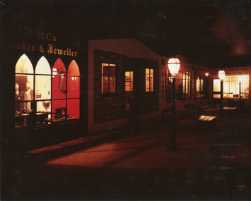
Taken in 1990, this photograph depicts a row of shops in Beechworth, with the shopfront of watchmaker and jewellers, William Turner and C.F. Falck, in the foreground, and newsagent and bookseller James Ingram's shop in the background.This photograph is of social significance to the Beechworth community in depicting the Street of Shops, the creation of curator, Roy Harvey, which opened in 1979 at Burke Museum. According to the Indigo Shire Council webpage for Burke Museum, this addition 'began a new period of collecting with Roy Harvey calling to the community for donations. The response resulted in an influx of material adding to the town history/ development and local identities collections. The Shops and their contents reflect another period in museology.' The historic shopfronts in this image portray those of local settlers, William Turner and CF Falck's Watchmaker and Jeweller store, and James Ingram's news agency and bookshop. William Turner was originally a goldfields official who became a commissioner on the Ovens goldfield, and later a resident warden, at times performing magisterial duties and chairing the Local Court. Charles Frederick Falck, born in Korlin, Germany, in 1833, a skilled watchmaker and jeweller, ran the jewellery business from 1862. Along with William Turner and Melbourne barrister, George Milner Stephen, he prepared a dazzling display of gems and jewellery from Beechworth for the Royal Society's Exhibition in Melbourne in 1865. This act signposted Beechworth's progress as a nineteenth-century gold rush town with a population of around 3000. In the mid-1850s, newsagent James Ingram established a newsagency and supplied papers and stationary to the goldfields. He and bookseller R.T. Vale stocked a wide range of literary, historical and religious works, textbooks, periodicals and newspapers, as well as hosting a reading and writing room on Camp Street{?}. James Ingram was a 'devoted instigator and supporter of the town's welfare institutions', who raised funds for to establish a hospital, primary school and benevolent asylum, and assisted people who'd fallen on hard times with his wife. He was also a mainstay of the early Baptist church, holding meetings in his house. He died in 1928, six weeks short of his 100th birthday. Ingram's Rock, north-west of Beechworth near where he lived in later life, was named after him. Colour rectangular photograph printed on matte photographic paper.Obverse: FALCK 1880 / maker & Jeweller/ WARDENS OFFICE/COACHING OFFICE/ EST. ??55/ ????ON HOUSE/ JAMES INGRAM/ NEWS?????? AND BOOKSELLER/ TOYS visible above shopfront in left foreground. Reverse: Catalogue item number 3305 pencilled in top right-hand corner.beechworth, beechworth historic shops, william turner, cf falck, james ingram, turner and falck watchmaker and jeweller, james ingram newsagent and bookseller, burke museum, promoting settlement, marketing and retailing, living in country towns, making regional centres, preserving traditions and commemorating, beechworth founders, victorian gold rush towns, beechworth pioneers, ingram's rock, 1860s beechworth, street of shops, roy harvey -
 The Beechworth Burke Museum
Audio - Oral History, Jennifer Williams, Desmond (Bill) Thomas, 25th May 2000
Desmond (Bill) Thomas moved to Beechworth when he was one year old. He was born in 1923 and his family moved to Beechworth in 1924. His father was offered a job in Beechworth as a leather tanner. His first job was in the Tannery in Beechworth. However, in 1938 he was involved in a accident at the Tannery that resulted in him losing his arm. The Zwar Brothers acquired the Tannery in 1877 and it operated until 1961. His interests included bushwalking and nature. When he was younger he would often go ferreting instead of going to school. His favorite place to visit was near Stanley. This included Zwar's paddock and Eldorado. One of his first memories was when he went to Sunday School at the Methodist Church. He remembered Miss Peach as the Methodist Superintendent. He eventually had to leave that Sunday School because of his behavior. This oral history recording was part of a project conducted by Jennifer Williams in the year 2000 to capture the everyday life and struggles in Beechworth during the twentieth century. This project involved recording seventy oral histories on cassette tapes of local Beechworth residents which were then published in a book titled: Listen to what they say: voices of twentieth century Beechworth. These cassette tapes were digitised in July 2021 with funds made available by the Friends of the Burke.Desmond (Bill) Thomas' oral history has important historical significance for the local Beechworth region. The Zwar Brother's Tannery was a large part of Beechworth and had a long history. Both Mr Thomas and his father has contributed to this history because they both worked there. Mr Thomas' both of the bush and nature demonstrates the history of ferreting and bushwalking in this region. Desmond (Bill) Thomas has made many contributions to his community but also the history of Beechworth. This life tells us many things about the struggles and joys of living in and around Beechworth. This oral history account is socially and historically significant as it is a part of a broader collection of interviews conducted by Jennifer Williams which were published in the book 'Listen to what they say: voices of twentieth-century Beechworth.' While the township of Beechworth is known for its history as a gold rush town, these accounts provide a unique insight into the day-to-day life of the town's residents during the 20th century, many of which will have now been lost if they had not been preserved.This is a digital copy of a recording that was originally captured on a cassette tape. The cassette tape is black with a horizontal white strip and is currently stored in a clear flat plastic rectangular container. It holds up 40 minutes of recordings on each side.Desmond (Bill) Thomasleather tanner, leather, beechworth tannery, tannery, tannery accident, bushwalking, bushland, nature, ferreting, school, sunday school, beechworth methodist church, church, baptist church, beechworth, oral history, recording, 1924, listen to what they say: voices of twentieth century beechworth, listen to what they say, jennifer williams, burke museum, zwar brother's beechworth tannery, zwar bros. tannery -
 Glen Eira Historical Society
Letter - Kilvington Baptist Girls Grammar School
Four items about Kilvington functions. Two school speech night pamphlets for 11/12/1985 and 09/12/1987. They detail the principal’s report, staff, school community, curriculum subjects, award lists, school council, teaching staff and departments. Correspondence to Mayor J. Campbell inviting him to attend speech night on 09/12/1987 at Robert Blackwood Hall. Art and craft exhibition and sale 21/08/1987 to 23/08/1987.kilvington baptist grammar school, corner leila road, katandra road, ormond, stone g.w., teachers, campbell a.j.e., inn of china restaurant, north road, farmers fashion shoes, centre road, bentleigh, bailey mavis, sierra holiday travel, brown john a., brown ruth m., ormond squash and fitness centre, delbake bread and cake spe, sinclairs coaches pty ltd., murrumbeena, ferrari fashions pty ltd., ormond fruit emporium, taranto bob, allison sports, bryant fiona, draper marli, malley kara, calvert rowena, davenport gillian, alder s., bradd j., bransgrove a., drummond k., elsey m., edwards m., fisher s., gehman r., knapp l., weston l., grinblat nadine, stanley louise, andrew carolyn, mcvernon jodie, green carolyn, every karen, yang melissa, bransgrove katrina, fleming cleo, pados susan, rogers susan, schiffter tanya, smith amanda, smith lyndall, welsh rachel, woolacott kristen -
Glen Eira Historical Society
Article - Kilvington Baptist Girls Grammar School
Two items about Kilvington Diamond Jubilee celebrations 1923-1983. Two fourteen-page pamphlets on Kilvington’s Diamond Jubilee. Includes activities on the day, may layout of school, a timeline, named buildings and school houses. Newspaper article from Caulfield Contact 28/11/1983 giving the history of Kilvington, beginnings, location and general history of the school. Includes two photographs, author unknown.kilvington baptist girls grammar school, fethers peter, barrett constance, fysh f. muriel, ross m., mckie r.m.e., stone g. warren, teachers, schools, steel h.g., pollard w.m., mason c.g., evans p.e. rev., keyte b.d., lillimur road, hall of christ church, halls, north road, kilvington, merton hall, malva street, methodist hall, glenorme avenue, walsh street, baptist union of victoria, steele h.g. mr., leila road, katandra road, collard house, ratcliff house, wheatley road, ulupna road -
Glen Eira Historical Society
Article - Kilvington Baptist Girls Grammar School
This file contains seven items about Kilvington students. The first item is a copy of Kilvington News December 1994. It includes comments from the Principal about the current school prefects, a photograph of the principal with prefects, as well as reports on awards and school activities. The next six documents include recognition of students’ achievements and integration of boys to Kilvington Grammar and opening news sport complex. Kilvington student wins Glen Eira Rotary Award dated 28/09/2012, Caulfield Leader. Kilvington student receives a perfect VCE score dated 21/12/2010, Caulfield/Port Phillip Leader. Kilvington Grammar decides to open its doors to boys and become a co-educational school. Dated 01/02/2011 Port Phillip/Caulfield Leader. Advertising feature on forthcoming musical production at Kilvington Grammar school of Fame. The school has choreographer Karen Young on board, who appeared in Fame on London’s West End, dated 29/03/2011. Caulfield/Port Phillip Leader. Kilvington students take part in a half day short film workshop on 24 March as part of this year’s Panasonic Kid Witness News short video competition. Article dated 12/04/2012. Caulfield/ Port Phillip Leader. Brief Caulfield/Port Phillip Leader article dated 09/08/2011 mentioning the opening of Kilvington Grammar’s new one million dollar sports complex. Caulfield/Port Phillip Leader.kilvington baptist girls grammar school, leila road, ormond, ngo angela, glen eira rotary youth award, kilvington girls grammar, holper sarah, charlton jon, kilvington grammar, baptist union of victoria, fame, musical events and activities, ling jenny, gall celia, young karen, dancers, mohan bianca, carroll luke, moustra isabelle, hay tia, amoore izzi, bahn jessica, hyams jamie, councillors, glen eira, opray annie -
Glen Eira Historical Society
Ephemera - Kilvington Baptist Girls Grammar School
Navy and white enameled hat badge for Kilvington Girls School with motto NON NOBIS SED OMNIBUS inscribed. The badge was donated by T.J. Hart.kilvington girls grammar school, crests and emblems, hart t.j., hats -
Glen Eira Historical Society
Document - BOX FAMILY
Extensively detailed family history from 1838 in UK to present day. Provides much local history and social history into early pioneering and market gardening families. Forty one page computer print out with numerous black and white photographs.box w.h. george, box george, box mary nee cripps, box caroline, box william, box henry, box john, box anna, box eliza, box elizabeth nee avis, box francis, box lydia, moeller a., mclean n., robilliard george james, box ester, box fanny (downard), box eleanor, philbrick richard, fairlam richard, hale jasper, dendy henry, renick mark, renick stefanie (nee riemann), brighton cemetery, ormond, east brighton, prahran, centre road, jasper road, manchester road, mckinnon road, north road, brighton, box cottage, moorabbin historical society, thomas street, elsternwick, paterson road, east bentleigh, tucker road, jasper road, harwood thomas, box violet, hordeen lebbens, augustus arthur, wattle, pioneers, ancient order of foresters, council of moorabin, elster creek, primitive methodist church, lewis’ timber yard, grape growing, paling house, wells, water wagon, market gardens, farming, aboriginal people, king billy, chinese, kayon (?), kay you (yu?), cheong ki, boxer rebellion, chinese missionary, brickmakers, midwife, corben’s monumental masons, sculptor, cottage, parlour, verandah, scullery, le man’s swamp, flower nursery, chook houses, ladies college, moorabbin roads board, western market, eastern market, victoria market, st. kilda road, nepean road/highway, mckinnon, ormond, carnegie, oakleigh, murrumbeena, moorabbin, mordialloc, heathcote, bentleigh, brighton east, manchester road, brighton council, city of moorabbin, west joseph, porter harriet, moore henry, moeller a (moller), box mary, lindsay mccurry elizabeth, lindsay elizabeth, lindsay henry, lindsay frederick, schmidt william, robilliard james cpt., beckett ida, beckett nellie, beckett martha, beckett martha maud, robinson eleanor, robinson joyce, dowling thomas, anderson william snowden, mccurry henry mr & mrs, box emily jane (nee mccurry), jorgensen justin, jorgensen dr., jorgenson bertha, ross william murray, st. kilda, merrie creek, pentridge (now coburg), murray road, wyuna dunoos st, grange road, rosstown, tucker rd, elizabeth st, common school no 213 east brighton, bentleigh, steel roads tracks, rabbits, cheltenham, brighton cemetery, cheltenham cemetery, paterson road, east boundary road, baptist church, lay preachers, missionaries- china, oakleigh tyre works, belfast hotel sandhurst (bendigo), mornington, gas street lighting, brighton historical society, moorabbin primary school, bravis road, lewis street, chalmers street, grange road, butcher shops, ormond state school, oakleigh council, wedding dress, methodist children’s home cheltenham, bentleigh baptist church, auctioneer, lindsay mark, balkham jane, balkham stephen, reitman august william, fitzwilliam catherine, quashdorf (?phonetic) mr, box violet, montford paul, reitman stephanie (renick mrs), reitman william, box ada, downard alicia (lill), downard arthur, downard edward, graham elizabeth, downard octavia rose, downard william alfred, downard arthur henry (harvey), downard fanny, thompson eliza jane, box lena caroline, viloudaki rebecca, box anna (pay), pay henry, box eliza (gurr), johnson geoffrey, rushall eleanor (nellie), gurr eliza nee box, gurr jabez henry tasman, marriot william mrs, ross william murray, box gladys (nee battersby), box dulcie (bussell), bussell samuel robert, bussell norma (hoult), bussell darren lyle, bussell craig andrew, bussell sylvia june (barry), barry j. haydon, barry rachael alexandra, barry phillipa anne, barry vanessa kate, bussell joan lorraine (millie), millie john, bussell harold leslie, euston mr, purdue edgar robert, box lydia elizabeth, wilkinson coral doreen, mitchell donald, centre road, court pride of st george aof, dunoon street, vickery street, darey street/ave., oakleigh state school, methodist church, mill street, koornang road, regent street, marriage road, box olivia christina, box ernest charles, box walter william, lawson robert, lawson nancy eunice (curtis), box walter stanley, box eleanor (nellie) rushall, box martha, box john, box nellie gladys, andrews william (bill), box ray, mccurry mrs elizabeth, box william henry george, schreiber family, jorgensen family, downward arthur, downward alicia – lill, downward octavia rose, downward william alfred, downward arthur henry/harvey, cummings ida, cummings william, downward alice (nee cleary), downward ada, downward lucy (mrs bailey), downward alice, downward arthur harvey, bailey lawrence, bailey ian, bailey carol viola (bartlett), bailey colin harvey, bailey julie alison (hardware), bailey val, bailey adina, bailey david, bartlett brian, bartlett bradley grant, bartlett clayton lawrence, hardware michael, hardware dion michael colin, hardware jevon michael bailey, box elanor, box alice amelia (dale), dale george, dale elizabeth, dale lilly, dale john, dale thomas, dale rose, dale ethelbert, dale george, dale elsie, box thomas henry, box annie lavinia (rogers), rogers annie elizabeth, rogers william richard, box arthur walter, nelson dagma marie (box), box walter kingston, box marie, box cecilia eliza (ainger), ainger james, box ida may, cumming william george, cumming wendy (nee mansell), cumming susan, cumming paul, cumming felicity (steel), cumming shane, cumming melissa, cumming angel, box harold, box dorothy may (jackson), jackson frederick, jackson margaret (walker), jackson judith, walker david, walker michelle (neville), neville andrew, walker darren, walker rebecca (coyne), walker joshua, walker bradley, johnson steven, johnson carl, johnson judith (jackson), johnson peter, johnson melissa (hamid), johnson craig, ely johnson/jackson judith, ely steven, linham arthur, box thelma elizabeth (eagle), eagle keith, eagle nancye elizabeth (harpin), harkin john, harkin mary anne (howe), howe barry, howe samuel, harkin michael, harkin christopher, harkin elizabeth, eagle roddan, eagle carolyn (mansell), eagle gerard, eagle kerri – lee, box avis ann (eldridge), eldridge alf, eldridge robert, eldridge sandra, eldridge adam, eldridge nicholas, eldridge patric, eldridge john, eldridge carol (biggs), eldridge robert james, eldridge catherine elizabeth, eldridge meredith, box william john, box maud (nee hanchette), box malcome, box sandra (ede), box stephen, box nicolle, box andrew, box christine (dormer), box corrina, box jennifer (turpin), turpin phillip, box herbert, box olwyn (richard), box elaine henry, henry bruce, henry james, henry robin, henry david, box richard, box nerida (bowen), box duncan, box john, box cerwiden, box ewan, box bryan, box collen (malony), box kieran, box eden, box christopher, box pam (smith), box sue (tirchett), box thomas, box william, box george frederick, box olive (cameron), box eliza jane (thompson), box francis george, box lena caroline, box-hembrow mable alma, box charles francis, clinch mr., box robinson jessie melinda, box clay edith florence, north brighton, waun alex, waun robert, marquis peter, sheppard w., warnbach mr, marriott william mrs, box dorothy (seabrook), box hazel, box jessie, box frank (francis), seabrook len, box henry, seabrook albert, seabrook stanley allan, barry j. haydon, barry rachel alexandra, millie john, bussell harold leslie, bussell sue, bussell leanne melinda, bussell benjamin leslie, bussell lynette, box george, box jean (holms), box george, box alisa (hughes), hughes justin, hughes ebony, hughes tasman, box robin, box veronica (roman), box andrea roman, box lisa roman, box jodi roman, box malcome, box sue (kerrison), box amanda, box anthony, clay john (jack) francis, clay lynda blanche (nee sibte), clay vivien, clay majory joy, lipman vernon (vern) ronald, clay kenneth graham, clay laura jean -
 Glen Eira Historical Society
Article - E. E. Gunn Reserve
This file contains three items about this Park, formerly known as Ormond Park: An original photograph of E. E. Gunn Reserve Hall. An article from the Caulfield Contact relating to the history of E.E. Gunn Park and the achievements of the committee of management of the Park, dated January/February 1992. An article from The Leader summarising the football competition results, some of which may have been held at E.E. Gunn Park, dated 26 July 2011.e. e. gunn reserve, e.e. gunn park, ee gunn park, ormond park, caulfield south ward, foch street, malane street, ormond, ormond amateur football club, ormond/glen huntly baseball club, ormond cricket club, ormond tennis club, ormond football club, ormond park trust, caulfield, caulfield council, kilvington girls baptist grammar school, e.e. gunn committee of management, barret james, singleton clive, robertson john, gunn ernest edwin, dorothy avenue, newham grove, collegians, de la salle, st. bedes, the tigers, ajax, rupertswood, blieden gary, old camberwell, rombotis john, toolongs steve, glen eira, paterson tom, boyd glenn, demashki mark, the saints, the monds, eltham, elsternwick, albert park, the falcons, the wicks, convery james, hunter justin, power house, prahran/assumption, parks, reserves, playgrounds, sportsgrounds, football, australian rules football, sporting clubs, sports people, clubs, associations, football clubs, sports, recreations, leisure, cultural events, cultural activities, cricket club, baseball club, ovals, playing fields, club houses, scout halls, halls, tennis clubs, athletics, cycling -
Glen Eira Historical Society
Letter - ELSTERNWICK BAPTIST CHURCH, GLEN HUNTLY ROAD, 481, ELSTERNWICK
Two documents about the history of this church: Pamphlet with a brief history of events & names from 1858 to 1962 (November) & handwritten additions to 1974 Letter to Mr Wells, dated 04/04/1977, from Helen Lewis is advising him that the foundation stones actual inscription is Caulfield Union Church erected 1889.elsternwick baptist church, elsternwick, reid john rev, congregational union, old grammar school, caulfield union church, day edwin rev., regent street, gregson john rev., st. george’s road, glen eira road, orrong road., glenhuntly road., poole w rev., king street, hebenstreit mr., fires, brick building, thompson a. r. rev., president, thomas bernard, moulton harold, webber w., architects, warner l. e., brett h. m, builders, george r. l. rev, brown arthur, gregson j rev., mclean d. f. pastor, linden o. r. rev., roth a. g. rev., robertson r rev., thompson a. r. rev., mcdonald s. a. rev., wood f. j. rev., allison j. b. rev., scholefield h. g. rev., holland a. r. rev., paice j.v. rev., smith a. e. rev., merry g. e. rev., edmonds n. a. r. rev., shannon l. b. rev., drew c. a., davis h. s., davies w, swanton e. e., parkinson j. t., sheldon j, steel p. w., montgomery b, thompson j.c. rev., moulton h. h., webber w. e, whitehead l, redpath b, chibnall a. miss, lewis h. mrs., golden jubilee review, organs, kindergartens, women’s fellowship, choirs, sunday schools, halls, festivals & celebrations, wells mr, lewis helen -
Glen Eira Historical Society
Letter - Masonic Hall St Georges Rd, 17, Elsternwick
A typed valuation by W.V Scott dated 4/08/1964 of the Masonic Hall at 17-19 St Georges Road, Elsternwick on behalf of EJ Maskell. It includes land measurements, details of the rooms and their features as well as the final valuation and additional note as to the cost of the valuation. Handwritten notes of the valuer included.masonic hall, st georges road, scott wv, maskell fj, glenhuntly road, churches, baptist church, caulfield council, land values, property values, elsternwick, halls -
Glen Eira Historical Society
Plan - Nettalie
An A4 photocopy of the 'Plan of the Caulfield Road District' dated 1867. This plan shows the location of the properties owned by A Shaw and Blundell on Balaclava and Orrong Roads where Nettalie is situated. The plan includes all the landowners listed where their property was, the street names and other landmarks of 1867 including railways, hotels and reserves.caulfield, caulfield north, elsternwick, st kilda east, parish of prahran, parish of moorabbin, caulfield road district, melbourne and brighton railway, rosstown railway, elsternwick railway station, caulfield railway station, rosstown railway station, murrumbeena railway station, baptist church, paddy’s swamp reserve, cemetery reserve, leman swamp reserve, caulfield racecourse reserve, brighton cemetery, the vine caulfield hotel, the tam o’shanter hotel, melbourne hunt hotel, royal hotel, hotham street, horne street, nepean highway, north road, orrong road, dandenong road, princes highway, kooyong road, alma road, inkerman road, balaclava road, glen eira road, glen huntly road, hawthorn road, cemetery road, bambra road, redan road, kambrook road, neerim road, booran road, racecourse road, grange road, koornang road, murrumbeena road, crosbie road, kangaroo road, poath road, ford w, lempriere, cople j, riddell j c, manifold j, testar t, billing r h, semple, blundell, shaw a, butchart g, stephen j w, stephen g sir, hart j, duncan g, blackie r, stephen f, mccombie t, woollaston h, higgins j, lloyd j c, daish j, mcleod j, hughes d, wilson a, jamieson g, webb g h, renwick s, pennington h, dunn j, kirkpatrick w, ricketson w, toad a, sayce j, watts t, widgery, store, guess j, anketell j, clack j, sissen w, clayton g, dickson d, bevan j, hart t, anderson j, hart mrs, webb h, masters s, waghorn j, hemming c, hiam c, farquhar w, newing t, payne t, cooper r, snipe s, chambers j, forster w, summers r, harriman b, warrick, o’connell, long j, peck r, cochrane c, murray ross w, evans c, kennedy j, maclean n, forster, lyall w, dean j, newton h, looker w, baker c, johnston, crosbie j, kerr, jones, parr, nelson c, montgomery l, parsons w, james j c, sibon c, smith sydney w, plans, maps, land subdivisions, land use, settlements, roads and streets, hotels, churches, police stations, post offices, land surveys, railway stations, railways, schoolhouses, commerce, clergy residences, official buildings, local government, road districts -
 Eltham District Historical Society Inc
Photograph, Eltham Ridge complex, 256 Bolton Street, Eltham, September 2009, 2009
Colour photographbolton street, eltham ridge, industries, classic fireplaces and bbqs, creative lighting, eltham baptist church, loanworx, pfa victoria -
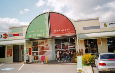 Eltham District Historical Society Inc
Photograph, The Ridge Complex, Bolton Street, Eltham, September 2009, 2009
Colour photographbolton street, industries, eltham baptist church, endota spa, the ridge cafe -
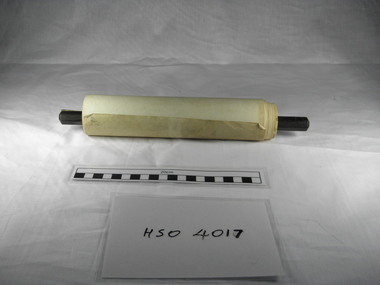 Richmond & Burnley Historical Society
Petition, Richmond Churches Petition regarding Sunday Icecream Vendors 1908
The scroll describes the concerns of the Churches of Richmond against the Street Icecream Vendors who are threatening the sanctity of the Holy Sunday. Each denomination organsied for each of their Sunday School Teachers to sign the petition and these where pasted together to form a Sroll. The Scroll provides an indication of the sizes of the Sunday Schools and the number of Churches in the area in 1908. The petition to the City of Richmond was intended to introduce a By-law to prevent Sunday Trading in the municipality of Richmond. A combined record demonstating the collaboration between Richmond Churches to form a residents action group to combat the threat of Sunday Vendor Trading. The scroll has a record of the names and addresses of the hundreds of School Teachers from each demonination in 1908. A petition to the Richmond City Council From local churches protesting about the Sunday Trading by Icecream Vendors and the impact on the Holy Day. The petition contains signatures of Sunday School Teachers from each particpating denomination. The petition is presented as a paper scroll fixed to a wooden rod. (July 1908)Signatures of Sunday School Teachers and Leaderschurches, scroll, petition, richmond council, sunday school, icecream vendors, congregational church, central methodist church, baptist church, north richmond church of christ, balmain church of christ, burnley methodist church, richmond congregational church, burnley congregational church, st stephens church of england richmond, richmond presbyterian church, burnley presbyterian church, local action groups -
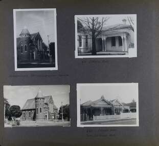 Glen Eira Historical Society
Album - Album page, Orrong Road, Circa 1972
This photograph is part of the Caulfield Historical Album 1972. This album was created in approximately 1972 as part of a project by the Caulfield Historical Society to assist in identifying buildings worthy of preservation. The album is related to a Survey the Caulfield Historical Society developed in collaboration with the National Trust of Australia (Victoria) and Caulfield City Council to identify historic buildings within the City of Caulfield that warranted the protection of a National Trust Classification. Principal photographer thought to be Trevor Hart, member of Caulfield Historical Society. Most photographs were taken between 1966-1972 with a small number of photographs being older and from unknown sources. All photographs are black and white except where stated, with 386 photographs over 198 pages. Victorian Heritage Database H0704 FORMER UNION CHURCH 84-86 ORRONG ROAD ELSTERNWICK https://vhd.heritagecouncil.vic.gov.au/places/428 The Former Union Church, Elsternwick, designed by the architect George de Lacy Evans, and erected in 1889-90 is a building of historical and architectural significance for the following reasons:- (1) it is a rare and well- developed example of the early French Gothic manner as popularised through the muscular Victorian re-interpretation of English architect William Burgess, which in turn were derived from the publications of EE Viollet-le-Duc. Other Victorian cases of detailing derived from Viollet-le-Duc include Barwon Park (1868), the Presbyterian Church at Skipton (1871), the Bourke Street West Police Station by Bindley and Brittingham (PWD) dating from 1888-9 and the Lutheran Manse, East Melbourne by JAB Koch (1890). However, none of these buildings relates closely in form to the Union Church, Elsternwick. The only building which has been identified as closely comparable is The Bairnsdale Court House by AJ Macdonald (PWD) which dates from 1892. (2) the use of bright red brickwork is of significance, as the Former Union Church is believed to be only the second church building in Victoria to employ this material as a matter of conscious choice. Amongst red brick churches, it is thought to be preceded only by Reed, Henderson And Smart's Sacred Heart (1884), a Renaissance inspired design. (3) the building is believed to be a rare, possibly unique, surviving example of a church building erected for dual use by the Congregationalists and Baptists. In 1894 it was bought by the Congregationalists and continued as a Congregational Church until the formation of the Uniting Church.Page 165 of Photograph Album with four photographs, two of a church with the other two of houses on Orrong Road.Handwritten: ELSTERNWICK CONGREGATIONAL CHURCH [under top left photo] / 82 ORRONG ROAD [under top right photo] / 663-1 ORRONG ROAD / SEMI - DETACHED PAIR / 165 [bottom left]trevor hart, elsternwick congregational church, king street, orrong road, church, elsternwick, red brick, former union church, early french gothic style, architects, george de lacy evans, baptist church, conical towers, houses -
Glen Eira Historical Society
Document - SHELFORD GIRLS’ SCHOOL AND KINDERGARTEN
This file contains 2 items relating to plans for the buildings and grounds of the school: 1/2 copies (1photocopy, 1 original) of the July 1982 ‘Shelford Planning Brief: Church of England Girls’ Grammar School’, written by the Caulfield City Council. The brief describes the history of the school, its current grounds and plans for future expansion. It also contains 2 ground plans: one of the existing school site and 1 of the planned future school site. 2/1 copy of a City of Caulfield Council memo regarding the July 1982 Shelford Planning Brief, describing small changes to the brief. Written by J. Floyd, 24/11/1982.city of caulfield, shelford c.e.g.g.s., caulfield, glen eira road, st mary’s anglican church, seymour road, allison road, ‘helenslea’, hood justice mr, hood crescent, st mary’s parish hall, helenslea road, education, gymnasiums, schools, students, secondary schools, primary schools, bentleigh, classrooms, car parks, libraries, traffic, playgrounds, teachers, windows, plans, shelford planning brief, kilvington planning brief, shelford church of england girls’ grammar school, floyd j, fences, kilvington baptist girls’ -
Glen Eira Historical Society
Document - BRIGHTON GENERAL CEMETERY
This file contains two brochures from the Brighton General Cemetery, one black and white dated 2013, the other in colour and undated. The first provides eight short biographies of notable writers and journalists interned at the cemetery, the other containing a map with the location of thirty-four notable internments unrelated to literature. Both provide a brief history of the cemetery with the first also including images of some of the people discussed and what appears to be the cemetery emblem. The second brochure displays a colour photograph of a structure in the cemetery.cemeteries, brighton, authors, journalists, occupations, people, documents, pamphlets, tourist leaflets, migrants, widowers, knowles marion, cambridge ada, buckley herbert, browne thomas alexander, walstab george alexander, cunningham edward sheldon, dow john lament, dexter caroline, lynch caroline, brighton general cemetery, people associated with culture, brighton cemetorians, east brighton north road, people by circumstance, knowles joseph, cross george frederick, ribbledon herbert, horseracing, equestrian events, pioneers, squatters, civil servants, police, boldrewood rolf, robbery under arms, the miner’s right, babes in the bush, communication activities, the age, the herald, the argus, edward wilson estate, burketown, the leader, walstab mary anne, nolan anne, jackson maval mary, sir graham barry ministry, dow marion jane, orr marion jane, mckenzie david, dexter william, ladies almanack: the southern cross or australian album and new years gift, institute of hygiene, lynch william, mayors, bombala, cheltenham pioneer cemetery, cheltenham memorial park, bunurong memorial park, cheltenham and regional cemeteries trust, springvale cemetery, southern metropolitan cemeteries trust, manson johanna, religious groups, groups (people), funerals, cremation, joynt william donovan, boyd arthur, peeler walter, soldiers, armed forces, mccubbin frederick, casey james joseph, buckley maurice vincent, ogg charles, catani carlo, sutton henry, newland james ernest, laver frank joseph, furphy john, boyd guy, ballantyre george frederick, gordon adam lindsay, mccoy frderick, higin batham george, monash john, bent thomas, miller septimus, cohen godfrey abraham, creswell william rooke, guilfoyle william, boyd theodore penleigh, heinze bernard, taylor joseph leslie theodore, taylor squizzy, tritschke alma, elder james alexander mackenzie, breen marie, boyd william merrie, boyd doris, maps, east brighton hawthorn road, east brighton sheffield road, east brighton sussex road, presbyterian religion, baptist religion, jewish religion, roman catholic religion, methodist religion, church of england, anglican religion -
Glen Eira Historical Society
Document - CAULFIELD CITY CHOIR
This file contains five items: 1/A program of the ‘Second Folk Song Festival’ presented by Caulfield City Choir conducted by David Plummer. Date unknown. 2/Three musical score sheets transcribed by Michael Finnissy for the Caulfield City Choir, dated 1983. 3/A black and white program for the Caulfield City Choir’s Christmas Celebrations at St. John’s Uniting Church on 06/12/1986, conducted by Douglas Heywood. 4/Two black and white programs of presentations given by the Caulfield City Choir and the Camberwell Chorale with the Camerata Orchestra, conducted by Douglas Heywood, at the Camberwell Centre. The first is of the Verdi Requiem on 03/05/1987; the second is ‘The Creation’ by Joseph Haydn on 14/05/1988. 5/A black and white program of the Caulfield City Choir Inc.’s presentation of Victorian Lollipops, conducted by Douglas Heywood at St. Stephen’s Uniting Church Hall on 13/09/1987.emms betty miss, kooyong road, caulfield, caulfield city choir, plummer david, law bernard, butler eric, finnissy michael, murrumbeena, harries rita, st. john’s uniting church, glenhuntly road, glen huntly road, elsternwick, hopetown gardens, heywood douglas, shewan joan, st. margaret’s anglican church caulfield, baptist church murrumbeena, church of christ carnegie, st. james’ lutheran church moorabbin, st. andrew’s presbyterian church caulfield south, holy cross roman catholic church caulfield south, st. john’s uniting church elsternwick, baker tim, sneddon j.f. mrs., snowdon avenue, caulfield city council, caulfield philharmonic society, sneddon marjorie, snedden marjorie, north road, ormond, barnard j., cook d., copley m., duncan d., field b., ford r., fraser g., granger t., greenhaugh h., howells c., jefferies c., kuca m., lockett j., mcalpine c., mcconchie c., mealy m., moorees j., nicholas n., nixon v., polites s., pope m., port m., provelsen m., provelson m., rose r., simmons h., terkuile k., alcock j., bannister j., barnett m., beeson b., cinaglia c., glasson m., griffon b., holmes w., sneddon m., weickhardt j., henderson v., ingram h., ketels m., nutt a., polites c., warden n., dobbin l., mccaffrey p., newbold r., prebble r, shewan j., st. stephen’s uniting church hall, balaclava road, hawthorn road, kooyong road, dobbin leo, heywood thomas, ford dellys, the scotsglen players, caulfield city hall, glen eira road, new city hall, st. stephen’s uniting church, glasson m. mrs, new caulfield city hall, nicholas n. miss, quaife merlyn, ashton-smith david, lukey desmond, reither charles, caulfield town hall, hirst susan, anderson peter, town halls, orchestras, music, people associated with culture, singers, choirs, official buildings, uniting church, festivals and celebrations, musical events and activities, cultural events and activities, musicians, conductors (music), operas, religious festivals, christmas, official buildings, clubs and associations -
Glen Eira Historical Society
Document - Organs
This file contains eight items about the history and construction of church organs in the Glen Eira area: 1/A photocopy of notes on the history of the church organ in the Bambra Road Church of Christ (1 page). 2/A photocopy of an extract from the book ‘The Christ Church Chronicles 1901-2001’ p20-24, by Vi Manson, giving a detailed description of the life of the organ in Christ Church Anglican Church, Ormond. It describes the building, relocation, restoration, rededication and role of the organ in church activities. 3/Extracts from ‘Colonial Organs and Organbuilders’, p121-122, 126, 131, 140, 182-183, by E. N. Matthews, 1969, about organ installations, repairs and sales. It contains entries about organs previously and currently located in Murrumbeena, Caulfield, Elsternwick, Balaclava and Bentleigh. 4/A photocopied extract from a letter from Mrs. M. Ring to the Caulfield Historical Society, dated 14/03/1986, describing the organ at ‘Crotonhurst’ (1 page). 5/A photocopy of notes (1 page), written by Trevor Hart, dated unknown, on the history and building of Elsternwick Congregational Church (Caulfield Union Church) containing a note about an organ built by George Fincham that was sold in 1962. 6/A photocopy of a small paragraph about the organ in St. Mary’s Anglican Church, paraphrased from E. N. Matthews ‘Colonial Organs and Organbuilders’, author and date unknown (1 page). 7/A photocopy of a page of a research project by Kate William, date unknown, giving a brief history of the organ and choirs at St. Mary’s Catholic Church, Caulfield. 8/A photocopy of a draft resolution to gift the Merklin-Shutze pipe organ located in the Uniting Church, Orrong Road, Ormond to the Australian Catholic University. Author and date unknown (1 page).bambra road church of christ, bambra road, organs, choirs, religious groups, fincham george, organists, fullard leonard, depression 1929-1939, world war 1939-1945, durance ronald rev., dunlop julie, larner john, muston ged. bishop, musical events and activities, christ church anglican church ormond, concerts, balaclava, holy trinity church balaclava, torrance g. w., parsons c. r., ure james, bryant mr., brentnall t., meedham s. p., inge h. j., stevens j. n., balaclava methodist church, fentum g. b., eggleston j., bentleigh, st. george’s church bentleigh, caulfield, st. mary’s church caulfield, perry bishop, reed joseph, lee kaye, taylor hugh ms., stephen miss, hart mr., kaye s., dixon miss, hardeman j. j., dumergue charles, wright j. d., dixon f. miss, courcelle john, elsternwick, elsternwick baptist church, warner l., andrewartha c. w., elsternwick methodist church, rippon lea, ripponlea, sargood frederick t. hon. sir., croton hurst, crotonhurst, webb g. h. f., mclaughlin j., murrumbeena, murrumbeena methodist church, hill william, hart trevor, caulfield historical society, caulfield union church, elsternwick congregational church, st. mary’s anglican church caulfield, music, dixon h. mr., smithers mr., merklin-schutze, orrong road, elsternwick/caulfield south church council, ormond -
Glen Eira Historical Society
Article - Elsternwick Park
This file contains items pertaining to Elsternwick Park: 1/A clipping from the Caulfield/Port Philip Leader (titled ‘Hunter takes reins at Elsternwick’, author unspecified, 17/04/2012), which pertains to Justin Hunter being installed as the captain of the Elsternwick Amateur Football Club. 2/A clipping from the Caulfield/Port Philip Leader (titled ‘Wicks lose a champion’, by Brad Beitzel, undated), which pertains to Graham Holmes of the Elsternwick Amateur Football club dying of cancer. 3/A book titled Bazaar Beginnings: A Century of Sport at Elsternwick Park (author unspecified, undated, 37 pages), which describes the history of Elsternwick Park from 1901 to 2003, with an emphasis on sports.elsternwick park, parks and reserves, sport, sporting clubs, sportsgrounds, australian rules football, elsternwick amateur football club, elsternwick hockey club, sculthorpe a. , elsternwick park committee of management, world war 1939-1945, langford-jones andrew, dunstan mark, todd barry, price , bill, riddell mrs, riddell ken, scott arthur, coombs percy, emburey john, potter jack, holmes graham, blumfield chris, jorgensen james, baxter andrew, taft shura, hunter justin, mahony craig, beddingfield lachie, hodskiss nathan, cesario john, mcdonald jack, rose james, warren phil, gaze andrew, local history, cricket, miller keith r., burgoyne a.d. mr, beadle ken cr., bent thomas, st. kilda cricket club, south st. kilda cricket club, muntz mr, lloyd c.d. cr., fundraising events, ground improvement fund, elsternwick hall, sargood frederick sir, foote ian, hockey, victorian hockey association, elsternwick baptist cricket club, elsternwick methodist cricket club, soccer, brighton soccer club, barr alex, loghran frank, bignell bonb, pettigrew john, morrow bruce, baseball, brighton baseball club, victorian baseball league, victorian baseball association, elsternwick baseball club, brighton football club, williamson col., mcindoe rus, warburton keith, blood michael, sherrin cup, bourke mick, l.a. adamson cup, watt judy, anderson sue, connell brett, lawry bill, stackpole keith, hookes david, hurst alan, graf shaun, madden simon, dipierdimenico robert, parkin david, malthouse mick, cleary phil, madden justin, jordan ray, michael barry, carroll wayne, mildenhall bill, brown joyce, matthews alf, madigan laurie, lane tim, roberts sandy, leonard tony, cover ian, phillips steven, marmalade trevor, fleet greg, whittle slim, marasco con, warne shane, elsternwick, elsternwick hotel, cox charles mr, turner george sir, fairbairn mr, russell-brown j. mr, peacock cr., huntley cr., taylor j.h. mr, elsternwick lacrosse club, elsternwick football club, elsternwick district football club, elsternwick junior football club, victorian amateur football association, elwood central school, elsternwick primary school, australian broadcasting commission, mcdonald a.j. mr, mccutcheon r.g. mr, melbourne cricket club, victorian cricket league, wardill b. mr, melbourne & metropolitan board of works, elsternwick golf club, clubs and associations, balme kate, stevens phil, new tommy, pratt bob, elsternwick cricket club, searle barney, blundell norm, power john, gartrell rob, victorian junior cricket association, victorian turf cricket association, australian cricket board, victorian cricket association, russell simon cr. , white cameron, abbey alan, blizzard aiden, bull adam, murphy liam, scorgie stuart, tenace kane, victorian women’s cricket association, hunt reg, hatch ron, community groups, elliot matthew, fraser colin, pike arthur, young darryl, mills alf, werf pat van der, leather tom, gregory ross, fullerton norma, sharkie keith, johnson alex, dixon brian, trezise neil, rundle noel, corner donald dr., loysh len cr., french peter, francis chris, johnson cameron, miles john, de la salle old collegians club, old xavierans club, victorian amateur football association umpires’ association, hinton wayne, cultural events and activities -
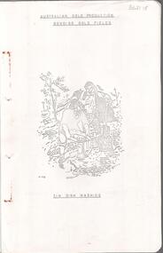 Bendigo Historical Society Inc.
Document - MINING IN BENDIGO COLLECTION: BENDIGO GOLD FIELDS, 1968
Typed copy of the Bendigo Gold Fields , collected and arranged by V. R. Dwyer, 1968. On front cover: Australian Gold Production Bendigo Gold Field. Image of tin dish washing. Cover has an image of two people tin dish washing. Notes include a brief history of gold in Australia, Bendigo Goldfield yields, Bendigo Gold Nuggets, Victorian Nuggets, gold prices, yield for the years 1851 to 1890, lines of reef, mine shafts and depth, location, public buildings and organisations and mines listed for each reef. Typed copy of this document is held in Folder 130, number 3621.18.cottage, miners, mining in bendigo, bendigo gold fields index, v r dwyer, strzelecki, edward hargreaves, thomas hancock, henry frenchman, wittscheibe, ballerstedt, fortuna villa, george lansell, the rocks, victoria nugget, dascombe nugget, welcome stranger, welcome nugget, canadian nugget, sarah sands, lady hotham, maryborough, heron nugget, blanche barkley, vicount canterbury, precious nugget, poseidon, gold prices, gold yield 1851 - 1890, location of shafts, mechanics institute, old masonic hall, court, st killians, forrest st methodist church, hospital, baptist church, bendigo gas company, st andrews presbyterian church, bendigo benevolent home, railway, st marys church of england, bendigo m p building society, st pausl church of england, high school, city family hotel, fire brigade, b u f s dispensary, synagogue, beehive store, school of mines, bendigo miners association, st marys convent, dr backhaus, st mathews long gully, salvation army, post office, art gallery, sacred heart cathedral, eaglehawk town hall -
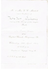 Bendigo Historical Society Inc.
Document - FOSTER AND WILSON COLLECTION: WEDDING INVITATION, 1914
Off white wedding invitation with silver printing and rough edges and watermarks. Front watermark is: Charta Egypta with vertical lines about 3 cm apart. Back watermark is: English Made NM with vertical lines about 3 cm apart.document, invitations, wedding, foster & wilson collection, mr & mrs g. c. mitchell, mr & mrs wilson, freda mitchell, ernest christie, baptist church hargreaves st., 'clydagh' -
Port Melbourne Historical & Preservation Society
Document - 2011 Calendar, Pat Grainger, Historic Port Melbourne - Borough people, Sep 2010
Researched, written and designed by member Pat GRAINGER as a fundraiser for PMH&PS. Production volume: 675 copies2011 PMHPS calendar ; Historic Port Melbourne - Borough People. Cover photo is Benjamin BOLTON, Grocer All following years calendars also recorded against cat no 1864societies clubs unions and other organisations, families, transport - tramways, religion - baptist church, business and traders, domestic life, public action campaigns, sport - australian rules football, local government - city of port melbourne, workers, celebrations fetes and exhibitions, port melbourne historical & preservation society, pmhps, charles s dillon, the settlement, excelsior hall, jack gould, poolman street, cruikshank street, education - sunday schools, benjamin bolton, beach street, tommy lahiff, bob skilton jnr, hester reserve, piers and wharves - waterside workers, port melbourne town hall -
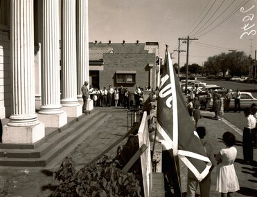 Ballaarat Mechanics' Institute (BMI Ballarat)
Auction on Dawson St Sth old Baptist Church steps
ballarat, auction, dawson st sth, baptist church, 1960s -
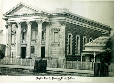 Ballaarat Mechanics' Institute (BMI Ballarat)
Baptist Church
This photograph is from the Max Harris Collection held by the Ballaraat Mechanics' Institute. Please contact BMI for all print and usage inquiries.ballarat, dawson, baptist church