Showing 846 items matching "map rsl's"
-
 Mrs Aeneas Gunn Memorial Library
Book, Arthur Conan Doyle, The great Boer war, 1902
While most people remember Sir Arthur Conan Doyle for his 'Sherlock Holmes' stories, he actually wanted more to be a journalistic and historical writer. This is one of his works in that vein, documenting the events of the Boer War, which had yet to end at the time of writing.Index, maps, p.743.non-fictionWhile most people remember Sir Arthur Conan Doyle for his 'Sherlock Holmes' stories, he actually wanted more to be a journalistic and historical writer. This is one of his works in that vein, documenting the events of the Boer War, which had yet to end at the time of writing.boer war 1899-1902, arthur conan doyle -
 Mrs Aeneas Gunn Memorial Library
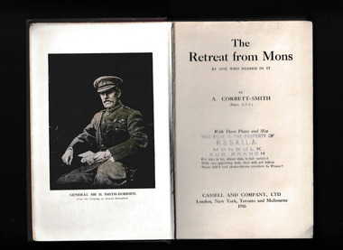
Book, A. Corbett-Smith, The retreat from Mons by one who shared in it, 1916
A firsthand description of the battle of MonsAppendices, ill, maps, p.255.non-fictionA firsthand description of the battle of Mons world war 1914-1918 - campaigns - france, world war 1914-1918 - personal recollections -
 Mrs Aeneas Gunn Memorial Library
Book, Heinemann, The old front line, 1917
An account of the beginning of the battles of the SommeIll, maps, p.128.non-fictionAn account of the beginning of the battles of the Sommeworld war 1914-1918 - campaigns - france, world war 1914-1918 - battle of the somme -
 Mrs Aeneas Gunn Memorial Library
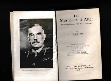
Book, A. Corbett-Smith, The Marne-- and after, 1917
This companion volume to "The retreat from Mons" describes the Battle of the MarneIll, maps, p.324.non-fictionThis companion volume to "The retreat from Mons" describes the Battle of the Marneworld war 1914-1918 - campaigns - france, world war 1914-1918 - battle of the marne -
 Mrs Aeneas Gunn Memorial Library
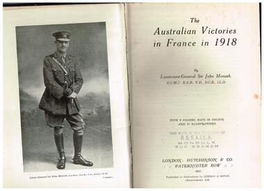
Book, John Monash, The Australian victories in France in 1918, 1920
Republished in full, this edition features a new foreword by Bruce Haigh, colour reproductions of the original maps that were hand-drawn under Monash's supervision, and new photos. It also includes a memo from General Rawlinson congratulating Monash on the performance of the Australian Corps: 'I feel that no mere words of mine can adequately express the renown that they have won for themselves and the position they have established for the Australian nation not only in France but throughout the world.'Index, ill, maps, appendices, p.351.non-fictionRepublished in full, this edition features a new foreword by Bruce Haigh, colour reproductions of the original maps that were hand-drawn under Monash's supervision, and new photos. It also includes a memo from General Rawlinson congratulating Monash on the performance of the Australian Corps: 'I feel that no mere words of mine can adequately express the renown that they have won for themselves and the position they have established for the Australian nation not only in France but throughout the world.'world war 1914-1918 - campaigns - france, world war 1914-1918 - australian involvement -
 Mrs Aeneas Gunn Memorial Library
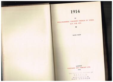
Book, 1914, 1919
Field Marshal French's account of the first year of the warIndex, maps, p.361.non-fictionField Marshal French's account of the first year of the warworld war 1914-1918 - campaigns - france, world war 1914-1918 - personal recollections -
 Mrs Aeneas Gunn Memorial Library
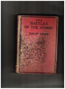
Book, Phillip Gibbs, The Battles of the Somme, 1917
An account of the Battle of the SommeIll, maps, p.336.non-fictionAn account of the Battle of the Sommeworld war 1914-1918 - battle of the somme, world war 1914-1918 - campaigns - france -
 Mrs Aeneas Gunn Memorial Library
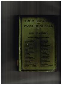
Book, Heinnemann, From Bapaume to Passchendaele, 1917, 1918
Account of the pointless battles in France in 1917Ill,maps, p.384.non-fictionAccount of the pointless battles in France in 1917world war 1914-1918 - campaigns - france, world war 1914-1917 - passchendaele -
 Mrs Aeneas Gunn Memorial Library
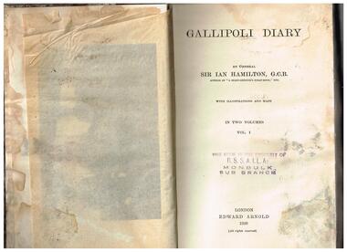
Book, Edward Arnold, Gallipoli diary vol.1, 1920
A history of the Gallipoli campaignIndex, ill,maps, p.387.non-fictionA history of the Gallipoli campaignworld war 1914-1918 -campaigns - gallipoli, sir ian hamilton - diaries -
 Mrs Aeneas Gunn Memorial Library
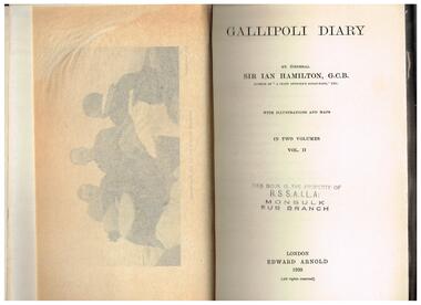
Book, Edward Arnold, Gallipoli diary vol.2, 1920
A history of the Gallipoli campaignIndex, ill,maps, p.337.non-fictionA history of the Gallipoli campaignworld war 1914-1918 -campaigns - gallipoli, sir ian hamilton - diaries -
 Mrs Aeneas Gunn Memorial Library
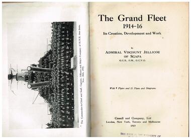
Book, Cassell and Company, The grand fleet, 1914-16 : its creation, development and work, 1919
A record of the work of the Grand Fleet from the outbreak of war until the end of November 1916Index, ill, maps, p.517.non-fictionA record of the work of the Grand Fleet from the outbreak of war until the end of November 1916 world war 1914-1918 - naval operations, great britain - royal navy -
 Mrs Aeneas Gunn Memorial Library
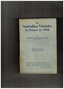
Book, John Monash, The Australian victories in France in 1918, 1923
Second edition of the previous workIndex, ill, maps, appendices, p.321.non-fictionSecond edition of the previous workworld war 1914-1918 - campaigns - france, world war 1914-1918 - australian involvement -
 Mrs Aeneas Gunn Memorial Library
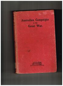
Book, Staniforth Smith, Australian campaigns in the Great War : being a concise history of the Australian naval and military forces, 1914 to 1918, 1919
A general review of the various campaigns in which Australians were involved in the Great WarAppendices, ill, maps, p.206.non-fictionA general review of the various campaigns in which Australians were involved in the Great Warworld war 1914-1918 - australian involvement, worls war 1914-1918 - history -
 Mrs Aeneas Gunn Memorial Library
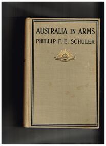
Phillip F.E. Schuler, Australia in arms : a narrative of the Australasian Imperial Force and their achievement at Anzac, 1916
An account of the Gallipoli campaignIndex, ill, maps, p.328.non-fictionAn account of the Gallipoli campaignworld war 1914-1918 -campaigns - gallipoli, world war 1914-1918 - personal recollections -
 Mrs Aeneas Gunn Memorial Library
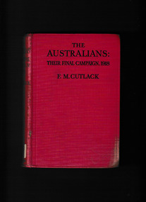
Book, F.M. Cutlack, The Australians : their final campaign, 1918 : an account of the concluding operations of the Australian divisions in France, 1919
The 1918 campaigns of the Australian army in FranceIndex, appendices, maps, p.336.non-fictionThe 1918 campaigns of the Australian army in Franceworld war 1914-1918 - campaigns - france, australian army - 1st aif -
 Mrs Aeneas Gunn Memorial Library
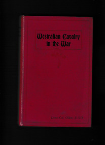
Book, Alexander McCubbin, Westralian Cavalry in the War, 1921
The story of the tenth light horse regiment, AIF in the Great War 1914-1918Ill, maps, appendices, p.343.non-fictionThe story of the tenth light horse regiment, AIF in the Great War 1914-1918world war 1914-1918 - campaigns - middle east, world war 1914-1918 - australian light horse -
 Mrs Aeneas Gunn Memorial Library
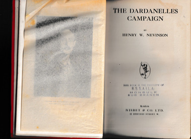
Book, Henry W. Nevison, The Dardanelles campaign, 1918
Comprehensive account of the Dardanelles campaignIndex, bib, ill, maps, p.439.non-fictionComprehensive account of the Dardanelles campaignworld war - campaigns - dardenalles., world war 1914-1918 -campaigns - gallipoli -
 Mrs Aeneas Gunn Memorial Library
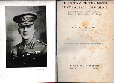
Book, Hodder and Stoughton, The story of the Fifth Australian Division : being an authoritative account of the Divisions doings in Egypt, France and Belgium, 1920
The operations and exploits of the Australian fifth division mainly in FranceIll, appendices, maps, p.468.non-fictionThe operations and exploits of the Australian fifth division mainly in Franceworld war 1914-1918 - regimental histories - australia, world war 1914-1918 - campaigns - france -
 Mrs Aeneas Gunn Memorial Library
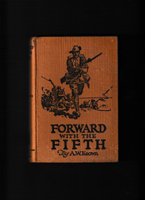
Book, Specialty Press, Forward with the Fifth : a history of the Fifth Battalion, 1st A.I.F, 1921
History of the fifth Battalion, 1st AIF in Gallipoli and France.Ill, maps, p.342.non-fictionHistory of the fifth Battalion, 1st AIF in Gallipoli and France. world war 1914-1918 -campaigns - gallipoli, world war 1914-1918 - regimental histories - australia -
 Mrs Aeneas Gunn Memorial Library
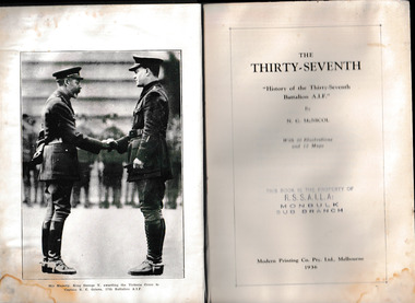
Book, Modern Printing, The Thirty-Seventh : history of the Thirty-Seventh Battalion A.I.F, 1936
A regimental history of the 37th Battalion AIFIll, maps, p.354.non-fictionA regimental history of the 37th Battalion AIFworld war 1914-1918 - regimental histories - australia, world war 1914-1918 - campaigns - france -
 Mrs Aeneas Gunn Memorial Library
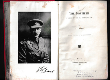
Book, Government Printer Tasmania, The Fortieth : a record of the 40th Battalion, A.I.F, 1922
A regimental history of the 40th Battalion 1st AIFIndex, maps, p.248.non-fictionA regimental history of the 40th Battalion 1st AIFworld war 1914-1918 - campaigns - france, world war 1914-1918 - regimental histories - australia -
 Mrs Aeneas Gunn Memorial Library
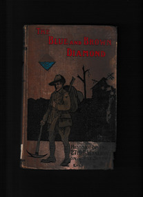
Book, Lonnen & Cope et al, The blue and brown diamond : a history of the 27th Battalion Australian Imperial Force, 1915-1919, 1921
A regimental history of the 27th Battalion 1st AIFIll, maps, p.227.non-fictionA regimental history of the 27th Battalion 1st AIFworld war 1914-1918 - regimental histories - australia, world war 1914-1918 - campaigns - france, world war 1914-1918 -campaigns - gallipoli -
 Mrs Aeneas Gunn Memorial Library
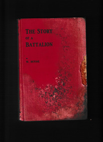
Book, Melville & Mullen, The story of a battalion, 1919
A regimental history of the 48th Battalion 1st AIFIll, maps, p.179.non-fictionA regimental history of the 48th Battalion 1st AIFworld war 1914-1918 - campaigns - france, world war 1914-1918 - regimental histories - australia -
 Mrs Aeneas Gunn Memorial Library
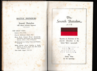
Book, A. Dean and E.W. Gutteridge et al, The Seventh Battalion, A.I.F. : resume of the activities of the Seventh Battalion in the Great War, 1914-1918, 1933
A regimental history of the 7th Battalion 1st AIFIll, maps, p.190.non-fictionA regimental history of the 7th Battalion 1st AIFworld war 1914-1918 - regimental histories - australia, world war 1914-1918 - campaigns - france, world war 1914-1918 -campaigns - gallipoli -
 Mrs Aeneas Gunn Memorial Library
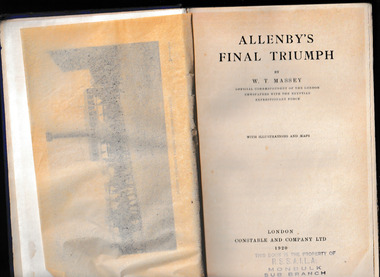
Book, Constable, Allenby's final triumph, 1920
A history of the Egyptian Expeditionary Force under General AllenbyIndex, ill, maps, p.347.non-fictionA history of the Egyptian Expeditionary Force under General Allenbyworld war 1914-1918 - campaigns - middle east, world war 1914-1918 - personal recollections -
 Mrs Aeneas Gunn Memorial Library
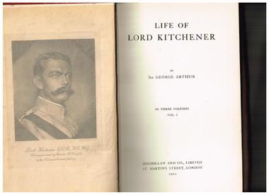
Book, Macmillan, Life of Lord Kitchener, 1920
Biography of Lord KitchenerIll, maps, 3.v, non-fictionBiography of Lord Kitchenergenerals - great - britain - biography, world war - 1914-1918 - history -
 Mrs Aeneas Gunn Memorial Library
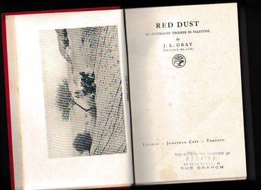
Book, J.L Gray (Donald Black), Red dust, an Australian trooper in Palestine, 1931
Recollections of an Australian soldier in Palestine.Ill, map, p.299.non-fictionRecollections of an Australian soldier in Palestine.world war 1914-1918 - australian light horse, world war 1914-1918 - personal recollections -
 Mrs Aeneas Gunn Memorial Library
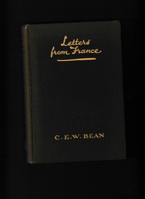
Book, Cassell, Letters from France, 1917
Letters from CEW Bean, an Australian war correspondent in France during the First World WarIll, maps, p.232.non-fictionLetters from CEW Bean, an Australian war correspondent in France during the First World Warworld war 1914-1918 - campaigns - france, world war 1914-1918 - personal recollections -
 Mrs Aeneas Gunn Memorial Library
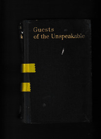
Book, John Hamilton, Guests of the unspeakable : the odyssey of an Australian airman -- being a record of captivity and escape in Turkey, 1928
A diary of the doings and sufferings of prisoners of war in TurkeyIll, maps, p.322.non-fictionA diary of the doings and sufferings of prisoners of war in Turkeyescapes - turkey, world war 1914-1918 - personal recollections -
 Mrs Aeneas Gunn Memorial Library
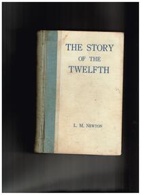
Book, 12th Battalion Association, The story of the twelfth : a record of the 12th Battalion, A.I.F. during the Great War of 1914-1918, 1925
The story of the 12th battalion in the Great WarIll, maps, p.508.non-fictionThe story of the 12th battalion in the Great Warworld war 1914-1918 - regimental histories - australia, australian imperial force - 12th battalion