Showing 6560 items matching "parkes historical society"
-
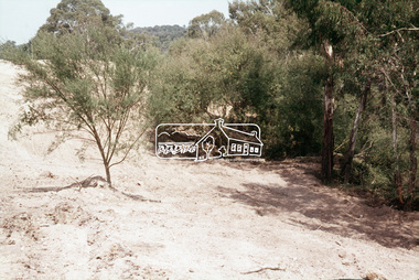
 Eltham District Historical Society Inc
Slide, Construction of Eltham Town Park, 22 Feb 1974
Construction of Eltham Town Park, later renamed Alistair Knox Park. In the distance can be seen the Eltham Tip accessed from Susan Street and the Shell Service Station which was situated on the corner of Susan Street and Bridge Street, now the site of Bunnings35 mm colour positive transparency Mount - Agfacolor Service (Blue)alistair knox park, eltham town park, eltham tip, shell service station, susan street -
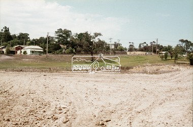
 Eltham District Historical Society Inc
Slide, Construction of Eltham Town Park, 22 Feb 1974
Construction of Eltham Town Park, later renamed Alistair Knox Park. In the foreground is where the Diamond Creek Trail runs along the creek and in the distance is the Bridge Street bridge.35 mm colour positive transparency Mount - Agfacolor Service (Blue)alistair knox park, eltham town park, bridge street bridge -
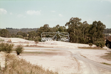
 Eltham District Historical Society Inc
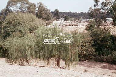
Slide, Construction of Eltham Town Park, 22 Feb 1974
Construction of Eltham Town Park, later renamed Alistair Knox Park.35 mm colour positive transparency Mount - Agfacolor Service (Blue)alistair knox park, eltham town park -
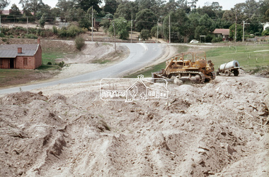
 Eltham District Historical Society Inc
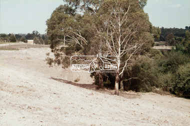
Slide, Construction of Eltham Town Park, 22 Feb 1974
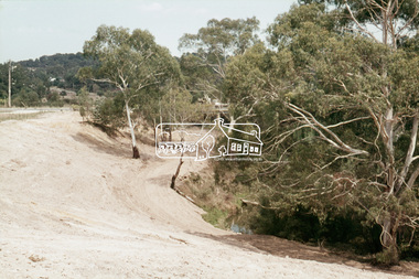
Construction of Eltham Town Park, later renamed Alistair Knox Park. View looking towards the Eltham Trestle Bridge.35 mm colour positive transparency Mount - Agfacolor Service (Blue)alistair knox park, eltham town park, eltham trestle bridge -
 Eltham District Historical Society Inc
Slide, Construction of Eltham Town Park, 22 Feb 1974
Construction of Eltham Town Park, later renamed Alistair Knox Park.35 mm colour positive transparency Mount - Agfacolor Service (Blue)alistair knox park, eltham town park -
 Eltham District Historical Society Inc
Slide, Construction of Eltham Town Park, 22 Feb 1974
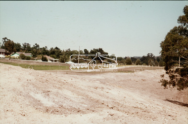
Construction of Eltham Town Park, later renamed Alistair Knox Park. View looking towards the intersection of Main Road and Bridge Street. The lake body has been formed and young trees planted.35 mm colour positive transparency Mount - Agfacolor Service (Blue)alistair knox park, eltham town park, bridge street, main road -
 Eltham District Historical Society Inc
Slide, Construction of Eltham Town Park, 22 Feb 1974
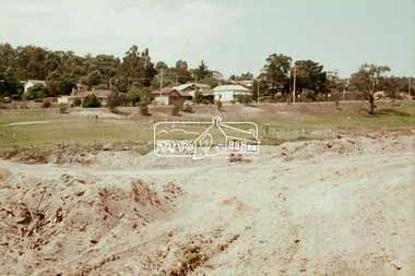
Construction of Eltham Town Park, later renamed Alistair Knox Park. View looking across Shillinglaw Cottage and what was to be developed as the Eltham Town Common (now the site of the Eltham Library) across to the Eltham Town Park development.35 mm colour positive transparency Mount - Agfacolor Service (Blue)alistair knox park, eltham town park, eltham tip, eltham town common, shillinglaw cottage -
 Eltham District Historical Society Inc
Slide, Construction of Eltham Town Park, 22 Feb 1974
Construction of Eltham Town Park, later renamed Alistair Knox Park. View looking across the front of Shillinglaw Cottage and what was to be developed as the Eltham Town Common (now the site of the Eltham Library) across to the Eltham Town Park development. To the right is the Eltham Trestle Bridge and to the left what was once the overflow site for the Susan Street Tip.35 mm colour positive transparency Mount - Agfacolor Service (Blue)alistair knox park, eltham town park, eltham tip, eltham town common, eltham trestle bridge -
 Eltham District Historical Society Inc
Slide, Construction of Eltham Town Park, 22 Feb 1974
Construction of Eltham Town Park, later renamed Alistair Knox Park. View looking up along Panther Place and Shillinglaw Cottage to Main Road.35 mm colour positive transparency Mount - Agfacolor Service (Blue)alistair knox park, eltham town park, main road, panther place, shillinglaw cottage -
 Eltham District Historical Society Inc
Slide, Construction of Eltham Town Park, 22 Feb 1974
Construction of Eltham Town Park, later renamed Alistair Knox Park. View looking towards Bridge Street and shows the Diamond Creek and formation of the Diamond Creek Trail.35 mm colour positive transparency Mount - Agfacolor Service (Blue)alistair knox park, eltham town park, bridge street bridge, diamond creek -
 Eltham District Historical Society Inc
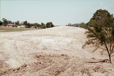
Slide, Construction of Eltham Town Park, 22 Feb 1974
Construction of Eltham Town Park, later renamed Alistair Knox Park. View looking towards Bridge Street.35 mm colour positive transparency Mount - Agfacolor Service (Blue)alistair knox park, eltham town park, main road, bridge street -
 Eltham District Historical Society Inc
Slide, Construction of Eltham Town Park, 22 Feb 1974
Construction of Eltham Town Park, later renamed Alistair Knox Park. View looking up towards Main Road and the old bakery and feed store on opposite corners of York Street. The feed store is the present site of Le Pine Funerals.35 mm colour positive transparency Mount - Agfacolor Service (Blue)alistair knox park, eltham town park, main road -
 Eltham District Historical Society Inc
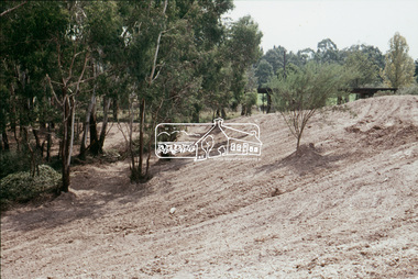
Slide, Construction of Eltham Town Park, 22 Feb 1974
Construction of Eltham Town Park, later renamed Alistair Knox Park. View looking towards the Eltham Trestle Bridge through to Central Park.35 mm colour positive transparency Mount - Agfacolor Service (Blue)alistair knox park, eltham town park, eltham trestle bridge, central park -
 Eltham District Historical Society Inc
Slide, Construction of Eltham Town Park, 22 Feb 1974
Construction of Eltham Town Park, later renamed Alistair Knox Park. View looking towards the Eltham Trestle Bridge through the trees.35 mm colour positive transparency Mount - Agfacolor Service (Blue)alistair knox park, eltham town park, eltham trestle bridge -
 Eltham District Historical Society Inc
Slide, Maroondah Aqueduct, Research, Victoria, 22 Mar. 1981
An inspection tour of the Maroondah Aqueduct was undertaken by the Shire of Eltham Historical Society on Sunday, March 22nd, 1981, commening where the aqueduct crosses Main Rd., Research, just below Eltham College. The Maroondah Aqueduct was part of Melbourne’s water supply system. It carried water over the 66 km from the Maroondah Reservoir on the Watts River at Healesville to the Preston Reservoir. Of this length, 41 km were open channel, 10 km, tunnel through hills and 15 km in 14 inverted siphons across stream valleys. The route of the aqueduct is north of Tarrawarra and Yarra Glen, along the Yarra escarpment south of Christmas Hills and crossing Watsons Creek into the present Shire of Eltham near Henley Rd. The eastern part of the route lies entirely within the former boundaries of the shire. The aqueduct passes south of Kangaroo Ground to Research and crosses the Diamond Creek by siphon at Allendale Rd., Eltham North. It then extends to Reservoir via St. Helena, Greensborough North and Bundoora. Water first flowed through the aqueduct in February 1891 when it was fed by a diversion weir on the Watts River. Records of the building of the aqueduct indicate that it was a significant construction achievement. The present Maroondah Reservoir was completed in 1927 and the aqueduct was enlarged at that time to take increased flows. About 1971 the section of the aqueduct through and north of Research was replaced by a large pipe and that section of the channel is now unused. The channel has remained largely intact (unlike sections at Greensborough and Bundoora where long lengths of the disused aqueduct have been demolished or filled in). The M.M.B.W. relinquished control of the disused aqueduct reserve which is crown land and the Shire of Eltham took control of this section of the reserve as a linear park. The Maroondah Aqueduct is considered to be an important historic structure, not just to the local area but to the metropolitan area generally. It is considered important to preserve substantially intact long lengths of the disused aqueduct, together with its bridges and other associated structures. 35 mm colour positive transparency (1 of 5) Mount - Agfachrome Agfa CS System black 8 dotsactivities, heritage excursion, maroondah aqueduct, research (vic.), shire of eltham historical society -
 Eltham District Historical Society Inc
Slide, Park Road, Eltham, Nov. 1981
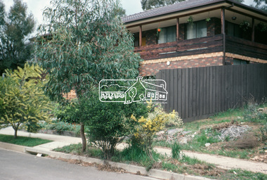
Roll of film taken by Eltham Shire Council officers (Nov. 1981) of the Beard street group, a private street scheme, before construction commenced in February 1982. They provide perspective of the changes in housing styles and road development that began sweeping in from the mid 1970s with increasing urbanisation of what was once more outlying suburbs and regions.35 mm colour positive transparency (1 of 27) Mount - Kodak Ektachrome CardProcessed 18 Jan 1982roads, housing estate, infrastructure, private street scheme, park road -
 Eltham District Historical Society Inc
Slide, Park Road, Eltham, Nov. 1981
Roll of film taken by Eltham Shire Council officers (Nov. 1981) of the Beard street group, a private street scheme, before construction commenced in February 1982. They provide perspective of the changes in housing styles and road development that began sweeping in from the mid 1970s with increasing urbanisation of what was once more outlying suburbs and regions.35 mm colour positive transparency (1 of 27) Mount - Kodak Ektachrome CardProcessed 18 Jan 1982roads, housing estate, infrastructure, private street scheme, park road -
 Eltham District Historical Society Inc
Slide, Main Road, Eltham South, Nov. 1981
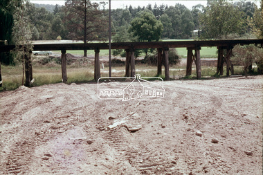
Roll of film taken by Eltham Shire Council officers (Nov. 1981) reflecting road infrastructure. Golden Fleece Service Station on left now the Shell/Coles Express. On right is Bremner's Flats where the original Eltham tennis courts were siutaed at the turn of the 20th century and where the circus would be located in the 1950s and 1960s; now Wingrove Park35 mm colour positive transparency (1 of 27) Mount - Kodak Ektachrome CardProcessed 18 Jan 1982infrastructure, main road, roads, bremner's flat, construction, eltham south, golden fleece service station, mount pleasant road, wingrove park -
 Eltham District Historical Society Inc
Photograph, Vacant Lot, 57 Park Road, Eltham, Dec. 1980
Roll of film taken by Eltham Shire Council officers of roads and houses in the Eltham East area in December 1980. They provide perspective of the changes in housing styles and road development that began sweeping in from the mid 1970s with increasing urbanisation of what was once more outlying suburbs and regions. Typically part of the Beard street group, a private street scheme that developed the road infrastructure commencing in February 1982.35mm colour positive transparency Mount - Kodak Kodachrome Cardeltham, housing estate, infrastructure, park road, roads -
 Eltham District Historical Society Inc
Photograph, 53 Park Road, Eltham, Dec. 1980
Roll of film taken by Eltham Shire Council officers of roads and houses in the Eltham East area in December 1980. They provide perspective of the changes in housing styles and road development that began sweeping in from the mid 1970s with increasing urbanisation of what was once more outlying suburbs and regions. Typically part of the Beard street group, a private street scheme that developed the road infrastructure commencing in February 1982.35mm colour positive transparency Mount - Kodak Kodachrome Cardeltham, housing estate, infrastructure, park road, roads -
 Eltham District Historical Society Inc
Photograph, 85 Park Road, Eltham, Dec. 1980
Roll of film taken by Eltham Shire Council officers of roads and houses in the Eltham East area in December 1980. They provide perspective of the changes in housing styles and road development that began sweeping in from the mid 1970s with increasing urbanisation of what was once more outlying suburbs and regions. Typically part of the Beard street group, a private street scheme that developed the road infrastructure commencing in February 1982.35mm colour positive transparency Mount - Kodak Kodachrome Cardeltham, housing estate, infrastructure, park road, roads -
 Eltham District Historical Society Inc
Photograph, Beard Street, Eltham, 3 Sep 1981
Roll of film taken by Eltham Shire Council officers of roads and houses in the Eltham East area, 3 September 1981 prior to construction of new water main; including views of existing damage to footpaths and gutters and general views of Beard Street. These images provide a perspective of housing estate developments and changes in housing styles and road development which began sweeping in from the mid 1970s with increasing urbanisation of what was once more outlying suburbs and regions.35mm colour positive transparency (1 of 28) Mount - Kodak Kodachrome Cardbeard street, eltham, infrastructure, roads, horse, park road -
 Eltham District Historical Society Inc
Photograph, Madine Way, Eltham, 3 Sep 1981
Roll of film taken by Eltham Shire Council officers of roads and houses in the Eltham East area, 3 September 1981 prior to construction of new water main; including views of existing damage to footpaths and gutters and general views of Beard Street. These images provide a perspective of housing estate developments and changes in housing styles and road development which began sweeping in from the mid 1970s with increasing urbanisation of what was once more outlying suburbs and regions.35mm colour positive transparency (1 of 28) Mount - Kodak Kodachrome Cardeltham, infrastructure, roads, madine way, tadema park -
 Eltham District Historical Society Inc
Slide, Park Road, Eltham, May 1983
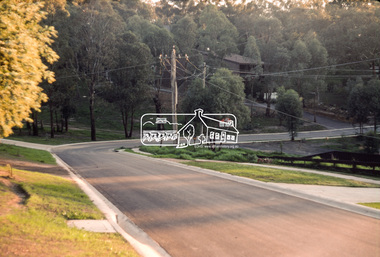
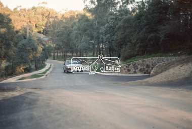
One of a series of images of roads and infrastructure taken by Eltham Shire Council Planning and Engineering officers, May 1983 specifically looking at Private Street Schemes post road construction/sealing operations35 mm colour positive transparency (1 of 21) Mount - Kodak Kodachrome Cardroads, infrastructure, road sealing, footpaths and gutters, private street scheme, eltham, park road -
 Eltham District Historical Society Inc
Slide, Park Road, Eltham, May 1983
One of a series of images of roads and infrastructure taken by Eltham Shire Council Planning and Engineering officers, May 1983 specifically looking at Private Street Schemes post road construction/sealing operations35 mm colour positive transparency (1 of 21) Mount - Kodak Kodachrome Cardroads, infrastructure, road sealing, footpaths and gutters, private street scheme, eltham, park road, t-bowl -
 Eltham District Historical Society Inc
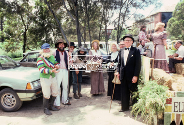
Photograph, Grand Parade, Eltham Community Festival, 17 Nov. 1984
The Society again arranged a float for the festival parade. Members dressed appropriately to the theme "Pioneers of Eltham". The parade commenced at 12 noon, participants assembling at 11.30am in Cecil Street. As in past parades, several members of the Victorian Folk Music Club accompanied the Society. The Society also arranged a display at the Eltham Community Centre in association with the activities there over the Festival weekend. The theme of this year's display was the waterways of the local area.35mm colour positive transparency Mount - Kodak Kodachrome Cardeltham, eltham festival, parade, parade floats, central park, doug orford, eltham shire office, garnet burges, joh ebeli, opal smith, panther place, peter bassett smith, peter bassett-smith, russell yeoman, victorian folk music society