Showing 10681 items
matching east melbourne
-
 Ringwood and District Historical Society
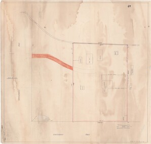
Map - Ringwood Animal Welfare Clinic, 1958 Land Survey Drawing, Ringwood, Victoria
Plan of driveway and property east of Heatherdale Road and Canterbury Road corner, with details of house, shed, bungalow, dog pen, kennels and enclosures.Survey by H.L.M. 31-7-58. Scale 20'=1" -
 Ringwood and District Historical Society
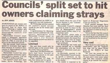
Newspaper, Scrapbook Clipping, Library Collection, Ringwood, Victoria, `
``Newspaper clipping from "The Mail" 7-1-97, P 11. Councils' split set to hurt owners claiming strays. By Jeff Jones Maroondah pet owners now have to travel to the RSPCA in Burwood East to claim their strays, following a sudden split between Maroondah and Manningham councils over pound usage.` -
 Ringwood and District Historical Society
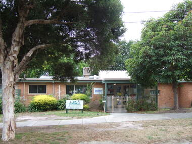
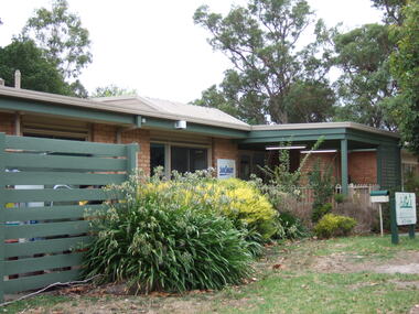
Photograph, Knaith Road Child Care Centre, Ringwood East showing front and entrance in January 2007
-
 Ringwood and District Historical Society
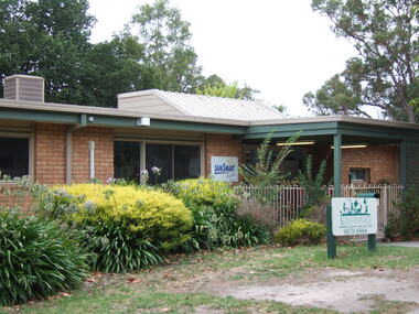
Photograph, Knaith Road Child Care Centre, Ringwood East, showing side angle of entrance in January 2007
-
 Ringwood and District Historical Society
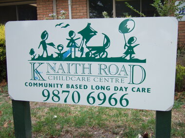
Photograph, Knaith Road Child Care Centre, Ringwood East - community based long day care - entrance sign in January 2007
-
 Ringwood and District Historical Society
Photograph, Knaith Road Child Care Centre, Ringwood East, side shot of entrance in January 2007
-
 Ringwood and District Historical Society
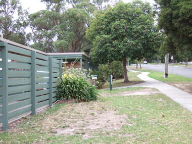
Photograph, Knaith Road Child Care Centre, Ringwood East, showing driveway to rear reserve in January 2007
-
 Ringwood and District Historical Society
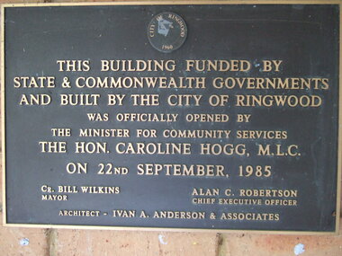
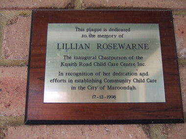
Photograph, Knaith Road Child Care Centre, Ringwood East, plaque offically opened on 22nd September 1985 by Hon. Caroline Hogg MLC
Mayor Cr Bill Wilkins of City of Ringwood, Chief Executive Officer, Alan Robertson, architect Ivan A Anderson & Associates -
 Ringwood and District Historical Society
Photograph, Knaith Road Child Care Centre, Ringwood East, plaque dedicated to the memory of Lilian Rosewarne, inaugural Chairperson of the Centre
-
 Ringwood and District Historical Society
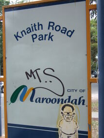
Photograph, Knaith Road Park, Ringwood East, sign in January 2007
City of Maroondah -
 Ringwood and District Historical Society
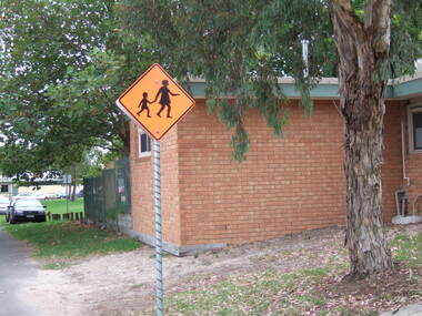
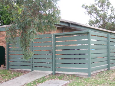
Photograph, Knaith Road Child Care Centre, Ringwood East, showing side view of building in January 2007
City of Maroondah -
 Ringwood and District Historical Society
Photograph, Knaith Road Child Care Centre, Ringwood East, eastern view of building in January 2007
City of Maroondah -
 Ringwood and District Historical Society
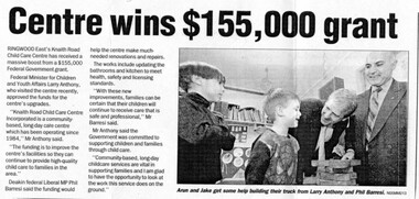
Newspaper, Knaith Road Child Care Centre, Ringwood East, wins grant in 2003
Maroondah Leader 12 Aug 2003 -
 Ringwood and District Historical Society
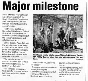
Newspaper, Knaith Road Child Care Centre, Ringwood East, planting tree by Phillip Barresi MP in 2003, to celebrate building's extensions
Maroondah Leader 7 December 2004 -
 Ringwood and District Historical Society
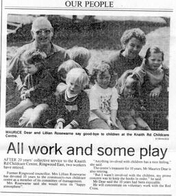
Newspaper, Knaith Road Child Care Centre, Ringwood East, retirement of Lillian Rosewarne (Executive) and Maurice Dear (Treasurer) after 10 years service in 1994
Ringwood Mail 19 October 1994 -
 Ringwood and District Historical Society
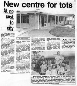
Newspaper, Knaith Road Child Care Centre, Ringwood East, start-up of centre on 8 July 1985
Ringwood Mail 26 June 1985 -
 Ringwood and District Historical Society
Plan - Proposed Ringwood East Railway Station, VR Ringwood-Croydon (Dublin Road) - 1923
Technical drawing of "Proposed Station At 16Mls 38Chs 89Lks (Dublin Road)" inluding boundary line, red shaded platform with station buildings, and green shaded possible future "up" track. Surrounding streets include Dublin Road, Patterson Street, and subsequent hand-written additions of Railway Avenue, Lawrence Grove, Stanley Avenue, Wenwood Street, and Lois Street. Land title details of Patterson Street properties mainly illegible.Scale: 40'=1". Possible future (platform) extension for 8 car trains (and) extension for 10 car trains. -
 Ringwood and District Historical Society
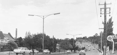
Photograph, Maroondah Highway East, Ringwood- 1971. Looking east towards Mt Dandenong Road
Black and white photographWritten on back of photograph: "Maroondah Highway, looking east towards Mt Dandenong Road turnoff past lake. 1971." -
 Ringwood and District Historical Society
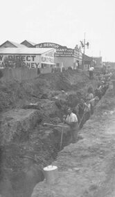
Photograph, Maroondah Highway East, Ringwood- c1920's. Excavation for new water main
Black and white photograph (2 copies- 1 large, 1 small)Written on rear of backing sheet: "Digging trench for water main along Maroondah Highway." -
 Ringwood and District Historical Society
Photograph, Maroondah Highway East, Ringwood- 1965. Corner of Mt Dandenong Road before widening
Black and white photograph (3 separate images)Typed note on back of photograph: "M'dah Hwy, June 1965, before it was widened from Mt Dandenong on." -
 Ringwood and District Historical Society
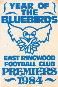
Poster, East Ringwood Football Club
Commemorative poster featuring local Australian Rules football club's bluebird logo depicting the team's achievement of premiership success for season 1984. -
 Ringwood and District Historical Society
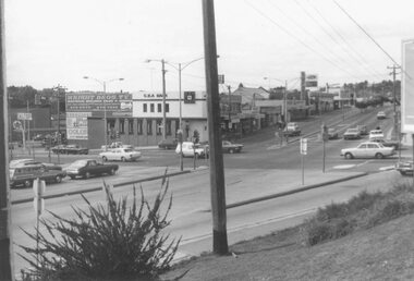
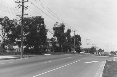
Photograph, Maroondah Highway East, Ringwood- 1976. Looking east from Warrandyte Road intersection
Black and white photographImage shows intersection with C.B.A. Bank on north east corner. Photograph taken mid 1976. -
 Ringwood and District Historical Society
Photograph, Maroondah Highway East, Ringwood- 1969. Looking west towards Ringwood from Everard Road
Black and white photographWritten on back of photograph: "Site of Cass's school, 1874. (1 acre left out of 5 acres). -
 Ringwood and District Historical Society
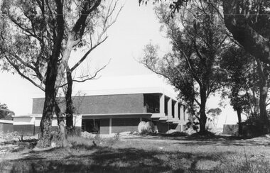
Photograph, Maroondah Highway East, Ringwood- 1969. New Civic Centre being built in Braeside Ave
Black and white photographWritten on back of photograph: "New municipal offices being built". -
 Ringwood and District Historical Society
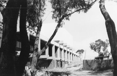
Photograph, Maroondah Highway East, Ringwood- 1969. New Civic Centre being built in Braeside Ave
Black and white photographWritten on back of photograph: "New municipal offices being built." -
 Ringwood and District Historical Society
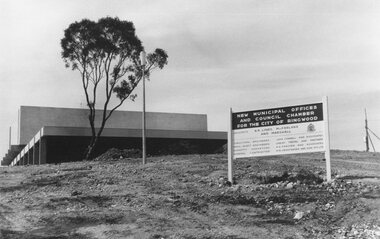
Photograph, Maroondah Highway East, Ringwood- 1969. New Civic Centre being built in Braeside Ave
Black and white photographSign on construction site reads: New Municipal Offices and Council Chamber for the City of Ringwood. Also shows names of Architects and other Contractors. -
 Ringwood and District Historical Society
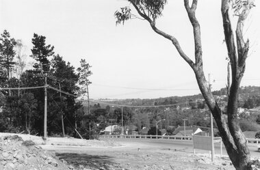
Photograph, Maroondah Highway East, Ringwood- 1969. View looking north from Civic Centre towards Norwood High School
Black and white photographWritten on back of photograph: "Norwood High from Civic Centre, Nov 1969." -
 Ringwood and District Historical Society
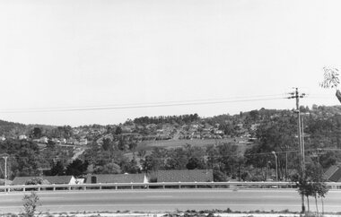
Photograph, Maroondah Highway East, Ringwood- 1969. Looking towards Mullum Road oval from Civic Centre
Black and white photographWritten on back of photograph: "From Civic Centre looking across Mullum Road oval, Nov 1969." -
 Ringwood and District Historical Society
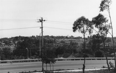
Photograph, Maroondah Highway East, Ringwood- 1969. View of Loughnan's Hill from Civic Centre
Black and white photographWritten on back of photograph: "Loughnan's Hill from Civic Centre. Nov 1969. -
 Ringwood and District Historical Society
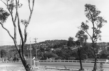
Photograph, Maroondah Highway East, Ringwood- 1969. Looking north from Braeside Ave towards Loughnan's Hill
Black and white photographWritten on back of photograph: "From Civic Centre, Nov 1969.