Showing 11329 items
matching on the map
-
 Victorian Aboriginal Corporation for Languages
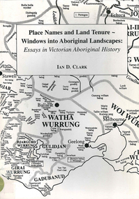
Book, Ian D Clark, Place names and land tenure : windows into Aboriginal landscapes : essays in Victorian Aboriginal history, 1998
This work is a collection of twelve essays that are concerned with place names, clan organisation and local and regional Aboriginal history.maps, document reproductionsdjab wurrung, ngengen wurrung, koroitgundidj, dhauwurud wurrung, djab wurrung, barababaraba, daung wurrung, taungurung, dja dja wurrung, jardwadjali, jodajoda, yorta yorta, nguri-illam wurrung, waywurru, koroit, buangor, mt eccles, mt napier, langi ghiran, grampians national park, massacres, clan organization, land tenure, george augustus robinson, samuel carter, aldo massola, alfred william howitt -
 Victorian Aboriginal Corporation for Languages
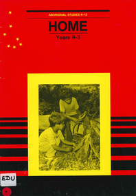
Book, Education Department of South Australia, Aboriginal studies R-12. Years R-3., Home, 1988
This unit is one of eleven making up the R-7 Aboriginal studies course, developed to meet the needs of students, teachers and Aboriginal people. It contains a course outline, cultural and historical information and activities.photographs, illustrations, mapsprimary school education, aboriginal studies, teaching aboriginal culture -
 Victorian Aboriginal Corporation for Languages
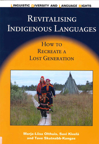
Book, ?Marja-Liisa Olthuis et al, Revitalising Indigenous languages : how to recreate a lost generation, 2013
The book tells the story of the Indigenous Aanaar Saami language (around 350 speakers) and cultural revitalisation in Finland. It offers a new language revitalisation method that can be used with Indigenous and minority languages, especially in cases where the native language has been lost among people of a working age. The book gives practical examples as well as a theoretical frame of reference for how to plan, organise and implement an intensive language programme for adults who already have a professional training. It is the first time that a process of revitalisation of a very small language has been systematically described from the beginning; it is a small-scale success story. The book finishes with self-reflection and cautious recommendations for Indigenous peoples and minorities who want to revive or revitalise their languages.Maps, colour photographsnative language studies, bilingual education, casle project, saami, language revival -
 Victorian Aboriginal Corporation for Languages
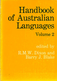
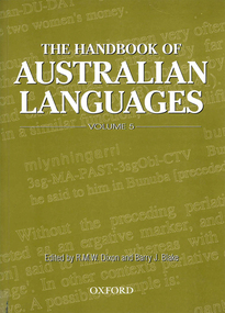
Book, Robert M Dixon, Handbook of Australian Languages. Vol.2, Wargamay, the Mpakwithi dialect of Anguthimri, Watjarri, Margany and Gunya Tasmanian, 1981
Various authors, includes technical linguistic sketch grammars of Wargamay, Mpakwithi (Anguthimri), Watjarri, Margany, Gunya and a survey of extant Tasmanian materials.Maps, word listswargamay, mpakwithi dialect of anguthimri, watjarri, margany, gunya tasmanian -
 Victorian Aboriginal Corporation for Languages
Book, Robert M Dixon, The handbook of Australian languages. Vol.5, Grammatical sketches of Bunuba, Ndje?bbana and Kugu Nganhcara, 2000
Maps, word listsbunuba, ndjebbana, kugu nganhcara, south kimberley region, western australia, central arnhem land, cape york peninsula, north queensland, language programs, bilingual education, language in media -
 Victorian Aboriginal Corporation for Languages
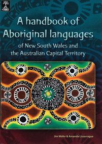
Book, Jim Wafer et al, A handbook of Aboriginal languages of New South Wales and the Australian Capital Territory, 2008
Provides a survey of the Indigenous languages of NSW and the ACT and word-lists for 42 distinct language varieties. With a chapter on contact languages by Jean HarkinsMaps, word listsmadhi madhi, wemba wemba, yorta yorta, dhudhuroa, bidawal -
 Victorian Aboriginal Corporation for Languages
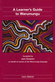
Book, A learner's guide to Warumungu, 2002
Maps, word listswarumungu, tennant creek, central australia -
 Victorian Aboriginal Corporation for Languages
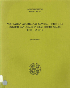
Book, Jakelin Troy, Australian Aboriginal contact with the English Language in New South Wales : 1788 to 1845, 1990
Early language contacts between Aboriginals and Colonists. Looks at the history of the area and explorationa dn pastoralists.Maps, word listscolonisation, pidgin -
 Victorian Aboriginal Corporation for Languages
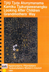
Book, Jo Harrison, Tjitji tjuta atunymanama kamiku tjukurpawanangku =? looking after children grandmothers' way : report to the Child Protection Policy and Planning Unit, S.A., on the Child Protection Project, 1991
This report presents the results of a project that looked at the attitudes to child protection of Pitjantjatjara women living on the AP lands in South Australia. It also looks at the implications of the views and experiences discussed by the women interviewed.colour illustrations, mapspitjantjatjara, child abuse, child welfare, social policy -
 Victorian Aboriginal Corporation for Languages
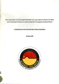
Book, Ian D Clark et al, The restoration of Jardwadjali and Djab wurrung names for rock art sites and landscape features in and around the Grampians National Park : a submission to the Victorian Place Names Committee, 1990
Lists each site and gives details.maps, word listsjardwadjali, djab wurrung, djabwurrung, rock art, grampians national park, gariwerd, major thomas l mitchell, aboriginal place names -
 Victorian Aboriginal Corporation for Languages
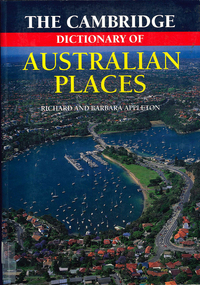
Book, The Cambridge dictionary of Australian Places, 1992
Lists thousands of place names across Australia, giving a detailed account of the name and location, shire etc.maps, pronunciation guidesgazetteer, nomenclature, maps, geography, pronunciation -
 Victorian Aboriginal Corporation for Languages
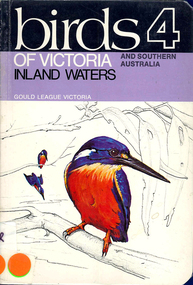
Book, AJ Reid, Birds 4 : of Victoria and southern Australia : inland waters, 1975
Colour illustrations, mapsbirds, southern australia -
 Victorian Aboriginal Corporation for Languages
Book, Rodger Elliot et al, Plant identikit : common native plants of the Grampians, 1998
This little book features detailed sketches of plants and includes a flowering seasons chart.Colour illustrations, mapsgrampians, plants -
 Victorian Aboriginal Corporation for Languages
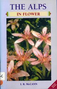
Book, I R McCann, The Alps in flower, 2001
Format using photographs and a brief description of each plant.Maps, colour photographsalps, victorian national parks association, bogong unit, alpine national park, mount buffalo national park, wonnangatta-moroka unit, kosciusko national park -
 Victorian Aboriginal Corporation for Languages
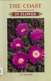
Book, I R McCann, The coast and hinterland in flower, 1992
Format using photographs and a brief description of each plant.Maps, colour photographswildflowers, plants, australia, grampians, identification, native plants -
 Victorian Aboriginal Corporation for Languages
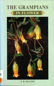
Book, I R McCann, The Grampians in flower, 2000
Contains brief descriptions of flowering plants in the Grampians area.Maps, colour photographswildflowers, plants, australia, grampians, identification -
 Victorian Aboriginal Corporation for Languages
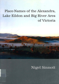
Book, Nigel Sinnott, Place-names of the Alexandra, Lake Eildon and Big River area of Victoria, 2003
Contains 2000 entries for the Alexandra area, giving a clearly detailed description of the site and source of the name.Maps, colour photographsplace names, alexandra, lake eildon, strathbogie ranges, yea, marysville, healesville -
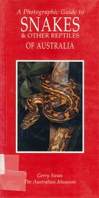 Victorian Aboriginal Corporation for Languages
Book, Gerry Swan, A photographic guide to snakes &? other reptiles of Australia, 1997
Species accounts of snakes across Australia.Maps, colour photographssnakes, reptiles -
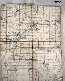 Bendigo Military Museum
Map, 1917
Area of map covers the Somme from Suzanne, Clery, Perone then onto Doingt, Rosiel, Ronssoy. Item re William Alexander No 502 AIF. Refer Cat No 3746.3 for his service details. Map, France, Ordnance survey May 1917, Edition 1, sheet 62c, scale possibly 1:20,000. On rear is a glossary of terms French to English.map, trench, france -
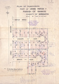 Ringwood and District Historical Society
Document, Plan of Subdivision - Part of Crown Portion 7, Parish of Ringwood, County of Mornington - 1962
Map of residential allotments coloured red, with land coloured blue set apart for drainage & sewerage easements. Rubber stamped J.P. Tuohy, Licensed Surveyor, 25 Howe Street Murrumbeena, Tel. 561945, dated 38.8.1962.Map includes Maidstone Street, Norfolk Avenue, Stanhope Court and Wrights Court, Ringwood, Vic. Also includes handwritten Estate Agent sales notations. -
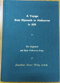 Kew Historical Society Inc
Book, J B Were & Son, A voyage from Plymouth to Melbourne in 1839: The shipboard and early diary of Jonathan Binns Were, 1964
[Melbourne] : J.B. Were & Son, 1964 xv, 309 p. : ill., facsims., maps, port. ; 20 cm. non-fictionwere, jonathan binns, victoria - history -
 Kew Historical Society Inc
Book, Oxford University Press, The Narrative of George Russell of Golf Hill with Russelliana and selected papers, 1963
Account of early pastoral settlement in Tasmania and Port Phillip focusing on the progress of the Russell family; includes observations on relations between settlers and Aborigines; account of the Black War in Tasmania; story of William Buckley, description of Port Phillip Aboriginal shelters, corroborees, missions, rapid extinction.London : Oxford University Press, 1935 469 p. : ill. map, ports., geneal. table ; 25 cm. non-fictionAccount of early pastoral settlement in Tasmania and Port Phillip focusing on the progress of the Russell family; includes observations on relations between settlers and Aborigines; account of the Black War in Tasmania; story of William Buckley, description of Port Phillip Aboriginal shelters, corroborees, missions, rapid extinction.russell family, clyde company, voyages and travels -
 Kew Historical Society Inc
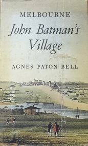
Book, Agnes P Bell, Melbourne: John Batman’s Village, 1965
A history of Melbourne, tracing its development from the riverside village founded by John Batman to the metropolis of the 1960s; includes description of Aboriginal corroborees and other early encounters with the Aboriginal inhabitants of the area.Melbourne, Vic. : Cassell Australia, 1965 xiv, 178p. : ill. (some col.), facsims., map, porto. ; 25cm. non-fictionA history of Melbourne, tracing its development from the riverside village founded by John Batman to the metropolis of the 1960s; includes description of Aboriginal corroborees and other early encounters with the Aboriginal inhabitants of the area.batman, john, 1801-1839, melbourne (vic.) -- history., settlement and contacts - colonisation - 1851- -
Whitehorse Historical Society Inc.
Map, Environment effects statement, 1/03/1979 12:00:00 AM
Diamond Creek-Ringwood study: Planning Scheme reservations and zones with recommended concept.Diamond Creek-Ringwood study: Planning Scheme reservations and zones with recommended concept. City of Nunawading: section north of Canterbury Road. Scale 1:25,000 metric. Map B with drafting ref. no. 145Diamond Creek-Ringwood study: Planning Scheme reservations and zones with recommended concept. city of nunawading, land use, melbourne metropolitan planning scheme -
 Bendigo Military Museum
Administrative record - Royal Australian Survey Corps - Central Command Operation Order C/1/61 Northern Territory 1961, DAD Svy, HQ Central Command , Keswick Barracks, SA, 1961
This is a Central Command Operation for the Royal Australian Survey Corps to conduct a Survey Operation in Northern Territory in 1961. The task is to acquire Survey Control for the production of maps coving the following 1:250 000 map areas of Alligator River, Mt Evelyn, Coburg Peninsula, (including the offshore Islands, Melville Island and Bathurst Island. The Operation Order details the tasks for the 6 x Officers (or equivalent) and 34 x OR's (or equivalent) and the support that was allocated including Frigate HMAS Gasgoyne, LSM landing craft, Trucks amphibian (DUKW), Helicopter and Cessna aircraft.A 11 x page foolscap size paper report and 1 x foldout map Annex held together with a paper clip. Two hole punched.Hand written File Number in top RH Corner "101-310-4". Distribution stamp in top LH Corner. Hand written No7 in Top RH Corner.royal australian survey corps, rasvy, fortuna, army survey regiment, army svy regt -
Tatura Irrigation & Wartime Camps Museum
Book, The River Murray, 1990
Written to record history of River Murray from aboriginal times, early settlers, riverboats, maps, irrigation, agriculture.Map of Murray River and districts on front cover. 4 river scenes in square boxes. Gold disc, paddle steamer, names of 3 states. Early scenes n back cover. 1 present day.irrigation, books, reference, rural, industry -
 Bendigo Military Museum
Map - TRENCH MAP, FRANCE WW1, 1918
Areas covered on this map, “Ribemont, Morlancourt, Dernacourt, Fricourt, Mericourt, Saily Le Sec” Item re William Alexander No 502 AIF. Refer Cat No 3746.3 for his service details.Trench map, France, Edition 2 E, sheet 62D N.E, scale 1:20,000, trenches corrected to 28.5.1918, German trenches in red, British in blue.map, france, trench -
 Bendigo Military Museum
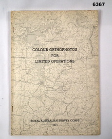
Administrative record - Royal Australian Survey Corps - Colour Orthophotos for Limited Operations 1971, Army Survey Regiment, Bendigo, 1971
This is a report on the experimental production of the colour Orthophoto Map 1:25,000 7924 - 3 - SW Northwood (Puckapunyal area) during 1971 conducted at the Army Survey Regiment Bendigo. The report covers all aspects of production including cartographic enhancement, test proofing, platemaking and printing. While Annexes A and C are listed in the contents, they are missing from the document. A second copy has been added to this record that contains Annex A that is a colour enhanced colour orthohotomap of the map sheet.Soft covered A4 sized booklet stapled along the left hand side. Title and a greyed map image printed on cover. A second copy containing Annex A was added in 2025royal australian survey corps, rasvy, fortuna, army survey regiment, army svy regt, asr -
 Greensborough Historical Society
Map, Melbourne and Metropolitan Board of Works. Survey Division, MMBW, Yarra 2500 / 17.27. Central Hurstbridge, 1978_02
Melbourne and Metropolitan Board of Works. Yarra 2500 [base map] 17-27. Central Hurstbridge. Parish of Greensborough 2724, Municipalities of Diamond Valley 257, Eltham 238 and Whittlesea 239. Prominent streets include: Anzac Avenue and Hurstbridge-Arthurs Creek Road. MMBW Map in 1:2500 [scale] series. Cream parchment with green tape reinforcing on edges and punched holes on left edge.mmbw, melbourne and metropolitan board of works, shire of diamond valley, hurstbridge - maps -
 Greensborough Historical Society
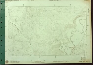
Map, Melbourne and Metropolitan Board of Works. Survey Division, MMBW, Yarra 2500 / 16.25. Wattle Glen, 1978_07
Melbourne and Metropolitan Board of Works. Yarra 2500 [base map] 16-25. Wattle Glen. Municipalities of Diamond Valley 257 and Eltham 238. Prominent streets include: Nimmo Road, Broad Gully Road and Heidelberg-Kinglake Road. Includes Yulong Park.MMBW Map in 1:2500 [scale] series. Cream parchment with green tape reinforcing on edges and punched holes on left edge.mmbw, melbourne and metropolitan board of works, shire of diamond valley, wattle glen - maps