Showing 2304 items matching "parishes"
-
 Rutherglen Historical Society
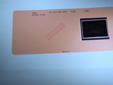
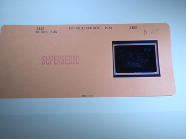
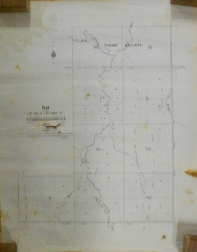
Aperture Card microfilm, Victorian Land Tiltes Office, Parish Plan Chiltern West (Superseded)
Parish Schedule of Chiltern Westcard with a single microfilm insertschedule -
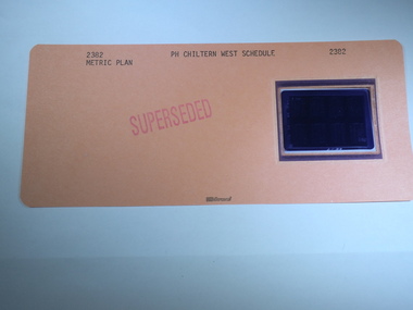
 Rutherglen Historical Society
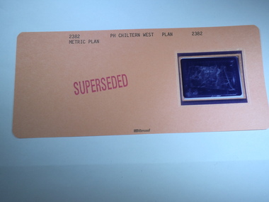
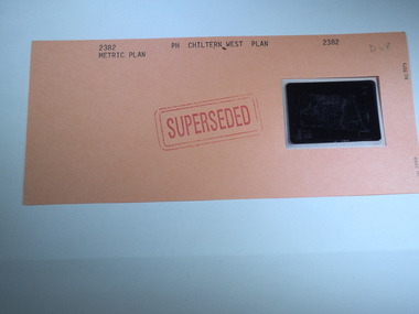
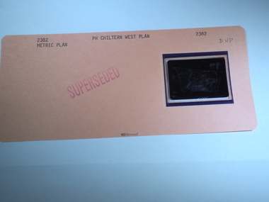
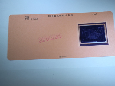
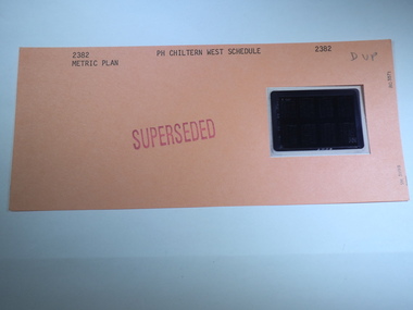
Aperture Card microfilm, Victorian Land Tiltes Office, Parish Plan Chiltern West (Superseded)
Parish Schedule of Chiltern Westcard with a single microfilm insertplan, lots, roads, boundary -
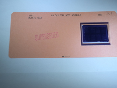
 Rutherglen Historical Society
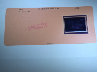
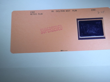
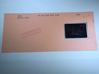
Aperture Card microfilm, Victorian Land Tiltes Office, Parish Plan Chiltern West (Superseded)
Parish Schedule of Chiltern Westcard with a single microfilm insertplan, lots, roads, boundary -
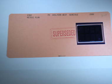
 Rutherglen Historical Society
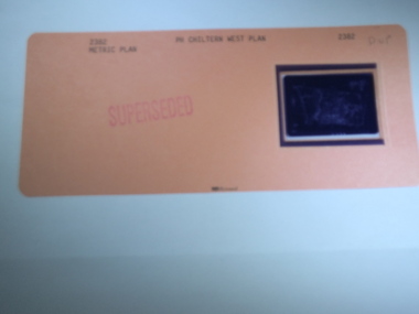
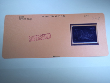
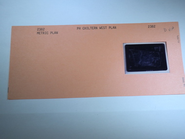
Aperture Card microfilm, Victorian Land Tiltes Office, Parish Plan Chiltern West (Superseded)
Parish Schedule of Chiltern Westcard with a single microfilm insertplan, lots, roads, boundary -
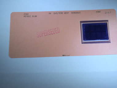
 Rutherglen Historical Society
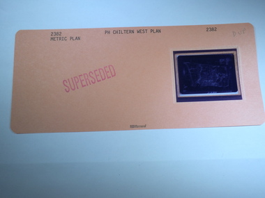
Aperture Card microfilm, Victorian Land Tiltes Office, Parish Plan Chiltern West (Superseded)
Parish Schedule of Chiltern Westcard with a single microfilm insertplan, lots, roads, boundary -
 Rutherglen Historical Society
Aperture Card microfilm, Victorian Land Tiltes Office, Parish Plan Chiltern West (Superseded)
Parish Schedule of Chiltern Westcard with a single microfilm insertplan, lots, roads, boundary -
 Rutherglen Historical Society
Aperture Card microfilm, Victorian Land Tiltes Office, Parish Plan Chiltern West (Superseded)
Parish Schedule of Chiltern Westcard with a single microfilm insertplan, lots, roads, boundary -
 Rutherglen Historical Society
Aperture Card microfilm, Victorian Land Tiltes Office, Parish Plan Chiltern West (Superseded)
Parish Schedule of Chiltern Westcard with a single microfilm insertplan, lots, roads, boundary -
 Rutherglen Historical Society
Aperture Card microfilm, Victorian Land Tiltes Office, Parish Plan Chiltern West (Superseded)
Parish Schedule of Chiltern Westcard with a single microfilm insertplan, lots, roads, boundary -
 Rutherglen Historical Society
Aperture Card microfilm, Victorian Land Tiltes Office, Parish Plan Chiltern West (Superseded)
Parish Schedule of Chiltern Westcard with a single microfilm insertplan, lots, roads, boundary -
 Rutherglen Historical Society
Aperture Card microfilm, Victorian Land Tiltes Office, Parish Plan Chiltern West (Superseded)
Parish Schedule of Chiltern Westcard with a single microfilm insertplan, lots, roads, boundary -
 Rutherglen Historical Society
Aperture Card microfilm, Victorian Land Tiltes Office, Parish Plan Chiltern West
Parish Schedule of Chiltern Westcard with a single microfilm insertplan, lots, roads, boundary -
 Rutherglen Historical Society
Aperture Card microfilm, Victorian Land Tiltes Office, Parish Plan Chiltern West (Superseded)
Parish Schedule of Chiltern Westcard with a single microfilm insertplan, lots, roads, boundary -
 Rutherglen Historical Society
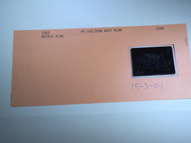
Aperture Card microfilm, Victorian Land Tiltes Office, Parish Plan Chiltern West, 15/03/2001
Parish Schedule of Chiltern Westcard with a single microfilm insertplan, lots, roads, boundary -
 Rutherglen Historical Society
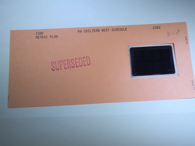
Aperture Card microfilm, Victorian Land Tiltes Office, Parish Schedule Chiltern West (Superseded)
Parish Schedule of Chiltern Westcard with a single microfilm insertschedule -
 Rutherglen Historical Society
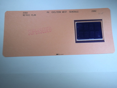
Aperture Card microfilm, Victorian Land Tiltes Office, Parish Schedule Chiltern West (Superseded)
Parish Schedule of Chiltern Westcard with a single microfilm insertschedule -
 Rutherglen Historical Society
Aperture Card microfilm, Victorian Land Tiltes Office, Parish Schedule Chiltern West (Superseded)
Parish Schedule of Chiltern Westcard with a single microfilm insertschedule -
 Rutherglen Historical Society
Aperture Card microfilm, Victorian Land Tiltes Office, Parish Schedule Chiltern West (Superseded)
Parish Schedule of Chiltern Westcard with a single microfilm insertschedule -
 Rutherglen Historical Society
Aperture Card microfilm, Victorian Land Tiltes Office, Parish Schedule Chiltern West (Superseded)
Parish Schedule of Chiltern Westcard with a single microfilm insertschedule -
 Rutherglen Historical Society
Aperture Card microfilm, Victorian Land Tiltes Office, Parish Schedule Chiltern West (Superseded)
Parish Schedule of Chiltern Westcard with a single microfilm insertschedule -
 Rutherglen Historical Society
Aperture Card microfilm, Victorian Land Tiltes Office, Parish Schedule Chiltern West (Superseded)
Parish Schedule of Chiltern Westcard with a single microfilm insertschedule -
 Rutherglen Historical Society
Aperture Card microfilm, Victorian Land Tiltes Office, Parish Schedule Chiltern West (Superseded)
Parish Schedule of Chiltern Westcard with a single microfilm insertschedule -
 Warrnambool and District Historical Society Inc.
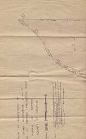
Subdivision plan, Part of Preston Estate Parish of Wappan
This map possibly relates to land of John Bostock at Preston, Delatite. Part of a collection of papers relating to the Bostock family one of the earliest pioneering families in Warrnambool.Cream coloured map printed in black with sections coloured in pink. Plan of subdivision of part of crown allotments 15 and 17 and part of Preston pre- emptive right, Parish of Wappan, County of Delatite.warrnambool,bostock,augustus bostock map, delatite map,district of wappan map, -
 Ringwood and District Historical Society
Document, Gardens of Remembrance (Heathmont and East Ringwood) - Internments
Typed documentsRegister of Internments - Garden of Remembrance, Djerrnong Parish - Heathmont Centre Internments at Holy Trinity Memorial Garden (Djerrnong Ringwood East) -
Stawell Historical Society Inc
Book, Marie Hemley & Rev. Graeme, The opening and Dedication of the Stawell Uniting Church Community Centre, 26 June1994
Order of Service for the opening and dedication of the Stawell Uniting Church Community CentrePhotocopy White Paper cover with Photo of a church behind Title of BookletThe Unitng Church in Australia Parish of Stawell. The OPening and Dedication of the Stawell Uniting Church Community Centre. Sunday 26th June 1994stawell religion -
 Eltham District Historical Society Inc
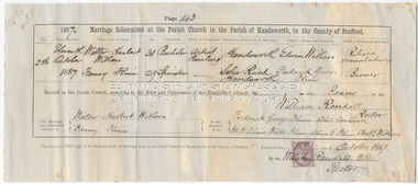
Certificate - Marriage Certificate, Walter Herbert Withers and Fanny Flinn, 11 October, 1887
Marriage solemnized at the Parish Church in the Parish of Handsworth, in the Couthy of Stafford Witnessed by Frederick George Flinn, Ethel Creswell, M.W. Flinn, Walter Flinn, Alice E. Flinn, Charles E. Withers1887, alice e. flinn, charles e. withers, edwin withers, ethel creswell, fanny flinn, fanny withers (nee flinn), frederick george flinn, m.w. flinn, marriage certificate, walter flinn, walter herbert withers, john withers collection -
 Bendigo Historical Society Inc.
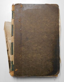
Document - LANDS OFFICE: RESIDENCE AND BUSINESS AREA LEASE REGISTER, 15.12.1953 - 5.9.1974
Document: hard cover journal, brown cover with buff spine, in very poor condition. Journal contains details of leases with number and date of application, name and address of applicant, parish, allotment area, date and issue of lease. Entries mainly for parish of Sandhurst, Bendigo, some for Swan Hill, Kerang, Echuca. On spine ' Bendigo 138 01401 to - then onto cards'Lands Officebendigo, residence and business leases, lands office -
 Bendigo Historical Society Inc.
Document - MARKS COLLECTION: STRATHFIELDSAYE PLAN 1854
Plan drawn on light paper. Written on LH side of plan 'Plan of Part of the Parish of Strathfieldsaye 1854. Scale (shown) Lithographed at the Surveyor Generals Office, Melbourne July 10th. By I. Jones'. Plan shows Emu Creek and Village Reserve at top of plan, Shepherd's Creek on RH side, Parish Boundary Line on RH and bottom of plan.map, bendigo, shire of strathfieldsaye 1854 -
Clunes Museum
Map - PLAN / MAP
.1 MAP, TOWN OF CLUNES, PARISH OF CLUNES, COUNTY OF TALBOT, STAMPED BOROUGH OF CLUNES .2 PLAN OF SUBDIVISION OF PART OF CLUNES COMMON, BOROUGH OF CLUNES, PARISH OF CLUNES,COUNTY OF TALBOT. P. CAMPBELL. ASSISTANT SURVEYOR, MARCH 1904 ON RIGHT HAND BOTTOM CORNER C71/1 CLUNES COMMON. MARKED: CHARTED R.L.A.7/2/57.1 PHOTO LITHOGRAPHED. DEPARTMENT OF LANDS AND SURVEY, MELBOURNE .2 PHOTO LITHOGRAPHED AT THE DEP. OF LANDS AND SURVEY, MELBOURNE PRICE 1/- 10.11.08map town of clunes, borough of clunes, parish of clunes, county of talbot -
 Federation University Historical Collection
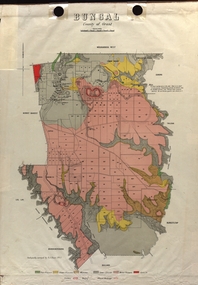
Map - Plan, E.J. Dunn, Bungal County of Grant Parish Plan
E.J. Dunn was the surveyor of this parish plan.Colour geological plan of Bungal in the County of Grant, Victoria. The areas circled in red ar craters.plan, bungal, bungeltap, black horse co. egerton, egerton, mount egerton, sister rose shaft, south learmonth co, kerrit bareet, bungaeeltap, yaloak, eastern moorabool river, corong, bungal station preemptive right, lal lal, western moorabool river, moorabool rover, borhoneychurck, mount egerton battery, bungal creek