Showing 2157 items matching "reefs"
-
 Bendigo Historical Society Inc.
Map - STRUGNELL COLLECTION: HUSTLER'S LINE OF REEF, BENDIGO, September 1913
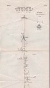
Map, Hustler's Line of Reef, Hustler's Royal Reserve No. 2 Co, Bendigo,Transverse Section, Plate No.V11 (7). Bulletin No 33 Signed H.A.Whitelaw Underground survey Office Bendigo September 1913 Drawing shows mine shaft to over 1640 feet deep and appears to show samples of connecting horizontal shafts with their respective mineral contentsUnderground Survey Office, Bendigo.map, bendigo, hustler's royal reserve no. 2 mine* -
 Bendigo Historical Society Inc.
Photograph - PHOTOGRAPHS OF BENDIGO (COPIES)
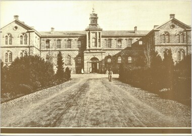
Seven copies of sepia photographs of Bendigo. a. Bendigo Hospital b. Hustler's Reef Mine Bendigo c. View Street Bendigo d. Shamrock Hotel (second Building). e. City Family Hotel f. Old Chum Claim g. Old Chum Hill Enlarged copies of photos. Each photo has a 1.2 cm brown border.bendigo, history, buildings/streetscapes -
 Bendigo Historical Society Inc.
Document - MCCOLL, RANKIN AND STANISTREET COLLECTION: NAPOLEON REEF GOLD MINING CO. N.L, 1941-1950
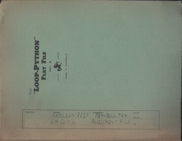
Documents: Napoleon Reef Gold Mining Co Pay Roll Tax Assessment File, Loop Python Flat File containing Payroll Tax Exemption Certificates and Return of Wages Paid (Annual) from 1941 - 1950, Also a Payroll Tax Refund notification dated 3 March 1944, Markings: File Name written in ink on front cover.organization, business, industrial - mining, mccoll rankin & stanistreet, mining, gold mining, napoleon reef -
 Bendigo Historical Society Inc.
Book - JOAN O'SHEA COLLECTION: BENDIGO GOLDFIELD BOOK, 1936
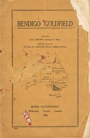
Joan O'Shea collection. Buff coloured book issued by Mines Department Melbourne. Victoria Australia 1936. Information contained within refers to History, Recent developments and future Prospects, Geology, Lines of Reef for the Bendigo area, information regarding tonnage of gold and values of same at that time. The index at the rear of the book lists all of the mines in the Bendigo area.Geo. Brown, Secretary for Mines, Mines Departmentmining, business, mines department -
 Tarnagulla History Archive
Newspaper article - A Promise Of A Golden Rebirth Rekindles Fire And Hope In The Aging Heartbeat Of The Old Tarnagulla, A Promise Of A Golden Rebirth Rekindles Fire And Hope In The Aging Heartbeat Of The Old Tarnagulla, June 4,1988
Don Clark Collection. An article (across two clippings) from the Bendigo Advertiser newspaper of June 4,1988 titled 'A Promise Of A Golden Rebirth Rekindles Fire And Hope In The Aging Heartbeat Of The Old Tarnagulla'. Discusses Western Mining returning to mine Poverty Reef and hopes it will revitalise the town of Tarnagulla. Images of Les Williams, John Lavery, Chris Williams, Don Shipston and Bill Goltz. tarnagulla, mining, western mining, revitalization, people, golden age hotel, lochcarron -
 Bendigo Historical Society Inc.
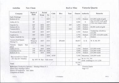
Document - VICTORIA QUARTZ - NOTES ON VICTORIA QUARTZ
Handwritten page of notes listing Company, Depth of Shaft, Years and Ounces of Gold, Names of Companies listed: Roberts & Co, Ashley & Co, Grant & Co, Holmes & Co,Touzeau & Co, Woodward & Co, Coath & CO, Taylor Gould & Co, Victoria Reef Quartz Mining Co, Victoria Quartz Syn, Cranshaw & Co and Bon Accord Co.document, gold, victoria quartz, victoria quartz, notes on victoria quartz, roberts & co, ashley & co, grant & co, holmes & co, touzeau & co, woodward & co, coath & co, taylor gould & co, victoria reef quartz mining co, victoria quartz syn, cranshaw & co and bon accord co, dickers, macartney, w rae, p ritchie, production statistics - bendigo mines n l, mines dept bendigo, history & production gen index of companies & reefs -
 Bendigo Historical Society Inc.
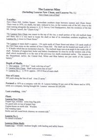
Document - THE LAZARUS MINE - NOTES ON THE THE LAZARUS MINE
One siix page handwritten and three typed copies of notes on the The Lazarus Mine including the Lazarus New Chum and the Lazarus No 1 on the New Chum Line of Reef. Notes include locality, depth of shafts, size of lease, plant, early history, the Lazarus Company, Prominence, Best Gold and Total Gold Yields. Notes prepared by Albert Richardson.document, gold, the lazarus mine, the lazarus mine, notes on the the lazarus mine, lazarus new chum, lazarus no 1, australian headquarters survey unit, george lansell, new chum hill, b c v 8 studios, sheepshead, central red white & blue, mr lazarus, lansell's 222, old chum mine, lazarus company, mr george gibbs, lansell's fortuna, ballerstedt, mr barnet lazarus, the black lead, the white lead, mount alvernia hospital, mines dept special edition 'australian mining standard' 1/6/1899, mines dept booklet 'bendigo goldfield' 1936, mines dept annual and quarterly reports, annals of bendigo mining sections 1868 - 1910, a richardson, the bendigo goldfield registry j n macartney 1/3/1871 -
 Bendigo Historical Society Inc.
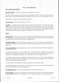
Document - NEW CHUM RAILWAY MINE - NOTES ON THE NEW CHUM RAILWAY MINE
Typed copies of handwritten notes on the New Chum Railway Mine on the New Chum Line of Reef. Notes include depth of shaft (4,318 feet), Size of lease, locality, plant - includes poppet legs,winding engine, two engine houses, crushing battery, early history, where the best gold was found, prominence, total gold production and dividends.document, gold, new chum railway mine, new chum railway mine, notes on the new chum railway mine, w d c denovan, mr piper, rourke & henderson's claim, mines dept special edition australian mining standard 1/6/1899, mines dept booklet 'bendigo goldfield' g brown 1936, 'annals of bendigo' mining sections 1890 to 1910, a richardson -
 Bendigo Historical Society Inc.
Document - HUSTLERS REEF RESERVE CONSERVATION MANAGEMENT PLAN
Conservation management plan (112 pages) prepared by Lee Andrews & Associates, Heritage Consultants, in 2011, for the Hustlers Reef Reserve. The reserve cover the site of the former Great Extended Hustlers Mine site. Leigh McKinnons amendments to the plan are included with the document. History of the site, a physical survey and analysis, comparative analysis, cultural significance and conservation policy are addressed in the document.bendigo, mining, great extended hustlers mine site -
 Bendigo Historical Society Inc.
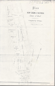
Map - NEW CHUM & VICTORIA LINES OF REEF - PLAN OF NEW CHUM & VICTORIA LINES OF REEF
Two pages of a Plan of New Chum & Victoria Lines of Reef, compiled by G. W. Hart. Taken from J. N. Macartney's G'Fields Registry for 1871. Plan shows leases from High Street to California Gully. Location of the Manchester Arms, British & American Hotel and the Quartz Miners Arms are shown. Townships of Long Gully and Ironbark are shown.map, goldfields, new chum & victoria lines of reef, victoria catharine g m coy, thornton & co, extd victoria reef g m co, ural tribute compy, nil desperandum compy, koch, north victoria g m co, danger hill coy, north endeavour coy, wheadon & co, pilot co, north energetic co, energetic compy, endeavour company, hercules co, victoria gold mines compy, iron duke g m co, golden fleece united, ballerstedt, alfred co, confidence co, prince alfred co, canterbury co, advance co, wells, humboldt co, adventure co, try me well, sterry & co, gibbs & ballerstedt, handy andy, wells?, south adventure co, w rae, victoria reef quartz m co, myra co, jackson, wybrants, burrows & sterry, new chum & victoria tribute, old chum co, ballerstedt, lazarus, watson, koch & hildebrand, lansell & hunt, dennis, abe lincoln co, bonati & co, ellesmere co, moore late menzies, british co, british tribute co, garibaldi, c c co, new chum trib, dobson & co, young chum co, little chum co, old chum co, new chum trib, little chum trib, g w hart, j n macartney's g'fields registry for 1871, manchester arms, british & american, quartz miners arms -
 Bendigo Historical Society Inc.
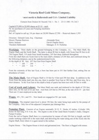
Document - NEW CHUM & VICTORIA LINES OF REEF - VICTORIA REEF GOLD MINES COMPANY
Photocopied handwritten notes about the Victoria Reef Gold Mines Company. Extracts from Dickers M. Record Vol. 1 23/11/1861 Ps 2 &3. Extracts include Capital, Shares, Names of Directors and Manager, Workings, Main shaft size and depth, Cost of work and labour, Drainage, Pumping Plant and Engine House.document, gold, new chum & victoria lines of reef, victoria reef gold mines company, ballerstedt & co l l, edward cook esq, thomas burrows, henry jackson, alexander rose, david chaplin sterry, theodore ballerstedt, h b nicholas, canal basin foundry glasgow -
 Stawell Historical Society Inc
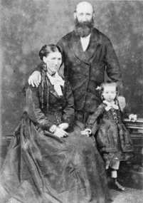
Photograph, Mr Nicholas Scallan & Mrs Kate Scallan nee unknown with their daughter c1865-1870 --- Studio Portrait
Portrait of Nicholas & Kate Scallan with Daughter c 1865 -1870. The Scallan brothers Patrick, David, Phillip and Nicholas were pioneer reefs minors and storekeepers. "The Golden Years of Stawell" by Robert Murray and Kate White mentions the Scallan Clan see page 71 Photograph of a male and female with a young child. The male standing with hand on shoulder of seated female. The child standing by her knee. An enlarged copy of the same photo also exists. stawell -
 Stawell Historical Society Inc
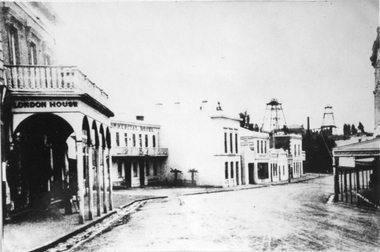
Photograph, Upper Main Stawell Street looking East with London House on the left 1880
Upper Main Street looking East. c 1880. Chadwick's Draper / Liddiard's / London House on left. Commercial Hotel, Oriental Bank / Bank of Australia, Punchard Furniture, Earlier Union Bank. Extended Cross Reef and Sloane and Scotchmans poppet Heads in Background.Street scene of north side of upper Main Street looking east. London House on left, Commercial Hotel near centre of image. Two poppet heads of mines at right distance.stawell streetscape -
 Daylesford & District Historical Society
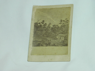
print of artwork, 1882 comet sighted near Daylesford, circa 1887
A super comet known as the 'Great September Comet' and renowned by some to be the brightest comet ever seen. Visible by the naked eye in the Southern skies in 1882. Depicts visual record of a local sighting by early settlers of a special astronomical event in the Daylesford area in the 1880's.A print of art work depicting a man and woman near their hut in forest clearing, looking up to comet in sky. Rectangular shape, sepia colour and adhered on card. On front bottom; THE COMET of 1882 as seen from Sailors Creek near Daylesford Sept 6 at 4.30am. On back; Donated by O.Bell Musk Vale written in ink. Olive Bell of Bells Reef Road family hist Mathew Bell written in pencil. At bottom written in ink; Seen at 4.30a.m Sept 6 1882astronomy, comets, daylesford, sailors creek, bell, bell family -
 Phillip Island and District Historical Society Inc.
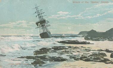
Photograph - Post Card, 1906
The "Speke" was a three masted steel ship built in Wales 1891 - the second largest at the time. The ship drifted broadside on to a reef to the east of Kitty Miller Bay on the 22nd February 1906 while on route from Peru via Sydney to Geelong in ballast to pick up wheat. Coloured postcard of the Wreck of the "Speke" near Kitty Miller Bay, Phillip Island.Wreck of the Speke," Cowes. Robb Bros. Cowes. On back: A letter from Miss Palmer's niece, Elsie with general family information. Sent on the 24/11/1907wreck of the speke, kitty miller bay phillip island, robb bros cowes phillip island, joan wilson -
 Eltham District Historical Society Inc
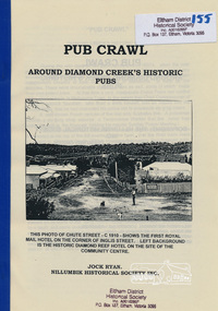
Book, Nillumbik Historical Society, Pub Crawl: around Diamond Creek's historic pubs by Jock Ryan, 2001
Hotels described include: Evelyn Arms Hotel or Tunnel Camp Hotel or Half-Way House, the Diamond Reef Hotel, the Loyal Diamond Lodge Hotel and the Royal Mail Hotel all located in Diamond Creek during a rapid population growth in Diamond Creek in the 1860s.This small publication discusses the history of local hotels in the Diamond Creek area during a significant period of development in the 1860s when mining took place in the local area. The history of hotels connects to the wider history and important social and civic link to the community at that time. [10] p. includes text and very poor photocopy reproductions of historical photographs. Perfect bound with plastic front cover only.EDHS Property stamp on front coverdiamond creek, hotels, pubs, bars, 1860s -
 Bendigo Historical Society Inc.
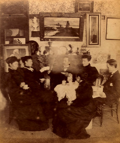
Photograph - Creeth Street Studio, 1895
Long Gully is a suburb of Bendigo, 3 km north-west of the city's centre. The Long Gully Creek signifies the physical location of the suburb, and the Long Gully reefs ran southwards from Eaglehawk. It was particularly rich, realising yields as high as five ounces of gold to the ton.Four black and white photos of a painter's studio in Creeth Street, Long Gully, Bendigo. The photos were of very low quality and have been restored as much as possible. The photos are of: 8679a Three women in long dresses and two men sitting around a table having tea in front of a mantle-piece. Several paintings are on the wall above. 8679b Four female artists (or students) painting pictures. They are supervised by a man and a woman. Various pieces of art are on the wall and floor around them. A painter's pallet is open on the floor in the foreground. 8679c Three women and one man are viewing pictures in the studio. 8679d Paintings on display in the studio history, bendigo, creeth street long gully, artist studio -
 Ballarat Heritage Services
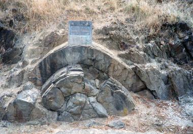
Photograph - Photograph - Colour, Clare Gervasoni, Anticlinal Fold, Castlemaine, c2007
In 1927 a plaque was installed at this anticlinal fold. Since no plaque is evident in the photo the date would be pre1927. The plaque states "This fine exhibit was disclosed when Lyttleton Street East was constructed in 1874. Saddle reefs occur in similar folds of the sandstones and slates on lower geological horizons."Colour photograph of an anticlinal fold in Lyttleton Street, Castlemaine, Victoriaanticlinal fold, geology, geological feature, castlemaine -
 Ballarat Heritage Services
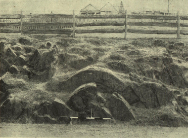
Photograph - Image, Anticlinal Fold, Lyttleton Street, Castlemaine, c1880, c1880
In 1927 a plaque was installed at this anticlinal fold. Since no plaque is evident in the photo the date would be pre1927. The plaque states "This fine exhibit was disclosed when Lyttleton Street East was constructed in 1874. Saddle reefs occur in similar folds of the sandstones and slates on lower geological horizons." An anticline at Castlemaine, Victoria. This natural feature was uncovered during Lyttleton Street roadworks in 1880. anticlinal fold, geology, castlemaine -
 Ringwood and District Historical Society
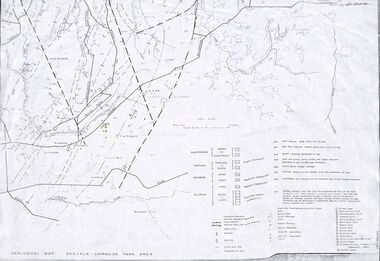
Map - Maps, Geological Map Donvale to Chirnside Park, also Victorian Railways Maps of Hawthorn to Lilydale Line incl Ringwood to East Ringwood - 1881
Faint photocopies of sections of larger maps. Geological map includes location of mine shafts circa 1920.Victory Shaft, North Victory Shaft, South Caledonia Shaft, Caledonia Shaft, North Caledonia Shaft, Black Swan Shaft, Reward Shaft, Consols Shaft, Blocks Shaft, Devonshire Shaft, Crown Shaft, Yarra Tunnel Reef Working, Bright's Shaft, Kingwood Antimony Company Shaft (Boardman's Shaft), Southern Shaft. -
![View of the township of Golden Square / [by] Nicholas Caire, circa 1876](/media/collectors/550653872162f11fb04854aa/items/578340aed0cdd1176c6899f4/item-media/5783411dd0cdd1176c68c568/item-fit-380x285.jpg) Kew Historical Society Inc
Kew Historical Society IncPhotograph, Anglo-Australasian Photographic Company, View of the township of Golden Square, c. 1876
Nicholas Caire was born on Guernsey in the Channel Islands in 1837. He arrived in Adelaide with his parents in about 1860. In 1867, following photographic journeys in Gippsland, he opened a studio in Adelaide. From 1870 to 1876 he lived and worked in Talbot in Central Victoria. In 1876 he purchased T. F. Chuck's studios in the Royal Arcade Melbourne. In 1885, following the introduction of dry plate photography, he began a series of landscape series, which were commercially successful. As a photographer, he travelled extensively through Victoria, photographing places few of his contemporaries had previously seen. He died in 1918. Reference: Jack Cato, 'Caire, Nicholas John (1837–1918)', Australian Dictionary of Biography.An original, rare photograph from the series 'Views of Victoria: General Series' by the photographer, Nicholas Caire (1837-1918). The 60 photographs that comprise the series were issued c. 1876 and reinforced a neo-Romantic view of the Australian landscape to which a growing nationalist movement would respond. Nicholas Caire was active as a photographer in Australia from 1858 until his death in 1918. His vision of the Australian bush and pioneer life had a counterpart in the works of Henry Lawson and other nationalist poets, authors and painters.‘View of the township of Golden Square’ : Views of Victoria (General Series) No.57 : Albumen silver photograph | Photo on card with Title and Description on reverse | Mounted 24 x 30 cm; Photo 12 x 17 cm.On Reverse: ‘This Township is situated in the Bendigo district, on the road to Castlemaine, and although it is of little importance as a business town, is nevertheless of large importance in consequence of the great number of Quartz Reefs it contains. Almost every house is undermined, and large fortunes have been made by the proprietors. The Church in the distance is that of the Wesleyan body. It was in this township that gold was first discovered in the district of Bendigo.’nicholas caire (1837-1918), golden square (vic), bendigo (vic), gold mining, landscape photography - victoria -
Bendigo Historical Society Inc.
Book - HISTORIC GUIDE TO BENDIGO
Historic Guide to Bendigo. 5401 has Four(4) loose slips of paper at the front. Maps are in the back.The map of the goldfields shows Streets, Lines of Reef, and Principal shafts. Recommended for tourists, students, prospectors and historians. Produced by the Bendigo Branch of The Royal Historical Society of Victoria, which was compiled from material supplied by members, and edited by H. J. G. Biggs.Produced by the Bendigo Branch of The Royal Historical Society of Victoria, which was compiled from material supplied by members, and edited by H. J. G. Biggs.bendigo, history, city history. the goldfields. -
Bendigo Historical Society Inc.
Map - MAP: VIRGINIA MINE GARDEN GULLY LINE OF REEF
Map of Virginia Mine on the Garden Gully line of reef, Eaglehawk, transverse section. Shaft, levels and Garden Gully anticlinal axial line drawn. Key shows types of formations - quartz, spurs, sandstone, slate, cleavage, lava. This map forms part of the Geological Survey of Victoria, Structure of Bendigo Goldfield report, No. 47, 1923. H.Herman, late Director of Geological Survey.Geological Survey Victoria, Geological Survey Office, Bendigo.bendigo, gold mining, virgina mine eaglehawk, eaglehawk, bendigo, gold mining, virginia mine, garden gully line of reef. -
 Bendigo Historical Society Inc.
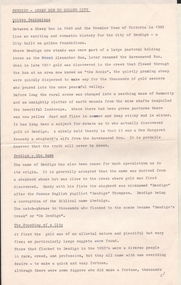
Document - BENDIGO - SHEEP RUN TO GOLDEN CITY
Seven pages typewritten documents on the history of Bendigo titled Bendigo - Sheep Run to Golden City. Chapters: Golden Beginnings, Bendigo-The Name, The Founding of a City, Quartz Reefing, Gold Decline, Bendigo-The City, A City for All, A Spectacle of Delights for the Visitor, Bendigo-City of Progress. Authored by Felicity Kingerlee, Assistant Secretary, Royal Historical Society of Victoria, Bendigo Branch.bendigo, history -
 Bendigo Historical Society Inc.
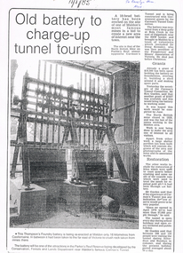
Newspaper - LONG GULLY HISTORY GROUP COLLECTION: 10 HEAD BATTERY
Copy of a newspaper article titled Old battery to charge-up tunnel tourism. Date written on the paper is 11/1/85. The Thompson's Foundry Battery was re-erected in the Parkin's Reef Reserve after being used at Bola Creek near the NSW border. A team of volunteers and a Grant had it moved to Maldon where it was set up and the area made attractive for tourists.bendigo, history, long gully history group, the long gully history group - 10 head battery, thompson's foundry battery, parkin's reef reserve, conservation forests and lands department, carman's tunnel, north british mine, parkins reef, carman's tunnel committee, dr doug kemsley, prospectors' and miners' association of victoria, mr ken garden -
 Bendigo Historical Society Inc.
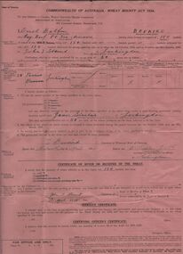
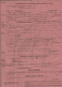
Document - ERROL BOVAIRD COLLECTION: WHEAT BOUNTY CLAIM
The John Bovaird Collection : Commonwealth of Australia Wheat Bounty Act 1934 State of Victoria Claim for Payment. By Errol Balfour Bovaird of May Reef PO via Avonmore. Regarding 150 bushels delivered for sale to John T Stewart of Lockington. Wheat produced on 50 acres : Allotment 25 Parish of Pannoo Bamawm. Dated 13/4/1935. Pink paper.agriculture, farm, wheat crop -
 Bendigo Historical Society Inc.
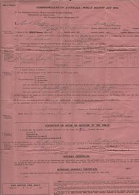
Document - ERROL BOVAIRD COLLECTION: WHEAT BOUNTY CLAIM
The John Bovaird Collection. Commonwealth of Australia Wheat Bounty Act 1934 State of Victoria Claim for Payment. By Errol Balfour Bovaird of May Reef PO via Avonmore. Regarding 96 bushels delivered for sale to R. Anderson of Lockington. Wheat produced on 50 acres : Allotment 25 Parish of Pannoo Bamawm. Dated 13/4/1935. Pink paper.agriculture, farm, wheat crop -
 Bendigo Historical Society Inc.
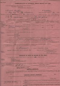
Document - ERROL BOVAIRD COLLECTION: WHEAT BOUNTY CLAIM
The John Bovaird Collection. Commonwealth of Australia Wheat Bounty Act 1934 State of Victoria Claim for Payment. By Errol Balfour Bovaird of May Reef PO via Avonmore. Regarding 96 bushels delivered for sale to R. G. Anderson of Lockington. Wheat produced on 50 acres : Allotment 25 Parish of Pannoo Bamawm. Dated 13/4/1935. Pink paper.agriculture, farm, wheat crop -
 Bendigo Historical Society Inc.
Document - ERROL BOVAIRD COLLECTION: WHEAT BOUNTY CLAIM
The John Bovaird Collection. Commonwealth of Australia Wheat Bounty Act 1934 State of Victoria Claim for Payment. By Errol Balfour Bovaird of May Reef PO via Avonmore. Regarding 96 bushels delivered for sale to Henry Jackson of Lockington. Wheat produced on 50 acres : Allotment 25 Parish of Pannoo Bamawm. Dated 13/4/1935. Pink paper.agriculture, farm, wheat crop -
 Bendigo Historical Society Inc.
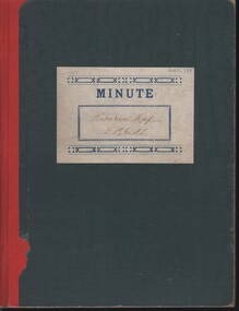
Document - MCCOLL, RANKIN AND STANISTREET COLLECTION: NAPOLEON REEF GOLD MINING CO. N.L, 1940 - 1952
Document: Napoleon Reef Gold Mining Company Minute Book, Handwritten minutes of meetings of the mine directors from 9 May 1940 - 26 March 1942, Minutes of ordinary general meetings of shareholders 4 August 1942 - 19 December 1952, Minutes signed by A.Mackay (Chairman), final entry on page 102 is a typed resolution relating to voluntary liquidation.organization, business, industrial - mining, mccoll rankin & stanistreet, mining, gold mining, napoleon reef