Showing 1735 items
matching region. | aboriginal australians -- victoria -- condah
-
 Kew Historical Society Inc
Photograph - Flooding of the Yarra River in North Kew, 1934
North Kew, now divided between Kew and Kew East, bordered the Yarra River. As such, it was a region subject to flooding in the Yarra Valley. Development beyond this point (ie Kellett Grove) was limited by the City of Kew's planning regulations. Prior to urban development, the area since European settlement and the first land sales in the district in the 1840s, had been used for dairy farming. Small sepia snapshot of floodwaters in North Kew, from the rear of 8 Kellett Grove. Verso: OUR BACKYARD / Stamped 52yarra river -- north kew, floods -- yarra valley, floods -- north kew, floods -- 1934, natural disasters -- kew, willsmere road -
 Kew Historical Society Inc
Photograph - Grandfather and granddaughter in the yard of 8 Kellett Grove, Kew, 1934
North Kew, now divided between Kew and Kew East, bordered the Yarra River. As such, it was a region subject to flooding in the Yarra Valley. Development beyond this point (ie Kellett Grove) was limited by the City of Kew's planning regulations. Prior to urban development, the area since European settlement and the first land sales in the district in the 1840s, had been used for dairy farming. Vivid photograph contrasting domestic life and relationships with natural disasters such as the flood of 1934.Small sepia snapshot of a grandfather and granddaughter sitting in the backyard of 8 Kellett Grove, North Kew, with the floodwaters stretching behind them.Verso: GRANDDAD AND I IN BACKYARDyarra river -- north kew, floods -- yarra valley, floods -- north kew, floods -- 1934, natural disasters -- kew, willsmere road -
 Kew Historical Society Inc
Photograph - Submerged houses in River Avenue, North Kew, 1934
North Kew, now divided between Kew and Kew East, bordered the Yarra River. As such, it was a region subject to flooding in the Yarra Valley. Development beyond this point (ie Kellett Grove) was limited by the City of Kew's planning regulations. Prior to urban development, the area since European settlement and the first land sales in the district in the 1840s, had been used for dairy farming. Vivid photograph contrasting domestic life and relationships with natural disasters such as the flood of 1934.Small sepia snapshot of two submerged houses belonging to local families in River Avenue, North Kew, during the 1934 floods. The view is presumably from near Kellett Grove looking north towards Fairfield.Verso: COES & HYATTS ROOF / RIVER AVENUE / Stamped: 6414yarra river -- north kew, floods -- yarra valley, floods -- north kew, floods -- 1934, natural disasters -- kew -
 Kew Historical Society Inc
Photograph - Flooding of the Yarra River in North Kew, 1934
North Kew, now divided between Kew and Kew East, bordered the Yarra River. As such, it was a region subject to flooding in the Yarra Valley. Development beyond this point (ie Kellett Grove) was limited by the City of Kew's planning regulations. Prior to urban development, the area since European settlement and the first land sales in the district in the 1840s, had been used for dairy farming. Vivid photograph contrasting domestic life and relationships with natural disasters such as the flood of 1934.Small sepia snapshot of the donors grandfather rescuing the family dog's kennel from rising floodwaters at the rear of 8 Kellett Grove, North Kew, .Verso: DAD SECURING NIPPY'S DOG KENNEL / Stamped 6414yarra river -- north kew, floods -- yarra valley, floods -- north kew, floods -- 1934, natural disasters -- kew -
 Kew Historical Society Inc
Photograph - Flooding of the Yarra River in North Kew, 1934
North Kew, now divided between Kew and Kew East, bordered the Yarra River. As such, it was a region subject to flooding in the Yarra Valley. Development beyond this point (ie Kellett Grove) was limited by the City of Kew's planning regulations. Prior to urban development, the area since European settlement and the first land sales in the district in the 1840s, had been used for dairy farming. .Small sepia snapshot of a local family's house in what was then River Avenue, North Kew being surrounded by floodwaters.Verso: THE SIDE OF RYANSyarra river -- north kew, floods -- yarra valley, floods -- north kew, floods -- 1934, natural disasters -- kew -
 Kew Historical Society Inc
Photograph - Flooding of the Yarra River in North Kew, 1934
North Kew, now divided between Kew and Kew East, bordered the Yarra River. As such, it was a region subject to flooding in the Yarra Valley. Development beyond this point (ie Kellett Grove) was limited by the City of Kew's planning regulations. Prior to urban development, the area since European settlement and the first land sales in the district in the 1840s, had been used for dairy farming. .Small sepia snapshot of what was then River Avenue, North Kew submerged by floodwaters.The photo was taken in the vicinity of 8 Kellett Grove, North Kew. Verso: TAKEN FROM OUR STREET JUST SEE A BIT OF RYAN'S FENCE / 1934yarra river -- north kew, floods -- yarra valley, floods -- north kew, floods -- 1934, natural disasters -- kew -
 Kew Historical Society Inc
Photograph - Flooding of the Yarra River in North Kew, 1934
North Kew, now divided between Kew and Kew East, bordered the Yarra River. As such, it was a region subject to flooding in the Yarra Valley. Development beyond this point (ie Kellett Grove) was limited by the City of Kew's planning regulations. Prior to urban development, the area since European settlement and the first land sales in the district in the 1840s, had been used for dairy farming. .Small sepia snapshot of the devastation caused by the 1934 flood.The photo was taken in the vicinity of Kellett Grove, North Kew and includes the roof of Chipperfield's Boathouse as well as other local houses.Verso: THIS IS CHIPPERFIELD'S BOAT SHEDS & COES & WILLIAMS TAKEN FROM OUR STREET / 1934yarra river -- north kew, floods -- yarra valley, floods -- north kew, floods -- 1934, natural disasters -- kew, chipperfields boathouse -
 Vision Australia
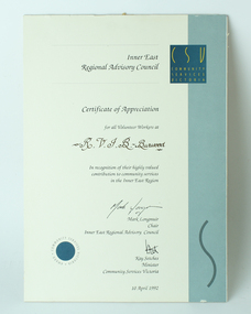
Award - Text, Community Services Victoria Certificate of Appreciation to RVIB Burwood, 10 April 1992
A certificate from Community Services Victoria to the volunteers at the RVIB Burwood school. It reads "Awarded for all Volunteer Workers at R.V.I.B. Burwood in recognition of their highly valued contribution to community services in the Inner East Region." Signed by the Chair of the Inner East Regional Advisory Council, Mark Longmuir and Minister, Community Services Victoria, Kay Setches, dated 10th April 1992.1 A4 sized certificate of appreciationrvib burwood school, awards -
 Vision Australia
Audio (item) - Sound recording, Royal Victorian Institute for the Blind, Around the Institute: February 20, 2001
Around the Institute was a weekly program designed to keep clients and staff informed of events, activities and thoughts relating to low vision and blindness. It consisted of interviews undertaken by Jo Matthews, with sound engineer Ed Gamble, designed to inform, educate and explore on a variety of topics. February 20: Eastern Region office move – Graeme Craig, My role as an Education Consultant – Sean Tyrell.royal victorian institute for the blind, radio shows -
 Orbost & District Historical Society
plan, before 1948
Drainage infrastructure was developed and maintained in this region by the Snowy River Improvement Trust. The Trust was administered by a local committee and its activities funded by a local rate charged on the farmers and land owners in the Trust’s designated district. The level of the rate charged by the Trust was designed to be proportionate to the benefit derived from the works undertaken. Financial assistance was provided by the State Government from time to time for specific projects such as post flood repairs but not for new capital works. The Trust undertook new drainage and river management works including tree planting, rock beach construction and servicing of the drains and flood gates. The Trust also provided a personal flood warning service to the farmers in its district. The Trust ceased to operate in 1997 with the advent of the East Gippsland Catchment Management Authority. The infrastructure developed by the Trust continues to provide a service to the farmers in the region. (ref. 4 East Gippsland CMA Submission to Inquiry into Flood Mitigation Infrastructure in Victoria) This plan is significant as a historical document. The Snowy River Improvement Trust was vital to the Orbost district because of its ability to apply local knowledge and to engage the local farming community.A large plan of divisions of land for the purpose of levying the Snowy River Improvement District - Bete Bolong, Orbost, Waygara, Newmerella and Orbost East. The properties are coloured according to levy amount. The scale is 1" - 20 chains. snowy-river-improvement-trust -
 Orbost & District Historical Society
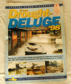
pictorial magazine, From Drought to Deluge '98, 1998
This magazine cost $2.50 and was produced to support the East Gippsland Red Cross Flood Appeal. Following heavy rain in East Gippsland in June, 1998, major flooding occurred in the Mitchell, Nicholson, Tambo, Snowy, Brodribb and Bemm Rivers. Other streams in the region also experienced high flows during this time. Probably the most severe direct impacts of the floods were to the rural sector.This magazine is a contemporary record of a significant local event.Two copies of a magazine pictorial of the floods of 1998. Photos are black and white. They are of Bairnsdale, Orbost, Lakes Entrance, Raymond Island, Bemm River, Bruthen , Tambo and Cabbage Tree. flood-1998 flood-east gippsland disaster-floods -
 Orbost & District Historical Society
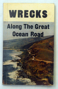
book, Wrecks Along The Great Ocean Road, 1976
Jack Kenneth Loney (21 October 1925 – 13 February 1995) was an amateur Australian marine historian who published over one hundred books and numerous newspaper and magazine articles. He was a schoolteacher and principal until his retirement. He became interested in maritime history after preparing several general history booklets covering the Otway region of western Victoria, Australia.This item is a useful reference tool.A 132 pp book with a coloured photograph of the Great Ocean Road, on the south-western coast of Victoria, on the front cover. The title. "Wrecks Along The Great Ocean Road" is in black print above the photograph. The book contains black / white photographs and sepia text.It lists and describes shipwrecks on the west coast from Point Lonsdale to Portland.shipwrecks-great-ocean-road-victoria shipping-history -
 Warrnambool and District Historical Society Inc.
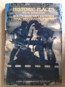
Book, Historic Places of South West Victoria
This is the third in a series of booklets produced by the Land Conservation Council in 1997 (176 pages). Booklets One and Two (1996) contained A Descriptive Report and Proposed Recommendations. The Final Recommendations include information on processes for protection of historic places, lists of significant places in the south-western region and aboriginal historic places. Attached inside the back cover are two maps showing the location of the significant places.This is a useful book as it lists the declared historic sites in the region and researchers will find the information helpful. This is a soft-cover book with a multi-coloured cover featuring a photograph of the Pioneers Memorial, Deep Lead. It has a red-coloured spine and back cover.Front Cover – Historic Places - Special Investigation - South-Western Victoria - Final Recommendations – Land Conservation Council Spine – Historic Places – South-Western Victoria – Final Recommendations – Land Conservation Council Back Cover – Historic Places, Final Rec., code used for retail sales warrnambool -
 Warrnambool and District Historical Society Inc.
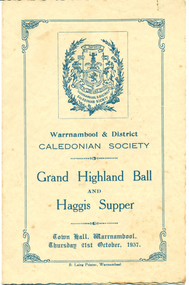
Programme, Grand Highland Ball and Haggis Supper 1937, 1937
This is a programme for a ball and a supper conducted by the Warrnambool and District Caledonian Society in 1937. The Western Caledonian Society was formed in Warrnambool in 1864 to promote and preserve Scottish culture in the region and in the 19th century ran many highland gatherings. The Warrnambool and District Caledonian Society still operates today.The programme indicates the Society was also active in the 20th century. The motto of the Society is that of the first Stuart King of Scotland. This programme is of considerable historical importance because of its menu, its toasts and its list of office bearers of the Warrnambool and District Caledonian Society in 1937.A piece of light weight card folded in two to make four pages with blue printing on each page on a buff coloured background. The front page has a decorative border and a society crest.Warrnambool & District CALEDONIAN SOCIETY Grand Highland Ball and Haggis Supperwarrnambool, warrnambool & district caledonian society, haggis supper -
 Warrnambool and District Historical Society Inc.
Badge, Port of Warrnambool Flagstaff Hill, Late 20th century
Flagstaff Hill is a maritime museum which draws on the rich maritime history of the region. It is situated overlooking Lady Bay in Warrnambool and is designed to represent the town of Warrnambool in around the 1870-80’s As well as paid staff on site it enjoys a large volunteer group who do various tasks around the village from tours to maintenance and recording of information. This badge recognises the contribution of one such volunteer. An item which recognizes effort in the local community.Round gold edged medal with picture of lighthouse and flagstaff surrounded by red with gold lettering. Number engraved on back.698 engraved on back. Port of Warrnambool Villager 1850. Flagstaff Hillflagstaff hill badge, warrnambool -
 Warrnambool and District Historical Society Inc.
Book - Biography of Charles Pratt, Kevin O'Reilly, Charles Pratt of Belmont Common, 2016
Biographical material of Charles Pratt and diary extractsThis is a book of 280 pages with a blue and brown hard cover with sepia -coloured photographs on the front and back covers and multi-coloured print on the cover and spine. The dust cover has the same content as the hard cover. The pages contain printed text, black and white photographs, charts and sketches. non-fictionBiographical material of Charles Pratt and diary extracts charles pratt, 1920s aerial photographs, warrnambool history -
 Falls Creek Historical Society
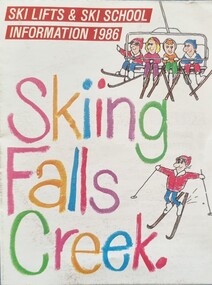
Flyer - Skiing Falls Creek, Information 1986
Part of yearly marketing and information material promoting Falls Creek ski region for the winter holidays, this brochure includes a Lesson Timetable Planner and booking details. During the summer of 1985-1986 an artificial snowmaking system had been installed at Falls Creek to service the Panorama, Towers, Tom Thumb and Playground Ski Runs. This flyer also recognised 25 years of skiing at Falls Creek.This item is important because it documents seasonal activities at Falls Creek Alpine ResortA small fold-out flyer including images, caricatures of skiers and a table of the price structure for activities at Falls Creek in 1986.On Cover: SKI LIFTS & SKI SCHOOL INFORMATION 1986 Skiing Falls Creekfalls creek marketing, falls creek ski, falls creek ski school -
 National Communication Museum
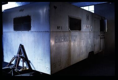
Vehicle - Mobile Telephone Exchange, c. 1965
Manufactured in the 1960s, this mobile emergency telephone exchange was fitted into a caravan. Part of the Shepparton Division State Disaster Plan, the caravan could be towed to areas affected by disasters to enable communications to recommence. The caravan remained in service until approximately 1974.Mobile infrastructure plays an important role in Australian communications, owing to the often remote and hostile environments in which Australians live and work. Exchanges such as this facilitated phone calls in the aftermath of an emergency, particularly for hospitals, police and other emergency services. Today, Mobile Exchange on Wheels (MEOWs), Cell on Wheels (CoW) and Satellite Cell on Wheels (SatCOW) - which provide temporary landline and broadband services, mobile phone coverage and service in areas without communications infrastructure respectively - are a critical part of emergency response procedures for natural disasters such as fire and flood. Though technology has progressed, the need for rapid service in remote areas remains a present concern of the communications service providers in Australia. This mobile service infrastructure is historically significant as an early example of a service which has evolved over decades, yet is still needed today. The exchange, as a representative example of a vehicle which would provide early-response in a disaster, is socially significant as a facilitator of critical communications needs in devastated communities: access to emergency services and contact with family and friends. The exchange itself, intact from its period of use, provides an insight into technology of the 1970s.Mobile emergency exchange housed in a caravan trailer on 2 wheel base, duralin body, steel tow bar, Caravan divided into 3 sections; the exchange room; the relay room and the main frame room. The exchange room contains 3 switchboards, a folding table, cupboards, benches and switch rack (.1). table (.2), steel bar for attaching the table (.3), back boards of switchboards (.4-.6), switches (.7-.16), box of switches (.17). There is a wall phone magneto, 300 type handset on wall and 2 skylights with wire screens. .11? hat pegs and shelf; there are 2 fluorescent tubes for lighting, all in exchange section. The floor is covered with 2 tone grey tiles and there are wire mesh on outside of windows and a geometric curtain inside behind switch rack. There is a flywire screen door as well as exterior door. The relay room has a sectioned door so half can open at a time. Room contains a cupboard with folding bench top beneath a curtained window. The opposite wall has a bank of batteries and transmission condensers; there is a shelf above window, one fluorescent tube and fuse boxes. Tiles on floor also. The main frame room contains many metres of coiled black covered cable, a black covered magneto wall telephone with 300 type handset; grey plastic jumper cords, a rack of termination points and wire with wasp nests attached. There is a small iron step under door, a fluorescent tube on wall and 3 hat hooks. Roll of Paper Handtowels (.18), cord and handle (.19), red exchange cords and plugs (.20-.22), plastic aluminium runners (.23,.24), headset (.25,.26), logbook (.27), battery readings (.28), box containing papers circuit drawings etc (.29-.93), paper lists off wall (.94,.95). Books, record books etc (.96-.103). Manila folder (.104) containing circuit drawings (105-.124). Wooden drawer (.125), metal drawer containing subscribers master cards, record of faults cards, particular switchboards connected, Junction line cards (.126). Box of valves (.127), box of clamps (.128). Box of 2000 type rack fuses, red 1 1/2 AMPS, black 3 AMP, blue 1/2 AMP (.129). Box of sleeves for covering wire joints (.130), plastic beakers (.131,.132), soap (.133), box of white plastic squares (.134), time switch "Venner BF/43 time switch" Made in England (.135), box of bolts, knobs etc (.136), box of switchboard number indicators (.137), fuse (.138), fuse wire (.139), football card (.140). Box of cartridge fuse 6 AMP (.141). Envelope of drawing pins, rubber bands (.142), black plastic, paper tape centres (.143-.152), metal plug (.153), 2 signs "Beware of vehicles" (.154-.155). Paper listing Naringal East automatic conversion (.156). Green Commonwealth of Australia note pad (.157). Wiring plug for tail lights (.158). Black fuse plugs (.159,.160). Box of bolts (.161). 2 sections of blue plastic coated wires (.162,.163). Gloves used for working on batteries (.164-.167). Wasp nests (.168,.169). White fuse (.170). Photographs of van in use (.171,.172)..1 on front: "ANOTHER / MOBILETRAIL / PRODUCT" "MAX SPEED / 25MPH" "TRAILER BRAKES / --- / " On sides: "EMERGENCY TELEPHONE EXCHANGE" "NO 1" "PMG" "TCQ / GROSS 250 / TARE 182 / LOAD 162" "6" "COUNTRY BRANCH / NORTH REGION / [SHEPPARTON DIVISION]" "LAW'S SIGNS" "Telecom Australia" On back: "DANGER / LONG LOAD" "MQA 3787" .133: "FIR OIL" "AUSTRALIA"mobile telephone exchanges, mobile telecommunications trailers, trailers, transport, natural disaster, black saturday, bushfires, floods, emergency communications -
 Warrnambool and District Historical Society Inc.
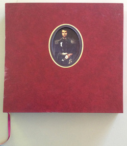
Books, La Trobe Journal and Art Works Vol 1 & Vol 2, 1999
These volumes reproduce the diary material and the landscapes and sketches of Charles La Trobe, the Superintendent of the Port Phillip District of New South Wales ( 1839- 1851) and Lieutenant Governor of the colony of Victoria ( 1851-54 ). La Trobe is regarded as the man most responsible for the establishment of Warrnambool in 1847. His diaries document his trips to the Warrnambool region in 1845, 1846, 1848 and 1849 before and after the town site was settled.These volumes are of artistic significance being beautifully and expensively produced. The volumes contain information of vital importance to our knowledge of our early Warrnambool history. Other important details in the diary include information on early shipwrecks and the first settlers in our district in our district, especially the Allan brothers..1 This is a burgundy leather bound book of 380 pages. It has gold lettering on the cover and the spine and an oval inset in the centre of the front cover containing a coloured portrait of Charles La Trobe. The pages contain black and white and coloured art works and sketches and printed material. There is a burgundy coloured ribbon for marking pages The book is encased in a hard leather cover with a cut out window with gold edging. .2 This is a burgundy leather bound book of 343 pages. It has gold lettering on the cover and the spine and a rectangular inset in the centre of the front cover containing a coloured sketch of a rock, sea and cliffs drawn by Charles La Trobe. The pages contain sepia and black and white drawings and printed material. There is a burgundy coloured ribbon for marking pages. The book is encased in a hard leather cover with a cut out window with gold edging . .1 Charles Joseph La Trobe AUSTRALIAN NOTES 1839-1854 .2 Charles Joseph La Trobe LANDSCAPES AND SKETCHES charles la trobe -
 Federation University Historical Collection
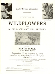
Correspondence, "Banner " Print, Dimboola, Correspondence from Kiata State School concerning an Exhibition of Wildflowers, 1958, 1958
The following were office bearers of the Kiata Progress Association in 1958: K. Jordon (President) G. Osborne (Secretary) Ivan Cole & S. Clark (Vice_Presidents Alison Jordan (Assistant Secretary) It is a assumed that the Kiata Progress Association Wildflower Exhibition was the predecessor of the Little Desert Wildflower Exhibition is held each year in September-October. Kiata is a town in the Wimmera region between Nhill and Dimboola, western Victoria, Australia.Correspondence from Kiata State School to the Ballarat School of Mines concerning an Exhibition of Wildflowers, 1958 .1-2) Two page hand written letter dates 20 August 1958 and signed by G.B. Osborne, Honorary Secretary of the Kiata Progress Association. .3) one page typed letter (carbon copy) dated 28 August 1958 in reply to above .4) Printed flyer advertising the Kiata Progress Association Exhibition of Wildflowers and Museum of Natural History to be held in Kiata Hall on 25 September to 05 October 1958. The flyer includes photographic depictions of Kakea Petiolaris, Hakea multilineata and Mallee Hens.mallee hens, kiata progress association, wildflower exhibition, kiata hall, little desert, lowan sanctuary, k. jordan, ivan cole, s. clarke, g. osborne, alison jordan -
 University of Melbourne, Burnley Campus Archives
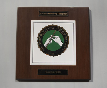
Plaque, 1996-2013
The plaque was presented in 2013 to Ross Gregory Hall, Senior Lecturer (Production Horticulture) Faculty of Agriculture, Forestry and Horticulture. The letter to Ross Gregory Hall was written by Jolyon Burnett, Senior Industry Program Manager, granting funding for NY538 International Propagators Society Australian Region Annual Conference, Melbourne, May 1996. The agreement between The Horticultural Research and Development Corporation and the Faculty of Agriculture, Forestry and Horticulture for this project. 1. Plaque on wooden board. 2. Letter to Ross Gregory Hall. 3. Agreement between The Horticultural Research and Development Corporation and the Faculty of Agriculture, Forestry and Horticulture for this project.ross gregory hall, jolyon burnett -
 National Wool Museum
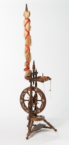
Spinning Wheel
Part of the Zakrzewski Collection of spinning wheels donated to the National Wool Museum by Mr Wlodzimierz Zakrzewski. For many years, Mr Zakrzewski collected, researched and repaired spinning wheels from all over the world. This wheel is from the Black Forest region of Germany and dates from the late 19th century. It would have been used mostly for spinning flax. It was purchased from MacDonald Antiques at the Hawthorn Market.Part of the Zakrzewski Spinning Wheel collection.handicrafts - history flax, spinning wheels, highlights of the national wool museum: the zakrzewski spinning wheel collection - exhibition (28/07/2001 - 02/12/2001), zakrzewski, mr wlodzimierz, handicrafts - history, flax -
 National Wool Museum
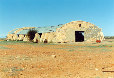
Photograph
Photo depicts Cordillo Downs Shearing Shed, located 176kms north of Innaminka. Donated by Gwen Cox (Hon. Staff Member). Once the largest sheep station in the world, the shearing shed had 120 stands. The wool clip had to be carted 600km down the track to the rail head at Farina by camel train. In 1883, a complete scouring plant was installed at "Cordillo". The region now (1989) carries cattle.shearing sheds, photographs, cordillo downs -
 Vision Australia
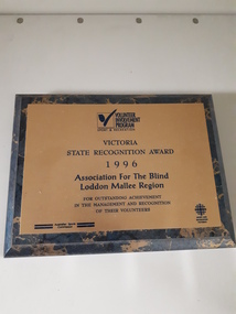
Photograph - Image, Victoria State Recognition Award
Volunteering has been an integral part in providing services. This award was presented to the Loddon Mallee (Bendigo and Swan Hill) offices for their active use of volunteers in providing recreational programs. It reads as follows: Volunteer Involvement Program - Sport and Recreation Victoria State Recognition Award 1996 Association for the Blind Loddon Mallee Region For outstanding achievement in the management and recognition of their volunteers Australian Sports Commission Sports and Recreation VictoriaDigital image of bronze inscribed plate on marbled surfaceassociation for the blind, awards -
Vision Australia
Audio (item) - Sound recording, Royal Victorian Institute for the Blind, Around the Institute: April 16, 2002
Around the Institute was a weekly program designed to keep clients and staff informed of events, activities and thoughts relating to low vision and blindness. It consisted of interviews undertaken by Jo Matthews-Lamb, Susan Thompson, Janet Cronin and Corey Nassau, with sound engineer Ed Gamble, designed to inform, educate and explore on a variety of topics. April 16: SEDA - David Blyth, Western region services - Laurel Sutherland.royal victorian institute for the blind, radio shows -
 City of Greater Bendigo - Civic Collection
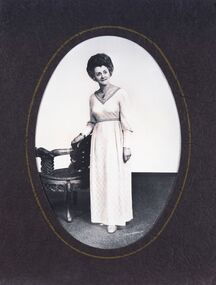
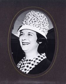
Photograph - Portrait, Martin Washington, Gwen Jeffrey, Mayoress 1969 - 70, c 1969
Prior to the election of female Councillors and Mayors in the 1960’s, the Lady Mayoress role was one of the few ways women could officially undertake civic duties. Mayoresses made important contributions to their local communities through their charity work and as ambassadors for their region on a state and federal level. They also undertook some Mayoral duties on occasions when their husband was unavailable. Gwen Jeffrey served as Mayoress from 1969 - 70.Reproduction of Black and White photographic studio portrait sitting behind oval mount.lr; Martin Washingtoncity of bendigo mayoress, city of greater bendigo portraits, city of bendigo mayor, mayor jeffrey, mayoress jeffrey, lansell pendant -
 City of Greater Bendigo - Civic Collection
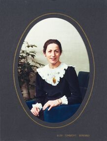
Photograph - Portrait, Peg Elliott, Mayoress 1971 - 72, c 1971
Prior to the election of female Councillors and Mayors in the 1960’s, the Lady Mayoress role was one of the few ways women could officially undertake civic duties. Mayoresses made important contributions to their local communities through their charity work and as ambassadors for their region on a state and federal level. They also undertook some Mayoral duties on occasions when their husband was unavailable. Peg Elliott served as Mayoress from 1971 - 72.Black and White photographic portrait sitting behind oval mount.lr; Martin Washingtonstudio photography, city of bendigo mayoress, city of greater bendigo portraits, city of bendigo mayor, elliott collection, mayor d elliott, mayoress p elliot, lansell pendant -
 City of Greater Bendigo - Civic Collection
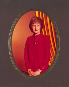
Photograph - Portrait, Don Semmens, Kathy Tomkinson, Mayoress, 1980 - 81, c 1980
Prior to the election of female Councillors and Mayors in the 1960’s, the Lady Mayoress role was one of the few ways women could officially undertake civic duties. Mayoresses made important contributions to their local communities through their charity work and as ambassadors for their region on a state and federal level. They also undertook some Mayoral duties on occasions when their husband was unavailable. Kathy Tomkinson served as Mayoress from 1980 - 81.Colour photographic studio portrait sitting behind oval mount.Inside lr; Don Semmens / Bendigocity of bendigo mayoress, city of bendigo mayor, mayoress tomkinson, mayor tomkinson, lansell pendant -
 City of Greater Bendigo - Civic Collection
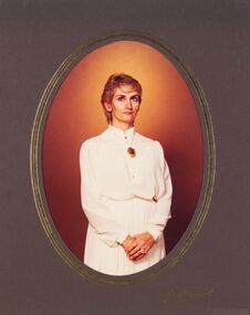
Photograph - Portrait, Don Semmens, Elizabeth Stoltz Mayoress 1981 - 82, c 1981
Prior to the election of female Councillors and Mayors in the 1960’s, the Lady Mayoress role was one of the few ways women could officially undertake civic duties. Mayoresses made important contributions to their local communities through their charity work and as ambassadors for their region on a state and federal level. They also undertook some Mayoral duties on occasions when their husband was unavailable. Elizabeth Stolz served as Mayoress from 1981 - 82.Black and White photographic portrait sitting behind oval mount.lr; Don Semmens Bendigocity of bendigo mayoress, city of greater bendigo portraits, city of bendigo mayor, lansell pendant, mayoress stoltz, mayor stotz -
 City of Greater Bendigo - Civic Collection
Photograph - Portrait, H. Hampel, Judith Mansell, Mayoress 1983 - 84, c 1983
Prior to the election of female Councillors and Mayors in the 1960’s, the Lady Mayoress role was one of the few ways women could officially undertake civic duties. Mayoresses made important contributions to their local communities through their charity work and as ambassadors for their region on a state and federal level. They also undertook some Mayoral duties on occasions when their husband was unavailable. Judith Mansell served as Mayoress from 1983 - 84.Colour photographic portrait sitting behind oval mount.lr; H. Hampelcity of bendigo mayoress, city of greater bendigo portraits, city of bendigo mayor, lansell pendant, mayor mansell, mayoress mansell