Showing 6434 items matching "robinvale-aboriginal community. | housing-aborignal"
-
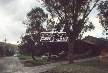
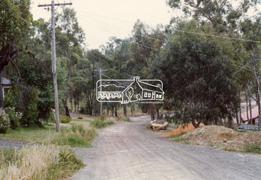
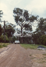
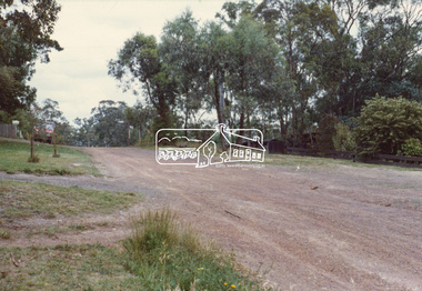
 Eltham District Historical Society Inc
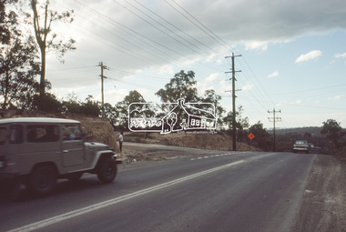
Slide, Quinn Estate near Sackville Reserve, Montmorency, c.Oct. 1980
One of a series of images of roads and infrastructure focussed on the Quinn Estate in Montmorency taken by Eltham Shire Council Planning and Engineering officers. They provide perspective of the changes in housing styles and road development that began sweeping in from the mid 1970s with increasing urbanisation of what was once more outlying suburbs and regions.35 mm colour positive transparency Mount - Kodak Kodachrome CardProcessed Oct 1980quinn estate, housing estate, infrastructure, montmorency, roads, sackville reserve, sackville street -
 Eltham District Historical Society Inc
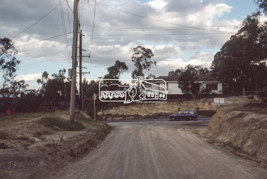
Slide, Reichelt Avenue, Montmorency at intersection with Bolton Street (now closed), c.Oct. 1980
One of a series of images of roads and infrastructure focussed on the Quinn Estate in Montmorency taken by Eltham Shire Council Planning and Engineering officers. They provide perspective of the changes in housing styles and road development that began sweeping in from the mid 1970s with increasing urbanisation of what was once more outlying suburbs and regions.35 mm colour positive transparency Mount - Kodak Kodachrome CardProcessed Oct 1980bolton steet, eltham, infrastructure, montmorency, reichelt avenue, roads -
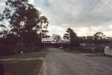
 Eltham District Historical Society Inc
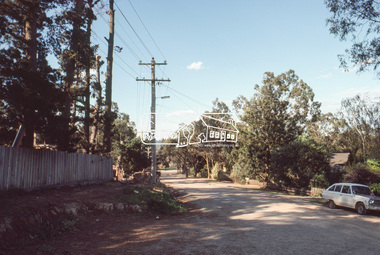
Slide, Quinn Estate, Reichelt Avenue near Riverina Road, Montmorency, c.Oct. 1980
One of a series of images of roads and infrastructure focussed on the Quinn Estate in Montmorency taken by Eltham Shire Council Planning and Engineering officers. They provide perspective of the changes in housing styles and road development that began sweeping in from the mid 1970s with increasing urbanisation of what was once more outlying suburbs and regions.35 mm colour positive transparency Mount - Kodak Kodachrome CardProcessed Oct 1980housing estate, infrastructure, montmorency, quinn estate, reichelt avenue, roads -
 Eltham District Historical Society Inc
Slide, Quinn Estate, Buena Vista Drive, Montmorency near school looking northwest, c.Oct. 1980
One of a series of images of roads and infrastructure focussed on the Quinn Estate in Montmorency taken by Eltham Shire Council Planning and Engineering officers. They provide perspective of the changes in housing styles and road development that began sweeping in from the mid 1970s with increasing urbanisation of what was once more outlying suburbs and regions.35 mm colour positive transparency Mount - Kodak Kodachrome CardProcessed Oct 1980housing estate, infrastructure, montmorency, quinn estate, roads -
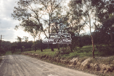
 Eltham District Historical Society Inc
Slide, Quinn Estate looking west along Cressy Street, Montmorency, c.Oct. 1980
One of a series of images of roads and infrastructure focussed on the Quinn Estate in Montmorency taken by Eltham Shire Council Planning and Engineering officers. They provide perspective of the changes in housing styles and road development that began sweeping in from the mid 1970s with increasing urbanisation of what was once more outlying suburbs and regions.35 mm colour positive transparency Mount - Kodak Kodachrome CardProcessed Oct 1980cressy street, housing estate, infrastructure, montmorency, quinn estate, roads -
 Eltham District Historical Society Inc
Slide, Quinn Estate looking west along Cressy Street, Montmorency near no. 29, c.Oct. 1980
One of a series of images of roads and infrastructure focussed on the Quinn Estate in Montmorency taken by Eltham Shire Council Planning and Engineering officers. They provide perspective of the changes in housing styles and road development that began sweeping in from the mid 1970s with increasing urbanisation of what was once more outlying suburbs and regions.35 mm colour positive transparency Mount - Kodak Kodachrome CardProcessed Oct 1980cressy street, housing estate, infrastructure, montmorency, quinn estate, roads -
 Eltham District Historical Society Inc
Slide, Quinn Estate, looking along Cressy Street towards Quinn Way, Montmorency, c.Oct. 1980
One of a series of images of roads and infrastructure focussed on the Quinn Estate in Montmorency taken by Eltham Shire Council Planning and Engineering officers. They provide perspective of the changes in housing styles and road development that began sweeping in from the mid 1970s with increasing urbanisation of what was once more outlying suburbs and regions.35 mm colour positive transparency Mount - Kodak Kodachrome CardProcessed Oct 1980quinn estate, cressy street, housing estate, infrastructure, montmorency, roads -
 Eltham District Historical Society Inc
Slide, Reichelt Avenue, Montmorency at T-bowl near no. 27, c.Oct. 1980
One of a series of images of roads and infrastructure focussed on the Quinn Estate in Montmorency taken by Eltham Shire Council Planning and Engineering officers. They provide perspective of the changes in housing styles and road development that began sweeping in from the mid 1970s with increasing urbanisation of what was once more outlying suburbs and regions.35 mm colour positive transparency Mount - Kodak Kodachrome CardProcessed Oct 1980infrastructure, montmorency, reichelt avenue, roads, t-bowl -
 Eltham District Historical Society Inc
Slide, Intersection of Reichelt Avenue, Montmorency at Bolton Street, c.Oct. 1980
One of a series of images of roads and infrastructure focussed on the Quinn Estate in Montmorency taken by Eltham Shire Council Planning and Engineering officers. They provide perspective of the changes in housing styles and road development that began sweeping in from the mid 1970s with increasing urbanisation of what was once more outlying suburbs and regions.35 mm colour positive transparency Mount - Kodak Kodachrome CardProcessed Oct 1980infrastructure, bolton steet, eltham, montmorency, reichelt avenue, roads -
 Eltham District Historical Society Inc
Slide, Reichelt Avenue/Buena Vista Drive closure towards Bolton Street, c.Oct. 1980
One of a series of images of roads and infrastructure focussed on the Quinn Estate in Montmorency taken by Eltham Shire Council Planning and Engineering officers. They provide perspective of the changes in housing styles and road development that began sweeping in from the mid 1970s with increasing urbanisation of what was once more outlying suburbs and regions.35 mm colour positive transparency Mount - Kodak Kodachrome CardProcessed Oct 1980buena vista drive, infrastructure, montmorency, reichelt avenue, roads -
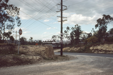
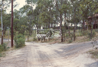
 Eltham District Historical Society Inc
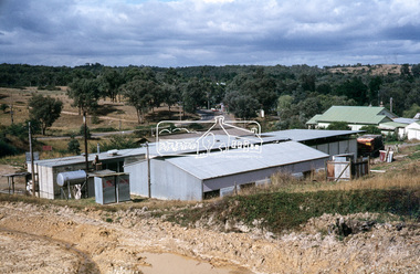
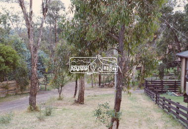
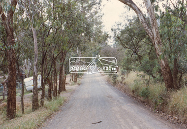
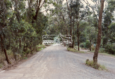
Slide, Maroondah Aqueduct, Research, Victoria, 22 Mar. 1981
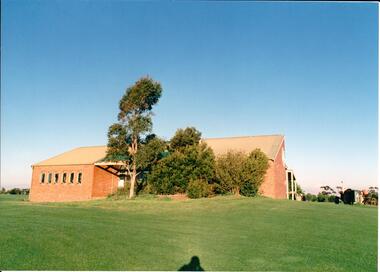
This view shows the area that would develop into the Research Industrial Estate. In centre distance though largely hidden by trees is the site of the Research Hall, which was later demolished and a new Eltham Little Theatre constructed in 1988 as a bicentennial project. The hills in the distance near the power lines now a housing estate.35 mm colour positive transparency (1 of 5) Mount - Agfachrome Agfa CS System black 8 dotsactivities, heritage excursion, maroondah aqueduct, research (vic.), shire of eltham historical society -
 Eltham District Historical Society Inc
Slide, Shalbury Avenue, Eltham, c. Jan 1983
Roll of film taken by Eltham Shire Council officers of the Beard street group, a private street scheme, before construction commenced. They provide perspective of the changes in housing styles and road development that began sweeping in from the mid 1970s with increasing urbanisation of what was once more outlying suburbs and regions.35 mm colour positive transparency (1 of 7) Mount - Blank Card,eltham, housing estate, infrastructure, private street scheme, roads, shalbury avenue -
 Eltham District Historical Society Inc
Slide, Andrews Street, Eltham, c. Jan 1983
Roll of film taken by Eltham Shire Council officers of the Beard street group, a private street scheme, before construction commenced. They provide perspective of the changes in housing styles and road development that began sweeping in from the mid 1970s with increasing urbanisation of what was once more outlying suburbs and regions.35 mm colour positive transparency (1 of 7) Mount - Blank Card,eltham, housing estate, infrastructure, private street scheme, roads, andrews street -
 Eltham District Historical Society Inc
Slide, Thomas Street, Eltham, c. Jan 1983
Roll of film taken by Eltham Shire Council officers of the Beard street group, a private street scheme, before construction commenced. They provide perspective of the changes in housing styles and road development that began sweeping in from the mid 1970s with increasing urbanisation of what was once more outlying suburbs and regions.35 mm colour positive transparency (1 of 7) Mount - Blank Card,eltham, housing estate, infrastructure, private street scheme, roads, thomas street -
 Eltham District Historical Society Inc
Slide, Andrews Street, Eltham, c. Jan 1983
Roll of film taken by Eltham Shire Council officers of the Beard street group, a private street scheme, before construction commenced. They provide perspective of the changes in housing styles and road development that began sweeping in from the mid 1970s with increasing urbanisation of what was once more outlying suburbs and regions.35 mm colour positive transparency (1 of 7) Mount - Blank Card,eltham, housing estate, infrastructure, private street scheme, roads, andrews street -
 Eltham District Historical Society Inc
Slide, Frank Street, Eltham, c. Jan 1983
Roll of film taken by Eltham Shire Council officers of the Beard street group, a private street scheme, before construction commenced. They provide perspective of the changes in housing styles and road development that began sweeping in from the mid 1970s with increasing urbanisation of what was once more outlying suburbs and regions.35 mm colour positive transparency (1 of 7) Mount - Blank Card,eltham, housing estate, infrastructure, private street scheme, roads, frank street -
 Eltham District Historical Society Inc
Slide, Beard Street, Eltham, c. Jan 1983
Roll of film taken by Eltham Shire Council officers of the Beard street group, a private street scheme, before construction commenced. They provide perspective of the changes in housing styles and road development that began sweeping in from the mid 1970s with increasing urbanisation of what was once more outlying suburbs and regions.35 mm colour positive transparency (1 of 7) Mount - Blank Card,eltham, housing estate, infrastructure, private street scheme, roads, frank street, beard street -
 Federation University Historical Collection
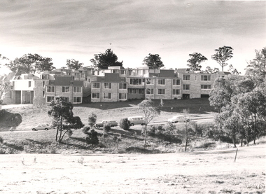
Photograph - Black and White Photographs, Views of Mount Helen Campus, c1973
Ongoing photgraphic record of Mount Helen Campus development. A contract for the construction of Student housing, Union building (later Albert Coates Complex), and a four storey library (later E.J.. Barker Library) on the Mt Helen campus was signed in November and December 1971. They were all completed and occupied in 1973. Views of Mount Helen Campus .1) Signposts of first turnoff campus road from Gear Avenue .2) Mount Helen Student Residences (stage 1) .3) Rear view of Mount Helen Student Residences (Stage 1)mount helen campus, buildings, student residences -
 Hume City Civic Collection
Photograph, early 1980s
The series of photographs were taken shortly after the opening of the newly established Goonawarra Golf Club in the early 1980s. The golf club was part of the Goonawarra Housing Estate which was developed on the area previously known as Goonawarra Farm. The new golf club replaced 'The Pines' which was part of the Caloola complex.A coloured photograph of the rear of Goonawarra Golf Club's Clubrooms. Along the wall of a small vestibule are 6 narrow casement windows. A native garden is planted along the building with a large grassy area extending downhill from the building.goona warra golf club, george evans collection -
 Eltham District Historical Society Inc
Colour Print, David Taylor, Western boundary, Eltham High School, c.1976
View looking north towards intersection of Susan Street and present-day Withers Way, behind the school near the western boundary. To the left of the photo is the housing development of Cronus Court. Aerial photos for 1976 reflect the undeveloped landscape as viewed. By 1981 the estate was well established with all houses built.david taylor collection, eltham, eltham high school, cronus court, susan street, withers way -
 Sunbury Family History and Heritage Society Inc.
Photograph, Leo O'Brien Reserve, November 2015
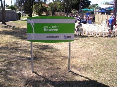
The sign was erected in the reserve in November 2015. Leo O'Brien was a long time Sunbury resident and the son of Terence O'Brien, who farmed in the district. The reserve is on a section of land that Leo owned, which fronted Barkly Street to the west and Jackson Street to the east. As Sunbury developed the higher section of the property was subdivided for housing and today Terence Street is in that subdivision. The Leo O'Brien Reserve area could not be developed for housing because that land is part of the former main drain, which was a natural waterway that flowed through a part of Sunbury an entered Jacksons Creek at the end of Brook Street. Today the open drain is covered over. Terrence O'Brien served as Shire President on Shire of Bulla Council during the first two decades of the twentieth century and was also a member of the Sunbury Waterworks Trust from 1913 - 1914.A coloured photograph of sign placed at the entrance of a small open space. Tables and chairs have been set out for refreshments in the reserve.leo o'brien, leo o'brien reserve, terence o'brien -
 Kiewa Valley Historical Society
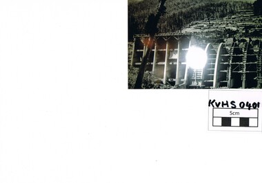
Photograph Junction Dam, Photo Junction Dam and Bogong Village in Background, circa 1950s
This item clearly shows the conditions covering both working conditions and housing in the construction of the Junction Dam in the 1940s. Working conditions were extreme and health and safety legislation was at its infancy. The residential buildings were intended to last only for the period of construction, however greater demand for longevity as a tourist haven prevailedThis photo of the construction of the Junction Dam, with The Bogong village as backdrop, details the harsh conditions faced by construction workers, building dams and villages to accommodate workers in the 1940s to the 1950s. Australia at this period in time, experienced a surge of population (influx of World War II refugees), which was the catalyst for developing and undergoing an enormous hydroelectricity program for the Alpine regions, both in Victoria and New South Wales. This program was initiated to supply electricity to the major southern Australian cities of Adelaide, Melbourne and Sydney. It was thought that these developments would reduce, if not eliminate, the requirement for coal driven power stations. However time has demonstrated that these power stations have not matched the demand required by the industries and the populations of the major urban and cities.Black and white photo of original photo with a flashlight reflection in the bottom centre. The photo is on Kodak XtraLife II paper. The paper is semi gloss.This photo is of the construction of the Junction Dam Wall with the Bogong Townshiip in the background.Back of photo is printed " Kodak XtraLite II paperdam construction, bogong village, alpine development, junction dam -
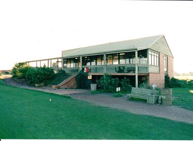 Hume City Civic Collection
Photograph, early 1980s
The series of photographs were taken shortly after the opening of the newly established Goona Warra Golf Club in the early 1980s. The golf club was part of the Goonawarra Housing Estate which was developed on the area previously known as Goonawarra Farm. The new golf club replaced 'The Pines' which was part of the Caloola complex.A coloured photograph of the front view of Goonawarra Golf Club's clubrooms. The building is on 2 levels with a large balcony across the front. Native plants have been planted around the building and a gravel path leads to the building.goona warra golf club, george evans collection -
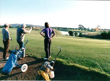 Hume City Civic Collection
Photograph, early 1980s
The series of photographs were taken shortly after the opening of the newly established Goona Warra Golf Club in the early 1980s. The golf club was part of the Goonawarra Housing Estate which was developed on the area previously known as Goonawarra Farm. The new golf club replaced 'The Pines' which was part of the Caloola complex.A coloured photograph of 3 men who are looking towards the lake at the Goonawarra Golf Club. Their golf buggies are behind them.goona warra golf club, george evans collection -
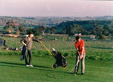 Hume City Civic Collection
Photograph, early 1980s
The series of photographs were taken shortly after the opening of the newly established Goona Warra Golf Club in the early 1980s. The golf club was part of the Goonawarra Housing Estate which was developed on the area previously known as Goonawarra Farm. The new golf club replaced 'The Pines' which was part of the Caloola complex.A coloured photograph of two golfers. One is preparing to hit off while the other is standing in the background with the golf buggy. They are standing overlooking the Goonawarra and Craiglea vineyards and the Jacksons Creek valley.goona warra golf club, george evans collection -
 City of Kingston
Photograph - Colour, 31 January 1993
Patterson Lakes is a suburb in the City of Kingston that is built one kilometre upstream of the mouth of the Patterson River. The area is bordered by the Patterson River and Eel Race Drain which enters the Kananook Creek. The suburb consists predominantly of newer housing developments and the tidal canal system of the development joins Port Phillip Bay. Patterson Lakes and the Kananook Creek were previously part of the extensive Carrum Carrum Swamp. The area was once a source of fish and eels for the Mayone-Bulluk clan of the Bunurong people. Over time the area was drained and in 1973 investigations commenced into the development of a unique residential area that would be built adjacent to canals and waterways. It was originally proposed to be known as "Gladesville". The development would give the suburb's homeowners access to Port Phillip Bay "from their back door". Circa 1974, the area was rezoned from rural to residential and named Patterson Lakes. Development has been continuous since the 1970s with construction of residential housing, schools, shopping centres, marinas, a hotel and library.Laminated colour aerial photograph of the Carrum and Patterson Lakes region within City of Kingston. This 1993 image includes Patterson River Secondary College, Roy Dore Reserve, Kananook Creek and Nepean Highway. The railway line can be seen as it veers inland from Eel Race Road, Seaford. The section of Ocean Reef Drive and Palm Beach Drive in Patterson Lakes appears to be a recent development with many spare blocks and new houses under construction.Black typed lettering on white adhesive label: 31.1.93 Black typed lettering on white adhesive label: 27E/7140 31/1/93 12.55 pm Black typed lettering on white label: 7140 Yellow round adhesive label located on left sidepatterson lakes, seaford, kananook creek, carrum carrum swamp, canals and waterways -
City of Kingston
Photograph - Colour, c. 1993
Patterson Lakes is a suburb in the City of Kingston that is built one kilometre upstream of the mouth of the Patterson River. The area is bordered by the Patterson River and Eel Race Drain which enters the Kananook Creek. The suburb consists predominantly of newer housing developments and the tidal canal system of the development joins Port Phillip Bay.Patterson Lakes and the Kananook Creek were previously part of the extensive Carrum Carrum Swamp. The area was once a source of fish and eels for the Mayone-Bulluk clan of the Bunurong people. Over time the area was drained and in 1973 investigations commenced into the development of a unique residential area that would be built adjacent to canals and waterways. It was originally proposed to be known as "Gladesville". The development would give the suburb's homeowners access to Port Phillip Bay "from their back door". Circa 1974, the area was rezoned from rural to residential and named Patterson Lakes. Development has been continuous since the 1970s with construction of residential housing, schools, shopping centres, marinas, a hotel and library.Laminated colour aerial photograph of the Carrum and Patterson Lakes region within City of Kingston. This 1993 image includes Patterson River Secondary College, Roy Dore Reserve, Kananook Creek and Nepean Highway. The railway line can be seen as it veers inland from Eel Race Road, Seaford. The section of Palm Beach Drive, Curlew Point Drive, Snapper Point Drive, Clipper Island and Myola Street in Patterson Lakes appears to be a recent development with many spare blocks and new houses under construction.patterson lakes, seaford, kananook creek, carrum carrum swamp, canals and waterways