Showing 2626 items
matching house plan
-
 Eltham District Historical Society Inc
Slide, Adam Crescent, Montmorency, c. Feb. 1981
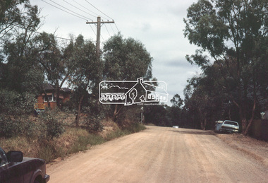
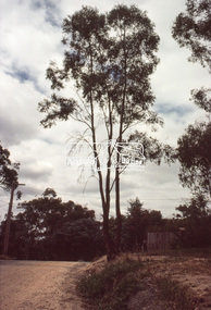
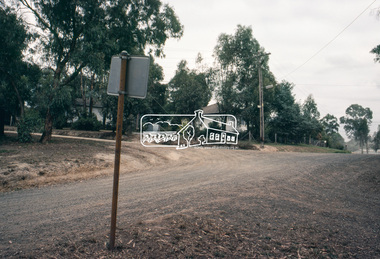
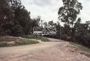
One of a series of images of road infrastructure focussed on Adam Crescent in Montmorency taken by Eltham Shire Council Planning and Engineering officers. They provide perspective of the changes in housing styles and road development that began sweeping in from the mid 1970s with increasing urbanisation of what was once more outlying suburbs and regions. All images have been identified with GPS though house numbers have changed35 mm colour positive transparency (1 of 21) Mount - Kodak Kodachrome CardProcessed Feb 1981adam crescent, infrastructure, montmorency, roads, gordon grove -
 Eltham District Historical Society Inc
Slide, Adam Crescent, Montmorency, c. Feb. 1981
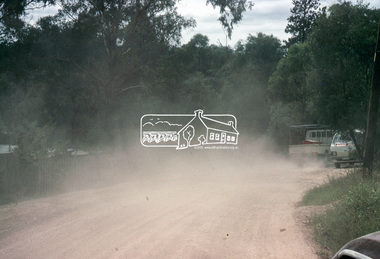
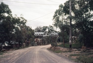
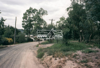
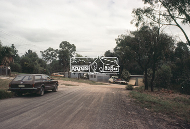
One of a series of images of road infrastructure focussed on Adam Crescent in Montmorency taken by Eltham Shire Council Planning and Engineering officers. They provide perspective of the changes in housing styles and road development that began sweeping in from the mid 1970s with increasing urbanisation of what was once more outlying suburbs and regions. All images have been identified with GPS though house numbers have changed35 mm colour positive transparency (1 of 21) Mount - Kodak Kodachrome CardProcessed Feb 1981adam crescent, infrastructure, montmorency, roads -
 Eltham District Historical Society Inc
Slide, Adam Crescent, Montmorency, c. Feb. 1981
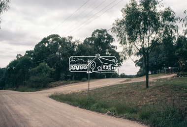
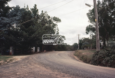
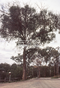
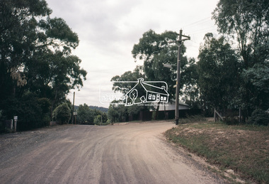
One of a series of images of road infrastructure focussed on Adam Crescent in Montmorency taken by Eltham Shire Council Planning and Engineering officers. They provide perspective of the changes in housing styles and road development that began sweeping in from the mid 1970s with increasing urbanisation of what was once more outlying suburbs and regions. All images have been identified with GPS though house numbers have changed35 mm colour positive transparency (1 of 21) Mount - Kodak Kodachrome CardProcessed Feb 1981adam crescent, infrastructure, montmorency, roads, gordon grove -
 Eltham District Historical Society Inc
Slide, Adam Crescent, Montmorency, c. Feb. 1981
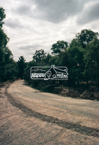
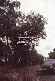
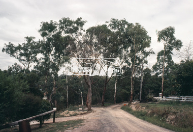
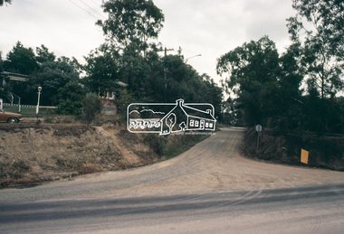
One of a series of images of road infrastructure focussed on Adam Crescent in Montmorency taken by Eltham Shire Council Planning and Engineering officers. They provide perspective of the changes in housing styles and road development that began sweeping in from the mid 1970s with increasing urbanisation of what was once more outlying suburbs and regions. All images have been identified with GPS though house numbers have changed35 mm colour positive transparency (1 of 21) Mount - Kodak Kodachrome CardProcessed Feb 1981adam crescent, infrastructure, montmorency, roads -
 Eltham District Historical Society Inc
Slide, Adam Crescent, Montmorency, c. Feb. 1981
One of a series of images of road infrastructure focussed on Adam Crescent in Montmorency taken by Eltham Shire Council Planning and Engineering officers. They provide perspective of the changes in housing styles and road development that began sweeping in from the mid 1970s with increasing urbanisation of what was once more outlying suburbs and regions. All images have been identified with GPS though house numbers have changed35 mm colour positive transparency (1 of 21) Mount - Kodak Kodachrome CardProcessed Feb 1981adam crescent, infrastructure, montmorency, roads, gordon grove -
 Eltham District Historical Society Inc
Slide, Adam Crescent, Montmorency, c. Feb. 1981
One of a series of images of road infrastructure focussed on Adam Crescent in Montmorency taken by Eltham Shire Council Planning and Engineering officers. They provide perspective of the changes in housing styles and road development that began sweeping in from the mid 1970s with increasing urbanisation of what was once more outlying suburbs and regions. All images have been identified with GPS though house numbers have changed35 mm colour positive transparency (1 of 21) Mount - Kodak Kodachrome CardProcessed Feb 1981adam crescent, infrastructure, montmorency, roads -
 Eltham District Historical Society Inc
Slide, Adam Crescent, Montmorency, c. Feb. 1981
One of a series of images of road infrastructure focussed on Adam Crescent in Montmorency taken by Eltham Shire Council Planning and Engineering officers. They provide perspective of the changes in housing styles and road development that began sweeping in from the mid 1970s with increasing urbanisation of what was once more outlying suburbs and regions. All images have been identified with GPS though house numbers have changed35 mm colour positive transparency (1 of 21) Mount - Kodak Kodachrome CardProcessed Feb 1981adam crescent, infrastructure, montmorency, roads, gordon grove -
 Eltham District Historical Society Inc
Slide, Adam Crescent, Montmorency, c. Feb. 1981
One of a series of images of road infrastructure focussed on Adam Crescent in Montmorency taken by Eltham Shire Council Planning and Engineering officers. They provide perspective of the changes in housing styles and road development that began sweeping in from the mid 1970s with increasing urbanisation of what was once more outlying suburbs and regions. All images have been identified with GPS though house numbers have changed35 mm colour positive transparency (1 of 21) Mount - Kodak Kodachrome CardProcessed Feb 1981adam crescent, infrastructure, montmorency, roads, sherbourne road -
 Eltham District Historical Society Inc
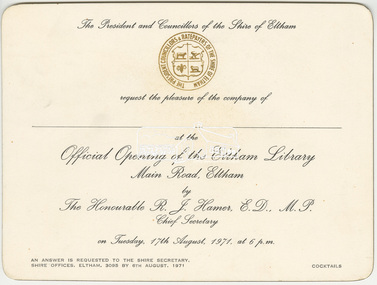
Invitation, The President and Councillors of the Shire of Eltham request the pleasure of the company of __ to the Official opening of the Eltham Library, Main Road, Eltham by The Honourable R.J. Hamer, E.D., M.P. Chief Secretary on Tuesday, 17th August, 1971, at 6 p.m, 1971
The Eltham Library was located at the southern end of the newly constructed southern wing of the Shire Offices at 895 Main Road. The first dedicated library in the shire was the Children's Library built by the Eltham War Memorial Trust (now the Eltham War Memorial Hall). Funds were raised by volunteers to purchase books, the land and construct the building. This library initially opened in the Eltham Public Hall on the corner of Main Road and Arthur Street around 1948. The Children’s Library building was opened in 1961 but the transfer to the Eltham Council of the War Memorial Trust land and buildings in 1965 saw the closure of the children's library, which held over 2,000 books that were then transferred to all the schools in the shire which had participated in the monthly book exchange of boxes of books by use of the railways, bus companies and private cars. In late 1966 the children’s library service was integrated into the Heideberg Regional Library Service and the building was officially renamed the Eltham War Memorial Hall. The Brinkkotter house in Dudley Street became the first of the general library services in Eltham with shelving from the old Heidelberg City Library, staff borrowed form the Heidelberg Library and some use of the 1941 Shire Office in Main Road. By 1971 the 1964 Shire Office had the southern extension added and the Library was located on the lower level with Engineering and Planning on the level above. By 1986 this library was experiencing overcrowding from lack of space and equipment needs. With Federal Government assistance, Council was able to design and build a new library which was located in the Eltham Common and opened in May 1994.Background workings for the funding of a Public Hall at Eltham. The funding was provided by public subscription and the money loaned to Council to build the hall. The hall was part of the new Eltham Shire offices located at the corner of Main Road and Arthur Street. A similar funding approach was used a few years later to provide for the Eltham War Memorial located on the opposite side of Main Road.Printed card 10.5 x 15.7 cmeltham library, eltham library opening, eltham shire council, opening ceremony, r.j. hamer, shire of eltham -
 Eltham District Historical Society Inc
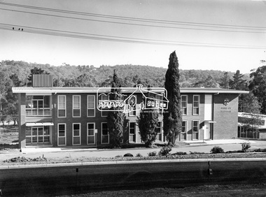
Photograph, Eltham Shire Office, shortly after duplication of Main Road, c.1968
Eltham Shire Council office built 1964 on the former site of Shillinglaw Cottage. In 1971 the offices were extended with a southern wing (to the left of the building) which housed the Eltham Library and planning offices. Taken shortly after widening of Main Road between Pitt Street and Elsa Court which was undertaken between February 1968 and August 1968. Image was most probably commissioned by Eltham Shire Council and taken by Hugh Fisher, photographer who operated from premises between Arthur and Dudely streets and was often contracted by the shire for official photographic work. The image was used in the August 1971 issue of Australian Municipal Journal This photo forms part of a collection of photographs gathered by the Shire of Eltham for their centenary project book,"Pioneers and Painters: 100 years of the Shire of Eltham" by Alan Marshall (1971). The collection of over 500 images is held in partnership between Eltham District Historical Society and Yarra Plenty Regional Library (Eltham Library) and is now formally known as the 'Shire of Eltham Pioneers Photograph Collection'. It is significant in being the first community sourced collection representing the places and people of the Shire's first one hundred years.Digital image and 120 format B&W negativesepp, shire of eltham pioneers photograph collection, eltham, main road, duplication, road widening, shillinglaw trees, local government -
 Eltham District Historical Society Inc
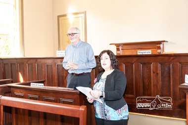
Photograph, Peter Pidgeon, Official opening of the restored Eltham Courthouse, 730 Main Road, Eltham, 23 Mar 2022
Eltham Courthouse Officially Reopened (Jim Connor, EDHS Newsletter No. 263 April 2022) In the Conservation Management Plan prepared in 2006 for the Eltham Justice Precinct there is mention that more than 350 court houses have been built by the Public Works Department since 1856, when the Department was established. It also states Eltham was in an early group of 'Victorian Free Classical' structures, featuring a projecting entry porch and gabled roof. Characteristically, this group shares a simple, rectangular shape, central placement of the court room with smaller-scale offices set back at the sides or rear of the court room, arched openings, and decorative string courses. The Statement of Significance listed in the Victorian Heritage Register states: ‘The Eltham Court House dates from the time when the town was largely self-contained. It was initiated in response to itinerant gold prospectors who turned to crime when their quest was unsuccessful. This type of localised solution is characteristic of the self reliance preserved in Eltham today. The court house is an important symbol of the spirit which makes Eltham distinctive as a community.’ It also states: ‘The Eltham Court House, built in 1860, is one of only two intact examples in the state of this simple design with projecting entry.’ So with this background it is most appropriate this valued historic building has recently been the subject of a total restoration, as detailed in previous newsletters. This was a major project undertaken by Nillumbik Shire Council. At a small function in the Eltham Courthouse, on 23rd March 2022, Nillumbik Shire Council Mayor Fran Eyre declared the fully restored building officially reopened. In doing so the Mayor spoke about the earlier law and order function of the court and the importance of this building to the Eltham community. Wingrove Ward Councillor Geoff Paine then highlighted the importance of historical societies and groups within the shire and their valued activities in recording and preserving their local history. EDHS president Jim Connor thanked everyone involved with the project and provided an overview of the history of the courthouse. Michael Ioannides, Council’s project manager, spoke about how the restoration process proceeded and those involved in undertaking the works required. Cr. Natalie Duffy, various council officers, EDHS executive committee members, as well as representatives of the head contractor Ducon Building Services and the heritage advisors, RBA architects and Conservation Consultants, were also in attendance, as was a representative of Nillumbik U3A. After the formal part there was some light hearted interpretation of how past legal proceedings may, or may not have, occurred within this courthouse, before some refreshments were shared in the former second courthouse at the rear, which is now utilised by Nillumbik U3A. This was a successful celebration of a very worthwhile project.Born digital image (38)conservation consultants, cr. geoff paine, cr. natalie duffy, ducon building services, eltham courthouse, eltham district historical society, eltham justice precinct, jim connor, mayor cr. fran eyre, michael ioannides, nillumbik shire council, nillumbik u3a, opening ceremony, rba architects, restoration project -
 Eltham District Historical Society Inc
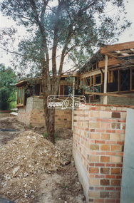
Photograph - Colour Print, Nathan Islip, Eltham Library under construction, c.1993
Photo taken by Nathan Islip who at the time was studying Architecture at the University of Melbourne. During his experience year he worked as a builder's labourer on the new Eltham Library construction project. Eltham Library Service 1930s - 1994 Originally collated by Harry Gilham, President, Eltham District Historical Society Inc (1993-2009) (edited 2022) In the Eltham township area, in the early 1930s, library books for adults were available from E J Andrew's newsagency in Main Road. In the newsagency cum haberdashery, some shelves were set aside for a lending library of adults' books. In 1935, Mr & Mrs JC Rains purchased the newsagency and continued the lending service until the late 1940s. At this time the business was extended from haberdashery to sell ladies' and men's clothing. The library section was discontinued. In the 1930s a mobile book library was also run by a Mr Foster of Bible Street, Eltham. In the 1950s adult books were available from racks in the foyer of the Eltham Shire Offices which was then located beside the Eltham Hall on the comer of Arthur Street and Main Road. In the early 1950s a referendum of ratepayers was called to seek public opinion on the issue of raising money for a public library for which the rates would have to be increased - the motion was defeated. On 11 November 1965 Eltham Shire Council, in conjunction with the City of Heidelberg and the Shire of Diamond Valley, met to form the Heidelberg Regional Library Service. Eltham was represented by Councillors Charis Pelling and John Lewis. The first library service for the Shire of Eltham from this group came in the shape of a bookmobile van which had, amongst others, a central stopover near the Shillinglaw trees outside the newly opened Shire offices at 895 Main Road, the original site of Shillinglaw Cottage and the former Shillinglaw farm. Present-day Wingrove Park was another stopover and the many recorded requests for this service can be read as denoting the areas of population or gathering points at that period throughout the Shire. 1968 saw the Shire convert the ‘Brinkkotter’ house in Dudley Street to house both adult and children's books. This library was originally staffed from the City of Heidelberg Library and records of committee meetings range from borrowing Heidelberg's old library shelving to trying to increase the Government's subsidy to a dollar for dollar basis. Book loans in the period 1966-67 totalled 30,400 and the following year ran to 52,113. With 2 books plus 1 paperback the limit per person, it was overcrowded and unable to house the range of other services which had become common library stock. Planning to extend the Shire Offices by the addition of the south wing was an opportunity to re-house the Shire's Library. The opening of the library in the extension was carried out on 17th August 1971 by the Hon R J Hamer ED, MP, Chief Secretary of Victoria. Cr Geoffrey Dreverman officiated as the Shire President. The Heidelberg Regional Library Service continued until September 1985 when it disbanded. On 21 November 1985 the Yarra Plenty Regional Library Service was established. At that time Eltham was represented by Councillors Mary Grant and Robert Manuell. By 1987, over-crowding of the Eltham Library and an inability to house the range of other services yet again rose to prominence. At a Council meeting held on 1 June 1987, the Councillors supported a resolution which threatened to close the library on 30 September 1987. Council's frustration arose from yet another re-run of the annual State Government versus Council Library funding and records show first arose in Eltham Council in 1967 with the Government of 1he day. After prolonged public anger and petitions the motion to close the library was rescinded in August 1987. Council, considering the community's concern, set up a ‘Library Review Working Party’ which a year later became the Library Occasional Committee with direct access to Council. This Committee investigated the workings of the 386 square metre library and found inadequate space for storage and display, lack of equipment, out-of-date furniture together with an increasing patronage which resulted in queues of borrowers becoming longer no matter when the library was open. Community consultation took the form of 1,000 questionnaires sent to users and non-users along with noticeboard reminders of what was planned. Council developed a strategy to set aside capital funds from 1988 on an annual basis so that preliminary planning and consultative expenses could be met, and construction could be completed early 1997. The Committee visited metropolitan libraries which were catering for a similar population as was projected for Eltham. Australia-wide Federal Government funding grants under the Local Capital Works Program became available from October 1992 for community projects endorsed by local Councils. The Eltham Council submitted a proposal, based on library findings and requirements accumulated by the Library Occasional Committee, to the Federal Grants Committee to build a new Eltham Library. The Federal Grants Committee supported the funding request allowing commencement of the library project three years earlier than planned. With finance finalised, the Council set up its Eltham Library Re-development Special Committee which was given the task of overseeing what could be the last major expansion of the Shire's Library Service as Eltham's population nears its projected maximum. The new library was designed by Gregory Burgess and Peter Ryan of Gregory Burgess Pty Ltd. Construction of the library commenced in 1993 and was officially opened May 22nd, 1994. The library building was designed to reflect its parkland setting. External features include: the roof which includes interesting aspects when viewed from Main Road; verandahs which provide ramp access and give a sheltered entrance to the building; walls which feature locally made mudbricks, conventional bricks and copper panels; and space for an outdoor courtyard/reading area which will be developed later. Internally there are several features. The building includes a foyer with a fireplace suitable for displays including artwork, a community multi-purpose room suitable for meetings or functions and an outdoor cafeteria. The ceilings are lined with Victorian Ash. The shapes for the ceiling give a free-flowing form to the building. Brush Box has been used for the circulation and information desks. The tree trunk columns are Grey lronbark from New South Wales. Arches and various-shaped windows add interest to the internal structure. The carpet design reflects the Eltham environment and compliments the natural colours and timbers used in the building. Tiles by artist Felix Bosari feature in the building and additional art by local artists added externally and internally to the building. Since 1994 the library has undergone a major extension to cater for children’s services and others. See also EDHS_02111 construction, eltham library -
 Eltham District Historical Society Inc
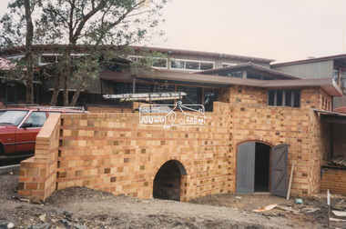
Photograph - Colour Print, Nathan Islip, Eltham Library under construction, c.1994
Photo taken by Nathan Islip who at the time was studying Architecture at the University of Melbourne. During his experience year he worked as a builder's labourer on the new Eltham Library construction project. Eltham Library Service 1930s - 1994 Originally collated by Harry Gilham, President, Eltham District Historical Society Inc (1993-2009) (edited 2022) In the Eltham township area, in the early 1930s, library books for adults were available from E J Andrew's newsagency in Main Road. In the newsagency cum haberdashery, some shelves were set aside for a lending library of adults' books. In 1935, Mr & Mrs JC Rains purchased the newsagency and continued the lending service until the late 1940s. At this time the business was extended from haberdashery to sell ladies' and men's clothing. The library section was discontinued. In the 1930s a mobile book library was also run by a Mr Foster of Bible Street, Eltham. In the 1950s adult books were available from racks in the foyer of the Eltham Shire Offices which was then located beside the Eltham Hall on the comer of Arthur Street and Main Road. In the early 1950s a referendum of ratepayers was called to seek public opinion on the issue of raising money for a public library for which the rates would have to be increased - the motion was defeated. On 11 November 1965 Eltham Shire Council, in conjunction with the City of Heidelberg and the Shire of Diamond Valley, met to form the Heidelberg Regional Library Service. Eltham was represented by Councillors Charis Pelling and John Lewis. The first library service for the Shire of Eltham from this group came in the shape of a bookmobile van which had, amongst others, a central stopover near the Shillinglaw trees outside the newly opened Shire offices at 895 Main Road, the original site of Shillinglaw Cottage and the former Shillinglaw farm. Present-day Wingrove Park was another stopover and the many recorded requests for this service can be read as denoting the areas of population or gathering points at that period throughout the Shire. 1968 saw the Shire convert the ‘Brinkkotter’ house in Dudley Street to house both adult and children's books. This library was originally staffed from the City of Heidelberg Library and records of committee meetings range from borrowing Heidelberg's old library shelving to trying to increase the Government's subsidy to a dollar for dollar basis. Book loans in the period 1966-67 totalled 30,400 and the following year ran to 52,113. With 2 books plus 1 paperback the limit per person, it was overcrowded and unable to house the range of other services which had become common library stock. Planning to extend the Shire Offices by the addition of the south wing was an opportunity to re-house the Shire's Library. The opening of the library in the extension was carried out on 17th August 1971 by the Hon R J Hamer ED, MP, Chief Secretary of Victoria. Cr Geoffrey Dreverman officiated as the Shire President. The Heidelberg Regional Library Service continued until September 1985 when it disbanded. On 21 November 1985 the Yarra Plenty Regional Library Service was established. At that time Eltham was represented by Councillors Mary Grant and Robert Manuell. By 1987, over-crowding of the Eltham Library and an inability to house the range of other services yet again rose to prominence. At a Council meeting held on 1 June 1987, the Councillors supported a resolution which threatened to close the library on 30 September 1987. Council's frustration arose from yet another re-run of the annual State Government versus Council Library funding and records show first arose in Eltham Council in 1967 with the Government of 1he day. After prolonged public anger and petitions the motion to close the library was rescinded in August 1987. Council, considering the community's concern, set up a ‘Library Review Working Party’ which a year later became the Library Occasional Committee with direct access to Council. This Committee investigated the workings of the 386 square metre library and found inadequate space for storage and display, lack of equipment, out-of-date furniture together with an increasing patronage which resulted in queues of borrowers becoming longer no matter when the library was open. Community consultation took the form of 1,000 questionnaires sent to users and non-users along with noticeboard reminders of what was planned. Council developed a strategy to set aside capital funds from 1988 on an annual basis so that preliminary planning and consultative expenses could be met, and construction could be completed early 1997. The Committee visited metropolitan libraries which were catering for a similar population as was projected for Eltham. Australia-wide Federal Government funding grants under the Local Capital Works Program became available from October 1992 for community projects endorsed by local Councils. The Eltham Council submitted a proposal, based on library findings and requirements accumulated by the Library Occasional Committee, to the Federal Grants Committee to build a new Eltham Library. The Federal Grants Committee supported the funding request allowing commencement of the library project three years earlier than planned. With finance finalised, the Council set up its Eltham Library Re-development Special Committee which was given the task of overseeing what could be the last major expansion of the Shire's Library Service as Eltham's population nears its projected maximum. The new library was designed by Gregory Burgess and Peter Ryan of Gregory Burgess Pty Ltd. Construction of the library commenced in 1993 and was officially opened May 22nd, 1994. The library building was designed to reflect its parkland setting. External features include: the roof which includes interesting aspects when viewed from Main Road; verandahs which provide ramp access and give a sheltered entrance to the building; walls which feature locally made mudbricks, conventional bricks and copper panels; and space for an outdoor courtyard/reading area which will be developed later. Internally there are several features. The building includes a foyer with a fireplace suitable for displays including artwork, a community multi-purpose room suitable for meetings or functions and an outdoor cafeteria. The ceilings are lined with Victorian Ash. The shapes for the ceiling give a free-flowing form to the building. Brush Box has been used for the circulation and information desks. The tree trunk columns are Grey lronbark from New South Wales. Arches and various-shaped windows add interest to the internal structure. The carpet design reflects the Eltham environment and compliments the natural colours and timbers used in the building. Tiles by artist Felix Bosari feature in the building and additional art by local artists added externally and internally to the building. Since 1994 the library has undergone a major extension to cater for children’s services and others. See also EDHS_02111 construction, eltham library -
 Eltham District Historical Society Inc
Photograph - Colour Print, Belle Vue, Livingstone Road, Eltham, c.2015
Belle Vue property in Livingstone Road, Eltham was once owned by Society member Jo McCormick. Jo was a valued member of our committee and dear friend of many of our members until her death in 2009. Belle Vue is the farmhouse of a property that is now a significant part of suburban Eltham, just a short distance north of the town centre. Originally purchased by pioneer Eltham farmer Henry Stooke, the present-day old farmhouse sits within an extensive suburban residential area. The history of the property is largely based on a heritage assessment prepared by consultant Lorraine Huddle for Nillumbik Shire Council. Additional information from our Society records reveals Belle Vue farm comprised about 56 ha (140 acres) extending northerly from the northern boundary of Holloway’s 1851 Little Eltham subdivision. On the present day map the southern boundary was just north of Elsa Court and Grove Street. The western boundary was the Diamond Creek and extended northerly to Main Road where it turns easterly towards Research. It was traversed by the main road to Kangaroo Ground and beyond and from 1912 by the railway to Hurstbridge. From 1895 the farm was owned by William Williams and his wife Mary Ann. In 1914 -15 they built a new house now known as Belle Vue. They sold the land in 1920 and residential subdivision began soon after that. Belle Vue remains today on a substantially subdivided and very much reduced size residential lot in Livingstone Road. The house and many old trees on the site were subject to a heritage overlay under the Nillumbik Planning Scheme. Despite that overlay, the development and subdivision of the original land resulted in most of the heritage listed trees being removed. belle vue, eltham, livingstone road -
 Port Melbourne Historical & Preservation Society
Letter - Port Melbourne Council Health Inspector re apratments/boarding houses, 1974 - 1978
Retained by donor from his service on Port Melbourne Council 1973-78Miscellaneous Port Melbourne Council documents 1974-78 Letter from Health Inspector re apartments/boarding houses, 24 May 1977local government - city of port melbourne, town planning, glen cosham -
Port Melbourne Historical & Preservation Society
Document - Report, The Docklands Authority Bill, 1991
Report from Melbourne's Western Region Commission Inner Metropolitan Regional Association on meeting with Hon Jim Kennan MP, Minister for Major Projects, Parliament House, Melbourne 23 April 1991; bound copy of written comments on the Draft Dockland Authority Billtown planning -
Port Melbourne Historical & Preservation Society
Plant specimen - Branch, Port Jackson fig tree, Holy Trinity Anglican Church, Dec 1999
The tree was chopped down December 1999 in spite of local opposition, to make way for a planned development of the church hall. The application was refused by Port Phillip Council but approved by VCAT in a contentious decision. There was conflicting advice about the health of this tree which at that time enjoyed no protection under the planning scheme. Local landscape architect, Ray PICKFORD, landscape architect and owner (at that time) of Morley's house at cnr Farrell and Nott St, was so distressed by this action that he stripped in an attempt to generate media attention. Subsequently, ward councillor Julian HILL purchased a portion of the timber from a wood recycler and it was re-made into timber benches for the refurbished Port Melbourne Library.Portion of branch from Port Jackson fig located in the grounds of the Holy Trintiy Church Hall, demolished December 1999 (Ref 1421)religion - anglican (holy trinity), built environment, demolitions -
Port Melbourne Historical & Preservation Society
Programme, Roland Harvey, 1999 Port Melbourne Festival, Feb 1999
Produced by the Port Melbourne Festival Committee in conjunction with the Bay Street Traders and Circus Oz and distributed throughout the municipality. 1999 was the infamous street festival sponsored in part by the Gateway Project, a group of three developers intending to build tall buildings of up to 22 stories in Bay Street between Graham and Rouse Streets (see p. 11). This so angered the Port Phillip Council that they took the Festival from the Committee and put it out to tender from anyone that would restore its 'community' basis. Port Melbourne Neighbourhood House won the tender for 200 to 2002 (see items 1255)Program for Port Melbourne Festival 1999: A4, 16pp, full colour (two copies)arts and entertainment, celebrations fetes and exhibitions, town planning - proposals shelved, port melbourne festival committee, circus oz -
Port Melbourne Historical & Preservation Society
Plan - Area bounded by Nott Street, Graham Street, Esplanade West and Rouse Street, Port Melbourne, 29 Feb 1952
Plan showing properties in area bounded by Nott, Graham, Esplanade W. and Rouse Streets with plan showing properties in area bounded by Station, Graham, Nott and Rouse Streets (House Common Orders) Also statistics of 1948.Top RH corner - reverse: notation - 'residential zoning amendment':Face: continuing notations (at least up to 1963):Lower, indication : 'Existing conditions 1948'built environment - commercial, built environment - civic, built environment - domestic, built environment - industrial, town planning, religion - roman catholic church (st josephs), swallow & ariell ltd, troedel & cooper pty ltd, wilsons sheet metals, franklin & anderson, g h westwood & sons, atlas plastics, w j carr, craven, robert timms, sunkist, tip top paints, knox schlapp pty ltd, daro plastics, triton construct, newmans, national bank, religion - wesleyan methodist church, court house, port melbourne police station