Showing 1753 items matching "destroyed"
-
 Vision Australia
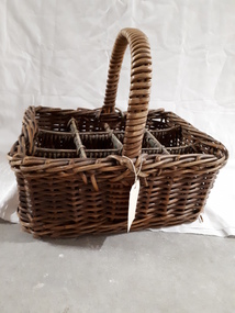
Functional object - Object, Cane milk bottle basket, 1930-1940
Basket weaving and brush making was a source of income for those who worked in the workshops at RVIB and other institutions in New South Wales and Queensland. A diverse range products could be produced with cane, such as cane chairs, cots, washing baskets and trolleys, and the Institution sought to highlight these in the annual report. Over time the demand for, and supply of, cane changed - particularly during World War 2 when Asian sources were under attack or destroyed. At home, other materials such as plastics as well as the ability to import cheaper pre-produced products further reduced the demand for workshop pieces. A milk bottle basket was designed for milkmen to deliver their wares quickly from door to door, without the bottles impacting upon each other. The milk basket was made in the basket shop of the RVIB for use in the organisation. It was used to carry milk bottles, then containers to the various tea rooms and could have been part of the kitchen equipment for the RVIBCane basket with handle and dividers to carry milk bottlesroyal victorian institute for the blind, equipment, employment -
 Federation University Historical Collection
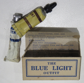
Object, Blue Light Outfit, c1914
The bluelight outfit was offered to members of the armed services in an attempt to prevent venereal disease. Around 60,000 Australian soldiers had contracted venereal disease by the end of the First World War. (http://www.canberratimes.com.au/act-news/secret-wwi-history-of-australian-soldiers-with-venereal-disease-20141022-119wan.html, accessed 21 August 2017) Australia colloquial language defines a Blue Light clinic as a venereal disease clinic.A cardboard box with two tubes of ointment - an anti-Venereal Disease outfit supplied to Australian Armed Services Tube number one is filled with brown contents known as 'No. 1 ointment BROWN' and has a long, tapered opening, with black pastic lid. Tube number two is filled with a thick white ointment 'No. 2 ointment WHITE', with a normal opening and metal lid. The tubes contained 3 percent Argyrol Jelly for gonorrhea and 33% Calomel Ointment (Mercury-Chloride) for syphilis prophylaxis.Inside box: Directions for Use Before Connection 1. Rub head and shaft of Penis with half the tube of No. 2 Ointment, White. 2. Always wear a sheath After Connection 1. Pass water IMMEDIATELY 2. Wash thoroughly Penis and Scrotum with soap and water. 3. Inject the whole of the contents of the Tube of No. 1. Oitnment, Brown, into pipe and massage back 2 inches. 4. Rub remainder of tube No. 2 Ointment, White, on head and shaft of Penis and Scrotum 5. Hold urine some hours after treatment 6. Report at V.D. Prevention Depot (Blue Light Depot) as soon as possible. 7. Having read directions and understood them, destroy by tearing up or by burning.blue light outfit, veneral disease, vd, armed services, gonorrhea, syphilis, disease, medical -
 Victorian Interpretive Projects Inc.
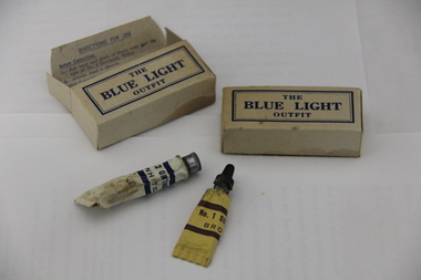
Medicine, The Blue Light Ointment, c1917
Photograph of a box containing two tubes. It was given to Australian soldiers during World War One to prevent venereal disease.Inside box: Directions for Use Before Connection 1. Rub head and shaft of Penis with half the tube of No. 2 Ointment, White. 2. Always wear a sheath After Connection 1. Pass water IMMEDIATELY 2. Wash thoroughly Penis and Scrotum with soap and water. 3. Inject the whole of the contents of the Tube of No. 1. Oitnment, Brown, into pipe and massage back 2 inches. 4. Rub remainder of tube No. 2 Ointment, White, on head and shaft of Penis and Scrotum 5. Hold urine some hours after treatment 6. Report at V.D. Prevention Depot (Blue Light Depot) as soon as possible. 7. Having read directions and understood them, destroy by tearing up or by burning.world war one, medicine, ointment, venereal disease, vd, world war 1, world war, mmm -
 Frankston RSL Sub Branch
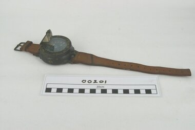
Compass, Divers
Diver's underwater compass used by British Royal Navy clearance divers during World War ll. Originally issued to ex-RN demolition diver (frogman), PO Leslie Wade, service number RJX 162991 of the Landing Craft Obstacle Clearance Unit (LCOCU), 1939 to 1945. Wade participated in the 'Operation Overlord' D Day landing at 'Juno' Beach, Normandy, France on the 6th June, 1944, in the early hours of the morning prior to the Canadian Army task force landing. Wade was with the LCOCU team tasked with clearing anti landing craft obstacles which were destroyed by placing explosive demolition charges. note: at some stage during the day Wade was wounded by enemy mortar fire and successfully evacuated to England for treatment. This compass is a large round prismatic type compass in a substantial watertight housing designed to be worn on the lower arm (wrist area). There is a thick leather two piece strap for attaching to the arm. The compass is presumably oil filled with a rotating disc marked with the numerals 2 to 34 in mirror image characters. The compass reading is viewed through a prismatic lens attached over the fixed heading marker.The rotating disc is marked with the usual compass markings of "N, E, S, W". The disc is marked in five degree divisions with mirror image numerals indicating the "2nd to 34th" major divisions. The circular bezel surrounding the compass viewing glass is stamped "Patt 251, No 177D"compass, frogman, diver, underwater -
 Kiewa Valley Historical Society
Photographs and copies of photographs of the pack horses and early horsemen who transported supplies to outposts in the Bogong High Plains, via cattle tracks before access roads were made
In the mid to late 1930’s survey outposts were established to plot the early stages of the Kiewa Hydro Electric System for the SECV in the Bogong High Plains. Before any roads were built, the old cattleman’s tracks were used with packhorses to deliver supplies, wages and mail and collect timesheets and correspondence from the workmen and dam builders living in canvas tents and at the outlying survey posts. The trip up the mountain was long and hard and dangerous for both horse and man Most of the men of the survey teams were not bush-men and were often ill equipped for the harsh weather and living conditions of bush camping, often arriving in their city clothes ready for work. The tent city at Bogong was destroyed by bush fires in 1939 after which an access road was built from Mt Beauty to transport building materials for more permanent dwellings for workmen. Pack horses continued to be used for transporting goods etc. to workers further up the mountain.Without the work of horsemen and their pack horses providing supplies and communications for outlying outposts, surveying and early planning for the Kiewa Valley Hydro Electric scheme could not have gone ahead and the dams and power stations which support the system could not have been constructed. The Hydro-electric scheme, and the workers who planned and built it play a major part in the early history of the Kiewa Valley and many original families still remain living, or have ties with the local area.: Set of 21 black and white photographs and copies of photographs depicting the pack horses and the men who handled them, transporting supplies and correspondence to the outlying camps and survey posts in the Bogong High Plains, via the rough cattlemen’s tracks. Photographs also show the early tent camps of the workers. Some photos mounted on A4 white paper. Some photos enlarged to A3 poster size for display1. Handwritten on back – Max Lawrence 2. -8 No inscriptions 9. Handwritten on back- Packing in supplies for early workers of the Kiewa Hydro scheme. There were no roads in the early days of the scheme 10. Printed on bottom of photo- Roper’s cattle on road below Howman’s Gap 11. Handwritten on back – Roper’s et al about to leave for the high plains 12. Printed under photo- Syd Ryder at the Pretty Valley Cut-Out (JBR) 13-16. No markings 17. Printed under photo- Gwen Talbot visits the Camp area. 1937 18. Handwritten on back- 14/1 Barbara Talbot 19. No markings 20-21. No markings 22. Printed under photo- STATE ELECTRICITY COMMISSION OF VICTORIA. Date: 15-3-45 Time: 8.0pm No: K 1838 Kiewa Hydro-Electric Works, Investigations 1944-1945 – Survey Camp at Young’s Hut pack horses; bogong high plains; survey posts; supplies delivery -
 Warrnambool and District Historical Society Inc.
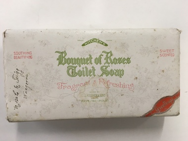
Box, Bouquet of Roses Toilet Soap, Mid 20th century
The business of Kitchen and Sons began in 1856 when John Kitchen began to make tallow candles in their backyard in Emerald Hill but had to move two years later due to it being an offensive trade. Bad luck plagued them again after two years when fire destroyed their premises. However after rebuilding , the expanded and moved to Footscray ten years later. Over the next 30years the business expanded further employing upwards of 300 people and became one of the leading manufacturers of soaps, candles and associated products in Australia and New Zealand. They were makers of long standing brands such as Velvet soap and Solvol and by the mid 1920's were employing about 1400 people. It was around this time that they merged with the Lever Co of Sydney and after absorption of other soap companies over the next 40 years , the company became known as Lever & Kitchen in 1962. This box contained gift soaps and probably belongs to the period prior to 1924. Miss C M Trigg of Wangoom was the owner. A common item with links to a district family.White card box with overlapping lid which is covered in white paper with green and red text. A red banner across right bottom corner. Light grey floral pattern as background.Miss C M Trigg Wangoom written in black ink on left corner. Made by J Kitchen & Sons Pty Ltd.warrnambool, warrnambool history, wangoom, c m trigg wangoom -
 Warrnambool and District Historical Society Inc.
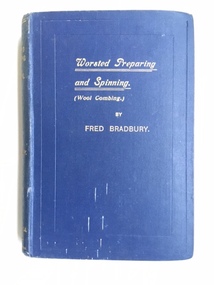
Book, Worsted Preparing & Spinning, 1923
This book is a technical book that was originally from the Wendouree Woollen Mills but latterly was part of a collection of books owned by the Warrnambool Woollen Mill. The Wendouree Woollen Mills in Ballarat began in 1870 as a flour mill and became the Doveton Woollen Mill in 1877. In 1918 it became the Myer Woollen Mill (Myer Emporium ownership) and in the 1920s it was a knitting mill. After Myer sold the mill it was known as Wendouree Woollen Mill but it closed in 1975. The Warrnambool Woollen Mill in Harris Street, Warrnambool was established in 1910 on the site of an earlier woollen mill destroyed by fire in 1882. It was a successful business for many years and closed in 2000 after 90 years of operations but by that time it had been bought by successive companies including the multinational company Dunlop. In 1968 the Warrnambool Woollen Mills (Dunlop era) purchased Wendouree Woollen Mills and transferred much of its operations to Warrnambool until the Ballarat mill was closed in 1975. This explains why a Wendouree Woollen Mill book was in the Warrnambool Woollen Mill building when it closed. This book is of some interest as a good example of technical books produced in the early 1920s. It would have been well-used by woollen mills workers and foremen at the time. It is also of interest as it comes from the Warrnambool Woollen Mill and so it is a memento of a most important and influential business in Warrnambool in the 20th century. A great number of local people were employed at this mill over the years and it enjoyed for many years a national reputation for quality products. This is a hard cover book with a dark blue cover and gold lettering on the front cover and the spine. The title of the book is printed in an ornate script and is underlined with two gold lines. The book has 277 pages commencing with page 273 as the book is Volume Two of this title. The book, about wool combing was written by Fred Bradbury. It has a Preface, a Contents page and fifteen chapters commencing with Chapter 21 and ending with Chapter 35, an Index and several pages of advertisements for other technical books. The book has several black and white photographs of machinery and illustrations and sketches demonstrating mechanical and technical processes. The book has some small stains on the front cover.Front Cover: ‘Worsted Preparing and Spinning (Wool Combing) by Fred Bradbury’ Spine: ‘Worsted Preparing and Spinning, Vol11- Bradbury – F.King & Sons Ld., Halifax, England’. Inside in two places: stamp of Wendouree Woollen Mills Pty Ltd wendouree woollen mills, warrnambool woollen mill, history of warrnambool -
 Eltham District Historical Society Inc
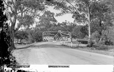
Negative - Photograph postcard, The Rose Stereograph Company, Approach To Eltham, c.1939
Looking east along the unsealed main road heading into Eltham across the concrete bridge over the Diamond Creek circa 1939. The original wooden bridge was destroyed by flood waters in 1924. This glass plate negative was used to manufacture postcards (1:1 printing) for commercial sale by the Rose Sterograph Company and its subsidiaries. George Rose founded the Rose Stereograph Company in 1880 and was joined by Herbert (Bert) Cutts in the early 20th Century. The pair formed a lifetime working partnership and strong personal friendship. Assisted by George’s two sons, Herbert George and Walter, and later by Neil Cutts, the Rose Stereograph Company continued its operations for more than 140 years. The company was initially built on stereographs, but as cinema took over and stereographs fell out of fashion, the Rose Stereograph Company developed Australia’s first commercially viable photographic postcard business. Specialising in postcards of iconic historical moments and significant landmarks, The Rose Stereograph Company became a staple of the Australian travel industry.This remarkable collection of glass plate negatives, transparencies, and postcards – arguably Australia’s most significant photography collection outside of public hands – has been passed down through the generations, surviving war, relocation, and the harsh Victorian climate. The historic Rose Stereograph collection is the culmination of George Rose’s dream of capturing and preserving precious moments in time and remains the legacy of the Rose and Cutts families. It is with great sadness that the Cutts family says goodbye to a collection that spans five generations and 140 years. The Cutts family understands that for these historically important pieces to rest with one family is to deny others the pleasure of their custodianship.Glass Plate Negative Size: 9 x 14 cmApproach to Eltham, Valentine Series No. 3197, Copyrightbuildings, electricity lines, eltham, postcard, travel, rose stereograph company, valentine series postcard, main road bridge, glass plate negative, main road, peter and elizabeth pidgeon collection, diamond creek (creek), eltham south, rose stereograph -
 Eltham District Historical Society Inc
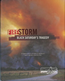
Book, Glenvale School (Lilydale, Vic.). Committee of Parents and Friends, Firestorm : Black Saturday's Tragedy, 2009
This book is dedicated to all who lost so much on the darkest Saturday in Australia's history. Australia's worst natural disaster was a tragedy beyond belief that scarred Victoria physically and the whole Australian nation physiologically. Extreme temperatures, tornado-like wind speeds and tinder-dry land, culminated in the disaster we now know as Black Saturday. Before the sun would set on the blackest day in Australia's history, thousands of hectares would become blackened landscape and an unparalleled loss of lives could only mean that many areas would never be the same again. This graphic pictorial record takes you through the conditions prior to the day, the horrific fires that destroyed both bush and townships alike, the amazing bravery of emergency services personnel and the tragic aftermath. Accounts from eye-witnesses describe a fire like never seen before, a wild fire that outran every warning system. "A comprehensive account of Australia's worst natural disaster ever"black saturday, bush fires, bushfire, fire damage - buildings, victorian bushfires - 2009 -
 Eltham District Historical Society Inc
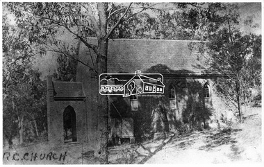
Negative - Photograph, Eltham - Old R.C. Church (building not there in 1923)
Eltham - Old R.C. Church (building not there in 1923). The original St Mary’s Roman Catholic Church (1865-1912) was built of clay brick with buttress walls and a slate roof on the corner of Fordhams Road and Maria Street (Main Road), Eltham South, opposite the present-day Wingrove Park. It was blessed on September 3, 1865. With the arrival of the railway in 1901 and the town centre moving closer to the station, the decision was made to relocate the site of the church to its present-day location on Henry Street at the corner of Main Road. A new timber weatherboard church, also called St Mary's was erected and blessed on October 13, 1912. The church and land cost £1,400 (Evelyn Observer). The original brick church It was demolished in the 1920s and the bricks and windows were recycled to build a dairy on the Brinkkotter farm at Research. The timber church was destroyed by fire in 1961 and a new modern architectural (1960s) style church was erected in its place and named Our Lady of Help Christians Church.This photo forms part of a collection of photographs gathered by the Shire of Eltham for their centenary project book,"Pioneers and Painters: 100 years of the Shire of Eltham" by Alan Marshall (1971). The collection of over 500 images is held in partnership between Eltham District Historical Society and Yarra Plenty Regional Library (Eltham Library) and is now formally known as the 'The Shire of Eltham Pioneers Photograph Collection.' It is significant in being the first community sourced collection representing the places and people of the Shire's first one hundred years.Digital image 4 x 5 inch B&W Negsepp, shire of eltham pioneers photograph collection, eltham, roman catholic church, catholic church, church, main road, st marys catholic church -
 Eltham District Historical Society Inc
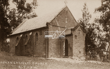
Negative - Photograph, St Mary's Roman Catholic Church, Eltham, c.1910
Note the extensive cracking of the mortar and bricks in the front facade near the portico entrance. The original St Mary’s Roman Catholic Church (1865-1912) was built of clay brick with buttress walls and a slate roof on the corner of Fordhams Road and Maria Street (Main Road), Eltham South, opposite the present-day Wingrove Park. It was blessed on September 3, 1865. With the arrival of the railway in 1901 and the town centre moving closer to the station, the decision was made to relocate the site of the church to its present-day location on Henry Street at the corner of Main Road. A new timber weatherboard church, also called St Mary's was erected and blessed on October 13, 1912. The church and land cost £1,400 (Evelyn Observer). The original brick church It was demolished in the 1920s and the bricks and windows were recycled to build a dairy on the Brinkkotter farm at Research. The timber church was destroyed by fire in 1961 and a new modern architectural (1960s) style church was erected in its place and named Our Lady of Help Christians Church.This photo forms part of a collection of photographs gathered by the Shire of Eltham for their centenary project book,"Pioneers and Painters: 100 years of the Shire of Eltham" by Alan Marshall (1971). The collection of over 500 images is held in partnership between Eltham District Historical Society and Yarra Plenty Regional Library (Eltham Library) and is now formally known as the 'The Shire of Eltham Pioneers Photograph Collection.' It is significant in being the first community sourced collection representing the places and people of the Shire's first one hundred years.Digital image 4 x 5 inch B&W Neg Sepia postcardsepp, shire of eltham pioneers photograph collection, eltham, roman catholic church, church, catholic church, main road, st marys catholic church -
 Orbost & District Historical Society
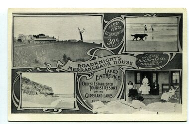
black and white postcard, C1910
This an advertisement / souvenir for Merrangbaur House in Lakes Entrance. Merrangbaur was in , Lakes Entrance and stood on the on the Prince's Highway, about a kilometre from Lakes Entrance. It was destroyed by fire on the early morning of December 15, 1935. The original residence of the Roadknight family, the first white settlers in the Lakes Entrance district, Merrangbaur House had been conducted as a guest house for many years. Much of the furniture was lost, although a portion of the building, consisting of the ballroom and several bedrooms, was saved Mrs. Anne McInnes, aged more than 80 years, the mother of the proprietress, Miss McInnes, was the only guest sleeping in the house when the fire began and had to be assisted from her blazing bedroom on the ground floor. She was carried through a window by members of the fire brigade and spent the remainder of the night at the house of a friend. Miss McInnes was in Melbourne on a business visit arranging for Christmas bookings, when she was informed of her loss. (info. from The Argus Melbourne Monday December 16 1935)This item is associated with tourism in East Gippsland in the early 20th century.A black / white photograph / postcard.There is a photograph of a Lakes Entrance scene in each corner with a banner for "ROADKNIGHT'S MERRANGBAUR HOUSE' in the middle.In a circle is "FIRST CLASS ACCOMMODATION TARIFF 30/- WEEKLY". It has a note that "Coaches for Buchan Caves call at Merrangbaur daily".merrangbaur-lakes-entrance roadknight-lakes-entrance postcard-lakes-entrance -
 Dutch Australian Heritage Centre Victoria
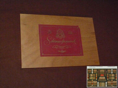
Cigar Box
The Schimmelpenninck factory stood in Wageningen until it finally closed in 2000. The Schimmelpenninck brand started in 1924 when two brothers and an uncle merged their cigar factories into one company. It was called after Rutger Jan Schimmelpenninck, raadspensionaris (kind of a prime minister) of the Batavian Republic in 1805-1806. The tobacco industry has a long history in this town; in the 17th century one fifth of all arable land around the town was used for tobacco. Originally used in pipes and as snuff, the popularity of cigars in the 19th century led to a large expansion of the Dutch tobacco industry. The Schimmelpenninck factory was at its largest just before World war II, 700 employees produced 32 million cigars. Wageningen was heavily damaged during operation Market Garden in 1944, the whole population was evacuated and most of the machines of the Schimmelpenninck factory were stolen or destroyed. After the war, consumption of cigars was much reduced and the firm slowly merged with others. Eventually they became part of Rothmans.This box and the brand name Schimmelpenninck represent several periods of Dutch history between the time of the Republic and the post WWII years. Cigar smoking was very popular in the Netherlands pre-war but less so in the second half of the 20th century partly due to a growing awareness of tobacco's carciogenic properties.Large flat wooden box designed to hold 78 cigars. The lid is attached with brass hinges and two brass clasps enable it to be closed. A large red label with silver script and illustrations is attached to both the outside and the inside of the lid.Schimmelpenninck. Hollands Finest Cigars -
 Otway Districts Historical Society
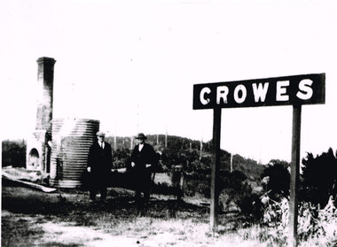
Photograph, Brucker, Crowes after the 1919 fires, 1919
The 1919 bushfire was the worst the area suffered. The fire struck on Saturday afternoon on the 15th February. It destroyed the station at Lavers Hill and Crowes, departmental residences at Lavers Hill and Weeaproinah, the overhead bridges at Beech Forest and Wimba, and damaged the track at various points along the line so that two locomotives became temporarily marooned at Beech Forest.. By the following Tuesday a daily fire relief train had begun operation. By the following Sunday a special train loaded with army tents travelled through to Lavers Hill and deposited most of its consignment there because little remained of this sizeable settlement. An outsider would have had difficulty in picking the place. The letters of the Lavers Hill station nameboard had been burnt although the metal letters survived, and one of the local wags had rearranged them to read "LIARS HELL". By the 1920s water trains were being used to help fight fires, a simple NQR open wagon loaded with the standard 1500 litre square iron water tank.B/W. Crowes station sign, the remains of a chimney, galvanised iron sheet and a water tank, and two men gazing at the camera. Note in the background the clear felling of the timber.crowes; lavers hill; beech forest; weeaproinah; wimba; railways; bushfire; -
 Glen Eira City Council History and Heritage Collection
Document (Item) - Newspaper (digital), Caulfield Contact
The Caulfield Contact was the official newspaper of the City of Caulfield from 1976-1994. The City of Caulfield was the Municipal Council for an area of the South Eastern suburbs of Melbourne, including Brighton East, Carnegie, Caulfield, Elsternwick, Gardenvale, Glen Huntly, McKinnon, Murrumbeena, Ormond and St Kilda East. Following Amalgamation of City of Caulfield and parts of the City of Moorabbin in 1994, the Caulfield Contact was followed by the Glen Eira News. Includes references to the following: Children's Neighbourhood Centre Caulfield; Fire destroyed Caulfield Park Bowling Club; Naming of Harleston Park; Home Handyman Service; Profiles Councillors Peter Baitz, Ron Walters; Carnegie-Glenhuntly Football Club formed Council drops approval of rail crossings over Neerim and Glenhuntly Roads; Profiles Councillor Alwyn Samuel, Glen Richards; First stage of Nepean Highway widening; Minister approved re-subdivision; Council spills; Exciting development of Caulfield Park; Profiles Councillor Max Blair, Councillor Brian Rudzki; Tram shelter classified by National Trustcity of caulfield, caulfield, glen eira, city of glen eira, caulfield contact, children's neighbourhood centre caulfield, fire destroyed caulfield park bowling club, naming of harleston park, home handyman service, profiles councillors peter baitz, ron walters, carnegie-glenhuntly football club formed, council drops approval of rail crossings over neerim and glenhuntly roads, profiles councillor alwyn samuel, glen richards, first stage of nepean highway widening, minister approved re-subdivision, council spills, exciting development of caulfield park, profiles councillor max blair, councillor brian rudzki, tram shelter classified by national trust -
 Port Fairy Historical Society Museum and Archives
Photograph
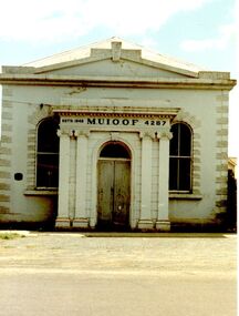
This building is the second of the Manchester Unity Independent Order of Oddfellows rooms the first built in 1862 and opened in that year on the fifteenth anniversary of the foundation of the Lodge in Belfast/Port Fairy. In 1872 a 35foot addition was added to the back and in 1873 the grand porch was added. The hall was destroyed by fire in 1875 and the only item saved was the cedar Dispensation frame of the past Grand Masters made by John Gallin that now resides in the Historical Society Rooms. The Trustees bought another building which occupied the land now occupied by the National Australia Bank on the corner of Sackville and Cox Streets but it was not suitable so they decided to re-instate the building whose ruins in the meantime had been used by Cobb and Co. This new building was designed by Charles Neylon an architect and built by Robert Ireland. The completed building was re-opened in December 1888 with four front rooms, a mezzanine floor and a hall measuring 32' by 26' and capable of holding 200. The Trustees of the Loyal Prince Albert Lodge sold the building in 1978 and is now a private home.Coloured photograph of Imposing M.U.i.O.O.F. Society building with a faux columned portico, double door entry two large windows either sideinstitution, loyal prince albert lodge, m.u.i.o.o.f., manchester unity independent order of oddfellows, society, muioof hall pt fairy -
 Surrey Hills Historical Society Collection
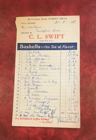
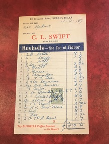
Document - Account, C. L. Swift order docket re Mrs Matthews. 21/8/1957
Clive Leslie Swift (RAAF 430415) was born in Elsternwick in 1924 and served in the RAAF in Borneo during WW2. He was mentioned in dispatches. He married Enid (Ina) Mary Smith in 1947. Together they ran the grocery store at 10 Croydon Road from 1949 until some time after 1954. In the 1980s they were living in Highbury Road, East Burwood and Clive was working for Unigate (later Bonlac) in a managerial position. (REF: Oral testimony, Libby Wilson, Canterbury History Group). The shop continued after the Swifts left but was later destroyed by fire. Clive Swift died in March 2014. This and other dockets were tucked into Ruth Matthews' recipe folder. Ruth and Harold Geoffrey (Geoff) Matthews lived at 42 Guildford Road, Surrey Hills. The donor recalled that her paternal grandmother (Ethel May Matthews) also occasionally shopped at the Swifts' shop as it was closer to her home (31 Guildford Road) than either than Griffith’s on Union Road or Thomas’ on Maling Road . Dockets such as these are reflective of shopping in the pre-supermarket era when women generally walked to the local shop or had proprietors or a staff member come to the house to take weekly orders. A pre-printed grocery docket for C. L. Swift (Late R.A.A.F.) on cream (discoloured) paper printed in black, red and blue filled in with 20 hand-written items, their prices and the total of the grocery order. Signed with initials as having been paid. Order was for Mrs Matthews of Guildford Road.On the rear in blue ink an addition in pounds, shillings and pence.clive leslie swift, miss enid (ina) mary smith, mrs enid (ina) mary swift, croydon road, guildford road, grocery store, docket, accounts, bushells tea, mrs ruth matthews, harold geoffrey matthews, 'geoff' matthews -
 Surrey Hills Historical Society Collection
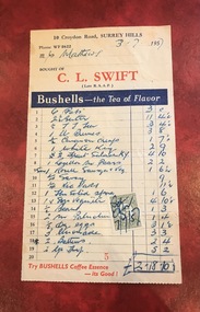
Document - Account, C. L. Swift order docket re Mrs Matthews. 21/8/1957
Clive Leslie Swift (RAAF 430415) was born in Elsternwick in 1924 and served in the RAAF in Borneo during WW2. He was mentioned in dispatches. He married Enid (Ina) Mary Smith in 1947. Together they ran the grocery store at 10 Croydon Road from 1949 until some time after 1954. In the 1980s they were living in Highbury Road, East Burwood and Clive was working for Unigate (later Bonlac) in a managerial position. (REF: Oral testimony, Libby Wilson, Canterbury History Group). The shop continued after the Swifts left but was later destroyed by fire. Clive Swift died in March 2014. This and other dockets were tucked into Ruth Matthews' recipe folder. Ruth and Harold Geoffrey (Geoff) Matthews lived at 42 Guildford Road, Surrey Hills. The donor recalled that her paternal grandmother (Ethel May Matthews) also occasionally shopped at the Swifts' shop as it was closer to her home (31 Guildford Road) than either than Griffith’s on Union Road or Thomas’ on Maling Road . Dockets such as these are reflective of shopping in the pre-supermarket era when women generally walked to the local shop or had proprietors or a staff member come to the house to take weekly orders. A pre-printed grocery docket for C. L. Swift (Late R.A.A.F.) on cream (slightly discoloured) paper printed in black, red and blue filled in with 19 hand-written items, their prices and the total of the grocery order. A green and cream duty stamp to the value of 3d is attached and over-signed with initials as having been paid. Order was for Mrs Matthews of Guildford Road.clive leslie swift, miss enid (ina) mary smith, mrs enid (ina) mary swift, croydon road, guildford road, grocery store, docket, accounts, bushells tea, mrs ruth matthews, harold geoffrey matthews, 'geoff' matthews -
 Surrey Hills Historical Society Collection
Document - Account, C. L. Swift order docket re Mrs Matthews. 21/8/1957
Clive Leslie Swift (RAAF 430415) was born in Elsternwick in 1924 and served in the RAAF in Borneo during WW2. He was mentioned in dispatches. He married Enid (Ina) Mary Smith in 1947. Together they ran the grocery store at 10 Croydon Road from 1949 until some time after 1954. In the 1980s they were living in Highbury Road, East Burwood and Clive was working for Unigate (later Bonlac) in a managerial position. (REF: Oral testimony, Libby Wilson, Canterbury History Group). The shop continued after the Swifts left but was later destroyed by fire. Clive Swift died in March 2014. This and other dockets were tucked into Ruth Matthews' recipe folder. Ruth and Harold Geoffrey (Geoff) Matthews lived at 42 Guildford Road, Surrey Hills. The donor recalled that her paternal grandmother (Ethel May Matthews) also occasionally shopped at the Swifts' shop as it was closer to her home (31 Guildford Road) than either than Griffith’s on Union Road or Thomas’ on Maling Road . Dockets such as these are reflective of shopping in the pre-supermarket era when women generally walked to the local shop or had proprietors or a staff member come to the house to take weekly orders. A pre-printed grocery docket for C. L. Swift (Late R.A.A.F.) on cream (slightly discoloured) paper printed in black, red and blue filled in with 19 hand-written items, their prices and the total of the grocery order. A green and cream duty stamp to the value of 3d is attached and over-signed with initials as having been paid. Order was for Mrs Matthews of Guildford Road.clive leslie swift, miss enid (ina) mary smith, mrs enid (ina) mary swift, croydon road, guildford road, grocery store, docket, accounts, bushells tea, mrs ruth matthews, harold geoffrey matthews, 'geoff' matthews -
 Wodonga & District Historical Society Inc
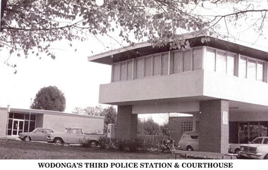
Photograph - Codling Collection 01 - Wodonga's 3rd Police Station and Court House
Miss Olive Codling was a Foundation Member and a Life Member of the Wodonga Historical Society. Many of her prize-winning photos are held in the Society Collection. She also held a range of roles and committee positions in a wide range of Wodonga community organisations. WODONGA's 3rd Police Station and Court House were constructed in Elgin Street, Wodonga. The Court House had to be relocated after the earlier building had been destroyed by a fire in 1964. In 1966, the new Wodonga Police Station was built but lay empty and idle for about three months. The reason given was that no furniture was available. After this situation was remedied the station was opened on December 23, 1966. The previous police station was vacated and pulled down. The new station was built in front of the new court house, which had been operating for approximately 12 months. The Police and Court House continued to operate on this site until they were again relocated in 2002. They are now located in Hovell Street, Wodonga.This photo collection is significant as it documents how the businesses and buildings in Wodonga have evolved and contributed to community throughout the 20th century.2 images of the 3rd police station built in Wodonga with the courthouse in the background.wodonga businesses, wodonga police station, wodonga court house -
 Vision Australia
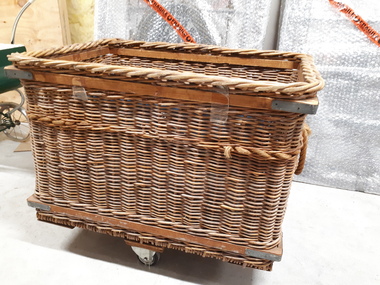
Functional object - Object, Cane basket on wheels
Basket weaving and brush making was a source of income for those who worked in the workshops at RVIB and other institutions in New South Wales and Queensland. A diverse range products could be produced with cane, such as cane chairs, cots, washing baskets and trolleys, and the Institution sought to highlight these in the annual report. Over time the demand for, and supply of, cane changed - particularly during World War 2 when Asian sources were under attack or destroyed. At home, other materials such as plastics as well as the ability to import cheaper pre-produced products further reduced the demand for workshop pieces. This cane basket was used at QBIC for transporting heavy items. The side has been reinforced with wood and four metal bands to help the cane keep it's shape and take the weight of heavy items. The base has two pieces of board and rotating wheels are attached to the middle of the lower board which allows it to sit above ground level and be wheeled over flat surfaces. A rope handle is attached to two sides as well.1 deep cane basket with two wheelsQBIC Industries - Asset Number: 1430-1 Description: Push Trolley 7 Location: 18R Block Cane Shop employment, qbic industries -
 Wooragee Landcare Group
Photograph, circa April 2003
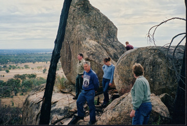
This photograph was taken in the Mount Pilot Chiltern National Park. It was taken during a search for the tiger quoll conducted by a team of volunteers from the Wooragee Landcare Group. The tiger quoll is also known as the spotted-tail quoll and is found in the national park. The 2003 bushfires caused worry for the safety of the tiger quoll, hence the need for a search for it. Mount Pilot Chiltern National Park is located near Chiltern in Victoria. It's most notable landmarks include Mt Pilot and Woolshed Falls. It also has many mines from the Gold Rush in the late 1800s. It is home to much flora and fauna, including the tiger quoll. The park is also home to the box-ironbark forest that once was present in most of north-eastern Victoria. The park is a large tourist destination as in there are many bushwalks and other attractions for visitors. In 2003, bushfires raged through Mount Pilot National Park and destroyed much of the environment. Some of this damage can be seen in the burnt trees in the picture. This photograph represents the work that goes into protecting a important species like the tiger quoll and there has been much work done to preserve it. This photograph was taken when the Wooragee Landcare group went to ensure the survival of this species, highlighting how the tiger quoll is being protected. This photograph also demonstrates the significance of Mount Pilot Chiltern National Park. The park has many special flora and fauna that can only be found in this area. For example, the box-ironbark forest and the tiger quoll. The forest used to stretch over much of north-eastern Victoria and is therefore reminiscent of what that area of Victoria was once like. This park is historical for this reason but it is also historical through it being once goldfields from the Gold Rush in the 1800s.Landscape coloured photograph printed on gloss paperReverse: WAN NA 0ANA2N0 NNN- 1 1636 / [PRINTED] (No.8) / 922mount pilot, mount pilot chiltern national park, chiltern, victoria, landmark, woolshed falls, gold rush, tiger quoll, flora, fauna, spotted tail quoll, marsupial, andy murray, andy murray quolls, carnivorous marsupial, forests, rainforests, coastal heathlands, woodlands, photograph, species, wooragee, wooragee landcare group, wooragee landcare, bushfires, identification, search, dna, droppings, box ironbark forest, ironbark, box iron bark -
 Wodonga & District Historical Society Inc
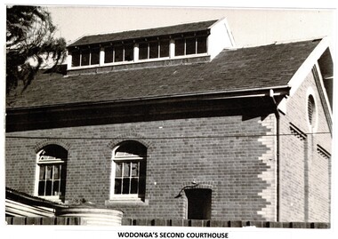
Photograph - Codling Collection 01 - Wodonga's Second Court House
Miss Olive Codling was a Foundation Member and a Life Member of the Wodonga Historical Society. Many of her prize-winning photos are held in the Society Collection. She also held a range of roles and committee positions in a wide range of Wodonga community organisations. WODONGA'S SECOND COURTHOUSE The Court House was situated in the Customs or Bond Store building alongside the Wodonga Police Station in 93 High Street. This was on the west side of High Street at its intersection with Bond Street. The building was converted to the courthouse in 1920. In early 1964, the courthouse building was burnt beyond repair and furniture and other property destroyed. The cause of the fire was never found. The Police Station was lucky to survive but only because of the efforts of the local Fire Brigade. After the fire, the court was held first at the old Fire Station premises near where the present Wodonga Post Office, then it moved to a vacant building in Mitchell Street which was later turned into a Child Care Centre. Foundations for the new courthouse in Elgin Street were laid in October 1965.This photo collection is significant as it documents how the businesses and buildings in Wodonga have evolved and contributed to community throughout the 20th century.2 black and white photos of the Court House, formerly used as a Bond Store for collection of customs.high st wodonga, wodonga court house -
 Wooragee Landcare Group
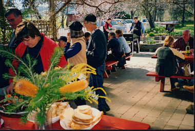
Photograph, 5 September 2004
This photograph was taken at Tatong Tavern, Victoria on Sunday the 5th of September as part of a day trip by the Wooragee Landcare Group. The event was about looking at land use on small farms and as a social get-together for the Group. Wooragee was also researching how small landholders could run some enterprises around the time of the trip. This photograph includes Jo Luisi, Bob Bennet, Christine Stewart, and Julius Holt. Tatong Tavern was built in the 1880's as Tatong Hotel or 'Pub' hotel for Mr. William Worrall. The original hotel was destroyed in 1923 by a fire, but was rebuilt for Mr. M. C. Clarke. The building is a representation of the changing society, as it changes as its uses and visitors change. The photograph shows the beer garden, which has been added more recently. The Tavern has a bar, restaurant, and accommodation area. Wooragee Landcare Group was created in 1988. Its core mission is to work towards eradicating animals and pests from the land to protect the natural vegetation and promote revegetation projects.This photograph is a great example of the type of events that Wooragee Landcare Group has organized, while educating the public about the importance of land use management. It showcases the social aspect of the Group, as well as the historic Tatong Tavern. Landscape colored photograph printed on gloss paper. Reverse: WAN NA E0NA2N2. NNN+ 1 4240/ [PRINTED] (No. 22) / 375wooragee, wooragee landcare group, wooragee landcare's collection, land use, social, tatong tavern, tatong hotel, tatong pub -
 Wooragee Landcare Group
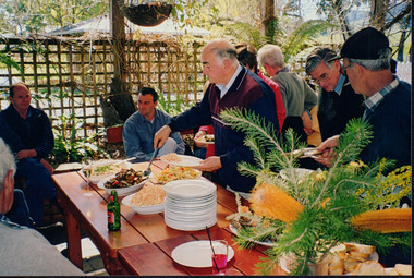
Photograph, 5 September 2004
This photograph was taken at Tatong Tavern, Victoria on Sunday the 5th of September as part of a day trip by the Wooragee Landcare Group. The event was about looking at land use on small farms and as a social get-together for the Group. Wooragee was also researching how small landholders could run some enterprises around the time of the trip. This photograph includes Christine Stewart, Julius Holt, Graeme Missen, Peter Finedon, and Sue Brunskill. Tatong Tavern was built in the 1880's as Tatong Hotel or 'Pub' hotel for Mr. William Worrall. The original hotel was destroyed in 1923 by a fire, but was rebuilt for Mr. M. C. Clarke. The building is a representation of the changing society, as it changes as its uses and visitors change. The photograph shows the beer garden, which has been added more recently. The Tavern has a bar, restaurant, and accommodation area. Wooragee Landcare Group was created in 1988. Its core mission is to work towards eradicating animals and pests from the land to protect the natural vegetation and promote revegetation projects.This photograph is a great example of the type of events that Wooragee Landcare Group has organized, while educating the public about the importance of land use management. It showcases the social aspect of the Group, as well as the historic Tatong Tavern.Landscape colored photograph printed on gloss paper. Reverse: WAN NA E0NA2N2. NNN+ 2 4240 / [PRINTED] (No. 23) / 376wooragee, wooragee landcare group, wooragee landcare's collection, land use, social, tatong tavern, tatong hotel, tatong pub -
 Eltham District Historical Society Inc
Photograph, Fay Bridge, Clifton Pugh's Artists' Colony, Dunmoochin, Barreenong Road, Cottles Bridge, c.1995
Visit to Dunmoochin prior to Clifton Pugh's home being destroyed by fire in 2002. Following military service in the second world war, Clifton Pugh studied under artist Sir William Dargie at the National Gallery School in Melbourne as well as Justus Jorgensen, founder of Montsalvat. For a while he lived on the dole but also worked packing eggs for the Belot family saving sufficient to purchase six acres (2.4 ha) of land at Barreenong Road, Cottles Bridge. He accumulated more land and persuaded several other artists and friends to buy land nearby, resulting in a property of approximately 200 acres, stablishing it as one of the first artistic communes in Australia alongside Montsalvat in Eltham. It was around 1951 that Pugh felt he had '"done moochin' around" and so the name of the property evolved. He bought timber from Alistair Knox to build his house on the crest of a hill. Inspired by local goldminer's huts, it was a one room wattle-and-daub structure with dirt floor. Over the years it expanded with thick adobe walls made from local clay, high ceilings and stone floors. All materials other than the local earth were sourced from second hand materials, most found at wreckers' yards. Artists from across the nation were drawn to Dunmoochin, with several setting up houses and shacks on the property, maintaining their independence but sharing their artistic zeal. Artists who worked or resided at Dunmoochin included Mirka Mora, John Perceval, Albert Tucker, Fred Williams, Charles Blackman, Arthur Boyd and John Olsen. In 2002, Pugh's house along with its treasure trove of art and a library of some 20,000 books was destroyed by fire. Traces of Pugh's home remain with the presence of the Victorian doorframe archway with leadlight of intricate design, procured from a demolished Melbourne mansion; and two bronze life-sized female statues created by Pugh and cast by Matcham Skipper. In place of Pugh's house rose two double-storey mud-brick artists' studios topped with corrugated iron rooves curved like the wings of a bird with accommodation for seven. The original studios, gallery and other buildings survived the fire.fay bridge collection, 1995, barreenong road, cottles bridge, dunmoochin -
 Waverley RSL Sub Branch
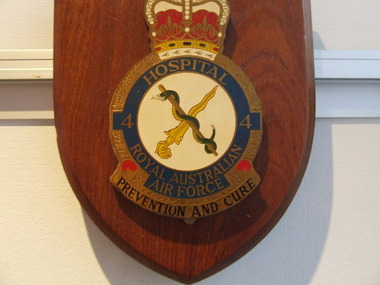
Plaque 4 Sqn.R.A.A.F. Hospital, R.A.A.F. Hospital
No 4 Squadron, Australian Flying Corps, formed at Point Cook, Victoria, in October 1916. After embarking for England to complete its training, the squadron deployed to France in December 1917. From the outset, No 4 Squadron aircraft regularly engaged the Red Baron's elite 'Flying Circus' and, in spite of their lack of experience, quickly gained the ascendancy over the German squadron. During its brief war service, No 4 Squadron destroyed some 128 enemy aircraft and spawned a total of eleven aces. The squadron's highest scoring airman was Captain Cobby who, in addition to shooting down 29 aircraft, also destroyed 13 observation balloons. World War II saw No 4 Squadron Wirraways deployed to Port Moresby in support of Australian troops fighting in the New Guinea jungles. In their slow and vulnerable aircraft, losses from anti-aircraft fire were high, however, this never deterred the Wirraway crews from completing their assigned tasks. This aggressive spirit was exemplified by Pilot Officer Archer and his crewman, Sergeant Coulston, who, while on a reconnaissance mission, found themselves above a Japanese Zero fighter. Despite operating a vastly inferior aircraft, Pilot Officer Archer dived to the attack and shot down the enemy aircraft. In June 1943, No 4 Squadron received its first Boomerang fighters and continued to support Allied troops during the Cape Gloucester landings before moving to Morotai. No 4 Squadron ended the war in Borneo and returned to Australia in November 1945, where it was renamed No 3 Squadron - thus closing the chapter on a very distinguished and proud unit. Summary of Unit Name(s) Start Date End Date No. 4 RAAF Hospital, Butterworth 06/06/1966 06/06/1966 No. 4 RAAF Hospital, Butterworth 03/07/1966 No. 4 RAAF Hospital, Butterworth 01/08/1966 01/08/1966 No. 4 RAAF Hospital, Butterworth 05/09/1966 No. 4 RAAF Hospital, Butterworth 29/09/1966 No. 4 RAAF Hospital, Butterworth 29/10/1966 29/10/1966 http://www.airforce.gov.au/raafmuseum/research/units/4sqn.htmWooden Plaque 15cm x 13cm with insignia of 4 Sqn.R.A.A.F. Hospital 4 Sqn R.A.A.F. Hospital r.a.a.f. 4 squadron, butterworth, r.a.a.f. hospital -
 Warrnambool and District Historical Society Inc.
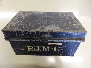
Box, Tin Box McGennan
Peter McGennan (1839-1920) arrived in Warrnambool in the 1870s and established a cooperage in Kepler Street and a boating business on the Hopkins River. He rebuilt the boating establishment after a fire in 1876. In 1896 McGennan established a Box and Case Factory in Davis Street (Merrivale Drive), importing timber from New Zealand, using chartered vessels and his own ships which included the ‘Speculant’. The box factory was a successful venture employing over 30 men until it was destroyed by fire in 1923. Peter McGennan was involved in the establishment of the Warrnambool Cheese and Butter Factory at Allansford and the Warrnambool Woollen Mill. He was a Director of the latter company until his death. Members of the McGennan family were also important business people in Warrnambool, being involved in the hotel business and civic affairs for many years. The tin box may have been used to house family papers or business documents during Peter McGennan’s life and it was used to house his estate papers after his death. Many of these documents are in the collection of the Warrnambool &District Historical Society.This box is of some importance as it belonged to a prominent Warrnambool businessman and his family. It has social significance as an example of the type of storage items used early in the 20th century to hold documents etc.This is a rectangular tin box with the black paint on the outside peeling and yellow paint inside. There is a metal lock which has no key. There is a small handle on the top added to the tin surface. The name ‘P.J.McGennan’ is painted on the front side in yellow paint.‘P.J.McGennan’ A typed label on faded yellow adhesive tape ‘Estate P.J.McGennan’ peter mcgennan, p j mcgennan, peter mcgennan metal box, mcgennan box factory, mcgennan warrnambool -
 Eltham District Historical Society Inc
Photograph, Fay Bridge, Former Morrison property, Killeavey, Laughing Waters Road, Eltham, 28 June 2004
Beatrice Wanliss Irvine was the daughter of former Victorian Premier Sir William Irvine. From age 13 she lived at “Killeavey” off Laughing Waters Road (later accessed from Reynolds Road). In 1923 she married James Morrison and the couple received Killeavey as a wedding gift. The property supported fruit and vegetable growing as well as an impressive botanical garden. But James died in 1936 after a period of ill health, leaving Beatrice to support their six children. The Killeavey house was built atop a cliff, 40 metres above the Yarra River. The garden was designed in 1910 by William Guilfoyle who was the second director of the Royal Botanical Gardens. The house was totally destroyed in the Black Friday bushfires in 1939, but was rebuilt. Beatrice continued to live at Killeavey and became well regarded as a botanist and naturalist. She died in 1989 and is buried in Eltham Cemetery with her husband and one of their sons. The (rebuilt) house was demolished by Parks Victoria. It contains significant garden remnants. The surrounding bushland is valued for its significant plant communities.fay bridge collection, 2004-06-28, beatrice wanliss morrison (nee irvine), eltham, james morrison, killeavey, laughing waters road, william irvine -
 Eltham District Historical Society Inc
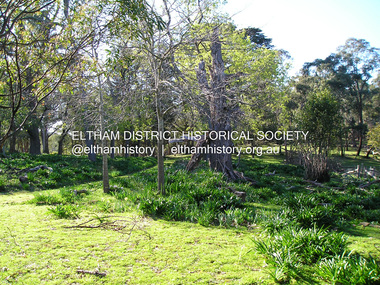
Photograph, Fay Bridge, Former Morrison property, Killeavey, Laughing Waters Road, Eltham, 30 August 2019
Beatrice Wanliss Irvine was the daughter of former Victorian Premier Sir William Irvine. From age 13 she lived at “Killeavey” off Laughing Waters Road (later accessed from Reynolds Road). In 1923 she married James Morrison and the couple received Killeavey as a wedding gift. The property supported fruit and vegetable growing as well as an impressive botanical garden. But James died in 1936 after a period of ill health, leaving Beatrice to support their six children. The Killeavey house was built atop a cliff, 40 metres above the Yarra River. The garden was designed in 1910 by William Guilfoyle who was the second director of the Royal Botanical Gardens. The house was totally destroyed in the Black Friday bushfires in 1939, but was rebuilt. Beatrice continued to live at Killeavey and became well regarded as a botanist and naturalist. She died in 1989 and is buried in Eltham Cemetery with her husband and one of their sons. The (rebuilt) house was demolished by Parks Victoria. It contains significant garden remnants. The surrounding bushland is valued for its significant plant communities.fay bridge collection, beatrice wanliss morrison (nee irvine), eltham, james morrison, killeavey, laughing waters road, william irvine, 2019-08-30