Showing 5282 items
matching flood-marker-orbost
-
 Eltham District Historical Society Inc
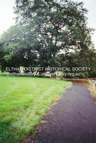
Photograph - Digital Photograph, Carlota Quinlan, Diamond Creek in flood, Diamond Creek Trail, Eltham South, 17 Oct 2021
diamond creek (creek), diamond creek trail, eltham south, flooding, floods, floodwater -
 Eltham District Historical Society Inc
Photograph - Digital Photograph, Carlota Quinlan, Diamond Creek in flood, Diamond Creek Trail, Eltham South, 17 Oct 2021
diamond creek (creek), diamond creek trail, eltham south, flooding, floods, floodwater -
 Eltham District Historical Society Inc
Photograph - Digital Photograph, Carlota Quinlan, Diamond Creek in flood, Diamond Creek Trail, Eltham South, 17 Oct 2021
diamond creek (creek), diamond creek trail, eltham south, flooding, floods, floodwater -
 Eltham District Historical Society Inc
Photograph - Digital Photograph, Carlota Quinlan, Diamond Creek in flood, Diamond Creek Trail, Eltham South, 17 Oct 2021
diamond creek (creek), diamond creek trail, eltham south, flooding, floods, floodwater -
 Eltham District Historical Society Inc
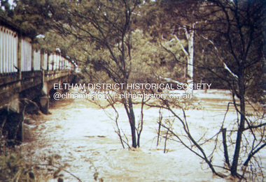
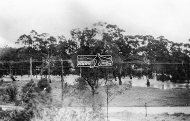
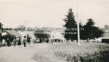
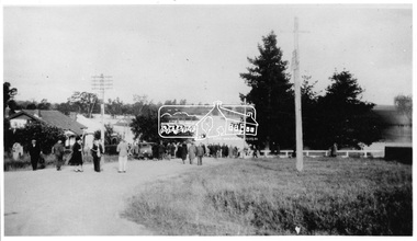
Slide - Photograph, 1934 flood, Eltham South, c.Sep. 1989
Part of a slide show presentation "Bridges & Waterways of the Shire" by Russell Yeoman to the 13 September 1989 Society meeting. The presentation included slides of historic photos from the Shire of Eltham Pioneers collections as well as several recent views.35mm colour positive transparency (1 of 33) Mount - Agfa CS System grey 8 dotsProcess Date Sep 1989eltham, diamond creek (creek), 1934 flood, eltham south, main road bridge -
 Eltham District Historical Society Inc
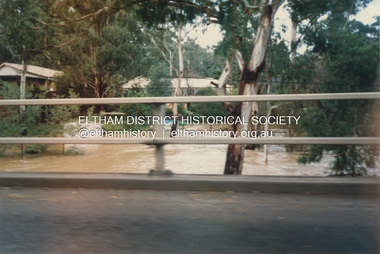
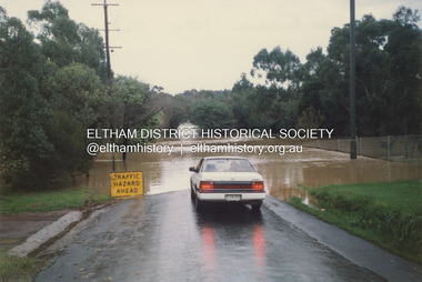
Photograph, Graeme Hardiman, Diamond Creek in flood, Antoinette Boulevard, Eltham, 6 June 1989
antoinette boulevard, diamond creek (creek), eltham, floods, floodwater -
 Eltham District Historical Society Inc
Photograph, Graeme Hardiman, Diamond Creek in flood, Antoinette Boulevard, Eltham, 6 June 1989
antoinette boulevard, diamond creek (creek), eltham, floods, floodwater -
 Eltham District Historical Society Inc
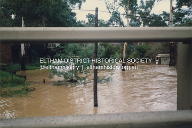
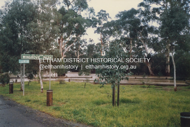
Photograph, Graeme Hardiman, Diamond Creek in flood, Wingrove Park, Main Road, Eltham, 6 June 1989
diamond creek (creek), eltham, floods, floodwater, main road, wingrove park -
 Eltham District Historical Society Inc
Photograph, Graeme Hardiman, Diamond Creek in flood, Brougham Street, Eltham, 6 June 1989
diamond creek (creek), eltham, floods, floodwater, brougham steet -
 Eltham District Historical Society Inc
Photograph, Graeme Hardiman, Diamond Creek in flood, Susan Street, Eltham, 6 June 1989
Opposite P.J. Timber and Trading Co. Pty Ltddiamond creek (creek), eltham, floods, floodwater, p.j. timber & trading co pty ltd, susan street -
 Eltham District Historical Society Inc
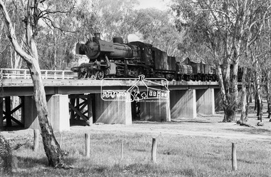
Photograph, Steam locomotive J-526 crossing a flood plain bridge at Moama, November 1963, 1963
Image dated as November 1963 based on same image in Port of Echuca collection (print 19.5 x 24.5cm) On reverse in blue pen:" Photo by: George L. Coop Nov 1963". Crossed out, in black pen: "564" https://victoriancollections.net.au/items/59e7dcaa21ea6a13c0626c8dDigital TIFF file Scan of 35mm Ilford FP3 black and white negative transparencygeorge coop collection, j-526, j-class steam locomotive (vulcan foundry), moama, railway bridge -
 Eltham District Historical Society Inc
Photograph, Grace Mitchell, Diamond Creek in flood, Bremners Flat, Main Road, Eltham, c.1958
View from Grace Mitchell's shop at the corner of Mount Pleasant Road and Main Road. Grace Mitchell was probably best known for her Eltham shop at the corner of Mt Pleasant Road and Main Road. Grace's memories covered many local identities who were patrons of her shop between 1954 and 1971. From the elevated position of her shop and home Grace was able to view a varied passing parade of Eltham events from ERSILAC, Easter and Eltham Festival parades passing on their way to Eltham Lower Park, circuses in Wingrove Park (then Bremner’s Reserve), roadworks and other happenings. Bremner's Reserve was renamed Wingrove Park c.1970 This photo was from a series of images presented by Grace Mitchell at a Society talk 10 March 1993 on the theme of “My Eltham”.Black and white print 17 x 25.4 cmbremner's flat, diamond creek, floods, main road, mount pleasant road, wingrove park -
 Eltham District Historical Society Inc
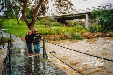
Photograph, Diamond Creek in flood, Bridge Street footbridge, Sunday, 7 November 2004, 07/11/2004
Colour photographbridge street, diamond creek, eltham, footbridge, floods -
 Eltham District Historical Society Inc
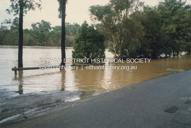
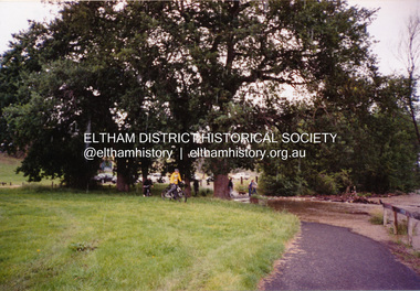
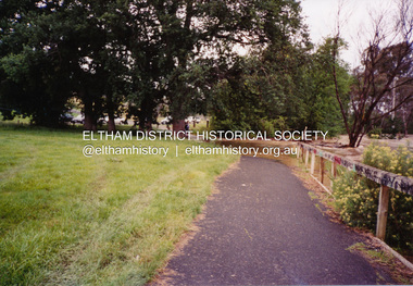
Photograph, Diamond Creek in flood, Eltham, 13 Nov 2004, 13/11/04
Three colour photographs of the floodwater from Diamond Creek crossing the path below the Eltham Community Centre.eltham, diamond creek, floods, eltham community centre -
 Eltham District Historical Society Inc
Photograph, Diamond Creek in flood, Eltham, 13 Nov 2004, 13/11/04
Three colour photographs of the floodwater from Diamond Creek crossing the path below the Eltham Community Centre.eltham, diamond creek, floods, eltham community centre -
 Eltham District Historical Society Inc
Photograph, Heidelberg - River Yarra in flood at Heidelberg, 1934
Black and white photographCopied by Hugh Fisher, Photographer, 6 York Street Eltham A1679Bfloods, heidelberg, other areas, shire of eltham pioneers photograph collection, yarra river -
 Eltham District Historical Society Inc
Photograph, Diamond Creek in flood, Eltham, 13 Nov 2004, 13/11/04
Three colour photographs of the floodwater from Diamond Creek crossing the path below the Eltham Community Centre.eltham, diamond creek, floods, eltham community centre -
 Eltham District Historical Society Inc
Photograph, Heidelberg - River Yarra in flood at Heidelberg, 1934, 1934
This photo forms part of a collection of photographs gathered by the Shire of Eltham for their centenary project book,"Pioneers and Painters: 100 years of the Shire of Eltham" by Alan Marshall (1971). The collection of over 500 images is held in partnership between Eltham District Historical Society and Yarra Plenty Regional Library (Eltham Library) and is now formally known as the 'The Shire of Eltham Pioneers Photograph Collection.' It is significant in being the first community sourced collection representing the places and people of the Shire's first one hundred years.Digital imagesepp, shire of eltham pioneers photograph collection, other areas, yarra river, floods -
 Eltham District Historical Society Inc
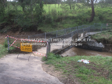
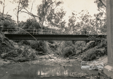
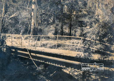
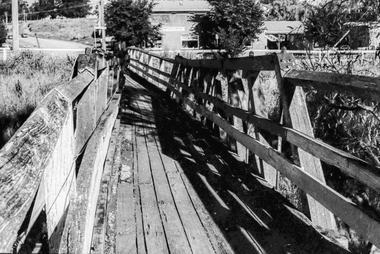
Photograph, Flood damage, Footbridge, Main Road, Eltham
Black and white photographeltham, infrastructure, shire of eltham infrastructure, bridge, footbridge, main road, floods -
 Eltham District Historical Society Inc
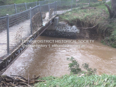
Photograph, Flood damage, Footbridge, Main Road, Eltham
Black and white photographeltham, infrastructure, shire of eltham infrastructure, bridge, footbridge, main road, floods -
 Eltham District Historical Society Inc
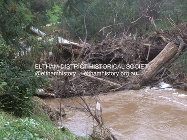
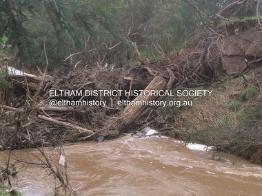
Photograph, Flood damage, Footbridge, Main Road, Eltham
Black and white photographeltham, infrastructure, shire of eltham infrastructure, bridge, footbridge, main road, floods -
 Eltham District Historical Society Inc
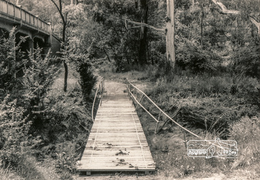
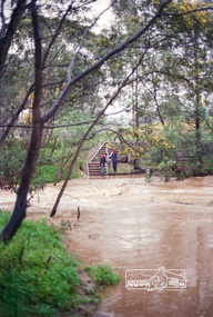
Negative - Photograph, Harry Gilham, Diamond Creek in flood, looking west towards Eltham High School (across submerged footbridge), c.Aug. 1996
This (submerged) footbridge has since been replaced by a higher-level bridge and the steps have been abolished.Roll of 35mm colour negative film, 5 of 6 stripsKodak Gold 100-5diamond creek, floods, dalton street, wingrove park trail, eltham high school -
 Eltham District Historical Society Inc
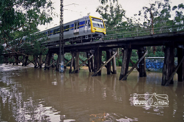
Photograph, Fred Mitchell, X'Trapolis Train crossing over the Railway Trestle Bridge at Eltham during Diamond Creek flood, 2005, 2005
Digital copy of colour photographfred mitchell collection, 2005, diamond creek, electric train, eltham, floods, trestle bridge -
 Ballaarat Mechanics' Institute (BMI Ballarat)
Film - Photograph by Herb Richmond. ca 1971, Skipton- Footbridge Over Emu Creek. No provision on road bridge for foot traffic. Note effect of flood waters
Ballarat History35mm B&W Kodak Plus X Pan Film.ballarat, ballaraat, skipton, footbridge, emu-creek -
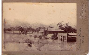 Echuca Historical Society
Photograph, 1870 Flood High St Echuca
-
 Tatura Irrigation & Wartime Camps Museum
CD, Tatura Flood Study
Photographs from community interviews March 2002CD in a clear plastic rectangle cover. Imation CDlocal history -
Tatura Irrigation & Wartime Camps Museum
Report, River Management, Drainage and Flood Plain Management, Report 1. 1982, 1980s
Typed reports about water management in Victoriairrigation -
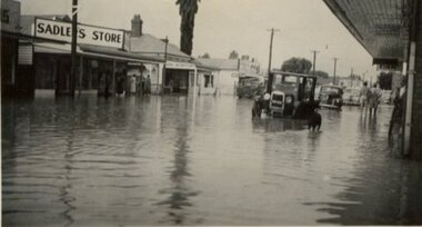 Tatura Irrigation & Wartime Camps Museum
Photograph, Hogan Street Flood 1952
hogan street, tatura in flood 1952 -
 Castlemaine Art Museum
Photograph - Black and white print, Hersche's house, previously Old Mt Alexander Hotel after the flood 01-01-1889
-
Swan Hill Regional Art Gallery
Painting, TREVOR, James, Murray in flood, Swan Hill, 1894