Showing 5778 items
matching location
-
 Bendigo Historical Society Inc.
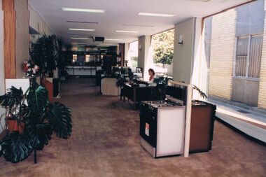
Photograph - CASTLEMAINE GAS COMPANY COLLECTION: PHOTO SHOWROOM
Bendigo Showroom Location and Date Unknown - Lady Sitting at Reception Desk, 2 stoves.Agfabusiness, retail, gas and fuel showroom -
 Bendigo Historical Society Inc.
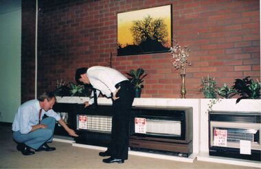
Photograph - CASTLEMAINE GAS COMPANY COLLECTION: PHOTO SHOWROOM
Bendigo Showroom Date and Location Unknown - 2 Males inspecting a range of Gas HeathersAgfabusiness, retail, gas and fuel showroom -
 Bendigo Historical Society Inc.
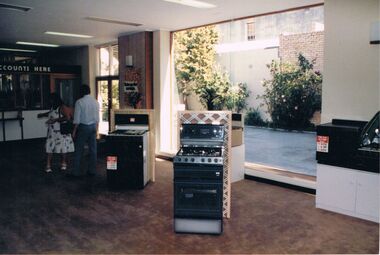
Photograph - CASTLEMAINE GAS COMPANY COLLECTION: PHOTO SHOWROOM
Bendigo Showroom Date and Location Unknown - A Male and a Female in the store , 2 stoves on displayAgfabusiness, retail, gas and fuel showroom -
 Bendigo Historical Society Inc.
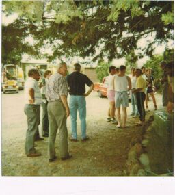
Photograph - CASTLEMAINE GAS COMPANY COLLECTION: PHOTO PEOPLE
Christmas Party Date and Location Unknown - Several People Standing outside Chatting and DrinkingPolaroidperson, group, christmas party -
 Bendigo Historical Society Inc.
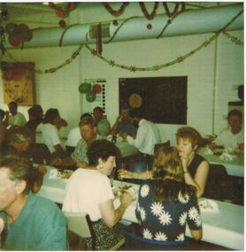
Photograph - CASTLEMAINE GAS COMPANY COLLECTION: PHOTO PEOPLE
Christmas Party Date and Location Unknown - 3 Females and Several Males sitting at TablesPolaroidperson, group, christmas party -
 Bendigo Historical Society Inc.
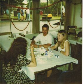
Photograph - CASTLEMAINE GAS COMPANY COLLECTION: PHOTO PEOPLE
Christmas Party Date and Location Unknown - 2 Females and 1 Male sitting at a tablePolaroidperson, group, christmas party -
 Bendigo Historical Society Inc.
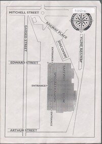
Flyer - HUGH ENNIS COLLECTION: FLYER SHOWS LOCATION MAP FOR THE OPENING OF THE BENDIGO MARKETPLACE ON TUESDAY 31ST OCTOBER 1995, 31/10/1995
Flyer shows location map for the opening of the Bendigo Marketplace on Tuesday 31st October 1995 -
 Wodonga & District Historical Society Inc
Map - Boorgunyah - "The Town that never was"
At the height of the river trade, there was a town surveyed and laid out, and streets were named. This town was to house the workers at the river port of Red Bank when the paddle steamers plied the Murray River as far as Albury, carrying produce such as wool and wheat to the various towns along the river in the 1800s. As the river trade died away, this town never went ahead – one might say, “The town that never was.” A lone gum tree stands on the site today.This item is significant because it documents plans which were made for the early development of Wodonga.A black an white map depicting the proposed location of the township. The map is based on a sketch and is not to scale,early wodonga, boorgunyah - "the town that never was", wodonga heritage -
 Whitehorse Historical Society Inc.
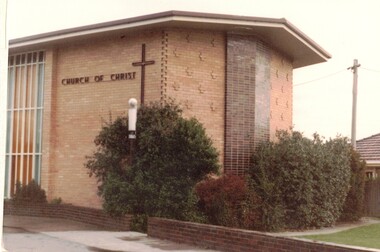
Photograph - Coloured photograph, Church of Christ Blackburn
Used by donor in 'Blackburn - a picturesque history'Coloured photo of Church of Christ at present location in Surrey Road, Blackburn. Built in 1961.blackburn church of christ, 1961 -
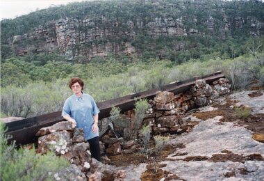 Stawell Historical Society Inc
Photograph, Fluming Water Supply in the Grampians with Stawell Historical Society Members inspecting the old Fluming -- 6 photos -- Coloured
Six coloured photos of Stawell Historical Society Members inspecting the old fluming. Some of the photos are of the remains of the open water flume in Grampians. 6 coloured photos of various views of water pipe line through different locations.grampians water supply flume -
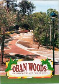 Ringwood and District Historical Society
Document - Land Sale Folder, Oban Woods Subdivision, Ringwood North, Vic., - circa 1997
Folder containing multi-fold colour pamphlet advertising Lots 6 to 12 of Oban Woods Estate with location map and summary of subdivision features. A4 size attachments include subdivision layout of Lots 2 to 25 with summary of property sizes and undated indications of whether sold or still available at the time, with price where known. Dates not documented however early sales within the development took place around 1997.Estate plan includes Oban Woods (thoroughfare) and Chifley Parade. Location map of area shows development site of Oban Woods Estate off Oban Road and Kubis Drive, Ringwood North. Agents - R.E. Appleby Ringwood Pty Ltd., 170 Warrandyte Road Ringwood North 3134, Telephone 9876 4222, Fax 9876 4209. -
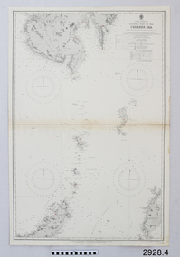 Flagstaff Hill Maritime Museum and Village
Document - Navigation Chart, Eastern Part of the Celebes Sea, Ca. 1928
This is an Official British Admiralty Navigation Chart, one of a set of 65 charts donated together with a wooden chart case. It was published and printed in London in 1928 by the British Admiralty. Navigation charts are drawn by professional hydrographers and describe the geography of land and water, enabling a water based navigator on board vessels such as ships to safely negotiate between ports locally and around the world. They are drawn to a particular standard with common symbols noting landmarks. The charts are used in conjunction with other navigational instruments and tools to calculate the vessel’s exact location and a safe route to its destination.The set of charts and their chart are of significance as examples of equipment and documents used to navigate the oceans of the world, particularly to Australia. Migration to Australia is an important part of this country's history.British Admiralty Navigation Chart - Eastern Part of the Celebes Sea - printed on rectangular white paper. Published in London by the British Admiralty in 1928.warrnambool, shipwreck coast, flagstaff hill, flagstaff hill maritime museum, flagstaff hill maritime village, chart, map, navigate, navigation, location, vessel, 1928, british admiralty, hydrographer, geography, admiralty chart, celebes sea -
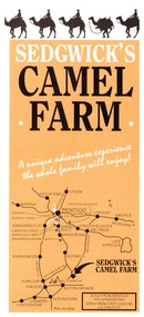 Bendigo Historical Society Inc.
Ephemera - Camel Farm, about 1980s
Now called Mattie's Sanctuary, it provides homes for all livestock animals although there is a particular emphasis on excess male camels from the camel dairies of regional Victoria.Sedgewick Camel Farm and Epsom Market Brochures 1. Camel Farm: Advertising Brochure complete with map of location, hours of operation, tours and prices. 2. Epsom Market, times and phone number, location, times of opening and invitation to become a seller. history, bendigo, merle lummis collection, sedgwick's camel farm, epson market -
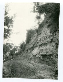 Orbost & District Historical Society
Photograph - Hofen's cutting, Bete Bolong, Orbost district, early 20th century
This photograph is of a cutting on a road at Bete Bolong known as Hofen's Cutting. This photograph was taken c. 1906 when transport was by horse, wagon and prior to cars and railways.This is a pictorial record of early Bete Bolong showing a road through a cutting which was known as Hofen's cutting. Two black / white photographs showing a dirt road heading down a cutting with a post and rail wooden fence on the left side in the background. In 958.1 there is a cut - away hillside beside the dirt road.on back - "Newmerella" (note: this location is at Bete Bolong and not on Newmerella Hill) 958.1 - on back - "Hofen's Bluff 1906"bete bolong, orbost, tracks/roads -
 Federation University Historical Collection
Pamphlet, Fletcher and Son Ltd, History on Display
Images and backgrounds histories and historical features/ Has a map of museum's location, as well as assitional information.ballarat historical society, museum -
 Greensborough Historical Society
Aerial Photograph, Greensborough, 1945_
Aerial photograph of Greensborough showing residents and businesses in the area. Annotations by Bill Cecil.Photocopy of enlargement of 1945 aerial photograph, with 2 p. of annotations indicating locations of residents and businessesgreensborough, bill cecil -
Glenelg Shire Council Cultural Collection
Photograph - Photograph - puppet workshop in Casterton, c. 2001
Coloured photo.Casterton workshop. Side-on view of head of sheep puppet, covered with patter pieces, with locationsworkshop, community art, casterton -
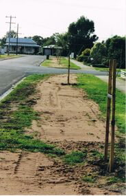 Bendigo Historical Society Inc.
Photograph - CASTLEMAINE GAS COMPANY COLLECTION: PHOTO NATURE STRIP
Photo of suburban street and nature strip, 2 houses at the end of the street. Date and location unknown.Kodakphotograph, streetscape, suburban -
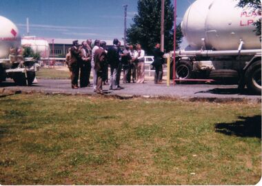 Bendigo Historical Society Inc.
Photograph - CASTLEMAINE GAS COMPANY COLLECTION: PHOTO PEOPLE
photo of a group of people standing between 2 gas transport trucks. Date and location unknown.Kodakperson, group, adults -
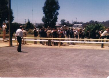 Bendigo Historical Society Inc.
Photograph - CASTLEMAINE GAS COMPANY COLLECTION: PHOTO PEOPLE
Photo of a group of people standing at the end of a gravel road behind a fence. Date and location unknown.Kodakperson, group, adults -
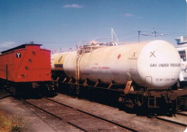 Bendigo Historical Society Inc.
Photograph - CASTLEMAINE GAS COMPANY COLLECTION: PHOTO TRAIN
Photo of a gas tank on train carriage and another goods train carriage. Date and location unknownKodakphotograph, train, goods -
 Bendigo Historical Society Inc.
Photograph - CASTLEMAINE GAS COMPANY COLLECTION: PHOTO MALE
Black and white photo of a man wearing jacket and tie answering the phone. Date and location unknown.organisation, industry, gas and fuel -
 Bendigo Historical Society Inc.
Photograph - CASTLEMAINE GAS COMPANY COLLECTION: PHOTO PEOPLE
Gas and Fuel Fashion,Food,Fitness. Female and male in wedding dresses. Date and Location unknown.event, social, gas & fuel fashion, food, fitness -
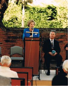 Bendigo Historical Society Inc.
Photograph - CASTLEMAINE GAS COMPANY COLLECTION: PHOTO PEOPLE
The Hon Marie Tehan delivering a speech, unknown male sitting at right. Date and location unknown.Kodakperson, group, marie tehan mp -
 Bendigo Historical Society Inc.
Photograph - CASTLEMAINE GAS COMPANY COLLECTION: PHOTO GARDEN
Garden with shrubs and roses and trees behind a fence and 2 buildings in the background. Date and location unknown.Agfabusiness, retail, gas and fuel -
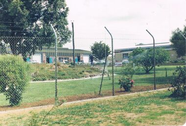
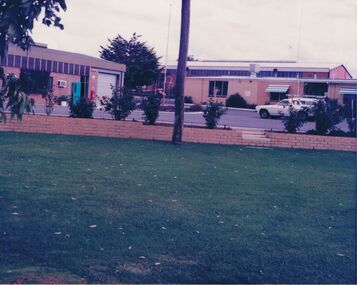 Bendigo Historical Society Inc.
Photograph - CASTLEMAINE GAS COMPANY COLLECTION: PHOTO BUILDINGS
Green lawn, rose garden bed, car park and 2 buildings. Date and location unknownbusiness, retail, gas and fuel -
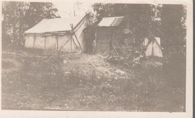 Bendigo Historical Society Inc.
Photograph - LAWRENCE EDWARD HOUSTON COLLECTION: TENT IN THE BUSH
Black and white photograph of the tent where Lawrence Houston and his brother lived. Location unknown. -
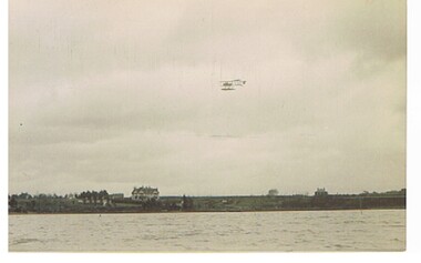 Bendigo Historical Society Inc.
Postcard - BASIL WATSON COLLECTION: POSTCARD, BIPLANE FLYING OVER WATER
postcard: biplane flying over water, land in background, houses and trees. Location possibly in UK.aviation, civilian, biplane, basil watson collection, biplane -
Port Melbourne Historical & Preservation Society
Plan - Berthing of HMY Britannia, HMAS Vampire/Torrens, Port of Melbourne Authority
Plan re berthing of HMY Britannia and HMAS Vampire/Torrens, and Royal Promenade Deck location.Traffic direction indicators in red, green, orange inks. Barriers indicated in red ink. Vampire crossed out, Torrens written above in pencil. Lifts and some areas of Waiting Hall marked in orange felt-tip.piers and wharves - station pier, royal visits and occasions, melbourne harbor trust - port of melbourne authority -
Port Melbourne Historical & Preservation Society
Postcard - Railway Pier, Port Melbourne, 1914
Collected by Alison Kelly when she was caretaking the Missions to Seamen Building 1987-90.One of six mounted postcards: Handcoloured postcard "Departure of R.M.S. Victoria". Possible location Geelong.piers and wharves - railway pier