Showing 8144 items matching "w. b."
-
 Halls Gap & Grampians Historical Society
Photograph - B/W
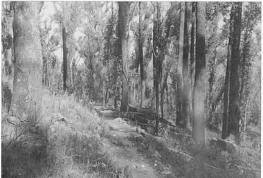
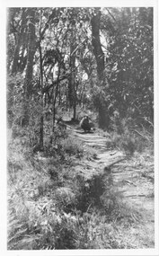
... B/W... through bush track better formed than others Photograph B/W ...The Jinker tracks were vitally important during the early years of European settlement The first routes were known as bridle pathsPhoto shows track through bush track better formed than othersBridle track written on backaccess routes, jinker track -
 Halls Gap & Grampians Historical Society
Photograph - B/W, C 1920s
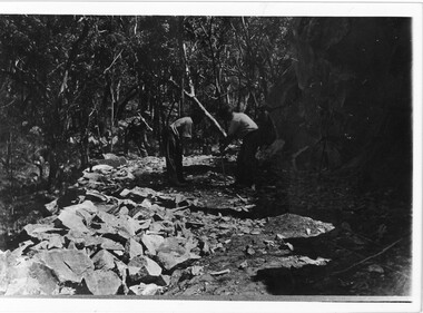
... B/W... on road Photograph B/W ...Men have started to form the Mt Victory Road. Until the 1900's access to the Stoney Creek gorge was via a winding bridal jinker track. Increased traffic lead to much of this route being widened into what became known as Bluff Road. Within a few years the route was further improved and was officially named Mount Victory Road in 1930.Photo shows 3 men working with pick and shovel on roadPick and shovel Mt Victory Rdaccess routes, roads, access routes, road building -
 Halls Gap & Grampians Historical Society
Photograph - B/W, C 1920s
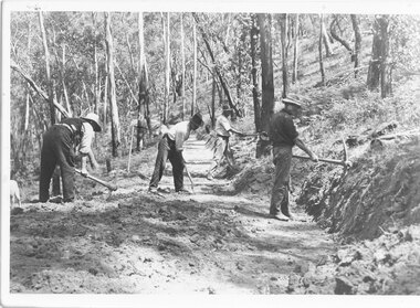
... B/W... is using a shovel The fourth is chopping a tree Photograph B/W ...See r record 140 for historical information on the building of Mount Victory Road. Two of the men in the photo are Charles D'Alton and Fred Paasch, however it is not known which ones they are.Photo shows 4 men engaged in road building Two have picks, a third is using a shovel The fourth is chopping a treeMt Victory road in the the making 1920s Commencement of My Victory rod Charles D/Alton, Fred Paaschaccess routes, roads, access routes, road building -
 Halls Gap & Grampians Historical Society
Photograph - B/W, C 1930s-1940s
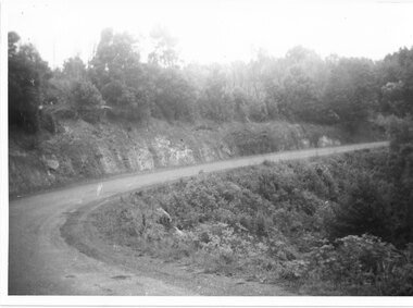
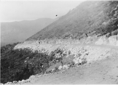
... B/W... Photograph B/W ...Mt Victory Rd once known as the Bluff road was opened by Lady Somers Mar 1930. This section of the raod is beyond Stoney Creek Gorgephoto shows sweeping bend on Mt Victory Rdaccess routes, mt victory rd, roads -
 Halls Gap & Grampians Historical Society
Photograph - B/W, C 1930s-1940s
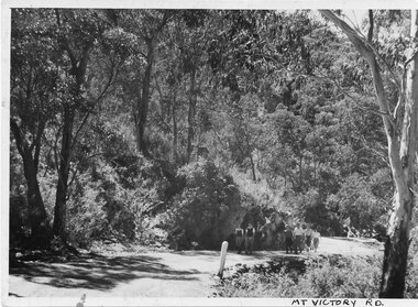
... B/W... Road not sealed Photograph B/W ...Photo shows 6 people walking up Mt Victory Road Road not sealedaccess routes, mt victory rd, roads -
 Halls Gap & Grampians Historical Society
Photograph - B/W, C 1890s
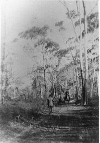
... B/W... towards camera Photograph B/W ...Entering the Gap from the eastPhoto shows 2 men One on foot with back to camera, the other on horseback walking towards cameraEntering the Gap taken about opposite Aebis House on forwardaccess routes, jinker track -
 Halls Gap & Grampians Historical Society
Photograph - B/W, C 1930
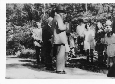
... B/W... of Mt Victory Rd. Lord Somers in foreground Photograph B/W ...Official opening of Mt Victory Rd People in photo Lord and Lady Somers, 2 Johsons Millie Bowtell, Bessie McKeon, M PawseyPhoto shows group standing on road opening of Mt Victory Rd. Lord Somers in foregroundaccess routes, mt victory rd, people, roads -
 Halls Gap & Grampians Historical Society
Photograph - B/W, C 1926
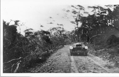
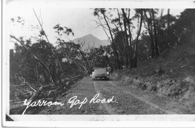
... B/W... Photograph B/W ...Mirranatwa Gap was originally known as Yarram Gap; this name was given to the opposite gap on the Mt William side of the Dunkeld Road sometime in the mid 20th century. An early touring car, claimed to be the first, crossing Mirranatwa (then Yarram) Gap.Photo shows car on Yarram Gap Road Road is rocky and unsealed. trees on left side of photo has been felledaccess routes, roads, yarram gap -
 Halls Gap & Grampians Historical Society
Photograph - B/W, C 1930s
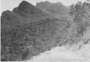
... B/W... of road have been felled. Photograph B/W ...Mirranatwa Gap was originally known as Yarram Gap The name later given to the adjacent gap in the Mt William Range sometime in the mid 20th century. This is an early touring car, claimed to be the first , crossing Mirranatwa gapPhoto shows car on road with man standing beside it. Road unsealed Trees on left side of road have been felled. access routes, roads, yarram gap -
 Halls Gap & Grampians Historical Society
Photograph - B/W, C 1926
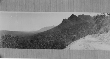
... B/W... into Wannon Valley Photograph B/W ...Photo shows car having driven over Mirranatwa Gap into Wannon Valleyaccess routes, roads, mirranatwa gap -
 Halls Gap & Grampians Historical Society
Photograph - B/W, C 1926
... B/W... into Wannon Valley Photograph B/W ...Photo shows car having driven over Mirranatwa Gap into Wannon Valley access routes, roads, mirranatwa gap -
 Halls Gap & Grampians Historical Society
Photograph - B/W, C 1960
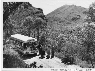
... B/W... Photograph B/W ...The name of the road Henham Gap was later changed to MirranatwaPhoto shows bus and tourists on road looking over Henham Gap, Bus company - BoyVictorian Railways Photographaccess routes, roads, henham gap -
 Halls Gap & Grampians Historical Society
Photograph - B/W, C 1927
... B/W... through Mirranatwa Gap with people walking??? Photograph B/W ...New road approaching Wirranatwa GapRoad through Mirranatwa Gap with people walking???access routes, mirranatwa gap, roads -
 Halls Gap & Grampians Historical Society
Photograph - B/W, C 1960s
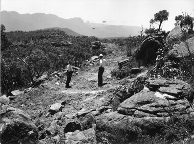
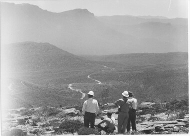
... B/W... Photograph B/W ...A track to the top of Mt William existed many years before, an all weather road was constructed in the early 1960s Not only did engineers and construction workers enjoy some spectacular scenery during "smokos" but so have thousands of tourists Some even experiencing the freezing gale force winds which greeting Major Thomas Mitchell and his party in July 1836sPhoto shows 3 men looking over to Wonderland Range from Mt William. Two men are wearing hard hats The third man a felt hat - he is pointing to a point in the distanceWMT (Wimmera Mail Times}access routes, walking track, roads, mount william -
 Halls Gap & Grampians Historical Society
Photograph - B/W
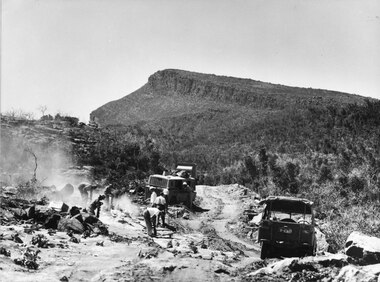
... B/W... Photograph B/W ...Photo shows men & machinery forming the road up Mt William. There are 8 men, 1 bull-dozer, 1 jeepaccess routes, roads, access routes, mt william road -
 Halls Gap & Grampians Historical Society
Photograph - B/W
... B/W... on construction work for road to Mt William Photograph B/W ...Photo shows men & machines on construction work for road to Mt Williamaccess routes, roads, access routes, mt william road -
 Halls Gap & Grampians Historical Society
Photograph - B/W
... B/W..., the other a felt hat. Photograph B/W ...Photo shows 2 men standing on rough formation of road to Mt William. One man is wearing a hard-hat, the other a felt hat.access routes, roads, access routes, mt william road -
 Halls Gap & Grampians Historical Society
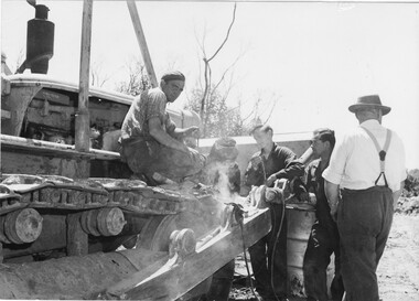
Photograph - B/W
... B/W... welding equipment. Photograph B/W ...Photo shows 5 men surrounding bulldozer. One is looking straight at camera, another is u;sing welding equipment.access routes, roads, access routes, mt william road -
 Halls Gap & Grampians Historical Society
Photograph - B/W
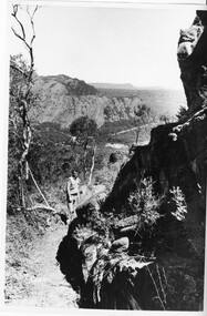
... B/W... on the Mt Zero track looking towards Mt Stapylton Photograph B/W ...Photo shows man on the Mt Zero track looking towards Mt Stapyltonaccess routes, walking track, access routes, walking track -
 Halls Gap & Grampians Historical Society
Photograph - B/W
... B/W... & flowers. Photograph B/W ...Photo shows construction workers taking a break. Men are seated, surrounded by thick bush & flowers.access routes, roads, access routes, mt william road -
 Halls Gap & Grampians Historical Society
Photograph - B/W
... B/W.... Photograph B/W ...Photo shows construction workers looking over valley with rough formation of Mt William road. There are 4 men in photo, 2 wearing hard-hats. There appears to be 2 vehicles on the road.WMT Mt William construction 1966-68access routes, roads, access routes, mt william road -
 Halls Gap & Grampians Historical Society
Photograph - B/W
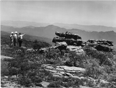
... B/W... Victory Rd. Dog in foreground. Photograph B/W ...Photo shows Charles D'Alton (left) and Fred Paasch (right & seated) looking at a point in the distance. Fred Paasch has arm raised & finger pointed. Both are standing on new & rough section of Mt Victory Rd. Dog in foreground.Charles D'Alton & Frederick Paasch (white hat)access routes, mt victory rd -
 Halls Gap & Grampians Historical Society
Photograph - B/W
... B/W... track 1925 Photograph B/W ...Photo shows a sheep on Zumstein's/MacKenzie Falls track 1925Sheep on Zumstein McKenzie Falls walking track / Stan Parfettaccess routes, walking track -
 Halls Gap & Grampians Historical Society
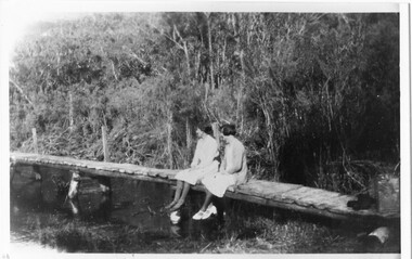
Photograph - B/W
... B/W... river Photograph B/W ...Photo shows 2 women sedated on wooden footbridge over the Wannon riverstructures, bridges -
 Halls Gap & Grampians Historical Society
Photograph - B/W
... B/W.... Photograph B/W ...Photo shows woman seated on footbridge at Wannon Ford. Car on track heading away from ford. Man standing beside car.heatherlie townshipheatherlie -
 Halls Gap & Grampians Historical Society
Photograph - B/W
... B/W... by front-end loaded. Photograph B/W ...Photo shows two buses - one Provincial Roadways, the other Ansett Road. Provincial Roadways bus is being pushed by front-end loaded.Writing on back - Zumsteins's camping. Provincial Roadways bus in trouble.transport, buses -
 Halls Gap & Grampians Historical Society
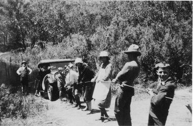
Photograph - B/W, C 1920s
... B/W... in the photo. Photograph B/W ...Photo shows a group of people pulling a car by rope out of the Wannon River. There are six adults and three children in the photo.transport, cars -
 Halls Gap & Grampians Historical Society
Photograph - B/W, C 1920s
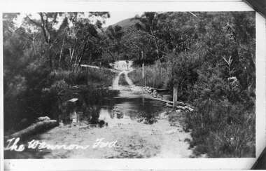
... B/W... (the Wannon Ford). Photograph B/W ...The Wannon Ford - typical of creek crossings in the Grampians.Photo shows a rough, unsealed road running through a ford (the Wannon Ford).access routes, roads -
 Halls Gap & Grampians Historical Society
Photograph - B/W, C 1940s (?)
... B/W..., looking towards the face of Mt. Frederick. Photograph B/W ...Photo shows unsealed section of the Dunkeld/Grampians Road, looking towards the face of Mt. Frederick.access routes, roads -
 Halls Gap & Grampians Historical Society
Photograph - B/W, C 1940s (?)
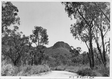
... B/W... in the distance. Photograph B/W ...Photo shows an unsealed section of Grampians Rd. near Jimmy's Creek. The sharp profile of Mt Frederick can be seen in the distance.access routes, roads