Showing 974 items
matching 'fortuna'
-
 Bendigo Military Museum
Administrative record - Army Survey Regiment - Exercise Mapex 78, Mar 1979
Exercise Report on exercise Mapex 78. The exercise was designed to test the Army Survey Regiment in an intensive production phase of 30 days duration.A4 soft covered booklet, printed map of part of the Kimberley region of Western Australia on front and back covers, staple boundTop right hand corner of front cover "File on 788-2-14"royal australian survey corps, rasvy, fortuna, army survey regiment, army svy regt, asr -
 Bendigo Military Museum
Administrative record - Royal Australian Survey Corps - Annual Report 1990/91, Royal Australian Survey Corps, Late 1991
Annual Report detailing the status of Australian mapping, charting and geodesy for the period 1 Jul 90 - 30 Jun 91A4 soft covered book, glossy paper pages and plastic pockets containing maps. Plastic ring bindingTop right hand corner "2IC Tech WO"royal australian survey corps, rasvy, fortuna, army survey regiment, army svy regt, asr -
 Bendigo Military Museum
Administrative record - Army Topographic Support Establishment: Performance Report Financial Year 1998 - 1999, 13 Jul 1999
A Report showing numerous charts of production objectives for all types of mapping production conducted by the Army Topographic Support Establishment in the Financial year 1998 - 1999A4 size, clear plastic front cover, white plastic back cover, bound with tape. 16 loose pages, 8 x coloured pages showing production rates, 7 x pages roduction summary and RAAF C-130E Hercules replacement programme, 1 x page summarising production.royal australian survey corps, rasvy, fortuna, army survey regiment, army svy regt, asr -
 Bendigo Military Museum
Booklet - History of the New Guinea Survey Section 1967 by LT Jack Viccars, Circa 1967
Military surveying in New Guinea began in in WWII with the formation of the New Guinea Force Field Survey Section which later became 8th Australian Field Survey Section and later 2 Field Survey Section of 6th Army Topographical Survey Section. This history was written by LT Jack Viccars and member of the Unit.A4 Booklet, Black and white, 43 Pages, 4 Annexes, Map Indexes, Gloss Paper Cover, Bound by staplesForward by Brigadier D. Macdonald (Retd) AM, Royal Australian Survey Corps 1936-1967, Preface by LT Jack J.S. Viccarsroyal australian survey corps, rasvy, fortuna, army survey regiment, asr -
 Bendigo Military Museum
Administrative record - Australian - United Kingdom Exchange End of Tour Report by WO2 KA Fenton RE 1990, 25.10.1990
A 2 x year personnel exchange program existed between RASvy and the Survey elements of the Royal Engineers UK. This is an end of Tour Report produced by WO2 KA Fenton RE of his experiences during his exchange tour. An A4 Booklet stylised map of the world with Corps Badges foe RASvy and Royal Engineers (UK), back cover overhead aerial Photo of Army Svy Regt, 14 Pages, 4 Annexes and an enclosureroyal australian survey corps, rasvy, fortuna, army survey regiment, army svy regt, asr -
 Bendigo Military Museum
Administrative record - RASvy - Defense Mapping Agency Exchange Officer End of Tour Report MAJ D Bowen 1982, 3. 5. 1982
A 2 x year personnel exchange program existed between RASvy and the US Army Corps of Engineers. This is the End of Tour Report produced by David H Bowen, Major, Corps of Engineers, US Army Exchange Officer, Australia in 1982A4 Document, Plastic cover, Purple and gold, RASvy Badge emblem and Defense Mapping Agency Badge emblems in gold, 17 pages, 13 enclosures, black and white print, colour photos and mapsReport compiled by David H Bowen, Major, Corps of Engineers, US Army Exchange Officer, Australiaroyal australian survey corps, rasvy, fortuna, army survey regiment, army svy regt, asr -
 Bendigo Military Museum
Administrative record - RASvy - Defense Mapping Agency Exchange Officer Mid Tour Report MAJ J Charland 1983, 15.08.83
A 2 x year personnel exchange program existed between RASvy and the US Army Corps of Engineers. This is the Mid Term Tour Report produced by John J Charland, Major, Corps of Engineers, US Army Exchange Officer, Australia in 1983A4 document, Purple Cover, Gold Badge Image US Defense Mapping Agency and RASvy, 13 PagesCompiled by John J Charland, Major, Corps of Engineers, United States Armyroyal australian survey corps, rasvy, fortuna, army survey regiment, army svy regt, asr -
 Bendigo Military Museum
Administrative record - American - Australian Officer Exchange - Mid Tour Report ASR 1988, Major J Wright US Corps of Engineers, 30 June 1988
Mid Tour Report USA - Aust Officer Exchange 1988 by Major Edward J Wright, US Army Corps of EngineersA4 Booklet, cream card, DMA and RASvy Corps Badges on cover, 16 pagesroyal australian survey corps, rasvy, fortuna, army survey regiment, army svy regt, asr -
 Bendigo Military Museum
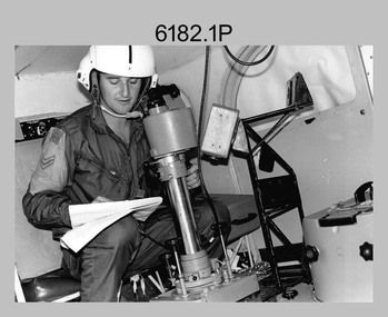
Photograph - Royal Australian Survey Corps Aerial Surveys, c1980
This is a set of nine photographs of technicians from the Royal Australian Survey Corps operating aerial surveys equipment c1980s. In photo .1P, CPL Steve Gloster was operating a RC10 air survey camera mounted in an Australian Army Pilatus Porter aircraft. The Wild RC10 super wide-angle air survey cameras were first introduced in 1971, were equipped with virtual distortion free lenses for supplementary, spot and special photography. In photo .2P, Roger Rees was operating Air Profile Recorder (APR) equipment. it was possibly taken during OP NERVOSE 84, sometime between June – August 1984 when based in Ngukurr, Northern Territory. The APR was operated at this time in unison with an RC10 camera. In 1963 the Royal Australian Survey Corps introduced the radar airborne profile recorder (Canadian Applied Research Ltd, Mark V, Airborne Profiler Recorder) was introduced for 1:100,000 mapping to replace terrain heighting by aneroid barometry. Later in 1974-1975, the Australian developed WREMAPS II airborne laser terrain profile recorder was introduced. In photo .3P, Neil Jones appears at the door of Airsearch Beechcraft Queen Air aircraft, Registration / Serial VH-MWX. This aircraft was typically used by RA Svy on air survey operations flying mission with Aerodist, APR and RC10 camera equipment. The Australian Army’s Pilatus Porter (short take-off and landing turbo propeller) was also equipped with a Wild RC10 aerial mapping camera for identification photography. The Pilatus Porter was also used on RA Svy’s map field checking operations. Photo .9P was taken at a survey station at an unknown location. In this photo an Australian Army Kiowa Light Observation Helicopter (LOH) is supporting a field survey party undertaking Magnavox AN/PRR-14 portable Doppler satellite observations. The satellite receiver’s antenna is plumbed over the survey ground mark surrounded by white plastic panels. The panels were used to identify the survey station on aerial photography. Introduced in 1974–1975, the Magnavox AN/PRR-14 portable Doppler satellite (US Navy Navigation Satellite System – TRANSIT) receivers and computing system provided independent three-dimensional point positions anywhere in the world, anytime, in any weather accurate to about 1.5metres with precise satellite ephemerides. The Bell OH-58 Kiowa LOH was a family of military helicopters used for observation, utility, and direct fire support. It was identified by RA Svy in the mid-1970s that considerable time was lost in replacing unserviceable remote equipment by road. Therefore Aerodist operations (pre-dating satellite receiver operations) were fully supported by Army’s Kiowa LOH aircraft. This is a set of nine photographs of technicians from the Royal Australian Survey Corps operating aerial surveys equipment c1980s. .1P to .3P, .5P to .9P - Colour and black and white photos on photographic paper and scanned at 300 dpi. .4P - Colour photo on 35mm slide film and scanned at 96 dpi. .1) & .2) - Photo, black & white, c1980s, CPL Steve Gloster operating an RC10 air camera. .3) - Photo, colour, 1984, Roger Rees operating Air Profile Recorder (APR) equipment. .4) - Photo, colour, c1980s, Neil Jones at the door of an Airsearch Beechcraft Queen Air aircraft, typically used by RA Svy on air survey operations. .5) - Photo, colour, c1980s. A Beechcraft King Air aircraft, also used by RA Svy on air survey operations. .6) - Photo, colour, c1980s. An Australian Army Pilatus Porter, used by RA Svy on air survey and map field checking operations. SGT Peter Mustart is possibly in the foreground. .7) to .8) - Photo, colour, c1980s. An Australian Army Pilatus Porter and unidentified personnel, used by RA Svy on air survey and map field checking operations. .9) - Photo, colour, c1980s. An Australian Army Kiowa helicopter supporting a field survey party undertaking Magnavox AN/PRR-14 portable Doppler satellite observations. There are biro marks on photos .4P to .9Proyal australian survey corps, rasvy, army survey regiment, asr, fortuna, aerial surveys -
 Bendigo Military Museum
Album - Photographic Identification Guide (PIG) of the Gove Penisula (Sic) Peninsula, May 1997
These photographs and a video were captured in May 1997 by Jeff Ruiz and Wayne Walsh from the Army Topographic Support Establishment (ATSE). The video taken onboard an aircraft has not been located at this time. A flight line diagram showing the path of the aircraft taking the video is enclosed in the album. The Army Topographic Support Establishment was created to perform some of the functions of the Army Survey Regiment.A Large Purple covered Album with gold dots containing maps, plans and coloured photographs of Gove Peninsula.royal australian survey corps, rasvy, fortuna, army survey regiment, army svy regt, asr, atse -
 Bendigo Military Museum
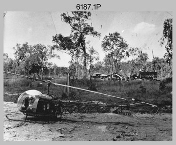
Photograph - Bell 47G-2 helicopter used in Royal Australian Survey Corps Field Operations, c1965
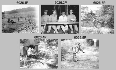
This is a set of four photographs of Bell 47G-2 helicopters used in Royal Australian Survey Corps Field Operations. c1965. From 1957, helicopter transport of survey parties revolutionised transport in remote areas. The most common helicopter used by the Royal Australian Survey Corps at this time was the civilian Bell 47G-2 and the Sioux, the Australian Army’s’s equivalent. equivalent. From 1964 an Aerodist MRC2 airborne Electronic Distance Measuring (EDM) system was extensively used for topographic surveys over long distances by trilateration to replace traverse requiring survey station intervisibility. In 1965 the command field survey unit personnel attached to the Army Survey Regiment’s Topographic Squadron were used mainly in support roles such as station clearing, tower operations, station monumenting, Aerodist computations, forward base operations, geodetic observations on the north-south traverse and logistic support for Remote teams. .1P is a photo of a civilian Bell 47G-2 helicopter Registration / Serial VH-UTB owned by Helicopter Utilities from Mascot, NSW c1965. In the background of this photograph is three personnel and vehicles at a field survey camp. The left-hand vehicle is a Willys Jeep with trailer and on the right is probably a Truck, 2 1/2 ton, 6x6, General Service GMC. The Bell 47G-2: VH-UTB was destroyed, and its pilot killed in tragic circumstances during a civilian survey operation on Cape York Peninsula in June 1966. .2P is a photo of a a civilian Bell 47G-2 helicopter Registration / Serial VH-IHB taken in Wyndham, WA. As the letters ‘TAA’ appear on the fuselage, the helicopter was charted from Trans Australian Airways. .3P is a photo of a Bell 47G-2: VH-UTC with survey camp in background. .4P is a photo of a Bell 47G-2 equipped with floats and unidentified personnel loading stores, possibly in Darwin. Acknowledgement: Royal Australian Survey Corps – Aerodist Years 1964-1975 Version 2021.0 Authored by Peter Jensen.This is a set of four photographs of civilian Bell 47G-2 helicopters used in Royal Australian Survey Corps Field Operations. c1965. The photographs were printed on photographic paper and are part of the Army Survey Regiment’s Collection. The photographs were scanned at 300 dpi. .1) - Photo, black & white, c1965, Bell 47G-2 helicopter: VH-UTB with survey camp in background. .2) - Photo, black & white, c1965, Bell 47G-2 helicopter: VH-IHB with survey station in foreground. .3) - Photo, black & white, c1965, Bell 47G-2 helicopter: VH-UTC with survey camp in background. .4) - Photo, black & white, c1965, Bell 47G-2 helicopter: Unidentified personnel loading stores possibly in Darwin..2P – annotated on bottom of photo ‘Wyndham Area – Helicopter drops observing party’ The other photographs are not annotated.royal australian survey corps, rasvy, army survey regiment, army svy regt, fortuna, asr, surveying -
 Bendigo Military Museum
Manual - TM5 - 245: (US) Department of the Army Technical Manual - Map Reproduction, 10 Sep 1956
Nine Chapters describing all aspects of Map Reproduction. 224 pages, including 8 appendices, glossary and indexA soft covered military manual, 224 pages of text, diagrams and annotated photographs"AHQ Survey Regiment" stamped inside front and back covers. Number "149" handwritten inside front cover.royal australian survey corps, rasvy, fortuna, army survey regiment, army svy regt, asr, mapping -
 Bendigo Military Museum
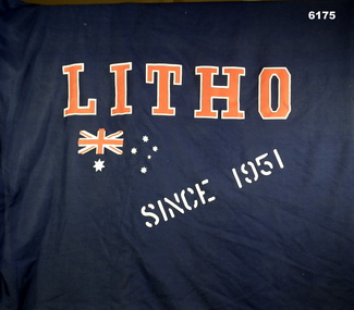
Flag - Lithographic Squadron, Army Survey Regiment Flag, circa 1970s
The Squadron Flag used by Lithographic Squadron, Army Survey Regiment members on social and ceremonial occasionsA Blue Flag with a 3.5cm diameter staff, 187cm long. Text "LITHO" , "SINCE 1951" and an Australian Flag logo silk screened onto it.royal australian survey corps, rasvy, fortuna, army survey regiment, army svy regt, asr -
 Bendigo Military Museum
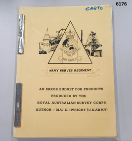
Administrative record - An Error Budget for Products produced by the RASvy Corps, 1988
This document is an analysis determining the positional accuracy (size of errors) within Topographic Mapping Products produced by the Royal Australian Survey Corps.A yellow carboard covered booklet, 2 x "ARNOS" fasteners, Army Survey Regiment Unit emblem designed by SSgt Denis MacCarthy.royal australian survey corps, rasvy, fortuna, army survey regiment, army svy regt, asr -
 Bendigo Military Museum
Manual - Shaded Relief Technical Manual - United States Air Force, May 1958
This manual describes how to hand create "Shaded Relief" or the appearance of hills. This manual was produced by the Aeronautical Chart Information Centre, United States Air Force, St Louis 18, Missouri. Shaded relief was produced by hand at the Army Survey Regiment in the 50's, 60's and 70's so that it could be shown on small scale topographical maps and RAAF Aeronauical Charts. Shaded relief continued to be produced by hand until the mid 1980's when it was replaced by digital production methods.Grey covered Manual, gloss paper, stapled together.royal australian survey corps, rasvy, fortuna, army survey regiment, army svy regt, asr -
 Bendigo Military Museum
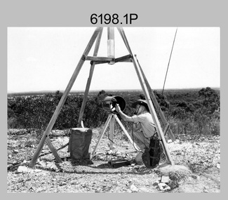
Photograph - Royal Australian Survey Corps Electronic Distance Measuring Equipment Demonstration, c1960s
This is a set of five photographs of CAPT James ‘Jim’ Leslie Stedman in the field demonstrating the setup of prisms used as electric distance measurement (EDM) receiver reflectors for tellurometer equipment and the sighting of a large surveyor’s light. This equipment was deployed in establishing mapping and geodetic control operations. The photos were most likely taken in the late 1950s or early 1960s. The tellurometers of this era were man-portable systems that improved geodetic survey efficiencies for rapid network extension and densification replacing triangulation with EDM and theodolite traverse sometimes using Bilby Towers to extend line lengths. Jim Stedman later reached the rank of Colonel, was Director of Military Survey from 1975 to 1978 and was appointed as Colonel Commandant (honorary appointment, Retd) of the Royal Australian Survey Corps from 1978 to 1983. Jim Stedman is demonstrating EDM equipment. See item 6180.16P, photos .14) to .16) for more information and photos of Jim Stedman’s EDM demonstration. This is a set of five photographs of a surveyor in the field demonstrating electric distance measurement (EDM) equipment. c1950s – 1960s. The photographs were printed on photographic paper and are part of the Army Survey Regiment’s Collection. The photographs were scanned at 300 dpi. .1) to .2) - Photo, black & white, c1960s, CAPT Jim Stedman demonstrating the sighting of a large surveyor’s light. .3) to .5) – Photo, black & white, c1960s, CAPT Jim Stedman demonstrating EDM prism equipment. .1P to .5P on back – CAPT Stedman EDM Eqpt.royal australian survey corps, rasvy, army survey regiment, army svy regt, fortuna, asr, surveying -
 Bendigo Military Museum
Manual - DIGO Historical Archive - SYMBAS 88 Master Symbols, 1988
Original Positive Masters of all SYMBAS 88 symbols used on RASvy Mapping. This standardized the process of adding symbols to maps. These fil positive masters were used to create "Copy Proof" adhesive copies that allowed symbols to be affixed to film positive type sheets.Large 4 Ring Binder - White Cardboard Plastic covered, Contains an index of All Symbas Symbol positives. Back half of folder contains "Copy Proof" adhesive copies of symbols.royal australian survey corps, rasvy, fortuna, army survey regiment, army svy regt, asr -
 Bendigo Military Museum
Journal - Army Survey Regiment Map Store Distribution Register 1978-1986, 04.07.1978
This is a record of the maps that were despatched from the Army Survey Regiment Map Store 1978 - 1986Leather Bound "Minute Book", lined paper, hand written records of ASR Map distribution. royal australian survey corps, rasvy, fortuna, army survey regiment, army svy regt, asr -
 Bendigo Military Museum
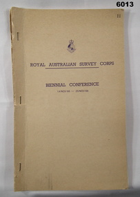
Administrative record - Report on Royal Australian Survey Corps Biennial Conference 14-25 Nov 1966, Nov 1966
Detailed Planning Report for the activities of the Royal Australian Survey Corps 1966-1968 as decided at the Corps Conference 14-25 Nov 1966Typed Report of decisions and plans for activities of the Royal Australian Survey Corps for 1996 -1998. Report includes names of attendees from all elements of the Survey Corps and their reports. paper report with light buff coloured card cover stapled along the left hand edge. 50 page report includes distribution list."Copy No 11" royal australian survey corps, rasvy, fortuna, army survey regiment, army svy regt, asr -
 Bendigo Military Museum
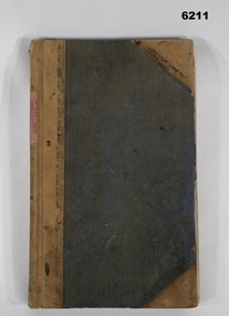
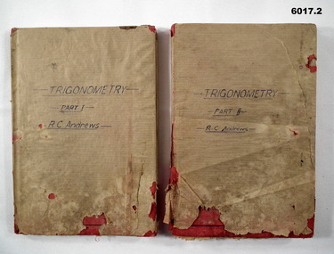
Manual - Trigonometry Part 1 and Part 2, Cambridge University Press, 1948
Manuals of Trigonometry as used by the Royal Australian Survey CorpsHardcovered, Red Book, Brown Paper covered, textroyal australian survey corps, rasvy, fortuna, army survey regiment, army svy regt, asr -
 Bendigo Military Museum
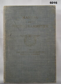
Manual - Manual of Photogrammetry, (Preliminary Edition), 1934 American Society of Photogrammetry, Circa 1934
This book belonged to Brigadier FD Buckland OBE Director of Survey Land HeadquarterHardcover, light blue, 819 pages, text, diagrams, photographsroyal australian survey corps, rasvy, fortuna, army survey regiment, army svy regt, asr, photogrammetry -
 Bendigo Military Museum
Manual - Ministry of Defence Map Catalogue, Volume 1 Planning Scales and World Series
Map Catalogue, Ministry of Defence, Planning Scales and World Series, The Directorate of Military Survey, Ministry of Defence United KingdomLarge Book, dark green, hard cover, gold text, metal binding, elastic strap keeper, text, diagrams.royal australian survey corps, rasvy, fortuna, army survey regiment, army svy regt, asr -
 Bendigo Military Museum
Journal - Field Survey Notebook No1 Christmas Island 1981, SSGT JD Mobbs and CPL NF Kelly, Department of Defence, Field survey Notebook No1 Christmas Island 1981, 09.02.1981
Notebook compiled by J.D. Mobbs, SSGT and N.F. Kelly, CPLCloth covered Cardboard, 100 Pages, Field Survey Notebook"Connection Details for Doppler Satellite Stations." "Xmas Is 1", "Xmas Is 2"royal australian survey corps, rasvy, fortuna, army survey regiment, army svy regt, asr -
 Bendigo Military Museum
Manual - The Lithographers Manual Fifth Edition, Graphic arts Technical Foundation, Produced by the Graphic Arts Technical Foundation, 1977
The Graphic Arts Technical Foundation Lithographers ManualHard Cover, Red, 20 Chapters, Text, Diagrams, Photographs, ISBN 0-88362-005-7Inside Front Cover - "B. McLachlan"royal australian survey corps, rasvy, fortuna, army survey regiment, army svy regt, asr -
 Bendigo Military Museum
Photograph - Army Survey Regiment – Regimental Training, c1960s
These photographs of RASvy personnel from the Army Survey Regiment undertaking regimental training lack any annotation that could identify names, dates and locations. The training was possibly conducted at Balcombe and Dromana, located on the Mornington Peninsula, Victoria. There is no explanation on the meaning of the annotation on back of the last photograph.This is a set of photographs of Army Survey Regiment personnel undertaking regimental training in the 1960s. All eight photographs were printed on photographic paper and are part of the Army Survey Regiment’s Collection. The photographs were scanned at 300 dpi. .1) to .7) Photo, black & white, Regimental Training .8) Photo, black & white, possibly Regimental Training.1) to .7) annotated on back “Regimental Training” .8) annotated on back “Fatted Pig-Coal Lift-Western Mines”royal australian survey corps, rasvy, army survey regiment, army svy regt, fortuna, asr -
 Bendigo Military Museum
Photograph - Army Survey Regiment - Defence Force Service Medal Presentations, c1977
These photographs were taken at a formal medal presentation at the Army Survey Regiment in 1977. The Director of the Survey Corps presented the Defence Force Service Medal to personnel in recognition of 15 years of efficient remunerated service, or the Clasp for 5 years of additional service.These four colour photographs were taken at a Defence Force Service Medal Presentation in c1977 at the Army Survey Regiment, Bendigo. The photographs were printed on photographic paper and are part of the Army Survey Regiment’s Collection. The photographs were scanned at 300 dpi. .1) Photo, colour, unidentified personnel .2) Photo, colour, unidentified personnel .3) Photo, colour, L to R: WO1 Roger Rix, WO1 Alex Munro, COL Jim Stedman, MAJ Peter Eddy .4) Photo, colour, L to R: WO1 Roger Rix, WO1 Alex Munro, MAJ Peter Eddy, COL Jim Stedman.1 to. 4P - no annotationsroyal australian survey corps, rasvy, army survey regiment, asr, fortuna -
 Bendigo Military Museum
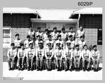
Photograph - Central Comd Fd Svy Unit at the Army Survey Regiment, 1966
This photograph of the Central Command Field Survey Unit, Field Survey Detachment was taken in front of the Survey building at Keswick Barracks in Adelaide, South Australia c1966. DR Ridge (later LTCOL) front Centre, SPR RJ Hayden top Right.This is a photograph of the C Comd Fd Svy Unit at the Army Survey Regiment, Bendigo. The photograph was printed on photographic paper and is part of the Army Survey Regiment’s Collection. The photograph was scanned at 300 dpi. .1) Photo, black & white 1966. Front Row to L to R: 5th MAJ Don Ridge. All other personnel are unidentified..1 - “C Comd Fd Svy Unit 1966” annotated on backroyal australian survey corps, rasvy, army survey regiment, army svy regt, fortuna, asr -
 Bendigo Military Museum
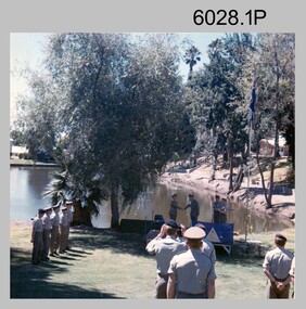
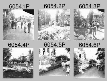
Photograph - AHQ Survey Regiment Open Day - c1970, c1970
This is a set of thirty photographs of an Open Day held at the AHQ Survey Regiment, Bendigo c1970. It’s evident in these photos there was also a technical tour for dignitaries through the production areas in Air Survey, Cartographic and Lithographic Squadrons. It is known an Open Day coincided with the Freedom of Entry to the City Parade, an honour that was conferred by the Bendigo City Council to the AHQ Survey Regiment and held on the 14th of June 1970. As the CO LTCOL Bill Sprenger is positively identified, it’s highly probable these photos were taken at that time.This is a set of photographs of an Open Day held at the AHQ Survey Regiment, Bendigo c1970. The photographs were printed on photographic paper and are part of the Army Survey Regiment’s Collection. The photographs were scanned at 600 dpi. .1) to .17) - Photos, black and white. Unidentified personnel and civilian visitors. .18) and .19) - Photos, black and white. CO LTCOL Bill Sprenger is wearing Sam Browne belt. .18) and .19) - Photos, black and white. CO LTCOL Bill Sprenger is wearing Sam Browne belt. .20) and .21) - Photos, black and white. Left rear: SPR John Bennett .22) - Photo, black and white, c1970. Unidentified personnel and civilian visitors. .22) - Photo, black and white, c1970. Unidentified personnel and civilian visitors. .23) - Photo, black and white. L to R: 1st CO LTCOL Bill Sprenger, 3rd WO1 Joe Farrington .24) - Photo, black and white. L to R: 2nd SGT Bob Williams .25) - Photo, black and white. Unidentified personnel .26) - Photo, black and white. L to R: 2nd CO LTCOL Bill Sprenger. .27) to .30) - Photos, black and white. Unidentified personnel and civilian visitors.royal australian survey corps, rasvy, army survey regiment, army svy regt, fortuna, asr -
 Bendigo Military Museum
Manual - Australian Defence Force - Military Geographic Information Encyclopedia, Information Strategic Concepts Branch of the Australian Defence Force Strategic Command Division, Directorate of Strategic Military Geographic Information, 27 Aug 1998
Military Geographic Information Encyclopedia in 3 Parts- Acronyms, Definitions, Web sitesSoft Film Cover, 3 Parts (Chapters), 77 Pagesroyal australian survey corps, rasvy, fortuna, army survey regiment, army svy regt, asr -
 Bendigo Military Museum
Manual - Defense Mapping Agency (US) - Digitizing the Future Third Edition, c1990
Digitizing the Future Third Edition, An information booklet describing the types of new digital geographic products produced by the US Defense Mapping Agency. The Australian Army Survey Regiment went on to also produce many of these digital productsSoft Cover Book, Paper Pages, 3 parts with Numerous Sections in each Part, Text, Diagrams and Photographs, Data Information Sheets, DMA Stock No: DDIPDIGITALPACFront Cover, "DO NOT REMOVE FROM CARTO SQN"royal australian survey corps, rasvy, fortuna, army survey regiment, army svy regt, asr