Showing 5780 items matching "location"
-
 Bendigo Historical Society Inc.
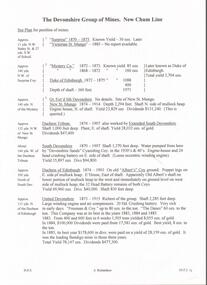
Document - DEVONSHIRE MINES - NOTES ON THE DEVONSHIRE GROUP OF MINES
Carbon copy of notes on the Devonshire Group of Mines - New Chum Line. Notes mention mines, years of operating, location in relation to other mines in the group, yields, dividends and depth of shafts. Some give locations in relationship to streets, etc. Signed by A. Richardson.mine, gold, devonshire mines, devonshire mines, new chum line, surprise, victorian st. mungo, mystery co., duke of edinburgh, gt ext'd st devonshire, new st mungo, duchess tribute, extended south devonshire, south devonshire, devonshire sands cyaniding coy, duchess of edinburgh, albert's coy, old albert's shaft, united devonshire, freeman & coy, the danes, west united devonshire, hopewell, phoenix, extended st mungo, princess alexandra, saxon & celt coys, east devonshire, sheepshead line, new st mungo east shaft, gt. extended hustlers -
 Port Melbourne Historical & Preservation Society
Pamphlet - Brochure, International Container Terminal Services Inc, Victoria International Container Terminal (Vict), Melbourne Australia
Coloured advertising brochure with photo of three cranes at Webb Dock east on cover front. Back cover has world map showing locations of International Container Terminal Services Inc. Inside has photos and text about location, services and the company.maritime, piers and wharves - webb dock, victoria international container terminal, webb dock east -
 Flagstaff Hill Maritime Museum and Village
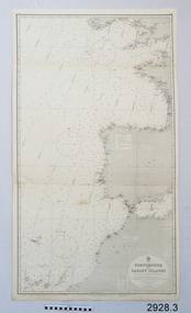
Document - Navigation Chart, Portsmouth to Canary Islands, Ca. 1928
This is an Official British Admiralty Navigation Chart, one of a set of 65 charts donated together with a wooden chart case. It was published and printed in London in 1928 by the British Admiralty. Navigation charts are drawn by professional hydrographers and describe the geography of land and water, enabling a water based navigator on board vessels such as ships to safely negotiate between ports locally and around the world. They are drawn to a particular standard with common symbols noting landmarks. The charts are used in conjunction with other navigational instruments and tools to calculate the vessel’s exact location and a safe route to its destination.The set of charts and their chart are of significance as examples of equipment and documents used to navigate the oceans of the world, particularly to Australia. Migration to Australia is an important part of this country's history.British Admiralty Navigation Chart - Portsmouth to Canary Islands - printed on rectangular white paper. Published in London by the British Admiralty in 1928.warrnambool, shipwreck coast, flagstaff hill, flagstaff hill maritime museum, flagstaff hill maritime village, chart, map, navigate, navigation, location, vessel, 1928, british admiralty, hydrographer, geography, admiralty chart, portsmouth, canary islands -
 Bacchus Marsh & District Historical Society
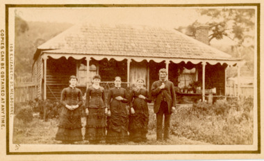
Photograph, Family group and farm house near Bacchus Marsh 1883
This image is one of several family group portraits taken by Stevenson and McNicoll on what appears to be a rural property. The identity of this family group and the location where the image was taken has not been identified. It is presumed to be in the Bacchus Marsh district and dates from around September-November 1883. The composition of the group appears to be a father and mother with three adult daughters.Small sepia unframed photograph on card with gold border framing photograph. Housed in the album, 'Photographs of Bacchus Marsh and District in 1883 by Stevenson and McNicoll'. The image shows a family group of four women and one man. They are standing in a single row in front of a farm house. The family in this image and the precise location of the property have not been identified. The house in the background is a single storey timber structure with a shingled roof and a verandah at the front. Two chimneys can be seen attached to the house.On the front: Stevenson & McNicoll. Photo. 108 Elizabeth St. Melbourne. COPIES CAN BE OBTAINED AT ANY TIME. On the back: LIGHT & TRUTH inscribed on a banner surmounted by a representation of the rising sun. Copies of this Portrait can be had at any time by sending the Name and Post Office Money Order or Stamps for the amount of order to STEVENSON & McNICOLL LATE BENSON & STEVENSON, Photographers. 108 Elizabeth Street, MELBOURNE. stevenson and mcnicoll 1883 photographs of bacchus marsh and district, farmhouses, families -
 Federation University Historical Collection
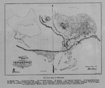
Image, The First Map of Melbourne, 1837
Scanned from "The Old Pioneers' Memorial History of Melbourne From the Discovery of Port Phillip to the World War".First map of Melbourne showing the location of Batman's Hill, Batman's House, Lonsdale's Residence, Commissarist Stores, location of John Falwkner, R. Webb, D'Acry, Carr, Diprose, Nodin, Robson, Alex Thompson, Surveyors tents, Burial Hill (AKA Flagstaff Hill)port phillip bay, batman's hill, batman's house, lonsdale's residence, commissarist stores, john fawkner, r. webb, d'acry, carr, diprose, nodin, robson, alex thompson, surveyors tents, burial hill, flagstaff hill -
 Mission to Seafarers Victoria
Photograph - Digital photograph, series, 1 January 2004
Images show the Mission in 2004: furniture, furnishing (carpet, lights, curtains), artworks in the chapel, courtyard, kitchen, club, Celia Little room54 photographs of various locations in the Mission in 2004: club, kitchen, Celia Little Room, courtyard, chapelcarpet, furnishing, lights, furniture -
4th/19th Prince of Wales's Light Horse Regiment Unit History Room
Photograph, Anglo-Swiss Photo Studio, British & Australian Officers, Egypt, abt 1914/15
A sepia toned photograph of 84 British and Australian officers outside a wooden building. The location appears to be in Egypt."Anglo-Swiss Photo Studio Cairo" impressed into bottom right corner photo, cairo, officers -
 Ringwood and District Historical Society
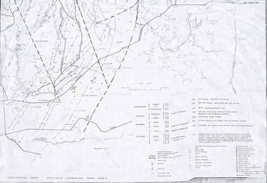
Map - Maps, Geological Map Donvale to Chirnside Park, also Victorian Railways Maps of Hawthorn to Lilydale Line incl Ringwood to East Ringwood - 1881
Faint photocopies of sections of larger maps. Geological map includes location of mine shafts circa 1920.Victory Shaft, North Victory Shaft, South Caledonia Shaft, Caledonia Shaft, North Caledonia Shaft, Black Swan Shaft, Reward Shaft, Consols Shaft, Blocks Shaft, Devonshire Shaft, Crown Shaft, Yarra Tunnel Reef Working, Bright's Shaft, Kingwood Antimony Company Shaft (Boardman's Shaft), Southern Shaft. -
 Federation University Historical Collection
Booklet - Exercise Book, Sebastopol Mines and Socialism
Sebastopol is a suburb of Ballarat..1) Black notebook with red spine .2) hand drawn map showing location of Sebastopol minesHandwritten pageswilliam robertson, new lady don company, kohinor company, leviathon company, newington, copenhagen company, hand in hand company, tannery ground, ballarat freehold company, rough and ready company, park company, inkerman alluvial lead, band & albion consols, gravel pits lead, robert gay, sebastopol mines, ballarat east, alluvial, dalton's flat, canadian gully, red streak, montezuma company, great republic company, golden point, gravel pits, j. hardy, scott's boot shop, lady don company, cgt -
 Bendigo Historical Society Inc.
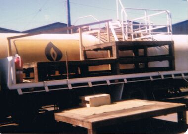
Photograph - CASTLEMAINE GAS COMPANY COLLECTION: PHOTO TRUCK
Photo of the tray of a truck with 3 pallets on, a gas tank on a train and a pallet on the ground. Date and location unknownKodakphotograph, tank, gas under pressure -
 Bendigo Historical Society Inc.
Photograph - CASTLEMAINE GAS COMPANY COLLECTION: PHOTO PEOPLE, 1987
1987 Cooking school's competition - Girton College Bendigo Cooking bench. Location Unknown. B20 on the back.Kodakevent, entertainment, school's cooking competition -
 Bendigo Historical Society Inc.
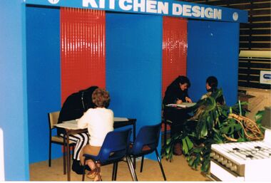
Photograph - CASTLEMAINE GAS COMPANY COLLECTION: PHOTO KITCHEN DESIGN
Gas and fuel kitchen design booths. Customers getting information from representatives. Date and location unknown.Agfabusiness, retail, gas and fuel showroom -
 Bendigo Historical Society Inc.
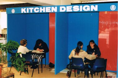
Photograph - CASTLEMAINE GAS COMPANY COLLECTION: PHOTO KITCHEN DESIGN
Gas and fuel kitchen design booths. Customers getting information from representatives. Date and location unknown.Agfabusiness, retail, gas and fuel showroom -
 Bendigo Historical Society Inc.
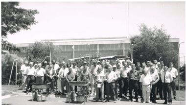
Photograph - CASTLEMAINE GAS COMPANY COLLECTION: PHOTO PEOPLE
Group photo of staff taken in front of a factory - 2 bqq's are to the left of the photo. Date and location unknown.bendigo, industry, gas and fuel -
 Bendigo Historical Society Inc.
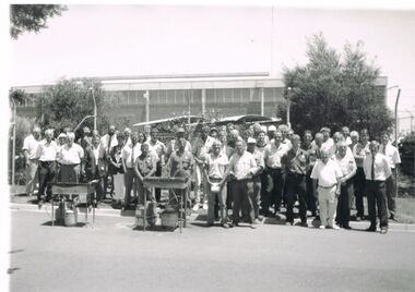
Photograph - CASTLEMAINE GAS COMPANY COLLECTION: PHOTO PEOPLE
Group photo of staff taken in front of a factory - 2 bqq's are to the left of the photo. Date and location unknown.bendigo, industry, gas and fuel -
 Bendigo Historical Society Inc.
Photograph - CASTLEMAINE GAS COMPANY COLLECTION: PHOTO PEOPLE
From left to right: Mayor Joe Pearce - Unknown Male - Professor Dawney - Date and location UnknownKodakperson, group, males -
 Bendigo Historical Society Inc.
Photograph - CASTLEMAINE GAS COMPANY COLLECTION: PHOTO PEOPLE
Date and Location Unknown - Mr John Barnett, Wally James Bill Payne in a Gas Appliances Showroomperson, group, males -
 Bendigo Historical Society Inc.
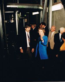
Photograph - CASTLEMAINE GAS COMPANY COLLECTION: PHOTO PEOPLE
The Hon Marie Tehan MP inside plant discussing with a group of unknown people. Date and location unknown.Kodakperson, group, marie tehan mp -
 Bendigo Historical Society Inc.
Photograph - CASTLEMAINE GAS COMPANY COLLECTION: PHOTO PEOPLE
The Hon Marie Tehan MP inside plant discussing with a group of unknown people. Date and location unknown.Kodakperson, group, marie tehan mp -
 Bendigo Historical Society Inc.
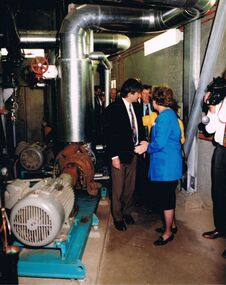
Photograph - CASTLEMAINE GAS COMPANY COLLECTION: PHOTO PEOPLE
The Hon Marie Tehan MP inside plant discussing with unknown male and female. Date and location unknown.Kodakperson, group, marie tehan mp -
 Bendigo Historical Society Inc.
Photograph - CASTLEMAINE GAS COMPANY COLLECTION: PHOTO PEOPLE
The Hon Marie Tehan MP delivering a speech, unknown male sitting on the right. Date and location unknown.Kodakperson, group, marie tehan mp -
 Bendigo Historical Society Inc.
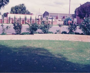
Photograph - CASTLEMAINE GAS COMPANY COLLECTION: PHOTO LAWN
Green lawn, roses, road 3 buildings in the background and a large gas tank. Date and location unknownbusiness, retail, gas and fuel -
 Bendigo Historical Society Inc.
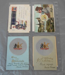
Postcard - Set of postcards
BHS CollectionSet of eight postcards addressed to Miss Pethard from various world locations. Lydia Chancellor collection.postcards, christmas cards, invitation -
Bendigo Historical Society Inc.
Map - MINE LOCATION DRAWING AT VICTORIA HILL
Claims and shafts location for: Rae and co. - Noye and co. - Wittscheibe. Some additions to drawing made in pencil.mining, business -
 Bendigo Historical Society Inc.
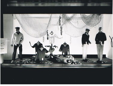
Photograph - HANRO COLLECTION: SHOP DISPLAY
Black and white photograph of a shop window display of Hanro Products, location unknown. Possibly Melbourne somewhereLloyd Hull, 27 Canterbury Road , Blackburnorganization, business, hanro, hanro products, shop window display, lloyd hull, canterbury road blackburn -
 Victorian Aboriginal Corporation for Languages
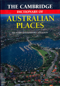
Book, The Cambridge dictionary of Australian Places, 1992
Lists thousands of place names across Australia, giving a detailed account of the name and location, shire etc.maps, pronunciation guidesgazetteer, nomenclature, maps, geography, pronunciation -
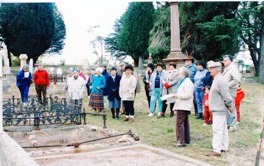
 Stawell Historical Society Inc
Photograph, Grave Headstone
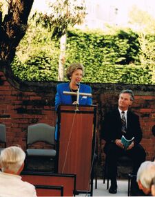
7083: A Group of People Standing inside the cemetery Gates. Stawell 7083-1 A group of people looking at a headstone. 7083-2 A Group of people looking at a monument with houses in the background. 7083-3 A Group of people looking at graves 7073-4 A Group of People on a dirt road over a small bridge with a white ute in teh right foreground.5 colour Photographs: showing a group of people at various locations looking at graves, Monuments and a bushland setting. -
Stawell Historical Society Inc
Photograph, Grave Headstone
7083: A Group of People Standing inside the cemetery Gates. Stawell 7083-1 A group of people looking at a headstone. 7083-2 A Group of people looking at a monument with houses in the background. 7083-3 A Group of people looking at graves 7073-4 A Group of People on a dirt road over a small bridge with a white ute in teh right foreground.5 colour Photographs: showing a group of people at various locations looking at graves, Monuments and a bushland setting. -
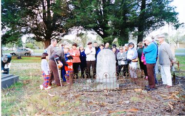
 Stawell Historical Society Inc
Photograph, Group of Stawell Historical Society members at Old Cemetery at One Tree Hill
7083: A Group of People standing inside the cemetery Gates. Stawell 7083-1: A Group of People looking at a fenced headstone 7083-2 A Group of people looking at a Monument with houses in background 7083-3 A groupd of people looking at graves 7083-4 A Group of people on a dirt road over a small bridge with a white ute in right foreground.5 Colour Photographs: showing a group of people at various locations lookning at graves, Monuments and a bushland setting. -
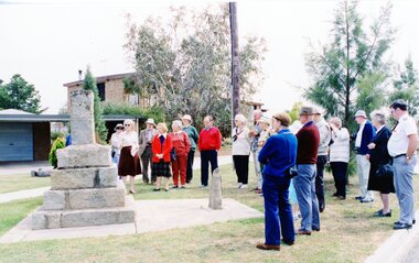
 Stawell Historical Society Inc
Photograph, Looking at a Monument
7083: A Group of People standing inside the cemetery Gates. Stawell 7083-1: A Group of People looking at a fenced headstone 7083-2 A Group of people looking at a Monument with houses in background 7083-3 A groupd of people looking at graves 7083-4 A Group of people on a dirt road over a small bridge with a white ute in right foreground.5 Colour Photographs: showing a group of people at various locations lookning at graves, Monuments and a bushland setting.