Showing 25579 items matching "plenty-township-estate"
-
 Eltham District Historical Society Inc
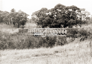
Photograph, Old Lower Plenty Bridge, c.1970
Old bridge across the Plenty River at Lower Plenty now part of the Plenty River Trail. Part of a slide show presentation "Bridges & Waterways of the Shire" by Russell Yeoman to the 13 September 1989 Society meeting. The presentation included slides of historic photos from the Shire of Eltham Pioneers collections as well as several recent views.Black and white photographmain road, plenty river, bridge, lower plenty, plenty river trail -
 Eltham District Historical Society Inc
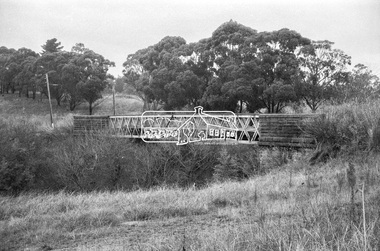
Negative - Photograph, Russell Yeoman, Old Lower Plenty Bridge, c.1970
Old bridge across the Plenty River at Lower Plenty now part of the Plenty River Trail. Part of a slide show presentation "Bridges & Waterways of the Shire" by Russell Yeoman to the 13 September 1989 Society meeting. The presentation included slides of historic photos from the Shire of Eltham Pioneers collections as well as several recent views.Roll of 35mm black and white negative film, 4 of 7 stripsIlford HP4bridge, lower plenty, main road, plenty river, plenty river trail -
 Greensborough Historical Society
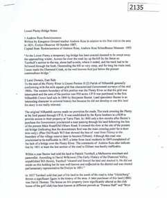
Notes, Lower Plenty Bridge notes by Russell Yeoman, 18/10/1887o
Notes on the history of Lower Plenty by Russell Yeoman, Eltham Historical Society; including references to Andrew Ross from his "Reminiscences" and an article from Trove on the Lower Plenty Bridge. 3 typed pages.lower plenty, russell yeoman, andrew ross -
 Ringwood and District Historical Society
Flyer, Land Sale Brochure, Heathmont Estate, Vic. - circa 1960
Advertisement for sale of residential lots - Heathmont Estate, opposite Heathmont Railway Station, with map and locality plan.Subdivision includes Canterbury Road, Royal Avenue, Coleman Street, Stoda Street, Herman Street, and Campbell Street. Agent - A.W. Dickson, opposite Station, Ringwood. Phone WU6007. -
 Whitehorse Historical Society Inc.
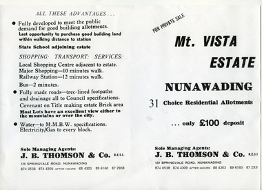
Document, Mt Vista Estate, n.d
Brochure (2p) advertising sale of home sites in 'Mt Vista Estate'.Brochure (2p) advertising sale of home sites in 'Mt Vista Estate'. Agent J.B. Thomson & Co.Brochure (2p) advertising sale of home sites in 'Mt Vista Estate'. mount vista estate, nunawading, lorikeet street, koala avenue, dagola avenue, land sales -
![Brochure for auction of Eastdawn Estate, Mitcham, 70 lots [20 February 1915]](/media/collectors/56f368632162f118acbff12e/items/60d923316e5f99545134e472/item-media/60d9477c6e5f995451350fb8/item-fit-380x285.jpg) Whitehorse Historical Society Inc.
Whitehorse Historical Society Inc.Document, Eastdawn Estate, 1915
Brochure for auction of Eastdawn Estate, Mitcham, 70 lots [20 February 1915]Brochure for auction of Eastdawn Estate, Mitcham, 70 lots [20 February 1915]. Agents Coghill & Haughton.Brochure for auction of Eastdawn Estate, Mitcham, 70 lots [20 February 1915]auctions, eastdawn estate, mother foster's estate, mitcham road, mitcham, orient avenue, hull parade, vernal avenue -
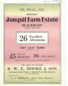 Whitehorse Historical Society Inc.
Document, Jonquil Farm Estate
Brochure of Richard's Jonquil Farm EstateBrochure of Richard's Jonquil Farm Estate featuring 26 allotments, 7 minutes from Blackburn Station.Brochure of Richard's Jonquil Farm Estate land subdivision, jonquil farm estate blackburn, laurel grove, blackburn, boongarry avenue, main street, linum street, hooke, r.w.e. & son, keegan, i.c. -
 Whitehorse Historical Society Inc.
Document, Drake's Real Estate, Mitcham, 8/02/1997 12:00:00 AM
Ian Armstrong talks about the history of Drake's Real Estate, Mitcham and Norman Armstrong.Ian Armstrong talks about the history of Drake's Real Estate, Mitcham and Norman Armstrong. Tape at NP1719Ian Armstrong talks about the history of Drake's Real Estate, Mitcham and Norman Armstrong. drake real estate, armstrong, norman, whitehorse road, mitcham, no 534, willis bus service, shire of nunawading, colombo street, mitcham -
Whitehorse Historical Society Inc.
Map, Lake Road estate Blackburn, c1960
Plan of subdivision of Lake Road Estate, 36 sites.Plan of subdivision of Lake Road Estate, 36 sites. Agent: Mark Padgett & Co Pty Ltd.Plan of subdivision of Lake Road Estate, 36 sites. lake road estate, blackburn, lake road, blackburn, ottawa avenue, blackburn, anjaya court, blackburn, leons court, blackburn -
Whitehorse Historical Society Inc.
Document, Hill 60 Estate Tunstall, 23/02/1929 12:00:00 AM
Sales Brochure of Hill 60 Estate, Tunstall of 37 residential sites.Sales Brochure of Hill 60 Estate, Tunstall of 37 residential sites by Frank Fisher & Co, Auctioneer.Sales Brochure of Hill 60 Estate, Tunstall of 37 residential sites. hill 60 estate forest hill, hill 60 estate tunstall, fisher, frank, frank fisher co -
 Whitehorse Historical Society Inc.
Photograph, Auction Plan of Eastdawn Estate, Mitcham, 1915
Black and white strip photo of Auction Plan of Eastdawn Estate, Mitcham Road and Orient Avenue, Mitcham.auctions, plans, eastdawn estate -
 Greensborough Historical Society
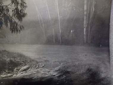
Photograph, Unknown, Muddy track in Lower Plenty, 1920c
Muddy track in Lower PlentyBlack and white photograph, enlarged and laminated.plenty river -
 Eltham District Historical Society Inc
Negative - Photograph, J.A. McDonald, Eltham-Yarra Glen Road, Lower Plenty, c. July 1962
View looking west across the Eltham-Yarra Glen Road approaching the Lower Plenty Bridge near turn-off for the Golf Club Hotel. Present-day Lower Plenty Road follows a revised alignment across a new bridge. The former bridge is now part of the Plenty River Trail and Edward Willis Court now follows this section of the original Eltham-Yarra Glen Road.. The Golf Club Hotel is gone and a new Lower Plenty Hotel was built slightly further up the hill.Record of various Shire of Eltham infrastructure works undertaken during the period of 1952-1962 involving bridge and road reconstruction projects, sometimes with Eltham Shire Council Project Reference numbers quoted. It was during this period that a number of significant improvements were made to roads and new bridges constructed within the shire that remain in place as of present day (2022). In many situations, the photos provide a tangible visible record of infrastructure that existed throughout the early days of the Shire. The album was put together by or under the direction of the Shire Engineer, J.A. McDonald.1962-07, shire of eltham, old eltham road, edward willis court, eltham-yarra glen road, golf club hotel, infrastructure, lower plenty, road construction -
 Greensborough Historical Society
Photograph - Digital image, Marilyn Smith, Plenty River bank at Greensborough 2015; Rear of lower Main Street shops, 16/08/2015
The Plenty River embankment in Greensborough looking up to rear of lower Main Street shops. A River bank stabilisation project along the Plenty River at Greensborough was conducted by Melbourne Water in 2015.Digital copy of colour photographplenty river, melbourne water -
 Eltham District Historical Society Inc
Slide - Photograph, Aerial Photo (c.1987): Main Road, Lower Plenty from Heidelberg Golf Course to Plenty River, c.Aug. 1990
Part of a presentation, "Roads and Byways of the Shire of Eltham", by Russell Yeoman to the 12 September 1990 Society meeting. Slides shown included copies of old photos and recent images ranging from the suburban streets of Eltham and Montmorency to the mountain roads of Kinglake. In the byways category are views of some iof the Shire's bicycle paths including then recently completed sections of the Main Yarra Trail at Lower Plenty.35mm colour positive transparency (1 of 37) Mount - Agfachrome Agfa CS System black 8 dotsinfrastructure, roads, aerial photographs, heidelberg golf club, lower plenty, lower plenty bridge, main road, plenty river -
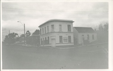 Kilmore Historical Society
Photograph, Real Estate House, c1970
The building was originally the Colonial Bank of Australasia and has a series of occupants, include a real estate firm in the 1970's20cm x 10cm black and white photograph of 1 Powlett street, former colonial bank of Australasia. corner of Powlett Street and Lancefield Road. Two story light coloured rendered building with signage for "Real Estate House" on top of the ground floor. Other signage painted on the Lancefield Road side of the building include: "Land specialists to Kilmore & district". The building also has an adjoining cottage on the Lancefield Road side of the property. There is also a figure crossing the road and five vehicles in the background of the photograph, three regular vehicles and two possible emergency service vehicles. A street sign can be seen pointing to: Lancefield, Kyneton, Foote Street, Melbourne and Seymour.PHO-00003banks and banking, real estate agents -
 Kew Historical Society Inc
Plan - Subdivision Plan, J R Mathers & McMillan, Willsmere Park Estate, c.1940
Pru Sanderson, in her groundbreaking ‘City of Kew Urban Conservation Study : Volume 2 - Development History’ (1988), summarised the periods of urban development and subdivisions of land in Kew. The periods that she identified included 1845-1880, 1880-1893, 1893-1921, 1921-1933, 1933-1943, and Post-War Development. These periods were selected as they represented periods of rapid growth or decline in urban development. An obvious starting point for Sanderson’s groupings involved population growth and the associated economic cycles. These cycles also highlighted urban expansion onto land that was predominantly rural, although in other cases it represented the decline and breakup of large estates. A number of the plans in the Kew Historical Society’s collection can also be found in other collections, such as those of the State Library of Victoria and the Boroondara Library Service. A number are however unique to the collection.The Kew Historical Society collection includes almost 100 subdivision plans pertaining to suburbs of the City of Melbourne. Most of these are of Kew, Kew East or Studley Park, although a smaller number are plans of Camberwell, Deepdene, Balwyn and Hawthorn. It is believed that the majority of the plans were gifted to the Society by persons connected with the real estate firm - J. R. Mathers and McMillan, 136 Cotham Road, Kew. The Plans in the collection are rarely in pristine form, being working plans on which the agent would write notes and record lots sold and the prices of these. The subdivision plans are historically significant examples of the growth of urban Melbourne from the beginning of the 20th Century up until the 1980s. A number of the plans are double-sided and often include a photograph on the reverse. A number of the latter are by noted photographers such as J.E. Barnes. In 1910, the Willsmere Park Estate Dairy was lauded in the Box Hill Reporter as ‘an object lesson in dairying’. Ten years later, in 1923, it was to be sold. The first subdivision of the Estate included 77 grand allotments with frontages to Belford and Kilby Roads, Elm and Willow Groves, and Acacia Avenue. Every lot was claimed to be ‘high and dry’, and with panoramic views of Kew and East Kew. The balance of the Estate, and the largest proportion of allotments was to be subdivided and sold from 1940. This second sale included 109 lots fronting Kilby Road and Elm and Willow Groves. Annotations on the plan indicate that the more expensive lots faced Belford Road opposite the Kew Golf Links. Two of these sold for £310. Lots further to the west in Willow Grove were sold for £60 less. Many of the houses to be built on these 109 allotments after the War faced Government restrictions on building materials and the dimensions of each house due to postwar shortages.subdivision plans - east kew, willsmere park estate -
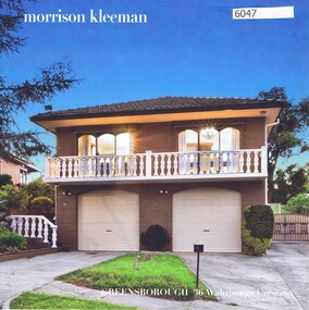 Greensborough Historical Society
Advertising Leaflet, 36 Wahroonga Crescent Greensborough, 08/05/2018
36 Wahroonga Crescent Greensborough. 6 bedroom house. Sold March 2018 for $968,000. Previous sales: May 2015 for $799,950. Real Estate advertising leaflet,1 sheet folded into 4 pages, printed in colour both sides. 2 copies.wahroonga crescent greensborough -
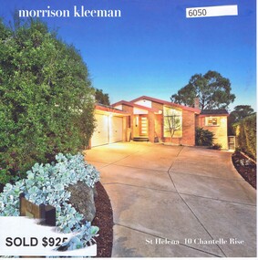 Greensborough Historical Society
Advertising Leaflet, 10 Chantelle Rise St Helena, 14/11/2016
10 Chantelle Rise St Helena. 4 bedroom house. Sold 14/11/2016 for $925,000. Previous sales: December 2007 for $507,500, January 1997 for $200,000, August 1993 for $160,000 and June 1988 for $199,700. Built 1985.Real Estate advertising leaflet,1 sheet folded into 4 pages, printed in colour both sides. 2 copies.chantelle rise st helena -
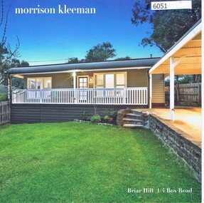 Greensborough Historical Society
Advertising Leaflet, 1/4 Box Road Briar Hill, 23/10/2018
1/4 Box Road Briar Hill. 3 bedroom house. Sold October 2018 for $744,000. Previous sales: May 2017 for $590,000, March 2007 for $315,000, and February 2005 for $291,000. Built 1980.Real Estate advertising leaflet,1 sheet folded into 4 pages, printed in colour both sides. 2 copies.box road briar hill -
 Greensborough Historical Society
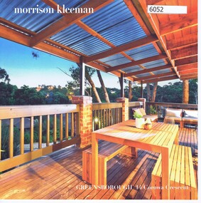
Advertising Leaflet, 14 Corowa Crescent Greensborough, 22/05/2017
14 Corowa Crescent Greensborough. 3 bedroom house. Sold 22/05/2017 for $710,500. Previous sales: March 2007 for $348,000, January 2002 for $225,000, and February 1989 for $40,000. Built 1985.Real Estate advertising leaflet,1 sheet folded into 4 pages, printed in colour both sides. 2 copies.corowa crescent greensborough -
 Greensborough Historical Society
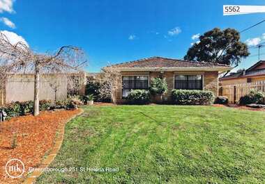
Advertising Leaflet, 251 St Helena Road Greensborough, 16/11/2012
251 St Helena Road Greensborough: Three bedroom home, built 1974, private sale, sold 16 November 2018 for $510,000Real estate advertising leaflet, 1 sheet, printed in colour both sides, with black and white property information sheetst helena road greensborough -
 Greensborough Historical Society
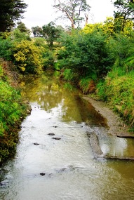
Photograph - Digital image, Marilyn Smith, Old swimming pool in Plenty River at Greensborough 2015, 16/08/2015
Old swimming pool in the Plenty River in Greensborough, built of concrete in the 1930s, it was a popular spot for the locals. A River bank stabilisation project along the Plenty River at Greensborough was conducted by Melbourne Water in 2015.Digital copy of colour photographplenty river, melbourne water -
 Eltham District Historical Society Inc
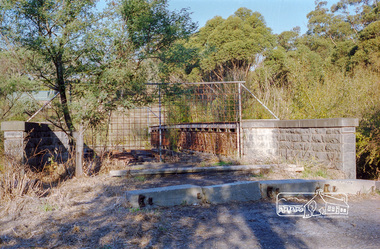
Negative - Photograph, Old Lower Plenty Bridge, 18 Apr 1998
EDHS Autumn excursion to Lower Plenty area The blocked-off iron bridge at Lower Plenty - now re-opened and used as a footway/bike path section joining the Yarra River path.Roll of 35mm colour negative film, 2 strips and associated colour printKodak Gold 200-6activities, lower plenty bridge, autumn excursion, eltham district historical society, lower plenty -
 Ringwood and District Historical Society
Photograph, Two photos of Panfield Estate, owned by Vic Hunter sold by Miles & Co. - view from Panfield Avenue looking to Mullum Road, c.1963-65
Two photos - various inscriptions. "This (first) photo is RHS partner of V15" "Panfield Estate 1960. Panfield Ave. to Mullum Rd." "1965. Panfield Estate owned by Vic Hunter sold by Miles & Co." and second photo has written below photograph,"This photo is LHS partner of V11". Written on backing sheet,"Panfield Estate looking to Mullum Rd, 1963". -
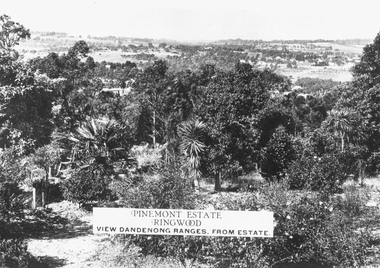 Ringwood and District Historical Society
Photograph, Two images of view from Pinemont Estate, Loughnans Hill, looking east, c1930
Black and white photograph of view. Trees and bushes in foreground, orchards and mountains towards background. (2 copies)Typed on photograph, "Pinemont Estate, Ringwood. View Dandenong Ranges, from estate". Typed below photograph, "View from Loughnans Hill, looking east, c1930. Club Hotel can just be seen top right corner". -
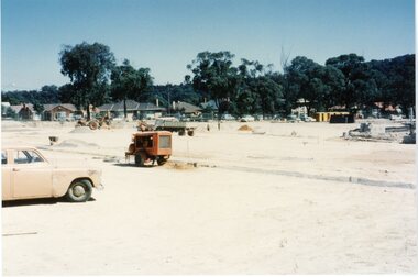 Ringwood and District Historical Society
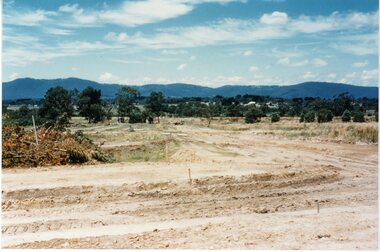
Photograph, New housing estate construction. circa 1960's
Postcard size coloured photograph"Written on back of photograph" Construction of new housing estate -site unknown. circa 1960's -
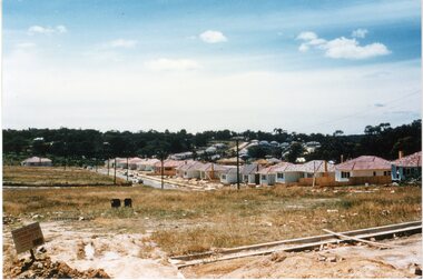 Ringwood and District Historical Society
Photograph, New housing estate construction. circa 1960's
Postcard size coloured photograph"Written on back of photograph" Construction of new housing estate -site unknown. circa 1960's -
 Ringwood and District Historical Society
Photograph, New housing estate construction. circa 1960's
Postcard size coloured photograph"Written on back of photograph" Construction of new housing estate -site unknown. circa 1960's -
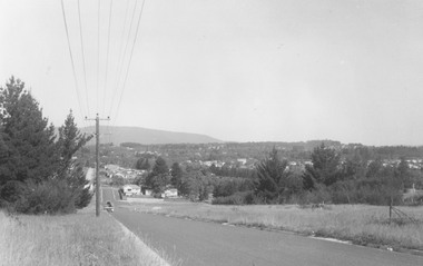
 Ringwood and District Historical Society
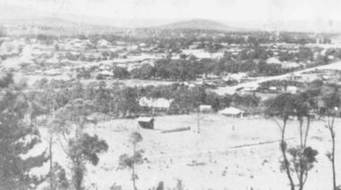
Photograph, A panorama of Ringwood from Mountain View Estate, Loughnan's Hill. (no date)
Typed below photograph, "A Panorama of Ringwood" and written on back of photograph, "Mountain View estate circular".