Showing 902 items
matching reservoirs
-
 Greensborough Historical Society
Map - Map (Copy), C. Hodgkinson, District Surveyor et al, Parish of Yan Yean 1856: Village site during construction of the Yan Yean Reservoir, 1978
Copy of map part Sec. 13, Parish of Yan Yean 1856, Map 3, Village site... Scale: 8 chains to 1 inch. Drawn by C. Hodgkinson, District Surveyor, redrawn by A. R. Blair 1978. 1 p. photocopy of map. yan yean reservoir, yan yean -
 Greensborough Historical Society
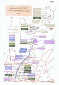
Maps, Yan Yean Water Supply System Conservation Management Plan: Construction dates Map 1, 2007_
Plan of Yan Yean Water Supply System, showing natural and constructed features from 1850s to 1930s from Silver Creek Weirs to Eastern Freeway.Printed in colour one side. 3 copieswater supply, yan yean reservoir, plenty river -
 Greensborough Historical Society
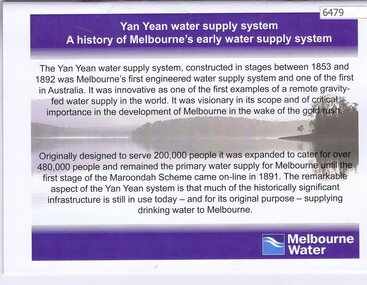
Booklet, Yan Yean water supply system: a history of Melbourne's early water supply system, 2010c
History of the Yan Yean water supply system - Melbourne's earliest. This is an early version of the history.Link: 6479:6482 24 p., colour illus., mapsyan yean reservoir, melbourne water -
 Greensborough Historical Society
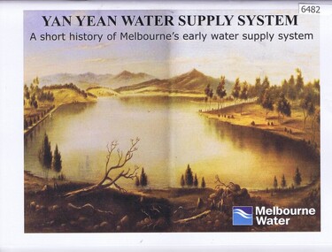
Booklet, Yan Yean water supply system: a short history of Melbourne's early water supply system, 2011c
Early history of the Yan Yean water supply systemLink: 6479:6482 40 p., colour illus. and mapsyan yean reservoir, toorourrong reservoir, melbourne water -
 Greensborough Historical Society
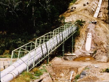
Photograph - Digital image, New pipeline replacing Watts Reservoir aqueduct, 1977_
Photograph of new aqueduct pipe near Plenty River Greensborough.Digital copy of colour photograph.aqueduct, maroondah aqueduct, plenty river -
 Greensborough Historical Society
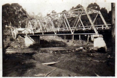
Photograph - Digital Image, Pipes over Plenty, construction of original bridge for Watts Reservoir aqueduct, 1950-1970
Photograph of the Maroondah aqueduct bridge over the Plenty River in Greensborough.Digital copy of black and white photograph.maroondah aqueduct, aqueduct, plenty river -
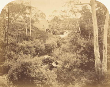
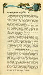
![Article, Greensborough RSL, Memorabilia: Did You Know [Article on water powered flour mills], 1842o](/media/collectors/4f729f5697f83e03086015b8/items/5091b7fc2162ef017426bfd2/item-media/509a25b52162ef0d908e9725/item-fit-380x285.jpg) Greensborough Historical Society
Greensborough Historical SocietyArticle, Greensborough RSL, Memorabilia: Did You Know [Article on water powered flour mills], 1842o
Contains a brief history of the various flour mills that existed on the Plenty River upstream from Greensborough and some others in the district.Contains some hard to find information on district flour mills and their fate.A one page article on Plenty River flour mills written by Jim Allen.Niljanefield mill, george coulstock, john brock, peter hurlestone, carome mill, thomas mill, plenty river, yan yean reservoir, boadles mill, marsh farm, diamond creek -
 Greensborough Historical Society
Book, In The Beginning There Was Only The Land, 1988_
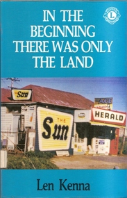
The book was written by Len Kenna as a fund raising item for the Lions Club of Bundoora.It details the history of Bundoora from before white settlement until the modern era.A black and white printed book of 227 pages plus bibliography and appendices. It has a multi coloured outer cover depicting the Bundoora local shop and first unofficial post office. Copy 2 is Lions International edition with brown hard cover and Lions stamp on front. 3 copies.A number of oval library stamps and its dewey number written in pencil on the inner flyleaf.bundoora, janefield, land army, larundel, len kenna, bundoora lions club, mont park, yan yean reservoir -
 Greensborough Historical Society
Book, Diamond Valley Sketchbook, 1973_
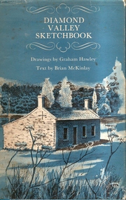
Diamond Valley Sketchbook, written by Brian McKinlay with drawings by Graham Hawley. Cover the area surrounding the Diamond Valley from Heidelberg to Mernda.A sketch book featuring landmarks around the Diamond Valley area in 1973. Many of these no longer exist.A 63 page hard back book with a map of the area covered by the book printed in blue in the inner covers. Three copies have a dust jacket printed in blue with title details, whilst the actual book cover lacks any detail. 4 copies.Some pencil markings in the inside cover.diamond valley, griffin house, rosehill, austin hospital, banyule house, trestle bridge eltham, shillinglaw cottage, montsalvat, old england hotel, eltham primary school, sweeney's cottage, pound bend tunnel, weller's pub, the eltham barrel, hassall's gallery, st katherine's chapel, yan yean reservoir, mernda hotel -
 Greensborough Historical Society
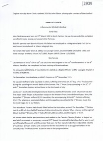
Article, John Cecil Jessop: a community minded individual, 29/03/1892o
Cecil Jessop was an important figure in the development of Greensborough. This outline of his life discusses his work as a councillor, MMBW, and Sutherland Homes.A brief outline of an important Greensborough identity.2 typed pages.jessop family, cecil jessop, councillors, mmbw, yan yean reservoir, greensborough -
 Greensborough Historical Society
Article, Norm Colvin et al, John Cecil Jessop: a community minded individual, 29/03/1892o
Cecil Jessop was an important figure in the development of Greensborough. This outline of his life by Norm Colvin discusses his work as a councillor, MMBW, and Sutherland Homes. Additional material on his War Service by John Gibson with photographs from the collection of Jean Luxford.A brief outline of an important Greensborough identity.7 pages, text and photographs.jessop family, cecil jessop, councillors, mmbw, yan yean reservoir, greensborough -
 Greensborough Historical Society
Photograph (copy), Willis's Mill, 1855c
Photograph of ruins of early flour mill on Plenty River.http://www.mintinc.com.au/pdf/carome_mill_arch_report.pdf Detailed report on same.A photocopy of a photograph of Willis's Flour Mill located on the Plenty River behind Carome Station Mernda.Nilplenty river, flour mill, mernda, yan yean reservoir, riparian rights, 1840, fred kruger, williss mill -
 Kiewa Valley Historical Society
Photograph from Lake Guy, Bogong Village, Scene from shores of Lake Guy to Mountain range, 1930s to 1950s
In 1940 Field Headquarters for the Kiewa Scheme were established at Bogong with office, workshop facilities and accommodation for workmen, staff and some families constructed. (There had been a 'tent camp' on this site in 1939 but was destroyed by bushfires) Construction of accommodation continued until 1947. A total of 40 houses plus a hostel for single staff, post office, police station, medical centre and primary school all with water and sewerage and electricity supply. The staff hostel was known as Kiewa House and is now occupied by the Education Department. Lake Guy was named after Mr. L.T. Guy who was the Resident Engineer in charge of construction work and associated activities on the Kiewa area. He held this position from 1939 to November 1946 when he was transferred to Head Office.The Bogong Township was developed firstly as an accommodation centre (base camp) for construction workers employed under the Kiewa Hydroelectric Scheme. Due to the influx of European workers into the Township the beautification of the immediate surrounds(gardens etc.) had a distinct European flavour. This environment has been very beneficial for tourism in later years. Strict environmental control has not allowed for any extensive redevelopment in tourist accommodation and basically restricted it to the accommodation initially built for the construction workers. Activities such a bike riding, snow skiing, restricted horse riding and bush walking on the Alpine plains and mountains are now a viable part of the Kiewa Valley Tourist Industry. The lake is one of the many water storage storage reservoirs used to supply the power stations their main power to run the huge turbines generating the final product, electricityThis black and white photograph shot from the shores of Lake Guy toward the mountain range of the Victorian Alps details the early construction of the construction worker's accommodation of the Bogong Village. The paper is of 200gms and is not photographic paper and can be assumed to be a reproduction of an original photobogong village circa 1930 to 1950, kiewa hydro-electricity scheme, victorian alpine region mid 1900s -
 Eltham District Historical Society Inc
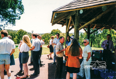
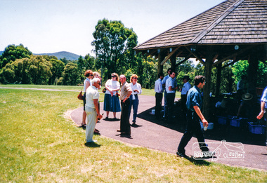
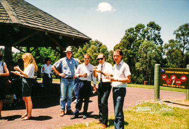
Photograph, Shire of Eltham staff Christmas Breakup BBQ lunch, Sugarloaf Reservoir, 1992, 1992
Colour photographcouncil staff, shire of eltham, 1992, sugarloaf reservoir -
 Eltham District Historical Society Inc
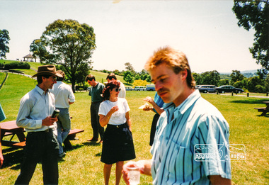
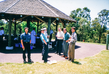
Photograph, Shire of Eltham staff Christmas Breakup BBQ lunch, Sugarloaf Reservoir, 1992, 1992
Colour photographcouncil staff, shire of eltham, 1992, sugarloaf reservoir -
 Eltham District Historical Society Inc
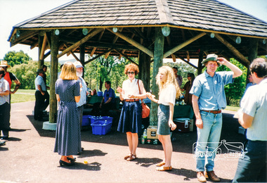
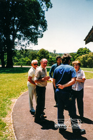
Photograph, Shire of Eltham staff Christmas Breakup BBQ lunch, Sugarloaf Reservoir, 1992, 1992
Colour photographcouncil staff, shire of eltham, 1992, sugarloaf reservoir -
 Eltham District Historical Society Inc
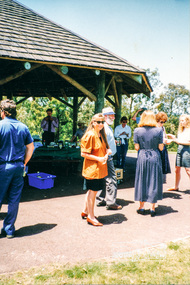
Photograph, Shire of Eltham staff Christmas Breakup BBQ lunch, Sugarloaf Reservoir, 1992, 1992
Colour photographcouncil staff, shire of eltham, 1992, sugarloaf reservoir -
 Eltham District Historical Society Inc
Photograph, Shire of Eltham staff Christmas Breakup BBQ lunch, Sugarloaf Reservoir, 1992, 1992
Colour photographcouncil staff, shire of eltham, 1992, sugarloaf reservoir -
 Eltham District Historical Society Inc
Photograph, Shire of Eltham staff Christmas Breakup BBQ lunch, Sugarloaf Reservoir, 1992, 1992
Colour photographcouncil staff, shire of eltham, 1992, sugarloaf reservoir -
 Eltham District Historical Society Inc
Photograph, Shire of Eltham staff Christmas Breakup BBQ lunch, Sugarloaf Reservoir, 1992, 1992
Colour photographcouncil staff, shire of eltham, 1992, sugarloaf reservoir -
 Eltham District Historical Society Inc
Photograph, Shire of Eltham staff Christmas Breakup BBQ lunch, Sugarloaf Reservoir, 1992, 1992
Colour photographcouncil staff, shire of eltham, 1992, sugarloaf reservoir -
 Eltham District Historical Society Inc
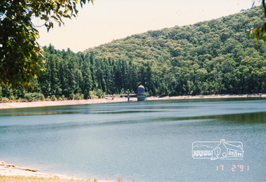
Photograph, Maroondah Reservoir, 17 Feb 1991, 17/02/1991
Colour photographmaroondah dam, maroondah aqueduct, maroondah reservoir -
 Kiewa Valley Historical Society
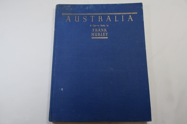
Book - Book- Photos, Australia - A Camera Study by / Frank / Hurley
Frank Hurley (1885-1962) was an Australian photographer and adventurer. He participated in trips to Antartica and was an official photographer with the Australian forces during both world wars. This book was first published in 1955.Photographs include the Hume Reservoir, Mt Buffalo and the Alpine High Country of Mt Kosciusko. (pages 140-144) All are associated with the type of country at each end of the Kiewa River. The Kiewa River flows into the Murray River just below the Hume Dam and Mt Buffalo and Mt Kosciusko are part of the Alpine High country near the Bogong High Plains. Clare Roper lived on a farm in the Kiewa Valley.Blue hard cover, bound book with the title in gold at the top. 208 pages. Mostly Black & white photos but some coloured.Inside back of first page - written 'Clare Roper'frank hurley photographer, australian photography, clare roper -
 Kiewa Valley Historical Society
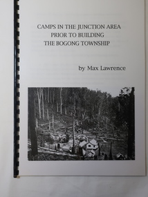
Booklet - Camps at Bogong Junction. 1930s, Camps in the Junction Area Prior to Building the Bogong Township by Max Lawrence
During the construction of the Kiewa Hydro Electric Scheme at Bogong Junction camps of tents were built from 1935. These were replaced by houses for the workers in 1940 when the Bogong township was built.The SECV constructed the Bogong township to house workers on the Kiewa Hydro Electric SchemeA plastic Folder with a black spiral spine and black back cover. 3 pages typed on one side naming and describing the camps at Bogong Junction in the 1930s.miners camp, staff camp, reservoir camp, bogong township, lewis construction camp, albion quarry camp -
 Eltham District Historical Society Inc
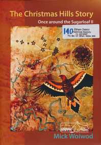
Book, Mick Woiwod, The Christmas Hills story : once around the Sugarloaf II / Mick Woiwod, 2010
Paperback; 275 p. : ill., facsims., maps, ports. ; 30 cm.Inscribed and signed by Author 2010christmas hills, sugraloaf reservoir, aborigines -
 Eltham District Historical Society Inc
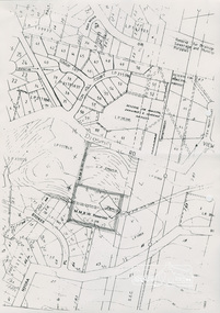
Document, Objection by P. and C. Vermey to Application Ref. No. E94/306 - proposed subdivision Melbourne Water Reservoir & Pumping Station - Diosma Road, Eltham, 1 September 1994, 1/9/1994
The Stokes Orchard Estate collection is typical of housing developments of the late 1970s and 1980s. It was one of the earliest estates in Eltham following the nearby Woodridge Estate development.A4 letter and five accompanying supporting pagesAs notedstokes place, eltham, stokes orchard, stokes orchard estate, streets, houses, peter and carla vermey, diosma road, letter of objection, melbourne metropolitan board of works, planning application, reservoir, shire of eltham -
 Eltham District Historical Society Inc
Document, Notice of Decision to Grant a Permit; Ref: E94/306 - Subdivision of 30-34 Diosma Road; 16 November 1994, 16/11/1994
This permit was eventually overturned following community objection and the land was donated by Yarra Valley Water for use as a community reserve.The Stokes Orchard Estate collection is typical of housing developments of the late 1970s and 1980s. It was one of the earliest estates in Eltham following the nearby Woodridge Estate development.A4 document consisting of ten pagesAs notedstokes place, eltham, stokes orchard, stokes orchard estate, streets, houses, peter and carla vermey, diosma road, letter of objection, melbourne metropolitan board of works, planning application, reservoir, shire of eltham -
 Eltham District Historical Society Inc
Photograph, Hot Rods at Yan Yean, 1987, 1987
Originally contained in a 'magnetic' photo album believed to have been donated by Mr Eric Stephenson, Jingalong, 110 Ryans Road, Eltham, Vic. 3095; relocated to archival safe storage.Five colour photographscars, hot rods, yan yean reservoir -
 Marysville & District Historical Society
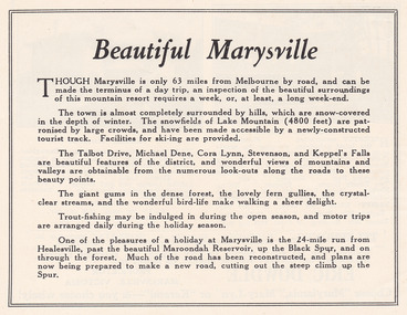
Ephemera (Item) - Advertisement, Beautiful Marysville, Unknown
An advertisement for Marysville and attractions in and around the local area.An advertisement for Marysville and attractions in and around the local area.marysville, victoria, lake mountain, talbot drive, lady talbot drive, michael dene, cora lynn falls, stevenson falls, steavenson falls, keppel's falls, healesville, maroondah reservoir, black spur -
 Marysville & District Historical Society
Ephemera (Item) - Book page, Unknown
A page from a unknown book regarding Marysville and the surrounding district including Narbethong, Healesville and Warburton.A page from a unknown book regarding Marysville and the surrounding district including Narbethong, Healesville and Warburton.marysville, victoria, narbethong, healesville, warburton, toolangi, launching place, box hill, ringwood, lilydale, watts river, yea river, sylvia falls, don road, wood's point, baw baws, maroondah reservoir, graceburn weir, mt juliet, fernshaw