Showing 1028 items matching "water river"
-
 Nillumbik Shire Council
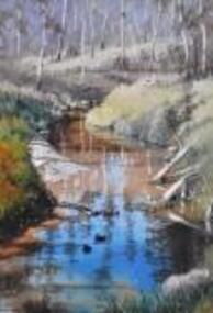
Painting: Walter MAGILTON, Walter Magilton, Sunlight and Shadows, Warrandyte, 2011
Walter Magilton's professional painting career is highlighted by numerous solo exhibitions, five of which have been in Great Britain. He has also won countless prizes, which include many 'Best in Show' awards. Walter is represented in a great number of private and corporate national and international collections, including ART Bank, in approximately twelve countries.This painting is a one of a series of approximately eight works of the river at Warrandyte and the local creeks, with particular emphasis on the reflections in the water and of the wattle growing along the banks. I was particularly inspired by Penleigh Boyde who did similar work while living in Warrandyte in the early 1920s.'Sunlight and Shadows, Warrandyte' is an oil on canvas painting depicting the Warrandyte landscape, featuring a winding creek with beautiful reflections cast upon it. The colour palate comprises muted green and earth tones, with a vivid aqua for reflective water.walter magilton, nillumbik, warrandyte -
 National Wool Museum
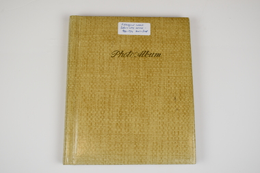
Photo Album, 1930-1934
The Photo Album was created by Hans Beck, who interned with the donor's father (Wilhelm Eckels). The Photo Album depicts wool buying and sheep station related life between 1927-1939. Each photograph has been individually labelled.Straw coloured booklet with gold cursive writing on front cover spelling 'Photo Album'. Inside are 18 pages containing 63 photographs, each individually captioned. Internal pages show signs of age with discolouration, particularly in areas of previous adhesive application.Lettering, Front: Historic Interest Before WME arrived - 1930-1934 Wool & Sheep Photo Album Lettering, Internal by Page: Page 1 - Bottom Left Conner: Table from right:/ O. Hilbert sen. / WW. Richter, W. Ehrig/ Sampler: C. McCarthy/ at desk: E.S. Bottom Right Corner: 1927/ Wool Sample Room/ O. Hilbert/ Terranora Buildings/ Reiby Lane Page 2 - Bottom Middle: 1931/ Opening Sale/ Sydney Page 3 - Bottom Middle: 1934/ Opening Sale/ Sydney Page 4 - Bottom Middle: 1933/ Wool Auctions/ Brisbane Page 5 - Top Left Corner: 1930 Escapade/ Sydney to CAIRNS/ via Bourke, Central/ Queensland, Hinter-/ land & Atherton/ Table Lands Top Right Corner: Dubbo: Main Street/ (1st Night)/ 31.7.1930 Middle Right: 1st Night-"OUT"/ Stranded 11 miles/ from Bourke. (Red/ Dust in Carburettor Bottom Right Corner: Our "ERSKINE'/ hits Culvert &/ breaks both King-/pins. 1 1/2 miles from/ CUNNAMULLA SW-Q. Page 6 - Top Right Corner: "Rosevale Station"/ via Cunnamulla SWQ/ "Gidgi" country/ Gidgi Creak &/ Warrigo R. Middle Left: STAN HILL Page 7 - Middle Top: Blackhall/ Tattersall's Hotel/ Yarning at Cross-/roads. Middle Left: FO Wool Sales/ 22 Horse team Middle Right: Roadsign to:/ ISIS DOWNS &/ Homestead (Fart Page 8 - Middle Top: Muster: 3000 sheep/ Semi-circular/ Shearing shed/ ISIS DOWNS Page 9 - Middle Top: Shearer/ Water Tower/ Counting out/ pens Middle Bottom: Shearers Cook/ Hot Water & Soup/ Cake for Shearing/ Shed Charity Ball Page 10 - Middle Left: Isis Downs Home-/ stead with fire// flood Lookout./ Artesian Borewell Bottom Right: Manager: Moore/ & Alfred Loh-/ mann with kills/ Ducks & Emus Page 11 - Top Middle: PORTLAND DOWNS/ Muster: 10,000/ Sheep Bottom Left: Manager:/ Mr. Luck/ with A.L./Moore Page 12 - Middle Top: ROOKWOOD Station/ near/ HUGHENDEN/ Central NWQ Page 13 - Top Middle: 'HINTERLAND"/ Cattle country/ Spear Grass/ Tracks Bottom Middle: Crossings:/ Creeks: Quick/ Sand/ Rivers: rocky Page 14 - Middle Right: Lyndhurst stat/tion/ Head Stockman Middle Left: -Valley of la-/goons/ Station Bottom Right Corner: Master Atkinson/ saves/ Petrol shortage Page 15 - Top Middle: ATHERTON TABLELANDS/ LAKE BERRINE Middle Centre: Tropical Rainforest/ near/ Lake Berrine Page 16 - Top Middle: ATHERTON TABLELANDS/ Timber Country Bottom Middle Edge: CAIRNS/ Imperial Hotel Page 17 - Hans Beck with/ Betty Hilbert/ Lapstone Hill 1931 wool - transportation, wool sales, wool growing, wool growing agriculture farming, wool industry, wool sales - sydney, wool sales - brisbane, dubbo, 1930, bourke, cunnamulla, isis downs, shearing, shearing - lifestyle, portland downs, muster, hughenden, hinterland, lake berrine, cairns -
 Whitehorse Historical Society Inc.
Document, My Memories of George Skewes, 1999
... Mitcham Nunawading Historical Society State Rivers and Water ...Memories of George Skewes by Ted Arrowsmith who knew him over a period of 45 years, and a letter from George's son, Eric outlining his father's history from 1897 - 1989. This history is in the Archives of both Christ Church, Mitcham and Nunawading Historical Society. With photo of George and Beryl Skewes.skewes, clarence george, arrowsmith, ted, toc h mitcham branch, clayton, 'tubby', rev, christ church, anglican church, mitcham, nunawading historical society, state rivers and water supply commission, keage, beryl colville, melbourne and metropolitan board of works, skewes, eric william, skewes, coryl isobel, skewes, luke, skewes, beryl -
Whitehorse Historical Society Inc.
Pamphlet, Victoria's Water Resources
... state rivers and water supply commission Pamphlet by Ministry ...Pamphlet by Ministry of Water Resources and Water Supply for Use Water Wisely Campaign.Pamphlet by Ministry of Water Resources and Water Supply for Use Water Wisely Campaign.Pamphlet by Ministry of Water Resources and Water Supply for Use Water Wisely Campaign.water supply, victoria. ministry of water resources and water supply, melbourne and metropolitan board of works, state rivers and water supply commission -
Whitehorse Historical Society Inc.
Pamphlet, Melbourne's water; a community problem, 1968
... of works state rivers and water supply commission lower yarra dam ...Collection of papers relating to Melbourne's future water needs by Leigh Blackburn with map extractsCollection of papers relating to Melbourne's future water needs by Leigh Blackburn with map extracts defining the area the author considers the most suitable for the development of future water resources and the dangers of the Lower Yarra Dam proposals.Collection of papers relating to Melbourne's future water needs by Leigh Blackburn with map extracts water supply, melbourne and metropolitan board of works, state rivers and water supply commission, lower yarra dam -
 Rutherglen Historical Society
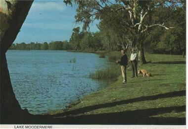
Post Card Folder, Big 7 Folder, Vue Pac. 7 Detachable Post Cards of Rutherglen Victoria, c1970
Donated by Mrs Brian Jasper.Coloured post cards in folder with views of Rutherglen and District. This one is a view of Lake MoodemereOn message side of card: "Rutherglen, Victoria. A billabong of the Murray River. A wildlife reserve incorporating camping and water sport facilities. | NCV.1050 Nucolorvue Productions Pty. Ltd."lake moodemere -
 Rutherglen Historical Society
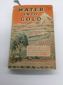
Book, Robertson & Mullens, Water Into Gold, 1946
... of orange and green with view of river and fields. Water Into Gold ...From the estate of Florence Iggsten.Book with orange cloth cover with black writing. Dust cover printed in shades of orange and green with view of river and fields.On inside page opposite first title - "Mrs Iggsten Xmas 1946"renmark, dried fruit, murray river, mildura, agriculture, irrigation -
 Rutherglen Historical Society
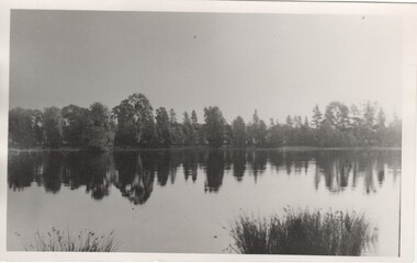
Image, c1870
Possibly Lake King shortly after the weir was built, or Lake Moodemere or the Murray River in flood.Black and white photograph of a body of water surrounded by trees.lake king, lake moodemere, murray river -
 Ballarat Heritage Services
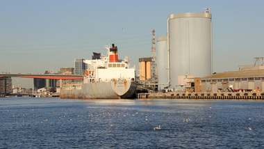
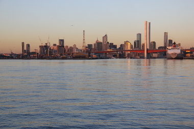
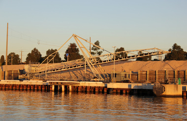
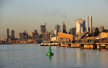
Digital photographs, birds Yarra River Melbourne Docklands, 2015
Digital Imagesyarra river melbourne docklands, yarra river, dock, docklands, shipping, port, channel, birds, water -
 Ballarat Heritage Services
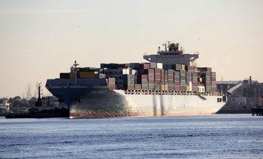
Digital photographs, L.J. Gervasoni, Yarra River Melbourne Docklands MOL Earnest container ship, 2015
Digital Imagesyarra river melbourne docklands, yarra river, dock, docklands, shipping, port, channel, water, mol, earnest -
 Ballarat Heritage Services
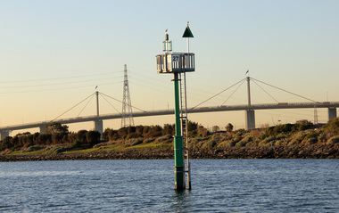
Digital photographs, L.J. Gervasoni, Yarra River Melbourne Docklands Westgate Bridge, 2015
Digital Imagesyarra river melbourne docklands, yarra river, dock, docklands, shipping, port, channel, water, west gate bridge, bridge -
 Ballarat Heritage Services
Digital photographs, Yarra River Melbourne Docklands Bolte Bridge, 2015
Digital Imagesyarra river melbourne docklands, yarra river, dock, docklands, shipping, port, channel, water, bridge, bolte bridge -
 Ballarat Heritage Services
Digital photographs, L.J. Gervasoni, Yarra River Melbourne Docklands Victoria Dock, 2015
Digital Imagesyarra river melbourne docklands, yarra river, dock, docklands, shipping, port, channel, water, victoria dock -
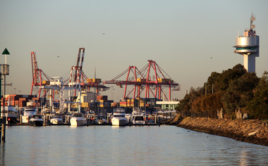 Ballarat Heritage Services
Digital photographs, L.J. Gervasoni, Yarra River Melbourne Docklands container dock cranes, 2015
Digital Imagesyarra river melbourne docklands, yarra river, dock, docklands, shipping, port, channel, water, container, cranes -
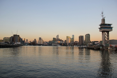 Ballarat Heritage Services
Digital photographs, L.J. Gervasoni, Yarra River Melbourne Docklands Port Control Tower, 2015
Digital Imagesyarra river melbourne docklands, yarra river, dock, docklands, shipping, port, channel, water, container, port control tower, control tower, tower -
 Ballarat Heritage Services
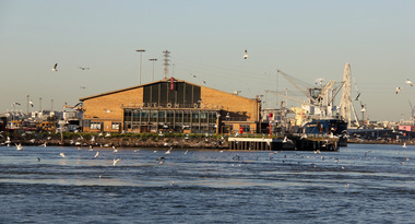
Digital photographs, L.J. Gervasoni, Yarra River Melbourne Docklands, 2015
... Office goldfields yarra river melbourne docklands yarra river ...Digital Imagesyarra river melbourne docklands, yarra river, dock, docklands, shipping, port, channel, water -
 Ballarat Heritage Services
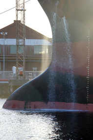
Digital photographs, L.J. Gervasoni, Yarra River Melbourne Docklands ship releases ballast, 2015
Digital Imagesyarra river melbourne docklands, yarra river, dock, docklands, shipping, port, channel, water, ship, ballast -
 Ballarat Heritage Services
Digital photographs, L.J. Gervasoni, Yarra River Melbourne Docklands willamstown yacht club, 2015
Digital Imagesyarra river melbourne docklands, yarra river, dock, docklands, shipping, port, channel, water, ship, yachts, williamstown -
 Ballarat Heritage Services
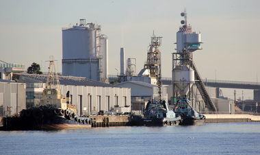
Digital photographs, L.J. Gervasoni, Yarra River Melbourne Docklands tug boats, 2015
Digital Imagesyarra river melbourne docklands, yarra river, dock, docklands, shipping, port, channel, water, ship, tug boats, tugs -
 Ballarat Heritage Services
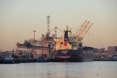
digital photographs, L.J. Gervasoni, Yarra River Melbourne Docklands Venture Pearl, 2015
Digital Imagesyarra river melbourne docklands, yarra river, dock, docklands, shipping, port, channel, water, ship, venture pearl -
 Ballarat Heritage Services
digital photographs, L.J. Gervasoni, Yarra River Melbourne Docklands wharves and markers, 2015
Digital Imagesyarra river melbourne docklands, yarra river, dock, docklands, shipping, port, channel, water, ship, wharf, channel marker -
 Ballarat Heritage Services
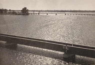
Photograph
Photograph of a bridge over water.river, bridge -
 Ballarat Heritage Services
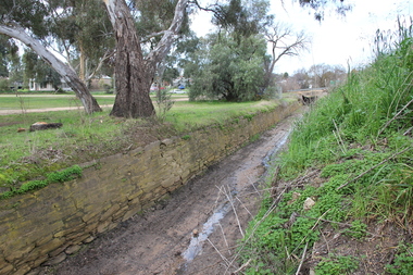
Photograph - Colour, L.J. Gervasoni, Channel near the Avoca River, Avoca, 2011, 06/08/2011
Colour photograph of a stone water channel near the Avoca River in Avoca. avoca, bridge, avoca river, channel, stone, drystone -
 Ballarat Heritage Services
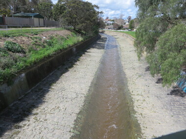
Photograph - Photograph - Colour, Clare Gervasoni, Yarrowee Creek after days of heavy rain, 2016, 17/09/2016
A number of photographs of the Yarrowee River after days of heavy rain. Two and three day previously the water reached the edges of the channel and was flowing very fast. The photographs were taken from and around the Hill Street Bridge near the Sunnyside Woollen Mills.yarrowee creek, yarrowee river, bridge, chanel, hill street, ballarat east -
 8th/13th Victorian Mounted Rifles Regimental Collection
Photograph - Born digital image
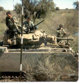
A region on the Lachlan River flood plain north of Booligal New South Wales with its lightly timbered grassland criss-crossed with numerous flowing channels and water filled billabongs provided a challenging training area for a unit equipped with M113 family of vehicles. A Squadron 8/13 VMR deployed there in September 1985 for its annual exercise. The MRV was from 3 Troop commanded by Corporal RAC (Bob) MacDonald of Wangaratta Victoria. Army Reserve training in challenging countryColour image of M113 Medium Reconnaissance Vehicle(MRV) of A Squadron 8/13 Victorian Mounted rifles on annual exercise in Booligal region NSW, 1985.booligal, annual exercise, 8/13 victorian mounted rifles -
 Otway Districts Historical Society
Photograph, Brucker, Gellibrand station, 1922, 1922
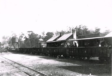
Gellibrand station became the railhead for traffic to the Carlisle River and Lardners, as well as the centre of timber and fruit trade. Outward loading was substantial at the time the photograph was taken. Sawn and split timber, firewood, sleepers and piles were loaded in large quantities. The general expansion in traffic led in October 1923 to the laying of an additional loop siding and provision for a goods shed., B/W. In 1922, Gellibrand station with passengers and workmen on the station concourse, and NQR wagons aligned ready to move. Note the water tank on the left and the start of the Refreshment Room on the right.gellibrand; railways; -
 Otway Districts Historical Society
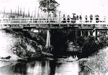
Photograph, Gellibrand River railway bridge, 1901, 1901
Photograph, B/W, A4. Railway bridge over the Gellibrand River with people standing at the right-hand end, a railway water tank nearby on the left, and a tent underneath on the left.gellibrand, gellibrand river;railways; bridge; -
 Bendigo Historical Society Inc.
Slide - Dunn's Rock Eppalock, 2012
The low rolling hills of the Kimbolton countryside consist of ancient, hard and fractured Ordovician rock up to 65 million years old, which was originally deposited deep under the sea. Rocks mainly are sandstone, mudstone, black shale and quartz conglomerates. Marine fossils can be found in the area. Around seven million years ago a basalt flow buried the original bedrock along the along the Campaspe River. Ongoing weathering, wind and water movement over the following years has produced younger clay, sand, silt and gravel deposits throughout the area. Patches of White Hills Gravel are also found in the area. Another unique geological feature of this area is the Permian Glacial Pavement rocks north and south of Eppalock and glacial sediments (such as “Dunn’s Rock” and “Kellams Rock”). During the ice age (up to 280 million years ago) large glaciers moving over the countryside, scoured out sediments, pulverized bedrock, polished and cut grooves into bedrock in the direction of ice movement. When the ice melted boulders etc where left behind in areas of entirely different rock types, such as a 100 Tonne granite block known as ‘The Stranger’ near Derrinal. Dunn's Rock (Glaciated Pavement) Eppalock - Photos of the rock and a field group collecting date with Lake Eppalock (Knowsley) in the backgroundhistory, bendigo, dunn's rock eppalock, kimbolton forest, lake eppalock, gately collection -
 Bendigo Historical Society Inc.
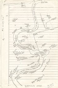
Document - PETER ELLIS COLLECTION: SKETCH OF THE BARFOLD GORGE
... of rock, some accessible areas to get down to the river... down to the river, geological features and water falls ...Two photocopies of hand-drawn sketch of the Barfold Gorge. On the sketch is the location of a house, trees, fences, different types of rock, some accessible areas to get down to the river, geological features and water falls.place, land, barfold gorge, peter ellis collection, barfold area, mitchell's falls, queen's fall -
 Bendigo Historical Society Inc.
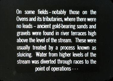
Slide - DIGGERS & MINING. GETTING THE GOLD, c1850
Diggers & Mining. Getting the Gold. Slide: On some fields - notably those on the Ovens and its tributaries, where there were no leads - ancient gold-bearing sands and gravels were found in river terraces high above the level of the stream. These were usually treated by a process known as sluicing. Water from higher levels of the stream was diverted through races to point of operations . . . Markings: 59 994.LIF:4. Used as a teaching aid.hanimounteducation, tertiary, goldfields