Showing 11442 items
matching maps
-
 Bendigo Historical Society Inc.
Document - BASIL MILLER COLLECTION: TRAMS - EVOLUTION BENDIGO TRAMWAYS
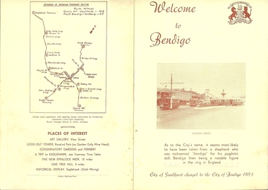
3 copies of a Yellow booklet printed in reddish brown ink 'Welcome to Bendigo' featuring image of trams in Charing Cross on cover. 'Evolution of Bendigo Tramways' composes the centre spread detailing the various tram types through the ages. Backcover shows map of the routes and places of interest.Arthur Hocking, Printer.person, individual, basil miller -
 Bendigo Historical Society Inc.
Book - EAGLEHAWK & DISTRICT PIONEER REGISTER VOLUME 3 J-M, c2001
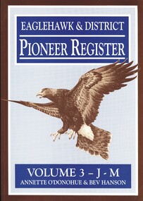
Eaglehawk & District Pioneer Register Volume 3 J-M. Publisher Annette O'Donohue, Bendigo. ISBN: 0 9585948 2 1. 334 pages. Book Mark also included listing abbreviations and their meaning. Photographs, illustrations & maps. Signed by Annette O'Donohue & Bev Hanson.Annette O'Donohue & Bev Hansonhistory, australian, pioneers, eaglehawk & district, bendigo history, eaglehawk pioneers, genealogy -
 Bendigo Historical Society Inc.
Book - BENDIGO 1967, c1967
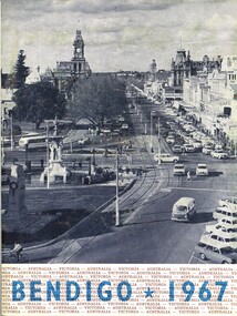
Bendigo 1967. City of Bendigo publication on services and industries within the municipality and districts J W H Publications, Bendigo. Industry, education, & services. 24 cm H x 18 cm W booklet, 32 pages, includes B/W photographs, illustrations & maps.cottage, miners, industry, education, & services in bendigo in 1967 -
 Bendigo Historical Society Inc.
Book - MINING & GEOLOGICAL JOURNAL. VOL,4. NO,4, 1951
Mining and Geological Journal, Volume 4, No.4. September 1951. Published by Department of Mines Victoria with 65 pages of articles on gold, coal & oil mining, Illustrations, maps, photographs including photographs of Bendigo mines. Name noted on front A.E.Richardson 29 Harrison St Bendigo.Dept of Mines Victoriamagazine, organization, mining, mining - mines - mining equipment, bendigo mines. -
 Bendigo Historical Society Inc.
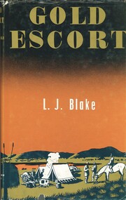
Book - GOLD ESCORT, c1971
Gold Escort by L J Blake. Publisher The Hawthorn Press, Melbourne. Date 1971. ISBN: 7256 0043 8. Pages 228. Photographs, illustrations & Map. Signed by: L J Blake. Hard cover, green gold embossed print on spine, glossy dust jacket.L J Blakebook, bendigo, gold escort, gold escort, gold rush, history, victoria, south australia -
 Bendigo Historical Society Inc.
Book - TOURING SACRED MINE SIGHTS OF BENDIGO, 1994
16 page booklet 'Touring Sacred Mine Sights of Bendigo' Produced by Bendigo Mining and the Victorian Chamber of Mines.1994. Researched and written by David Horsfall and printed by Bendigo Modern Press. Details and suggested walking and driving tours of old mine sites. Includes 3 maps.David G Horsfall -
 Bendigo Historical Society Inc.
Document - GOLDEN GULLY ALLUVIAL WORKINGS
Golden Gully alluvial workings, Diamond Hill area, site number 1.1. Document has map/grid references, parcel number and location - runs along Woodward Road. History from 1851 to 186 detailed. . Information from David Bannear's Bendigo goldfields survey. -
 Bendigo Historical Society Inc.
Map - STRUGNELL COLLECTION: HUSTLER'S LINE OF REEFS, September 1913
Map, Hustler's Line of Reefs, Hustler's Reef Mine, Transverse Section, Bendigo. Plate No. XV111 (18).Bulletin No 33 Signed, H.A.Whitelaw. Drawing shows the vertical shaft descending to over 2195 feet and appears to show samples of connecting horizontal shafts with their respective mineral contentsUnderground Survey Office, Bendigo.map, bendigo, hustler's reef mine -
 Bendigo Historical Society Inc.
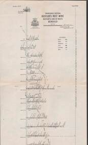
Map - STRUGNELL COLLECTION: HUSTLER'S LINE OF REEFS, September 1913
Map, Hustler's Line of Reefs, Hustler's Reef No.1 Mine Bendigo, Transverse Section.Plate No. XX1 (21).Bulletin No 33 Signed H.A.Whitelaw. Drawing shows the vertical shaft descending to over 1428 feet and appears to show samples of connecting horizontal shafts with their respective mineral contentsUnderground Survey Office, Bendigo.map, bendigo, hustler's reef no.1 mine -
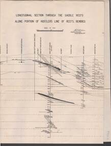 Bendigo Historical Society Inc.
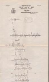
Map - STRUGNELL COLLECTION: HUSTLER'S LINE OF REEF, September 1913
Map, Longitudinal section through the Saddle Reefs along portion of Hustler's Line of Reefs, Bendigo. Plate No. XXX1V(34). Underground Survey Office,Bendigo, September 1913. Geological Society of Victoria.//Signed H.A.Whitelaw. Drawing shows the vertical shaft descending to over 3454 ftUnderground Survey Office, Bendigomap, bendigo, hustler's line of reefs -
Port Melbourne Historical & Preservation Society
Document - Submissions, Barak Road and Beacon Road developments, 1972
22 stapled pages regarding Barak & Beacon Roads development. Submissions to Minister of Lands from Cr TURNER and Cr JULIER 1972. MMBW planning map. Fishermens Bend Productivity Group working committee notes. Drawings and plans for housing, notes on developments 1955 -1972built environment - public housing, built environment - domestic, local government - city of port melbourne, leslie stanley turner, raymond frank julier, perce mcguire white, perce white, w a borthwick -
 Bendigo Historical Society Inc.
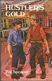
Book - HUSTLER'S GOLD
Hustler's Gold, a childrens' fictional book about 2 youths, best friends, and their escapades all set against the background of Hustlers Reef Bendigo, 126 pages with black and white illustrations by Rachel Tonkin and a map, first published 1969 by Lansdowne Press, hard cover with dustjacket.Pat Spencerbook, bendigo, childrens -
 National Vietnam Veterans Museum (NVVM)
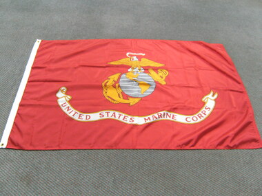
Flag, United States Marine Corps
Red nylon flag featuring yellow and white eagle, standing on a gray round map of the world featuring North and South America in yellow. Large banner on bottom of flag saying "United States Marine Corps" Also around the world globe is an anchor and rope also in yellowUnited States Marine Corpsflag, united states - marine corps -
Tatura Irrigation & Wartime Camps Museum
Photograph, 1941-1946
Made in Camp 3, handcrafts by various internees.Colour photograph of various handmade artifacts including top left, wooden jewel box with elongated paler pieces of wood with the letter HB; an opened book signed Gerda: serviettes, carved brooches heart shaped, 2 kangaroos, map of Australia. Some of the 24 items made.Herta Blaich below jewel box; Ramerabe Hillo on what could be a wallet, bottom left.camp 3, hand made objects, camp 3 hand crafts, templer society -
Ballarat Tramway Museum
Pamphlet, Peter Lambert, "Discover Historic Mount Pleasant - A guide to historic sites in Mount Pleasant", May. 2019
Pamphlet - 24 pages - full colour DL centre stapled, titled "Discover Historic Mount Pleasant - A guide to historic sites in Mount Pleasant" with map showing the various sites. Includes photographs of the Mt Pleasant tram terminus and the tram mural. See Reg item 7987.trams, tramways, mt pleasant, trams, history, heritage, barkly st -
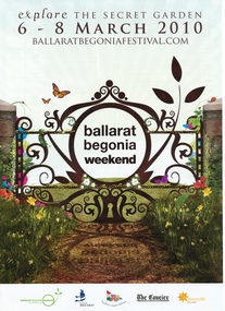 Ballarat Tramway Museum
Programme, Begonia Festival, "Ballarat Begonia Weekend 2010 - Explore the Secret Garden", Feb. 2010
Six page, folded to A4, full colour programme for the 2010 Begonia Festival, titled ""Ballarat Begonia Weekend 2010 - Explore the Secret Garden". Notes the BTM's depot is open (rear page), tramway is a free activity and map shows the various events. Two copies held.trams, tramways, begonia festival, btm -
 Otway Districts Historical Society
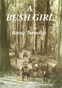
Book, Apollo Bay & District Historical Society Inc, A Bush Girl, December 2001
A family history about the Holmes family and one daughter's marriage to Mark Trevaskis between 1897 and 1912.A Bush Girl. A story about life in the Otway ranges between 1897 and 1912. Eveline Bessie Orlina Trevaskis. Apollo Bay; Apollo Bay & District Historical Society; 2001. vi, 64 p.; illus, maps. Soft cover. ISBN 0 9577956 2 9a bush girl; bessie trevaskis; otway ranges; family history; barramunga; wongarra; -
 Otway Districts Historical Society
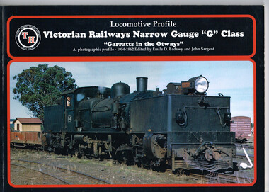
Book, Train Hobby Publications, Victorian Railways Narrow Gauge, Part 1, March 1998
The first in an historical series showing the Victorian Railway narrow gauge line from Colac to Crowes, and then from Colac to Beech Forest, in the Otways from 1954 until 1962 when the line closed.Victorian Railways Narrow Gauge "G" Class. "Garratts in the Otways" Part One. A photographic profile - 1954-1962. Emile D. Badawy (ed.); John Sargent (ed.). 1998; Train Hobby Publications; Studfield (Vic). ii, 48 p.; illus., maps. Soft cover.colac; beech forest; crowes; victorian railways; garratt; narrow gauge; emile d. badawy; john sargent; -
Bendigo Historical Society Inc.
Book - 'An Inch of Rain' A water history of Northern Victoria by Robyn Ballinger
184-page soft cover book entitled 'An Inch of Rain' by Robyn Ballinger A water history of Northern Victoria. Illustrated with B&W photos, maps and rainfall charts. Published 2012 by Australian Scholarly Publishing P/L, North Melbourne Printed by BPA Print Group rainfall, northern victoria, water -
 Kew Historical Society Inc
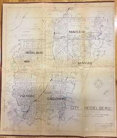
Plan, City Engineers Department (Heidelberg), City of Heidelberg Plan: Scale 20 chns to 1 inch, 1970-1993
Gwen Barton McWilliam (nee: Nelson), OAM, BA (1933- ). Gwen McWilliam is well known as an authority on the history of Boroondara and the author of a large number of books and pamphlets about the City. She was awarded the medal of the Order of Australia in 2001 ‘for service to the community of Hawthorn and district, particularly through the research, documentation and publication of its history.’ Primary source annotated by a distinguished local historian.Plan of number of areas in the City of Heidelberg showing municipal and ward boundaries, subsequently annotated by the historian Gwen McWilliam, identifying significant landholdings, subdivisions and key dates.The base map was printed in 1970 and annotated c.1993. The plan was donated to the Kew Historical Society by Gwen McWilliam. Handwritten annotations by Gwen McWilliam, 1993city of heidelberg, maps -- heidelberg (vic.), gwen mcwilliam -
 Beechworth Honey Archive
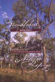
Publication, Bimblebox A Nature Refuge Under Siege (Maureen Cooper), 2013
Soft Cover A 5 size book, Front cover has a photo of Bimblebox trees with a small inset of a tree beside a large rock. The back cover is crimson with bimblebox flowers & a blurb in white On inside front cover is a map with the location of the Bimblebox refuge location 120 pages -
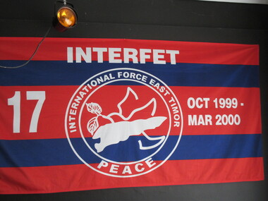 Lilydale RSL Sub Branch
Flag, Panhandling Australia Pty Ltd, Interfet
Red and blue horizontal stripes. The words Interfet - ttop centre. No 17 LHS October 1999 - March 2000 RHS. Historical information - Double circle, in centre is a map of East Timor with floral emblem, surrounded by the words 'International Force East Timor, Peace at base of circle. -
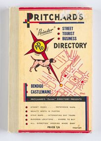 City of Greater Bendigo - Civic Collection
Book - Street Directory, A. E. Pritchard, Pritchards 'Pointer' Street - Tourist - Business - Directory, 1953
As tourism and car culture grew in the early and mid 20th century the need for street and touring directories grew. Bendigo's geographic location within central Victoria and relatively closeness to Melbourne meant that the district has long been an ideal car touring destination. A. E. Pritchard was a licensed surveyor with an office in Bull Street Bendigo and produced these handy bound directories which fit neatly into the car glovebox therefor serving both the local and state demand for high quality printed directories such as these. One hundred and thirty page printed and bound street and touring directory. Includes fold out reference and day touring maps, photographs of local 'beauty' spots and extensive advertising by local businesses. Heavy card used for front and back covers. Three colour print process.Pritchards 'Pointer' Directory Bendigo - Castlemaine.city of greater bendigo commerce, city of greater bendigo tourism, city of greater bendigo leisure, making a nation exhibition, cambridge press, mayor w cambridge -
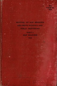 National Vietnam Veterans Museum (NVVM)
Booklet, British Army, Manual of Map Reading: Air Photo Reading and Field Sketching, Part 1: Map Reading, 1955 (Copy 1), 1955
A red coloured cover with black information. There are signs of possible water damage down the right hand side of the booklet. At the top figth hand reads WO Code No. 8868. Down the spine of the book reads Manual of Map Reading: Air Photo Reading and Field Sketching : 1map reading, air photo reading, manual -
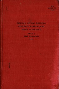 National Vietnam Veterans Museum (NVVM)
Booklet, British Army, Manual of Map Reading: Air Photo Reading and Field Sketching, Part 1: Map Reading, 1955 (Copy 2), 1955
A red coloured cover with black information. There are signs of possible water damage down the right hand side of the booklet. At the top figth hand reads WO Code No. 8868. Down the spine of the book reads Manual of Map Reading: Air Photo Reading and Field Sketching : 1map reading, air photo reading, manual -
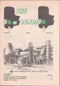 Bendigo Historical Society Inc.
Magazine - THE GO IN BENDIGO - MAGAZINE, April 1986
Magazine - 16 page guide for visitors and residents of Bendigo. Vol.2, Issue 4, April 1986. Includes tourist attractions, wineries, dining out, with a map on the back page. Sketch of the Bendigo Pottery by Stan Thomas on front cover. Editor Barry McNaught. Publisher not mentioned. bendigo attractions, bendigo pottery, stan thomas, barry mcnaught, rosalind park, gail tavener, arakoon resort -
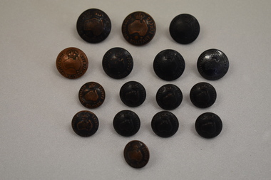 Warrnambool and District Historical Society Inc.
Buttons, Military Buttons
The buttons marked Australian Military Forces were used by Australian troops in both World War One and World War Two These buttons are of interest as examples of those used in the Australian Army during the first half of the 20th century,Two large sized circular bronze buttons featuring a raised map of Australia, a crown and text. A loop on the reverse was used for attaching the button. Five medium sized brass buttons otherwise identical to the ones above. Nine small sized buttons otherwise identical to the ones above. AUSTRALIAN MILITARY FORCESarmy, australan military forces -
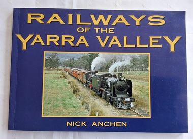 Mont De Lancey
Book, Nick Anchen, Railways of the Yarra Valley, 2010
The railway reached Lilydale in 1882, Healesville in 1889 and Warburton in 1901 linking the area to Melbourne. Sawmillers and farmers prospered, as well as tourists visiting the region.A blue covered book of the Railways of the Yarra Valley with a photograph on the front cover of the last steam train from Warburton in August 1965 and the back cover showing an old locomotive 'Little Yarra' in 1913. There is historical text and maps with black and white and coloured photographs of the railways and of the area.Pp.96.non-fictionThe railway reached Lilydale in 1882, Healesville in 1889 and Warburton in 1901 linking the area to Melbourne. Sawmillers and farmers prospered, as well as tourists visiting the region. trains, rail vehicles, australian history, yarra valley -
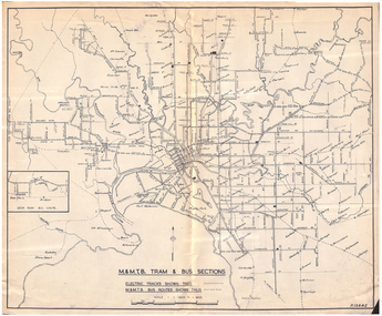 Melbourne Tram Museum
Map, Melbourne & Metropolitan Tramways Board (MMTB), "MMTB Tram and Bus Sections", mid 1960's?
Map - photocopy - titled "MMTB Tram and Bus Sections" showing tram tracks and bus routes, drawing No. P13842, c mid 1960's, Footscray and Point Ormond shown as bus. Shows railway lines, station, some cross streets. Scale 1"=1 Mile.trams, tramways, map, buses, melbourne, footscray -
 Melbourne Tram Museum
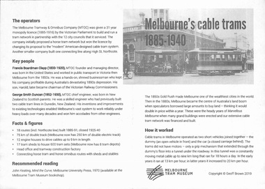
Pamphlet, Melbourne Tram Museum, "Melbourne' cable trams 1885-1940", 2019
Pamphlet, one fold, titled "Melbourne' cable trams 1885-1940", created by Geoff Brown for a tour of cable tram buildings for his Probus group on 6 Feb 2019. Has a map showing the Melbourne Cable Tram Network and a brief history of the cable tram network.trams, tramways, melbourne, map, routes, cable trams