Showing 10063 items
matching e.j.
-
 Federation University Historical Collection
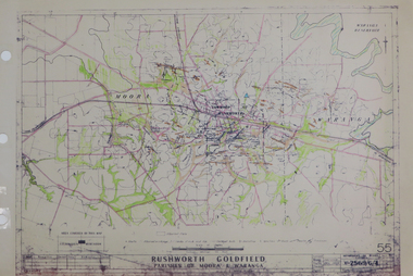
Plan, Rushworth Goldfield: Parishes of Moora and Waranga, pre 1954
Printed plan on paper with hand colouringrushworth, moora, waranga -
 Federation University Historical Collection
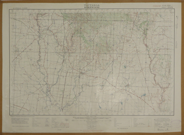
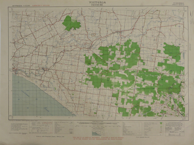
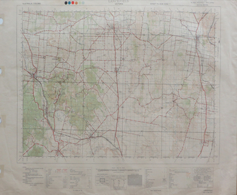
Map, Rokewood, 1937, 02/1937
printed colour map on paperrokewood, illabrook, woady yaloak river -
 Federation University Historical Collection
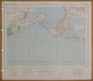
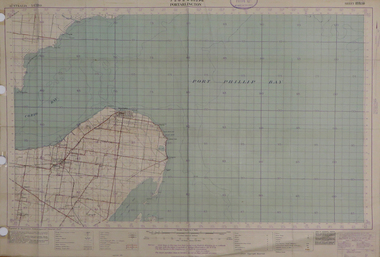
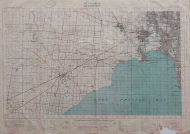
Map, Queenscliff, 1942, 1942
Two copies of printed colour map on paper showing Queenscliff and surrounds"This map in an official document, if found, it must be handed in to the nearest military headquarters or police station."queenscliff, portsea, point nepean, point lonsdale, barwon heads, geelong, corio bay, port phillip bay -
 Federation University Historical Collection
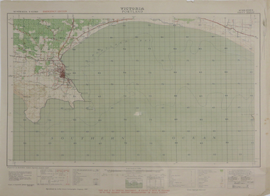
Map, Portland, 1942, 1942
Printed colour map on paper"This map is an official document. If found, it must be handed in to the nearest military headquarters or police. porland, cape nelson, lawrence rock, point danger, whaler's point -
 Federation University Historical Collection
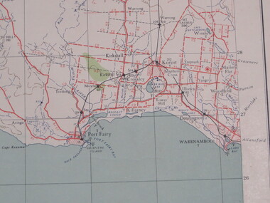
Map, Portland, 1941, 1941
Printed colour map on paperportland, port fairy, warrnambool, kirkstall, crossley, koroit, tower hill, woolsthorp -
 Federation University Historical Collection
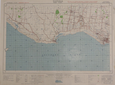
Map, Port Fairy, 1942
Printed colour mapport fairy, tower hill, killarney, armstrong bay, crossley, southern cross, kirkstall -
 Federation University Historical Collection
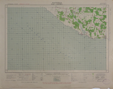
Map, Port Campbell, 1942, 1942
Printed colour map on paperport campbell -
 Federation University Historical Collection
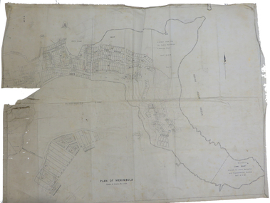
Plan, Plan of Merimbula, 1932, 1932
Printed plan on cottonmerimbula, south pacific ocean -
 Federation University Historical Collection
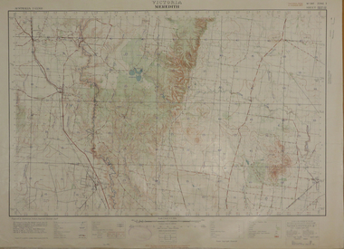
Map, Meredith, 1936, 08/1936
Printed colour mapmeredith, lethbridge, steiglitz, little river -
 Federation University Historical Collection
Map, Portarlington, 1929, 09/1929
Printed colour mapport arlington, corio bay, port phillip bay, clifton springs, swan bay, swan island, duck island, point wilson -
 Federation University Historical Collection
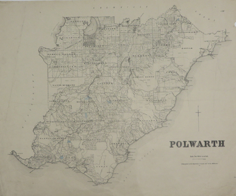
Plan, Polwarth, 1927, 1927
Printed plan with hand colouringotway, polwarth, cape otway -
 Federation University Historical Collection
Map, Panmure, 1942, 1942
Printed colour map on paperpanmure, garvoc, curdie, allansford, bushfield, hopkins river -
 Federation University Historical Collection
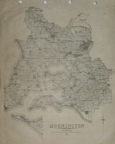
Plan, Mornington, 1926, 1926
Printed plan on papermornington, phillip island, western port bay, bass straight, wonthaggi, lang lang, sherwood, nepean, narre worran, ringwood -
 Federation University Historical Collection
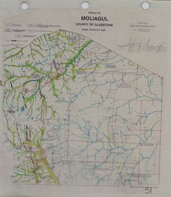
Map, Moliagul
printed map with hand colouringmoliagul, welcome stranger nugget -
 Federation University Historical Collection
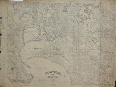
Plan, Melbourne and Suburbs, 1931
printed plan on paper backed onto linenmelbourne, richmond, prahran, st kilda, collingwood, kensington, footscray, kew, studly park, kew lunatic asylum, yarra bend national park, hawthorn, clifton hill -
 Federation University Historical Collection
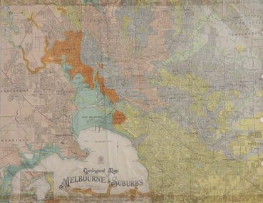
Map, Geological Map of Ascot, 1937, 1937
Coloured plan of Melbourne and suburbs.melbourne, geological, geology, caulfield, brighton, box hill, camberwell, richmond, prahran, st kilda, brunswick, coburg, keilor, braybrook, kew, hawthorn, northcote, williamstown, south melbourne -
 Federation University Historical Collection
Document - Notes, James Stirling, Report on the Mining Features of Portion of the Moliagul and Dunolly Districts, 1899
5 pages of photocopied and handwritten notes (located with 04473)moliagul, dunolly -
 Federation University Historical Collection
Map, Melbourne, 1943, 1943
2 copies of printed colour map on papermelbourne -
 Federation University Historical Collection
Map, Mallacoota, 1942, 1942
Printed colour map on paperThis map is an official document, if found, it must be handed in to the nearest military headquarters or police stationmallacoota, bass straight, cape evarard, cann river, genoa river, disaster bay -
 Federation University Historical Collection
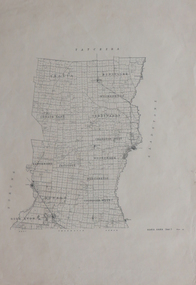
Plan, Parish of Lal-Lal County of Grant
Printed colour map on paperlal lal, mt doran, lal lal racecourse, geology, geological, moorabool river, mount duran -
 Federation University Historical Collection
Plan, Kara Kara
Printed plan on paperkara kara, tatchera, gladstone -
 Federation University Historical Collection
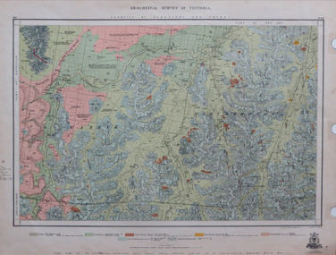
Map, Geological Survey of Victoria, 1913
Printed colour map on papervictoria, geological survey of victoria, gladstone, talbot -
 Federation University Historical Collection
Map, Lancefield, 1947
Printed coloured map on paperlancefield -
 Federation University Historical Collection
Map, Melbourne, Victoria, 1933
Printed colour map.melbourne, port phillip bay, werribee river, werribee, port melbourne, hobson's bay -
 Federation University Historical Collection
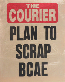
Poster, Ballarat Courier Poster: "Plan to Scrap BCAE", c1988
The Ballarat College of Advanced Education (BCAE) was a predecessor institution of Federation University Australia. It was located at Mt Helen Campus and became Ballarat University College in 1990. Newspaper poster with the headline "Plan to Scrap BCAE"ballarat college of advanced education, ballarat courier, poster, ballarat university college -
 Federation University Historical Collection
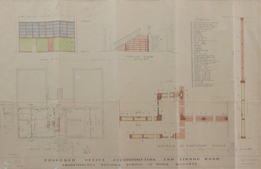
Plan, Ballarat School of Mines Administration Building Proposed Office Accomodation and Strong Room Plan, 1951, 12/06/1951
Plan of Ballarat School of Mines Administration Building plan with coloured shadingballarat school of mines, administration building, new classrooms, percy e. everett -
 Federation University Historical Collection
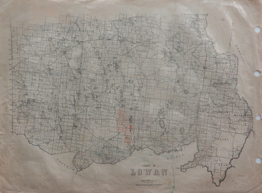
Maps, County of Lowan, 1930
Printed maps on paper backed onto linen: .1) County of Lowan .2) Weeahlowan -
 Federation University Historical Collection
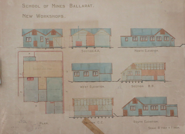
Plan, Ballarat School of Mines New Workshops, 1912, 08/1912
Original plan for new workshops for the Ballarat School of Mines. Includes elevations and sections, abd has been coloured with watercolour. The new workshops housed carpenters shop, plumbers, blacksmihing and stores. ballarat school of mines, new workshops, carpentry, blacksmithing, plumbing, architectural plan, laboratory -
 Federation University Historical Collection
Blueprint Plan, Ballarat School of Mines Administration Block - Plan for the Installation of UG Cables and Electric Light and Power, 1899, 03/10/1899
Blueprint of the Ballarat School of Mines Administration Block (A Building).ballarat school of mines, administration building, electricity, architectural plans, building a -
 Federation University Historical Collection
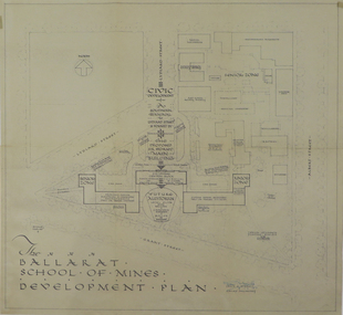
Plan, Ballarat School of Mines Development Plan, 1947, 09/12/1947
The Ballarat School of Mines was future planning before the proposed division of the tertiary division (Mt Helen Campus).Plan of the Ballarat School of Mines Lydiard Street Campus showing existing buildings, proposed demolition of all gaol buildings and court house. ballarat school of mines, development plan, former ballarat gaol, former ballarat court house, lydiard street, master plan, campus plan, ballarat school of mines campus