Showing 64942 items
matching historical photographs
-
 Ringwood and District Historical Society
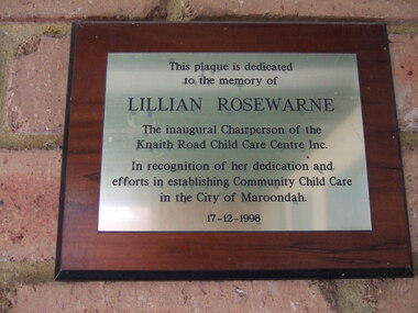
Photograph, Knaith Road Child Care Centre, Ringwood East, plaque dedicated to the memory of Lilian Rosewarne, inaugural Chairperson of the Centre
-
 Ringwood and District Historical Society
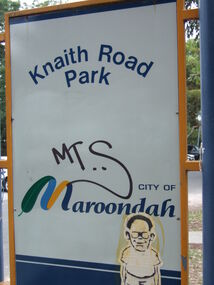
Photograph, Knaith Road Park, Ringwood East, sign in January 2007
City of Maroondah -
 Ringwood and District Historical Society
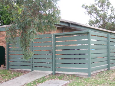
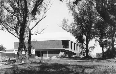
Photograph, Knaith Road Child Care Centre, Ringwood East, showing side view of building in January 2007
City of Maroondah -
 Ringwood and District Historical Society
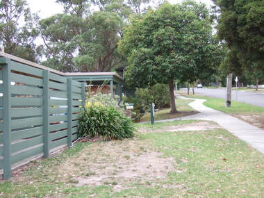
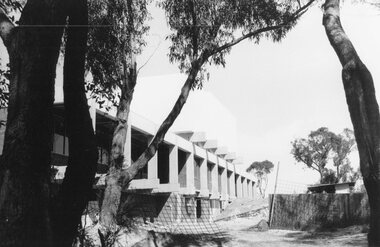
Photograph, Knaith Road Child Care Centre, Ringwood East, eastern view of building in January 2007
City of Maroondah -
 Ringwood and District Historical Society
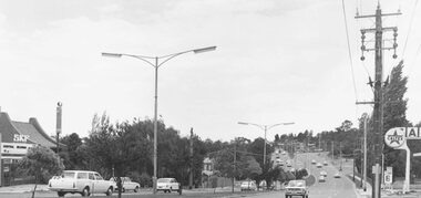
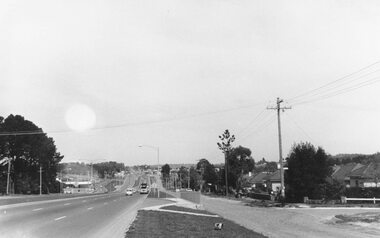
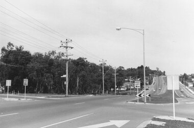
Photograph, Maroondah Highway East, Ringwood- 1971. Looking east towards Mt Dandenong Road
Black and white photographWritten on back of photograph: "Maroondah Highway, looking east towards Mt Dandenong Road turnoff past lake. 1971." -
 Ringwood and District Historical Society
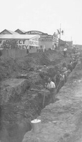
Photograph, Maroondah Highway East, Ringwood- c1920's. Excavation for new water main
Black and white photograph (2 copies- 1 large, 1 small)Written on rear of backing sheet: "Digging trench for water main along Maroondah Highway." -
 Ringwood and District Historical Society
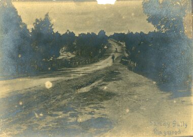
Photograph, Maroondah Highway, East Ringwood in 1870. Sandy Creek and Sandy Gully. Later dammed to create Ringwood Lake
One sepia photographWritten on back "1870", on front, "Sandy Gully, Ringwood". -
 Ringwood and District Historical Society
Photograph, Maroondah Highway East, Ringwood- 1965. Corner of Mt Dandenong Road before widening
Black and white photograph (3 separate images)Typed note on back of photograph: "M'dah Hwy, June 1965, before it was widened from Mt Dandenong on." -
 Ringwood and District Historical Society
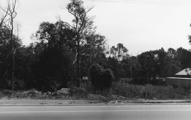
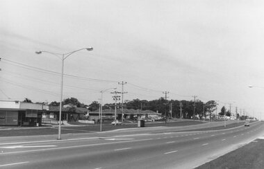
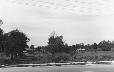
Photograph, Maroondah Highway East. Ringwood- c1969. North side near Peter Vergers Reserve
Black and white photographNil -
 Ringwood and District Historical Society
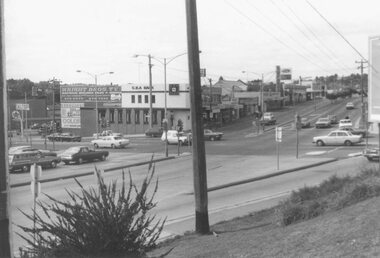
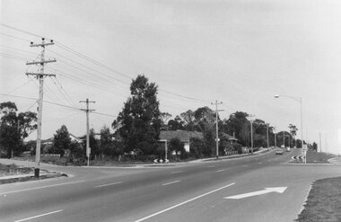
Photograph, Maroondah Highway East, Ringwood- 1976. Looking east from Warrandyte Road intersection
Black and white photographImage shows intersection with C.B.A. Bank on north east corner. Photograph taken mid 1976. -
 Ringwood and District Historical Society
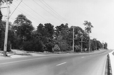
Photograph, Maroondah Highway East, Ringwood- 1969. Looking west towards Ringwood past Burnt Bridge shopping centre
Black and white photographNil -
 Ringwood and District Historical Society
Photograph, Maroondah Highway East, Ringwood- 1969. Looking west towards Ringwood from Burnt Bridge area
Black and white photographNil -
 Ringwood and District Historical Society
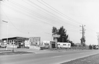
Photograph, Maroondah Highway East, Ringwood- 1969. Looking towards Ringwood from 'Chesneyland Mobile Homes'
Black and white photographNil -
 Ringwood and District Historical Society
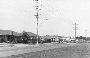
Photograph, Maroondah Highway East, Ringwood- 1969. Looking west towards Ringwood from Oban Road area
Black and white photographNil -
 Ringwood and District Historical Society
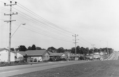
Photograph, Maroondah Highway East, Ringwood- 1969. Looking west towards Ringwood from Oban Road area
Black and white photographNil -
 Ringwood and District Historical Society
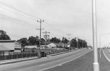
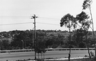
Photograph, Maroondah Highway East, Ringwood- 1969. Looking west towards Ringwood approaching Everard Road
Black and white photographNil -
 Ringwood and District Historical Society
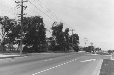
Photograph, Maroondah Highway East, Ringwood- 1969. Looking west towards Ringwood from Everard Road
Black and white photographWritten on back of photograph: "Site of Cass's school, 1874. (1 acre left out of 5 acres). -
 Ringwood and District Historical Society
Photograph, Maroondah Highway East, Ringwood- 1969. Looking west towards Ringwood from Dublin Road
Black and white photographNil -
 Ringwood and District Historical Society
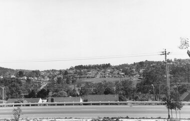
Photograph, Maroondah Highway East, Ringwood- 1969. Looking towards Ringwood from near Mines Road
Black and white photographNil -
 Ringwood and District Historical Society
Photograph, Maroondah Highway East, Ringwood- 1969. Looking west towards Ringwood from Mines Road
Black and white photographNil -
 Ringwood and District Historical Society
Photograph, Maroondah Highway East, Ringwood- 1969. Looking west towards Ringwood from Mines Road area
Black and white photographNil -
 Ringwood and District Historical Society
Photograph, Maroondah Highway East, Ringwood- 1969. New Civic Centre being built in Braeside Ave
Black and white photographWritten on back of photograph: "New municipal offices being built". -
 Ringwood and District Historical Society
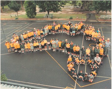
Photograph, Southwood Primary School staff and student photo forming map of Australia outline (undated) - circa 1997-8
colour photoSOUTHWOOD Primary School students and staff -
 Ringwood and District Historical Society
Photograph, Maroondah Highway East, Ringwood- 1969. New Civic Centre being built in Braeside Ave
Black and white photographWritten on back of photograph: "New municipal offices being built." -
 Ringwood and District Historical Society
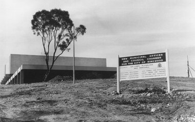
Photograph, Maroondah Highway East, Ringwood- 1969. New Civic Centre being built in Braeside Ave
Black and white photographSign on construction site reads: New Municipal Offices and Council Chamber for the City of Ringwood. Also shows names of Architects and other Contractors. -
 Ringwood and District Historical Society
Photograph, Maroondah Highway East, Ringwood- 1969. View looking north from Civic Centre towards Norwood High School
Black and white photographWritten on back of photograph: "Norwood High from Civic Centre, Nov 1969." -
 Ringwood and District Historical Society
Photograph, Maroondah Highway East, Ringwood- 1969. Looking towards Mullum Road oval from Civic Centre
Black and white photographWritten on back of photograph: "From Civic Centre looking across Mullum Road oval, Nov 1969." -
 Ringwood and District Historical Society
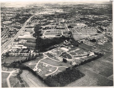
Photograph, Composite Aerial Views of Ringwood, Victoria - 1972
Two composite black & white aerial photographs with north-facing view over Maroondah Highway, including Railway Station precinct, Civic Centre precinct, Eastland, Mount Dandenong Road, Bedford Road, Ringwood Street, Warrandyte Road, Mullum Road, Loughnan's Road.Department of Crown Lands and Survey. Maroondah Highway Project - Run 3 - 20.1.72 - 3,900' ASL. -
 Ringwood and District Historical Society
Photograph, Aerial View of Ringwood, Victoria - circa 1970
Black & white west-facing view over Oban Road along Mullum Mullum Road and Creek. Foreground showing early subdivision development of "Dunn's Orchard Estate" with formation of Frederic Drive (named after the orchardist - Frederic Dunn), Baron Court, Towerhill Drive, Tyson Court, Adele Court, Marilyn Crescent, Abbey Court, Highland Boulevard, Ailsa Court. -
 Ringwood and District Historical Society
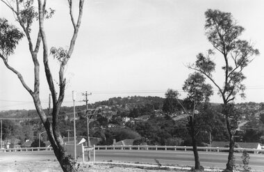
Photograph, Maroondah Highway East, Ringwood- 1969. View of Loughnan's Hill from Civic Centre
Black and white photographWritten on back of photograph: "Loughnan's Hill from Civic Centre. Nov 1969.