Showing 2286 items matching " parish."
-
 Stawell Historical Society Inc
Map, W.J. Butson, Subdivision of North Woodlands Estate 1922, 12.02.1922
Two (2) Copies. A1 Maps with Cloth Backing Annotated with Title HoldersParishes of Malkaff & Navarre County of Kara Kara Photlithograph by W.J Butson 12.02.2022farming -
Bendigo Historical Society Inc.
Map - DIGGORRA : COUNTY OF BENDIGO, 26-6-36
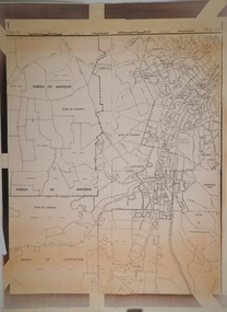
Map. Parish of Diggorra, County of Bendigo, Parish of Ballendella, Parish of Pannoobamawm, Pannoomilloo, Rochester West, Warragamba, Minto, Egerton, Elmore, Northern Railway to Echuca, Elmore and Cohuna Railway, Township of Elmore. By authority H.J. Green, Govt. Printer. Photo-Lithographed at the Deptartment of Lands and Survey, Melbourne. 26-5-36. (number 58 in map cupboard 1)H.J. Green, Govt. Printer.map, bendigo, diggorra -
 Bendigo Historical Society Inc.
Map - CAMPBELL COLLECTION: BENDIGO AND DISTRICT MAPS
Map. South and West of Bendigo, Parish of Marong, Moonta, West Bendigo, Specimen Hill, Golden Square, Shire of Marong, Golden Gully, Kangaroo Flat, Diamond Hill, Shire of Strathfieldsaye, Crusoe, Parish of Lockwood.map, bendigo, parishes -
 City of Moorabbin Historical Society (Operating the Box Cottage Museum)
Document,photocopy plan 'Two Acre Village 'c1852, c1960
In the 1852 Josiah Holloway, a developer, purchased 625 acres from the squatters Richard and John King and sectioned '2 acre allotments' south of Henry Dendy's Brighton Survey along the Arthur's Seat Road ( later Nepean Highway) for sale @ £10 It became known as The Two Acre Village as settlers took up the allotments and established market gardens, general stores, butchers, blacksmiths, post office and 2 hotels. Charles Whorral opened The Cheltenham Inn and it became so popular as a meeting place that the area was called Cheltenham. The early settlers, who were predominantly English and Scottish immigrants initially leased their allotments and, because the sandy soil was so fertile, they were soon able to purchase the land and increase their acreage. Cheltenham became a very important part of the large Moorabbin Shire1871 and City of Moorabbin 1934 In the 1994 Amalgamation of Councils, when the large City of Moorabbin was divided between the newly formed Glen Eira, Kingston and Bayside Councils, the Cheltenham area was assigned to the City of Kingston A photocopy of the Plan for the 2 Acre Village in Moorabbin Parish c1852. A3 laminatedmoorabbin, brighton, cheltenham, market gardeners, pioneers, early settlers, , king. john, holloway josiah, whorral charles, arthur’s seat road, nepean highway , cheltenham inn hotel, henry dendy special survey 1841 -
 Eltham District Historical Society Inc
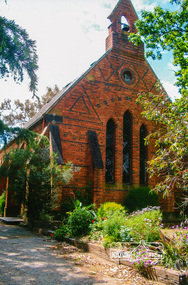
Photograph, St Margaret's Church, Eltham, 2012
Digital scan of photograph - Original Source Copy: St Margaret's Parish Archives. church of england, churches, eltham, st margarets church, mud bricks, robert marshall -
 Eltham District Historical Society Inc
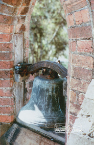
Photograph, 1861 Bell and Bell Tower, St Margaret's Anglican Church, Eltham
Digital scan of photograph - Original Source Copy: St Margaret's Parish Archives. church of england, churches, eltham, st margarets church, mud bricks, robert marshall -
 Eltham District Historical Society Inc
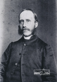
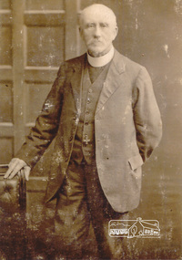
Photograph, Reverend William Heber Green, Vicar, St Margaret's Anglican Church, Eltham, c.1870s
Digital scan of photograph - Original Source Copy: St Margaret's Parish Archives. church of england, churches, eltham, st margarets church, william heber green -
 Eltham District Historical Society Inc
Photograph, Reverend William Heber Green, Vicar, St Margaret's Anglican Church, Eltham, c.1915
Digital scan of photograph - Original Source Copy: St Margaret's Parish Archives. church of england, churches, eltham, st margarets church, william heber green -
 Eltham District Historical Society Inc
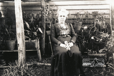
Photograph, Ruth Green (nee Maynard), first wife of Revd. William Heber Green, possibly taken at Surrey Hills prior to 1904
Digital scan of photograph - Original Source Copy: St Margaret's Parish Archives. church of england, churches, eltham, st margarets church -
 Eltham District Historical Society Inc
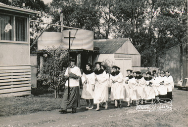
Photograph, The choir of St Margaret's, Eltham during the Blessing of the Plough at the home of Bel and Don Cracknell, Panton Hill, 28 Sept 1958
Digital scan of photograph - Original Source Copy: St Margaret's Parish Archives. church of england, churches, eltham, st margarets church, bel cracknell, don cracknell, panton hill -
 Eltham District Historical Society Inc
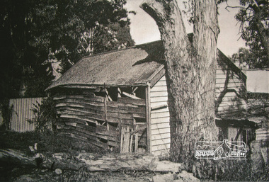
Photograph, Derelict building, St Margaret's Anglican Church site from John Street, Eltham, c.1960
Digital scan of photograph - Original Source Copy: St Margaret's Parish Archives. church of england, churches, eltham, st margarets church -
 Eltham District Historical Society Inc
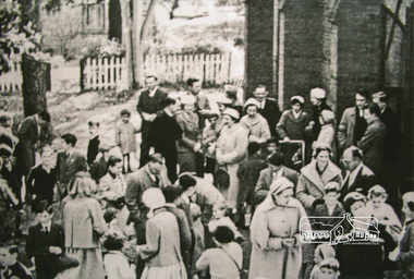
Photograph, Parishoners, St Margaret's Anglican Church, Eltham, c.1960
"For very nearly one hundred years, people of Eltham have worshiped at St. Margaret's usually spending a few pleasant minutes after the service chatting with friends. But the percentage of parishoners who attend church regularly and frequently is pitifully low." c.1960Digital scan of photograph - Original Source Copy: St Margaret's Parish Archives. church of england, churches, eltham, st margarets church -
 Eltham District Historical Society Inc
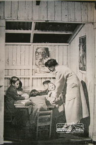
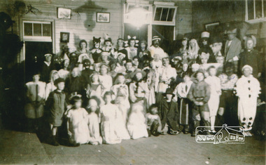
Photograph, Sunday School, St Margaret's Anglican Church, Eltham
"For the children, Sunday School is a happy place. St Margaret's is fortunate to have a group of young men and women parishoners who conduct the school, especially as accommodation is cramped, drab and uncomfortable. Class in picture is conducted in shack from motor car case"Digital scan of photograph - Original Source Copy: St Margaret's Parish Archives. church of england, churches, eltham, st margarets church -
 Eltham District Historical Society Inc
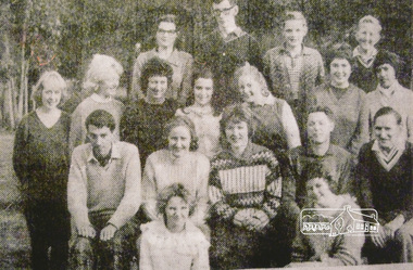
Photograph, Vicar Revd. William John Carter (far right, second row) with the St Margaret's, Eltham, Youth Group, 1963
Digital scan of photograph - Original Source Copy: St Margaret's Parish Archives. church of england, churches, eltham, st margarets church, william john carter -
 Eltham District Historical Society Inc
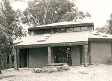
Photograph, Mudbrick Hall, St. Margaret's Anglican Church, Eltham, c.1985
Digital scan of photograph - Original Source Copy: St Margaret's Parish Archives. church of england, churches, eltham, st margarets church, buildings, mudbrick -
 Eltham District Historical Society Inc
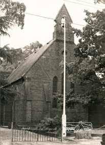
Photograph, St. Margaret's Anglican Church, Eltham and flagpole, c.1985
Digital scan of photograph - Original Source Copy: St Margaret's Parish Archives. church of england, churches, eltham, st margarets church -
 Eltham District Historical Society Inc
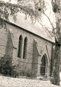
Photograph, West door entrance, St. Margaret's Anglican Church, Eltham, c.1985
Digital scan of photograph - Original Source Copy: St Margaret's Parish Archives. church of england, churches, eltham, st margarets church -
 Eltham District Historical Society Inc
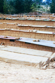
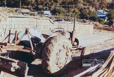
Photograph, Making the mudbricks for St Margaret's Anglican Church Hall, Eltham, 1978
Digital scan of photograph - Original Source Copy: St Margaret's Parish Archives. church of england, churches, eltham, st margarets church, mud brick construction, mudbrick -
 Eltham District Historical Society Inc
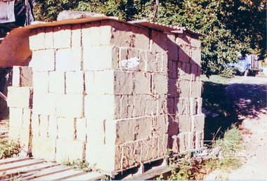
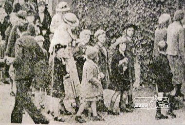
Photograph, Children entering St Margaret's, Eltham, 75th Patronal Festival, 1936
Digital scan of photograph - Original Source Copy: St Margaret's Parish Archives. church of england, churches, eltham, st margarets church, patronal festival, festivals -
 Eltham District Historical Society Inc
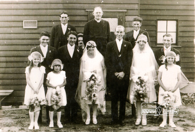
Photograph, The Reverend John Arthur Peck (centre back row) 1922-1924, wedding, 1926, venue unknown
Digital scan of photograph - Original Source Copy: St Margaret's Parish Archives. church of england, churches, eltham, st margarets church, reverend john arthur peck -
 Eltham District Historical Society Inc
Photograph, Children's party/concert, Church of the Transfiguration, Research, 1926
Digital scan of photograph - Original Source Copy: St Margaret's Parish Archives. church of england, churches, eltham, st margarets church, church of the transfiguration, research (vic.) -
 Eltham District Historical Society Inc
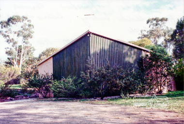
Photograph, The Church of the Transfiguration, Research, c.1990s showing the front of the church building. The entrance was at back of church
Digital scan of photograph - Original Source Copy: St Margaret's Parish Archives. church of england, churches, eltham, st margarets church, church of the transfiguration, research (vic.) -
 Eltham District Historical Society Inc
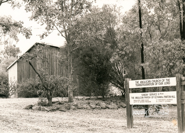
Photograph, The Anglican Church of the Transfiguration of our Lord
Digital scan of photograph - Original Source Copy: St Margaret's Parish Archives. church of england, churches, eltham, st margarets church, church of the transfiguration, research (vic.) -
 Eltham District Historical Society Inc
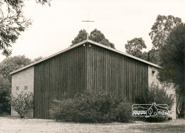
Photograph, The Church of the Transfiguration, Research, c.1985 showing the front of the church building. The entrance was at back of church
Digital scan of photograph - Original Source Copy: St Margaret's Parish Archives. church of england, churches, eltham, st margarets church, church of the transfiguration, research (vic.) -
 Eltham District Historical Society Inc
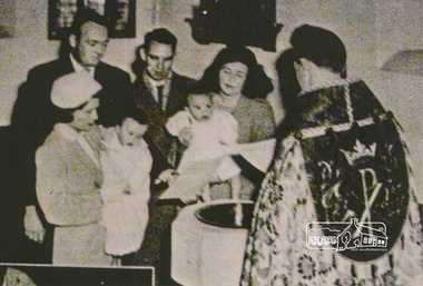
Photograph, A Baptism, conducted by the Reverend David Warren (1956-1960) wearing vestments, Vicar of St Margaret's, c.1960. The font is located in the south-east corner of the church
Digital scan of photograph - Original Source Copy: St Margaret's Parish Archives. church of england, churches, eltham, st margarets church, reverend david warren -
 Eltham District Historical Society Inc
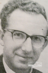
Photograph, Reverend C.D.H. Longfield, Vicar of St Margaret's (1964-1969)
Digital scan of photograph - Original Source Copy: St Margaret's Parish Archives. church of england, churches, eltham, st margarets church, reverend c.d.h. longfield -
 Eltham District Historical Society Inc
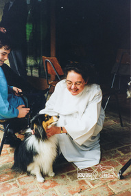
Photograph, Blessing of the Animals, Reverend Erica Mathieson, Vicar, St Margaret's (1997-2000)
Digital scan of photograph - Original Source Copy: St Margaret's Parish Archives. church of england, churches, eltham, st margarets church, blessing of the animals, reverend erica mathieson -
 Eltham District Historical Society Inc
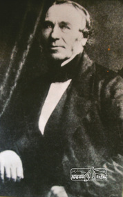
Photograph, Henry Dendy, c.1855
Digital scan of photograph - Original Source Copy: St Margaret's Parish Archives. church of england, churches, eltham, st margarets church, henry dendy