Showing 785 items matching "peaks"
-
 Sunbury Family History and Heritage Society Inc.
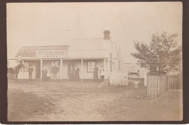
Photograph, Friendly Societies Hotel
The building in the image is the former Friendly Societies Hotel which was in Bulla and run by the Kelly family. The Black Horse hotel now occupies the site, which is to the east of the Alister Clark rose garden and former Bulla Roads Board building.By the 1880s when the Bulla township reached its peak this was one of 4 hotels in the township.A non-digital copy of an old sepia photograph of a single storey building with seven people standing on the verandah.hotels, friendly societies hotel, bulla township -
 Ballarat Tramway Museum
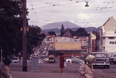
Slide - City Loop Ballarat Sturt St - set of 6, Ron Hood, 12/1970
Set of 6 slides showing trams parked in the City Loop 1 - taken from Lydaird St and Sturt St - looking east with Dickins food store, Patersons and a Neptune sign 2 - Photo looking east with tram 35 and 4 single truckers parked in the loop 3 - ditto with the Woolworths Big W store in the background. 4 - Head on view of 35 with a tram in Bridge St along with the Grenville St shelter 5 - as for 3 6 - ditto with tram 26 passing the parked trams.Yields information about the use of the City Loop in Sturt St to park out of service trams between the peak periods.Set of six colour slides in hanimount cardboard mounts."Ballarat" in ink on some of the slides and December 1970 on one. All are numbered in ink.tramways, trams, sturt st, city loop, tram 35, tram 26 -
 Marysville & District Historical Society
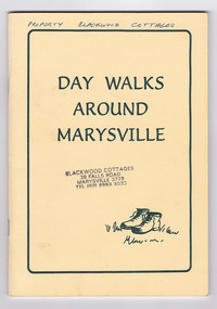
Booklet - Paperback booklet, Maroondah Bushwalking Club Inc, Day Walks Around Marysville, 1996
A booklet outlining day walks of various difficulties in and around the surrounds of Marysville.Paperback booklet. Front cover shows title with a cartoon drawing of a pair of walking boots. Back cover shows details of the publisher and distributor of the publication.non-fictionA booklet outlining day walks of various difficulties in and around the surrounds of Marysville.marysville, victoria, day walks, bushwalking, maroondah bushwalking club, cathedral range, sugarloaf peak, neds gully, maroondah highway, woods lookout, cement creek, acheron, lake mountain, snowy hill, cumberland reserve, wilks creek, mount strickland, the beeches, mount margaret, stevensons falls, steavensons falls, de la rue lookout, oxlee lookout, keppel lookout, keppel hut, north jawbone peak, cumberland scenic reserve, acheron road, buxton, man o war track, phantom falls, keppel falls, athols abbey, sunds road, trestle track, booklet -
 Marysville & District Historical Society
Booklet - Paperback booklet, Maroondah Bushwalking Club Inc, Day Walks Around Marysville, 1996
A booklet outlining day walks of various difficulties in and around the surrounds of Marysville.Paperback booklet. Front cover shows title with a cartoon drawing of a pair of walking boots. Back cover shows details of the publisher and distributor of the publication.non-fictionA booklet outlining day walks of various difficulties in and around the surrounds of Marysville.marysville, victoria, day walks, bushwalking, maroondah bushwalking club, cathedral range, sugarloaf peak, neds gully, maroondah highway, woods lookout, cement creek, acheron, lake mountain, snowy hill, cumberland reserve, wilks creek, mount strickland, the beeches, mount margaret, stevensons falls, steavensons falls, de la rue lookout, oxlee lookout, keppel lookout, keppel hut, north jawbone peak, cumberland scenic reserve, acheron road, buxton, man o war track, phantom falls, keppel falls, athols abbey, sunds road, trestle track, booklet -
 Ringwood RSL Sub-Branch
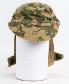
Equipment - Headgear camoflaged Army, Soft Peak Cap with chin strap
Rhodesian camaflauge hat belonging to T.G. Cross No. 48863. This cap was designed with a rear flap to keep rain and sun off the next. Velcro attached to hold flap up.