Showing 17523 items
matching plenty-hotel
-
 Greensborough Historical Society
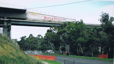
Photograph - Digital image, Frank Solomon, Plenty River Drive Bridge Roadworks 4, 2005c
These photos show the duplication of the bridge over Plenty River Drive on the Greensborough Bypass, circa 2005.Digital copy of colour photographplenty river drive, greensborough bypass -
 Greensborough Historical Society
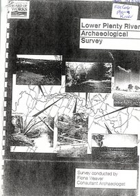
Report, Lower Plenty River Archaeological Survey; Fiona Weaver, 1989_
Archaeological survey of the Lower Plenty River undertaken in 1989-1990 by Fiona Weaver for the Board of Works. Indigenous heritage sites along the Plenty River are examined and recommendations made for the preservation and to lessen the impact of development on these sites.Printed on white A4 paper. Approx 92 pages (not numbered). Illus., maps. 2 copies.plenty river, board of works, aboriginal heritage sites, fiona weaver -
 Greensborough Historical Society
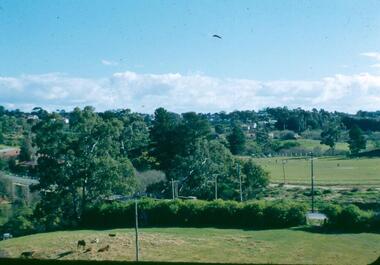
Photograph - Digital image, Frank Robinson, Looking north over the football ground with bridge over Plenty River, 1954_
Looking north over the football ground with bridge over Plenty River. The Blackjack property, house and acres of fruit orchards ran down to the Plenty River off Hume Street Greensborough and was the home of the Robinson family to late 1956. The photographs were taken as slides by Frank Robinson and digitised by his son James in 2015.Digital copy of colour photgraph.robinson family, blackjack, plenty river -
 Ringwood and District Historical Society
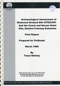
Book, Archaeological Assessment of Historical Orchard Site and Coach & Horses Hotel Site
Archaeological Assessment of Historical Orchard Site and Coach & Horses Hotel Site -
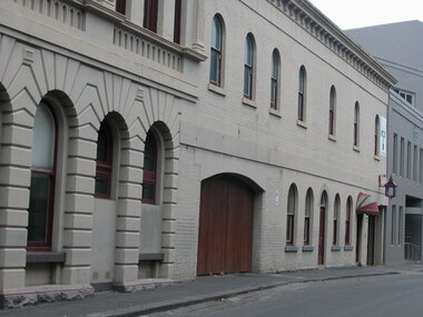 Ballarat Heritage Services
Photograph - Colour, Lisa Gervasoni, Craig's Royal Hotel from Bath's Lane, Ballarat
Colour photograph of Craig's Royal Hotel, stables entrance in Bath Lane. street lamp, hotel lamp -
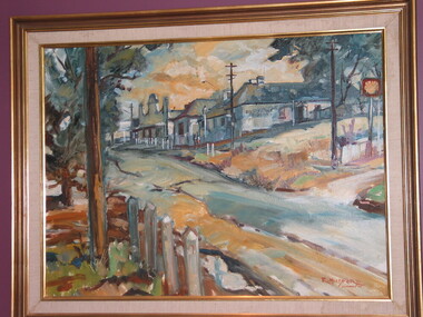 Brimbank City Council Art Collection
Painting, The Keilor Hotel, 1977
This contemporary view of the Keilor Hotel emphasizes the artist's expressive brushwork.Raymond Mudford. The Keilor Hotel. Oil on board, 59.5 x 80cm, -
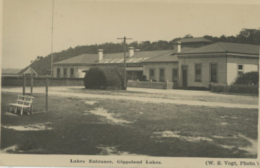
 Lakes Entrance Historical Society
Book, Britton, Tanya, Star Hotel Bruthen 1879-1968, 2004
Research, interpretation and management recommendations for the Star Hotel, Bruthen, by a Forestec student.township, hotels, land settlement -
 Buninyong & District Historical Society
Photograph - B&W photo of original photograph, Buninyong Hotel around 1890, Buninyong Hotel around 1890
BuildingsB&W photo of original photograph, Buninyong Hotel around 1890 -
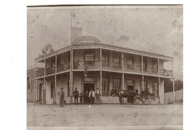
 Lakes Entrance Historical Society
Photograph, Club Hotel Lakes Entrance c1924, 1924 c
Kalimna escarpment in the background Lakes Entrance Victoria. Trimmed shrub beside telegraph pole near roadway was a huge box thornBlack and white postcard of the Club Hotel on Esplanade Lakes Entrance Victoria Lakes Entrance, Gippsland Lakes. (W. S. Vogt, photo)hotels, accommodation, businesses -
 Lakes Entrance Historical Society
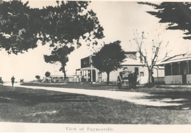
Photograph - View of Paynesville, hotel, the Esplanade Paynesville Victoria, 1910 c
copied from a postcardBlack and white photograph showing the hotel on the corner of the Esplanade Paynesville VictoriaView of Paynesvilletownship, hotels, roads and streets -
 Ringwood and District Historical Society
Photograph, Club Hotel, Mount Dandenong Road, East Ringwood in February 1960
Black and white photographs of Club Hotel February 1960 (1 original, three copies). The hotel has a long association with the Reddish family, thus given the name of "Daisy's Hotel". Included 2 copies of the photograph. Ryman Healthcare bought the site in 2019, including the garden supply business next door, making up a 2.2ha area. The proposal was for a $220 million retirement village to be built. The location is next to Ringwood Lake with the old hotel being knocked down in the early 2020s. -
 Greensborough Historical Society
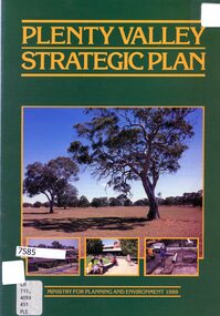
Booklet - Leaflet, Plenty Valley strategic plan, August 1989
A 1989 planning document for the Plenty Valley growth area, as much of it moved from rural to residential zoning.8 p., text and col. illustrationsplenty valley, urban development, plenty river, shire of diamond valley, whittlesea -
 Greensborough Historical Society
Photograph - Photograph (Copy), Anne Paul, Lot 2A Main Road Lower Plenty, 2007_05
Three views of entry into Lot 2A Main Road Lower Plenty, now Edward Willis Drive.3 colour photographs printed on paper, handwritten captionslower plenty, main road lower plenty, edward willis drive lower plenty -
 Greensborough Historical Society
Slide - Photograph, John Ramsdale, Along Plenty River near Para Road: Slide 86, 1990s
Photograph shows a track through bushland, along the Plenty River near Para Road, possibly Montmorency.Part of the John Ramsdale collection of slides and audio visual material.Colour photograph scanned from slide.No maker's marks. No caption on slide.plenty river, para road montmorency, bushland -
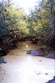
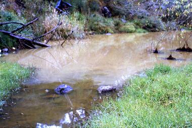 Greensborough Historical Society
Slide - Photograph, John Ramsdale, Muddy Plenty River: Slide 93, 1990s
Photograph shows a muddy Plenty River with a small creek entering the river. Note the dumped car in background.Part of the John Ramsdale collection of slides and audio visual material.Colour photograph scanned from slide.No maker's marks. No caption on slide.plenty river, pollution -
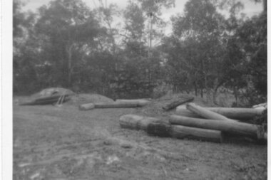
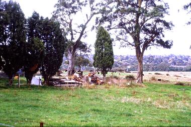 Greensborough Historical Society
Slide - Photograph, John Ramsdale, Farmland, Lower Plenty: Slide 116, 1990s
Photograph shows a rural scene - a farmyard with stacked wood and disused farm equipment - in Lower Plenty, 1990s.Part of the John Ramsdale collection of slides and audio visual material.Colour photograph scanned from slide.No maker's marks. No caption on slide.lower plenty, farms -
 Greensborough Historical Society
Slide - Photograph, John Ramsdale, Looking towards Bulleen from Lower Plenty; Slide 115, 1990s
Photograph shows a rural scene with gum tree and pylon, looking towards Bulleen from Lower Plenty.Part of the John Ramsdale collection of slides and audio visual material.Colour photograph scanned from slide.No caption. Printed maker's mark on slide "Kodak Kodachrome Slide"bulleen, lower plenty -
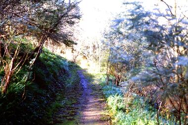
 Greensborough Historical Society
Slide - Photograph, John Ramsdale, Crossing Plenty River: Slide 12, 1990s
Photograph shows erosion on a path to a footbridge over the Plenty River down from George Court Montmorency.Part of the John Ramsdale collection of slides and audio visual material.Colour photograph scanned from slide.No maker's marks. No caption on slide.plenty river, erosion, montmorency -
 Greensborough Historical Society
Slide - Photograph, John Ramsdale, Plenty River with European trees: Slide 24, 1990s
Photograph shows a section of the Plenty River with European trees and clay run-off from building nearby.Part of the John Ramsdale collection of slides and audio visual material.Colour photograph scanned from slide.No maker's marks. No caption on slide.plenty river, vegetation -
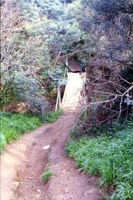
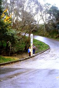 Greensborough Historical Society
Slide - Photograph, John Ramsdale, Ford over Plenty River at Partington's Flat: Slide 52, 1990s
Photograph shows 2 children with flood height marker at the ford over Plenty River at Partington's FlatPart of the John Ramsdale collection of slides and audio visual material.Colour photograph scanned from slide.No maker's marks. No caption on slide.partingtons flat, ford over plenty river, plenty river -
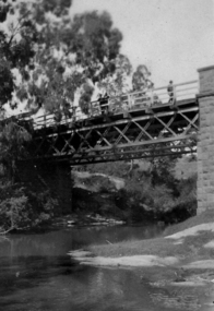 Greensborough Historical Society
Photograph - Digital image, Bridge over Plenty River, 1930-1940
Photograph of old bluestone bridge over the Plenty River in Greensborough. This photo is from the Lorraine Coates Collection.Digital copy of black and white photograph.plenty river greensborough, bluestone bridge greensborough -
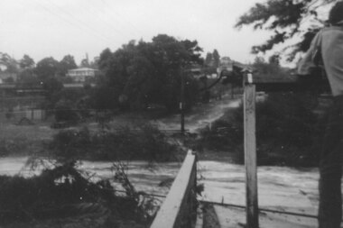
 Greensborough Historical Society
Photograph - Digital Image, Plenty River in flood 1972 (1), 1972_
Plenty River in flood near Greensborough. There were two major floods in Greensborough at the time, 1972 and 1974.Digital copy of black and white photograph.plenty river, floods -
 Greensborough Historical Society
Photograph - Digital Image, Plenty River in flood 1972 Flintoff Street Crossing (2), 1972_
Plenty River in flood, circa 1972. There were two major floods in Greensborough at the time, 1972 and 1974.Digital copy of black and white photograph.plenty river, floods -
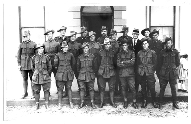 Tarnagulla History Archive
Photograph of soldiers in uniform in front of Victoria Hotel, Tarnagulla, Soldiers in uniform in front of Victoria Hotel, Tarnagulla, 8th November, 1919, 8 November 1919
Murray Comrie Collection. Subjects are posed in front of a building known locally as Victoria Hotel, now the Tarnagulla Public Hall.. Monochrome photograph of soldiers in uniform assembled in front of Victoria Hotel, in the main street of Tarnagulla. The men in uniform are all returned soldiers from the Tarnagulla district. They were drawn together to form the Guard of Honour on the occasion of the unveiling of the nearby War Memorial. Accompanied by a note that gives the following names: (Left to Right) Back Row: 1. _________ 2. George Graham 3. _____________ 4. Bob Clark 5. Joe Harwood Middle Row: 1. W. Kilgour 2. Perc. Ison 3. Lew Allen 4. Sam Patterson 5. Harry Bool 6. Bob Abbott 7. Will Smith Front Row: 1. Arthur Whimpey 2. Sgt ___ Graham 3. Les Radnell 4. Dave Roper 5. Fred Jackson 6. Bill James (David Gordon notes: This is not William James. He had been KIA by the time of the photograph.) tarnagulla, war, military, service, soldiers, veterans, ww1, first world war, graham, clark, harwood, kilgour, ison, allen, patterson, bool, whimpey, radnell, roper, jackson, james, abbott, smith -
 Greensborough Historical Society
Map, Melbourne and Metropolitan Board of Works. Survey Division, MMBW, Yarra 2500 / 13.19. Lower Plenty, Montmorency, Yallambie, 1979_02
Melbourne and Metropolitan Board of Works. Yarra 2500 [base map] 13-19. Lower Plenty, Montmorency, Yallambie. Parishes of Keelbundora 2856 and Nillumbik 3310. Municipalities of Heidelberg 228, Diamond Valley 257 and Eltham 238. Prominent streets include: Elder Street, Para Road, and Main Road Lower Plenty. Includes Watsonia Army Barracks.MMBW Map in 1:2500 [scale] series. Cream parchment with green tape reinforcing on edges and punched holes on left edge.mmbw, melbourne and metropolitan board of works, shire of diamond valley, montmorency - maps, yallambie - maps, lower plenty - maps -
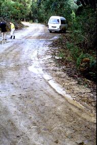 Greensborough Historical Society
Slide - Photograph, John Ramsdale, Plenty River catchment near Mt Disappointment: Slide 109, 1990s
Photograph shows a muddy road with white van and two people in the Plenty River catchment near Mt DisappointmentPart of the John Ramsdale collection of slides and audio visual material.Colour photograph scanned from slide.No maker's marks. No caption on slide.plenty river, mt disappointment -
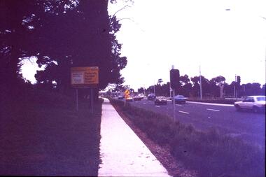 Greensborough Historical Society
Slide - Photograph, John Ramsdale, Plenty Road near Parade College: Slide 29, 1990s
Photograph shows a 3-lane road with "Federally funded" sign This is Plenty Road Bundoora, near Parade college.Part of the John Ramsdale collection of slides and audio visual material.Colour photograph scanned from slide.No caption. Printed maker's mark on slide "Kodak Kodachrome Slide"plenty road bundoora, parade college -
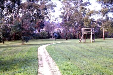 Greensborough Historical Society
Slide - Photograph, John Ramsdale, Along the Plenty River Trail: Slide 7, 1990s
Photograph shows park with narrow path, trees and timber play equipment taken along the Plenty River Trail.Part of the John Ramsdale collection of slides and audio visual material.Colour photograph scanned from slide.No maker's marks. No caption on slide.plenty river trail, greensborough, banyule parks -
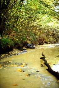 Greensborough Historical Society
Slide - Photograph, John Ramsdale, Plenty River: Slide 15, 1990s
Photograph shows the Plenty River with rubbish, including tyre and fallen branch. This part of the River is on the Montmorency - Greensborough border.Part of the John Ramsdale collection of slides and audio visual material.Colour photograph scanned from slide.No maker's marks. No caption on slide.plenty river, pollution -
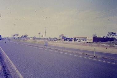 Greensborough Historical Society
Slide - Photograph, John Ramsdale, Plenty Road and urban creep: Slide 28, 1990s
Photograph shows Plenty Road Mill Park with Shell petrol station and Macdonalds, showing the urban expansion in this area.Part of the John Ramsdale collection of slides and audio visual material.Colour photograph scanned from slide.No maker's marks. No caption on slide.plenty road mill park, urbanisation